Author: Dave

  • Fall Foliage Spectacular

    Hello virtual crew members and fellow adventures.

    La Salle here catching you up to date on the latest travels of Still Waters II. Click on this link to see the day- to-day travel log.

    But first we have had a bunch of folks meet the crew on the pier and come aboard as virtual crew members.  So we need to pause and welcome aboard:

    • Shoaib R.
    • Matnobles
    • Ginasjoys
    • Russ B.

    So a hearty Welcome Aboard!!!!  Glad you joined the adventure.

    oct-21
    Sunday anchored near Clifton, Monday anchored near Savanah, Tuesday & Wednesday at Aqua Yacht Marina for repairs, Thursday anchored, Friday free dock in Decatur, and Saturday free dock in Guntersville

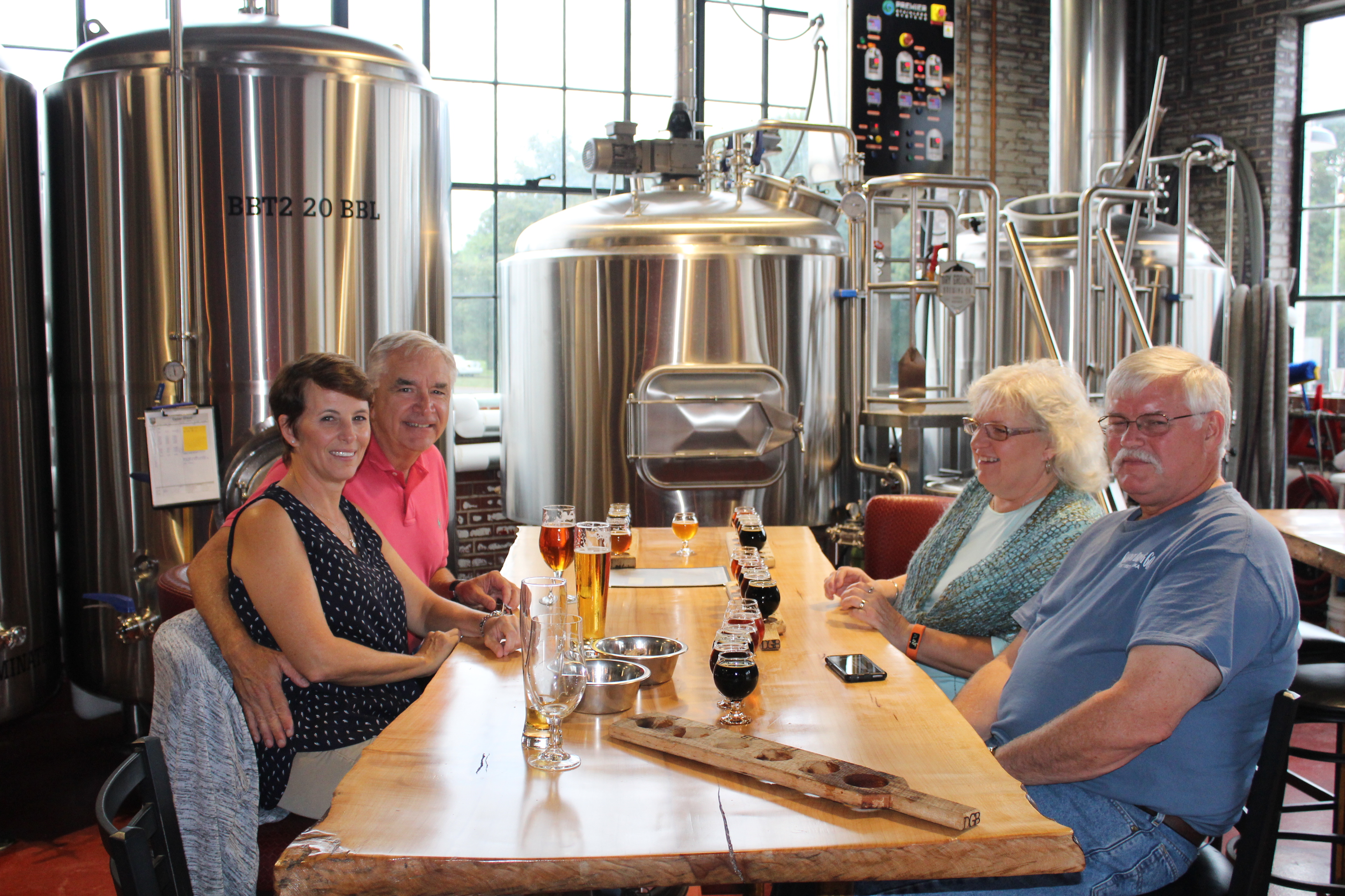
    The crew did not make their goal of Chattanooga this week.  Still Waters II decided she wanted some rest and relaxation at the Aqua Yacht Marina.  The crew limped into the marina on one engine on Tuesday.  After getting repairs complete the crew commenced the side trip up the Tennessee River towards Chattanooga.

    Sunday, October, 16, 2016

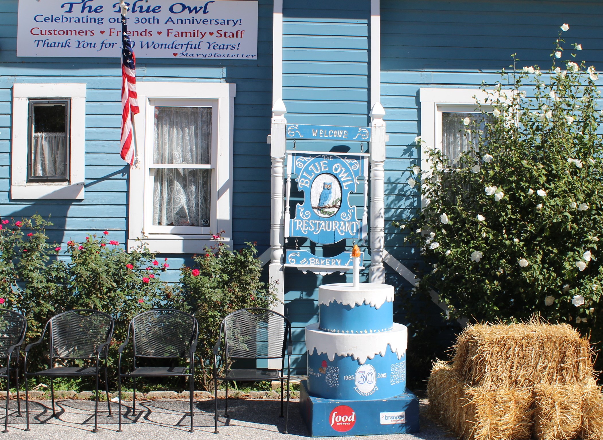
    The crew left out of Pebble Isle Marina after stopping at the fuel dock and taking on 216 gallons of fuel.  The marina gives a 10 cent per gallon discount for both a AGLCA and Boat US memberships, for a total of 20 cents off each gallon.  That was just too good of a deal to pass up without topping off the tanks.  Then there was an added surprise at the fuel dock.  The guy helping fuel the boat brought out three large hot cinnamon rolls from the restaurant and gave them to the Admiral.  Now this is a good way to start the day and week.

    img_0020
    Shoreline along Tennessee River


    Unfortunately, the good start to the day and week would not last long, but such is the life of a live aboard cruiser.  The skipper noticed that the port engine temperature was acting erratic during the cruise, a harbinger of things to come.

    img_0022
    Cypress Trees in the River – well sorta


    After cruising about 20 miles the crew passed under the Interstate 40 bridge between Nashville and Memphis.  The skipper can remember crossing over this bridge at least a dozen times over the years, but this is the first time either crew member has passed under the bridge in a boat.

    img_0024
    I-40 between Memphis and Nashville


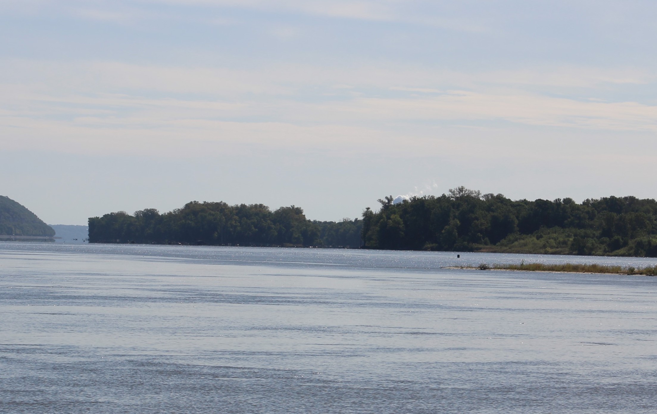
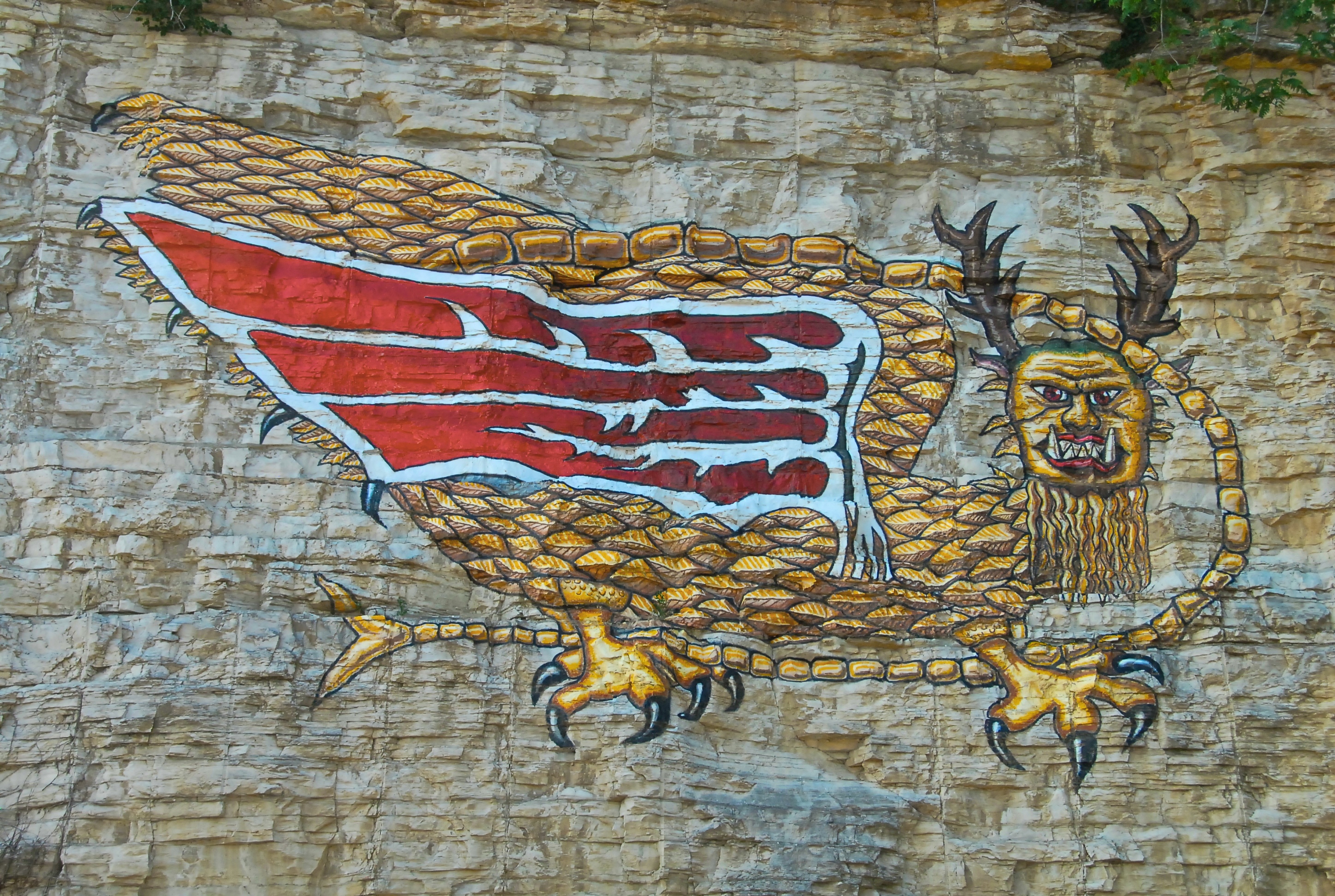
    Another 20 miles up-river, the crew passed Lady Finger Bluff.  The Bluff was so named after a woman jumped to her death from the bluff rather than be captured by Indians.

    img_0030
    Lady Finger Bluff


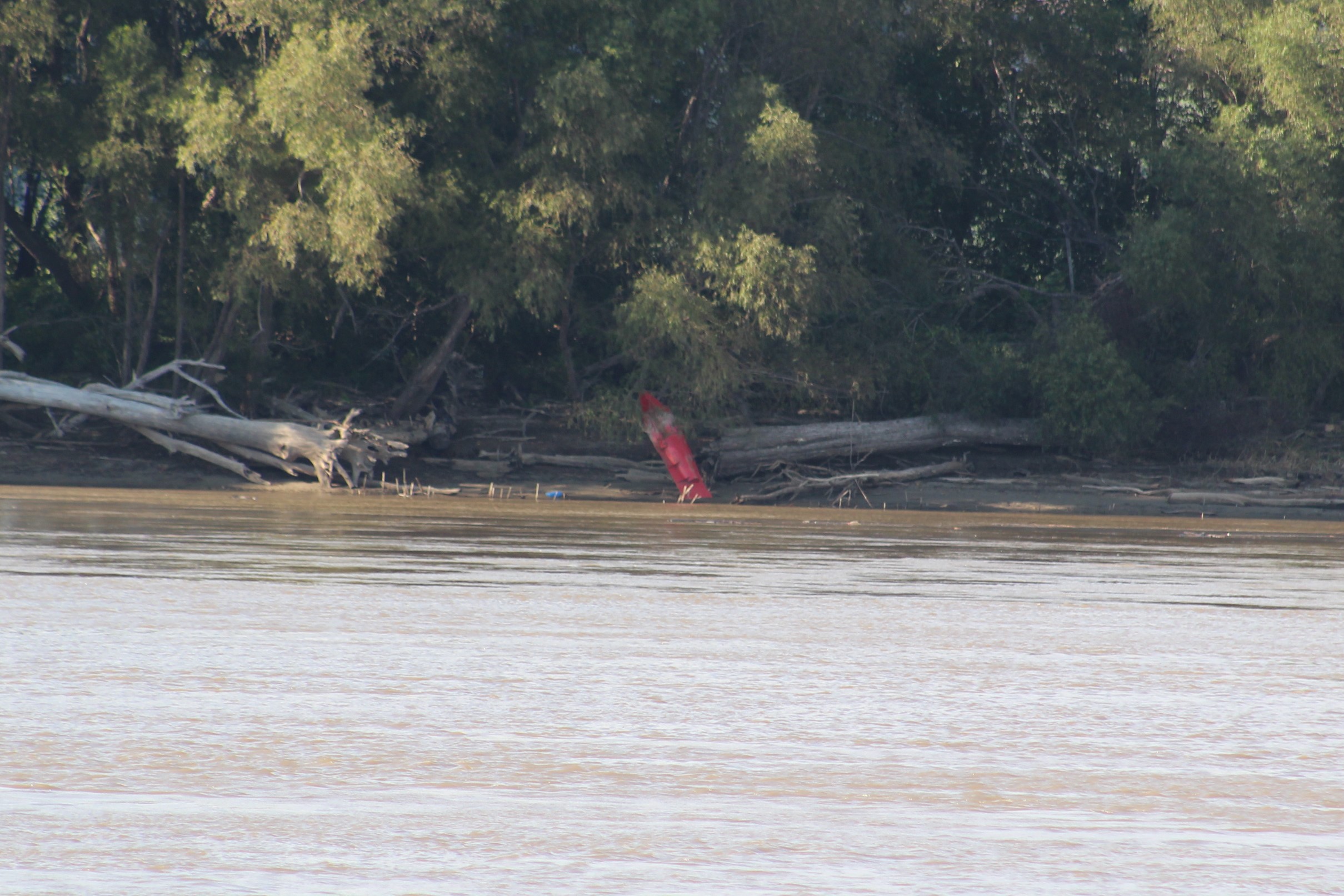
    Then 10 more miles found this little lady advertising for the Mermaid Marina.  The crew resisted the advertisement and went on up river to Double Island to anchor for the night.

    img_0033

    Monday, October 17, 2016

    This morning when the skipper started the engines to allow them to warm up, the port engine temperature again became erratic.  The temperature climbed up to about 200 degrees and then dropped down to 175 where the engine normally runs.  Then the temperature started to climb again.  This time the temperature kept going past 200.  When the temperature reached 210 and climbing the skipper turned the engine off.  The initial troubleshooting could not find anything wrong so the skipper decided to go on one engine for the day and look more in depth at the end of the day.

    img_0020
    Shoreline Shot


    Cruising on one engine developed a few new skills for the skipper.  The boat handles much differently and it took a while to get used to the new dynamics.  For example, trying to turn around on one engine is much more difficult.  And while at idle speed, steering with the wheel is tough because there is not much water passing by the rudder.  The skipper learned to increase the throttle a little to help steer while going slow.

    img_0040
    More Shoreline


    The crew passed by a small town on the river after they got going, Clifton, Tenn.  The town was almost the state capitol of Tennessee back in 1843.  The town lost by one vote to the eventual winner, Nashville.

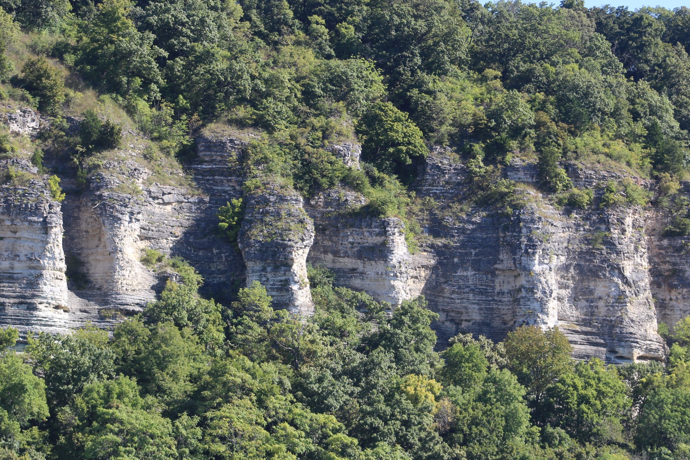
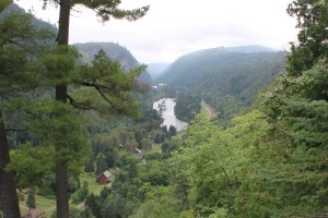
    Coming around a bend in the river the crew saw what the chart had plotted as Chalk Bluff, very scenic area.  As the crew approached the bluff, you can see that the bluff is actually clay and sand, no chalk.

    img_0041
    Chalk Bluffs


    Then just a little further up river, about five miles they came to Cherry Mansion.  The house was built in 1830 by David Robinson.  He gave the home to his daughter, Sarah, and her new husband, W.H. Cherry.

    img_0047
    Cherry Mansion – Built in 1830


    But the home was used by General Grant in April 1862.  Grant was actually eating breakfast in the home on Saturday morning, April 6, 1864 when the confederates attacked his soldiers about 8 miles up-river at Pittsburgh Landing.  The first day the Union forces took heavy losses and it looked to be a Confederate win in the making.  However, late in the day the confederates let up and stopped their attack.  This allowed the Union forces to bring in re-enforcements overnight and launch a counter attack on Sunday morning.

    img_0048
    Pittsburgh Landing where Union troops re-enforced from the river


    The confederates withdrew from the battlefield late Sunday and the Union troops did not pursue the Confederates.  When the fighting ended on Sunday, the Battle of Shiloh was the bloodiest battle to date with nearly 25,000 dead and wounded.  General Albert Sidney Johnston was one of the many casualties.  He is the highest ranking American ever killed in combat.

    After skirting around the sacred battle ground, the crew  made another 5 miles and dropped anchor at Wolf Island for the day.

    img_0055
    Water view from sundeck at Wolf Island


    Tuesday, October 18, 2016

    The crew weighed anchor and set out for the Aqua Yacht Marina to get the port engine repaired.

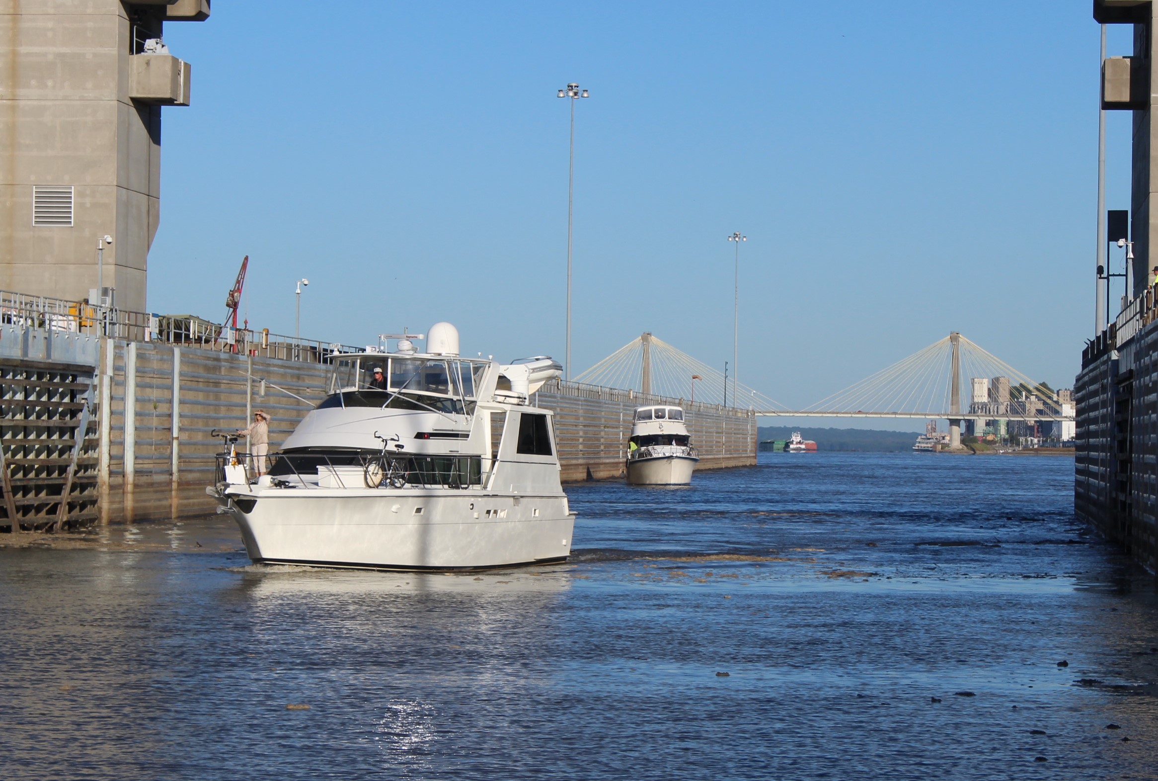
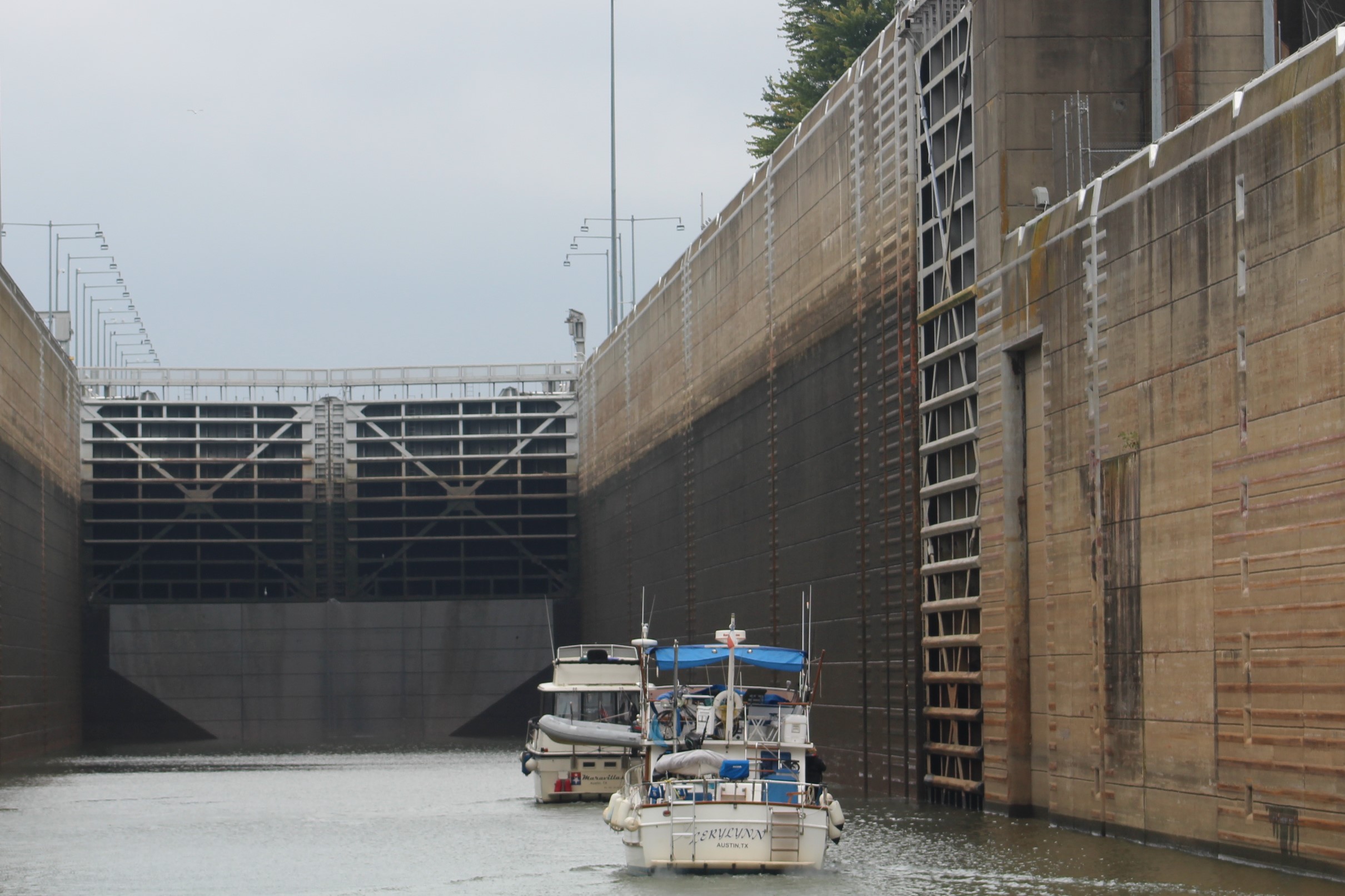
    To get to the marina though they would first have to make it through the Pickwick Lock, which was about two hours away.  The crew called the lock and learned that there was one tow about two miles in front of them.  The lockmaster agreed to lock the pleasure craft through the lock if they arrived more than 30 minutes ahead of the tow.  The skipper did some ciphering and figured they could catch the tow by mile 200.  Then due to the bends in the river and the slow speed that the tow would have to go to maneuver around the curves, that they could make the lock (mile 206.5) 30 minutes ahead of the tow.

    img_0050
    Looking out the Pickwick Lock


    When the crew was about two miles from the lock, the skipper called the lockmaster again. The lockmaster agreed to let Still Waters II and LeryLynn through the lock and he had the gate open when they arrived.  With only one engine, getting into the lock and safely secured was a bit of a challenge but the crew worked together and made it happen.

    After clearing the lock, it was only another hour to the marina.  The little bit of Pickwick Lake that the crew saw was beautiful.  But the crew had to turn off the Lake and head into the Tenn-Tom Waterway to get to the marina.  The crew passed one point where Tennessee, Alabama, and Mississippi merge in the waterway.

    img_0057
    In the water before the point, Tennessee, Alabama, and Mississippi borders meet


    The crew then made their way over to the transient dock at the marina and managed to safely land the boat.  No small accomplishment with the high winds blowing the boat off of the dock and maneuvering with only one engine.

    The maintenance team came down and decided that the water pump needed to be replaced.  They will order the part and the part should arrive sometime Wednesday.


    Thursday, October 20, 2016

    The new water pump arrived as expected on Wednesday and the mechanic changed the pump out.  Post maintenance checks were sat so the crew shoved off from the dock to test the port main engine repairs under actual running conditions.  Glad to report that the engine ran well all day.  The folks at Aqua Yacht Harbor did a fine job.

    img_0061
    Some Fall Foliage Color


    With the engine running well, the crew set out to return to the Tennessee River and start their side trip to Chattanooga.  The first half of the trip was wonderful, but about 1300 a thunderstorm caught the crew.  They were in a heavy down pour for about 45 minutes and even had one lightning strike less than a quarter mile from the boat. After the storm passed the sun tried to break through but just couldn’t make it.

    img_0063
    Been a while since the crew got drenched


    The crew timed another lock well and got a lift of 93 feet at the Wilson Lock.  The lock is named for Woodrow Wilson, our 28th president.  After clearing the lock, the crew entered Wilson Lake and headed another six miles upriver to six-mile creek to anchor.

    IMG_0066.JPG
    Waiting for the Wilson Lock gates to open


    Friday, October 21, 2016

    The crew weighed anchor and set out to the Joe Wheeler Lock.  This lock is named for Joseph Wheeler.  He was one of many West Point graduates that fought for the Confederate Army.  During his military career, he rose to the rank of General, fought in 127 battles, and had 16 horses shot out from underneath him.  After his military career, he served in Congress.  Upon his death, he was laid to rest in Arlington National Cemetery.

    The crew saw a small armada of 12 looper boats headed down bound leaving the fall looper rendezvous.  Because of the distance between the boats, the crew did not recognize any of the boats.

    img_0074
    Part of the armada leaving Joe Wheeler


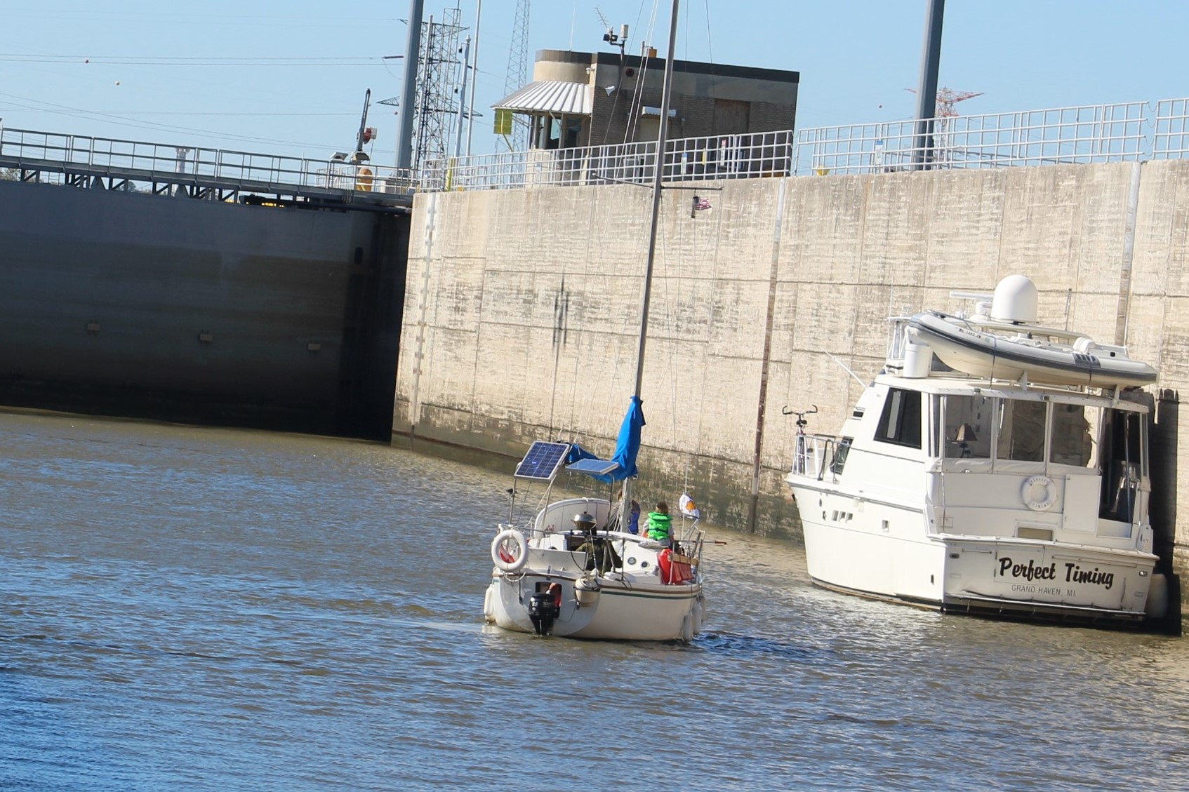
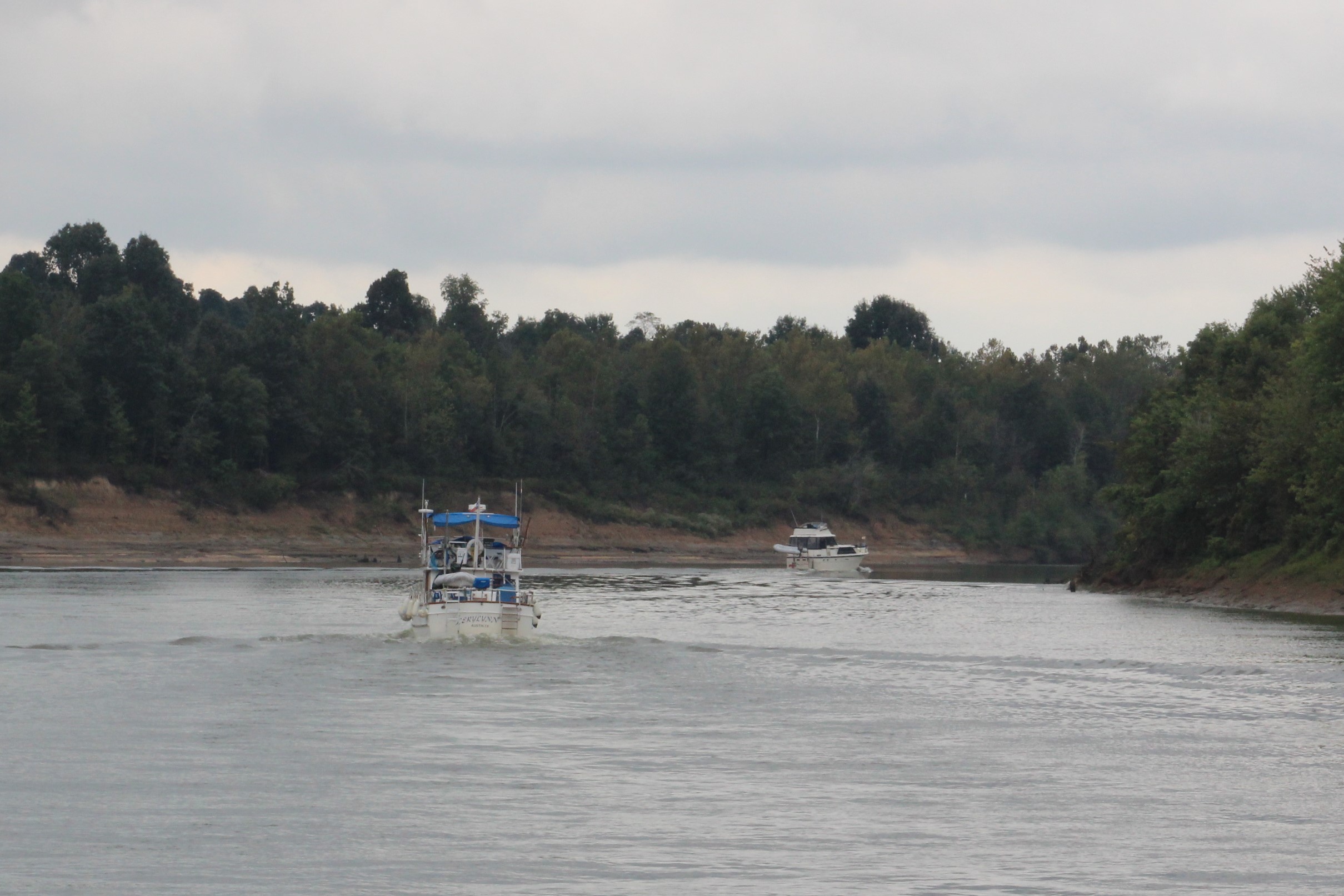
    Upon arrival at the lock, there was a tow entering the lock.  The lockmaster said it would be two and a half hours before the crew could enter the lock.  The lockmaster did give the crew permission to tie up along the wall of the auxiliary lock to wait.  The LeryLynn arrived about an hour later, so they rafted off of Still Waters II and the two crews chatted while waiting on the lock.

    img_0077
    Had to wait for this big guy to clear the lock


    Finally, a little after noon the tow completed locking up and the crew was prepped to go in the lock.  When the lockmaster lowered the water level in the lock, the water came boiling up near the crew.

    img_0079
    For a little perspective, the wall is about 5 foot tall


    Three looper boats locked down and the crew saw Abaco Lady for the first time since Norfolk, Virginia, way back in May.  The two crews waved at each other as they passed by.

    img_0080
    Abaco Lady and Crew


    After clearing the lock, the crew made their way to the town of Decatur where there is a free dock to tie up on for the night.  There was a looper boat, Irish Lady Too already on the dock so the crew came over to catch our crew’s lines and help them dock.   Kurt and Susan crew Irish Lady Too.  They set out on the loop in May of 2015 from Baltimore, Maryland.

    img_0084
    Sunset in Decatur


    Saturday, October 22, 2016

    After shoving off from the dock the crew dodged a near catastrophe.  Just another reminder that the crew has to be constantly diligent of their surroundings.  After getting past the break water wall for the dock the skipper ran the boat up on an underwater sand/mud bar.

    img_0088

    The depth changed from 9-10 feet to less than 4 feet almost instantly.  The good news was that the skipper was only running at idle speed waiting for the engines to fully warm up.  The starboard engine shut off and the skipper turned off the port.  The Admiral ran below and checked all the bilges and made sure there was no water coming in the boat.  After a positive report from the Admiral, the skipper started the port engine and tried reverse.  The boat budged a little bit.  The skipper tried reverse again and the boat rocked back a little more.  The skipper then started the starboard engine and put both engines in reverse.  The boat slid backwards and off the sandbar.  Not a good way to start the morning.

    img_0097

    After allowing the engines to warm up the skipper put the engines in forward and speed up.  The engines ran fine all day and all seems to be ok.

    The run along the river was breath taking today.  The fall foliage continues to change more colorful by the day.  The cool weather, in the 40’s at night might be the reason for the color change.  The run after the Guntersville Lock and Dam was spectacular.  The cliffs surrounding the lake were just gorgeous.

    img_0093

    The crew did pass one interesting area full of space history, Huntsville, Alabama.  This is the area where the US entered the space race thanks to the German engineering of Dr. Wernher von Braun.  Von Braun is credited for developing Germany’s V-2 rocket that was used to bomb the day lights out of the British.  With the war winding down and not wanting to be captured by the Russians, von Braun and his team headed towards American forces and surrendered to the Americans.  Following the war, von Braun and 100 members of his team agreed to come to the United States.

    img_0104
    Cruising with LeryLynn


    They initially were sent to Ft. Bliss, Texas.  In 1950, the von Braun rocket team was moved to Huntsville, Alabama.  On January 31, 1958 the US launched a Jupiter-C Rocket from Huntsville carrying Explorer 1, which became our first earth orbiting satellite.  Huntsville is the home of the Space & Rocket Center, the world’s largest space museum.  The crew plans to visit the museum on the return trip down the Tennessee River.

    img_0111
    LeryLynn


    About two hours after cruising by Huntsville, the crew approached the Guntersville Lock.  The Lockmaster had the gate open for the crew and they cruised into the lock for the 40 foot lift up to Guntersville Lake.

    img_0095


    After clearing the lock the crew headed for the town of Guntersville and found another free dock at a municipal park.  The crew tied up and grilled steaks on the dock with the crew of LeryLynn.

    Next Week – The crew is still two days away from Chattanooga.  The plan is to arrive on Monday and spend three nights in town.  They will leave Chattanooga on Friday morning and start the four-day journey to Knoxville, Tennessee.


    Loop On – The water goes on forever and the adventure never ends.

    La Salle

  • T for Tennessee

    Hello virtual crew members and fellow adventures.  This week’s post is a tad late because the crew has been without any internet signal since the weekend.  These backwoods Tennessee folks apparently have no need for the internet.  For some reason though the skipper keeps saying, “Speed up, I think I hear banjo music.”

    La Salle here catching you up to date on the latest travels of Still Waters II. Click on this link to see the day- to-day travel log.

    The week saw our crew return to Green Turtle Bay on the Cumberland River.  Then set out up the Tennessee River.  They have only made it to mile 96 near New Johnsonville, Tennessee.

    IMG_0014.JPG
    Near New Johnsonville on Tennessee River


    A little about the Tennessee River since the crew will be on this river for several weeks:

    The river is the 7th largest in the US.

    The river is the largest tributary of the Ohio River.

    The river begins east of Knoxville, flows southwest and then turns north to flow into the Ohio River at Paducah, Kentucky.

    Water from east of the Smoky Mountains actually flows westward through the mountains to the Tennessee River rather than flowing east to the Atlantic Ocean.

    Then the river flows almost 200 miles north to the Ohio River rather than flowing westward straight over to the Mississippi River which is actually much closer.

    The area was first visited by the Spanish explorer Desoto in 1540.

    Me and my French brothers claimed this area for France when we claimed all the lands drained by the Mississippi River.  We finally sold all this land to you Americans to help fund our Napoleonic wars.

     Monday, October, 10, 2016

    The crew shoved off this morning to complete the two day journey back to Green Turtle Bay.  Since we have shared the history of this section of river already, I have decided to show the river and let the beauty speak for itself.


    80-mile-95
    Cumberland River ~ mile 95
    83-mil3-90
    Cumberland River ~mile 85
    98-mile-80
    Cumberland River ~ mile 75
    109-mile-75
    Cumberland River ~ mile 75
    110-mile-73-dry-creek-anchorage
    Dry Creek Cove ~ mile 70 Anchorage
    111-sunset-at-dry-creek
    Sunset across Cumberland River at Dry Creek Cove


    One observation of the day though was that the skipper noticed an unusual number of Grey Herons along the shore.  He decided he would count the number of Herons spotted for the next twenty five miles before the crew anchored.  He spotted 80 of the birds in those twenty five miles.


    Tuesday, October 11, 2016

    The crew weighed anchor and made their way back to Green Turtle Bay.  There were not as many Looper boats in the marina as when the crew left last week.  Most of the Loopers are trying to get south for the fall rendezvous event at Joe Wheeler State Park, which starts next week.

    Our crew is lagging behind to allow this surge of boaters to get to the state park so there will not be crowds at anchorages and marinas.  The crew is skipping the rendezvous because they only need to get from Joe Wheeler to Fort Myers to cross their wake and complete this journey.  The crew thinks they can figure out how to get to Fort Myers from here.

    112-mile-70
    Cumberland River ~ mile 70


    115-mile-65
    Cumberland River ~ mile 65, snags in the shallow water


    116- mile 60.JPG
    Cumberland River ~ mile 60, making the Devil’s Elbow turn


    117-mile-55
    Cumberland River / Barkley Lake ~ mile 55


    118-mile-50
    Barkley Lake ~ mile 50


    119-mile-45
    Barkley Lake ~ mile 45, notice the Pen in the background


    121- mile 35.JPG
    Barkley Lake ~ mile 35, marina just ahead


    Thursday, October 13, 2016

    The crew has buddied up with LyreLynn once again.  The two crews had breakfast and then set out for a short cruise to Duncan Bay on Kentucky Lake.  As the skipper exited the marina, a large barge was going by so the crew waited for the tow to pass.  Unfortunately, the tow was also headed into Kentucky Lake.  The crew followed the tow through the canal.  I think this could be the longest two miles ever travelled, 32 minutes.


    IMG_0002.JPG
    Barkley Canal


    After the crew entered Kentucky Lake, they headed south, up bound on the Tennessee River.  Along the right descending bank, there are five large bays off of the lake.  The crew anchored in the third one, Duncan Bay.

    IMG_0006.JPG
    Anchored in Duncan Bay on Kentucky Lake


    Friday, October 14, 2016

    The plan was to weigh anchor at 0800 and head out on a 64 mile cruise.  However, the starboard engine decided it would play hard to start.  After trying to start the engine, troubleshooting and finding nothing wrong, and failing to start again: the skipper decided to weigh anchor and proceed on the port engine only.

    IMG_0008.JPG
    Rock formations along Kentucky Lake


    After the anchor was secure and the crew was idling back to the main channel, the skipper reached over and turned the key on and pressed the start button for grins.  To his surprise the starboard engine immediately cranked and started.  Interesting, interesting indeed.

    IMG_0009.JPG
    Big rock on Kentucky Lake


    With both engines running the crew made their way up the Tennessee River to the Pebble Isla Marina.

    IMG_0019.JPG


    The other issue today would be the rainy weather.  It looked as though the storms might pass and the crew would be spared cruising in the rain.  However, as the crew continued south they eventually caught the storm.  The rain was more of a drizzle and only functioned to make it hard to see.  On a brighter note, as the crew was approaching the marina the drizzle stopped and the crew was able to dock without getting wet.

    IMG_0011.JPG
    The skipper has spent many a day vacationing in the rain


    A few interesting highlights on the way south:

    –          The crew entered Tennessee at about mile 62.6

    –          There was an old building left abandoned in the river at mile 78.  The building was flooded when the Kentucky Dam was built.  Authorities tried to remove the building but it was so well built that efforts to destroy it failed.  The final solution was to leave it standing.

    IMG_0012.JPG
    Abandoned Building in Lake


    –          The crew passed Pilot Knob just before entering the marina.  Early steamboat captains used the knob as a handy landmark while piloting the river.  However, the knob also oversaw the only battle in history where a Cavalry defeated a Navy.  Yes, you read that right, a Cavalry defeated a Navy.  The crew will go visit the State Park and museum tomorrow to get the details.  This should be a good story.

    IMG_0016.JPG
    Pilot Knob


    Saturday, October 15, 2016

    The skipper likes to say that the victors in battle get to write the history.  Seems that is what has happened when it comes to Sherman’s famous march across Georgia.  Turns out there was a reason he decided to have his army live off the land as they headed to Atlanta, and then on to the Atlantic Ocean.  His supply lines and supplies were destroyed on November 4, 1864 in Johnsonville, Tenn.

    The Union army had created a large depot in Johnsonville where supplies were shipped down the Ohio, Cumberland, Mississippi and Tennessee Rivers.  Then the Union army had built a rail system connected with the existing rails that supplied Nashville.

    A Confederate Plan was put into motion to destroy the Depot in Johnsonville.  Confederate General, Nathan Bedford Forrest started the action to destroy the supply lines on October 24, 1864.  He initially attacked the Union forces further north on the Tennessee River and then disappeared.  The Union forces thought that they had defeated General Forrest and went back to business as usual.

    Actually, the General was busy placing heavy artillery within 50 yards of Johnsonville.  A young officer working for the General noticed that the Union cannons placed above Johnsonville were located such that they would be unable to lower the cannon fire to the low bluffs along the opposite side of the river.  He also noticed that the iron clad ships were too low in the water to return fire to the bluffs.  After strategically setting 10 cannons along the bluffs, the General opened fire at 1300 on November 4th.

    IMG_0018.JPG

    By nightfall, 33 Union ships had been sunk, two trains destroyed, Sherman’s supplies worth 6 million dollars were burned to the ground, and 150 Union troops were captured.  Sherman had no choice but to live off the land because all his supplies were literally up in smoke.

    Sherman was quoted as saying, “That devil Forrest must be hunted down, even if it costs 10,000 men and bankrupts the Federal Treasury.”

    Another fun fact about Forrest, he mustered into the army as a private and ended the war as a Lieutenant General.  The only person ever to pull off such a rise in American military history.

    Next Week – The crew will continue their journey up the Tennessee River with a goal to reach Chattanooga by the weekend.


    Loop On – The water goes on forever and the adventure never ends.

    La Salle

    IMG_0017.JPG
    Lynn painted this portrait of Still Waters II while anchored in Duncan Bay


    Thanks Lynn!!!!!

  • Nashville Nights

    Hello virtual crew members and fellow adventures.

    La Salle here catching you up to date on the latest travels of Still Waters II. Click on this link to see the day- to-day travel log.

    I would also like to welcome the crew of Moon Shadow aboard as fellow adventurers and voyagers.  They are cruising the loop in a 1997 Mainship Trawler.  Welcome aboard and hope to meet you on the water!

    The week was spent making the 160 mile run up the Cumberland River to Nashville, Tennessee.  Then beginning the return trip to Green Turtle Bay by stopping in Clarksville.

    The Cumberland River may not be one of America’s, biggest rivers, but it certainly has had a big impact on the nation’s history.

    img_0008
    Shore line of the Cumberland River


    The navigable waters start at the Ohio River and run for 381 miles to the small town of Celina, TN.  The river actually carries on for another 350 miles past Celina.

    The Cumberland River first served as a passage way through the Appalachian Mountains and then as a stream of commerce.  In the years before the Civil War, there were 340 steamships that carried cargo and passengers up and down the river.

    After the war, 26 steamboats continued to run cargo and people on the river.  In 1887 a plan was developed to reduce the hazards on the river because of a few dangerous places that caused both loss of life and loss of ships.  Eventually 15 locks and dams were built to calm the river.  As modern ships replaced the steamships requiring both more depth and width in the locks, the old locks were replaced with four new locks and dams.  Two above and two below Nashville.

    Today, the river still is an industrial artery for the nation’s commerce, but it also provides hydro-electric power, flood control, and recreation for people such as our crew.

    Tuesday, October, 4, 2016

    The crew left Green Turtle Bay and headed out into Lake Barkley.  The crew will actually follow the old river channel in the lake up to mile 148 where they will encounter the next dam and lock.  Though the lake is 2 miles wide at this point, most of the water is extremely shallow out of the river channel.  The fall draw down of the lake water level has also begun.  The water looks to be about 3 feet below normal summer pool level.

    img_0001
    The Castle on the Cumberland

    The first major landmark along the river was the Kentucky State Penitentiary.  The main building was completed back in 1888.  Kentucky imported 30 Italian stonemasons to work on the building.  The building has the nickname of “The Castle on the Cumberland.”  So, if you would like to live in a castle, come to Kentucky and commit a major crime.  I am sure they would be glad to house you in their only maximum security prison.  But buyer beware, this place also holds the record for the most legal executions in one day, set back on Friday, July 13th, 1928, when seven men met sparky, the electric chair.


    img_0011
    White Pelicans enjoying a sand bar


    Finally, at about mile 70, the lake changed to look more like a river.  The area is referred to as the “Thousand Islands” due to all the sandbars that stick up out of the water.  Then just a mere four miles further, the crew entered Tennessee.

    img_0013
    The Volunteer State


    When the crew came around a bend in the river at mile 86, they noticed a battery of cannons pointed at them.  This was Fort Donelson, the site of the first major victory for the North in the Civil War, and the beginning of the end for the South.  The battle took place on February 14, 1862 and eventually resulted in the surrender of 13,000 Confederate Troops.

    img_0021

    The surrender took place on February 26, 1862 in the Dover Hotel. General Grant accepted the unconditional surrender of Confederate General Simon B. Buckner.  Interesting enough, this was the one and only unconditional surrender by a large army during the war.

    The crew soon passed  Dover on the river and then continued up-river to anchor for the night behind Dover Island.

    img_0023
    Dover Island Anchorage


    Wednesday, October, 5, 2016

    img_0024
    These guys passed the crew on Tuesday.  The crew found them working on Wednesday morning replacing navigational aids


    After weighing anchor in the morning, the crew cruised a more scenic peaceful river until a few large stacks dominated the horizon.  The 1,000 foot stacks belong to the TVA Cumberland steam plant.  When the construction crews were excavating the foundation of the plant they found evidence from a meteorite.  Scientist believe that a 20 mile wide meteor struck the earth in the vicinity.

    img_0025

    After passing through the town of Clarksville, the crew arrived at the Cheatam Lock and Dam.  After clearing the Lock, the river passed through a waterfowl refuge.  The crew saw many birds in this area.

    IMG_0029.JPG
    Entering Cheatam Lock for a 26 foot lift


    As the sun began to drop in the late afternoon the crew pulled up a mile into the Harpeth River to drop the anchor for the night.

    img_0033
    Tonight’s water view in the Harpeth River


    Thursday, October 6, 2016

    img_0034
    Travelling the Cumberland River in the fog


    The crew wanted to get an early start so that they would arrive around noon in Nashville.  But as boating is teaching the crew, their plans do not always take shape.  With the warm water and cool fall night, there was a heavy fog in the morning.  The crew waited until they had about a mile visibility before heading out of the Harpeth River and into the Cumberland River.  The idea of rounding a bend and finding a down bound tow did not seem worth the effort to travel in the fog.

    img_0036
    Better view without the fog


    Along the river from here to Nashville there were many freight terminals working with such materials as grain, gravel, cement, petroleum, coal, and scrap metal.

    img_0039
    Look closely.  That is a Bobcat attached to the bucket.  They put the Bobcat down in the barge to get every last little bit of material.  The crew passed by as they were pulling the Bobcat out of the barge.


    At mile 182 on the river the crew passed under the Andrew B. Gibson bridge for Tenn I55.  The parkway encircles Nashville at a radius of about 5 miles from downtown.  However, by boat it is another 10 miles to the downtown docks due to the winding and twisting of the Cumberland River.

    img_0041
    5 by land – 10 by river


    The first white men to come to this area were my fellow French Fur Traders, but James Robertson and John Donelson are the folks credited for starting the town of Nashville.  James Robertson led a group of men, boys, and livestock overland to the banks of the Cumberland from the Carolinas.  The men arrived on Christmas 1779 and began to build shelters.  John Donelson, who arrived in the spring of 1780, took the wives and children of the men on 30 boats on a 1,000 mile journey up the Tennessee River, Ohio River, and then the Cumberland River to the site on the west bank where the men had started to build a fort.

    img_0054
    Founding Father Statue


    The little fort was renamed Nashville in 1784.  In 1843, the state capital was moved from Knoxville to Nashville.  During the Civil War, Nashville’s strategic location on the river and railroad links to towns further south, made it a natural target for the North.  After Fort Donelson fell protecting the river route to town, Nashville fell to the North and remained occupied for the three remaining years of the war.

    img_0043
    The view from Still Waters II on the east shore


    After the war years, Nashville prospered.  By the 1920’s the town was linked to country music and by the 1950’s every major record label had offices in the city.  America’s longest running radio show, WSM’s Grand Ole Opry, started in one of these studios in 1925.  Moved to the Ryman Auditorium in 1941, and has been in its new home near the Opry Land Hotel since 1974.

    img_3165
    Larry Gatlin at the Ryman Auditorium


    img_3161

    Night Life in Nashville


    Friday, October 7, 2016

    This was a shore excursion day for the crew.  The skipper loves him some hamburgers, and there is a Five Guys Burger and Fries only 1.8 miles from the boat.  The Admiral and skipper set out on foot to enjoy a burger for lunch.  It had been back in June since they had a Five Guys Burger, and well, that is just too loooooong.

    After satisfying their burger craze, they headed over to Vanderbilt University to explore the campus.  The 330 acre campus is actually a national arboretum and features over 300 different species of trees and shrubs.

    img_0046
    The stone column is all that remains from the original main entrance to campus


    The crew then headed back towards the downtown area.  When they arrived at the visitor center, they ran into a policeman who came up and introduced himself. The officer asked where the crew was from and welcomed them to his fine city.  During the conversation, the skipper asked the officer where the best ice cream in town could be found.  Without hesitation, the officer said Mike’s and gave directions.

    The Admiral and skipper found Mike’, and both had the banana pudding ice cream.  It was delicious.

    img_0045
    Budding Artist at the Art Museum


    img_0044
    Cornerstone laid in 1830


    The crew wandered around town a little longer and then headed back to the boat to sit on the dock and listen to the country music flow across the river.

    img_0053
    The Admiral found this guy and wandered over for a closer look.  Wish the skipper would have caught her shock when the snowman moved


    Saturday, October 8, 2016

    The crew shoved off from the dock and headed back down river with the current with the goal of making Clarksville.  Though they made the marina before dark, it was with only about 30 minutes left of light for the day.

    img_0058
    The skipper spotted this flag on an up bound tow


    img_0059
    The tug’s home port is Houston, TX


    When the crew arrived at the Cheatam Lock and Dam, there was an up bound tow in the lock.  The tow was pushing a 3 x 5 set of barges.  The lock was not long enough to get all the barges through with one lift so the tow had to untie the barges and put them through in two chunks.  After the first set of barges were through the lock, they were made fast on the wall.

    img_0057
    The crew prefers to meet this size tug


    The tug then went down and retrieved the remaining barges and locked up.  Then the tug crew had to tie and make fast before the tow could clear the lock.

    Our crew arrived when the first set of barges were locked up and the tug was headed back down.  The crew dropped the anchor and waited two hours before the evolution was complete and the tow passed the crew.  After the tow passed, the lock master gave our crew the green light to enter the lock and make the 26 foot drop back down to the Barkley Lake level.

    img_0060
    Interesting engineering solution to a boat launch problem


    With 25 miles to travel to the marina it was a good thing the current was providing a nice push down river.  The crew arrived at 1800 with an 1820 sunset.

    Next Week – The crew will continue their return to Green Turtle Bay on the Cumberland.  They then plan to cross over into Kentucky Lake and continue the loop south on the Tennessee River.

    Loop On – The water goes on forever and the adventure never ends.

    La Salle

    In the 60’s, Six Flags Over Texas opened with the famed LaSalle River Adventure.  The skipper was a young boy when this park opened and his family visited every season.  I can recall watching the young skipper dive for the bottom of the boat every time we approached the cannon fire of the Spanish Fort.

    I was a bit surprised when Eric told me that our skipper was going to even try to cruise down the Mississippi River.  I took this assignment just to see if his fears of cannon fire had subsided.  I did get a good chuckle when the crew rounded that bend on the Cumberland and the skipper was facing the cannons.  I sure wish one of them would have fired.  You would find me still laughing at the skipper.

    Since we did make it safely down the Mississippi, I thought I would share the virtual ride back in the day.  Click on the link to take the river boat ride.  The cannon fire starts about three minutes into the video.  Enjoy.


  • Divine Appointment

    Hello virtual crew members and fellow adventures!

    La Salle here catching you up to date on the latest travels of Still Waters II. Click on this link to see the day – to – day travel log.

    The week was spent making the 300 mile run down the upper Mighty Muddy Mississippi River, from Alton, Illinois to Cairo.  From here the crew travelled up the Ohio River to the Cumberland River and eventually landed at Green Turtle Bay Marina in Grand Rivers, Kentucky.

    gtb

    Monday, September, 26, 2016

    The crew was informed at docktails on Saturday night that both Hoppies Marine Services and Green Turtle Bay Marina transient docks were full of Looper boats and that a 48 hour advanced reservation was required to get dock space.

    The skipper called Hoppies and sure enough the 300 foot of available dock space was full for Monday night.  The skipper made reservations for Tuesday.  To shorten the run on Tuesday, the crew decided to move 15 miles down river to Alton.

    img_0001
    Convergence of Illinois and Mississippi River’s.  Pic taken from the Illinois River.  The upper  Mississippi River is on the other side of the sliver of land to the right of pic.

    This is mile 0 on the Illinois River and mile 218 on the upper Mississippi River.  The boat got an extra 1 knot push after entering these waters.

    img_0004
    Cliffs on the left descending bank (LDB)

    Almost immediately after entering the upper Mississippi River these limestone cliffs appeared.  During the Marquette-Joliet Expedition in 1673, to determine if the Mississippi River actually made it to the Gulf of Mexico, the native Indians warned the explorers that there were dragons that guarded the path south.  When the expedition saw these cliffs, they also saw a dragon painted onto the cliff walls.  Marquette actually made a sketch of the dragon in his journal and wrote:

    “While Skirting some rocks, which by Their height and length inspired awe, We saw upon one of them two painted monsters which at first made Us afraid, and upon Which the boldest savages dare not Long rest their eyes. They are as large As a calf; they have Horns on their heads Like those of a deer, a horrible look, red eyes, a beard Like a tiger’s, a face somewhat like a man’s, a body Covered with scales, and so Long A tail that it winds all around the Body, passing above the head and going back between the legs, ending in a Fish’s tail. Green, red, and black are the three Colors composing the Picture. We have learned that the great-great-great-great-great-great grandfather of Miss Jessica Beetner smote this monster. Moreover, these 2 monsters are so well painted that we cannot believe that any savage is their author; for good painters in France would find it difficult to reach that place Conveniently to paint them. Here is approximately The shape of these monsters, As we have faithfully Copied It.”

    piasa-bird-alton-il
    Reproduction now on the cliff wall


    But with the rain of time the dragon has washed away.  However, the cliffs remain standing guard over the river.

    img_0007
    Statue in Portage des Sioux on right descending bank (RDB)

    In 1951 the town of Portage des Sioux was threatened for the very first time in its history with flooding.  Father Edward B. Schlattmann called upon his parish to start praying for protection from the flooding.  While other river communities indeed were swept up under the flood, the town of Portage remained mostly high and dry.  In gratitude, the parish erected this statue overlooking the river.  The 25 foot statue stands on a 20 foot pedestal.

    img_0009
    First tow encountered on the upper Mississippi River

    As the crew continued down bound they encountered this large tow moving up bound.  The tow has three barges across and is 5 barges long (3×5) for a total of 15 barges.  The skipper hailed the tow to determine which side to pass down.  The tow captain said on the ‘One” so the skipper steered to starboard and passed the tow port – to – port.


    img_0010
    The Clark Bridge between Illinois and Missouri

    After passing the tow the crew could see the Clark Bridge 5 miles down river.  The Alton marina is just on the other side of this bridge at mile 203.

    img_0011
    The red line running across the tank below the flag marks the high point of flooding in 1993

    After docking, the crew walked around Alton to see what the town was all about.  What they learned was that flooding is a major problem and threat here.  There have been three major floods, 1844, 1973, and 1993.  The 1993 was the worst with the flood waters 23 feet above the flood level of the river.

    Tuesday, September 27, 2016

    The crew got off to a good start today by making the Mel Price Lock with a minimal wait.  Once the crew secured the boat to the bollard the lock master informed the crew that they would wait for two other boats who were just passing under the bridge two miles upstream.

    img_0012
    Lock companions at the Mel Price Lock

    Just a few miles down stream the crew encountered the Missouri River pouring into the Mississippi River.

    img_0014
    Looking back up the Missouri River


    The Lewis and Clark Expedition, also known as the Corps of Discovery Expedition, started up this spot in May 1804 to explore the Missouri River all the way to its head waters and then onto the Pacific Ocean.  Many know the story of the expedition, but have you ever wondered what happened to them after the expedition was over?

    Clark went on to become the first governor of the newly created Missouri Territory in 1813, and held the position until the time that Missouri became a state in 1821.  He also held the position of Superintendent of Indian Affairs for the west.  He died in September 1838.

    However, his story is not near as interesting as the mystery of Lewis.  Following the expedition, Lewis fell into depression that then led him to heavy drinking.  In the midst of his depression, he was on his way to Washington to collect some debts the government still owed him from the expedition.  On the Natchez Trail, he stopped at Grinder’s Stand, about 70 miles from Nashville.  He was found the next day, October 11, 1809,  with two pistol shots, one to the chest and one to the head.  His money and horses were missing.  The officials ruled suicide brought on by depression.  Others believe it was murder so the government would not have to pay the legitimate travel expenses that Lewis was trying to collect.  So, did someone get away with murder?

    The next thing encountered by our crew was this large sign telling them to go to the left down the canal rather than the right down the rapids caused by the ‘Chain of Rocks.’

    img_0017
    To the right is un-navigable rapids


    img_0016
    Looking down the canal

    When the crew arrived at the end of the canal at Lock 27, they found a large tow in the lock and four boats waiting to lock through.

    img_0018
    Tow in Lock 27

    After the tow exited the Lock, six pleasure craft entered the lock to get dropped down 12 feet. The lock master allowed the Living Life sailboat to just float in the lock while all others tied off.

    img_0020
    Floating in Lock 27

    Five miles downstream the crew drifted by the Gateway Arch in St. Louis.

    IMG_0022.JPG

    The river traffic along the St. Louis banks was busy with barges and tows all around.  In fact, it was nearly 8 miles of barges on both banks before the crew finally broke free of the view and saw the trees again.

    IMG_0026.JPG
    Barges just anchored in the river

    But before the crew left the city of St. Louis, they did see some interesting yard art along the houses overlooking the river.


    img_0025
    Bottoms up

    The crew continued down river dodging water hazards.  With the river running at a couple of knots, these water hazards can do some serious damage to the boat.  Luckily for the crew, there are less hazards this week than last.


    IMG_0028.JPG
    Old tree = Water Hazard

    The crew arrived at Hoppies Marine Services in good time due to the current.  After docking the crew walked around town and had lunch at The Blue Owl.  The town was a pleasant surprise but the Blue Owl was a great surprise.  Excellent food at reasonable prices.  Fern, the owner of Hoppies, had recommended their apple pie.

    IMG_0032.JPG

    The apple pie is named Levee High Apple Pie.  The name comes from the famous 1993 flood.  The town would have been under water except the temporary sandbag levee held and protected the town.

    img_0033
    White sandbags and dirt can be seen at the end of the bridge on either side of the road leading into town

    The Blue Owl commemorated the near miss with the Levee High Apple Pie. Here is one slice of pie.

    img_0031

    The crew needed to get back to the dock so they could attend the briefing that Fern does for the boaters.  She discusses the down stream hazards, anchorages, and safety precautions to be used for the next 200 miles.

    img_0029
    Fern holding court and a cigarette

    Yes, that green hose is the fuel line for the diesel.  Court is held on the fuel dock.  And yes there are signs posted that say No Smoking.

    img_0030
    No Smoking sign – dead ahead

    The briefing was excellent and the information was priceless.  The crew is ready to anchor out the next three nights as they make their way to the next marina at Green Turtle Bay on Barkley Lake.

    Wednesday, September 28, 2016

    The crew shoved off the dock a little after daybreak this morning because they plan to have a long cruise today, 110 miles on the Mississippi River.  There are no locks in this section of river so running with the current the crew should make these miles easily.

    img_0034
    On the dock at Hoppies

    The scenery did not change much all day.  The Missouri side of the river continued to have high limestone bluffs standing guard over the river.  While the Illinois side was mostly flat tree lined shore.

    The big news today was the big tows that were passed.  One tow was six barges wide and seven barges deep, a new record for our crew.  The tow was pushing up river and the prop wash from behind the boat was huge.  Water was churning up over five feet from behind the tug.  This caused five foot waves which then bounced off Kthe shore and back into the river.  Then the waves collided with each other out in the middle and caused confused seas.  It took almost four miles before the waves calmed down and the river returned to normal flow.

    IMG_0037.JPG
    6×7 tow


    Another new hazard was introduced today also.  There are underwater dikes and /or wing dams that have been built along the shore of the river.  These funnel the water from the shore out into the center of the channel to prevent shore erosion.  At some locations where the bend in the river is narrow, these dikes cause small to large whirlpools.  Some underpowered boats like a sailboat can get caught in the swirling water and not have enough force to get out.

    IMG_0044.JPG
    Small whirlpool


    Still Waters II has enough horsepower not to get caught, but the swirling action of the water can spin the boat around if you are not careful.  The crew had to pass two of the more dangerous whirlpool areas on the run today.  It was very impressive to see the water funnel clouds spinning around in the water as the crew passed safely by.

    Then the last surprise is the number of navigational aids that are missing or are off station.  Fern warned of this yesterday in her briefing.  The skipper estimates that at least 25 % of the aids are missing.  To counter this, the crew is piloting the boat down the sailing line drawn on the electronic chart plotter.

    img_0043
    Red Marker on the shore


    But interesting enough, the crew did pass a cache of new navigational aides stacked over on the left descending bank today.  Maybe the Corps of Engineers is staging for a work party to put some of the markers back in place.

    img_0042
    Need to get these on station


    The crew made the 110 miles down river in 9 hours and anchored in the Little River Diversion channel off the main River about 1700.  They found Maravillas  and LeryLynn also anchored in the area.

    Thursday, September 29, 2016

    The crew got another early start and left the anchorage at day break with Maravillas and LeryLynn to make a three boat flotilla for this next section of river.  This next section is famous for long delays at two separate locks.

    The flotilla made good time making the Cairo Point Junction 50 miles down river by 1045.  Cairo is mile 0 of the upper Mississippi, mile 953 of the lower Mississippi, and mile 981 of the Ohio River.

    img_0047
    Cairo Point, Looking down the lower Mississippi River


    img_0051
    Cairo Point, Looking up the Ohio River


    The run on the Ohio River slowed the flotilla as the boats were going against the current.  It took a little over two hours to make the 17 miles to the Olmstead Lock.  This lock is under construction and is scheduled for operation in 2020.  For now, boats are escorted thru the lock chamber that is completed.  Because of the escort, it not uncommon for boats to wait several hours to get thru the lock.

    img_0056
    Tow headed into Olmstead Lock


    Our flotilla arrived just as a tow was beginning to make the passage thru the lock.  The lock master told the flotilla to fall in behind the tow and go thru the lock.  The flotilla took less than an hour to clear the lock.

    From here it was another 23 miles to the infamous Lock 52.  This Lock is old and in need of retirement.  The Olmstead Lock is being built to replace Lock 52.  The flotilla arrived at Lock 52 to find five pleasure craft anchored and waiting to go thru the lock.  There were 11 tows below the lock and 14 tows above the lock waiting their turn to pass thru the lock.  It takes a tow about an hour to enter, lock, and exit the area to allow the next tow into the lock.

    When the flotilla arrived at 1700, there was a down bound tow in the lock.  The lock master radioed the pleasure craft and informed the boaters that he was going to allow them passage thru the lock when the tow exited.

    img_0063
    Floating in Lock 52


    img_0065
    Exiting Lock 52


    After exiting the Lock, the flotilla had eight miles to go to the nearest spot to anchor.  The crew arrived in the dark and got the anchor down to complete a very successful 97 mile day with few delays.

    Friday, September 30, 2016

    With only 44 miles needed to go and one lock to Green Turtle Bay Marina, the flotilla decided to weigh anchor at 0800.  After an hour and half of cruising on the Ohio River, the flotilla entered the Cumberland River.

    img_0072
    On the Cumberland River

    The Bald Eagles were plentiful during the day.  The crew saw 14 eagles, many were soaring along the shoreline looking for breakfast.


    img_0069

    The flotilla arrived at the Barkley Lock about 1330.  As they approached the lock the lock master was lowering the water level in the lock and opening the gates to allow the boats to enter.

    img_0075
    Entering the Barkley Lock


    After the 57 feet rise in the lock, the flotilla entered Barkley Lake and headed to the Green Turtle Bay Marina.

    The last challenge would be finding dockage.  Because the run south went so much better than anticipated, the boats arrived a day ahead of their reservations.  The marina told the boats to come to the fuel dock and they would find a place to put the boats.

    Still Waters II was docked at the end of pier 5.  After a short shower, a rainbow appeared in the sky just above the boat.  A gentle reminder of God’s promise of protection while on this adventure of a lifetime.

    fullsizerender-1

    Saturday, October 1, 2016

    The morning started out as a day of recuperation for the crew as they rested after a few long days cruising the inland rivers.

    However, Al and Ruth Darelius keep their boat in Green Turtle Bay and also just happen to be spending a long weekend on their boat this wekend.

    They called our crew and invited them out to see and experience some of the local sites.  The crew happily accepted the invitation and set out on a fun afternoon of exploration.

    The first stop was the Kentucky Lake Lock and Dam.  After spending a few minutes marveling at the size of the dam and contemplating the flood waters that the dam protects from, the couples headed to Paducah, Kentucky.

    Paducah is located at the junction of the Ohio and Tennessee Rivers, near where the crew anchored out on Thursday night.  The town was actually laid out by none other than William Clark in 1827.

    As with most of the towns along these rivers, flooding is a constant danger.  The worst flooding in Paducah occurred back in 1937.  The Ohio River rose 10.8 feet above flood level, which is 50 feet above normal pool level.  The earth levees did not prevent the town from flooding  so the town spent three weeks under water waiting for the water to recede back into its banks.

    The Corps of Engineers has since built a flood wall to protect the town.  The flood wall has been painted with murals to highlight the history of the town.  A few samples of the murals:

    After admiring the murals the group took a trip over to the Ice Cream Factory to sample the local cream.  The skipper tried the peanut butter ice cream.  It was amazingly good.  It had a texture and taste of creamy peanut butter fudge.

    The Admiral tried the banana, Ruth tried the pumpkin, and Al sampled the coffee ice cream.  All reported that their ice cream flavor was good so it was time to cleanse the palette with a little homegrown Kentucky Moonshine.

    img_0090
    Still at The Moonshine Company Museum


    The best moonshine in these parts can be found at The Moonshine Company.  Cousin Billy, the master distiller, has ben perfecting his craft for 54 years.  He actually started running moonshine when he was 12.  He learned the craft from Uncle Mosey who supported the family through the Great Depression and prohibition by running moonshine.  It is even said that the gangster Al Capone sold Uncle Mosey’s moonshine back in the day.

    img_0087
    – family owned and run –


    The group sampled some 80, 90, and 102 proof moonshine and then tried some flavored mixed spirits.  All seemed to agree that the Sweet Apple Pie was the best.  The skipper bought a bottle of Lewis & Clark Ardent Spirits (the 102 proof stuff) and a bottle of Apple Pie Moonshine Mixer.

    The next stop was at the Dry Ground Brewing Company.

    The Brewery gets its name from the 1937 flood.  The town Coca-Cola bottling plant was submerged during the flood.  A Mr. Carson used an empty syrup keg to float out the second floor window of the bottling plant to reach a rescue boat.  Mr. Carson was heard saying, “If I ever reach DRY GROUND, it is there that I will build my new bottling plant.”

    Mr. Carson did open a new bottling plant back in 1939 on that DRY GROUND.  Now the DRY GROUND Brewing Company proudly occupies the building.

    Even though loopers all basically travel the same 6,000 miles around the great loop, each boater has a completely different and unique experience.  The uniqueness truly makes this an adventure of a lifetime.  The people who were about to unexpectedly cross the crews path will forever make the trip to Paducah forever memorable.

    Upon entry into the Brewery, Al directed the crew to take a seat at the bar.  As he was talking with the bar tender a man came up to Al and said hi. The man works in Atlanta and recognized Al from his time working in Atlanta.  Turns out he just happened to be visiting family in Paducah.  He just happened to be in the Brewery with his wife when our crew arrived.  It just so happened that the skipper was on a three week work trip with this same man back in 2012.  What are the chances that these three would all end up at the same place, at the same time, in Paducah, Kentucky?

    img_0092
    Debbie & Russ on the left – Ruth & AL on the right

    The three couples sat down and chatted for a while.  Debbie and Russ have been contemplating buying a boat and doing some cruising of their own.  It was great fun for the Admiral and skipper to share their stories and encourage the new potential boat buyers.  Debbie and Russ swung by the marina on Sunday morning to tour Still Waters II as they were headed out of town to Nashville.  This gave them a chance to look around and start their ‘must have’ list for a boat.

    After this little party broke up it was time to go find some food.  The Admiral had been wanting a good rib eye and the skipper had a hankering for a chicken fried steak.  Turns out there was a Texas Roadhouse nearby that could fulfill both cravings.

    After supper, it was time to head back to the marina, but Al had one more surprise.  Metropolis was nearby and since we were this close, we just HAD to go see Superman.  And yes, in downtown Demopolis, there is a huge statue honoring the home town boy who has turned into America’s Hero fighting for “Truth, Justice, and the American way.”

    img_0094

    It was a great day of shore excursions in and around Paducah, Kentucky.  Thanks to Al & Ruth for their hospitality.  And what a bonus to unexpectedly run into Debbie & Russ.

    Next Week – The crew plans a side trip on the Cumberland River to Nashville, Tennessee and return to Green Turtle Bay.

    Loop on – The water goes on forever and the adventure never ends.

    La Salle

  • Following the Fall Color South

    Eric here catching you up to date on the latest travels of Still Waters II. Click on this link to see the day- to-day travel log.

    Also, I would like to welcome a new virtual crew member aboard on our journey.  You can become a virtual crew member also by going to the website and clicking on the ‘follow’ button.  Welcome aboard Jenny G!!

    Lastly, as many of you know, I am an Atlantic sailor and thought I would find a better narrator for this next leg of the journey down the Inland Rivers.  Someone who has been here before because you deserve the very best guide and pilot possible.  So I would like to introduce you to your next guide on this adventure, none other than …………………………………………. the French explorer Rene-Robert Cavelier, Sieur de La Salle.

    I will catch back up with you down the river, Eric the Red signing off.

    Les membres de l’equipe virtuelle bonjour et autres aventuriers.  Oooppps.  I forgot.  Eric told me that most of the virtual crew members and fellow adventurers do not speak French.

    Please forgive me.  Let me try again.  Hello virtual crew members and fellow adventures. Since I have a long name you may call me La Salle for short.  I started exploring these waters that you are about to cruise back in 1666, so you are in good hands.  You may recall from your history lessons, I am the one who claimed the Mississippi water shed for the French King.  And for those of you who really know your history, I have a Texas connection with the skipper.  But I will save that for later in case we sail to Matagorda Bay.  You may say that that was NOT my finest hour.

    The skipper refers to these waters as the inland rivers.  There is actually about 25,000 miles of inland rivers that are navigable.  For this leg of the journey though, from Chicago to Mobile, we will only cruise about 1,300 miles.  More if we take a few side trips to Nashville and to Chattanooga.

    win_20160925_13_34_59_proThe basic route is as follows:

    1. Illinois Waterway (Chicago, IL to Grafton, IL.)
      1. Route 1: Chicago River thru downtown Chicago, Sanitary & Ship Canal, Des Plaines River, Illinois River
      2. Route 2: Calumet River joins route 1 south of Chicago, north of Joliet

    2. Upper Mississippi River (Grafton to Cairo, IL)

    3. Ohio River (Cairo to Paducah, KY)

    4. Tennessee or Cumberland Rivers (Paducah to Kentucky Lake, TN)

    Route 1: Cumberland River to Tennessee River (Paducah to Barkley Lake, TN)

    Route 2: Tennessee River (Paducah to Kentucky Lake, TN)

    5. Tennessee River to Tenn-Tom Waterway (Kentucky Lake to Pickwick Lake, TN)

    6. Tenn-Tom Waterway to Gulf Coast (Pickwick Lake to Mobile, AL)


    You may be wondering why the Lower Mississippi River is not listed as an option,  more specifically the 855 miles from Cairo to New Orleans.  The main reason is that this route is primarily industrial commercial traffic with very few recreational marinas to allow stops for fuel or food.

    Hope this answers your question from last week Dr. Mary Alice B.

    So to get started, let’s review the past week: The week started out with the crew taking Route 1 of the Illinois Waterway through downtown Chicago to the Illinois River.  The route from the Lock at Chicago to Grafton, Illinois was about 327 miles.

    Saturday, September 17, 2016

    The skipper spent Friday working to lower the ‘air draft’ of Still Waters II to below 17.5 feet.  This would allow the crew to cruise through downtown Chicago which has a fixed bridge of 17.5 feet.  The skipper was able to get the boat clearance down to 15 feet 8 inches.

    On Saturday morning the crew met up with the Admiral’s cousin and family: Cyndy, Steve, Brandy, and Rich.  The four passengers got their safety briefing from the skipper and the boat headed over to the Chicago Harbor Lock.  This lock was put into place to cause the Chicago River to reverse flow.

    img_0221

    Prior to the lock, the Chicago River flowed into Lake Michigan.  Problem was that the Chicago waste water flowed into the Chicago River.  The drinking water was taken from Lake Michigan.  So, as you can see, the folks were polluting their own drinking water.  The Chicago population suffered from many diseases and illnesses due to their self-polluted drinking water.

    img_2993
    Brandy and Cyndy on bow, good thing the skipper lowered the air clearance


    img_2964
    Brandy and Rich on the bow


    img_3006
    Cyndy, Steve, and Brandy in the helm


    fullsizerender
    Brandy, Rich, and the skipper in the helm

    La Salle Color Comment: Brandy works in the marketing business and does work behind the camera professionally.  I think she knows how to get in front of the lens also.


    To solve the problem, Chicago dug the Sanitary Canal that would connect the Chicago River to the Illinois River.  They put the lock in place to prevent the flow into Lake Michigan.  So now the treated waste water flows into the sanitary canal, to the Illinois River, and then into the Mississippi River.

    I am not sure that the downstream neighbors are all that thrilled with having all of Chicago’s waste water; however, Chicago now has a clean source of drinking water.  As the skipper is fond of saying: the solution to pollution is dilution.

    Drawing of the home of Jean Baptiste Point du Sable as it appeared in early 1880’s

    The cruise through downtown Chicago was fun.  Pointe du Sable was the earliest recorded resident at the mouth of the Chicago River that eventually grew to become the city of Chicago.


    wolf-point-kennedy-hines.jpg

    This high rise now sits on the point once occupied by Jean Baptiste.  The building is owned by the Kennedy’s.


    The crew saw their first set of large tows on the river today.  The largest tow was two barges wide and four barges in length (2X4) for a total of 8 barges.  The crew hears that this is still a small tow compared to what they will see further down river.  But for now, it is the record.

    img_0227At one point the crew had to wait for about 20 minutes while a tug repositioned his barges.  The tug and barges completely blocked the river and there was no room to squeeze by them.


    img_0228The crew also passed through the electric fence barrier.  This barrier is to prevent the Asian carp from migrating north into the Great Lakes and hurting the fishing industry that seems to be holding on by a thread.

    img_0230
    Lockport Lock


    After passing through the Lockport Lock, the electrical gremlin re-appeared.  The skipper had secured the main engines while in the lock.  The starboard engine failed to start when the lock gate opened.  The skipper limped out of the lock on the port engine.  He finally got the starboard engine to start by paralleling to the port battery.  After the engine started the starboard battery bank was only showing about 10 volts.  With only 10 minutes to dock, this problem will have to wait to be solved another time.

    After docking, the crew and passengers enjoyed a wonderful meal prepared by Cyndy.  A great day aboard Still Waters II.

    Sunday the crew spent the morning going to church and enjoying a good lunch with Cyndy and Steve.  Then it was back to the boat for a fun afternoon of story telling and laughs. It was a great weekend spent with family.

    Monday, September, 19, 2016

    With three locks on the schedule and a desire to get 46 miles down river, today has the makings for some fun times.  After the skipper woke up with the chickens, he called the lockmaster for the Brandon Lock to determine what the commercial traffic looked like in the morning.  Remember, commercial traffic has priority over pleasure craft.  The lockmaster informed the skipper that there would be a window between 0800 and 0900 to clear the lock.  The crew readied the boat and headed towards the lock.

    The lockmaster was in the process of filling the lock chamber so the crew waited about 15 minutes and entered the lock with Tidings of Joy.  Even with this preplanning it still took about an hour to lock down the 34 feet.  These are some very large locks. (100 feet wide and 600 feet long)

    img_0239After clearing the Brandon Lock, the crew headed down river towards the Dresdon Lock on the Des Plains River.  The skipper had called ahead to the lockmaster and the lock was being readied for the crew when they arrived.  Good news, no commercial traffic and hardly any delay.  Tidings of Joy cleared the lock with Still Waters II and the boats finally entered into the Illinois River.

    img_0243About 12 miles down river, the crew came upon a dredge that was trying to deepen the channel.  The dredge operator told the skipper to pass on the 2 whistle.  This was the first time the crew has been given whistle orders.


    The whistle orders go back to the days when steam ships were king of the waterways and radio had not been invented.  When two ships approached head-on one ship would sound the whistle with one or two short blasts.  The other vessel would acknowledge the whistle blast with the same one or two short blats.  Then each captain would steer their ship in the appropriate direction:

    1 whistle blast – steer to starboard

    2 whistle blast – steer to port

    In the modern world, the steam whistle is no longer used but the verbal commands still exist.  Since the dredge said to pass on the 2, the skipper steered to port and kept the dredge on his starboard (right) side.

    img_0247
    4 boats anchored waiting on lock

    After the dredge, the good run came to an abrupt stop.  The skipper rounded a bend in the river while he was approaching the Marseilles Lock. Just in front of the lock gate, the skipper counted four looper boats anchored.  Calls to the lockmaster went unanswered and finally one of the boats informed the skipper it would be several more hours before they could enter the lock.  The captain also informed the captain that the flotilla of four boats had been waiting to enter the lock since 0900.


    The crew dropped anchor and began to wait for the commercial tow traffic to complete their operations.  After our crew waited about two hours, the skipper noticed that it appeared that the gate was opening.  The skipper called out over the radio that it appeared that the gate was opening; however, it could be wishful thinking or even a mirage.  The other boats then noticed the gate opening and all the boats began the process of weighing anchor.

    img_3028
    Rafted to Tidings of Joy

    The lockmaster gave the green light to enter the lock and seven pleasure craft were glad to get into the lock.  There were not enough floating bollards for each boat so the lockmaster directed Tidings of Joy to raft up against Still Waters II.  After nearly 6500 miles this would be the first rafting experience for both crews.  The captain of Tidings of Joy did a great job of easing his boat over to Still Waters II, and our crew took their lines and cleated them to Still Waters II.  Once secured the lock master dropped the boats 24 feet down.


    After exiting the lock, it was just three miles to the marina.  The marina closed at 1700, but stayed open late to assist five of the seven boats get tied up and secured at the marina.  The crew was pleasantly surprised that the marina had a courtesy car.  The crew used the car to make a Wal-Mart run.  On the way to Wally World, the crew drove past Washington Square in Ottawa.

    Image result for ottawa lincoln douglass

    The square is the location where Abraham Lincoln and Stephen A. Douglass held their first of six political debates.  On August 21, 1858 the two men argued for three hours before a throng of 10,000 on the subject of the introduction of slavery into new western states.


    Tuesday, September 20, 2016

    img_0256
    Two Asian carp jumping behind boat

    The crew got off on a good start today.  After arriving at the one and only lock for today, the crew was moved right into the lock and locked down 29 feet.  While waiting for the lock gate to open, the crew watched a boat drive around with an attachment on the front of the boat that made it look like he was plowing water.  The skipper noticed that in certain areas the Asian Carp would start jumping out of the water.  Not sure what the boat was doing, but it was fun to watch.


    img_0259
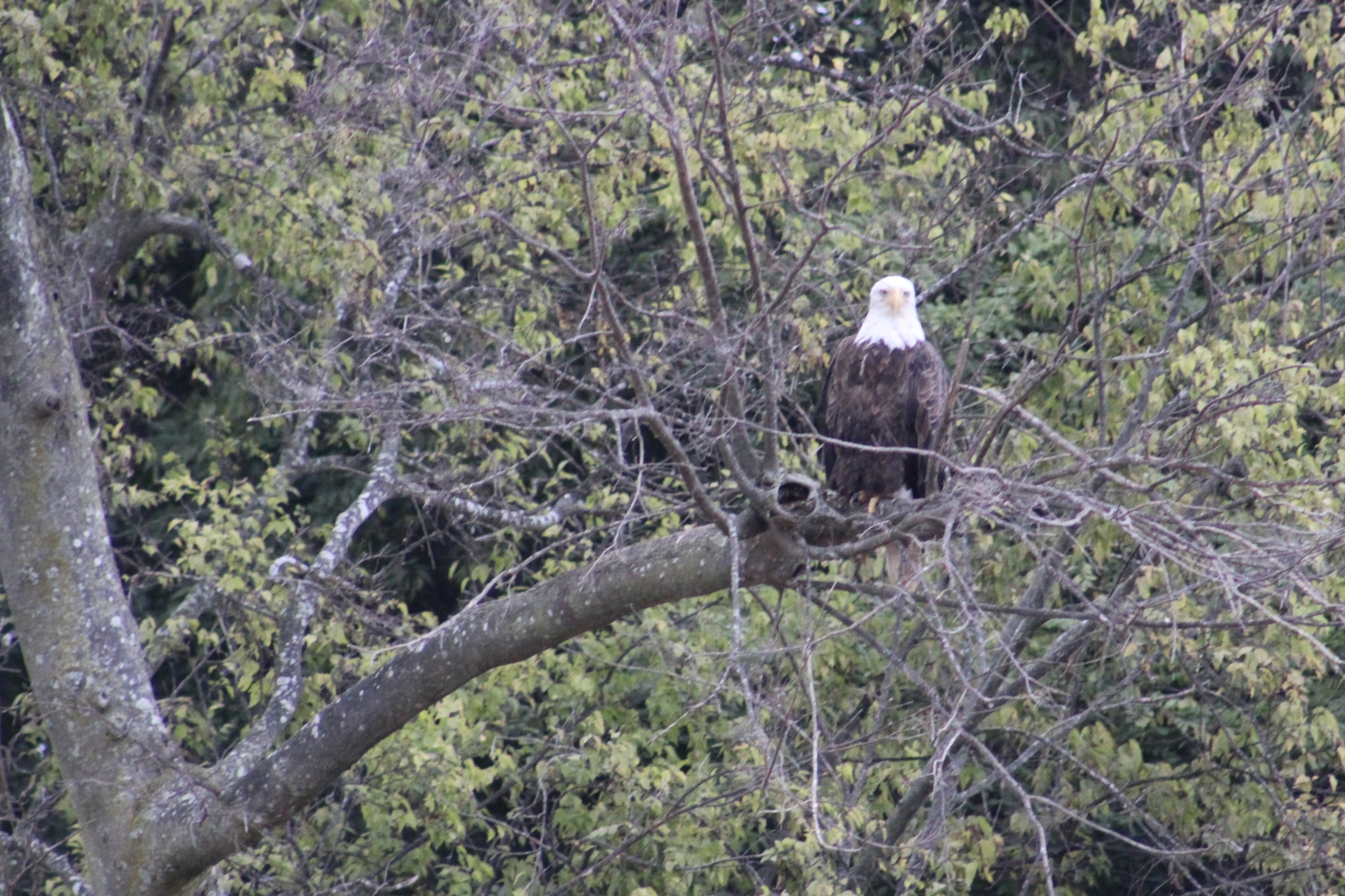
After entering the lock, a couple of ladies visiting the adjoining Lock Visitor Center pointed out a Bald Eagle that was perched in a tree about a half mile away.  That was the first Bald Eagle the crew had seen in a long time.  How appropriate since the crew is in the Land of Lincoln.


    Then a short time later, the skipper noticed another Bald Eagle soaring above the river.  As the boat approached, the eagle drifted right over the top of the boat and looked in to see if anything good to eat was available.  After spotting no dinner, the eagle went and landed in a tree along the river bank.

    img_0268

    img_0257The next lock was named after a rock formation that is nearby.  With a name like ‘starved rock’, you know there has to be a story.  The legend goes that the Ottawa Indians were seeking revenge for the assassination of their leader, Pontiac in 1769.  The Ottawa attacked a band of Illiniwek along the Illinois River.  The Illiniwek climbed the rock to seek refuge.  However, the Ottawa set siege to the rock until the band starved to death.  So much for taking the high ground.

    Wednesday, September 21, 2016

    img_0288Last night the Admiral kept asking if it was raining.  With no clouds in the sky, you could see all the stars in their full glory.  Well, this morning when the skipper awoke and went out on the sundeck he saw what the Admiral had been hearing.  There were dead May Flies at least four inches deep around the anchor light.  And these were giant May Flies.  After cleaning bugs for a while, the crew weighed anchor and headed out towards Peoria.

    This would be a short cruise day of only 25 miles.  The big surprise today was the Monarch Butterflies that were flying south.

    img_0306These are the lucky fourth generation Monarch Butterflies.  If you consider flying from here all the way to Mexico lucky.  The fourth generation is born in September and October, and unlike the other three generations do not die after two to six weeks.  Instead, this fourth generation migrates south to warmer climates and will live for six to eight months.  Starting a new first generation that hatch in February and March and start the migration back north in search of locations to lay more eggs.  The second generation is born in May and June.  The third generation will be born in July and August and complete the northern migration.  Their offspring are the fourth generation which the crew saw headed south today to complete another life cycle of Monarch Butterflies.

    img_0248
    Geese headed south


    After docking in Peoria after only a half day of cruising a big storm kicked up about 1500 with 20 – 25 mph gusts.  The river was white capping like Lake Michigan.  The crew was glad they were not trying to dock in those winds.

    img_3047
    The skipper, Al, and Ruth

    You may recall that Al Darelius came onboard back in Washington, D.C. last year.  Well, Al now lives about an hour south of Peoria, so he brought his wife, Ruth, up to meet the crew.  The two couples went out to eat and had a wonderful evening.  Al and Ruth plan to start the Loop in the Fall of 2017.  They have actually completed about 600 miles of the Loop, mostly moving their boat up and down the Illinois River.  She is currently berthed in Green Turtle Bay.  Our crew hopes to make Green Turtle Bay the first weekend in October and meet back up with AL and Ruth.


    I actually built a fort near today’s marina stop back in January 1680.  Fort Crevecoeur, which later led to the modern city of Peoria.

    Thursday, September 22, 2016

    Today was a good day to cruise along the shores of the Illinois River.  The banks continue to be lined with rural settings and trees starting to show their fall colors.  Then every so often, the scenery is interrupted by a small town where the barges are stacked along the river bank.

    img_0296
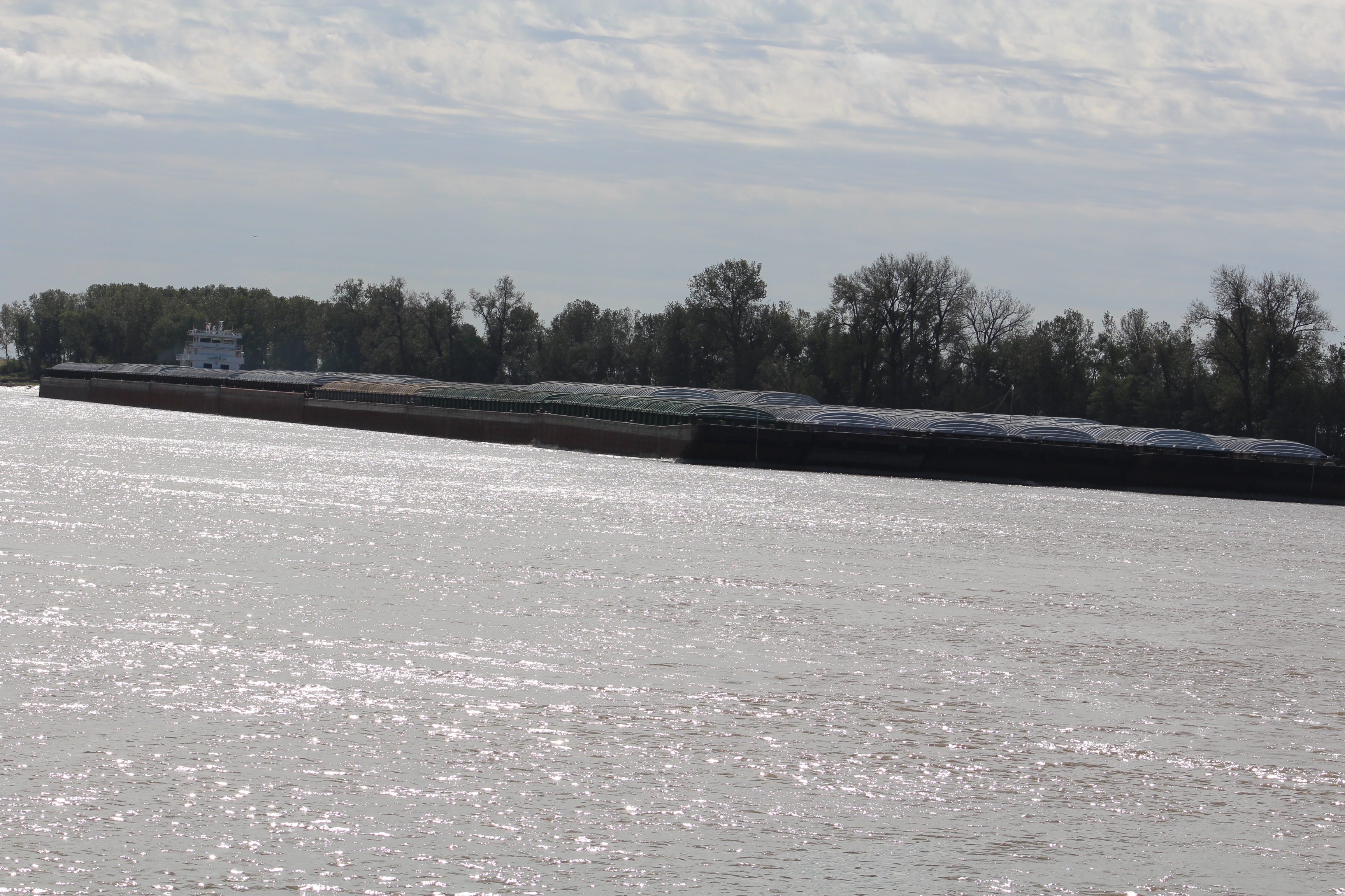
People are actively working to either load or unload the barges.  The barges that are full of material sit low in the water at the 10-12 foot water line marked on the side of the barge.  Empty barges float high in the water at the 2-3 foot water line.  Very interesting to sit back and watch the workmen.


    The crew saw three tows on the water today.  One tow was 3×4 hauling black coal up the river.  However, the crew saw a new record barge tow, 3×4+2 for a total of 14 barges.  The crew has been told that these are baby tows compared to the ones they will see on the upper Mississippi River.

    Friday, September 23, 2016

    Birding was the theme of the day.  When the skipper first woke up and went out on the sundeck, the swallows were thick in the air.  The swallows were darting about and putting on an ariel acrobatic performance.    After the crew weighed anchor and continued their journey down the Illinois River, they passed an irrigation ditch.  The ditch was lined on both sides with White and Blue Herons, there had to be more than 20 birds.

    img_0277Then the crew saw eight Bald Eagles throughout the day.  Four were fully mature and four still had their juvenile plumage.  One Eagle plunged into the river but came up empty and went to sit in a nearby tree.  He choose a bare limb that gave him a good view overlooking the water for his next attempt at fishing.


    img_0236
    One of many duck blinds along the river

    The ducks have also started their southward migration.  Duck hunting season must be soon because there were several boats loaded with duck decoys making their way to hunting blinds.  The crew has not heard any shots yet, but that cannot be too far off.


    Near the end of today’s travel, the shore scenery began to change.  Small hills are starting to rise off of the shore to provide some added dimension to the otherwise flat farmland.

    img_0307
    Living Life cruising past after anchor

    The crew pulled up into a narrow creek to anchor for the night.  They dropped anchor dead center in the middle of the creek but there is not enough room for the boat to swing around without hitting the shore.  In addition to the bow anchor, the skipper tossed out a stern anchor to prevent the boat from swinging into shore.  A new first for the crew.


    Saturday, September 24, 2016

    img_0309
    Same view as yesterday, but morning fog

    This turned out to be a beautiful day to cruise.  The weather was warm but the south breeze kept the crew cool.  As the crew continued down bound on the Illinois River, the river continued to get wider and wider until finally it converged with the mighty Mississippi River.  The skipper could tell the current was picking up by all the turbulence in the water.  He put the engines in idle speed and was still making 8.5 knots as the crew passed the marina entrance.  He then turned back up stream and entered the marina and pulled over to the fuel dock to take on fuel.


    img_0289
    Sun setting on this weeks adventure


    Next Week – The crew will head down the Mississippi River to Cairo, Illinois.  Then head up the Ohio River to Paducah, Kentucky.

    Loop on – The water goes on forever and the adventure never ends.

    La Salle the River Pilot and Explorer Extraordinaire

  • The Big Onion

    Hello virtual crew members and fellow adventurers!

    Eric here catching you up to date on the latest travels of Still Waters II. Click on this link to see the day- to-day travel log.

    The week started out great with a run to Port Washington, but the wind and small craft advisories kept the boat in the marina all day Monday.  Tuesday turned out to be a good weather day so the crew made the run to Racine.  However, the weather forecast for the remainder of the week was calling for small craft advisories each day due to the high winds.  Wednesday seemed to be the best available window to make the run to Chicago.  Turned out to be a good decision because the winds were really high Thursday and Friday causing 4-5 foot seas.

    Sunday, September 11, 2016

    fullsizerenderThe crew got off on an early start in the morning so that they could make Port Washington in the afternoon.  They planned to meet one of their softball family members, Sharon from Wisconsin, and spend the afternoon together.  Sharon arrived at the marina by land at 1300 and the crew made it in about 1330.  Sharon wore her Packer gear to support her team as the NFL season kicked off today.

    The group went to a Pub to catch the second half of the Packer game.  The Cheese Heads held on at the end of the game to score their first victory of the season.  The Cowboys played next but let the game slip away to start the season with a loss.  Oh well, another looooong season for Cowboy fans.

    img_0151The group headed back to the boat and spent a wonderful afternoon on the sundeck.  The skipper would liked to have taken Sharon out for a cruise but with the wind blowing at greater than 17 mph, the safest place to stay was tied to the pier.


    Monday, September 12, 2016

    With the high winds continuing to blow all day and most of the night, the crew took to sightseeing Port Washington.  The skipper started the day getting 20 miles in on the bicycle.

    The ride north was slightly up hill, but seemed to be rather easy.  After making it to the end of the Interurban Trail, it become obvious what was going on.  After turning around and heading back south, the skipper was going directly into a 20 mph head wind.  The 10 mile ride back in was a little more difficult than expected.

    img_0159
    The Fisherman

    Afterwards, the skipper headed to a small museum that had an Exhibit titled “Nothing But Net” which chronicled the commercial fishing industry of Port Washington.  The commercial fishing era in Port Washington came to an end on December 11, 1998 when the Linda E went missing.


    img_0160The Linda E had gone out on a calm December morning to check her nets.  At 0946 in the morning, the crew placed a call to the Smith Brothers fish shanty to announce that they had fish in the boat and would be in at 1400 to sell the days catch.  However, the Linda E never arrived.  The boat and three crew members were all lost at sea.


    linda-eThe Coast Guard spent 18 months investigating the missing boat and finally solved the mystery.  Turns out a large Laker ship unknowingly ran over the Linda E.  She was found by following the December 11th course of the large ship.  The Linda E was found crushed on the bottom.  During the investigation, the Coast Guard even found white paint from the Linda E on the bow of the large ship.

    The Linda E was the last commercial fishing boat to ply the waters out of Port Washington.  Today though, the port is home to a large and vibrant charter fishing industry.  One of the largest on the Big Lake and the largest in Wisconsin.

    Tuesday, September 13, 2016

    The wind and waves were going to co-operate today to allow passage to Racine, Wisconsin.  While trying to leave the marina, a guy landed a large salmon right in front of the boat.  The skipper waited and watched the struggle as the guy brought the fish into the net.

    img_0164
    On the shore line to Racine

    Afterwards the skipper made way for the breakwater wall and found another surprise.  The waves coming into the harbor were 3-5 footers.  He initially thought about turning around, but noticed that the waves were smoother outside the breakwater.  The configuration of the wall was causing the water to pile up and make a large wave.  After getting outside the breakwater, the crew found the cruise down to Racine comfortable.  When they arrived at the marina, they found themselves with three other looper boats, Inspiration, Leap of Faith, and Lone Star.

    The four couples all decided to go out on the town and eat at an Italian food joint.  The food was very good but the camaraderie and stories of life on the loop were better.  Turns out the crew of Inspiration owns property on one of the Admiral’s favorite lakes, Lake Lanier, north of Atlanta.

    With a look at the weather forecast before turning in for the night, it looks as though the crew may be stuck here for several days waiting for more favorable wind and wave conditions.

    Wednesday, September 14, 2016

    A large storm blew past during the night.  When the skipper awoke, he noticed that the wind was calm.  He checked the weather and found a big change in the forecast.  The wind was now predicted to be from the northeast with the swells moving south along the Big Lake.  He checked several other weather services and found agreement in the forecast.  The crew talked it over and decided to try and make the 64 mile run to Chicago.  If things changed during the day they had back up plans to pull into other marinas along the route.  Because of the ever changing weather on the Big Lake, there are marinas / safe harbors about every 25 miles down the lake.

    img_0168
    Kenosha, Wisconsin

    As one would expect, the weather changed after leaving the marina.  After only about an hour out on the water, the wind started to swing around directly out of the east.  And those 1-2 foot swells that were supposed to be travelling south, well they were travelling west.  The swells were about 3 seconds apart and directly on the beam as the crew travelled south.  Still Waters II slowly rolled back and forth all~day~long.


    img_0170
    Waukegan, Illinois – skipper’s daughter was born here

    The only good news with that was the wind happened to stay fairly calm around 5 mph.  Well at least till the crew got close to Chicago.  With about 6 miles to go (45 minutes), the Coast Guard came over the radio and issued a small craft advisory because the winds were picking up to over 20 mph.  This is never good.  Especially with beam swells attacking the side of the boat.


    img_0172
    Chicago Skyline about 6 miles out

    It did not take but just a few minutes and the wind whipped the waves to 3-5 footers.  As mentioned in other posts, when the average wave height is 3-5 feet, you can expect an occasional 7 footer.  And yes the crew got rolled pretty hard by one of these big waves.  The skipper normally tries to turn the boat into the larger waves to minimize the roll, but he did not see this one coming.


    img_0178
    Making the breakwater in Chicago

    The crew thinks this was the Big Lakes good bye kiss. After the big wave and big roll, the skipper turned the boat westward and headed to shore.  This put the waves behind the boat and they surfed their way into the harbor breakwater.  The Admiral commented that she was so glad to have Lake Michigan completed and was glad they did not have to navigate these unpredictable waters anymore.  The skipper wholeheartedly agreed.  In fact, the skipper has become fond of saying Lake Michigan is about endurance rather than enjoyment.


    The towns and people along the lake have been wonderful.  But the ever changing weather, wind, and waves has certainly made this leg of the journey more of an endurance event.

    Shore Excursion – Chicago

    With a town the size of Chicago, there is more to see and do than can be accomplished in just a few days.  They decided to go to Millennium Park, walk the Magnificent Michigan Mile, eat at the original stuff crust pizza joint, take the Architectural River Cruise, and enjoy the Navy Pier.

    On the Architectural River Cruise, they learned that the nickname of the town is ‘The Big Onion’.  This is due to the Indian name for the area that was translated as “Wild Onion.”  It also plays on the “Big Apple” of New York.

    bookcoverAnother interesting tale was the story of the Great Chicago Fire.  As many have probably heard, Mrs. O’Leary was milking her cow.  The cow kicked the lantern over and started the fire.  Turns out that the author of this story that appeared in the Chicago Tribune actually came forward 20 years later and said he made the whole thing up.

    Unfortunately, Mrs. O’Leary, a poor, Irish Catholic immigrant, who made the perfect scapegoat for the incident, went to her grave shunned by her ‘home town.’  In 1997, the city council officially exonerated Mrs. O’Leary and the cow for their non-part in the Chicago Fire of 1871.


    water-tower
    Chicago Water Tower – One of the few buildings to survive the fire


    The tale of the Chicago Tribune Building was interesting.  The building has parts and pieces from other famous places and buildings built into the outer wall.  For example, there was a piece from the White House, The Taj Mahi, British Parliament Building, and many, many, others.

    The crew actually found a piece of the Alamo on the side of the building.  Two other favorites were a rock from Yellowstone National Park, and Mount Rainier.

    img_0208img_0209img_0210

    The Chicago River Walk also has a Texas connection.  Mayor Daley had visited San Antonio, Texas and fell in love with the city river walk.  He wanted to create a similar outdoor space for the citizens of Chicago so he had zoning laws changed that required buildings along the river to include public walking space.  The Chicago River Walk is still a work in progress but it is a nice space.

    The last story to share is about another ship wreck.  The deadliest ship wreck on the Great Lakes happened right downtown Chicago.  The SS Eastland was a passenger ship that had flaws from the beginning.  Once completed, she was found to be top heavy and would list to one side with a full compliment of passengers.

    The first ‘fix’ was to limit the number of passengers on board and on upper decks.  After the Titanic sank, all passenger ships had to upgrade their lifeboat systems.  This added even more weight high up on the boat making the listing problem worse.

    ss-eastlandTo try and bring the center of gravity lower in the boat, the owners put very heavy solid wood furnishings in the passenger rooms.  On July 24, 1915 the ship listed while tied to the pier.  The passengers top side rushed to the handrail to see what was going on.  This caused the list to actually roll the ship over on her side in 20 feet of water.

    A total of 844 people were killed.  Most of these were passengers in the lower levels of the ship.  When she rolled the heavy furniture moved and either pinned people to the bulkheads or blocked the doorways so the people could not get out.

    img_0213

    Another Texas connection in Chicago.  Who would have thought Texas would have such an impact on the Windy City.

    And what is a trip to The Big Onion without a trip to the bean.

    img_0216

    Next Week – After a few days of rest in Chicago the crew will start the next leg of the journey down the inland rivers.  The Admiral has family near Chicago and the family members are planning to come aboard for the first day through the Chicago River and the beginning of the Illinois River. Hope to see you aboard as we travel the country’s heartland.

    Loop on – The water goes on forever and the adventure never ends.

    Eric the Red

  • Out of This World

    Hello virtual crew members and fellow adventurers!

    Eric here catching you up to date on the latest travels of Still Waters II. Click on this link to see the day- to-day travel log.

    img_0146As expected, the crew has been delayed on their way south down Lake Michigan.  The crew had heard that for every good travel day on the Big Lake there would be 2-3 days of high winds and waiting.  This certainly has been our crews experience.  The crew spent the Labor Day weekend tucked into Frankfort Municipal Marina while the winds howled for several days at greater than 20 mph.  The high winds sure build some wicked waves.  Wednesday the winds finally laid down so the crew made it across to the Wisconsin side of the lake.  They got one more day of cruising in to make a run to Manitowoc to visit the Maritime Museum dedicated to all things submarine, and to be the Texas Delegation at the International Sputnik Festival.

    Sunday – Tuesday, September 4-6, 2016

    img_0009
    Waves crashing over the breakwater wall


    Some boaters left the safe harbor and ventured out into the waves of Lake Michigan, but our crew has remained tied to the pier.  As much as the skipper would like to venture out and dance in the waves, his discernment for safety has won out over the desire for adventure.


    It has done the crew well to sit and relax for a few days.  They have done some small jobs around the boat, but mostly they have just relaxed and recharged their own batteries.  It is good to take some time off every once in a while, and just veg out.  From what I can see, they seem to be pretty good at this R&R.

    img_0017
    Labor Day in Frankfort

    One guy that is docked just a few slips down did come by to chat with the crew.  He lives in Arlington, Texas but spends the hot summer months boating the Great Lakes.  As you might recall, Arlington is the childhood home of the skipper.  He has many nieces, nephews, and a sister and sister-in-law that still reside in the area.  In fact, he lives on Kelly Perkins road not too far from Tina, the skipper’s sister-in-law.  An interesting 6 degrees of separation with him and the places the crew has been lately: he was in the Coast Guard back when the Edmund Fitzgerald sank.  His helicopter unit was sent to go aid with the search and rescue but never got off the ground due to the high winds and flight risk.  But he was at Whitefish point as part of the search effort.  The crew continues to meet the most interesting folks out on the loop.


    Wednesday, September 7, 2016

    With a good weather window in hand, the crew decided that they would leave this morning and decide where to go after they saw the actual conditions on the water.  The waves were predicted to be 1-3 feet initially but were supposed to dissipate as the day wore on.  After exiting the break water, the waves were already less than 2 feet and the swell was coming from the port quarter.  This was a good angle to cross the Big Lake, so the crew decided to head west to Kewaunee, Wisconsin.

    img_0022
    Last look at Michigan, 10 miles out

    The only variable was the storm clouds.  With the way the storm was moving it looked as though the crew would miss the worst of the storm and only get light sprinkles.  But you just never know what might spring up unexpectedly while out on a large body of water like Lake Michigan.


    As it turned out the weather was kind today and the crew had a nice crossing.  In fact, it would be hard to imagine it really ever being much smoother with the less than 1 foot swells.

    img_0020
    Herring Gull with Laker in the background

    About half way across, a large juvenile Herring Gull appeared out of nowhere.  He would fly a few laps around the boat then go land in the water.  When the wake would reach the gull, he would take off, catch up to the boat, fly a few more laps and then land again.  The bird kept this up for about two hours before finally flying off to never be seen again.  Cheap entertainment out here on the high seas for the skipper when there is nothing else in view except water in all directions.


    img_0030
    The harbor entrance is between the light to Port and the Red marker to Starboard

    As the crew began to approach the Kewaunee Harbor a low fog set in.  The crew could hardly see the markers for the entry into the harbor.  Then once through the break water wall, they could not see the channel markers.  Always some new challenge out here for our crew.  After docking, the sun finally burned through the clouds for a beautiful evening.


    You know you are in a fishing marina when the name of the place is Salmon Marina and they have the following clever fishing boat names:


    Thursday, September 8, 2016

    The crew had another good weather window and took advantage of the opportunity by moving another 30 miles south to Manitowoc, Wisconsin.   The cruise was uneventful, but before the crew could shove off from the dock another boater appeared and wanted to talk.

    img_0042
    Rawley Point Light

    Larry does estate planning for people and is hoping to retire in a few months after some foreign currency investments mature.  He has bought a boat that he lives on up north, and also has a place to live in Florida during the winter months.  When his ship comes in (investments mature) he plans on moving his boat to Florida, and buying a larger boat to charter out of Ft Lauderdale.  Here is to praying that your ship comes in Larry .  Another interesting contact on the loop.


    img_0064
    The coal fired Ferry Boat, Badger,  entering Manitowoc

    After docking the crew went on a walk around town.  They checked out the Wisconsin Maritime Museum in preps for tomorrow’s actual visit.  The last post may have you wondering (like the skipper) why the Navy was conducting submarine sea trials in Lake Michigan.  This museum answers that question.  But the answer will have to wait till the crew visits the museum.


    img_0054The crew also found a confectionary store in town.  Beerntsen’s Confectionary has been in business since 1932 and their sundaes come highly recommended.

    Fun Fact: The ice cream sundae was invented just 6 miles up the road in a town named Two Rivers.

    After the Admiral tried the Coconut Delight Sundae and the skipper had a banana split, they can vouch why this place has been in business so many years.  They have already decided to go back for lunch tomorrow to get the energy required to tour the massive maritime museum and WWII submarine.

    Upon return to the docks, the crew found two new looper boats had pulled into the marina.  The crew went and introduced themselves and exchanged boat cards.  One boat, Pura Vida, is being single handled by a young man named Forrest.  The other boat, Somewhere in Time, is on their first day of officially starting the loop.  The three crews seemed to hit it off together.

    Friday, September, 2016

    After the skipper made a 25 mile bike ride on the Mariners Trail along the lake shore and the Rawley Point Trail through the Point Beach Forest,……… it was time to explore the museum.

    img_0062The maritime museum was well done in providing the history of the Manitowoc Shipbuilding Company’s contribution to the second world war effort.  At the time, submarines were only built in Groton, Connecticut by Electric Boat.  The government approached the Manitowoc Shipbuilding Company to join forces with Electric Boat to increase the country’s capacity to build submarines in the event that they might be needed during wartime.

    img_0045In 1940, Manitowoc Shipbuilding Company was awarded a contract to build 10 GATO-class submarines.  By the end of the war, the company also built an additional 18 BALAO-class submarines.

    After construction was complete, the subs conducted their sea trials in Lake Michigan.  With a test depth off 300 feet there was plenty of deep water in Lake Michigan to test the boats.  The crew saw depths of 880 feet as they crossed the Big Lake.

    After sea trials the boats made their way to Chicago where a special barge was built to tow them down the Illinois and Mississippi Rivers.  After reaching the Gulf, the boats were re-launched and headed to the Panama Canal.  After getting into the Pacific Ocean the boats joined the Pacific Fleet in beating back the Japanese and helping win WWII.

    img_0060
    USS Cobia (SS-245)

    After spending a couple of hours in the museum, the Admiral and skipper learned many things about the USS Cobia (SS-245).  The USS Cobia was the last GATO-class submarine built and was commissioned on March 29, 1944.  She performed six war patrols where she is credited with sinking 13 Japanese ships.


    Her most famous sinking occurred in July 1944 when she attacked a Japanese convoy.  Two ships were sunk.  One of which was carrying 28 tanks headed for the island of Iwo Jima.  When US forces invaded the island six months later, US Marines credited their victory, in part, to Cobia’s earlier sinking of the transport and the tank battalion.

    img_0059
    Looking down a torpedo tube

    The two tourists then toured the USS Cobia.  They had a great tour guide.  They went down into the aft torpedo room, then forward to the control room.  While there, the tour guide sounded the dive alarm.  Brought back great memories for the skipper.  From there they continued forward through the boat and finally back up at the forward torpedo room.


    A few entertaining exhibits in the museum:

    img_0055

    img_0056
    The skipper earned his dolphins in 1982


    img_0057

    img_0058
    The Admiral and skipper


    After the museum, they decided to head back to their boat and skip the Miss Space Debris pageant.  However, the crew will go see the alien winner tomorrow during the Sputnik Festival.

    Saturday, September 10, 2016

    The crew has two new experiences to share today.  First was the Sputnik Festival and second was the marina customer appreciation dinner with a fish boil.

    img_0103The Sputnik Festival was born to celebrate an event that put the town of Manitowoc ‘on the map’ so to speak.

    On Sept 6, 1962 a 20 lbs. piece of Russian Sputnik IV crashed landed into 8th street.  The catch phrase for this year’s festival was, ‘Sputnik landed here……..Why don’t you?’


    The festival had several contests including a pageant for Ms. Space Debris.

    img_0067
    2016 MS Space Debris


    There was the alien space pet contest.

    img_0084
    All four alien pets


    The alien costume contest.

    img_0087
    Iron Mom


    There were all sorts of people dressed up milling around all day.  The alien in the pink dress travels the universe cleaning up space debris.  Notice the vacuum cleaner attachments on her uniform.


    img_0100

    A one act re-creation of the event was hilarious. They ended the play singing the following song, sung to the tune of Gilligan’s Island:


    Come listen to us and you’ll hear a tale

    The tale of Sputnik IV.

    It sailed about the atmosphere

    And landed at our door.

    We’re glad you joined us here our friends

    To celebrate this day.

    When Sputnik fell among us

    And became our claim to fame.

    img_0118The event concluded with an alien drop.  The Fire Department used a ladder truck to get above the landing location for the Sputnik Space Debris.  Then they dropped some five hundred alien erasers with numbers on them onto the street.  People had purchased raffle tickets with the numbers throughout the day.  The alien closest to the ring mark in the road won its owner one thousand dollars.

    img_0112
    Volunteers keeping kids at bay

    After the winner is determined, kids are allowed to pick up the aliens.  The kids were all lined up ready to snatch up the aliens once the signal was given.


    img_0121After the alien drop, the Admiral and skipper hustled back to the marina for the fish boil.  The owner was busy prepping the first of three boils when they arrived.  After the potatoes, onions and fish were done cooking, the owner threw some kerosene on the fire to cause a ‘boil over.’  Supposedly, the ‘boil over’ burns the fat and oils off the water before removing the food.  The skipper asked the cook about that idea and the cook replied that it was just for show, old Scandinavian showmanship.

    The Flame Thrower sequence:

    img_0127img_0130img_0131img_0133img_0136img_0142img_0144

    With a full tummy and a long day tomorrow, the crew headed back to the boat to turn in and prepare for next week.

    Speaking of Next Week – With only 156 miles to Chicago by water, the crew hopes they can find a few good travel days (3-4)  and land in the Windy City where they will spend a few days.

    Loop on – The water goes on forever and the adventure never ends.

    Eric the Red

  • The Secret of the Secret Garden

    Hello virtual crew members and fellow adventurers!  If you go to the website and look in the top right hand corner, you will notice a Guestbook has been added.  The crew would love to hear from the virtual crew members and visitors, so go visit the site and leave a reply.

    Eric here catching you up to date on the latest travels of Still Waters II.

    Click on the Travel Map or this link to see the day-by-day travel log.

    IMG_0149The crew made their way off of Lake Superior and headed back to Sault Ste. Marie, MI.  They then cruised south on the St Mary’s  River to De Tour Village.  Then it was on to Mackinac Island a few days before finally venturing into Lake Michigan.

    The crew has had to stay on the eastern shore of the lake because the weather has not cooperated to allow a safe passage to the western shore.  They have made stops in the ports of Charlevoix, Leland, and Frankfort so far.

    Sunday, August 28, 2016

    The skipper has noticed several road signs that show:

    End of Earth                                   2 miles

    Michigan Upper Peninsula         4 miles

    The crew has a new appreciation for the road sign based on their experience sleeping Saturday night.    At one point the Admiral got up and looked around and announced that this was the darkest night she had ever seen.  With heavy cloud cover there was no moon nor stars.  She could not even see any lights from the nearby houses.  Yes, it was pitch black and they felt like they were miles beyond the end of the earth on the Upper Peninsula.

    The skipper slept with one eye shut keeping the other eye open looking for three fingers Riley, and hoping Riley was not out on a midnight haunt.

    132

    After the skipper woke in the morning he checked the weather for wind conditions.  Then he went down and talked to a local fisherman that was on the pier.  The local guy said that the better crossing weather would be today rather than Monday and that he advised that the crew leave as soon as possible before the winds started picking up.

    IMG_0002
    Met this big fella crossing the Bay


    The skipper went and talked with the Admiral and she was more than ready to get back to civilization.  The crew readied the boat for the crossing of Whitefish Bay and shoved off by 0830.  With the wind in their backs the ride back to Sault Ste. Marie was calmer then before with only 3 foot swells.


    IMG_0007
    People at Visitor Center watching crew lock thru

    The crew came back thru the American Locks because there was no commercial traffic expected for the rest of the day.  Specifically, the MacArthur Lock which was named after General Douglass MacArthur.  After docking, the crew walked back down Historic Water Street to the Locks and Visitor Center.  The walk was full of history and interesting to say the least.  The Visitor Center was also well done.


    Fun Facts about Lake Superior and Lake Michigan:

    • Retention time for water in Lake Superior is 191 years.
    • Retention time for water in Lake Michigan is 99 years
    • Submarines had their sea trails on Lake Michigan during WWII
    • Lake Michigan is the only Great Lake completely in the US

    Monday, August 29, 2016

    The crew left the Soo area and finally headed south.  The destination was down the St Mary’s River to a small town named De Tour Village.  But before shoving off they had one last conversation with a couple from Florida.

    IMG_0032
    Round Island Light on St Mary’s River


    This couple may just own the record for being on the loop the longest without ever crossing their wake.  They started from Nashville, TN 11 years ago.  Upon arrival in the Great Lakes they decided to hang in the area for the summers and put the boat in storage for the winters.  They go home to Florida for the winters.  They also mentioned that they have no intentions of heading south in the boat to cross their wake anytime soon.  They prefer to stay in the Great Lakes and just cruise around up here.

    IMG_0036
    On a business in De Tour

    Our crew loves this area also, but they are determined to make it back down to Fort Myers, FL by boat, and cross their wake.


    IMG_0037
    On the door of a restaurant that advertises open 7 days a week in De Tour


    Tuesday, August 30, 2016

    IMG_0049
    Approach to Mackinac Island

    The crew got off on a nice cruise over to Mackinac Island.  This is another one of the looper must see spots.  The crew has heard about the island for over two years now.  The island has no automobiles.  Everything is done on bicycles or horse drawn carriage.  The only way to the island is by boat or plane.  Several tour boats ferry people to the island all day.


    IMG_0043The trip over to the island was marred by light fog.  The fog stayed with the crew most of the day.  As the fog finally started to lift about 1300 the skipper noticed another boat running parallel with them about a mile further south.  Turns out this boat had left De Tour just a few minutes ahead of Still Waters II.

    The skipper had wondered where they were because they had mentioned they were also heading to Mackinac Island today.  The two boats ended up docked side by side.  The crew learned that the couple has spent the last 4 years living in the Bahamas.  They bought their boat back in July on the Chesapeake Bay.  After closing on the vessel, they moved aboard and started the loop.

    IMG_0075
    The streets of Mackinac Island

    After arrival to the island, the crew walked around and explored the area.  The first problem encountered was that there was a fudge store and ice cream store on every corner.  With only a two day reservation available this may cause an unfair assessment of the best fudge and ice cream on the island since the skipper probably will not get to sample all the different stores.


    However, I have seen this boy in action when it comes to eating sweets.  He might not get to all the stores, but I am sure he will give it a hardy go.

    IMG_0076

    IMG_1729
    The taxi ride out to the Woods

    The crew would like to thank the crew of Tasteful Traveler for a great recommendation for dinner while on the Island.

    The skipper trolls a couple of other looper blogs to look for things not to miss.  The Tasteful Traveler mentioned a restaurant called  ‘Woods.’  The skipper decided that our crew would try the Woods to celebrate 6,000 miles on the Loop and completing the Canadian waters.


    IMG_1730
    The Woods

    They called for a taxi and were picked up at the marina.  The horse and buggy ride took them through town and then up to the Grand Hotel.  The buggy journey continued through the woods and finally arrived at the restaurant after about a 40 minute ride.


    IMG_1732
    Taxi for return trip to the marina

    The food and service at the restaurant were fabulous. After dinner, the crew took the taxi back by the Grand Hotel where the skipper learned that to sit out on the porch a man must be in a tie and jacket.

    The skipper thinks he will stick with his shorts and T-shirts on the sundeck and skip the Grand Hotel porch.


    The best part of the ride back was the driver.  He was a rather large man and told the crew that the best fudge on the Island was JoAnn’s.  In fact, he said. “take it from a fat man, the best fudge on the Island is JoAnn’s.”  He also mentioned that they had won best fudge on the Island four years in a row.

    The crew stopped at JoAnn’s on the way back to sample the fudge.  The crew agrees with the driver, that was some goooood fudge! A great way to top off the night.

    IMG_0138
    Would you like to try a bite of peanut butter and chocolate?


    IMG_0139
    MM MM that was good!

    Wednesday, August 31, 2016

    The skipper decided to bike the Island this morning.  The road is practically flat and takes an 8.2 mile course along the shore line.  After the skipper scoped the ride out, the Admiral decided she would ride the course also.  So they made the tour together stopping at each mile marker and taking pics:


    IMG_2896The Admiral and skipper spent the afternoon wandering around the island and taking in the sites.  One of the interesting beauties of the island are all of the flower gardens.

    The crew came across one garden named the “Secret Garden.”  There were many figurines and statues scattered throughout the garden.

    They had a poster of ten of the items and asked that you try and find the items in the garden.

    Easier said than done.  After an hour of looking the crew had found 9 of the 10 objects but they could not ever locate the dinosaur.  The skipper thinks the mouse with the big ears probably moved the item out of the garden and the home owners like to see how long frustrated patrons will look for the missing object.  That is the real secret of the Secret Garden.


    Thursday, September 1, 2016

    IMG_0079
    A look back at the Grand Hotel
    IMG_0081
    Mackinac Bridge – Opened in 1957 – Longest suspension bridge in western hemisphere

    Upon leaving Mackinac Island, the initial plan was to try and make Beaver Island.  However, the wind was out of the north and had the potential to build some nasty waves off of the beam since they would be travelling west.  As the crew passed under the Mackinac Bridge the waves did begin to build to 3-5 foot.  Since the crew was travelling due west, this made for some big rocking action side-to-side.  The decision was made to skip Beaver Island and head south to Charlevoix, MI and get the waves on the stern.


    IMG_0083
    Entry to harbor at Charlevoix

    Upon arrival at the marina, the dock master informed the crew that Perfect Day had just completed the Loop on August 28.  You might recall that the crew spent most of the Georgian Bay and the North Channel cruising with Perfect Day.  Great to see another crew complete the Great Loop.  Way to go Bill and Lori!


    IMG_0092
    Overlooking the harbor


    Friday, September 2, 2016

    IMG_0095
    Headed back into Lake Michigan from Charlevoix

    IMG_0102The winds decided to lay down so the crew made the run to Leland Township Harbor.  The run was enjoyable as the crew took in the sites along the shore.


    IMG_0105
    converted fish shanties into business


    After arriving the crew walked around the little town of Leland.  The town once was one of many commercial fisheries along the lake.

    Nowadays there are fewer than fifty commercial fisheries on the lake.  The town nickname is “Fishtown” and they take immense pride in their long history as a commercial fishery.


    IMG_0118As the crew was touring the town they watched this car drive to the boat ramp and launch itself as a boat.  Then in a few minutes it reappeared and drove out of the water.  Now that was fun to watch!

    IMG_0120

    Saturday, September 3, 2016

    The winds were single digit today, but the swells were still 2-3 feet and only seconds apart.  This causes the boat to rock fore and aft as she climbs and surfs down the swells.  The skipper decided to speed up a little bit to minimize the time on the water.

    IMG_0131
    Good example of Michigan sand dune


    The cruise south was enjoyable as the crew passed along the famed sand dunes on the Michigan shore.  The dunes are much taller than the skipper ever thought they would be.

    IMG_0147
    The boat to give a little perspective as to size


    IMG_0142
    Point Betsie Light

    The crew arrived safely in Frankfort, but the skipper will be studying the weather forecasts for the next few days to make plans on their next move.

    Next Week – The weather forecast for the next week is calling for winds 15-20 mph for most of the week.   There may be a window to move further south on Wednesday and then cross the Lake on Friday.  The crew hopes to make it to Manitowoc, Wisconsin by the weekend for the Sputnik Festival.  They hear it is out of this world.

    Loop On – The water goes on forever and the adventure never ends.

    Eric the Red


  • Famous Last Words

    Hello virtual crew members and fellow adventurers!

    Eric here catching you up to date on the latest travels of Still Waters II.

    Click on the Travel Map above or this link to see the day-by-day travel log.

    The crew started through the waters of the North Channel late last week.  This leg of the journey is 138 miles long.  The small craft route takes the cruiser through some very remote areas.  For example, in the village of Killarney, the first road was finally built in 1962.  The shore is not lined with summer cottages, just some of the oldest rocks known to exist on earth. The crew completed the North Channel and decided to stick their nose into Lake Superior to visit the Shipwreck Museum at Whitefish Point.

    Monday, August 22, 2016

    The wind howled all day yesterday and continued through the night.  As morning dawned, the wind was finally subsiding to a mild 11 mph.  Since the skipper figured the swells would still be out in the big part of the bay, he decided that the crew would take the more scenic long way through the islands.  This provided some break from the wind and waves and gave the crew something to look at instead of just wide open water.

    IMG_0003
    Benjamin’s in the background, the orange colored rocks are the sow and piglets

    They motored past Islands named the Benjamin’s, with rock formations named the sow and piglets.  Many a Captain have stubbed their pinky’s on these rocks.


    IMG_0010
    Turtle Rock

    After passing through a narrow channel named Little Detroit, the crew passed a rock formation known as Turtle Rock.


    After coming around the last island of the day, the crew had about an hour of 3-5 foot seas to contend with.  The good news was that these waves were coming directly out of the west and Still Waters II was cutting through them with ease.  However, as I have witnessed in the past, the boat can take much rougher seas than the crew.  They were glad to finally arrive near the marina where they could get behind the breakwater and out of the waves.

    WIN_20160827_18_28_37_Pro
    Geocaching Pin for FTF

    After arriving at the marina, the skipper checked his Geocaching app and noticed that someone had hidden a new cache in the marina on Saturday, and no one had found the cache yet.  With the cache only 385 feet from the boat and a chance for a First-to-Find (FTF) the skipper and Admiral were off the boat in a flash and in full search mode.  After a short walk and a quick find, the Tex Snoop Dogs found their 277 cache.  Best of all they were the FTF the cache.


    Tuesday, August 23, 2016

    IMG_0013
    Glad to be in safe harbor after rough day on the water

    Well as soon as the crew left the protected waters of the marina they realized that this would be another rough day on the water.  The wind had been predicted to be from the north-east which should have provided protection as the crew cruised just south of the mainland.  Unfortunately for the crew the wind was just about due west.  To make matters worse, there were swells of 3-5 feet that were coming directly against the beam.  This always makes for a rough ride as the boat rocks between the swells.


    After about an hour and a half, the swells began to dissipate and the crew only had to be concerned about the windblown waves dead ahead.  As the day wore on the crew began to see St Joseph Island in the distance.  As the crew began to close in on the island, the waves began to get smaller and smaller.

    IMG_0012
    Even the birds needed a rest after that wind

    The last hour of the cruise was actually nice as the skipper could enjoy the pretty water and surroundings rather than just stay focused on the wheel and trying to stay on course.


    Wednesday, August 24, 2016

    The crew left about 0900 and headed north to their last stop in Canada, Sault Ste. Marie.  This little community has an interesting history.  There is actually two Sault Ste. Marie’s, one in Ontario and one in Michigan.  Prior to the war of 1812 there was only one town.  As part of the Treaty to end the war, the St Mary’s River was used as the boundary between the US and Canada, which essentially split the town.

    IMG_0124
    The Soo Rapids

    The name is also a little odd.  Sault is French for rapids or falls.  The Sault is pronounced ‘su’.


    The name was based on the rapids that fall 20 feet from Lake Superior to the head waters of the St Mary’s River.  In the old days, merchandise would be shipped from Lake Superior to Sault Ste. Marie.  Then the goods would be portaged around the rapids and reloaded in a ship below.

    IMG_0023
    On the St Mary’s River

    The US side of Sault Ste. Marie had the lock, so the US controlled the shipping.  In 1870, the US refused to allow a Canadian steamer, Chicora, carrying Colonel Garnet Wolseley to pass through the lock.  The Colonel was on a mission to stop a rebellion of the western providences and prevent US expansion into Canadian territory.


    The Colonel portaged his goods on the Canadian side of the river and continued his successful campaign. However, the Canadians decided it was time they built a lock.  The lock was completed and opened in 1895.

    IMG_0030
    On the way to Sault St.  Marie


    Today, all commercial traffic goes through the US lock and all the recreational traffic goes through the Canadian Lock.

    IMG_0127
    The American Locks


    Thursday, August 25, 2016

    The crew took a shore excursion day and rode a train 114 miles into the Ontario back country.  The train was a rolling museum as the history of the area was broadcast on TV sets about every 20 minutes.  The train rolled past the shores of Lake Superior and many other smaller lakes and streams.  The train had a dining car where breakfast and lunch was served.  After a four hour ride through some gorgeous back country, the train arrived at the Agawa Canyon Park.  The train conductor provided an hour and a half site seeing break for the train riders.


    Our crew set out for the three waterfalls in the park.

    IMG_0085

    After the falls the crew headed back up the canyon to the Lookout station which was 300 feet up the canyon.  The lookout provided a great view up and down the canyon.  The crew arrived back at the train with 10 minutes to spare before the engineer headed back to the train station in Sault Ste Marie.


    IMG_0034.JPGAfter arriving back at the boat the crew went to a nearby Walmart to stock up on a few items.  On the way to the store the crew stopped at a statue honoring the first Canadian female astronaut.  The marina and surrounding park are named for her.


    Upon return to the boat they noticed that a boat had arrived with a hailing port of Dallas, Texas.  The crew spoke with the owners of the boat and learned that they had just bought the boat and this was their very first day of ownership.  The skipper quizzed the new owners about the old owner and learned that the owner was none other than Marty Turco, an ex-goalie for the Dallas Stars.

    IMG_0123Turns out Marty Turco was born in Sault Ste Marie, Ontario and still maintains a home here.  He also has a home in Highland Park, Texas.  He spends his summers here in Ontario.  The best line of the conversation was when the new owner mentioned that they had gotten Marty Turco’s autograph, most expensive autograph ever.


    Friday, August 26, 2016

    After spending nearly 10 weeks in Canada, today was the day that the crew would return to the states.  The skipper called border patrol and was told that he needed to check-in before heading into Lake Superior.  The skipper cruised across the river to Sault Ste Marie, Mi. and called border patrol.  While waiting for the agent to arrive, the skipper took on fuel.

    The customs agent arrived, asked his many questions, reviewed passports, gave the crew a thumbs up, and welcomed them home.  This border crossing was much easier than the last.

    IMG_0128
    Viewing area for people to watch boats lock through

    With the check-in complete the crew headed for the lock to cross into Lake Superior.  Not many loopers take the time to head this direction, but the crew has heard many good things about the Ship Wreck Museum at Whitefish Point and believe the side trip will be worth the effort.

    IMG_0137
    Whitefish Point Light

    The ride across the bay started out relatively calm but as the crew continued northwest across the Bay, the waves continued to build.  The waves were mostly 3 footers with an occasional 5 footer to keep the skipper on his toes.  After an hour of hammering through the waves, the point began to come into view.  As the crew continued to approach the point the waves became less of a problem as the land began to block the wind.


    IMG_0129As they arrived in the marina, the skipper noticed that their friends onboard Avocet were docked here.  The crew of Avocet came out and caught the crew’s lines and helped them get the boat secured.  The Admiral and skipper spent some time talking with Dick and Phyllis before heading down the road to the Lighthouse Museum.


    Fun Fact: This will mark the furthest north that the crew will venture in 2016.

    GPS Location:

    N   46* 45’.652

    W  84* 57’.819

    Time to start heading south.

    Saturday, August 26, 2016

    IMG_0132
    Rudder from lost ship

    The crew made the run to Whitefish Point so they could visit the Great Lakes Shipwreck Museum.  The museum complex was well worth the effort.  The complex included the Whitefish Point Lighthouse and Keepers Quarters, USCG Lifeboat Station, Shipwreck Museum, Video Theater, and several scenic overlooks.


    IMG_0174
    9 years to build Lego replica

    The crew went to the Theater first to watch the film about the sinking of the Edmund Fitzgerald.  The Big Fitz sank just 17 miles from Whitefish Point.  The winds had gotten up to 75 mph with gusts to 100.  The wind had churned up 30 foot waves that were actually coming over the deck of the vessel.  At one point the ship suffered a crack that began allowing water into the ship.  The bilge pumps were turned on and the pumps were keeping up with the flooding so that water level was not rising in the ship.


    IMG_0168A second ship was following the Edmund Fitzgerald and was staying in radio contact.  A series of large waves in excess of 35 feet crashed over the top of the second vessel.  The second vessel radioed forward to warn the Big Fitz about the series of large waves.  The Captain of the Big Fitz last words over the radio were “We are holding our own.”  Sometime after this transmission, on the night of November 10, 1975 the ship and her crew were lost in 530 feet of water along the Shipwreck Coast of Lake Superior.

    IMG_0134

    The crew’s tribute to the Edmund Fitzgerald:


    In 1994 the ship was found and in 1995 the ship’s bell was raised.  The original bell was replaced with a new bell.  The new bell was engraved with the names of the crew.  A memorial with the original bell was held to commemorate the lives of the lost crew.  The bell was rung 29 times as the name of each crew member was announced.  Then the bell was rung one last time for all the other mariners who have lost their lives while on the Great Lakes.

    One story told in the film was about two brothers who had lost their father when the older brother was 13.  The older brother went to work to support his other four siblings and mother.  When the younger brother got drafted to go to Vietnam, the older brother told the younger not to worry, if anything goes wrong, I will go over there and bring you home.  The younger brother was telling the story while they raised the bell from the ship.  You could see the anguish in the younger brother’s eyes and the tears down his face when he was apologizing to his older brother for never bringing him home.  The younger said that the raising of the bell would be as close as he would ever come to bringing his older brother home.

    IMG_0144
    The ship’s bell


    IMG_0148

    IMG_0155

    IMG_0169

    IMG_0170
    The Griffin


    IMG_0179
    Looking out over the graveyard


    Tune in next week to see the progress of the crew as they return from Lake Superior and continue thru Lake Michigan on their way to Chicago.

    The water goes on forever and the adventure never ends.

    Eric the Red


  • The Mystery of Danny Dodge

    Hello virtual crew members and fellow adventurers!

    Eric here catching you up to date on the travels of Still Waters II.

    Click on the Travel Map above or this link to see the day-by-day travel log.

    The crew completed their two week cruise of the Georgian Bay when they arrived in Little Current on Friday.  The scenery was spectacular and the crew loved these cruising grounds.  They have now started into the North Channel with their first stop in Kagowong.

    IMG_0089


    Sunday, August 14, 2016

    The crew has continued to travel with LyreLynn and Perfect Day through the Georgian Bay.  Today, LyreLynn took the lead position on the way to Bad River.  But before arrival at Bad River the three boat flotilla would have to pass through two very narrow and shallow passages.

    65
    Bone funny nautical humor

    The first passage was through Cunninghams Channel.  The channel is only about one mile long; however, the water just outside the channel is only 1-4 feet deep.  As the boats safely exited the passage they all noticed a skeleton sunbathing on a float in the water.  A little humor is always good after a tense passage.


    99
    Port prop damage

    Next up was Rogers Cut.  This is another one mile narrow passage.  At the narrowest point there were markers to help guide the skipper through.  LyreLynn safely made the run and radioed back that he saw 6 foot depth all the way thru the cut.  The skipper went next and just as he was exiting the cut he hit a rock with the port prop.  The margin of success was pretty slim here.


    Once the hit occurred the Admiral went below decks to make sure there was no water entering from a unwelcome hole in the boat.  The search showed that the hull was still intact.  Later the skipper dived down to look at the props and verified that the only problem was the port prop.

    72

    Devil Door Rapids

    Perfect Day was successful in making it through the cut with no issues so the flotilla continued on to Bad River to anchor for a few days.  After everyone got anchored the crews dropped dinghy’s and kayaks in the water to go exploring.  There were several small rapids and rivers flowing through the area that made this one of the best stops ever on the loop.


    Then a guy came over and offered the crew some fresh caught fish.  The skipper filleted the fish and Lynn cooked them.  All three couples came aboard Still Waters II for supper and a friendly game of Joker.

    Monday, August, 15, 2016

    74 Collins Inlet
    LyreLynn at anchor in Bad River

    The crew awoke to an unexpected weather change.  The weather was supposed to be good all week with low winds.  However, Wayne informed the crews that a storm was headed their direction that would be packing gale force winds (>40 mph).  The skippers all agreed it was probably best to pull anchor and head to a safe harbor.


    With one eye on the route ahead and one eye on the surrounding weather, the flotilla made way to Killarney.  About half way to Killarney, Wayne and Bill noticed that the weather report had changed again.  Now the report was calling for calmer winds in the area.  Seems a large storm was brewing south of the boats and had decided to turn east rather than come up into the Georgian Bay.

    78
    Beaverstone Bay

    Such it is when you try to base decision making on the unpredictable weather.  All was not lost though.  The clouds cleared and the flotilla had clear blue skies as they passed thru the 14 mile long Beaverstone Bay and Collins Inlet.  The pink granite had changed to more of a white granite in this area.  It made it look like snow on the nearby mountains.


    90
    Cruising Collins Inlet

    As they passed through Collins Inlet, the skipper noticed that there were many hunting camps along the water.  This got the skippers hopes up that they might see some wildlife.  About halfway through the Inlet the skipper noticed a hunting lodge high up on a point.  The lodge had a painting of a deer on a large rock.


    The skipper radioed back to the other boats and announced that he had seen a deer up on the starboard side bank about halfway up the point.

    86
    Beautiful Day in Collins Inlet

    The Admiral pointed out that she did not think that was very funny.  So after letting the other boats pass the point, the skipper called back and told the other boats that the Admiral did not think his little joke was funny so he was apologizing.


    Wayne announced that Lynn had nearly punched him to death trying to get him to locate the deer when they finally saw the painting.  Yes, now that is funny.

    96
    Night shot of Sportsman’s Mountain Lodge

    The flotilla arrived at the Killarney Sportsman’s Lodge to find a very nice town and community.  Everything that a small town should have to make the passing boaters happy, fish-n-chips and ice cream.


    After walking around town and getting the obligatory ice cream to stimulate the economy, the crew tried the heated swimming pool.  Upon entry into the water it was clear that someone had forgotten to turn on the heat.  After a few minutes though the water became tolerable and the crew enjoyed a good swim.

    95After the swim, it was time to try some of the towns world famous fish-n-chips.  The fish-n-chips were some of the best that the crew has sampled.  The crew ordered three pieces of fish but ended up with six pieces of fish for the price of three.  This is the kind of place the skipper and Admiral really like.  After finishing all the fish, the Admiral was ready for seconds.  The skipper informed her that she already had seconds, and thirds, and it was time to move on.

    The crew found the other two couples in the boater’s lounge, so our crew joined them for an entertaining night of conversation and music.

    Tuesday, August 16, 2016

    The crew started the day off with a challenging exit from the dock.  The boat was boxed in the fairway so one boat had to be moved to allow the crew to exit.  Then the wind was going to be a factor blowing the boat up against the dock while the skipper would try to get around the boat directly in front of Still Waters II.  A few people came over to help the crew out of these tight quarters.  The skipper threw a couple of lines across the open fairway onto the next dock over.  The dock help pulled these lines tight and then pulled the boat over to that pier.  This allowed the skipper then to pull around the boat in front and make a clean exit.

    97
    The skippers best shot from moving boat

    The crew was headed to Little Current for a 1500 appointment to get hauled out for a prop swap.  This was the first marina that had a travel lift large enough to haul Still Waters II out of the water.  The crew left in the rain, but took a short side trip out of the way to see an Indian Head that God made in the granite rock over at Portage Cove.


    Upon arrival in the area of the Indian rock, the skipper had to find the right angle for the best view.  The crew turned around about three times to get lined up to see the rock formation.  The skipper tried to get a good picture but with the rain it was not as good as some other pics he had seen.

    WIN_20160821_11_34_14_Pro
    The pro shot

    After viewing the Indian head several times, it was off to Little Current.  The crew arrived about 1300.  The marina hauled Still Waters II at 1400 and had her back in the water at 1600 after replacing both props.


    The crew then motored over to the town dock to spend the night.


    Wednesday, August 17, 2016

    The crew shoved off from the Town Dock so that they could make the 1000 Swing Bridge opening and be off on their way to Baie Fine.  There was congestion at the bridge with a couple of sailboats and a large tour boat.

    115
    Anchored in The Pool

    After clearing the bridge, Still Waters II crisscrossed paths with the tour boat all the way to the anchor location in ‘The Pool’.  A storm was chasing the two boats all the way to ‘The Pool’.  The good news was that the boats were just on the north edge of the storm.  However, other boaters were not so fortunate.


    There was significant radio chatter as the storm passed.  Two boats were discussing how the wind had turned them sideways (90 degrees) from there travel path.  Other boaters were talking about safe harbor locations to duck into to get out of the wind.

    Just prior to anchoring, the tour boat captain hailed the skipper and told him that a funnel cloud had passed over Little Current.  He did not have any damage assessment but had been told that the funnel cloud was spotted near town. After entering Baie Fine, the crew lost cell coverage due to the remoteness and high white granite cliffs on both sides of the channel. Wayne, captain of LyreLynn, kept the skipper informed of the storm movements as the crew made way to the anchorage by use of his weather radar.

    103
    White Granite and Quartz surrounding The Pool


    Just as the crew arrived the storm let up and the Admiral did not get soaked to the bone as she dropped anchor.  But then again, the anchor did not drop either.  After a few minutes of troubleshooting the skipper found the wire to the anchor power switch loose.  He tightened the connection and the anchor was back in business.

    The skipper finds it interesting that he talked to Jeff, another looper on the hard at Boyd Marine, and learned that he and his brother “lost” one of their rudders off of their catamaran.  Probably due to vibration loosening the setscrews and gravity pulling the rudder from the boat.  The skipper also talked with the captain of ‘Bright Angel’ who lost a rudder while under way.

    Then this morning’s Active Captain mail was about vibration induced problems with the electrical panels.  The Active Captain mail suggested routinely checking electrical screws for tightness.  The skipper will add this to his ever growing to do list, but he did go and check his rudder setscrews before setting sail today.

    106
    Trail to Lake Topaz

    The crew was invited to dinghy over to shore and take a hike up to Topaz Lake.  The hike was only about 30 minutes, but the crew met a very interesting young couple.  The family has four kids, 8 ,6 , 4, and six months.  They were initially spotted in one canoe on their way to dock at the trail head.


    When the crew arrived at the trail head the canoe and family were missing.  About halfway to Lake Topaz the crew caught the young family on the trail, without the canoe.  This begged the question, “What did you do with the canoe?”

    110
    Lake Topaz

    Turns out they are in the area on a four day canoe camping trip.  They are portaging the canoe and gear from lake-to-lake.  They had carried the canoe over to Artist Lake, about a mile away, and now were hiking back to Topaz Lake to see the pretty water.  The family said they did this kind of thing every year and that the kids all had started hiking when they were 18 months old.  Until then, dad also portages the infant.


    116 Bill, Lori, Lynn, Wayne.JPG
    After Lake Topaz – back row – Bill, Lori, Wayne, skipper, front row – Lynn, Claudia


    Thursday, August, 18, 2016

    127The crew stayed another day at Baie Fine and went on another hike to a second lake.  When they arrived at the lake they found two backpacks but no people.  In a little while another young couple showed up to claim their packs.  They had just completed portaging their canoe over to Artist Lake, but said the trail was too step to carry their gear and the canoe so they were making two trips.

    128
    Looking out over Lake


    After the hiking adventure, the crew of Perfect Day came over to share in grilled burgers on the sundeck.  Another delightful evening on Still Waters II.

    Friday, August, 19, 2016

    After two wonderful days in ‘The Pool’, the crew moved back to Little Current.  The 25 mile hop back to little Current marks the official end of the Georgian Bay Tour.  The crew spent two weeks in these waters and barely scratched the surface of places to see and things to do.  Also the crew has now cruised 5,735 miles on the Great Loop.

    132
    Leaving Baie Fine


    This also officially marks the beginning of the North Channel.

    03One interesting thing about this area is the Little Current Cruisers’ Net.  The Net is broadcast each morning starting at 0900 on channel 71.  The Net is able to cover about a 25 mile radius from around Little Current.  The host starts each program asking if any boaters need assistance.  If no boats require help, then the host provides a short news broadcast including the weather.  Then the fun part starts.  The host then asks boaters to radio in and provide their boat name and location.  By listening and participating, the crew could learn where other friends were anchored and headed.

    On even number days the host works east to west calling out favorite anchor spots and requesting boaters in that area to radio in.  On odd number days, the host works west to east.  Sometimes the ship radio cannot reach all the way back to Little Current so other boaters relay the boat name and location.

    The record number of boats participating in the roll call is 192.  Still Waters II has been participating in the daily roll call since first arriving in Little Current.  Only 70-80 boaters have participated in the broadcast due to the dwindling number of boaters at the end of the cruising season up in Canada.

    05Next to the town dock there was a young artist actively painting and showing his work.  Two motorcycles had ridden into town and commissioned him to paint their cycles.  The artist came over and asked the skipper if he would watch the ‘store’ while the artist went to grab a bite to eat.  The skipper was reading the book “the Boys and the Boat” so he moved up to the curb side showroom to read.  A couple of potential customers roamed by but the skipper was unable to close a sale.  Working the showroom floor is not at the top of jobs the skipper would make a good living at, in fact, he might starve if he had to depend on his sales.

    06

    Fun Facts:

    • Little Current is located on the island of Manitoulin.
    • The island is the largest freshwater lake island in the world covering 1,068 square miles.
    • The name is the English version of the French Manidoowaaling, which means ‘Cave of the Spirit’
    • This name was for an underwater cave where a powerful spirit was said to live


    Saturday, August 20, 2016

    13 Bridal Veil Falls
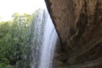
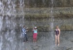
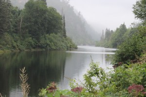
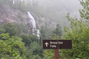
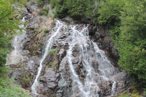
The crew made the quick jump over to Kagawong.  The town’s claim to fame is the Bridal Veil Falls that are just a half mile out of town.  ‘Perfect Day’ cruised over with our crew and Lori walked to the falls with the Admiral and skipper.  After a refreshing swim the three wandered back towards the boats via the Mill Museum.  The museum had two interesting and unique exhibits.

    The first was a family collection of wedding dresses.  The first dress dated back to a wedding in 1929.  The dress was on display along with a wedding portrait of the newlyweds.  The latest dress was from a wedding in 2006.  There were about two dozen dresses and portraits on display with an explanation of family genealogy back to the original couple.

    The second exhibit was about Daniel Dodge.  He was an heir to the Dodge Brother fame and fortune.  His dad, John, and uncle, Horace, both died of the flu pandemic in the early 1920’s.  There widows sold the Dodge Corporation for 146 million.  Daniel Dodge had a hunting lodge here on Manitoulin Island and met a local island girl he wished to marry.

    His widowed mother was none too happy that her son was marrying below his standard and tried to prevent the marriage to the local ‘gold digger’ who worked as the phone operator.

    However, in 1938, Daniel convinced his mother that all was well and the wedding took place back at the family mansion in Michigan on August 2.  The newlyweds showed up at the hunting lodge on the island a few days later.

    Daniel George Danny Dodge
    Danny on the left

    On August 15, the Cinderella story took a sharp turn towards disaster.  While playing with dynamite in his garage with a couple of the lodge staff, Danny tried to throw a stick of dynamite out the window.  The stick hit the window frame, bounced back in the garage and exploded.  With wood splinters and metal flying everywhere four people were injured.  One person was near death so they decided to take the boat to Little Current for medical assistance.


    The young bride took the wheel of the speedboat and headed towards Little Current for what should have been about a 40 minute ride in smooth water.  However, there were four foot waves that seriously slowed the speedboat down.  After two hours on the water, with another hour to go, the young bride was too tired to continue piloting the boat.  As the wounded shuffled around to allow another pilot at the wheel, Daniel fell overboard.

    The boat turned around and attempted a rescue but were unable to locate Daniel.  After about a ten minute search, it was agreed to continue to Little Current to save the life of the seriously wounded.   A $1,500 reward was posted for anyone who could find the body.  After three weeks the search was halted.  Then 23 days later, two fisherman found the body and claimed the reward.

    Danny Dodge in The Mac.
    Danny at the wheel of his speed boat


    Speculation started immediately that something was fishy in Denmark, well maybe Kagawong.  Some locals believed that the bride took advantage of the situation and pushed Daniel overboard to collect his 9 million dollar fortune.  Others believe that Daniel stepped overboard into the cool waters to stop the burning pain of his injuries.  Or just maybe he actually slipped as the passengers were moving around in the boat while being tossed around by 4 foot seas.

    The bride had to go to court to claim her portion of the estate, and finally won about 2 million of the 9 million bounty.  Not bad for a 13 day marriage.

    And in case you think this case cannot get any stranger, the skipper found this little bit of info from a local ……There is a story in my family lore that is part of the Dodge story as well. In addition to the reward money, Dodge’s family paid men $20 per day to search for Danny. This was good money back in the day. My grandfather (one of the fishermen who found the body) told us he actually found him on the first day but since he was already dead, they might as well earn a few extra dollars and keep “searching” for a few more days. Horrible, I know, but if you knew my grandpa, it was not done out of malice. He just knew how to squeeze a nickel out of a penny.

    After the quick tour of the museum, the crew of Perfect Day headed towards Gore Bay for the night.  Perfect Day is only about 180 miles from crossing her wake in Michigan.


    25
    Waving bye to Perfect Day


    Tune in next week to see the progress of the crew as they continue thru the North Channel.  The winds are predicted to raise to 25 knots on Sunday and may be above 15 knots most of the week.  The crew will have to monitor the weather closely next week to find weather windows to safely travel the North Channel.

    The water goes on forever and the adventure never ends.

    Eric the Red