Eric here providing an update on the crew of Still Waters II.
Every Thursday, the crew gets a Cruiser’s Weekly Update from WaterWay Guide. The Update provides new navigational alerts, cruising news, and Marina & Harbor Events. The skipper noticed that the Captains Club and the Jacksonville Sail and Power Squadron were hosting the annual Blessing of the Fleet on Palm Sunday.
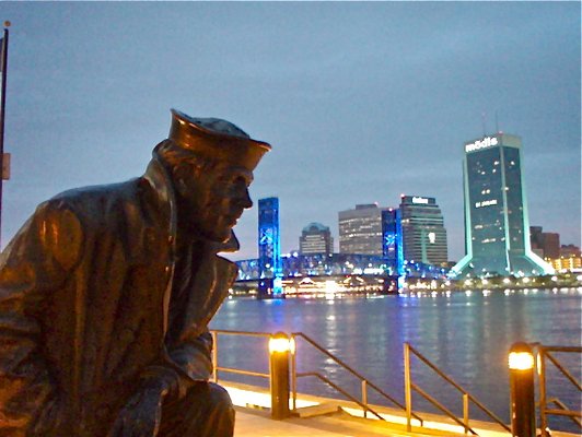
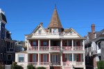
Lone Sailor Statue
Blessing of the Fleet is a tradition that was started many centuries ago in Mediterranean fishing communities. The vessel, captains, and crews were blessed to ensure a safe and prosperous season. The tradition is now held in coastal fishing communities throughout much of the world, including in a number of coastal cities in the United States.
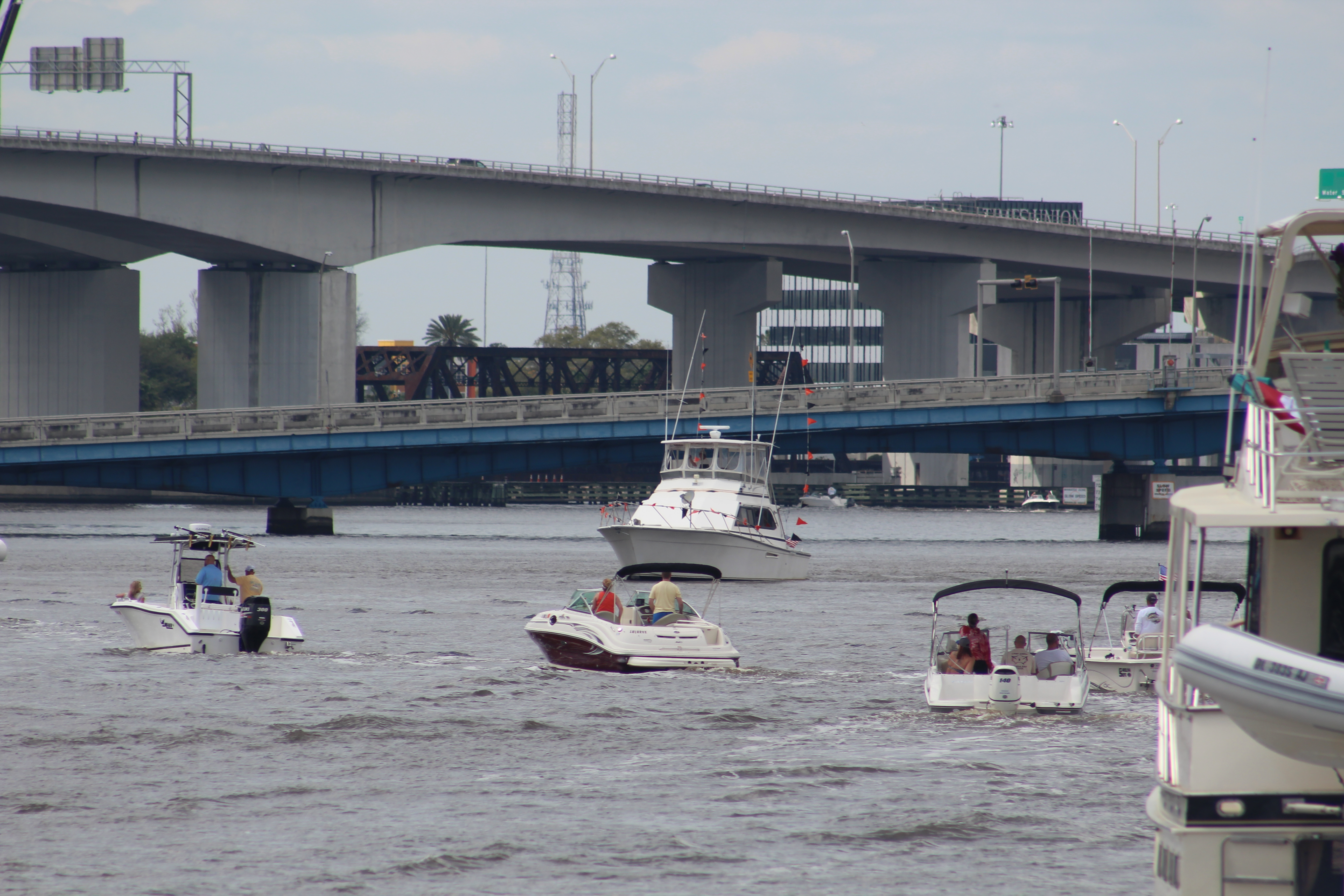
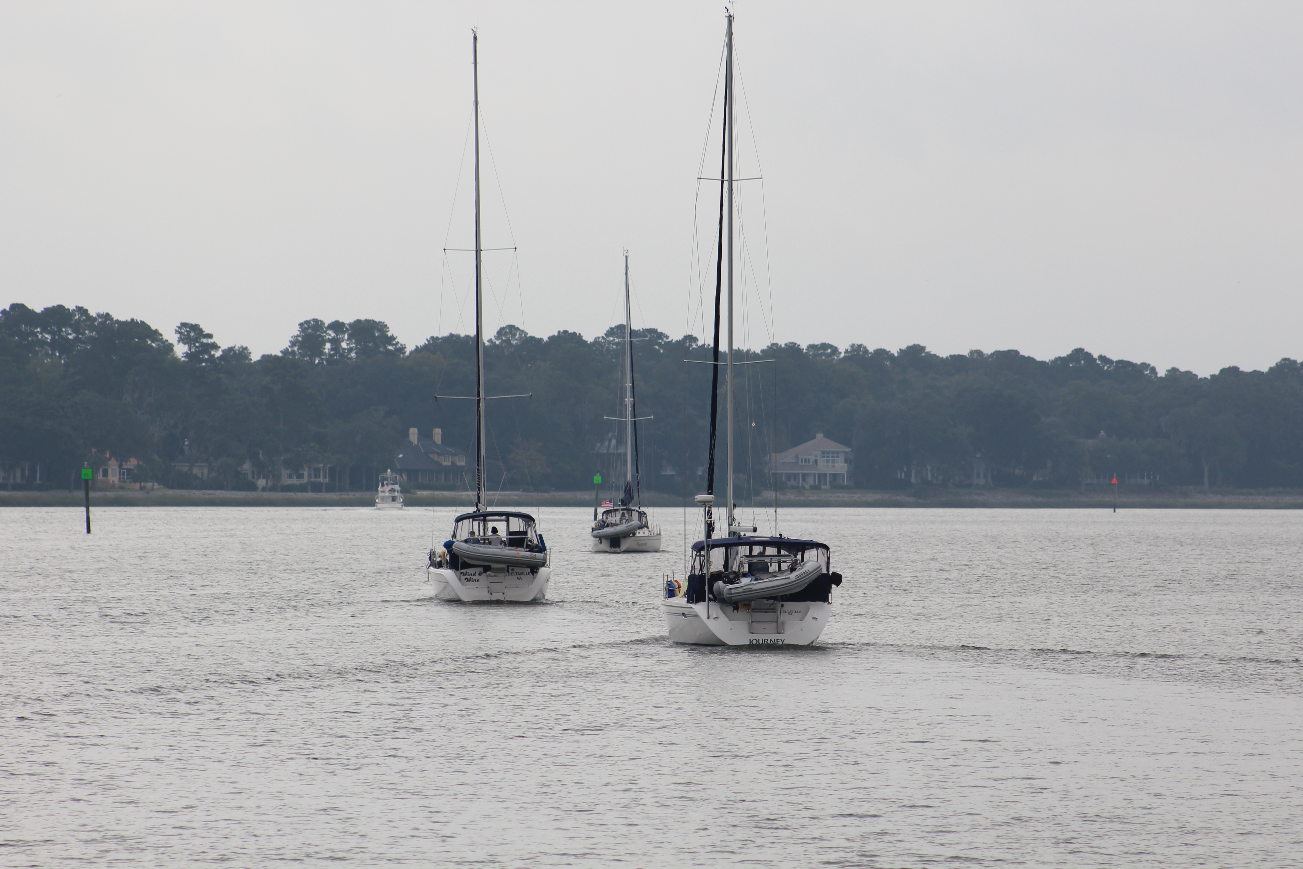
Line of Boats
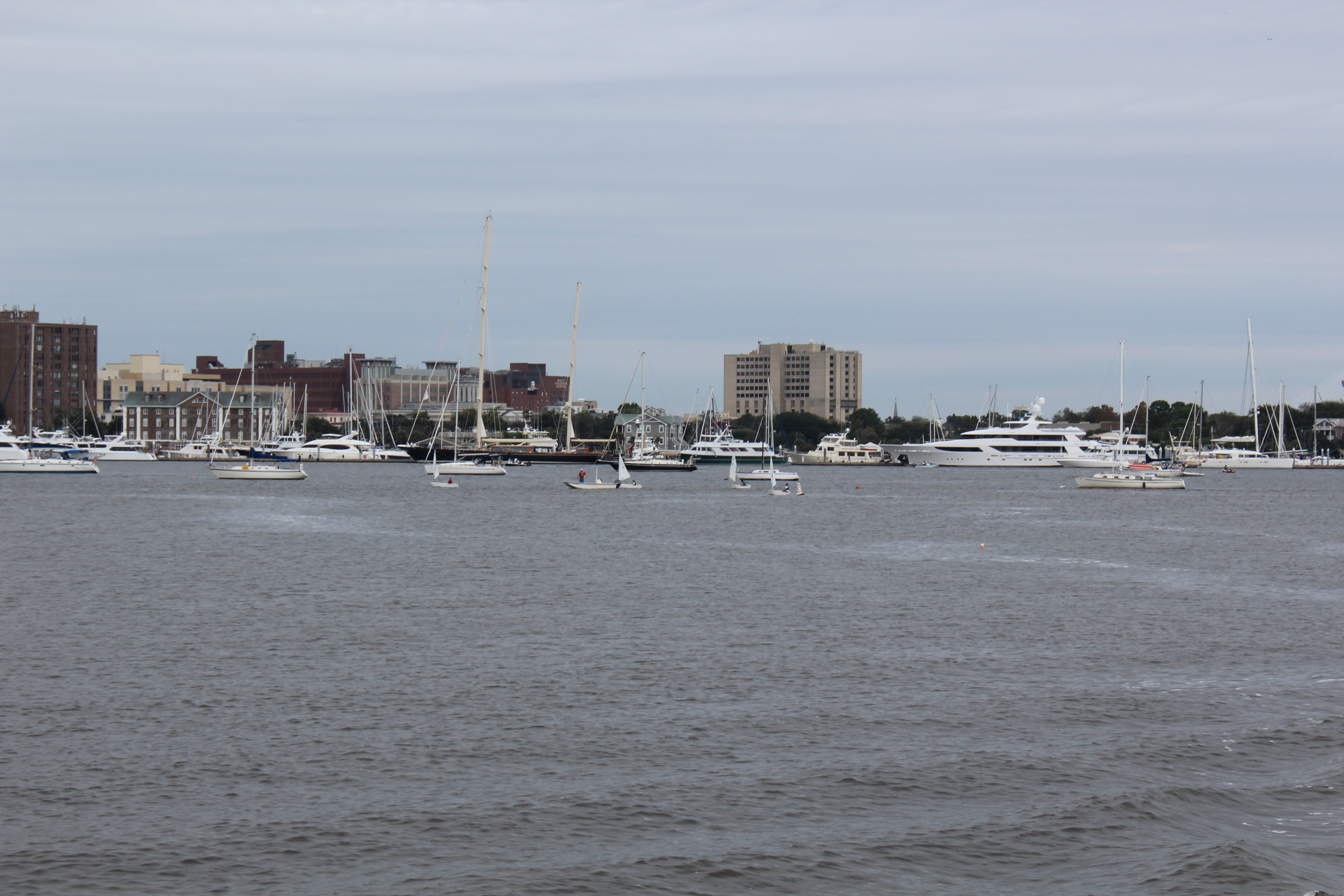
The crew decided to throw off the dock lines and make the hour cruise to downtown Jacksonville. The crew arrived at the staging area east of the statue at 1330 and joined about 50 other boats. The Master of Ceremonies came on Channel 72 at 1345 to give instructions and inform the boaters that they would start as soon as the Padre arrived. Seems he was running late, something about his service running long due to Palm Sunday.
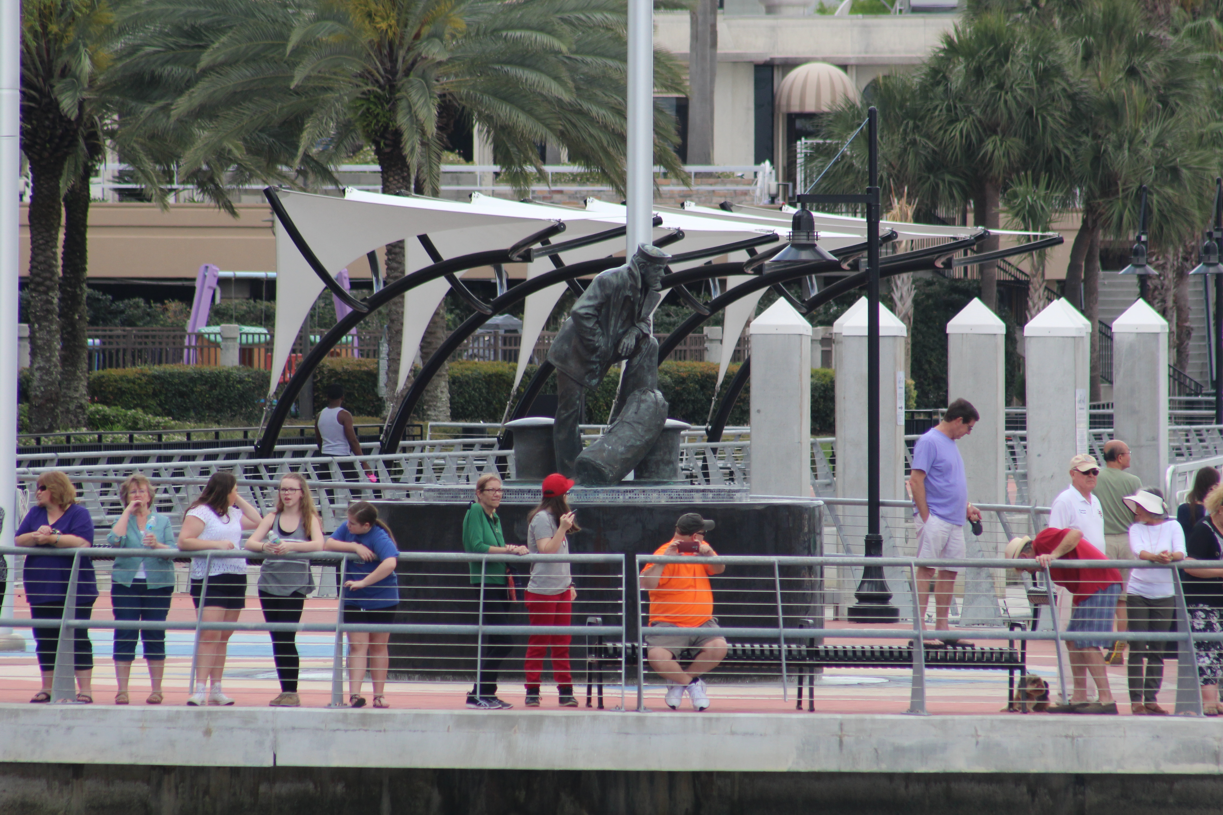
Spectators by the Statue
Amazing enough, the Padre arrived a few minutes later and the procession of boats made way to the Lone Sailor Statue for their individual blessing.
The Blessing
After all the boats passed the Padre, the official boats formed a wheel in the middle of the river and performed a wreath laying ceremony.
Click the Padre pic to watch a 40 sec video of Still Waters II Blessing.
Eric back, with a little update on the crew of Still Waters II.
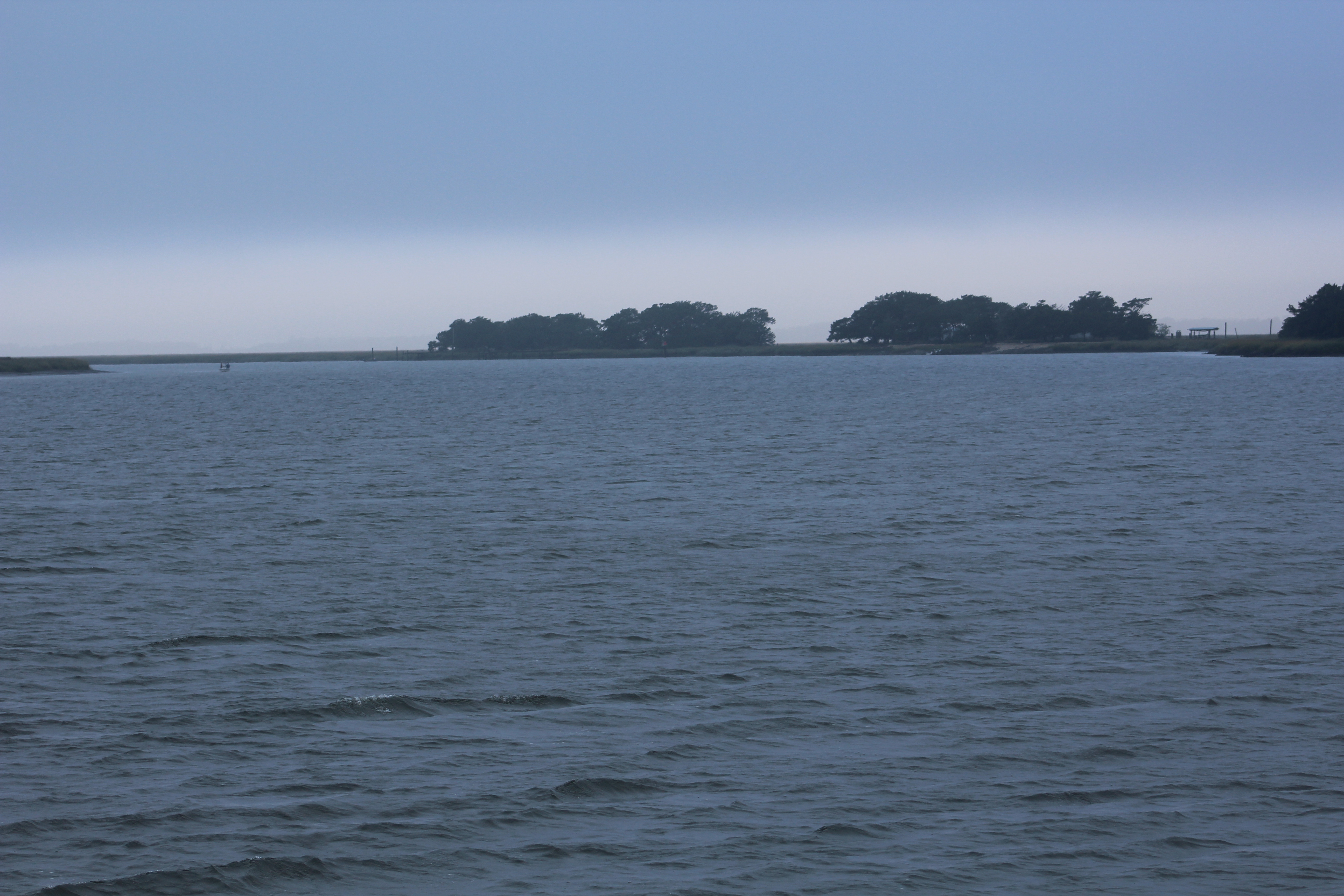
Foggy morning at the marina
Our crew has been working diligently on getting the boat ready for the 2016 cruising season. New furniture, new rugs, refurbished cabinet, updated stairs, and many other smaller items on the Admiral’s To Do List. Yes, the skipper has been busy this winter!
The skipper also added a 2015 map that links to the stops along the journey last year. You can find the link near the top right corner labeled mysteriously as “2015 Map.” The good news is that the Admiral has just about completed her over haul of the interior decorating and the summer cruising season is just around the corner.
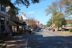
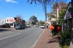
Walking around the local neighborhood
Current thinking is that the crew will leave Jacksonville March 29 and head south down the St Johns River for a few days. After exploring the River, the crew will head north back to Norfolk for the spring rendezvous of the America’s Great Loop Cruising Association (AGLCA).
One of many local little parks
The crew will then make way for Cape May, New Jersey where they stopped their forward progress in October 2015 due to cool weather. From Cape May, the crew will head to NYC, up the Hudson River, and then cross Lake Ontario into Canada. Eventually making it to Chicago about Labor Day Weekend.
Shake a leg and let’s get going. Boat from Christmas parade.
Hope to see you back aboard as a virtual crew member!
Hello fellow adventurers and virtual crew members!
Eric here gladly posting a log from the perspective of the guests Dave Weyandt (aka Fender Boy) and Martha (aka Best Mate Martha) who took a five day adventure on Still Waters II. In their own words:
Fender Boy and Best Mate Martha are reporting on their best adventure ever!!
BMM in Life Jacket with First Mate on day 1
BMM was very reluctant about the trip when FB said he wanted to go. She
finally agreed and off they went to Jacksonville, Florida to meet the crew
on Still Waters II. The boat was awesome and the crew, from the minute
we arrived to the minute we left, was outstanding. We can’t say enough
about the crew. The next morning, BMM strapped on her life preserver and the boating adventure began.
Day 1 ended at Jacksonville Beach with lots of rain, but it didn’t matter because we had a skillet cookie topped with ice cream to end our first leg of the trip.
FB playing in the Atlantic Ocean
Day 2 started with a walk/run to the Atlantic Ocean beach where FB had to
get in and ride the waves. Still Waters II got underway and headed south to
Palm Coast and the Hammock Beach Resort. (BMM got brave and put her life preserver away). Dolphins were spotted swimming with the boat. It was amazing, as were the houses all along the waterway. The resort was so nice we stayed there two nights.
BMM at the helm
During our stay, much time was spent at: the beach, the largest hot tub we’d ever seen, the lazy river, and the game room. The skipper introduced us to the ping pong game called, “Around the World” that turned out to be lots of fun to play. (Especially when BMM was the champion of all the games.)
FB, First Mate, and skipper enjoying the hot tub
Card games were played back on the boat where the skipper loves the first mate so much he lost the game of Hearts so she could be the winner.
Enjoying a little ping pong in the game room
Day 4 on the water led Still Waters II back north to St. Augustine, known
as the oldest continuously occupied city in the nation – 450 years and counting. A sight seeing tour on the Little Red Train and a tour of the St. Augustine Lighthouse were the hi-lights of the day.
Day 5, the last leg of the adventure, turned out to be the best traveling
day of the week. The weather was perfect for a 30 mile run in the ocean, so
the skipper and FB said, so off we went. The water was beautiful, filled
with jellyfish and dolphins. It was the perfect way to finish a great
adventure, one we’ll never forget!!!!!
Hello fellow adventurers and virtual crew members!
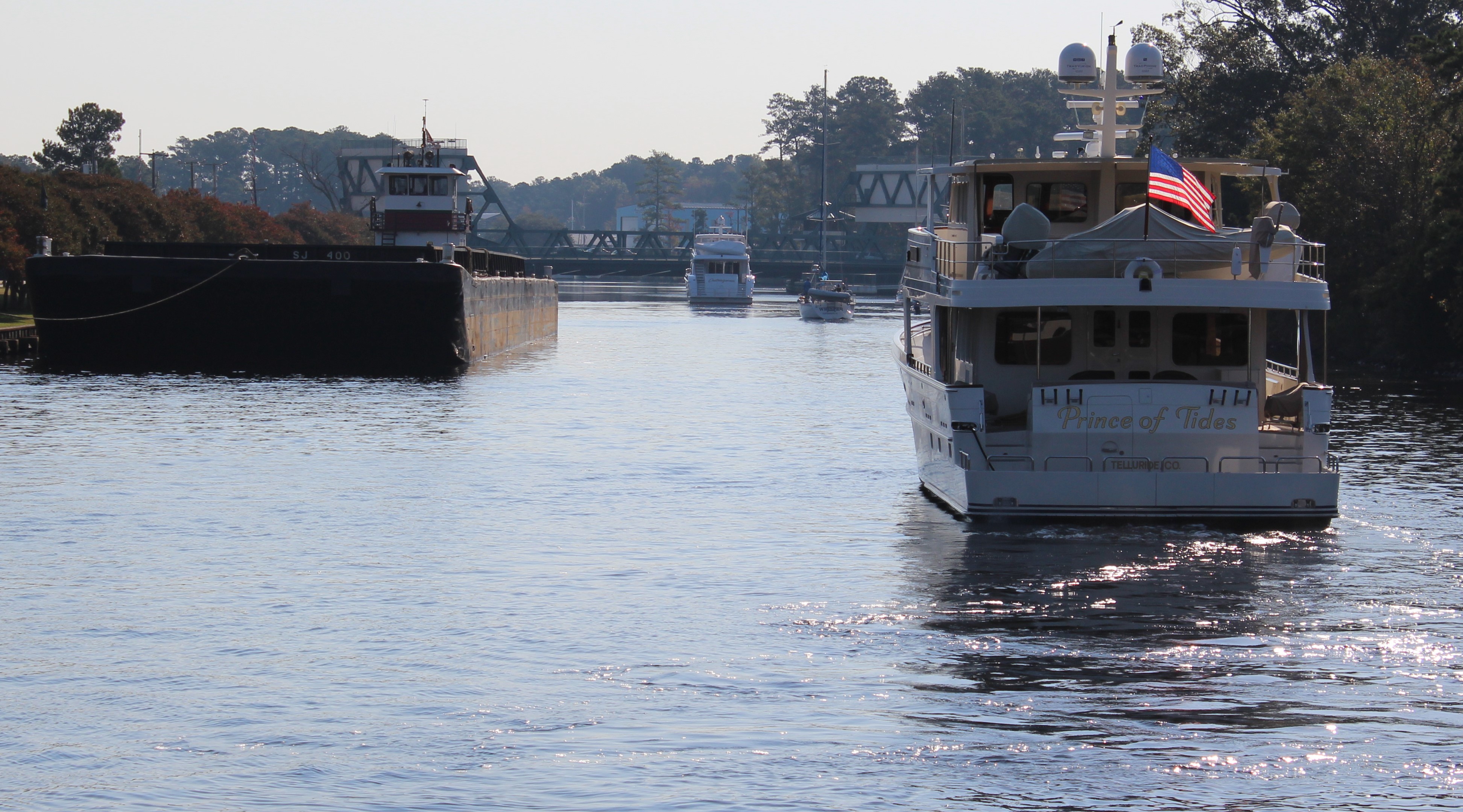
Eric here reporting on the latest travels of Still Waters II. David and Martha (D&M) Weyandt arrived onboard Saturday, November 7, from Granbury, Texas. They had to be headed back to Texas on Friday so a plan was made to cruise south and loop back to Jacksonville on Thursday.
Sunday, November 8, 2015 – Maroon Line
David Weyandt at the wheel
The weather was misty rain when the crew left the dock, but the crew did not let that dampen their spirits. By the time the crew travelled the 26 miles back to the ICW from the Ortega River, the weather began to break and the sun finally peaked out. The crew headed seven miles down the ICW and took advantage of the dry spell to pull into the Palm Cove Marina to refuel. After refueling, the crew motored across the ICW to dock at Beach Marine at Jacksonville Beach.
Dolphins headed to the boat
Dave Weyandt was out on the bow when some dolphins came up and headed to the boat. Our crew has noticed the dolphins swimming to the boat in the past but never went out to the bow to look for them. After this discovery, the crew started going to the bow when dolphins were spotted and the dolphins almost always start surfing off the bow.
Click on pic above to watch the dolphins swim.
The plan was to walk the mile and a half to Jacksonville Beach but the weather did not cooperate. The rain came wave after wave with high driving wind. The crew spent the evening on the sundeck playing cards and wiping up water from a few leaks that showed up around the windows.
Monday, November 9, 2015 – Orange Line
The weather finally broke during the night so the crew made their way to the beach first thing in the morning.
Dave and Martha out on bow of boat while underway
The crew then headed 54 miles south down the ICW to the Marina at Hammock Beach. The crew arrived about sunset which made for a beautiful dock setting. The dock master explained to the crew that the marina was part of a Resort that was a couple of miles down the road. The dock master provided a phone number that the crew could call to get a courtesy van ride to the Resort. The crew took time to eat and then set out on a reconnaissance mission to check out the Resort.
The “Fish Story” statue next to our dock
The Resort turned out to be a big surprise with multiple swimming pools, hot tub, lazy river, and beach access. They also discovered a ping pong table and played a little ‘Around the World.’ Martha took home the trophy after beating the skipper on match point. The crew headed back to the boat and decided that they would spend Monday at the Resort.
After eating a large breakfast, the crew made their way to a fun filled day at the Resort. The crew spent time in the hot tub and the lazy river.
One of the many pools
They also spent some quality time relaxing on the beach.
Ladies enjoying the beach
Wednesday, November 11, 2015 – Green Line
The crew headed back 24 miles north to explore St Augustine. With only half a day to take in the sites, the crew decided to buy tickets on the Red Train Tour. Due to it being Veterans Day, the skipper and Dave Weyandt got free tickets. The crew took a courtesy van out to the lighthouse.
View from top of Lighthouse
The crew spent about an hour on the grounds and then headed back to the Red Train Headquarters for the St Augustine tour. The tour was about eight miles and lasted an hour and a half. The conductor was Smokey and he provided details of over a hundred sites as he drove around historic St Augustine.
White Peacock with baby chick
After the tour the crew walked around town and finally stopped to have dinner at an Irish Pub. All enjoyed the fish (fresh cod) and chips.
Magnolia Street lined with Oak trees and Spanish Moss
Seems all the Magnolia trees died and the locals replanted with oak trees over a hundred years ago.
Thursday, November 12, 2015 – Blue Line
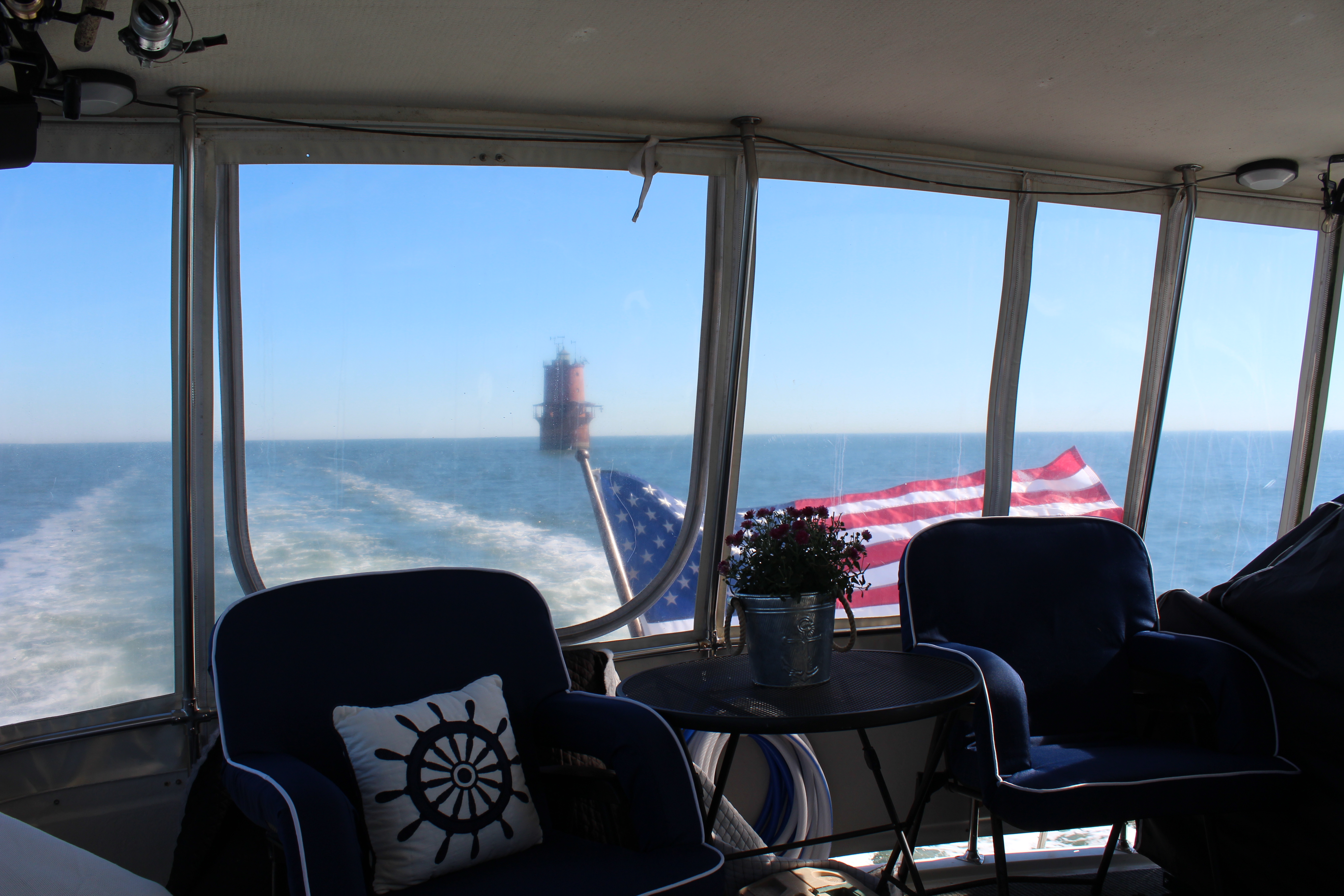
The crew shoved off early to make the run back to Jacksonville. The wind was predicted to be out of the west at only 4-6 mph for the day. So when the crew got to the St Augustine inlet they looked at the Atlantic Ocean and noted the smooth conditions.
Riding the bow in the Atlantic
The skipper took a vote to ensure that all onboard felt comfortable heading out into the Atlantic. After all agreed to make the run north in the Atlantic, the crew made their way out three miles offshore.
Approaching downtown Jacksonville
The crew turned north and travelled 35 miles north to the St Johns Inlet. The ride was smooth with the wind coming from the shore. After arriving at the inlet it was about 5 miles back to the ICW and then another 26 miles back to the Ortega Landing Marina.
Near the end of the journey
The crew got docked just before sunset and then celebrated a fun filled week by grilling burgers and eating dinner under the stars at the marina clubhouse.
Hello fellow adventurers and virtual crew members!
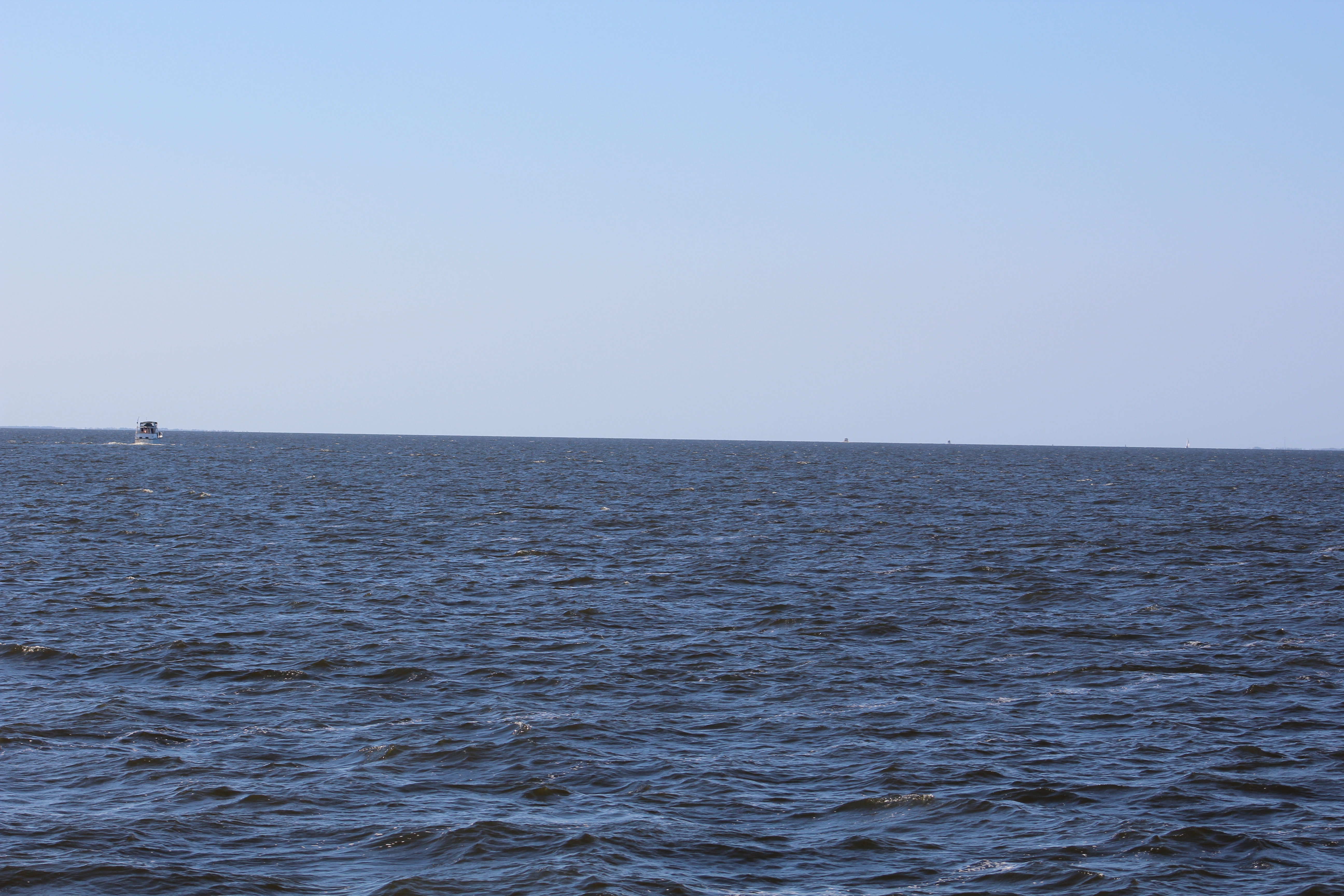
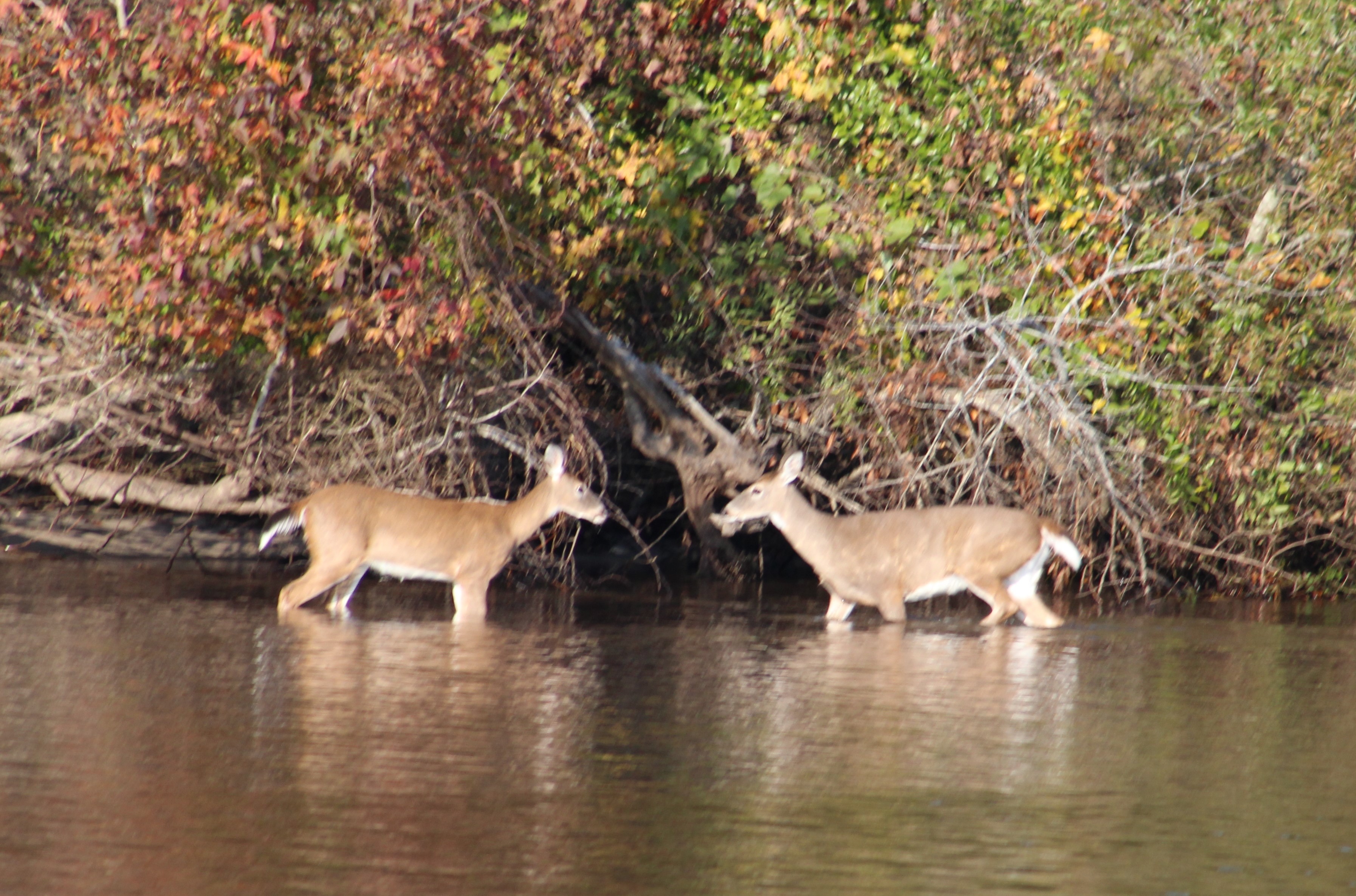
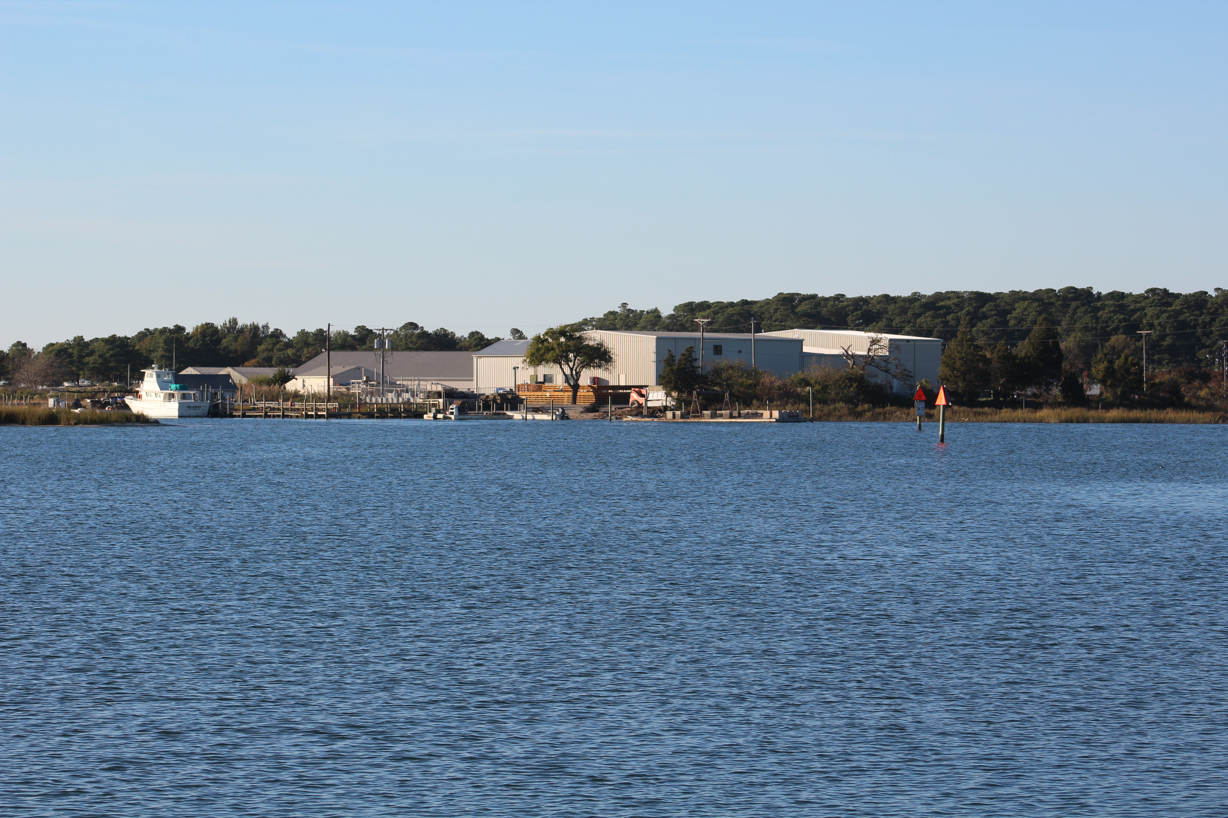
Eric here reporting on the southbound voyage of Still Waters II. The crew has travelled 400 miles over the last 6 days and now have pulled into Ortega Landing Marina in Jacksonville, Florida.
Saturday, October 31, 2015
This turned out to be a beautiful sunny day to cruise 67 miles over eight hours. About mid-day the crew turned into the Osprey Marina to take on fuel. After a full day of cruising, the crew dropped anchor in the South Santee River (STM 420) for a good night’s rest.
STM 390, Waccamaw River
Boat Name of the Day – On a 36 foot Carver motor yacht, “My Chelle’
Sunday, November 1, 2015
The crew put in a long day on the water and cruised 85 miles over ten hours. The crew passed back through Charleston and reminisced docking on the Mega Dock. As they passed the Marina there were several Mega Yachts on the Mega Dock.
STM 470, People enjoying Charleston Harbor
There were also four small sailboats circling a motorboat. Looked to be kids learning to sail with a coach in the motorboat giving instructions.
STM 500, South Edisto River
The crew dropped anchor in the South Edisto River (STM 505).
Boat Name of the Day – On a small tug boat, ‘Miss Alignment’
Skipper hopes the owner of the tug also owns a tire store.
Monday, November 2, 2015
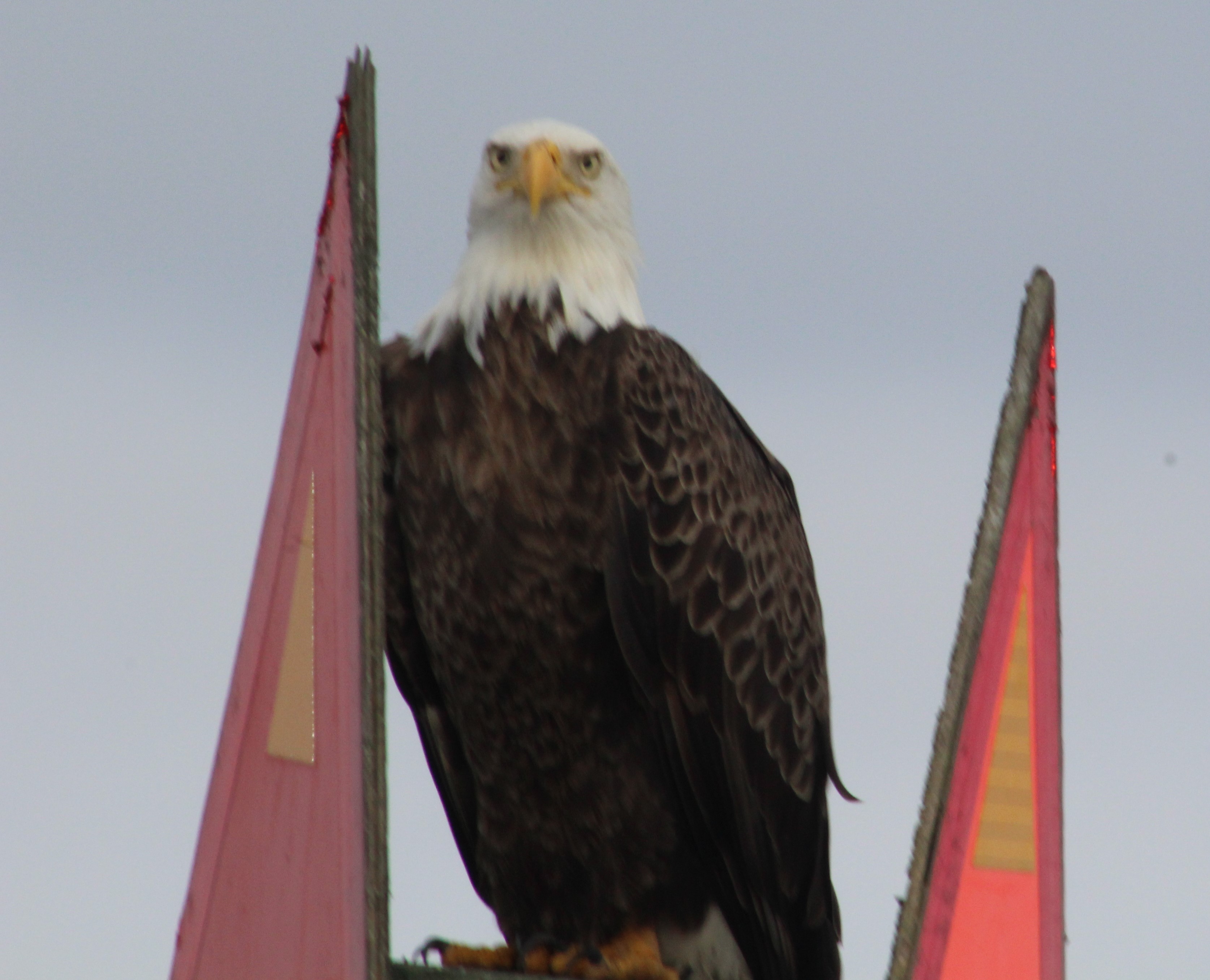
The crew was met by a Bald Eagle as they left the anchor spot to get back on the AICW. They cruised 68 miles over eight hours. They passed through the town of Beaufort, S. Carolina.
Crew getting the Eagle Eye
At the end of the day they were greeted by another Bald Eagle who observed them anchor in the Wright River. (STM 573)
Bald Eagle eating fish
Boat Name of the Day – No good names today
Tuesday, November 3, 2015
As they were leaving the anchor location the crew was greeted by the third Bald Eagle.
The crew put in 67 gloomy miles over eight hours. The sun never broke through the clouds and there was a thick mist that just hung in the air all day.
Following the herd south
On a brighter note, the mate spotted a big log in the water. Upon further inspection the log turned out to be a Georgia Manatee. First one spotted on the southern voyage.
The dolphins have also started showing back up at most of the inlets that the crew crossed. The crew always enjoys spotting the dolphins.
The crew dropped anchor in the Crescent River (643). Only about 100 miles to go to Jacksonville.
Boat Name of the Day – Still no good names today
Wednesday, November 4, 2015
The crew was greeted by another Bald Eagle as they weighed anchor and proceeded south.
While cruising through some shallow water the boat started to churn up some fish so the birds settled in behind the wake for a free lunch. This is a video sequence at the end of the feeding frenzy. Click on pic to watch the birds.
The crew put in another 67 mile day with little to report on. They dropped anchor in the Cumberland Sound (710) with about another dozen boats.
Boat Name of the Day – still no good boat names
Thursday, November 5, 2015
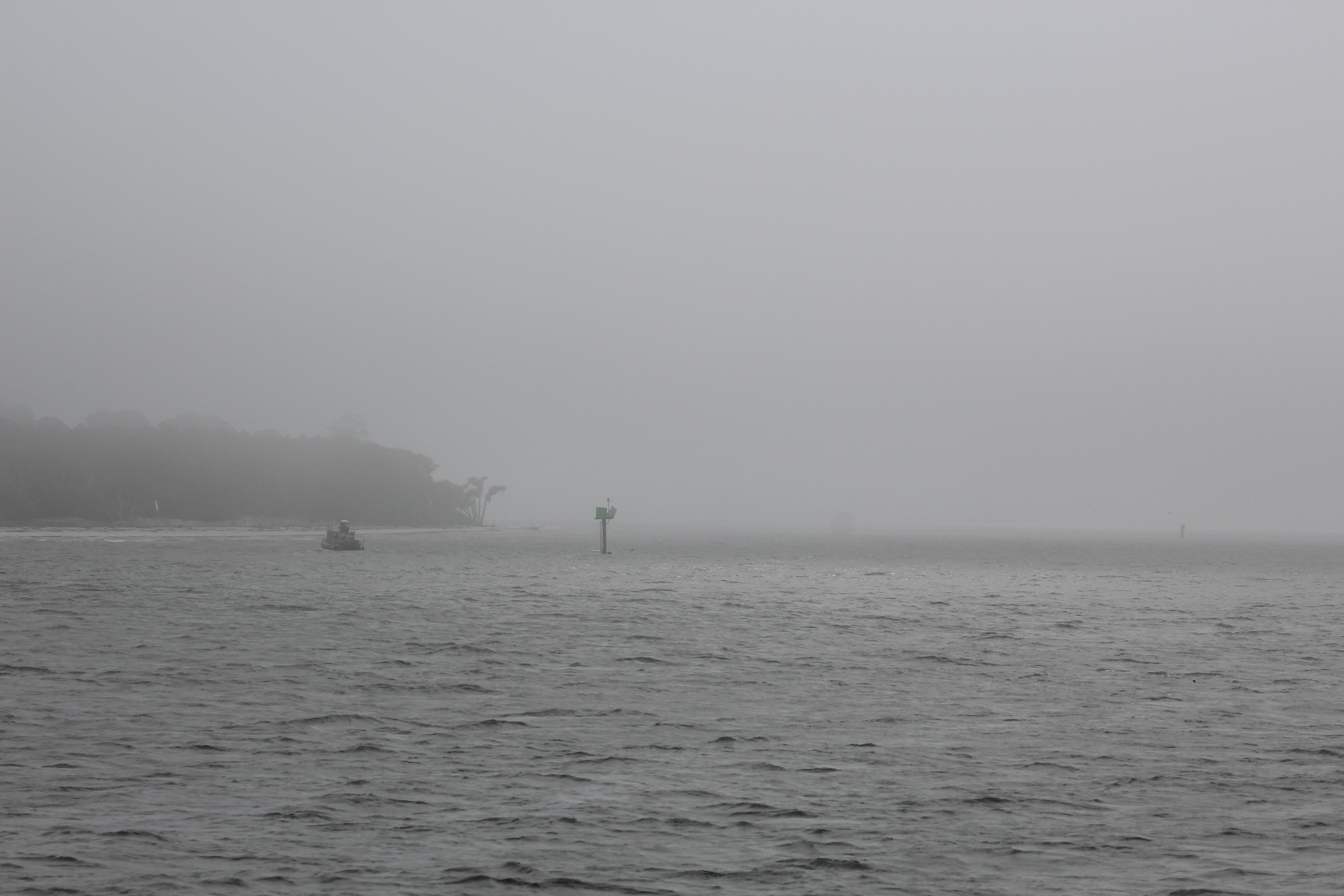
The crew was greeted by restricted visibility due to a heavy fog that was sitting on the Sound. A couple of boats left the anchorage in the heavy fog. Our crew waited an additional hour but conditions did not improve much.
Foggy, Foggy Morning
Per the Coast Guard Navigational Rules, every vessel is supposed to have a ‘Look Out” while navigating the waterways to spot vessels and help avoid collisions. Normally the helmsmen is also the Look Out. The mate stayed in the fly bridge and acted as the Look Out while the skipper was keeping an eye out for the navigational aids. The fog finally started to burn off and was finally gone by 0900.
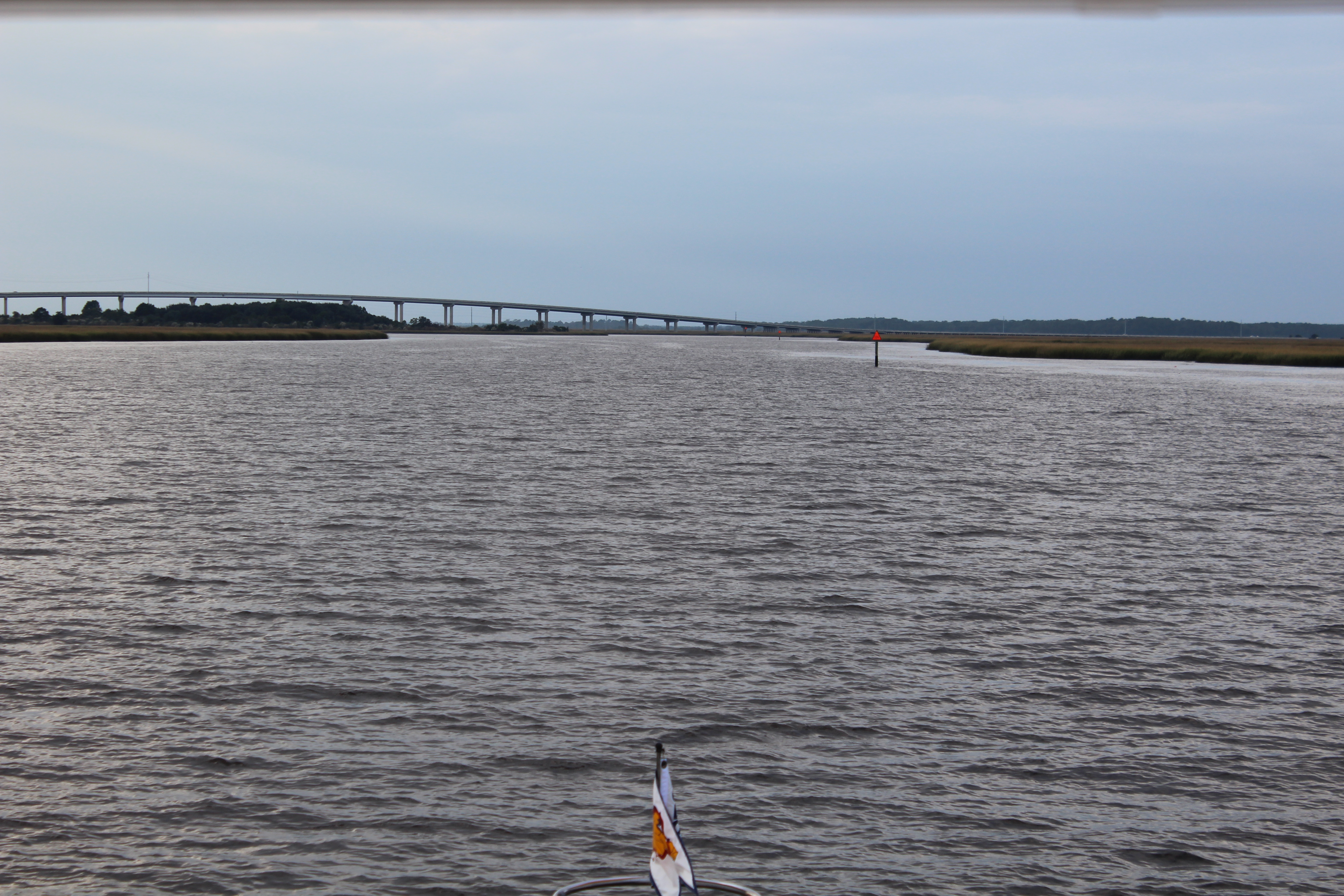
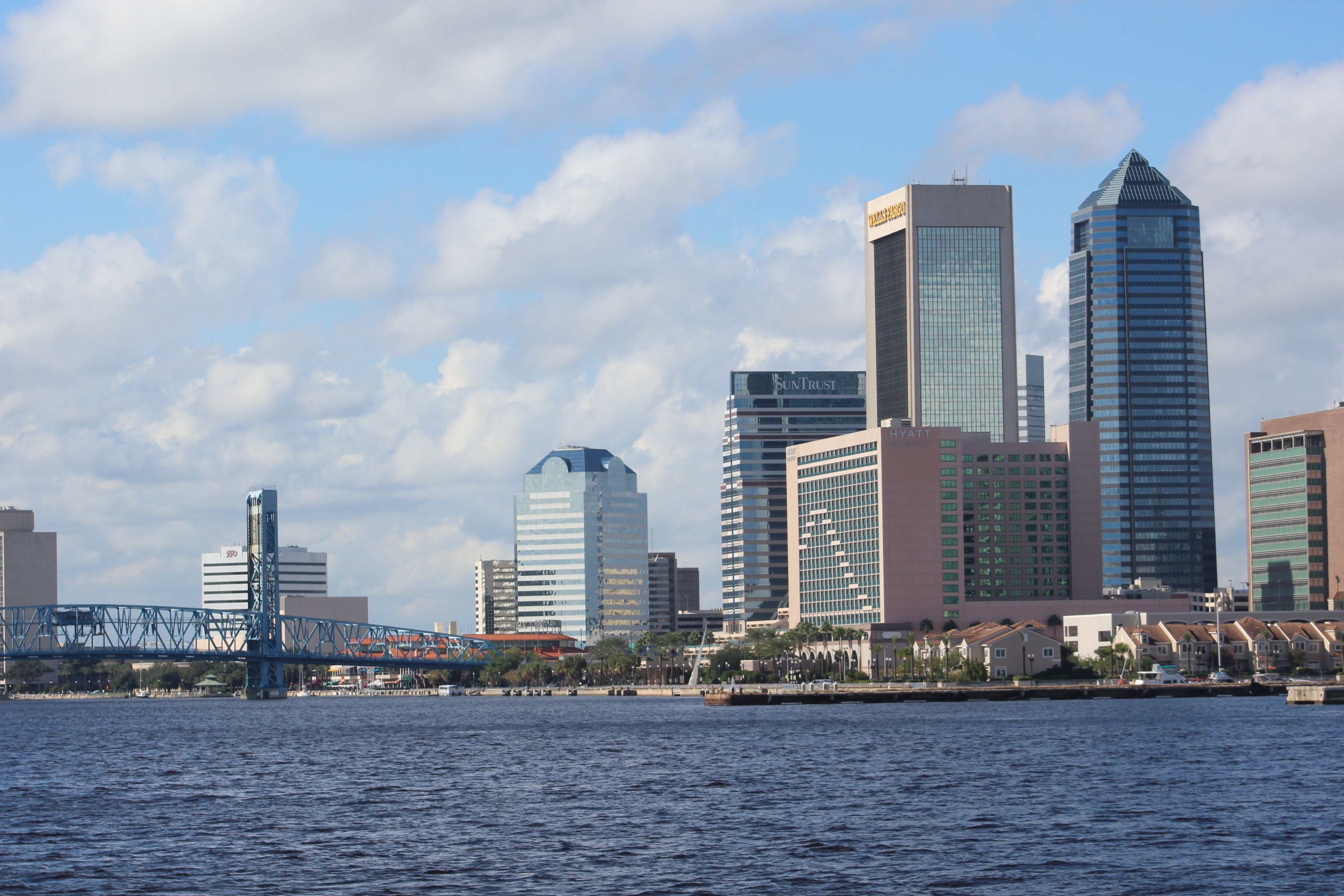
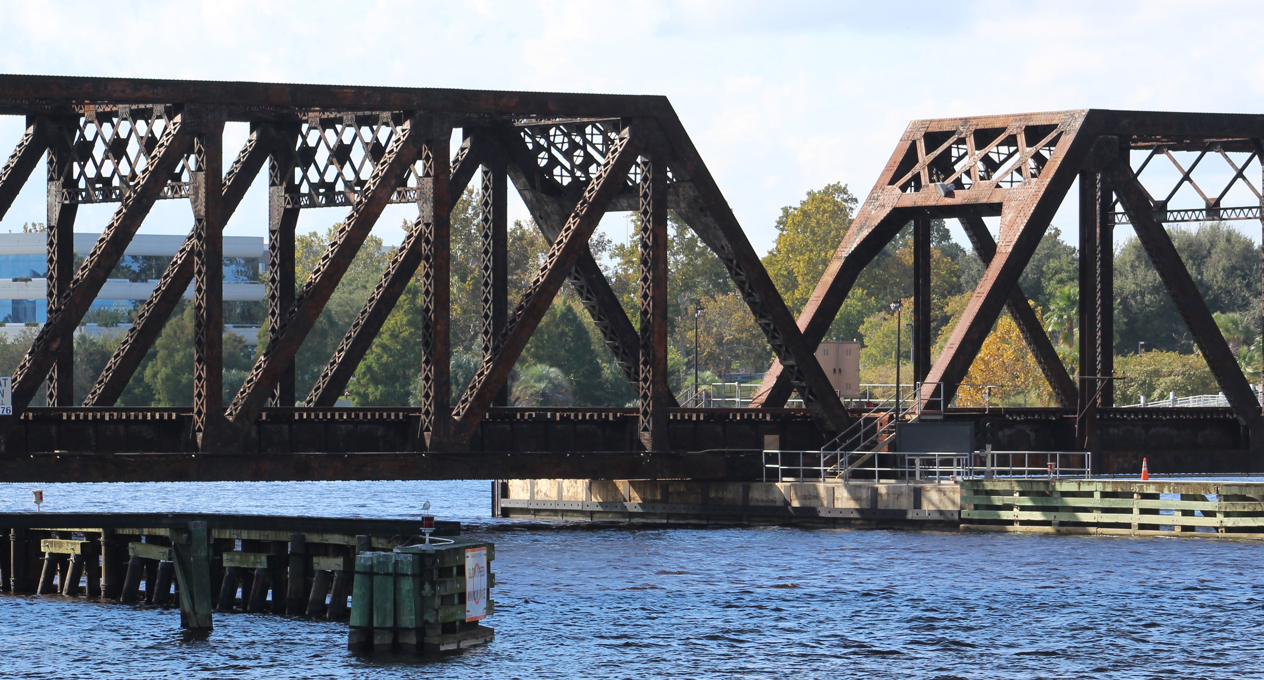
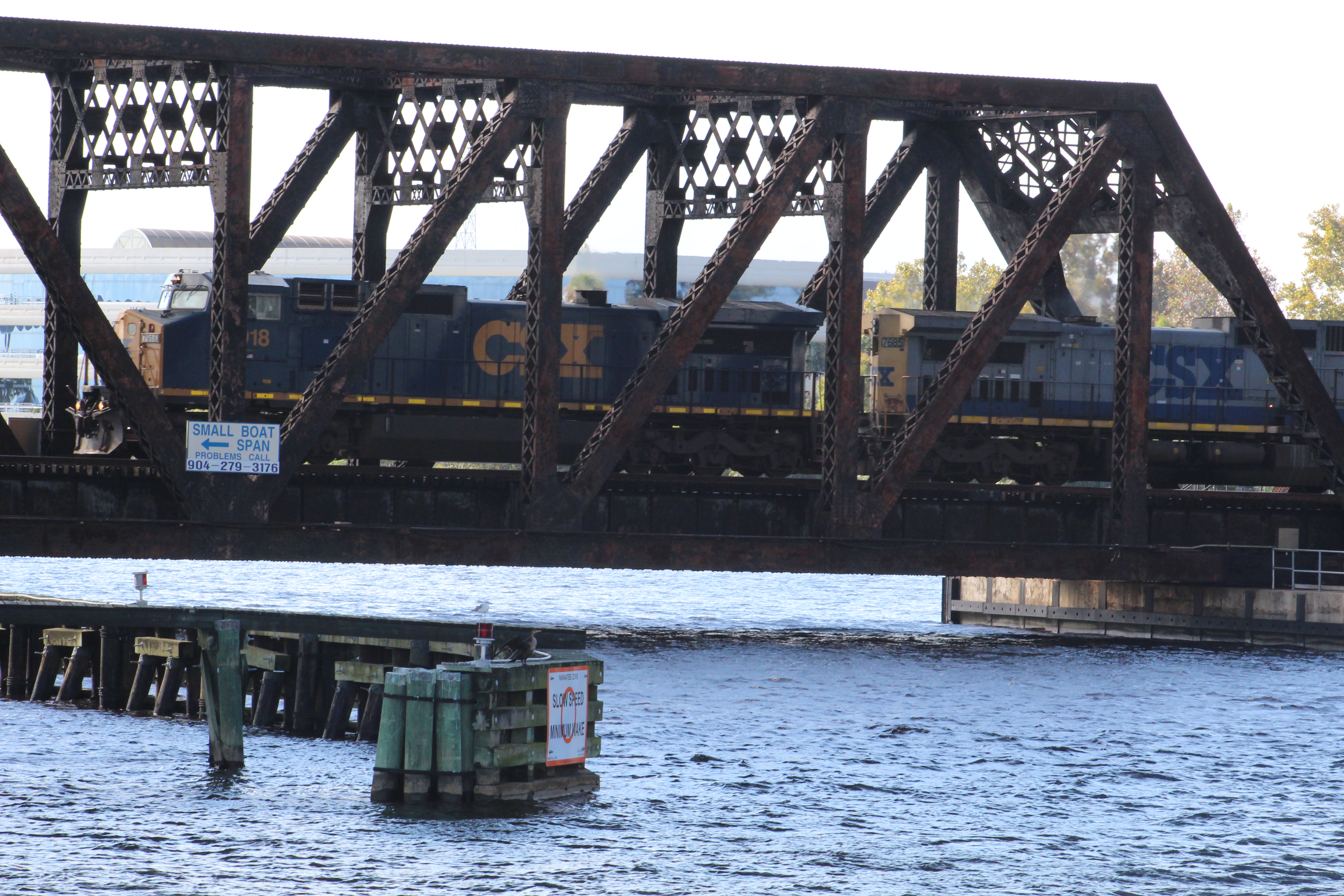
The crew arrived at the St Johns River at 1124 and made a right turn to head down river to the marina. The marina is located off the St Johns River on the Ortega River, 26 miles downstream.
Downtown Jacksonville
The crew passed downtown Jacksonville and then arrived at a closed railroad bridge that was advertised to be normally open. The skipper hailed the Bridge Tender and requested a bridge opening. The Bridge Tender informed the skipper that a southbound train was headed for the bridge and that he would open the bridge after the train crossed.
So the crew actually got to watch a train cross over one of these railroad bridges. Another first for the crew.
The crew then passed through the Fuller-Warren Bridge and headed into the Ortega Landing Marina. The Coast Guard had an active rescue in progress so they were all over channel 16 on the radio talking with the Captain in distress. That made hailing the Marina impossible. While trying to call on the phone, the battery decided to play dead. The crew had their dock and slip assignment already (B38) so they just went on in to dock. The skipper found the B dock and then idled down to slip 38. The fit was tight and the wind and current were strong. The skipper started to back into the slip and managed to get her backed in, but with no dock hand on the pier the plan was to have the mate jump over to the pier and tie them up. However, the wind was blowing them off the pier and the skipper could not get the boat over close enough for a safe leap. Luckily a few boaters came down and assisted getting the vessel tied down.
Winter resting spot, B38
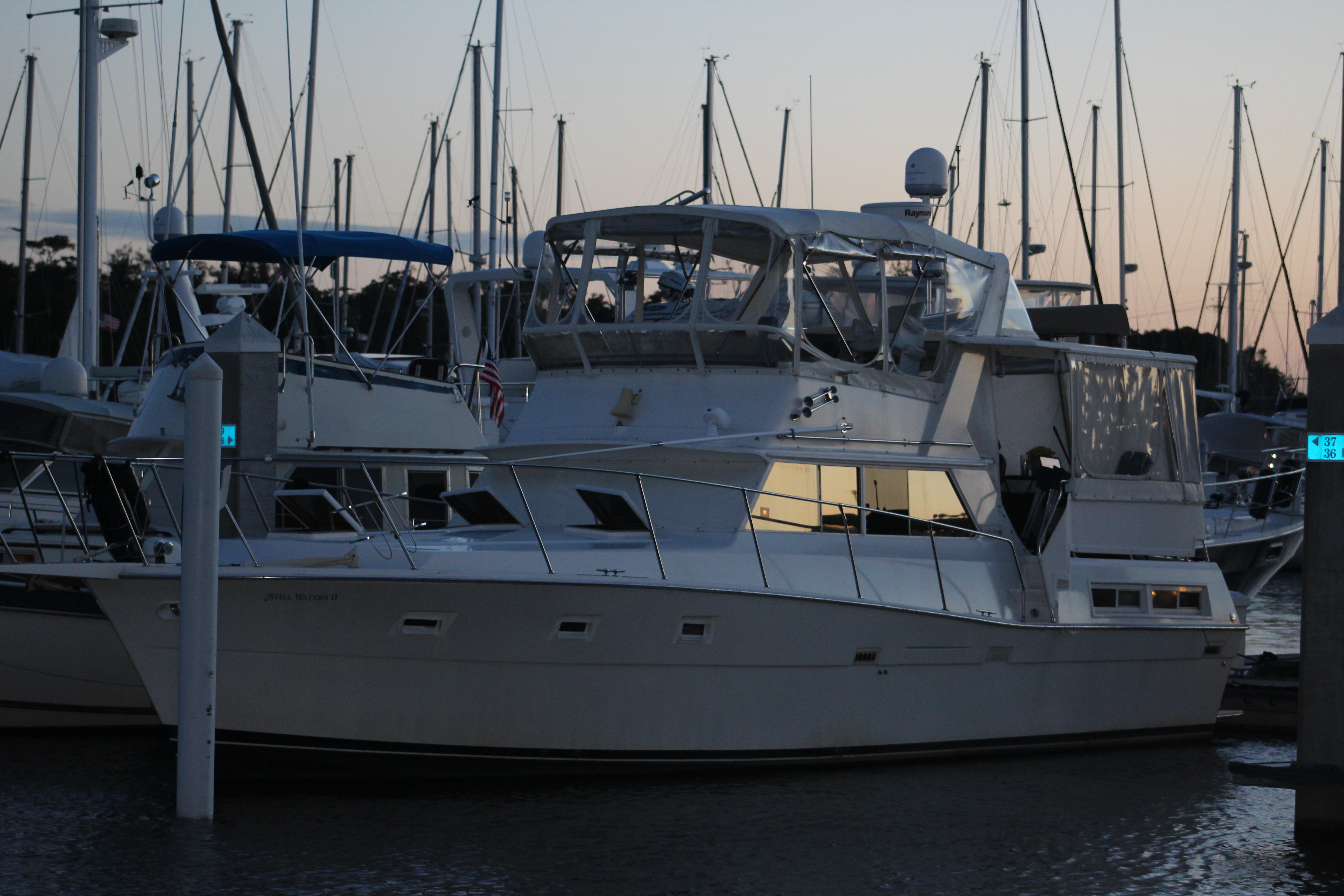
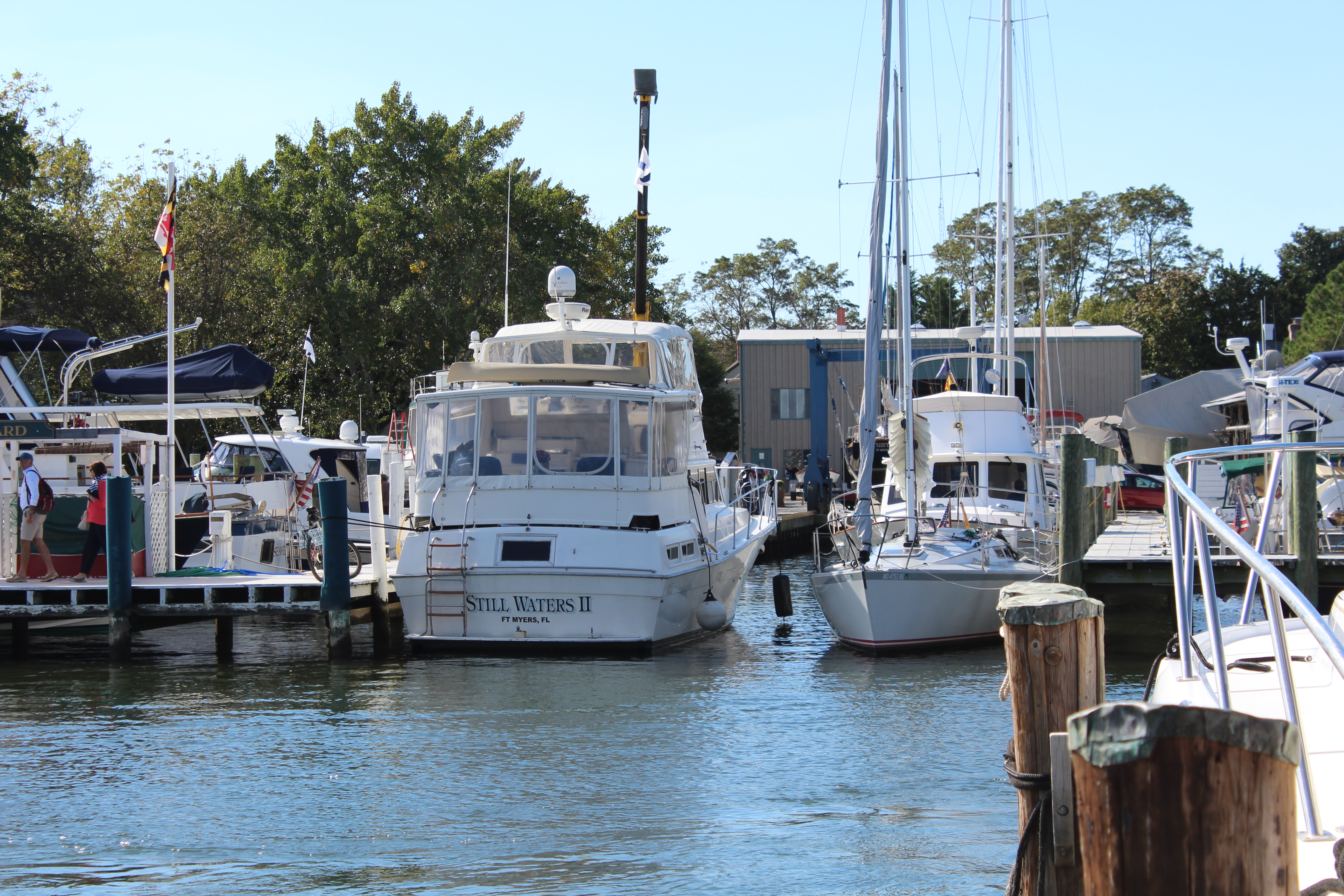
Ortega Landing will be where the crew winters for 2015/2016. They have signed a three month slip lease that will expire the first of February with options to extend the stay.
However, they will spend next week cruising with new mystery guests who will arrive on Saturday and fly back to Granbury, Texas on Friday.
Boat name of the Day – ea harp, owners are both music majors, the man graduated from Dallas Theological Seminary.
Hello fellow adventurers and virtual crew members! I would like to welcome Anna K. from Texas aboard as a new virtual crew member. Anna is a long time friend of the mate. Glad to have you aboard Anna!
Eric here reporting on the southbound voyage of Still Waters II. The crew has travelled 234 miles over the last 4 days and have pulled into Barefoot Landing Marina for two days. There continues to be new opportunities each day to sharpen the skills of our crew.
Monday, October 26, 2015
Weather, specifically the wind speed and direction, continued to be a challenge for safe boating. The wind for this passage was 12-15 mph out of the North-Northwest with gusts to 20. With most of the passage headed south this was not to bad; however, at one point there were 20 miles in 4-5 foot waves that made for some exciting times. Most of the day was spent in small chop of 1-2 foot waves with some really smooth water transiting some narrow canals.
Crossing the Pungo River at mile 140
While the crew was running the worst of the waves, they were tracking beside a red sailboat. The sailboat looked like a hotdog in boiling water as it rolled and bobbed up and down in the waves. The sailboat crew had on their full foul weather gear and were exposed to the wind, rain, spray, and cold. Our crew was glad they were enclosed in the fly-bridge and out of the weather.
Mile 160 in Gale Creek
By 1530 the crew had had enough and found a cove in Adams Creek to drop anchor. The cove was protected from the North wind but the wind continued to build during the night to over 20 mph. The anchor held in the wind with another night of rocking in the waves.
View in Adams Creek where the crew anchored
Boat Name of the Day – On a small boat with a golf ball and golf tie – Par Tie Boat
Tuesday, October 27, 2015
There were a couple of interesting and amusing experiences as the crew continued south for 57 miles through narrow rivers and canals that make up this section of the AICW.
Mile 190, still in Adams Creek
As the crew was approaching Camp Lejeune to pass through the AICW that borders the military installation, they were stopped by a military police boat at 1430. The military police boat explained that the route was closed until 1700 due to live fire exercises in progress. The crew dropped anchor andmwaited for the route to reopen.
Mile 240, Can you see the bridge in the distance
While waiting, another four boats were also stopped which caused a small boat jam. At 1555 the military police boat announced that the exercise was complete and that it was safe to proceed south.
Our crew had been the first to arrive and drop anchor. The other boats all passed Still Waters II and anchored between her and the police boat. So, once the boats were allowed south, Still Waters II found herself at the back of the pack.
Ahead of the pack was the Onslow Beach Swing Bridge that opens on the hour and half hour. The pack set speed to make the 1630 bridge opening.
The crew had a good laugh when they arrived at the bridge at 1632 and found the bridge still shut and the four boats waiting for the bridge to open. The skipper picked up the radio and hailed the Marine bridge tender on channel 13. The skipper then requested a bridge opening and the bridge tender said he would be happy to open the bridge. The horn sounded, the bridge opened, and all 5 boats passed through the bridge at 1635.
The crew wonders how long the other boats would have sat there before someone requested the bridge to open. You may recall the following exchange on the northbound cruise at this same bridge:
Skipper – “Are you opening the bridge on schedule?”
Bridge Tender – “If someone requests the bridge to open, I will open the bridge.”
Skipper – “I guess I am requesting you to open the bridge then.”
Bridge Tender – “Then I will open the bridge.”
Experience is a wonderful thing. Schedule or no schedule, one has to request the bridge to open before the Marine tender opens the bridge. Those Marines manning the bridge are having fun at the boaters expense.
mile 244, Hammock Bay
The crew decided to drop anchor in Mile Hammock Bay. When they turned off the AICW to enter the Bay there were 15 other boats already anchored. Still Waters II made 16, and at least one other boat pulled in a little after our crew. The crew found a spot over on the outside of the other boats and dropped anchor for a peaceful calm night.
Still Waters II with some close friends in Mile Hammock Bay
Boat Name of the Day – on a sport fishing boat – E Sea Fishing
Wednesday, October 28, 2015
Another strange day greeted our crew as they put in 77 miles on the water. At about 0900 the skipper ‘decided’ (using the word decided very loosely here) to take a side trip up the New River. It was an hour later when it dawned on the skipper he was sight-seeing and off course. The skipper turned around and made way back to the AICW.
The skipper was more than a little hacked at the navigator for missing the marker and leading the helmsman down the wrong course. (I will not mention that the navigator and helmsmen just happened to also be the skipper.) But the skipper believes that there is a reason for everything, and the reason became obvious later in the day.
High water in S. Carolina
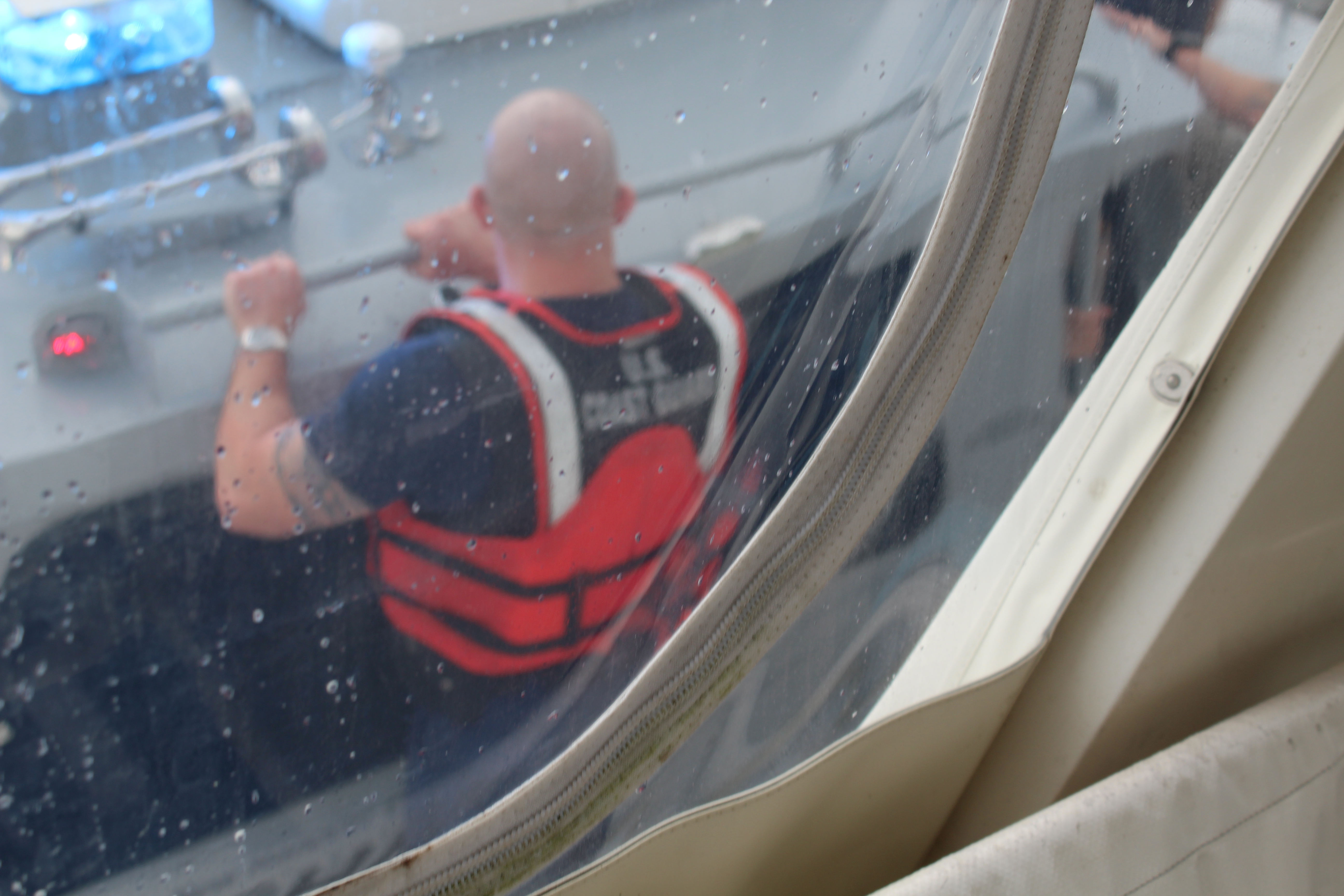
At 1540 a Coast Guard boat approached Still Waters II and one of the Coasties directed the skipper to maintain course and speed. Three Coasties boarded Still Waters II for a routine “Safety Inspection.” The Coasties spent about 30 minutes onboard looking all through the vessel and reviewing the boat documentation paperwork. Once they completed the inspection they reported that the vessel had NO Violations. They were also very complimentary of the overall condition of the vessel.
Coastie leaving the boat
As they were leaving Still Waters II and re-boarding their vessel they were also appreciative of the crew’s attitude towards the inspection. Seems they encounter many crews who have a bad attitude towards the safety inspections.
The crew would like to thank the two previous owners for taking good care of Still Waters II. The crew would also like to thank Captains Chris, Alyse, and Geoff for making sure she was incompliance with all Coast Guard regulations prior to the summer shack-down cruise.
Mile 280 at Mason Inlet
The crew dropped anchor in the Cape Fear River at dusk near Southport. This was not the best spot to anchor but the winds finally died down after midnight to allow some good sleep for a tired crew.
Anchor in Cape Fear River
Boat Name of the Day – on a catamaran – Kat Cha Later
Thursday, October 29, 2015
After weighing anchor, the crew set off for North Myrtle Beach. The crew put in 48 uneventful miles and tied up at the Barefoot Landing Marina at 1530.
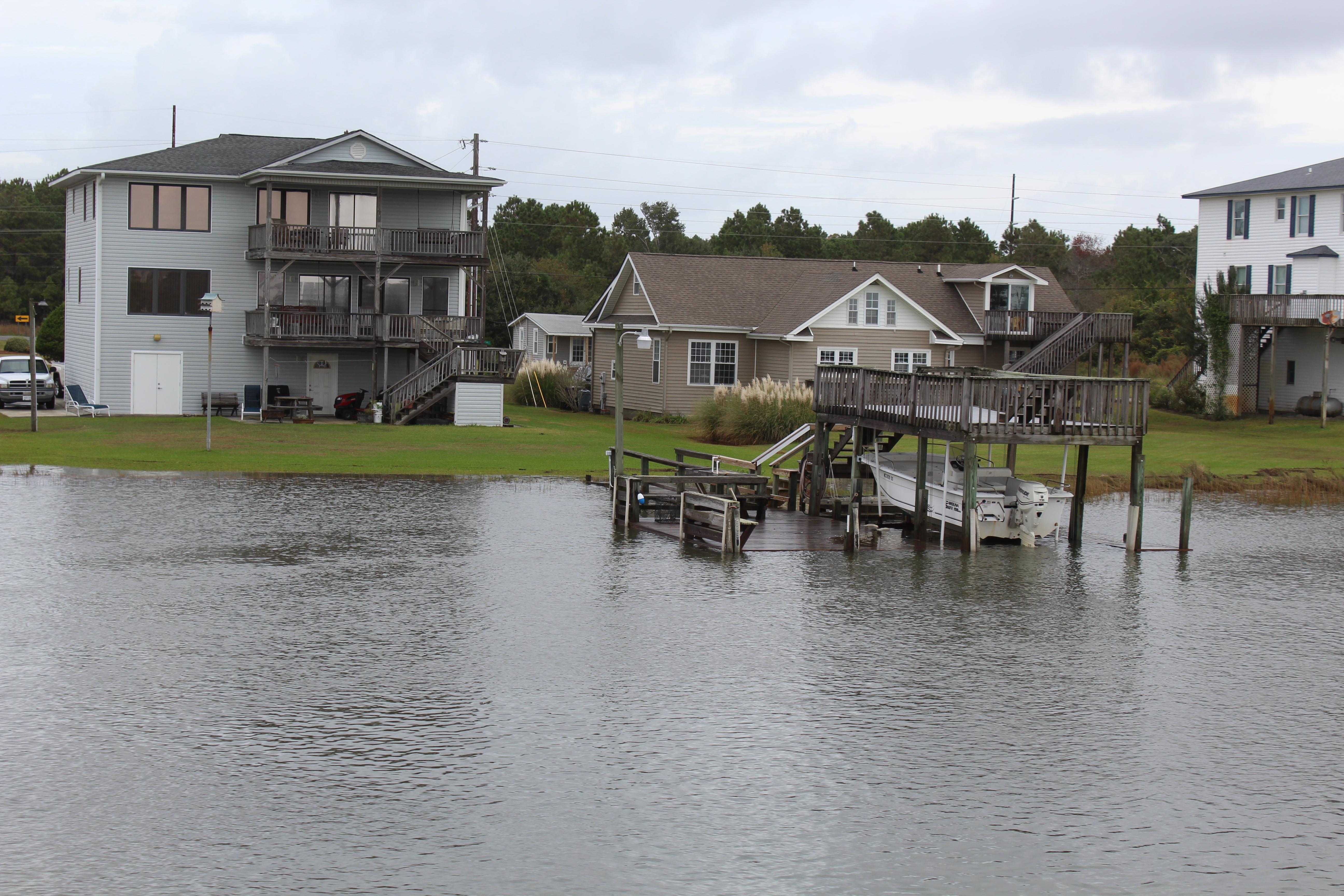
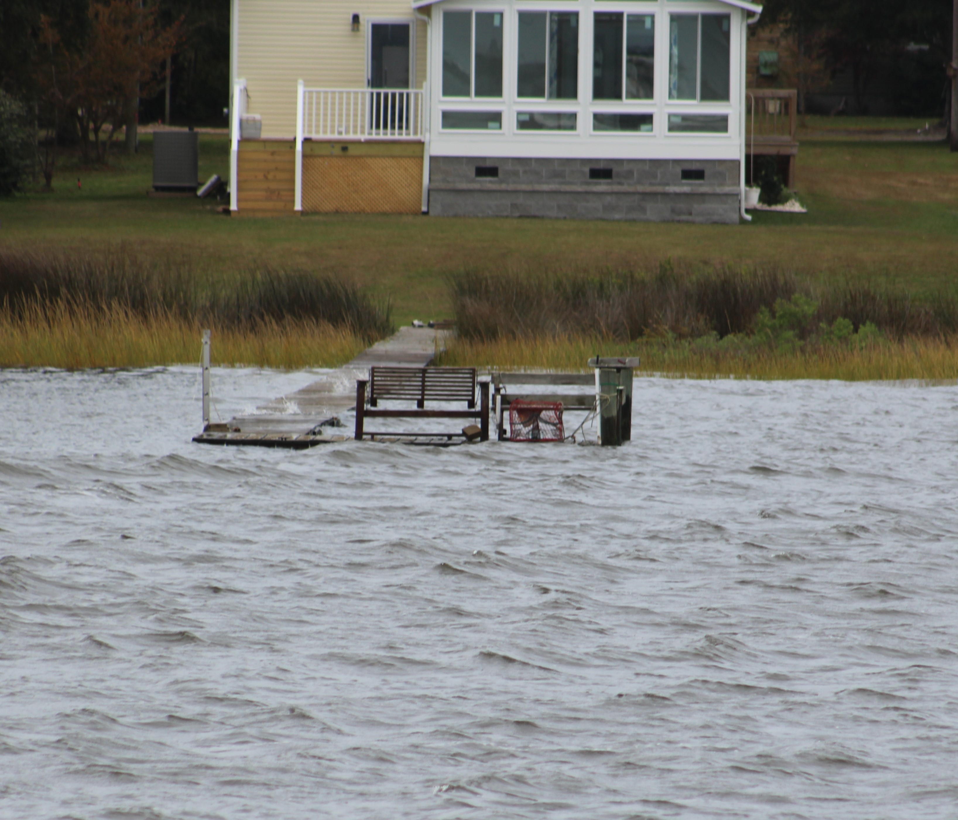
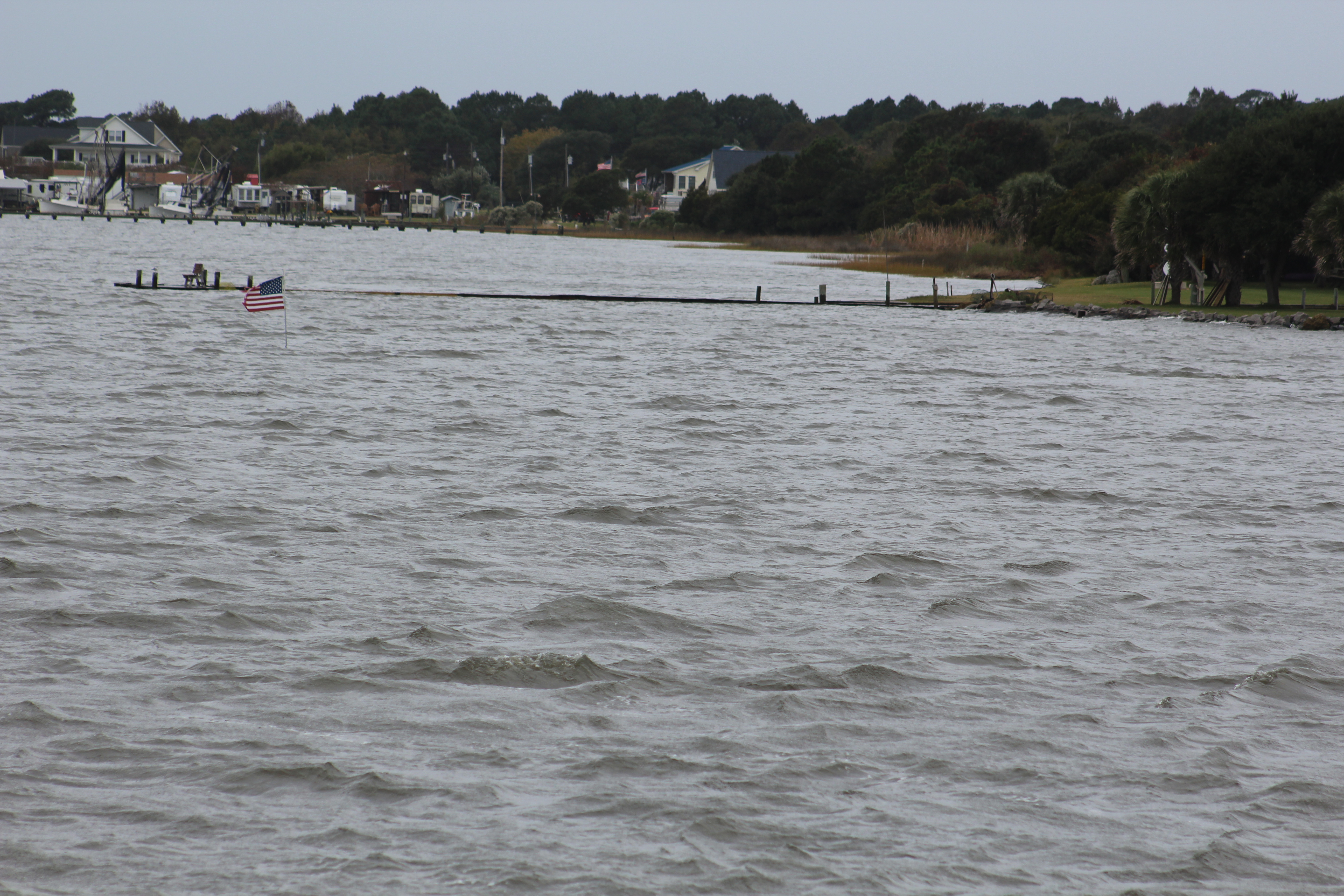
The most interesting thing for the day was the water level. It has been several weeks since the Carolina’s had the 1000 year rain that caused so much flooding. As the crew travelled south they have begun to see examples of the flooding. There are still many boat docks underwater, and houses with water very near the front door.
There are sailboats getting stuck at 65 foot bridges because their 63 foot masts will not fit under the bridge. They anchor beside the bridge and wait for the tide to go down and get some more clearance. There were two sailboats at a bridge showing 63 foot clearance that had been waiting for five hours to get under. The two captains had the following radio conversation as our crew passed them:
Monohull – What is your mast height?
Catamaran – 63 feet, what is your height?
Monohull – 63.5 feet. I am waiting for the bridge to show 64 ft clearance on the board marker before going under.
Catamaran – Good. I will follow you under.
Monohull – I was hoping you would go first. I am chicken.
Simply amazing that there is still this much water around after so many weeks. Water levels look to be at least two feet higher than normal.
Closing in on North Myrtle Beach
Boat Name of the Day – on a 45 foot cruiser – Sol Mate
The crew plans to spend two days at the marina before heading back out on the AICW on Saturday morning and making the final push to Florida.
Till then may the wind be in your back and you find still waters.
Hello fellow adventurers and virtual crew members!
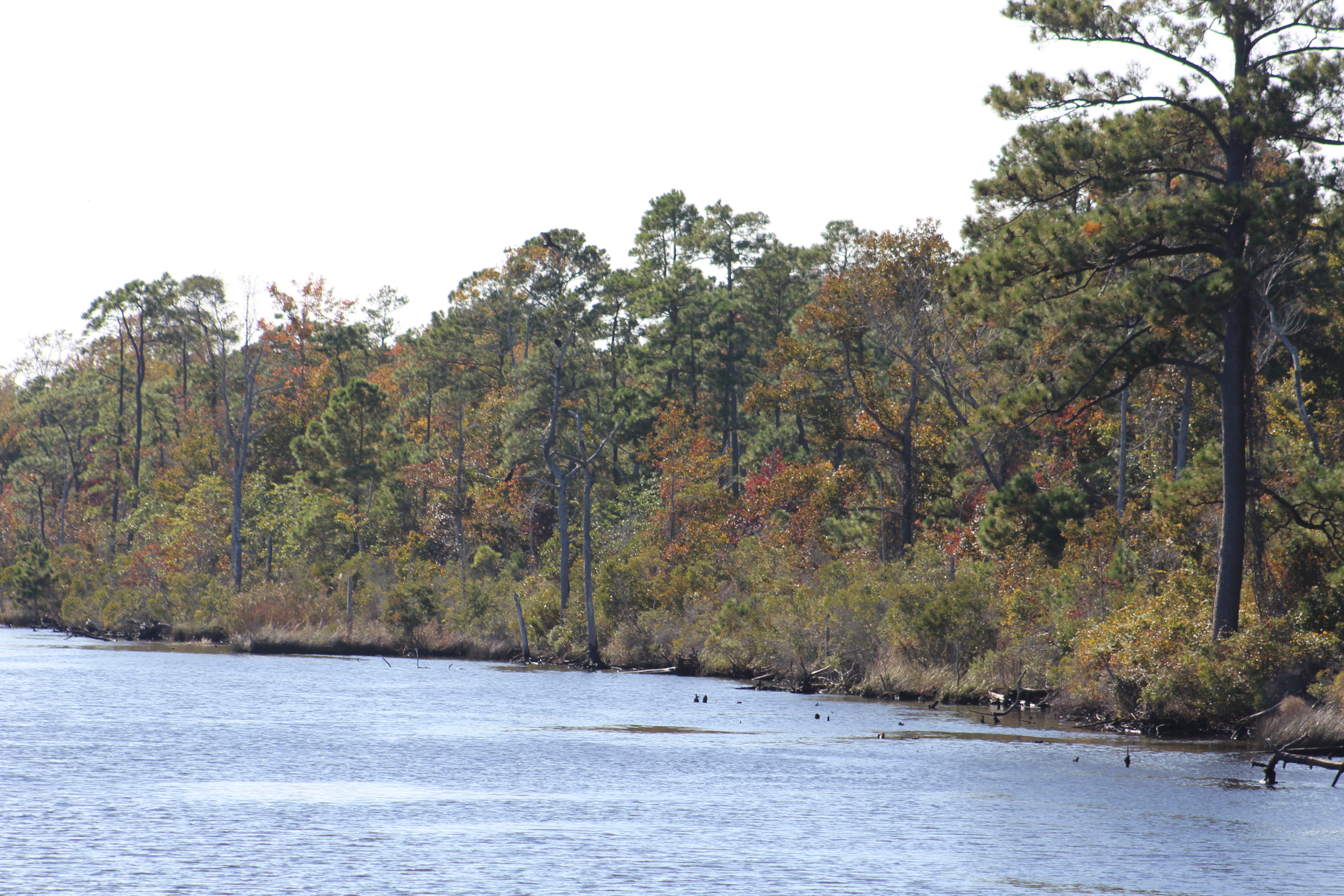
Eric here reporting on the southbound voyage of Still Waters II. Before leaving Top Rack Marina on Friday morning, the crew topped off the fuel tanks. After taking on fuel the crew headed south on the Virginia Cut route. The crew anchored out Friday and Saturday nights, then pulled into the River Forest Manor and Marina in Belhaven, North Carolina early on Sunday.
Friday October 23, 2015
There are two routes south from Norfolk to cross the Albemarle Sound. The Dismal Swamp and the Virginia Cut. Since the crew took the Dismal Swamp route on the way north, they decided to try the Virginia Cut on the way south. The Virginia Cut has one lock to navigate and several bridges that are on set opening schedules. So the way takes some patience and coordinating.
Entering the Great Bridge Lock
The Great Bridge Lock was the first obstacle to time. The lock operates on the hour and the crew arrived at 0953. A tug had just passed through so the lock gates were open and Still Waters II motored into the lock and took her place along the south wall. She was the fourth boat in the lock and one additional boat pulled in behind her. The gates were closed and the lock master raised the water level about a foot and opened the south bound gates. All five boats exited the lock with no issues and were headed to the Great Bridge for the 1000 opening.
Parade of boats at the Great Bridge
Next was the Centerville Turnpike Swing Bridge three miles south which opens on the hour and half hour. The five boats stayed in order and all made the 1030 opening.
Parade of Boats thru the swing bridge
Next up was the North Landing Swing Bridge 5 miles south. There was a sailboat that was second in line of the parade of boats and was not making much speed. There was not enough room for the three boats behind to pass so they arrived at the swing bridge at 1110 and had to wait 20 minutes for the 1130 opening. While waiting at the bridge the sailboat moved over and let the three motor boats pass.
Mile 10 – Southern Branch of Elizabeth River
After negotiating all the obstacles and clock, the crew dropped anchor in the North River after cruising an additional five hours.
Mile 50 – Coinjock Bridge over North Carolina Cut
With the parade of boats headed south, all of which are making different speed, and some in a hurry while others are not, the patience of some captains has begun to wear thin. Common boating curtesy is to hail the boat in front of you and request to pass. Once permission is granted the lead boat slows and the passing boat slows to minimize the wake while overtaking the lead boat. The radio was alive with chatter of boats requesting to pass. However, there are some folks in a hurry that just plow by other boaters and give off huge 3-5 foot wakes, some even larger. One of these guys got reported to the Coast Guard by several other boaters. When he passed within 15 feet of Still Waters II he threw a 7 foot wake and really rolled her. There is a special place in Sheol for people like that.
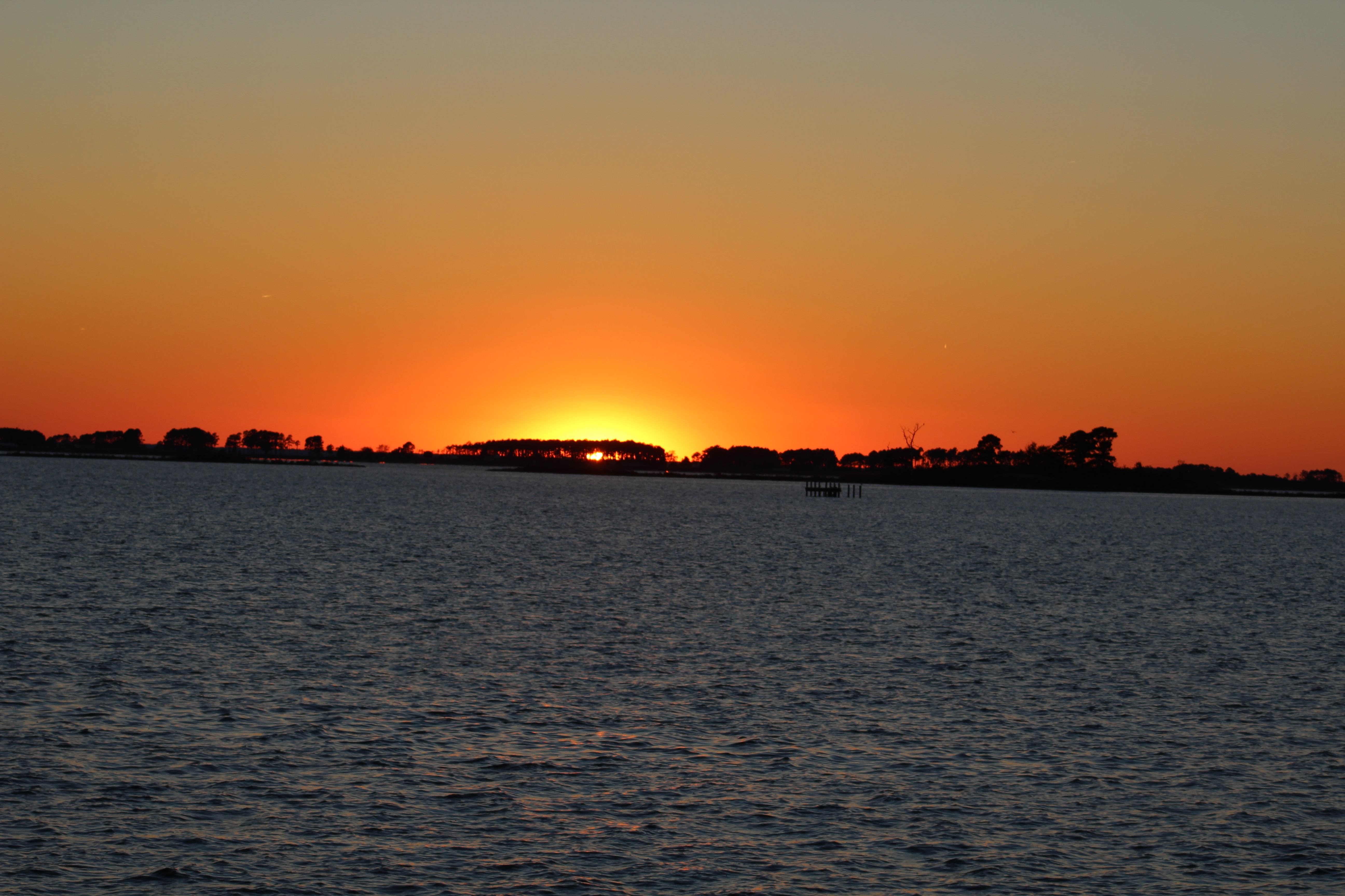
Mile 57 – Sunset at anchor in Broad Creek
On the lighter side, there are some very creative people who come up with interesting boat names so we will begin to feature the boat name of the day as the crew journeys south.
Boat Name of the Day – 44 foot powered catamaran – “Stray Cat”
Saturday October 24, 2015
The crew logged a 70 mile voyage and crossed the Albemarle Sound. The plan was to get across the Sound in the morning before the winds got up and caused the big waves that the Albemarle is famous for. The Sound is also known for ‘confused seas’ which means waves from all directions. The Sound did not disappoint. The wind was out of the north/northeast at 15 mph with gusts to 20. This made for 3-5 foot waves coming from all quarters and a bit of a rough ride across. However, the skipper is getting better at finding the right speed to cruise the rougher water to make for a smoother ride. He has been getting more practice than he wished for, but hey, practice makes perfect.
Mile 70 – in Abemarle Sound
After crossing the Sound the crew entered the Alligator River with plans to stop at the Alligator River Marina for lunch and one of Wanda’s excellent hamburgers. Unfortunately, when the skipper called Wanda to ensure that they could dock, she informed the crew that the low tide was very low and they would not be able to get into the marina. Since there would be no stopping the crew passed the marina and headed for the Alligator River-Pungo River Canal. The canal was a 25 mile long welcome escape from the wind and waves. After exiting the canal, the crew dropped anchor in a crowd of about a dozen other boats in the Pungo River.
Mile 110 – Alligator River-Pungo River Canaal
One interesting side note was a sailboat that also wanted to enter the Alligator Marina. The sailboat turned off the ICW and entered the channel markers leading to the Marina entrance. Wanda saw them coming so she tried hailing them on the radio. However, there was no response from the sailboat. When the sailboat entered the breakwater, Wanda came back on the radio and told them to stop, but the sailboat kept going. The next radio transmission was Wanda on Channel 16 in a very smug voice for all to hear, “Sailboat stuck, sailboat stuck, Alligator Marina back to monitoring Channel 16.”
Mile 125 – Alligator River- Pungo River Canal
Lesson Learned – One should carry a radio onboard and monitor Channel 16 while underway. You just never know what you might need to know.
Boat Name of the Day – on a 70 foot motor yacht – ‘Castle Finn’
Sunday October 25, 2015
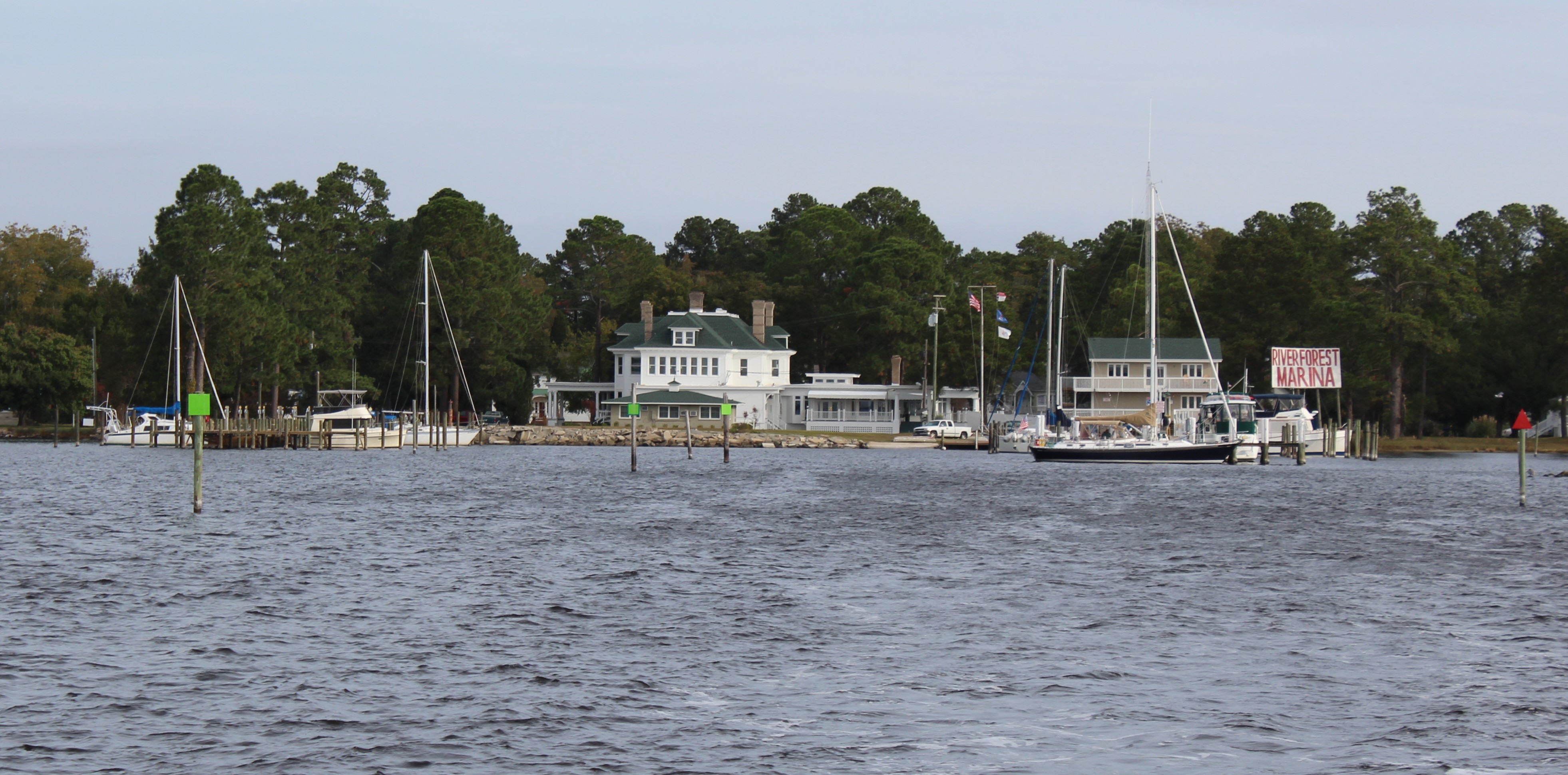
The crew weighed anchor and made 15 miles to the River Forest Manor and Marina in Belhaven, North Carolina, AKA “Beautiful Harbor.” The crew needed to provision and there was a grocery store about 1.5 miles from the marina. The marina offers courtesy golf carts and the crew used them to make the provisioning run to the store. New experience cruising through town on a golf cart.
River Forest Manor and Marina
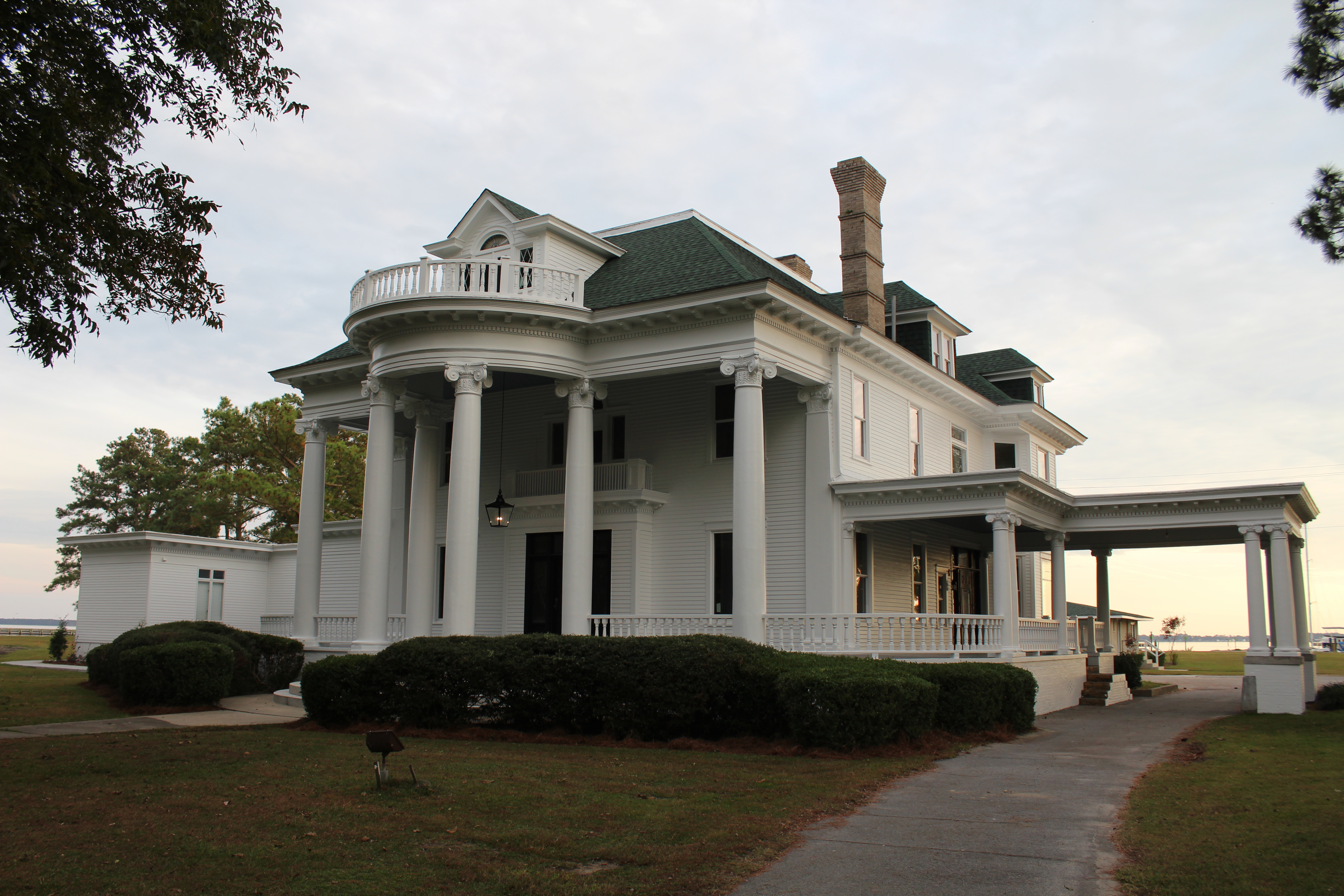
The marina is under new ownership and the owners have spent the last year performing upgrades to the marina. The owners and dock hands were very friendly and provided excellent service. The marina owners are now in the process of restoring the River Forest Manor that was built in 1899.
River Forest Manor
Boat name of the Day – 44 foot catamaran – Gypsea Cat
The next big challenge is to cross back through the edge of the Pamlico Sound. The weather report is for 15 mph winds on Monday, but the winds are going to grow to 20 mph on Tuesday. The talk of the dock was about who was going and who was staying. For those staying, the talk was for how long to stay before a good weather window.
Our crew has decided to venture out and cross with the 15 mph winds. The winds should be north/ northeast and only cause a problem for about an hour.
Keep a look out for the next log entry as I describe the wisdom or folly of the decision.
Till then may the wind be in your back and you find still waters.
Hello fellow adventurers and virtual crew members! Great news, we have a new virtual crew member on board, Scott from California. Welcome aboard Scott!
Captain John Smith returning to provide my last update on the travels of our crew. Strange things have continued to happen since the last log entry. Some amusing, some not so funny.
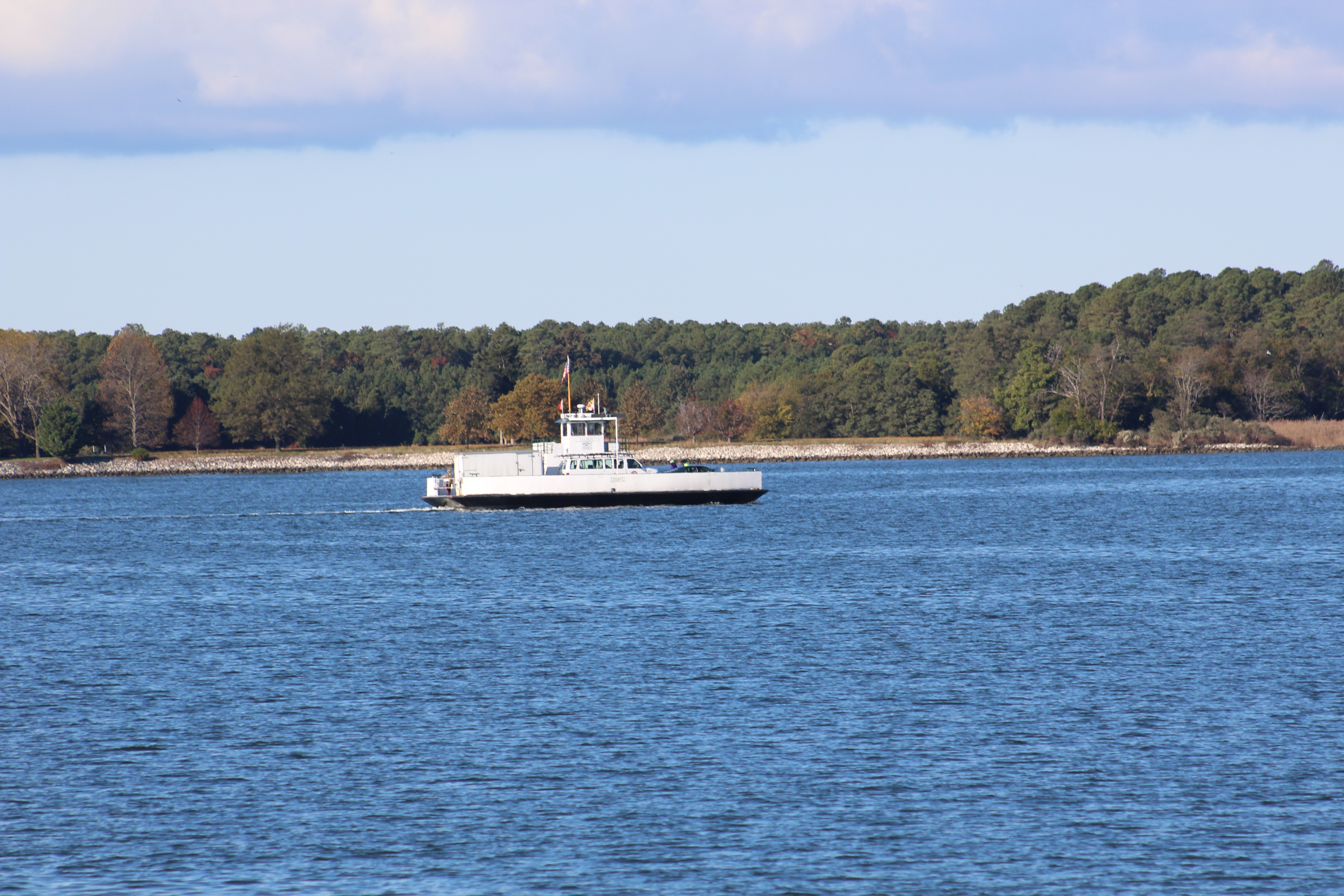
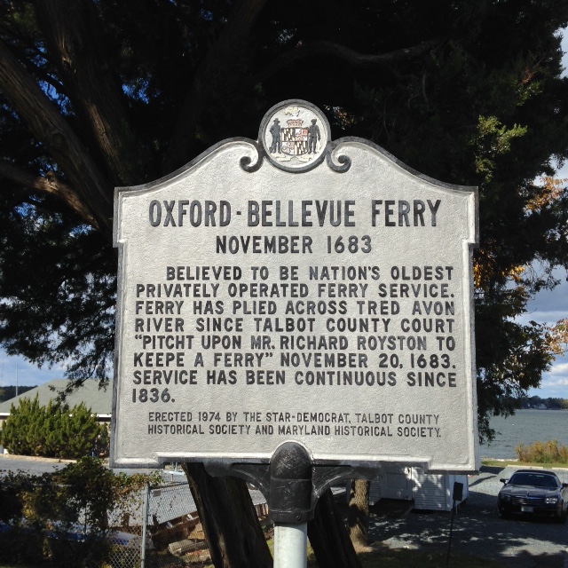
Oldest continuous ferry in US. Connects the Islands between St Michaels and Oxford.
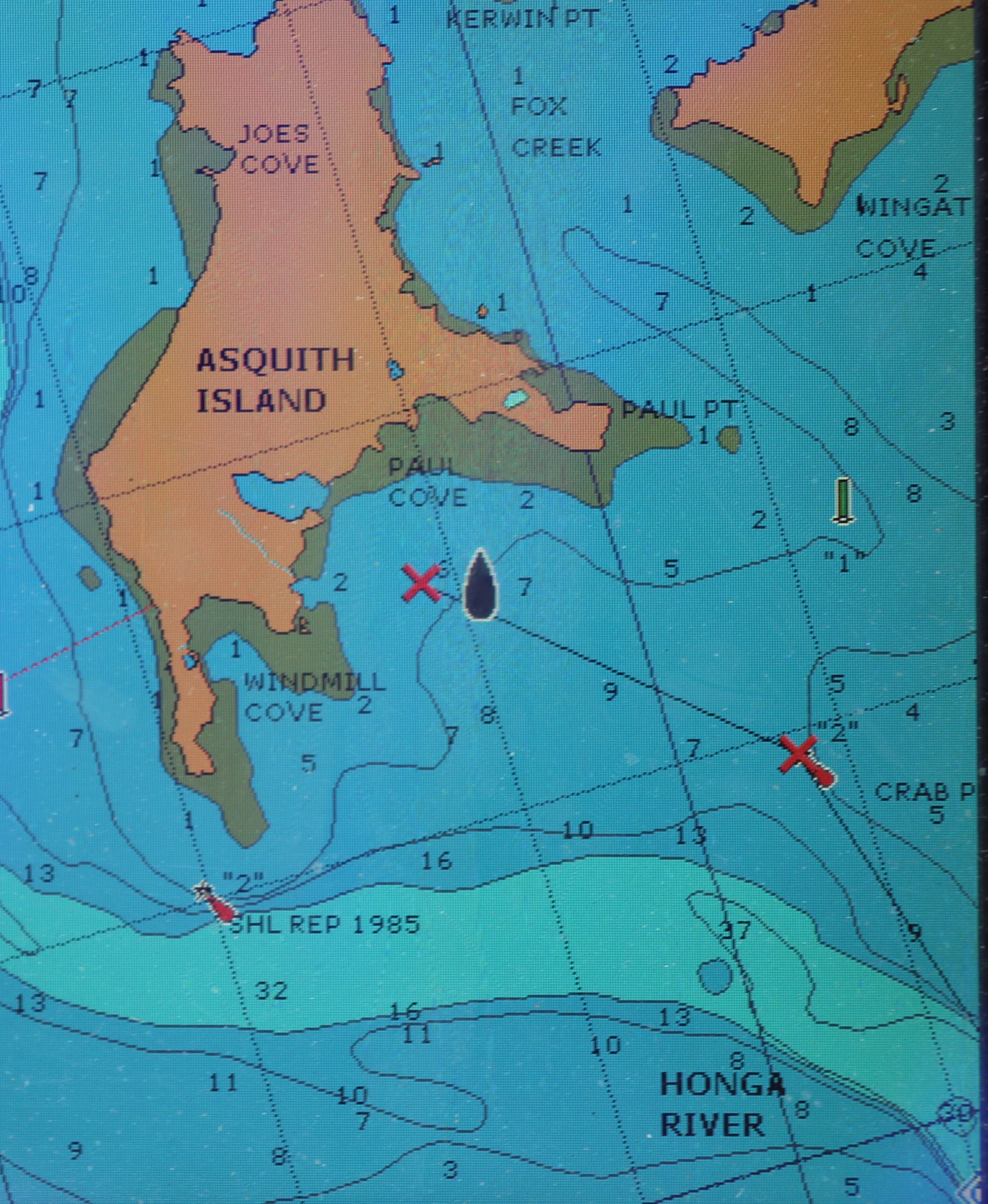
The crew left St Michaels and made a run over to Oxford where they continued to have electrical issues with the boat. From Oxford they went south and anchored near Asquith Island in Paul Cove where the crew spent a restless night. Then they fell off the face of the earth when they found themselves back in time at Tangiers Island. The crew then headed further south to Cape Charles where they anchored in Kings Creek before heading back to Norfolk.
Saturday, October 17, 2015
When the crew left St Michaels the weather report was for winds to be out of the North/Northwest at 7 – 12 mph. The plan was to cruise south for 39 miles over to the little town of Oxford. The weather should have been no problem, except the weather man got it wrong. The winds built all morning long and by early afternoon the winds were howling out of the North at 17 -20 mph with gust over 25. This had all boaters seeking shelter as the waves were really building.
This house sits on the point coming into Oxford
As the crew was rounding the bend to head into the marina around 1400, they heard a distress call over the radio. A man was hailing the Coast Guard for help and gave his position at the mouth of the river heading into Oxford. The man claimed he was stuck (hard to believe because the water was about 17 feet deep at his reported location) but that he was in no danger. The Coast Guard told him there was nothing they could do for him since there was no emergency. He then reported that his sails were damaged and that he had lost his electronics (GPS, depth gauge, and charts). Coast Guard recommended that he call Sea Tow or Boat US to get towed into a marina. You could hear the desperation and confusion in the man’s voice as he continued to ask for help from the Coast Guard. However, in defense of the Coast Guard, there was no emergency so there was nothing for them to do.
Reluctantly the crew turned Still Waters II around and headed back out into the nasty weather to see if he could help the sailboat. Sure enough the wind had torn his jib and main sails because he did not get then down in time. The wind also damaged the electronics which are mounted on the mast. The sails probably whipped into the electronics when they started tearing apart.
The man asked for directions to Virginia, “just point me in the right direction” he said. Besides no working electronics, he also had no paper charts. He did claim to have a working compass. The skipper pointed due West (270 degrees) and told him it was about 20 miles to the western shore of the Bay. The little sailboat headed out to motor across the Bay in the strong winds. That was probably a miserable trip. The crew was glad they were headed back into a safe marina.
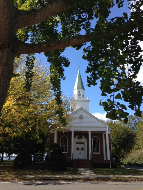
On Sunday, the crew decided to take a day of rest. The mate visited a small Methodist Church that will be celebrating their 150th anniversary in November. The skipper stayed behind to see if he could fix the electrical problems that have been hounding them lately.
He did get the inverter working again. The smarts book says that the invertor will auto restart once battery voltage is back to normal. However, it has yet to auto restart. The manual start button works once you find it and the invertor is now back functioning as designed. The skipper then did troubleshooting on the starboard engine alternator and voltage regulator. He found a wire disconnected, reconnected the wire and tested the alternator. Better than before, but still not 100%. Have to add that to the list of things to fix before next year.
Monday, October 19, 2015
The float plan for the day was to cruise 46 miles south and anchor out near Asquith Island. The weather report was for winds out of the North at 4 mph. All went well on the cruise and the electrical issues look to be solved. The crew dropped anchor just south of Asquith Island in Paul Cove. The Island and cove gave protection from the North, East, and West. However, the South was open to the river and Bay. With low winds forecasted out of the North this should have been no problem so the crew turned in about 1900 for a peaceful night of sleep. Wrong!
Anchor location for the night of unrest
The crew was jarred awake with the bouncing, rocking, and rolling of the boat. The waves were also slapping the starboard side of the boat and making much loud noise. The mate was the first one up and went walking around to make sure everything was riding OK. She came back to the master state room and announced that the boat was doing fine with the exception of the rocking and rolling. The skipper asked her what time it was and she answered that it was ONLY 9:22 pm. The skipper got up and checked the anchor line to ensure it was holding. After checking the anchor, he looked at the weather report. Great! Winds out of the south at 17 mph. Yes, this was a long night and nobody got much sleep.
The calm before the storm in Paul Cove
The mate showed great courage the next morning when she walked out on the bow of the boat and managed to get the anchor in with the high winds and rocking of the boat. Later in the day she claimed it was because of the grace of God and that she had to put on her big girl panties. She also said she did not want to have to do that again in those circumstances.
Tuesday, October 20, 2015
With the anchor back in and the mate safely back on the fly bridge, the skipper pointed the bow south into the winds and headed for calmer waters. The waves were the largest that the crew has experienced to date. They looked to be consistently greater than 7 feet. For one short run they needed to go east and took some pretty hard waves directly into the beam of the boat. She really rocked and rolled during the turn. After a few minutes they managed to get land between them and the South wind. The waves started to get smaller and more manageable.
As the morning went on, the wind began to shift out of the Southwest and dropped down to under 10 mph. With the Islands providing a break from the wind, the cruise turned out better and better as the day wore on. The crew will not soon forget the sleepless night in Paul Cove though.
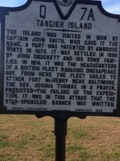
Entrance to Tangier Island
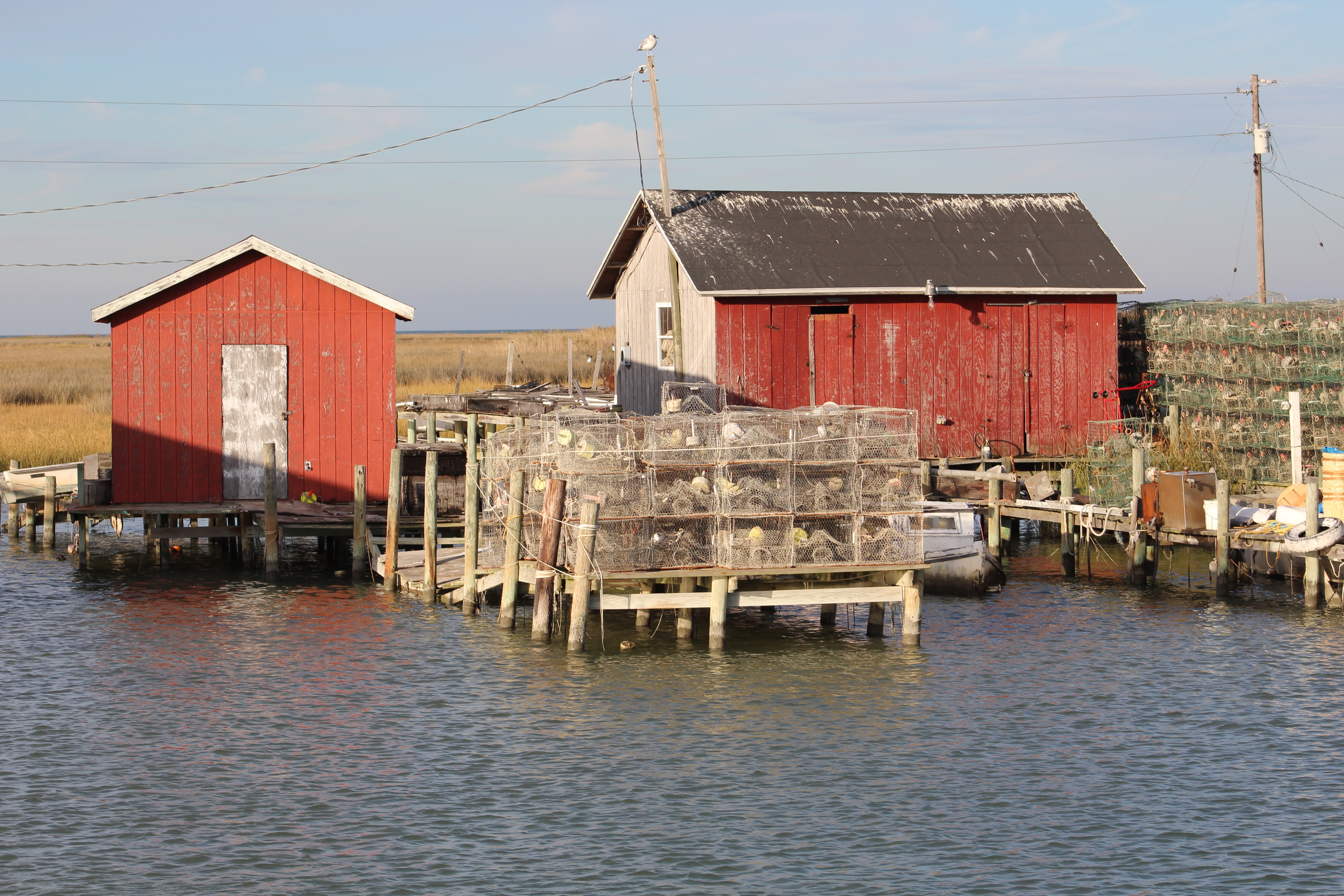
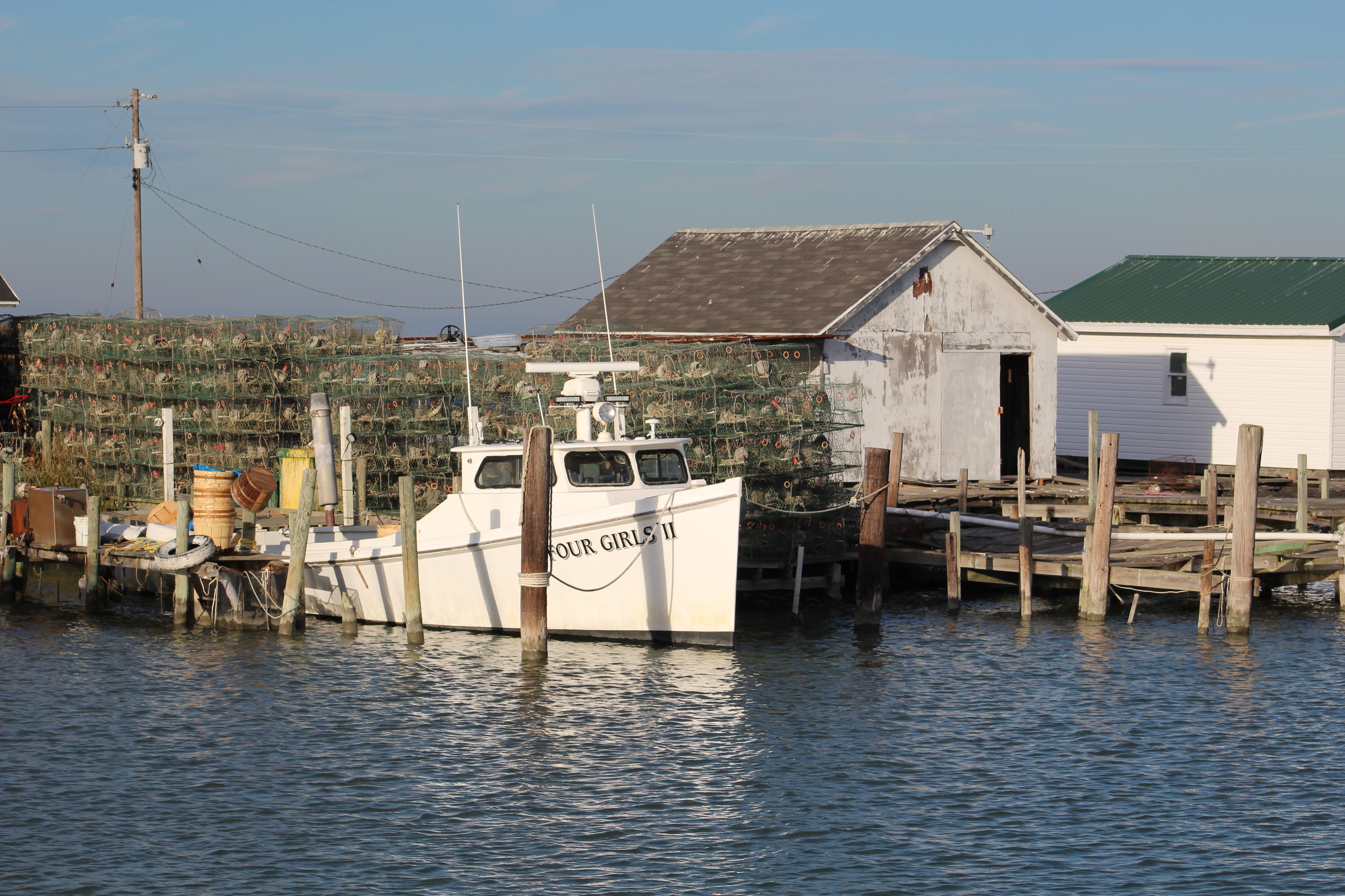
The crew had weighed anchor at 0747, so they were in the Parks Marina on Tangiers Island by 1230. The Waterway Guide states that the dock master does not normally monitor the radio or answer the phone, so just find a slip and pull in. After meeting the man, the skipper does not believe he knows what a radio or a phone might be.
The skipper tried hailing the dock master on the radio and calling on the phone to no avail. The crew picked slip number 10 to back into when they heard someone yelling. There was a little man standing on the face dock in front of the marina office. He was directing the crew to pull along side the face dock. The crew motored over and got secured along the pier. The crew was glad to have that day of cruising behind them.
A few hours later, a large 44 foot cat sailboat showed up. They had to wait an hour for the dock master to show back up. He then directed them to squeeze into an area on the face dock between shore and another sailboat. The captain was having trouble getting the big cat in the tight spot so our skipper went over to lend a helping hand. Before it was all over and the cat was docked, there were 7 men all helping get the boat safely to the dock.
Dock Master and Captain making nice after getting docked
The dock master was trying to tell the captain how to run his boat, and the captain was not always listening. The frustration level was rising when finally the old dock master yelled at the captain, “Young man, I was docking boats before you were born, shut up and do what I tell you to do.” After that the captain started listening and the boat finally got docked. Entertaining, entertaining indeed.
Tangiers is a step back in time. I, Captain John Smith, named the little Island back in 1608. The British used the Island during the War of 1812. The British Navy used the Island as their headquarters and launching grounds while they were attacking the young American country. The town is now supported by the fishing industry and the small amount of tourist that boat in.
The dialect is extremely hard to understand. A mix of British accent with some backwoods country charm. At the grocery store, the clerk asked the skipper about 3-4 times if he would like a biiiig. The skipper was trying to figure out what a ‘big’ was and why he might want one, when it finally dawned on him she was asking if he wanted a bag for his cookies.
The crew walked the entire Island down in a few hours and counted only 7 cars/trucks. Most of the islanders were riding around in golf carts or on small scooters. All in all a very charming place that has not been influenced by the outside world, not one bit. If you would like to be a full time fisherman, this is the place to live.
Wednesday, October 21, 2015
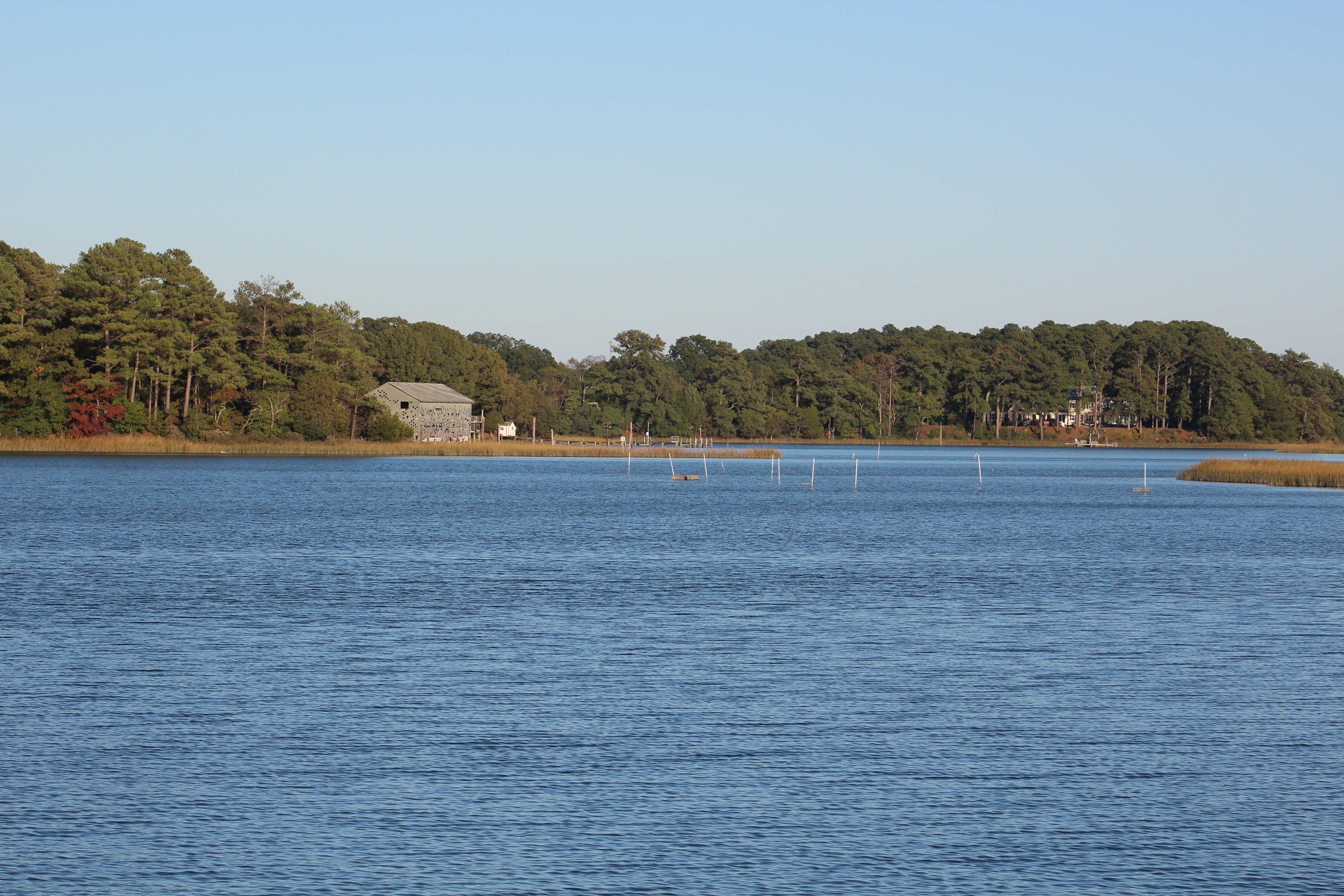
The wind decided to play nice and was only 5 – 10 mph out of the South. The crew had an uneventful 50 mile cruise down to Cape Charles where they found an anchorage in Kings Creek. The depths were shallow, mostly 5 feet, but the skipper found some 7-8 foot water to anchor in for the night. Getting out in the morning though turned out to be a different story.
Anchor location in Kings Creek
Thursday, October 22, 2015
The crew weighed anchor about 0830 and low tide for Kings Creek. The 7 foot of water they were in yesterday was now only about 5 feet. When they entered yesterday, they came over a few spots that were only 5 feet deep. The skipper would need to crawl out of here very carefully.
View from Kings Creek
There was a marina within 100 yards of where they were anchored so the skipper decided to go straight to the marina and then run along the marina back to the first channel marker. This plan worked well until the depth finder started acting up and then the radar lost its position. The electronics automatically started re-booting leaving the skipper blind to the depth of water. He placed both engines in neutral as the boat continued to drift forward. While looking away, trying to restart the chart plotter, and start up the back-up depth finder the boat drifted between land and the navigational aid. Not good. The skipper was on the wrong side of the marker and sure enough he found some soft mud.
After several tries of bumping the engines in reverse and not moving, the skipper tried only the starboard engine in reverse. This caused the back of the boat to swing over in some deeper water and they were able to back into 7 foot depths. The chart plotter came back to life and all was good again. Just another lesson in being vigilant, all the time.
Leaving Kings Creek
With the boat back in the channel, the skipper proceeded to the route to Norfolk. On the way back across the Bay I got my log entries back up to date. The crew will drop me back off at the James River and then pick Eric back up as they motor past Newport. It has been fun sharing my story with you up and down the Chesapeake Bay. Captain John Smith signing off.
Hello all! Eric here, gladly resuming my chores narrating the voyage of Still Waters II.
The skipper had several logistic challenges today. Not to mention almost getting stuck in the mud. He had to drop Captain John off after crossing the Bay, needed to pick me back up, and then needed to make a 1500 bridge opening at mile 3 of the Atlantic ICW.
The skipper decided to go a bit faster across the Bay to ensure that he had plenty of time to make the bridge. With maintenance on the bridge, the authorities are only opening the bridge at 0900, 1200, and 1500. Miss the 1500 bridge opening, you wait till the next morning to pass through. There were 70 boats reported stacked up at the bridge Thursday morning. The skipper does not want that happening to him.
The skipper arrived at the bridge at 1330 and was prepared to wait the 1.5 hours for the bridge to open. He set the video up to capture the opening and then sat back to wait on the bridge. There were several other boats also waiting to pass through.
The mate noticed that it looked like everyone had stopped work, and by 1340 there were no workers to be seen. Then, with no warning, the bridge started rising. The crew likes to say they walk in FOG (Favor of God) and once again they see the FOG lift in their favor. A 1.5 hour wait turns into a 15 minute wait. What a deal!
Click on above pic to watch Still Waters II pass under the Rail Road Bridge while it opens.
The crew then continued down river to the Top Rack Marina where the good deals just keep happening. The crew was in need of fuel and the marina has the cheapest prices they have seen since this adventure started. The first time diesel has been under $2. The marina price $1.93.
Then when the skipper went to check in and pay for the slip, the dock master asked what time the crew would like their dinner reservation. With a confused look on his face, the skipper asked why would he want a dinner reservation, he was there to pay for the slip. The dock master explained that if you spend $75 at the restaurant that the slip, water, and electricity are free.
With the cost of dockage > $75, this was a no brainer decision…………………the skipper said they would take their dinner reservation at 1700. The crew decided to use the dinner as a time to celebrate completing the Chesapeake and Delaware Bay loop. In summary:
The crew left Norfolk September 8, passed the Thimble Shoal Light at 1147, and returned by the light, October 22 at 1115. During this time they have visited 11 marinas (for 30 days) and anchored out in 13 locations (for 15 days).
Still Waters II wake at Thimble Shoal Light
But all good things have to come to an end, and so it is with the summer shake-down cruise. The crew has learned much about boating and navigating the waterways and are confident that they can complete the Great Loop during the 2016 boating season.
However, for now it is time to get south to warmer weather. The crew has a plan to cruise south over the next 18 days or so, and arrive in Jacksonville, Florida mid November.
Hello fellow adventurers and virtual crew members!
Christopher Columbus here reporting on the run to St Michaels on Thursday and shore excursions on Friday.
Thursday, October 15
The cruise down to St Michaels was 56 miles of surprises. Still Waters II decided it was time she gave the crew some more onboard training. When starting the main engines the port engine decided not to start. The skipper noticed that the battery voltage was very low. There is a parallel switch that allows the port engine to start from the starboard battery bank. It took a couple of tries to figure out how the switch works, but the port engine finally started.
Then pulling the anchor was a bit more challenging than usual, but in the end the anchor finally lost and got back in its stowed position.
About 1000 the mate reported that the refrigerator was not working and the inverter was not showing that it was working. She took the wheel and the skipper went below to troubleshoot the electrical problem. The inverter was completely ‘dead’ and not converting any DC to AC. The skipper checked the batteries and they were at 12.5 volts and being charged by the alternators.
The skipper got the smarts book out on the inverter and found a paragraph that stated that if the batteries drop below 10.5 volts that the inverter auto shuts itself off. What a nice inverter. The inverter will auto restart once the batteries are back to 13.5 volts. The skipper decided to start the generator to charge the batteries and run the AC loads while underway. With the generator carrying the AC loads and charging the batteries, the inverter sensed the battery voltage greater than 13.5 volts and came back to life as promised.
The skipper was making 1 hour engine and generator checks to ensure all was working well. This gave the mate some valuable time at the wheel.
The crew arrived at Piney Narrows at 1425 just in time for the 1430 Draw Bridge Opening. Click on the photo below to watch the bridge open and Still Waters II pass through the bridge.
After making the bridge passage and navigating the thin line of deep water the skipper turned the wheel back over to the mate to go do the 1500 engine checks. Before going below the skipper noticed a big boat approaching fast. He decided to stick around a few minutes for the boat and wake to pass before going below.
The skipper advised the helmswoman to move more to starboard to give the fast boat some additional room to pass to port. She moved over to the edge of the channel to make room for the fast boat. She even commented “that looks like a brand new boat.”
The skipper watched as the boat passed because he knew there was not much room and the boat looked to be over in shallow water. Sure enough the big fast boat came to an abrupt stop. The skipper noticed that the fast boat captain tried to put the engines in neutral, but it was too late, they ran their brand new fast boat aground. The skipper remembered Captain Geoff’s comment about 1K for every knot. The big fast boat just learned that experience is expensive.
As the crew approached St Michaels they called ahead for their docking instructions. The dock master advised that they would go bow first into a pier with port side tie and a sailboat less than two feet clearance on the starboard side.
As they approached the dock, the sailboat owner heard the engines and stuck his head out to watch the skipper dock. Luckily there was very little current and the wind was blowing straight down the boat. The mate got a breast line over to the dock hand quickly and then got the bow secured so we would not be bumping into the sailboat.
The skipper took a big deep breath and turned the engines off. Wow, what a strange day.
Friday, October 16
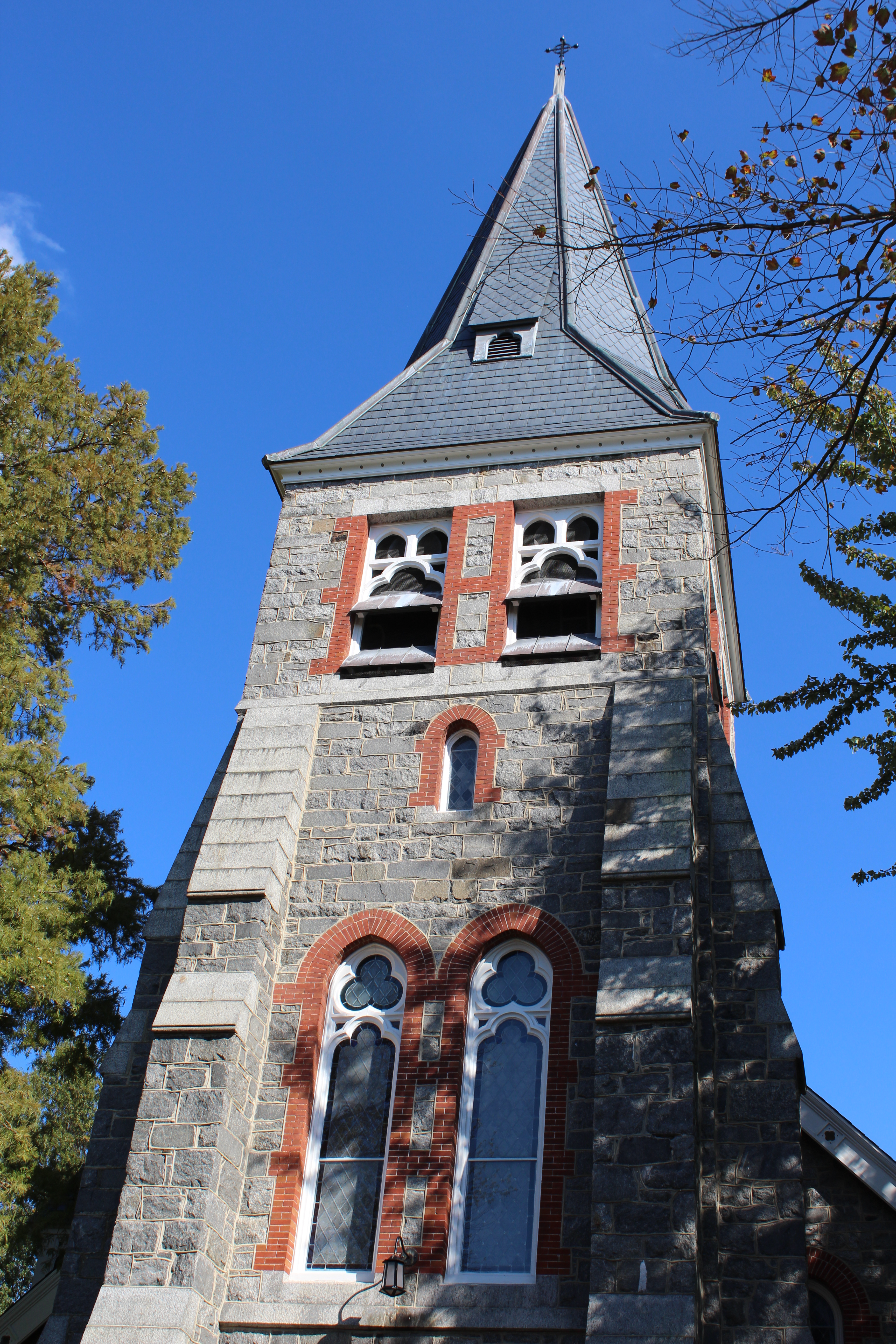
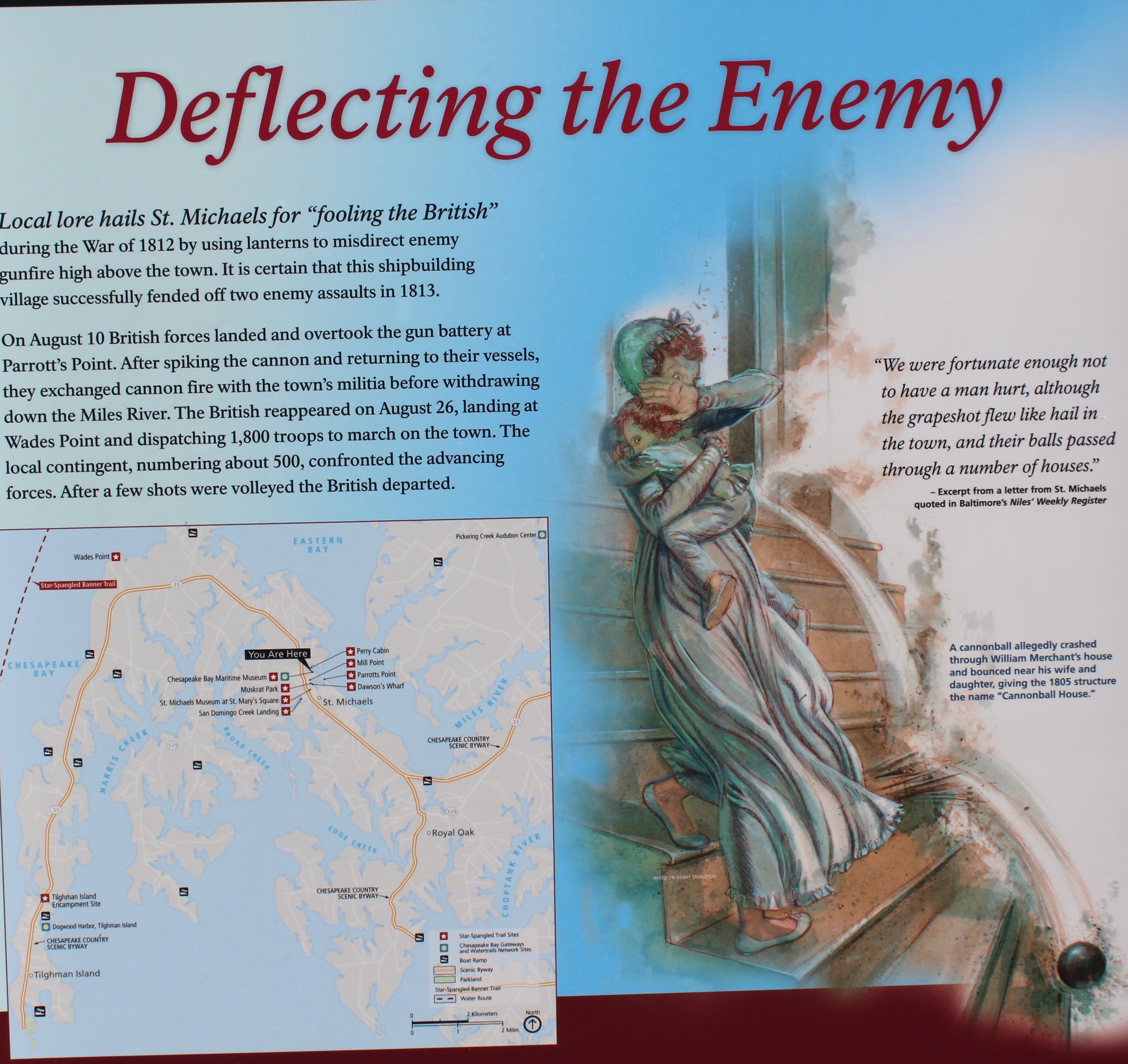
St Michaels gets its name from the church named “Saint Michael’s” that was the first building in about 1677. The town grew around the church and eventually took its name. The church bell rings every 15 minutes, and on the hour rings longer with an old hymn.
St Michael’s Church
St Michaels advertises itself as the town that fooled the British. As the story goes, in the morning hours of August 10, 1813, the British attacked St Michaels to destroy the 7 shipyards. Legend has it, that the residents knew of the attack so they put their lanterns in the tree tops and blacked out the rest of the town. The British only hit one house with the rest of the cannon fire over shooting the town.
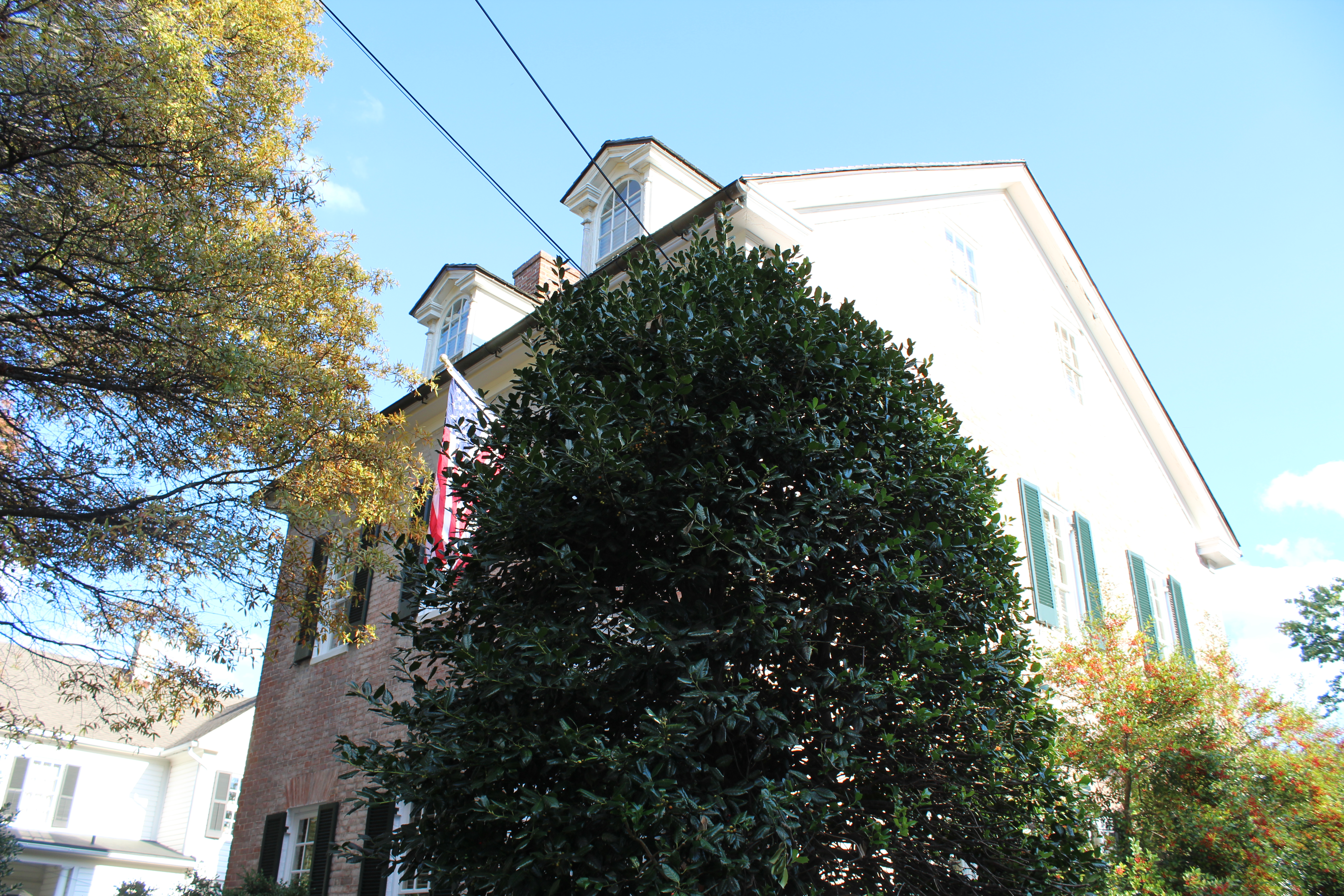
The one cannon ball penetrated the roof and rolled down the stair case as Mrs. Merchant carried her young daughter down the stairs. The home is still a private residence.
Cannon Ball House
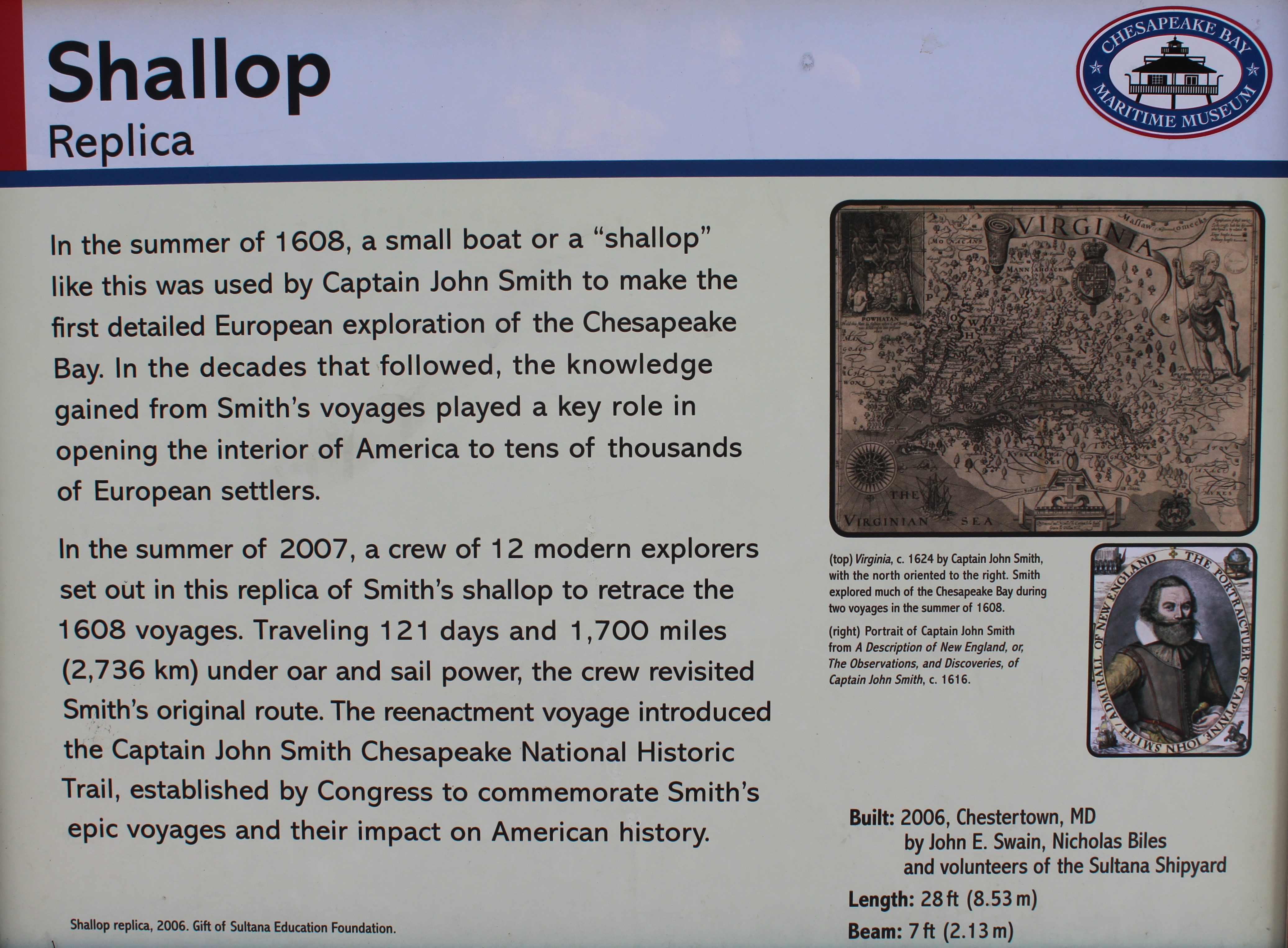
The crew decided to visit the Chesapeake Bay Maritime Museum. The museum covers 18 acres explaining how people live, work, and play on the Bay. The museum has 14 separate buildings and exhibit areas.
Replica boat for crew of 12
One of the exhibits is a floating fleet of Chesapeake Bay watercraft. One of the boats was a replica of Captain John Smith’s boat that he used in 1608 to explore and map the bay. More amazing is that Captain John Smith was in the Bay History Building giving tours when he noticed the skipper. The Captain said he was ready to return to Jamestown so he is rejoining the crew on their southerly run to Norfolk.
Hello fellow adventurers and virtual crew members!
Christopher Columbus here reporting on the run to Cape May and return to the Chesapeake Bay. Upon leaving Philly on Saturday morning, October 10th the crew cruised back down the Delaware River and anchored one night in the Cohansey River. On Sunday, October 11th they arrived in Cape May, New Jersey to celebrate the completion of the 2015 northern run. On Monday, the crew walked the town of Cape May and enjoyed the shops and Victorian Homes. On Tuesday, October 13, the crew had a rough voyage back up the Delaware Bay to the Salem River anchor spot. Wednesday found the crew passing back through the C&D canal into the Chesapeake Bay.
Ship John Shoal Horn in Delaware River
Saturday, October 10
The crew timed their departure from Penn’s Landing to coincide with the ebb tide so they could take advantage of the 1.5 knot current on the way down the river and bay. The weather was perfect for smooth sailing so the crew made a long day on the water and cruised 70 miles, their longest run to date. The crew pulled up into the Cohansey River at 1700 and set anchor for the evening.
Anchor spot in Cohansey River
Sunday, October 11
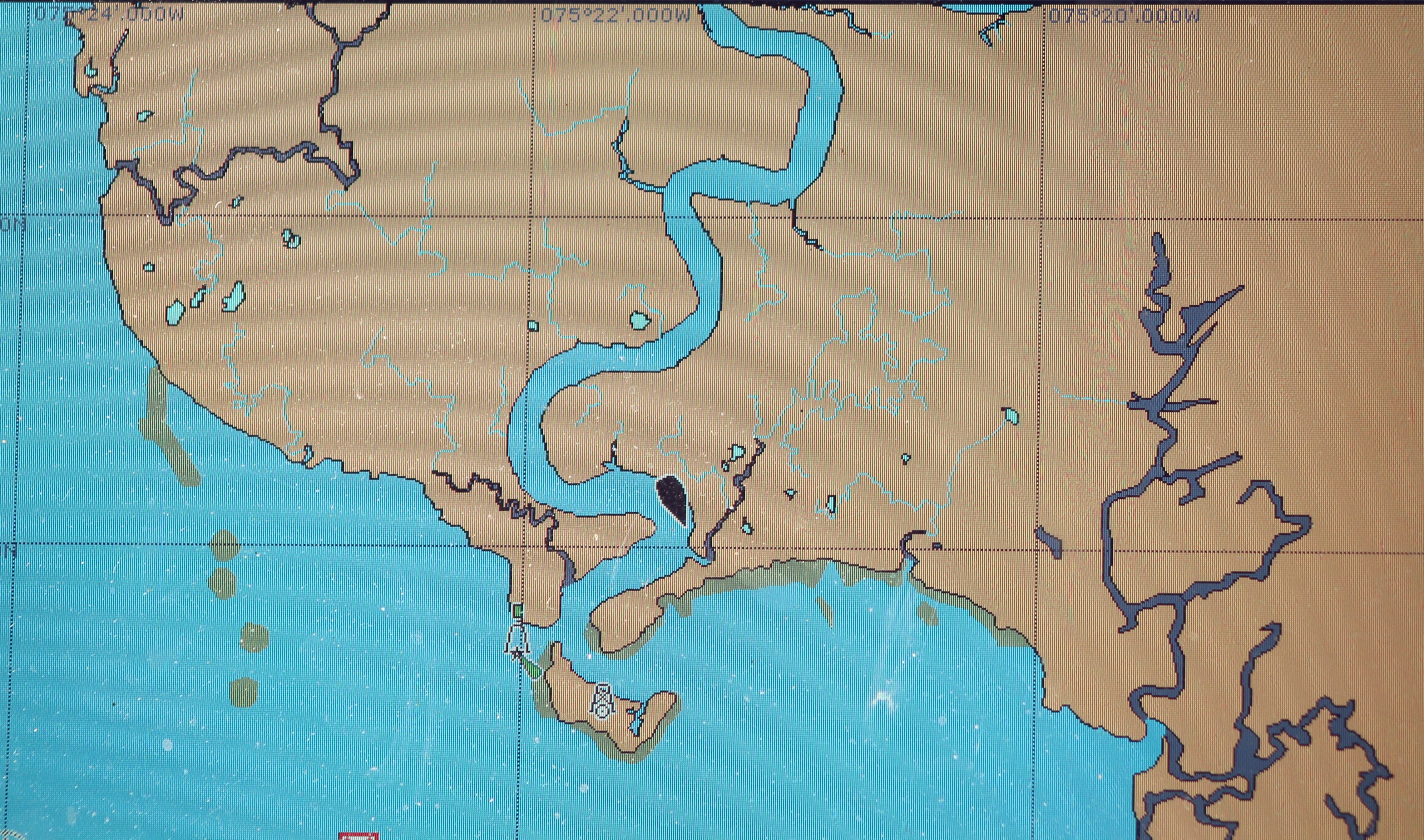
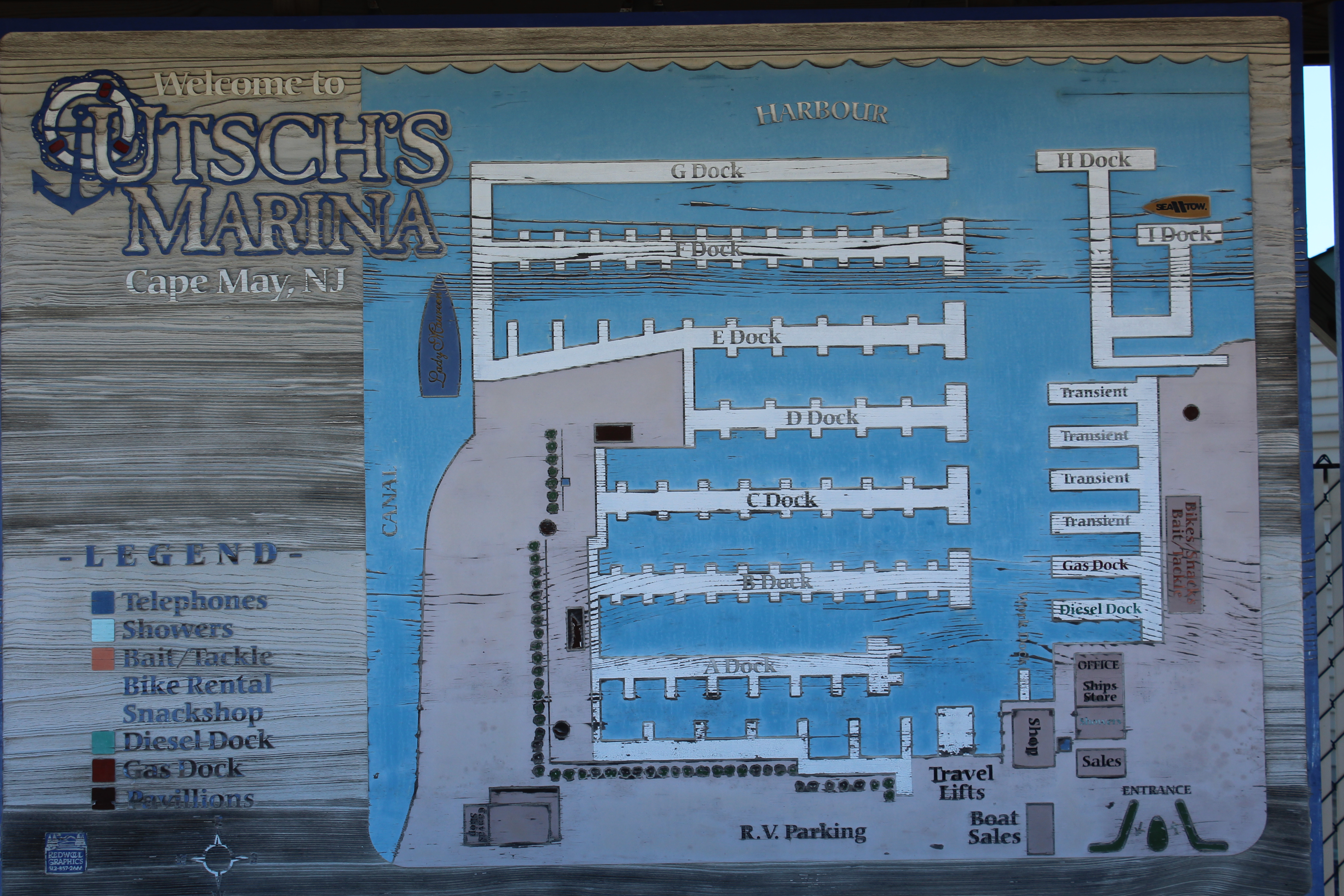
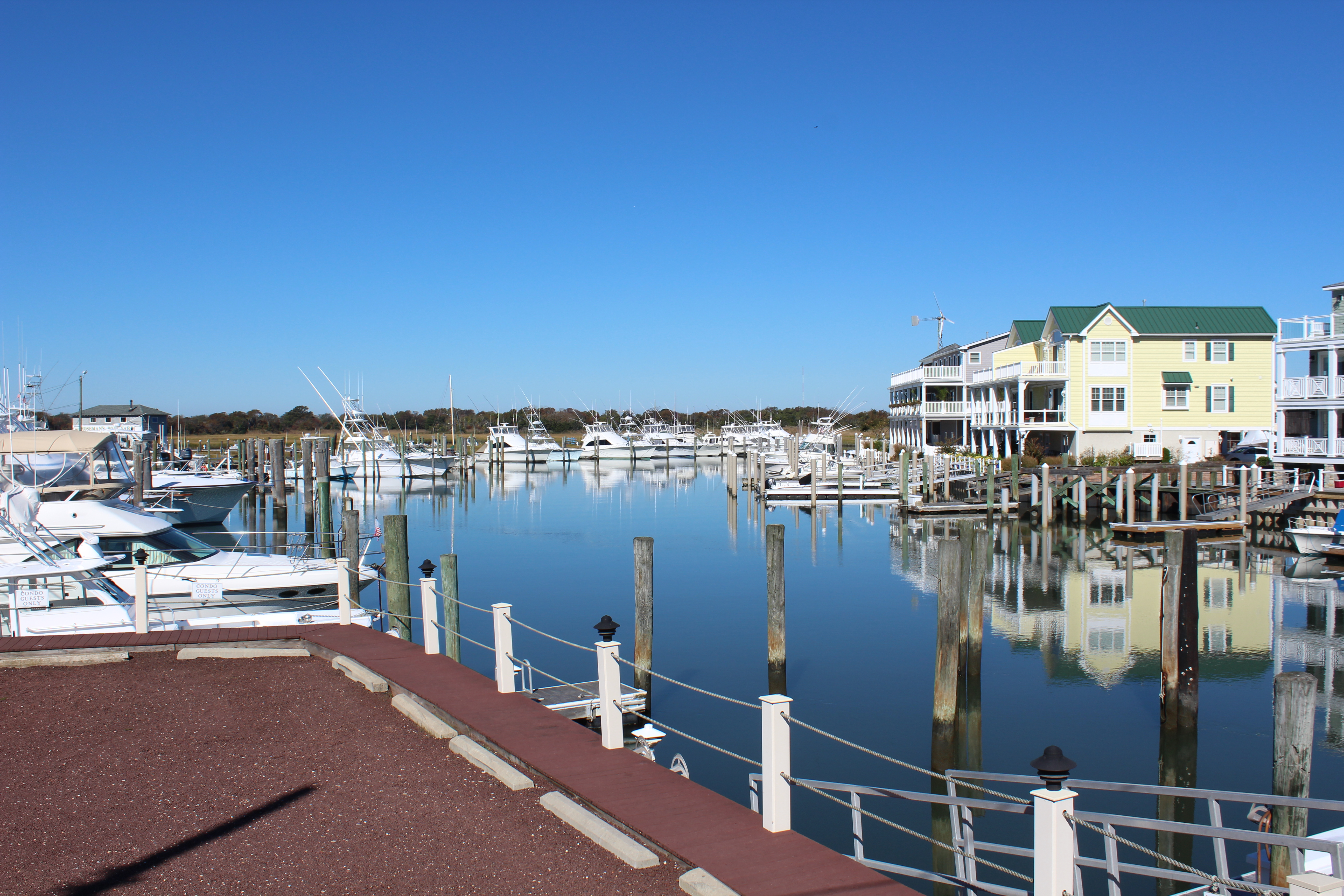
The run to Cape May was 40 miles and was relatively calm and smooth. The crew docked at the Utsch’s Marina (pronounce like Dutch without the D). The crew ran into two other looper boats in the marina. One boat was from Maine and one boat was from New York. They are both headed south for the winter with plans to start the loop in the spring of 2016.
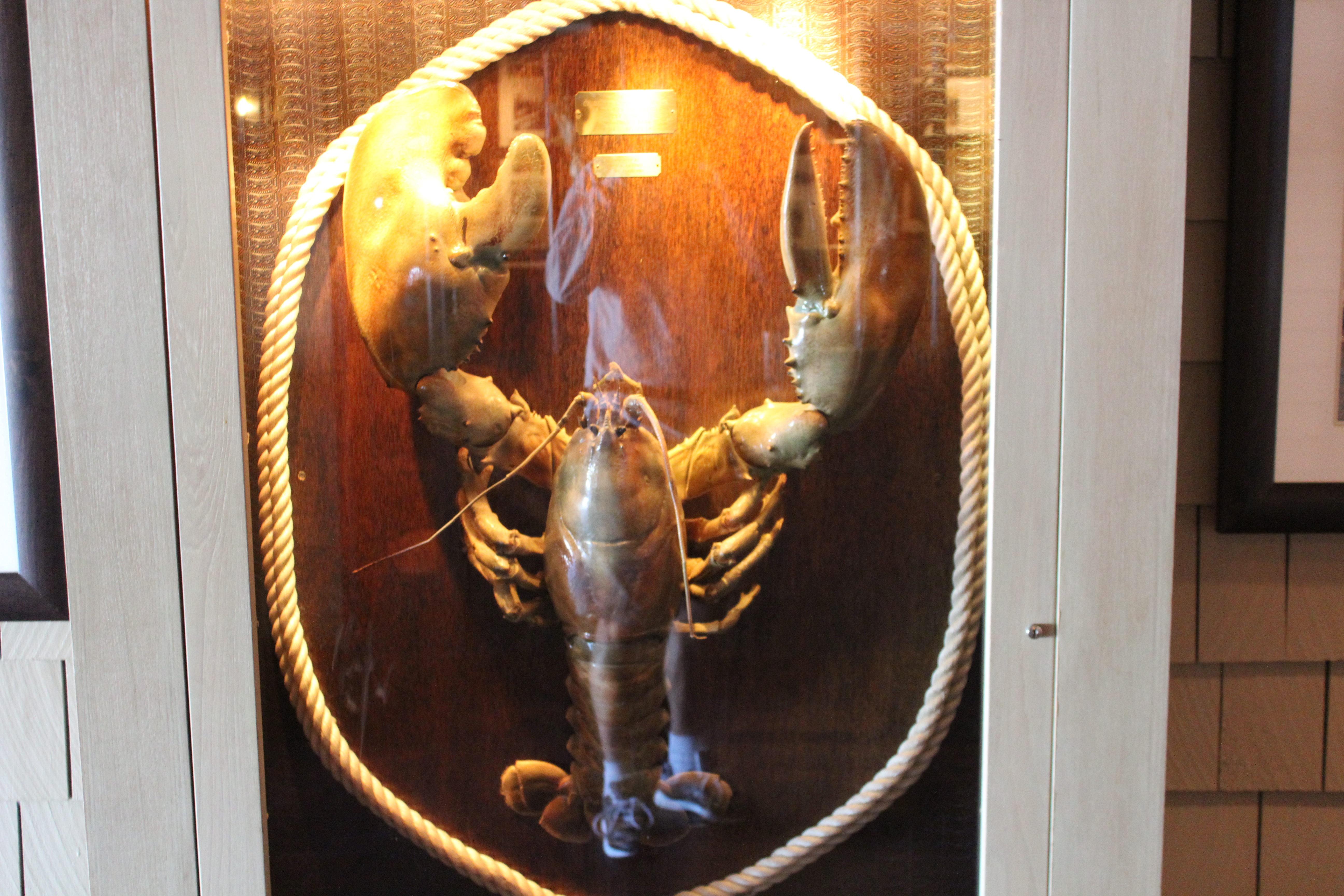
After getting all settled in transient slip 16, the crew headed next door to the Lobster House for dinner. The restaurant has been serving fresh seafood in Cape May since 1922. The crew arrived early, around 1600, and immediately got seated. By the time they had completed dinner, the place was packed out with customers with a 40 minute wait to be seated. Did I mention that the place seats around 500.
34 lbs lobster at the Lobster House
The mate had lobster and crab cakes while the skipper enjoyed fried flounder. Both were exceptional. The crew toasted their successful summer shake-down cruise and took the time to reflect on their travels. Claudia even got a fist bump and an ‘atta girl’ from an elderly woman sitting at the table next to the crew once the woman discovered that they had traveled up from Ft Myers. The women spent 10-15 minutes peppering the crew with questions about the voyage. It was a great way to celebrate the success of the trip.
Monday, October 12
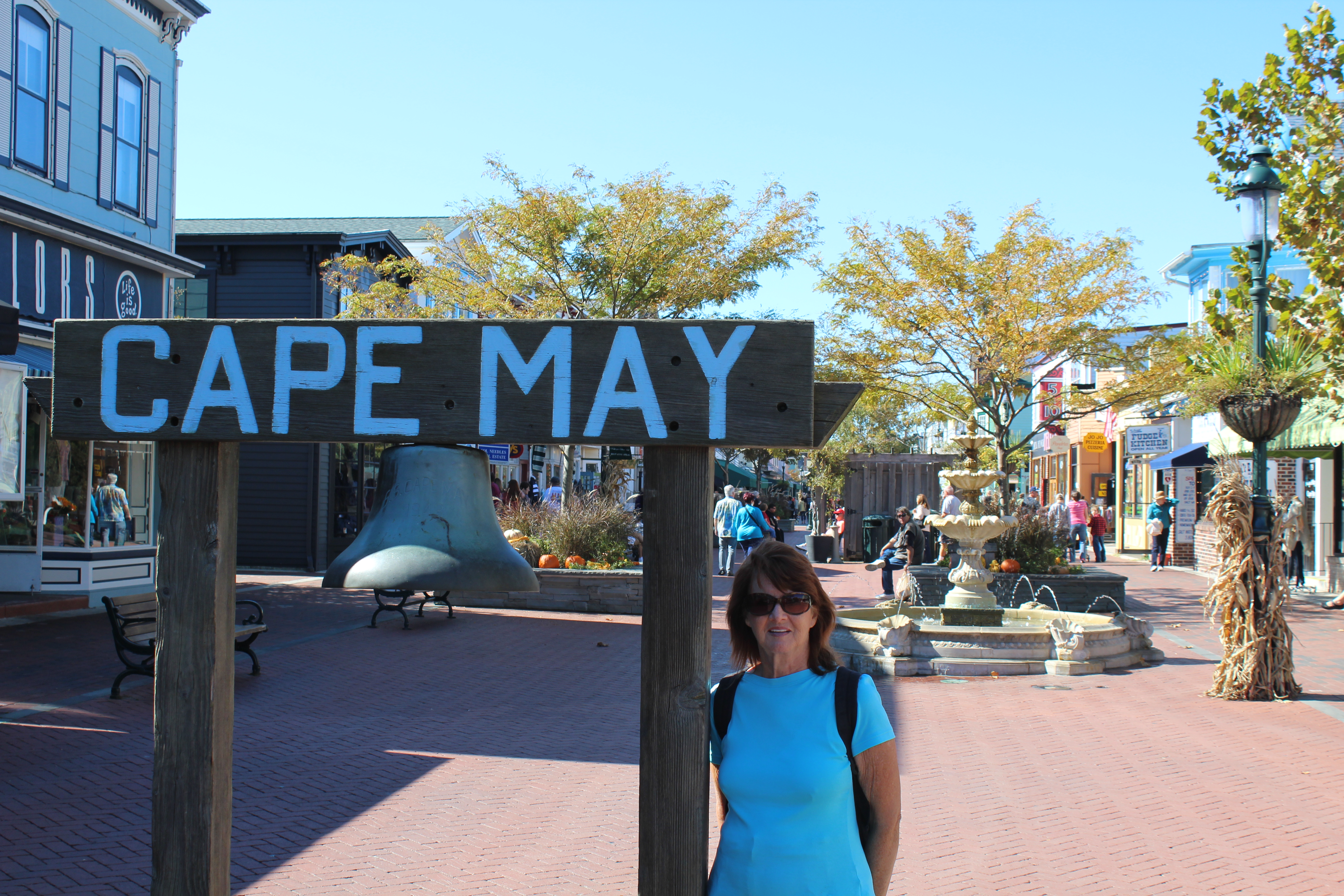
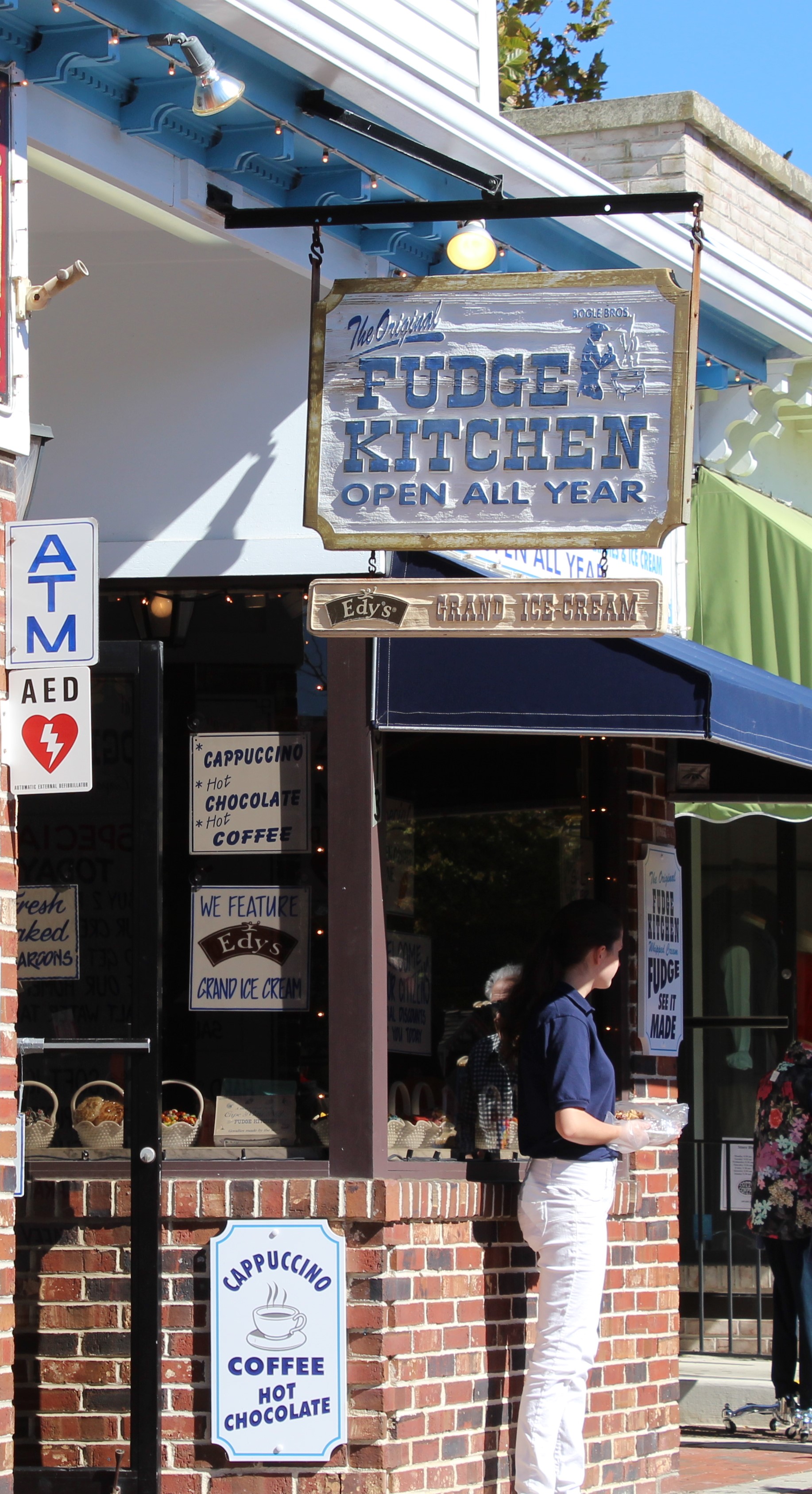
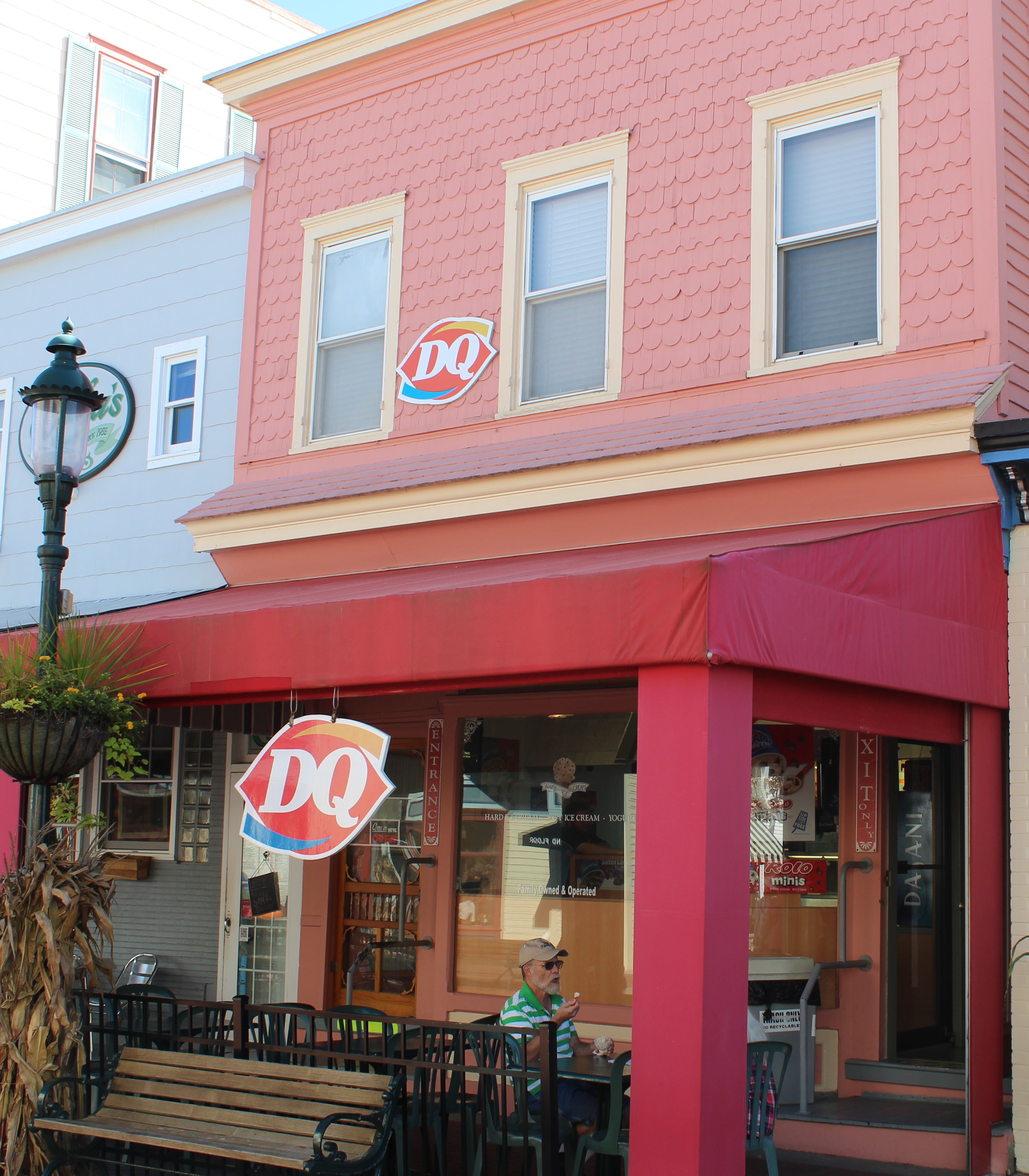
Yes, today is all about me……..It is Columbus Day! While I took the time to celebrate my achievements, the crew took a walk through Cape May.
Washington Street is a 4 block area where no cars are allowed and only pedestrian traffic is on the streets. One of the best stops was the Fudge Kitchen for a 1 lb purchase of creamy peanut butter and chocolate fudge.
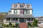
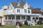
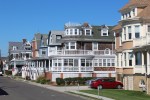
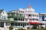
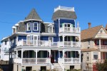
After touring the Washington Street area, the crew set off to go see the beach and Atlantic Ocean. The street that fronts the beach is lined with restored Victorian Homes.
Texas Stop sign in Cape May
The day was coming to a close so the crew hoofed it back to the boat. Good thing they bought that fudge for a little energy boost to make it back.
Tuesday, October 13
While checking the weather report the skipper discovered that the winds would be blowing out of the west at 11-12 mph all day. With the run up the Delaware Bay being mostly due north this wind direction would cause the waves to strike the boat along its side causing some good rock and roll action.
Entering Delaware Bay from Cape May Canal
After leaving the Cape May Canal and turning to the North the ride became more than a little rough. The skipper used some of his old sailing tricks and tried tacking back and forth across the Bay while making some progress towards the north. After about three hours, the crew was past the widest part of the Bay. As the Bay began to narrow, the ride became calmer.
Click on the pic below to watch a 3 minute video of Still Waters II in the bay.
By 1500, the water had become nothing but a small chop so the crew discussed the idea of going further up the Bay to anchor back in the Salem River where they were about a week before. Estimating their speed and distance they calculated their arrival time to be about 1900. Sunset was scheduled for 1835. Based on experience that one can usually see for about 30 minutes following sunset and that they had anchored in this spot already, the crew decided to go ahead and cruise on up to the Salem River.
Unfortunately they were not making good speed due to the ebb current and did not arrive at the mouth of the Salem River until 1900. The markers guiding the entrance up the river were flashing green and red so navigating the way in was not bad in the dark. However, at the last flashing green marker the crew still needed to go about a half mile in the dark and make a left turn. It was pitch black and hard to see. When the river “Y’d” and the crew needed to go left the houses lining the banks reflected enough light on the water that it became easy to see where to go again. By 1939 Still Waters II was safely anchored and the crew was ready for rest from a long day.
Wednesday, October 14
The first order of business on Wednesday was to make sure the crew FaceTimed Emma Grace and wished her a happy 11th birthday. She is one of the crew’s Panda loving, cheerleading, princess grand-daughters. Happy Birthday Emma!
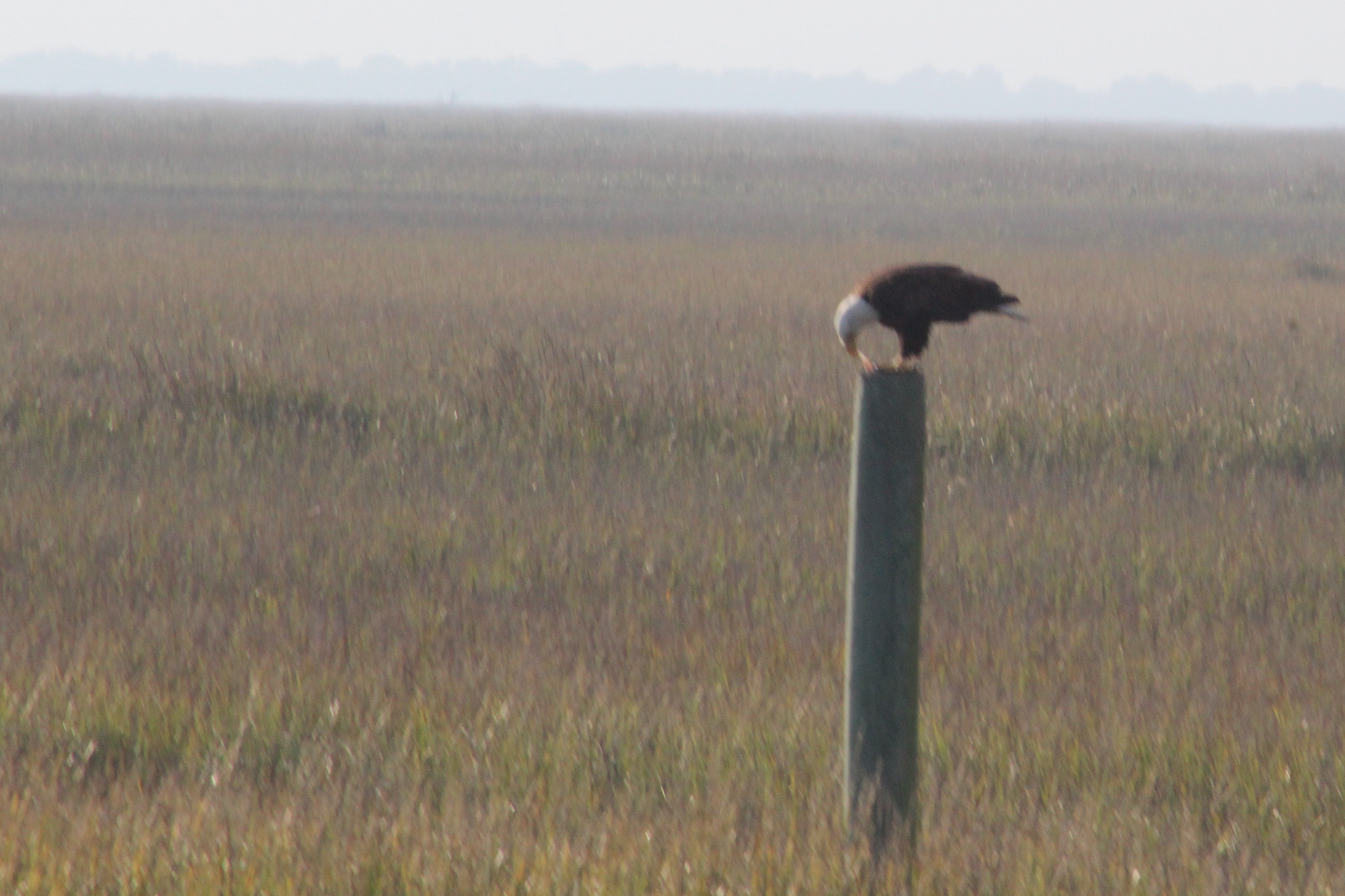
While leaving the Salem River and crossing over to the C&D Canal the crew spotted four different Bald Eagles. One of the Eagles was actually sitting on a marker and did not fly until the crew was within about 20 yards.
Along the banks of C&D Canal
Future To Do List – While passing through the C&D Canal the crew decided to stop in Delaware City next time and take the time to ride their bicycles along the canal. Looks to be a bike path that runs most of the way along the north bank.
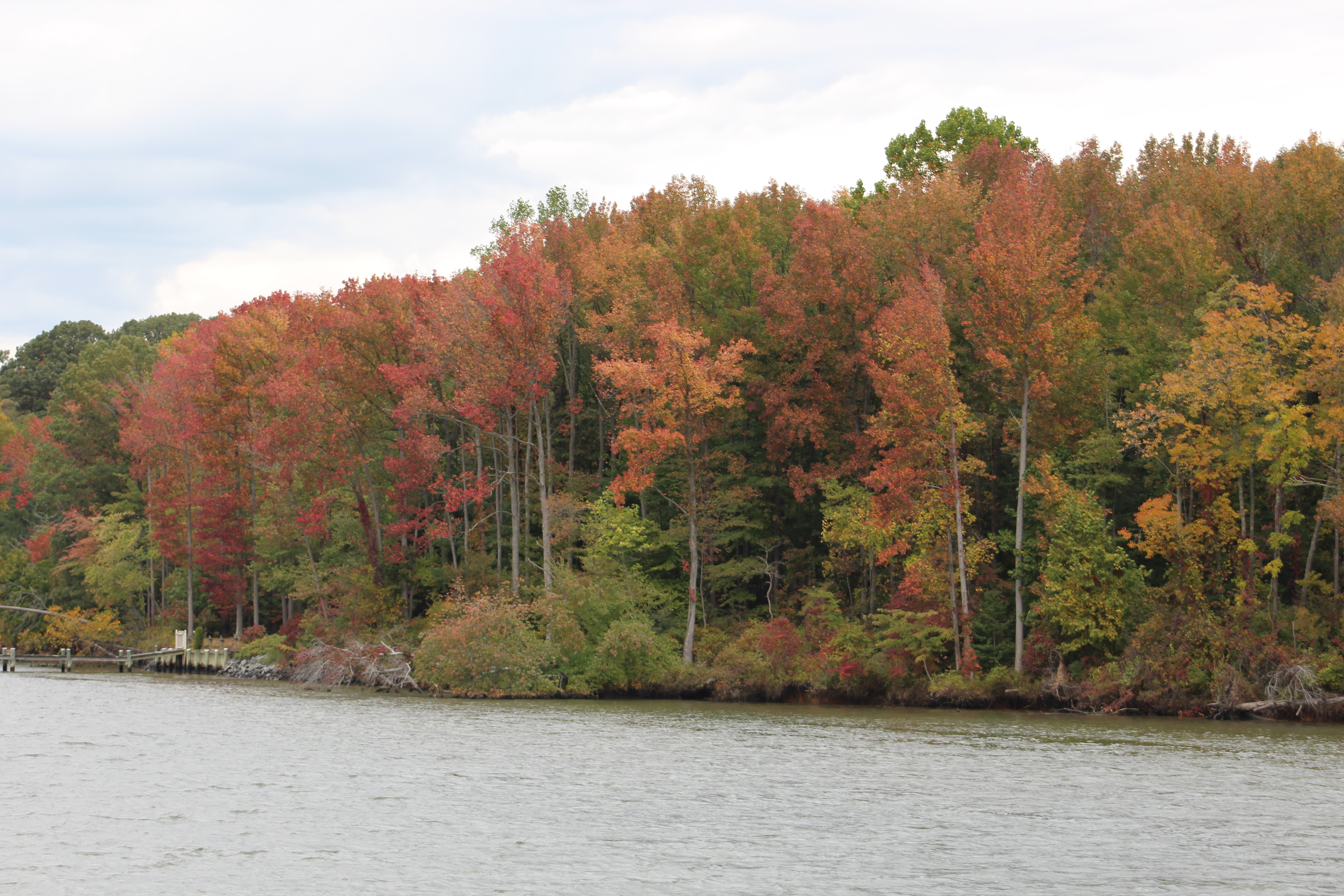
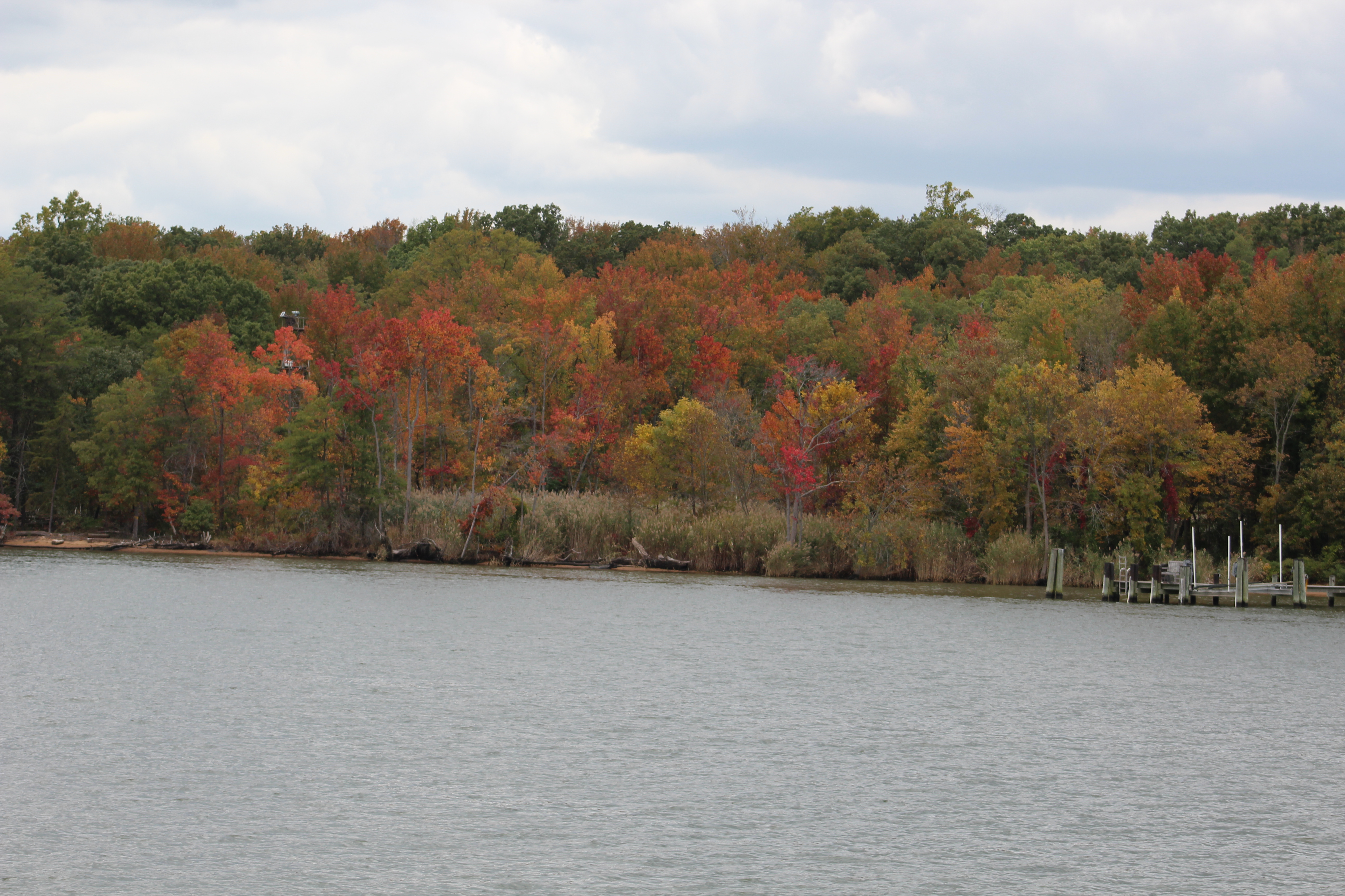
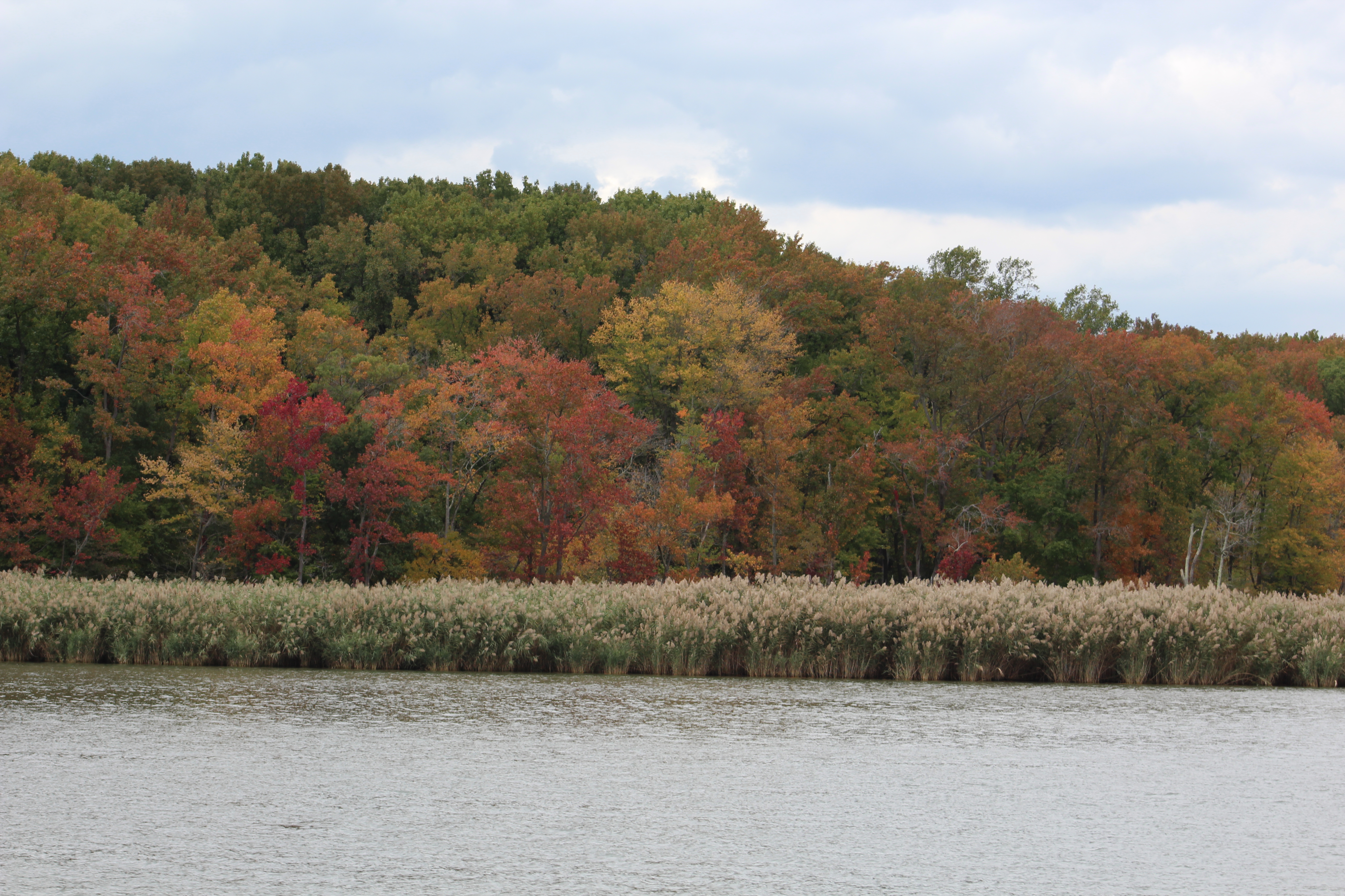
The cooler weather has really started the trees to start to turn colors and there were several areas along the banks that were spectacular.
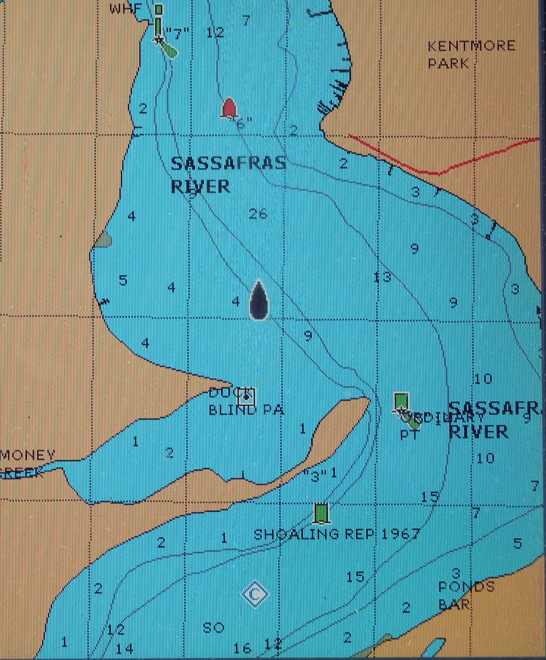
After leaving the C&D Canal the crew re-entered Back Creek, then the Elk River, and then back into the northern part of Chesapeake Bay. The crew took a turn off of the Bay and headed up the Sassafras River to find a place to anchor and bring a close to this 48 mile run.
The crew plans to work their way down the east side of the Chesapeake Bay visiting St. Michaels, Oxford, and Tangier Island before returning to Norfolk. Stay tuned as they venture south into these new areas waiting to be explored.