Tag: AICW

  • Georgia On My Mind

    Hello virtual crew members and fellow adventurers!

    I would like to welcome Tomwintexas@….. aboard as a virtual crew member.  Welcome aboard Tom!  Hope you enjoy the adventure.

    IMG_0003, near Kings Bay
    We may need to get one of these to carry all the virtual crew members.  Cruise ship on ICW near Kings Bay, Georgia


    Since leaving Jacksonville on Thursday, our crew has found themselves in the midst of a mighty big windstorm.  Seems there is a low pressure area out in the Atlantic that has caused 20 mph north-north east winds hammering the southern seaboard.  This has caused some rough water as the crew has crossed the sounds of Georgia.  In fact, crossing one sound, the crew encountered the biggest waves to date on this adventure.  But more on that later.

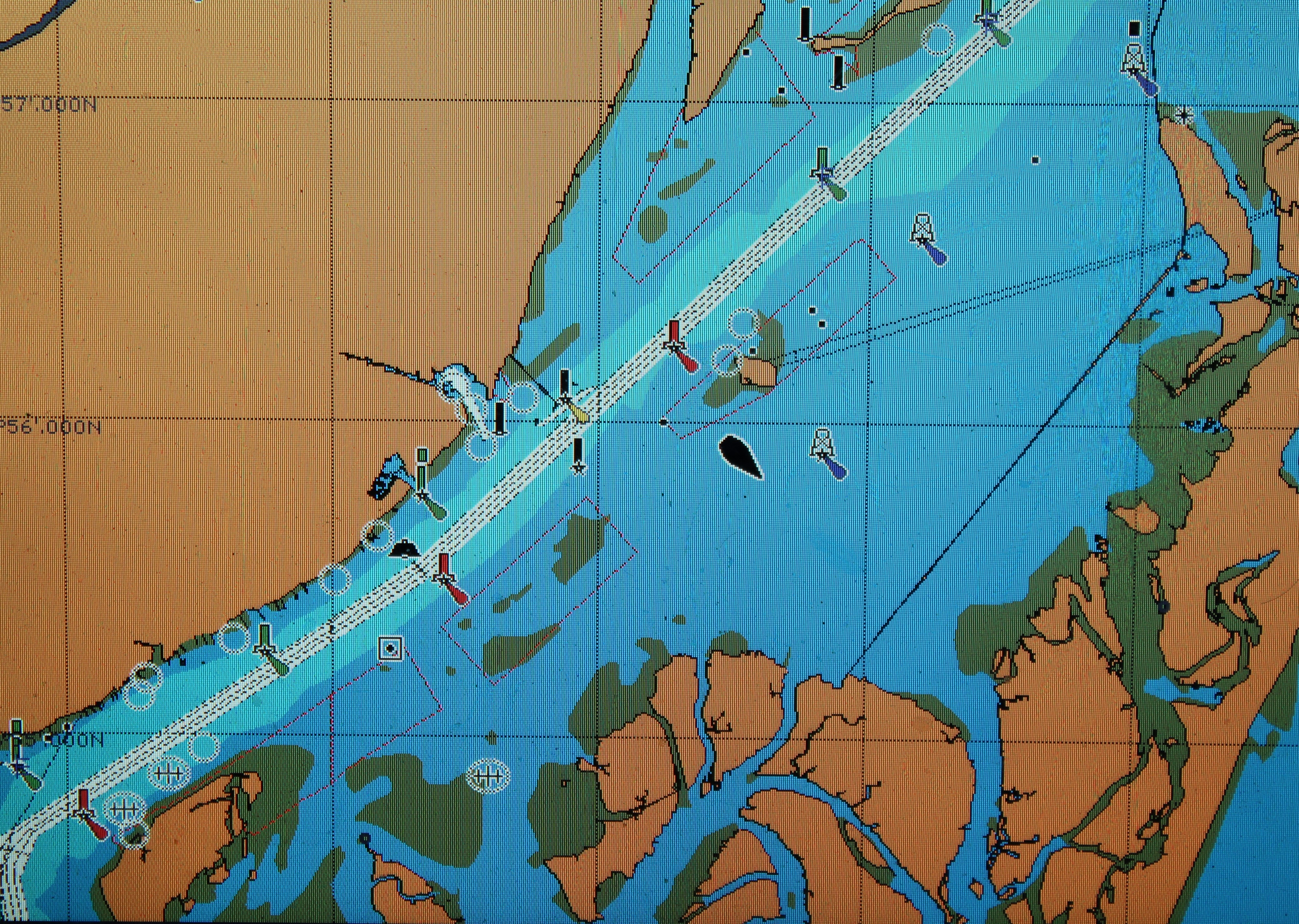
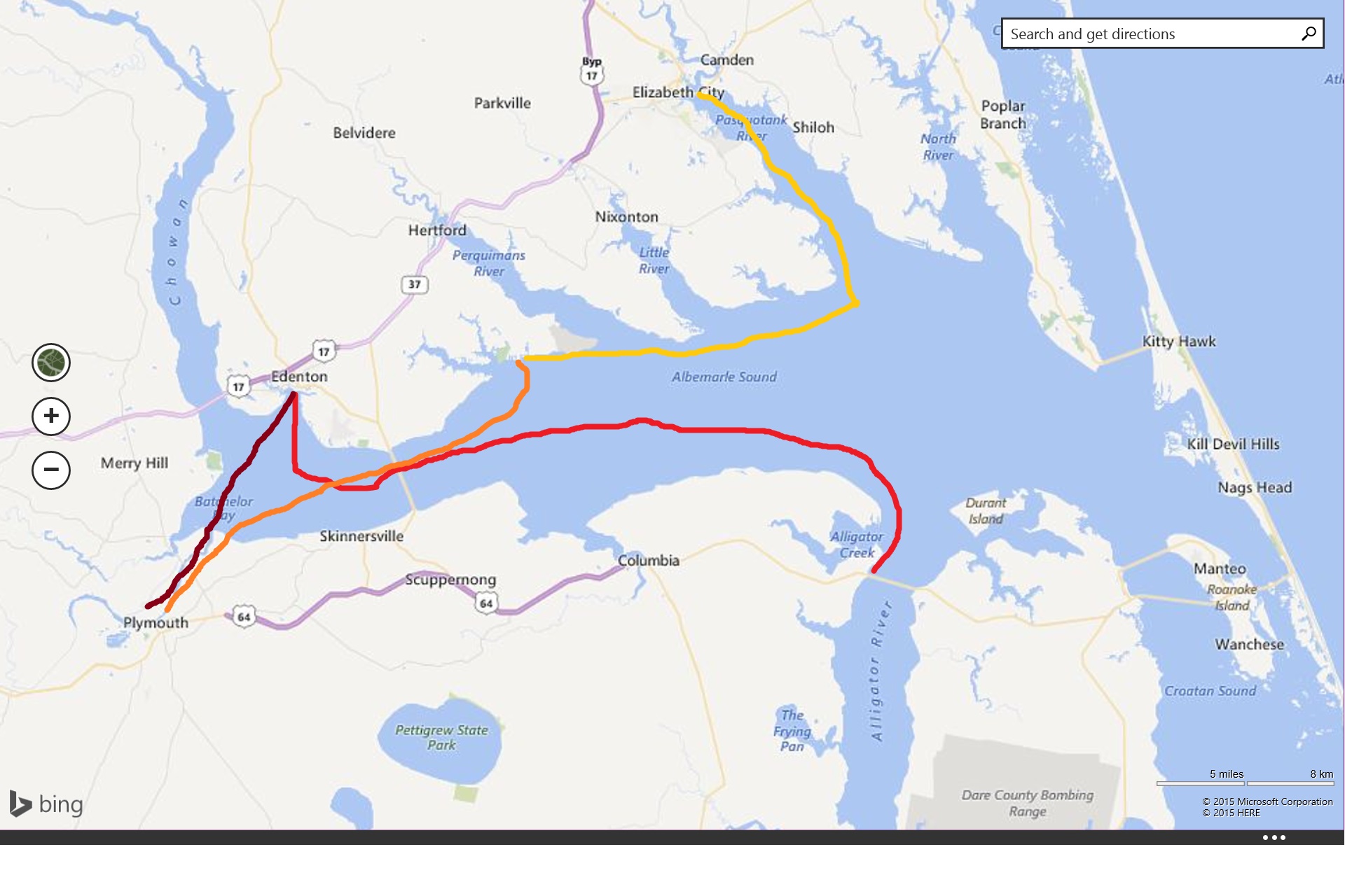
    Some virtual crew members have asked if there is a way to follow the route more accurately on a map.  I am proud to let you know that there is an app for that.  Not really sure what an app is but the skipper informs me that you will know.  When I was a captain and cruising we did not have all this fancy electronic gizmo’s.  My how times have changed.

    IMTA award-winning Avenza PDF Maps iOS App - iPhone and iPad - Get the App. Get the Map.

    But back to the app.  In nautical lingo we call them charts not maps.  Go to your app store and search for Avenza PDF Maps.  Download the free app.  Within the app there is a store.  You can go to the in app store and download free charts of the areas the crew is passing thru by putting the chart number in the search window.  Even has a pretty magenta line that shows the travel path through the water.  On travel days, the skipper updates the 2016 travel map link.  The skipper will provide you the chart numbers along with a short summary of the day’s cruise in the travel map link.

    Now to catch up on the wanderings of our crew.

    IMG_0008, horse on Cumberland Island.JPG
    Wild Horse grazing on Cumberland Island


    As I already mentioned the crew left Jacksonville on Thursday, April 14, 2016.  They did get about an hour late start because the dry cleaners, who promised they would return the items in need of cleaning by Wednesday, failed to return all items.  The cleaners said the late items would arrive Thursday morning.  The Admiral went to pick them up and the items still were missing in action.  The owner made another promise that they will mail the items to the Admiral once the articles arrive.

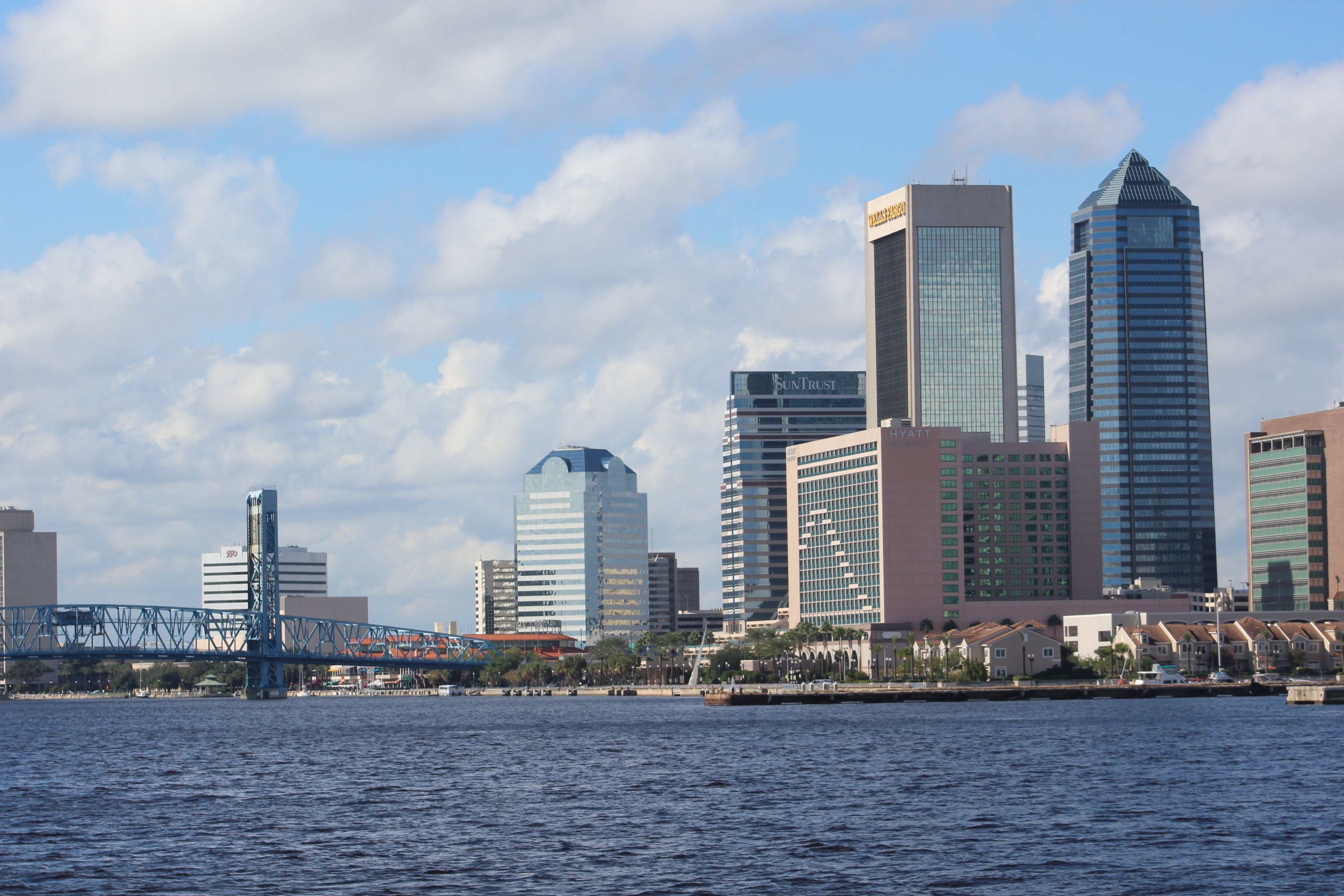
    Once the Admiral returned empty handed, the crew shoved off at 0955 to head to Fernandina Beach.  The trip from Ortega to the Atlantic ICW is about 26 miles.  It was low tide when they left Ortega, so the water was, well, low which made for a slow go in the misty morning.  The water is only 5-7 feet deep in the marked channel until you get to the St Johns River.  With the misty rain it was hard to find and see the markers.

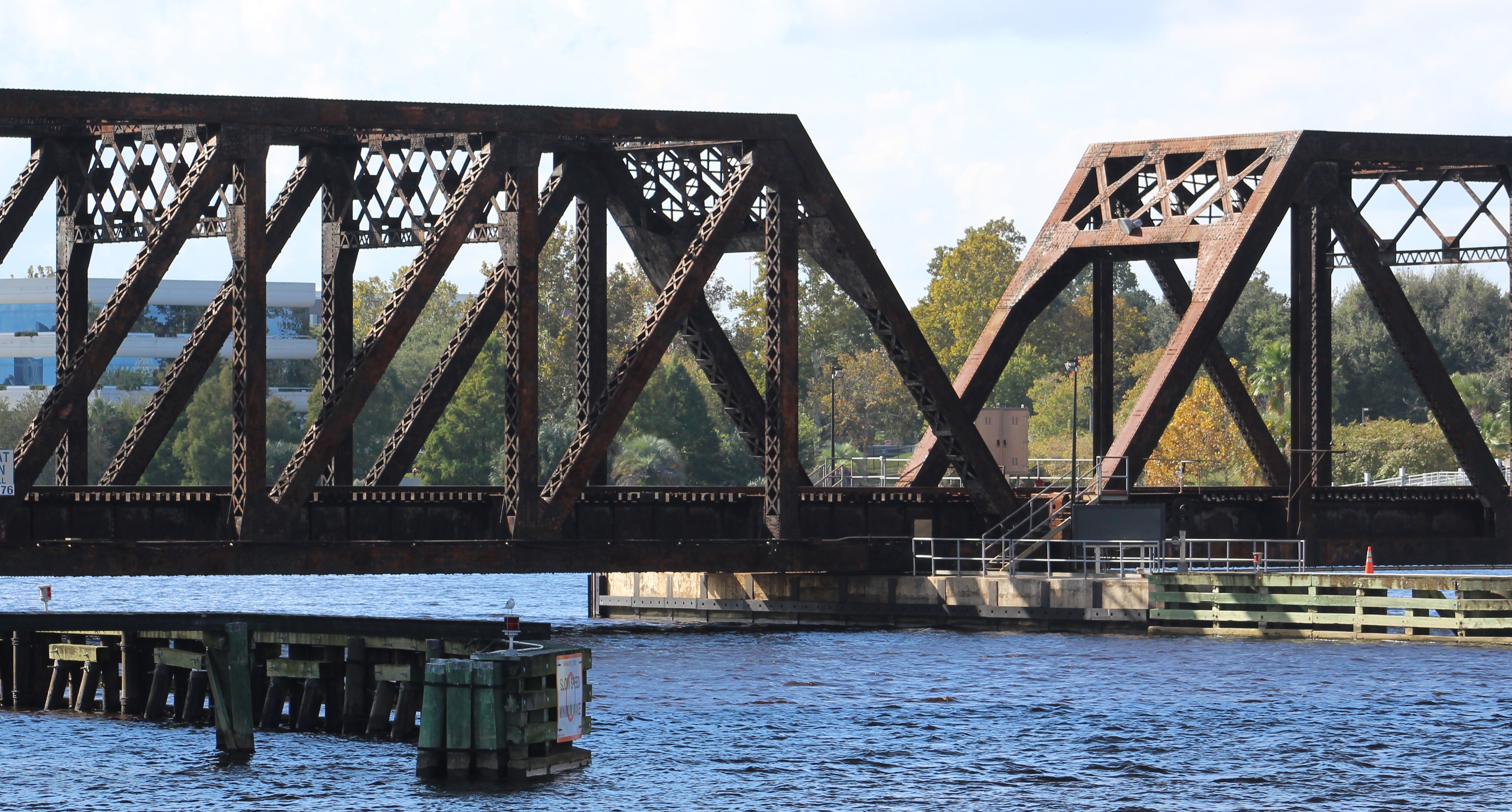
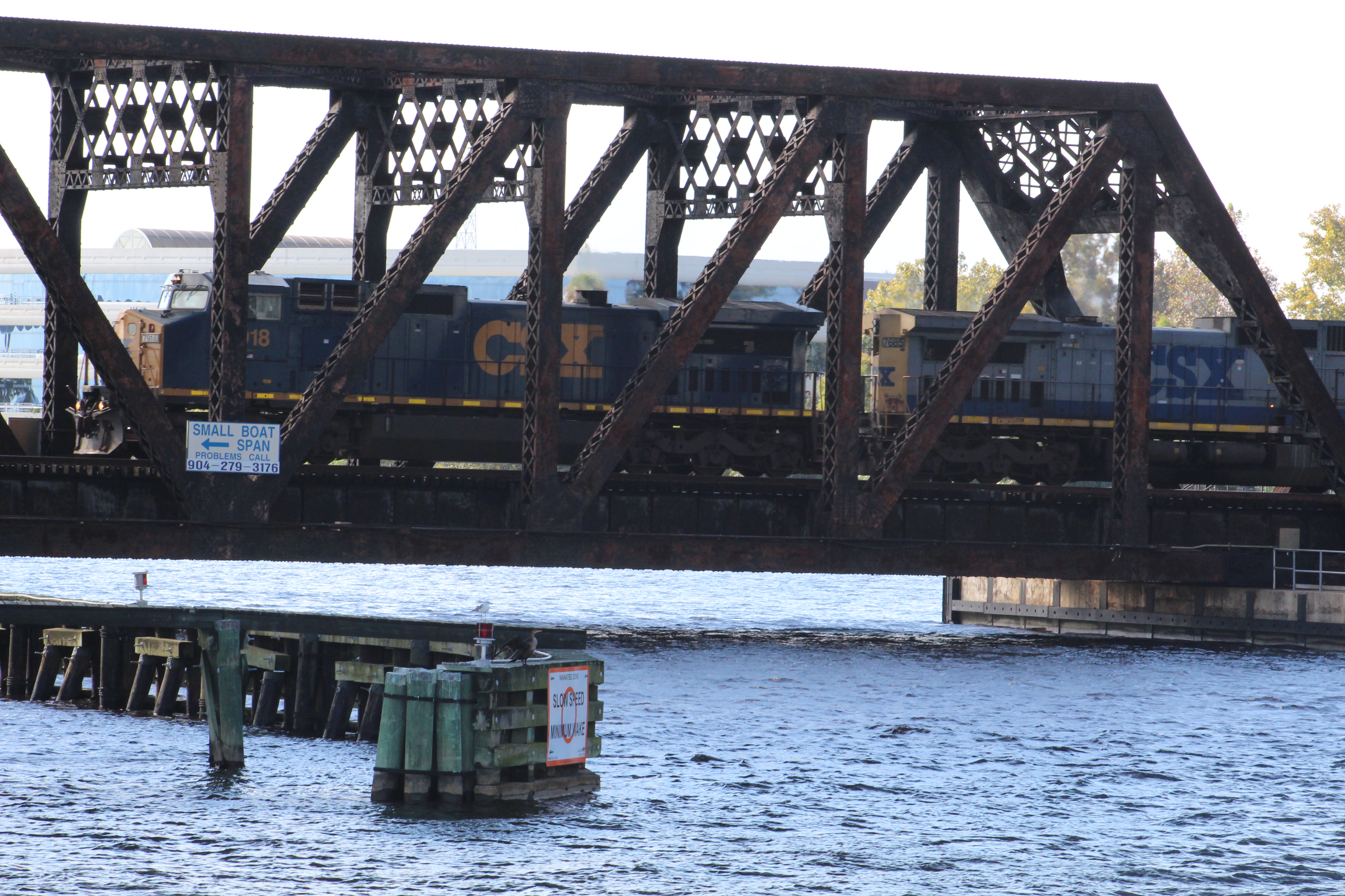
    Once the crew found the Fuller-Warren Bridge they had to idle speed thru the 5 Jacksonville downtown Bridges.  Finally, at 1106, the crew passed under the last bridge and could set some speed on the engines.

    Downtown JAX
    Goodbye Jax


    The crew found their first ICW marker at flashing red 88 at about mile 740 and made a turn to port up Sisters Creek.  As a reminder, the mile markers count down the mileage to Norfolk, Virginia.  So the crew is 740 miles from their destination for this first leg of the journey through Florida and Georgia.

    The skipper has started using a crowd sourced program called ‘Active Captain’.  He was not sure how it worked and had trouble getting it to run on the iPad so he did not use the program during the 2015 adventure.  However, Greg has since taught him how to use the program and the skipper has it running on a small android tablet.  While running the program, the ‘Active Captain’ talks to you and warns the skipper when there is a known hazard ahead.

    Entrance Fernandina Harbor Marina
    Anchors aweigh on 2016 adventure


    So about 1330, while still in Sisters Creek, the ‘Active Captain’ voice came on and warned of a shoaling hazard in the middle of the channel between green 73 and red 74.  The skipper picked up the tablet and reviewed a few of the comments and noticed that as boaters approached green 73 that the depth went to 5 feet at low tide.  As the crew actually got within 50 yards of green 73 the depth began to change and eventually got to 4.5 feet before returning to 13 feet.  The skipper said he really likes this new set up with ‘Active Captain’.  Thanks Greg for taking the time to show the skipper how to be safer on the water.

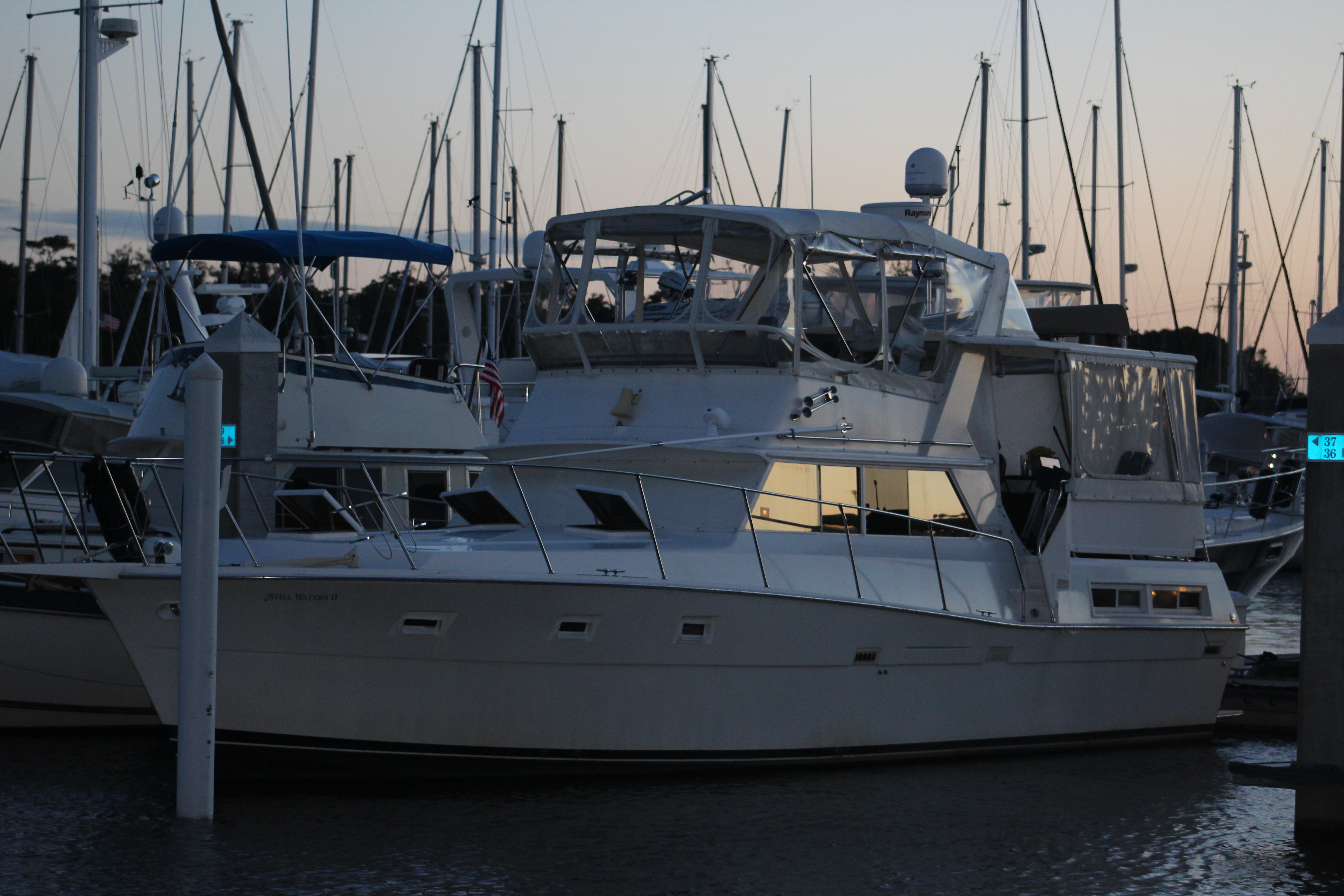
    At 1600 the crew docked at Fernandina Harbor Marina.  Luckily the dock master put them inside the breakwater just opposite a couple of large 58 foot boats on the outside of the breakwater.  The two boats blocked the wind and the breakwater stopped the wave action.  Those two big boats on the outside were not so lucky.  They rocked and rolled all night in the high winds and waves.

    The crew could only stay one night in Fernandina so they made the best of the situation.  First stop was the Fudge Factory for desert and then to the Marina Seafood Restaurant for supper.

    Old Bar
    Fernandina


    The Marina Seafood Restaurant Building has a rich history.  Major William B.C. Duryee completed the building in the mid 1880’s.  The building was the first US Customs House in the United States.  The Customs House occupied the building into the early 1900’s.

    The building then housed the oldest newspaper (the Florida Mirror) in the state of Florida.  The restaurant also began to share the building with the newspaper in the early 1900’s.  The restaurant was also the first Five Star Restaurant in Northeast Florida.  The skipper reports that the food was delicious.

    Friday April 15, 2016

    The crew departed from the marina at 0900 with strong winds and worsening conditions projected.  Winds were around 20 mph with gusts 25-30.  At 0935 the crew crossed into Georgia as they crossed the Cumberland Sound.  This section of Georgia Coast is a series of small islands.  In between each Island is an inlet and sound.

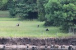
    Around noon ‘Active Captain’ warned of shoaling ahead at mile 704.  The skipper reviewed the comments and determined that they needed to steer wide of the red markers and favor the green markers as they rounded the approaching curve.  With the boat at green 63, the Admiral targeted green 59A and then moved further to the green side of the channel.  Even with these precautions, the depth sounder began to show 7, 6, 5 and then 4 feet of water.  The props were churning the mud up bad so the skipper took the helm and backed her up.  He moved the boat further outside the green line and still found 4 foot water.  He backed out again, scooted over some more and still could not get past the shoal.  The crew decided to back up to 10 feet of water, drop anchor and wait for the rising tide to give them some more depth.

    7-53-54[1]

    After dropping the anchor, a big Cat approached and radioed the crew to see if they needed help.  The crew explained their dilemma and the Cat captain responded that he knew the way and said, “follow me.”  The skipper watched as the big Cat continued past green 63 following the shore line.  When the Cat had green 59A off his port side about 9 o’clock he made a hard turn to port and motored past the shoal in 13 feet of water.

    Our skipper pulled anchor and executed the same maneuver and also cleared the shoal.  The skipper also updated ‘Active Captain’ to give other boaters more info how to get past this tricky curve at low tide.

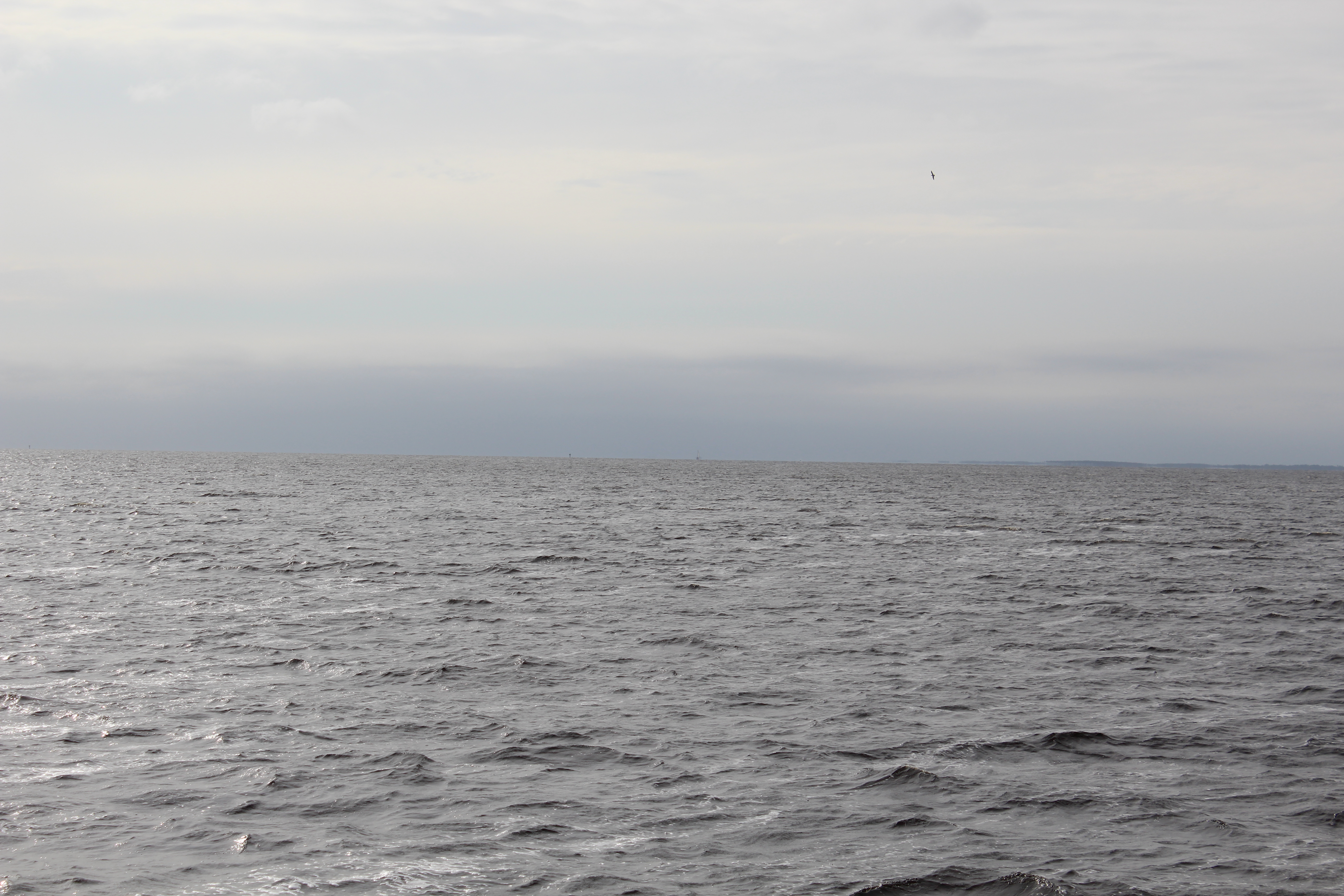
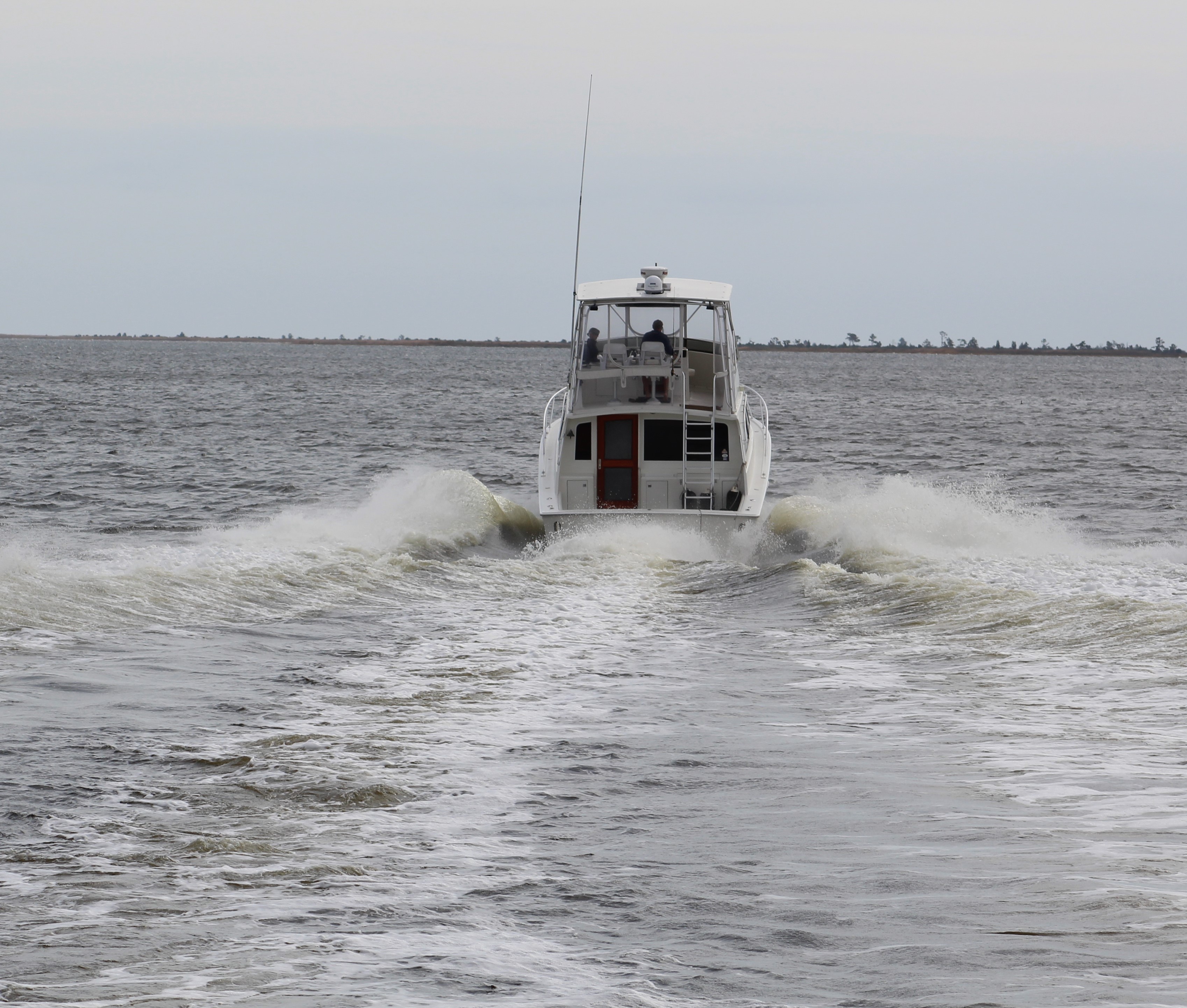
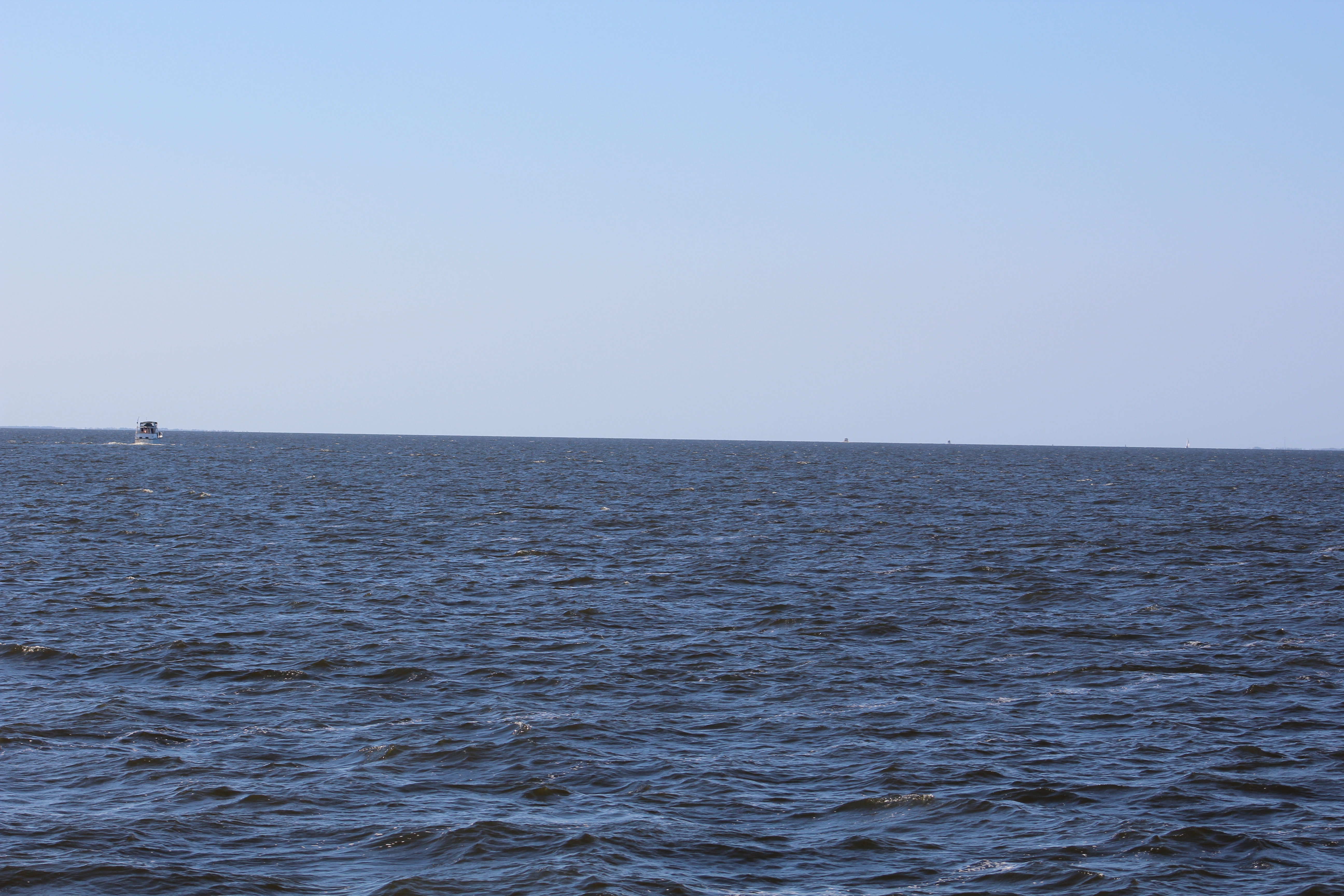
    While in the Cumberland River a south bound Captain hailed the skipper on the radio and asked if they were headed to Jekyll Sound.  The skipper answered in the affirmative.  The captain of the south bound vessel mentioned that they had just crossed and it was very rough.  He cautioned going into the sound into the wind.  The skipper thanked him for the warning and pressed on.  As the crew got closer to Jekyll Sound the waves began to build.  They were growing to 3 footers and making for an interesting ride.
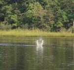
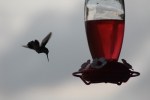
    565963608_260x146[1]

    Click on the pic above to take a two minute ride on Still Waters II as she enters Jekyll Sound and rides 2-3 foot waves.  The waves continue to build and get larger as the video runs.

    The skipper increased speed to get the vessel up on top of the waves to smooth out the ride.  As the south bound captain had warned, the sound was very bad.  The worst our skipper has seen on this adventure.  The bow of Still Waters II is 7 feet out of the water.  It is not a pretty picture when the waves are as high as the bow of the boat.  But Still Waters II has proved her sea going strength and handled the waves much better than the crew.  With a little persistence all was better at 1443 as the crew finally made it to mile 685 and into a narrow creek.

    IMG_0018
    Still Waters II at anchor in Frederica River


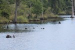
    At about 1611, the crew took a small side trip up the Frederica River.  The crew dropped anchor across from Fort Frederica National Monument at 1657 and were glad to get some rest.

    Saturday April 16, 2016

    At 0900 the crew launched the dinghy and tried to get to the dinghy dock at the Fort.  Unfortunately, the current was strong and working with the wind to push the dinghy the wrong direction.  The dinghy finally made it close to shore where the skipper then headed her into the wind and current.  The Admiral took over steering the dinghy while the captain assisted the little motor by paddling.  The crew finally reached the dinghy dock and took a walk around the grounds of the National Monument.  Interesting place.

    IMG_0019

    The Fort was established by the British on lands claimed by the Spanish.  Then the British claimed that the lands south of the Fort but north of the Spanish Fort at St Augustine were disputed lands.  As expected, the Spanish disputed these claims and went to war to reclaim their land.  The short of it is the Spanish lost and the British took control of what we now call Georgia.

    There was also a small town that was started to support the Fort.  John Wesley actually visited and preached at the town and Fort.  But the most interesting character was a crazy lady described below.

    IMG_0032

    After spending the morning at the Fort, the crew headed back to the mother ship.  The current was still headed in the direction of Still Waters II so the crew just drifted down to her.  Once they got beside her the skipper tried to grab the railings, but the speed of the dingy just about pulled him out of the dingy.  Plan B was quickly devised and the crew turned the dinghy behind the mother ship and managed to fight the current to get back on the stern swim platform.

    IMG_0046
    The remains of Fort Frederica


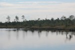
    After the dinghy was secured, the crew pulled anchor and went 23 miles north to anchor in the Crescent River.  The crew had anchored here back on November 3, 2015 and found the same peaceful surroundings.

    IMG_0051
    Sunset on the Crescent River


    Sunday April 17, 2016

    IMG_0059
    Tight squeeze between the red and green markers on a Sunday afternoon.


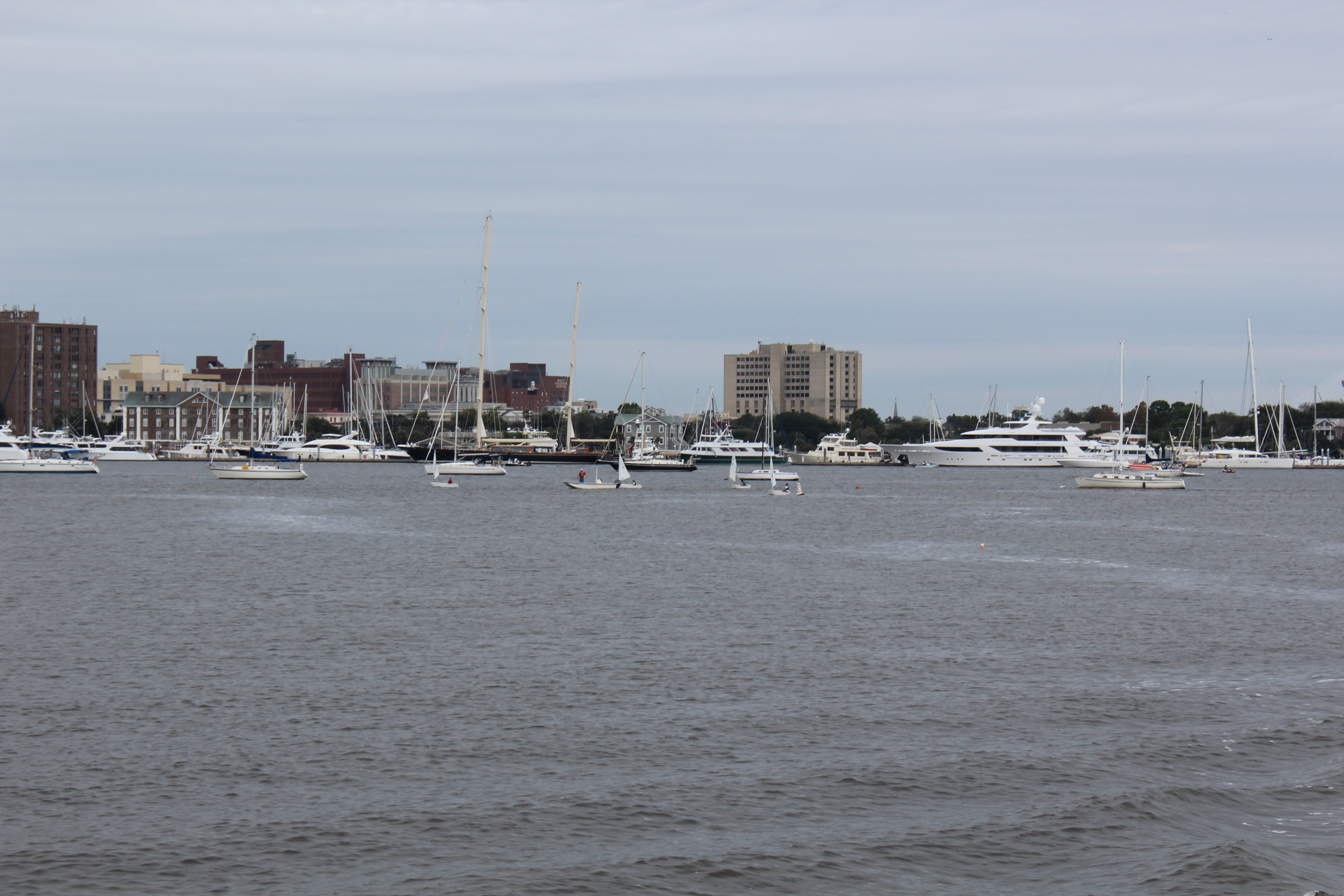
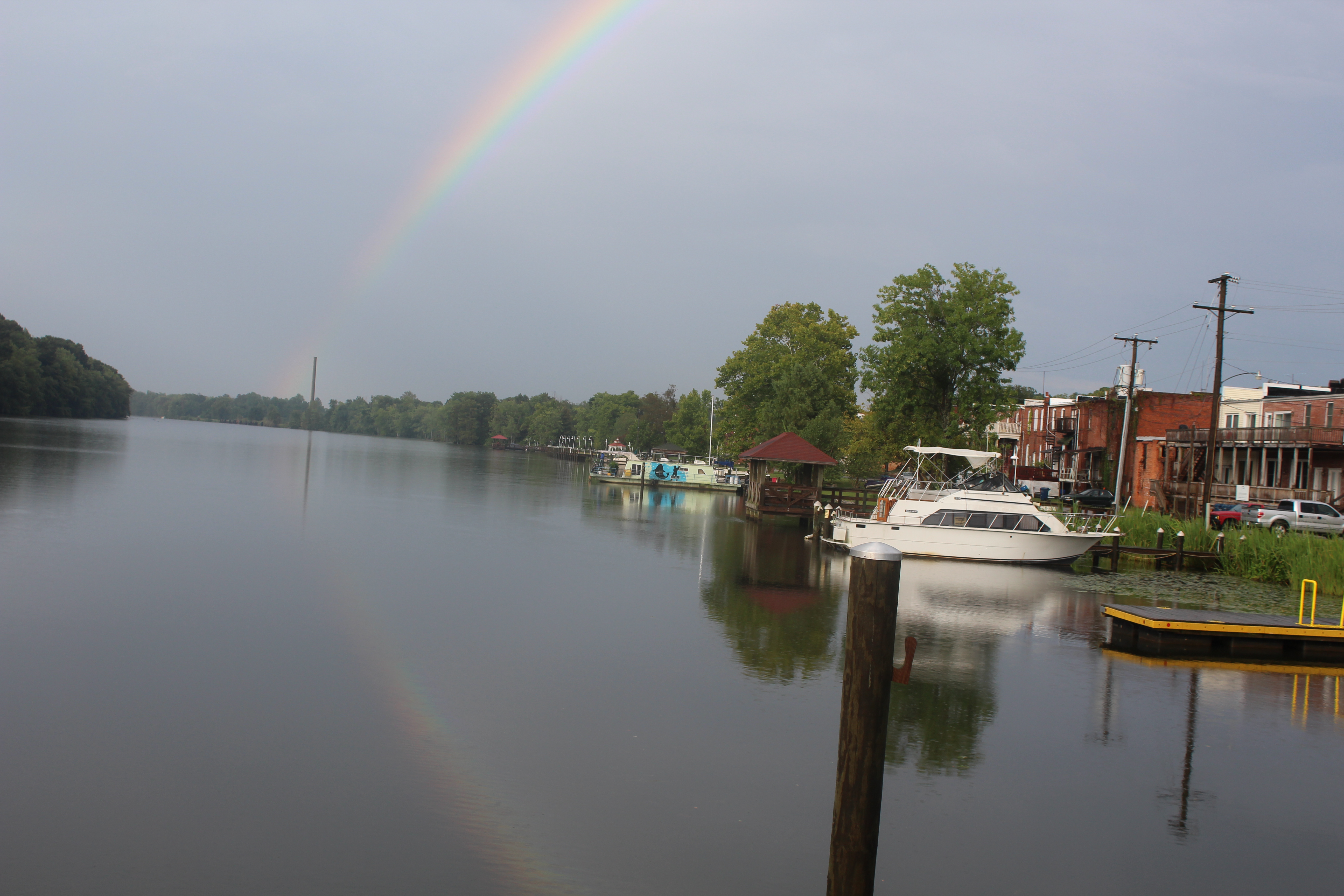
    The winds started out strong but began to weaken as the day went on.  The cloudy skies also began to break up and the sun finally showed itself for the first time since leaving Jacksonville.  By early afternoon, the skies were clear and the wind was down to a more manageable 15 mph.  The crew had an easy day of cruising and pulled into the Isle of Hope Marina (ICW mile 590) on the edge of Savannah.

    IMG_0060
    Sunset at Isle of Hope


    The marina was very nice.  Had loaner cars and bicycles.  The crew used a car and made a Wal-Mart run to restock on a few items.


    Monday April 18, 2016

    Finally, calm seas and sunshine.  Weather report was for only 5-10 mph winds today with a high in the low 70’s.   The crew only planned a short 26 mile cruise today to Hilton Head Island.  They decided to take on fuel before leaving the marina.  However, the fuel dock was full of boats tied up for the night.  About 0930, the fuel dock cleared and the crew maneuvered over to get fuel.

    IMG_0065
    Big yachts getting worked on at Thunderbolt Marina


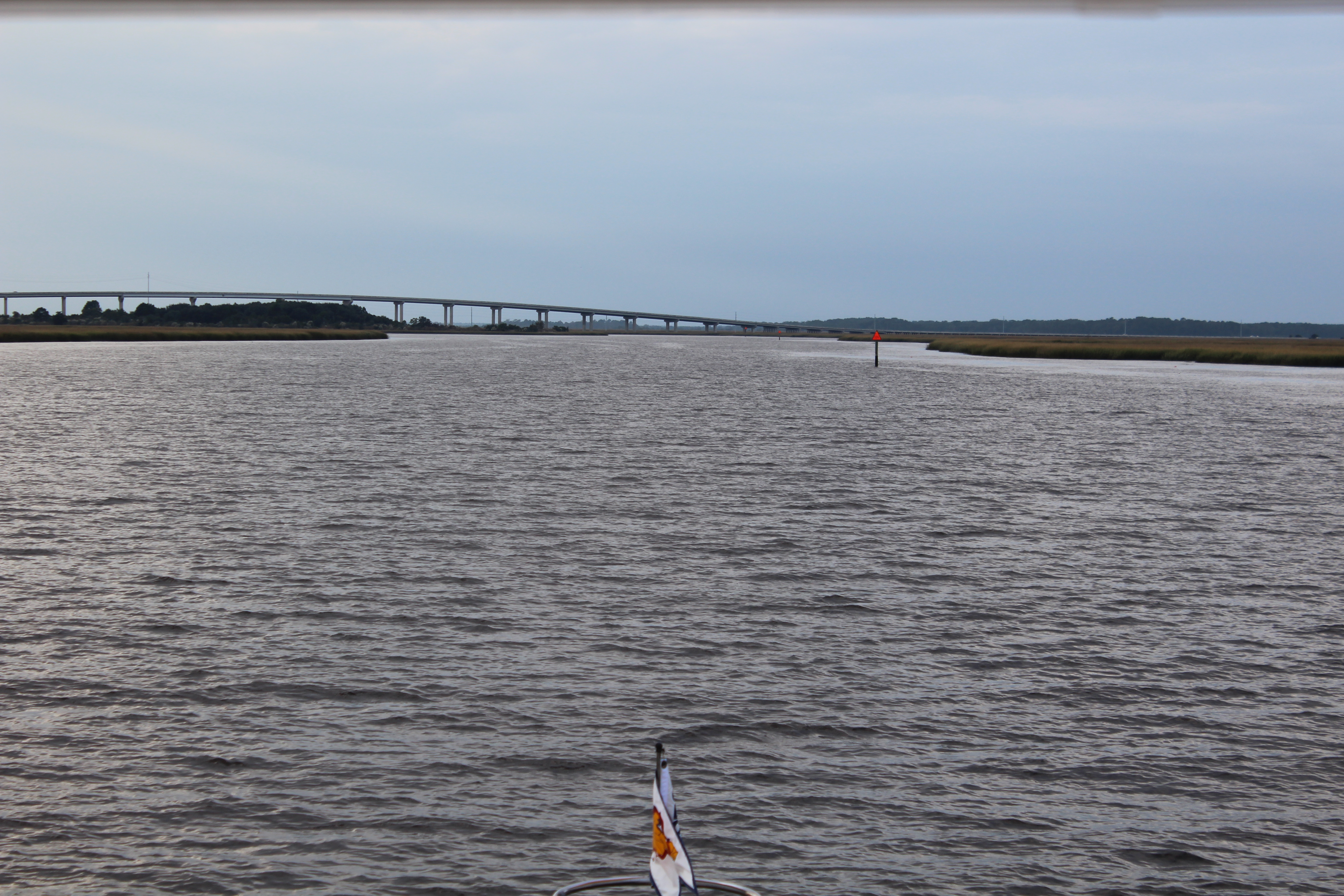
    After fueling, the next 10 miles were a slow go at mostly idle speed due to the number of marinas in the area.  At 1140, the crew crossed the Savannah River and entered South Carolina.

    At 1214, the first of many Coast Guard radio calls went out about a 38 year old male who was missing.  Seems he went out kayaking last night and still had not returned.  The Coast Guard was asking people in the area of the Savannah River to keep an eye out and report any sightings of a blue kayak.  Grim reminder that this is not all fun and games.

    IMG_0076
    Entering Harbor Town Yacht Basin


    The crew pulled into Harbor Town at the Yacht Basin.  The plan is to spend two nights here and explore Hilton Head Island and prepare for the second leg of this journey through South Carolina in route to Norfolk, Virginia.

  • The Relunctant Boater

    Hello fellow adventurers and virtual crew members!

    Eric here gladly posting a log from the perspective of the guests Dave Weyandt (aka Fender Boy) and Martha (aka Best Mate Martha) who took a five day adventure on Still Waters II.  In their own words:

    Fender Boy and Best Mate Martha are reporting on their best adventure ever!!

    IMG_7851
    BMM in Life Jacket with First Mate on day 1

    BMM was very reluctant about the trip when FB said he wanted to go. She
    finally agreed and off they went to Jacksonville, Florida to meet the crew
    on Still Waters II.  The boat was awesome and the crew, from the minute
    we arrived to the minute we left, was outstanding. We can’t say enough
    about the crew. The next morning, BMM strapped on her life preserver and the boating adventure began.

    Day 1 ended at Jacksonville Beach with lots of rain, but it didn’t matter because we had a skillet cookie topped with ice cream to end our first leg of the trip.

    IMG_7871
    FB playing in the Atlantic Ocean

    Day 2 started with a walk/run to the Atlantic Ocean beach where FB had to
    get in and ride the waves. Still Waters II got underway and headed south to
    Palm Coast and the Hammock Beach Resort. (BMM got brave and put her life preserver away).  Dolphins were spotted swimming with the boat. It was amazing, as were the houses all along the waterway. The resort was so nice we stayed there two nights.

    IMG_0369
    BMM at the helm


    During our stay, much time was spent at: the beach, the largest hot tub we’d ever seen, the lazy river, and the game room. The skipper introduced  us to the ping pong game called, “Around the World” that turned out to be lots of fun to play. (Especially when BMM was the champion of all the games.)

    IMG_7994
    FB, First Mate, and skipper enjoying the hot tub

    Card games were played back on the boat where the skipper loves the first mate so much he lost the game of Hearts so she could be the winner.

    IMG_1485
    Enjoying a little ping pong in the game room

    Day 4 on the water led Still Waters II back north to St. Augustine, known
    as the oldest continuously occupied city in the nation – 450 years and counting. A sight seeing tour on the Little Red Train and a tour of the St. Augustine Lighthouse were the hi-lights of the day.

    IMG_0269

    Day 5, the last leg of the adventure, turned out to be the best traveling
    day of the week. The weather was perfect for a 30 mile run in the ocean, so
    the skipper and FB said, so off we went. The water was beautiful, filled
    with jellyfish and dolphins. It was the perfect way to finish a great
    adventure, one we’ll never forget!!!!!

    IMG_1486
    The last supper back in Jacksonville
  • D & M Loop

    Hello fellow adventurers and virtual crew members!

    D&M Loop

    Eric here reporting on the latest travels of Still Waters II. David and Martha (D&M) Weyandt arrived onboard Saturday, November 7, from Granbury, Texas. They had to be headed back to Texas on Friday so a plan was made to cruise south and loop back to Jacksonville on Thursday.

    Sunday, November 8, 2015 – Maroon Line

    IMG_0357
    David Weyandt at the wheel

    The weather was misty rain when the crew left the dock, but the crew did not let that dampen their spirits. By the time the crew travelled the 26 miles back to the ICW from the Ortega River, the weather began to break and the sun finally peaked out. The crew headed seven miles down the ICW and took advantage of the dry spell to pull into the Palm Cove Marina to refuel. After refueling, the crew motored across the ICW to dock at Beach Marine at Jacksonville Beach.

    IMG_0219
    Dolphins headed to the boat

    Dave Weyandt was out on the bow when some dolphins came up and headed to the boat.  Our crew has noticed the dolphins swimming to the boat in the past but never went out to the bow to look for them.   After this discovery, the crew started going to the bow when dolphins were spotted and the dolphins almost always start surfing off the bow.

    Click on pic above to watch the dolphins swim.

    The plan was to walk the mile and a half to Jacksonville Beach but the weather did not cooperate. The rain came wave after wave with high driving wind. The crew spent the evening on the sundeck playing cards and wiping up water from a few leaks that showed up around the windows.

    Monday, November 9, 2015 – Orange Line

    The weather finally broke during the night so the crew made their way to the beach first thing in the morning.

    IMG_0206
    Dave and Martha out on bow of boat while underway

    The crew then headed 54 miles south down the ICW to the Marina at Hammock Beach. The crew arrived about sunset which made for a beautiful dock setting. The dock master explained to the crew that the marina was part of a Resort that was a couple of miles down the road. The dock master provided a phone number that the crew could call to get a courtesy van ride to the Resort. The crew took time to eat and then set out on a reconnaissance mission to check out the Resort.

    IMG_0237
    The “Fish Story” statue next to our dock

    The Resort turned out to be a big surprise with multiple swimming pools, hot tub, lazy river, and beach access. They also discovered a ping pong table and played a little ‘Around the World.’ Martha took home the trophy after beating the skipper on match point. The crew headed back to the boat and decided that they would spend Monday at the Resort.

    IMG_0239

    After eating a large breakfast, the crew made their way to a fun filled day at the Resort. The crew spent time in the hot tub and the lazy river.

    IMG_0347
    One of the many pools

    They also spent some quality time relaxing on the beach.

    IMG_0245
    Ladies enjoying the beach


    Wednesday, November 11, 2015 – Green Line

    The crew headed back 24 miles north to explore St Augustine. With only half a day to take in the sites, the crew decided to buy tickets on the Red Train Tour. Due to it being Veterans Day, the skipper and Dave Weyandt got free tickets. The crew took a courtesy van out to the lighthouse.

    IMG_0266
    View from top of Lighthouse

    The crew spent about an hour on the grounds and then headed back to the Red Train Headquarters for the St Augustine tour. The tour was about eight miles and lasted an hour and a half. The conductor was Smokey and he provided details of over a hundred sites as he drove around historic St Augustine.

    IMG_0290
    White Peacock with baby chick

    After the tour the crew walked around town and finally stopped to have dinner at an Irish Pub. All enjoyed the fish (fresh cod) and chips.

    IMG_0286
    Magnolia Street lined with Oak trees and Spanish Moss

    Seems all the Magnolia trees died and the locals replanted with oak trees over a hundred years ago.

    Thursday, November 12, 2015 – Blue Line

    The crew shoved off early to make the run back to Jacksonville. The wind was predicted to be out of the west at only 4-6 mph for the day. So when the crew got to the St Augustine inlet they looked at the Atlantic Ocean and noted the smooth conditions.

    IMG_0313
    Riding the bow in the Atlantic

    The skipper took a vote to ensure that all onboard felt comfortable heading out into the Atlantic. After all agreed to make the run north in the Atlantic, the crew made their way out three miles offshore.

    IMG_0358
    Approaching downtown Jacksonville

    The crew turned north and travelled 35 miles north to the St Johns Inlet. The ride was smooth with the wind coming from the shore. After arriving at the inlet it was about 5 miles back to the ICW and then another 26 miles back to the Ortega Landing Marina.

    IMG_0350
    Near the end of the journey

    The crew got docked just before sunset and then celebrated a fun filled week by grilling burgers and eating dinner under the stars at the marina clubhouse.

    IMG_0365
    Friday morning before heading home
  • Passage South to Jacksonville

    Hello fellow adventurers and virtual crew members!

    Eric here reporting on the southbound voyage of Still Waters II.  The crew has travelled 400 miles over the last 6 days and now have pulled into Ortega Landing Marina in Jacksonville, Florida.

    Saturday, October 31, 2015

    This turned out to be a beautiful sunny day to cruise 67 miles over eight hours.  About mid-day the crew turned into the Osprey Marina to take on fuel.  After a full day of cruising, the crew dropped anchor in the South Santee River (STM 420) for a good night’s rest.

    STM 390, Waccamaw River
    STM 390, Waccamaw River

    Boat Name of the Day – On a 36 foot Carver motor yacht, “My Chelle’

    Sunday, November 1, 2015

    The crew put in a long day on the water and cruised 85 miles over ten hours.  The crew passed back through Charleston and reminisced docking on the Mega Dock.  As they passed the Marina there were several Mega Yachts on the Mega Dock.

    STM 470, People enjoying Charleston Harbor
    STM 470, People enjoying Charleston Harbor

    There were also four small sailboats circling a motorboat. Looked to be kids learning to sail with a coach in the motorboat giving instructions.

    STM 500, South Edisto River
    STM 500, South Edisto River

    The crew dropped anchor in the South Edisto River (STM 505).

    Boat Name of the Day – On a small tug boat, ‘Miss Alignment’

    Skipper hopes the owner of the tug also owns a tire store.

    Monday, November 2, 2015

    The crew was met by a Bald Eagle as they left the anchor spot to get back on the AICW.  They cruised 68 miles over eight hours.  They passed through the town of Beaufort, S. Carolina.

    Crew getting the Eagle Eye
    Crew getting the Eagle Eye

    At the end of the day they were greeted by another Bald Eagle who observed them anchor in the Wright River.  (STM 573)

    Bald Eagle eating fish
    Bald Eagle eating fish

    Boat Name of the Day – No good names today

    Tuesday, November 3, 2015

    As they were leaving the anchor location the crew was greeted by the third Bald Eagle.

    IMG_0160

    The crew put in 67 gloomy miles over eight hours.  The sun never broke through the clouds and there was a thick mist that just hung in the air all day.

    Following the herd south
    Following the herd south

    On a brighter note, the mate spotted a big log in the water.  Upon further inspection the log turned out to be a Georgia Manatee.  First one spotted on the southern voyage.

    IMG_0177

    The dolphins have also started showing back up at most of the inlets that the crew crossed.  The crew always enjoys spotting the dolphins.

    The crew dropped anchor in the Crescent River (643).  Only about 100 miles to go to Jacksonville.

    Boat Name of the Day – Still no good names today

    Wednesday, November 4, 2015

    The crew was greeted by another Bald Eagle as they weighed anchor and proceeded south.

    While cruising through some shallow water the boat started to churn up some fish so the birds settled in behind the wake for a free lunch.  This is a video sequence at the end of the feeding frenzy.  Click on pic to watch the birds.

    The crew put in another 67 mile day with little to report on.  They dropped anchor in the Cumberland Sound (710) with about another dozen boats.

    IMG_0171

    Boat Name of the Day – still no good boat names

    Thursday, November 5, 2015

    The crew was greeted by restricted visibility due to a heavy fog that was sitting on the Sound.  A couple of boats left the anchorage in the heavy fog.  Our crew waited an additional hour but conditions did not improve much.

    Foggy, Foggy Morning
    Foggy, Foggy Morning

    Per the Coast Guard Navigational Rules, every vessel is supposed to have a ‘Look Out” while navigating the waterways to spot vessels and help avoid collisions.  Normally the helmsmen is also the Look Out.  The mate stayed in the fly bridge and acted as the Look Out while the skipper was keeping an eye out for the navigational aids.  The fog finally started to burn off and was finally gone by 0900.

    The crew arrived at the St Johns River at 1124 and made a right turn to head down river to the marina.  The marina is located off the St Johns River on the Ortega River, 26 miles downstream.

    Downtown Jacksonville
    Downtown Jacksonville

    The crew passed downtown Jacksonville and then arrived at a closed railroad bridge that was advertised to be normally open.  The skipper hailed the Bridge Tender and requested a bridge opening.  The Bridge Tender informed the skipper that a southbound train was headed for the bridge and that he would open the bridge after the train crossed.

    IMG_0197

    So the crew actually got to watch a train cross over one of these railroad bridges.  Another first for the crew.

    IMG_0200

    The crew then passed through the Fuller-Warren Bridge and headed into the Ortega Landing Marina.  The Coast Guard had an active rescue in progress so they were all over channel 16 on the radio talking with the Captain in distress.  That made hailing the Marina impossible.  While trying to call on the phone, the battery decided to play dead.  The crew had their dock and slip assignment already (B38) so they just went on in to dock.  The skipper found the B dock and then idled down to slip 38.  The fit was tight and the wind and current were strong.  The skipper started to back into the slip and managed to get her backed in, but with no dock hand on the pier the plan was to have the mate jump over to the pier and tie them up.  However, the wind was blowing them off the pier and the skipper could not get the boat over close enough for a safe leap. Luckily a few boaters came down and assisted getting the vessel tied down.

    Winter resting spot, B38
    Winter resting spot, B38

    Ortega Landing will be where the crew winters for 2015/2016.  They have signed a three month slip lease that will expire the first of February with options to extend the stay.

    However, they will spend next week cruising with new mystery guests who will arrive on Saturday and fly back to Granbury, Texas on Friday.

    Boat name of the Day – ea harp, owners are both music majors, the man graduated from Dallas Theological Seminary.

  • Passage to North Myrtle Beach

    Hello fellow adventurers and virtual crew members!  I would like to welcome Anna K. from Texas aboard as a new virtual crew member.  Anna is a long time friend of the mate.  Glad to have you aboard Anna!

    Eric here reporting on the southbound voyage of Still Waters II.  The crew has travelled 234 miles over the last 4 days and have pulled into Barefoot Landing Marina for two days.  There continues to be new opportunities each day to sharpen the skills of our crew.

    Monday, October 26, 2015

    Weather, specifically the wind speed and direction, continued to be a challenge for safe boating.  The wind for this passage was 12-15 mph out of the North-Northwest with gusts to 20.  With most of the passage headed south this was not to bad; however, at one point there were 20 miles in 4-5 foot waves that made for some exciting times.  Most of the day was spent in small chop of 1-2 foot waves with some really smooth water transiting some narrow canals.

    Crossing the Pungo River at mile 140
    Crossing the Pungo River at mile 140

    While the crew was running the worst of the waves, they were tracking beside a red sailboat.  The sailboat looked like a hotdog in boiling water as it rolled and bobbed up and down in the waves.  The sailboat crew had on their full foul weather gear and were exposed to the wind, rain, spray, and cold.  Our crew was glad they were enclosed in the fly-bridge and out of the weather.

    Mile 160 in Gale Creek
    Mile 160 in Gale Creek

    By 1530 the crew had had enough and found a cove in Adams Creek to drop anchor.  The cove was protected from the North wind but the wind continued to build during the night to over 20 mph.  The anchor held in the wind with another night of rocking in the waves.

    View in Adams Creek where the crew anchored
    View in Adams Creek where the crew anchored

    Boat Name of the Day – On a small boat with a golf ball and golf tie – Par Tie Boat

    Tuesday, October 27, 2015

    There were a couple of interesting and amusing experiences as the crew continued south for 57 miles through narrow rivers and canals that make up this section of the AICW.

    Mile 190, still in Adams Creek
    Mile 190, still in Adams Creek

    As the crew was approaching Camp Lejeune to pass through the AICW that borders the military installation, they were stopped by a military police boat at 1430.  The military police boat explained that the route was closed until 1700 due to live fire exercises in progress.  The crew dropped anchor andmwaited for the route to reopen.

    Mile 240, Can you see the bridge in the distance
    Mile 240, Can you see the bridge in the distance

    While waiting, another four boats were also stopped which caused a small boat jam.  At 1555 the military police boat announced that the exercise was complete and that it was safe to proceed south.

    Our crew had been the first to arrive and drop anchor.  The other boats all passed Still Waters II and anchored between her and the police boat.  So, once the boats were allowed south, Still Waters II found herself at the back of the pack.

    Ahead of the pack was the Onslow Beach Swing Bridge that opens on the hour and half hour.  The pack set speed to make the 1630 bridge opening.

    The crew had a good laugh when they arrived at the bridge at 1632 and found the bridge still shut and the four boats waiting for the bridge to open.  The skipper picked up the radio and hailed the Marine bridge tender on channel 13.  The skipper then requested a bridge opening and the bridge tender said he would be happy to open the bridge.  The horn sounded, the bridge opened, and all 5 boats passed through the bridge at 1635.

    The crew wonders how long the other boats would have sat there before someone requested the bridge to open.  You may recall the following exchange on the northbound cruise at this same bridge:

    Skipper – “Are you opening the bridge on schedule?”

    Bridge Tender – “If someone requests the bridge to open, I will open the bridge.”

    Skipper – “I guess I am requesting you to open the bridge then.”

    Bridge Tender – “Then I will open the bridge.”

    Experience is a wonderful thing.  Schedule or no schedule, one has to request the bridge to open before the Marine tender opens the bridge. Those Marines manning the bridge are having fun at the boaters expense.

    mile 244, Hammock Bay
    mile 244, Hammock Bay

    The crew decided to drop anchor in Mile Hammock Bay.  When they turned off the AICW to enter the Bay there were 15 other boats already anchored.  Still Waters II made 16, and at least one other boat pulled in a little after our crew.  The crew found a spot over on the outside of the other boats and dropped anchor for a peaceful calm night.

    Still Waters II with some close friends in Mile Hammock Bay
    Still Waters II with some close friends in Mile Hammock Bay

    Boat Name of the Day – on a sport fishing boat – E Sea Fishing

    Wednesday, October 28, 2015

    Another strange day greeted our crew as they put in 77 miles on the water.  At about 0900 the skipper ‘decided’ (using the word decided very loosely here) to take a side trip up the New River.  It was an hour later when it dawned on the skipper he was sight-seeing and off course.  The skipper turned around and made way back to the AICW.

    The skipper was more than a little hacked at the navigator for missing the marker and leading the helmsman down the wrong course. (I will not mention that the navigator and helmsmen just happened to also be the skipper.) But the skipper believes that there is a reason for everything, and the reason became obvious later in the day.

    High water in S. Carolina
    High water in S. Carolina

    At 1540 a Coast Guard boat approached Still Waters II and one of the Coasties directed the skipper to maintain course and speed.  Three Coasties boarded Still Waters II for a routine “Safety Inspection.”  The Coasties spent about 30 minutes onboard looking all through the vessel and reviewing the boat documentation paperwork.  Once they completed the inspection they reported that the vessel had NO Violations.  They were also very complimentary of the overall condition of the vessel.

    Coastie leaving the boat
    Coastie leaving the boat

    As they were leaving Still Waters II and re-boarding their vessel they were also appreciative of the crew’s attitude towards the inspection.  Seems they encounter many crews who have a bad attitude towards the safety inspections.

    The crew would like to thank the two previous owners for taking good care of Still Waters II.  The crew would also like to thank Captains Chris, Alyse, and Geoff for making sure she was incompliance with all Coast Guard regulations prior to the summer shack-down cruise.

    Mile 280 at Mason Inlet
    Mile 280 at Mason Inlet

    The crew dropped anchor in the Cape Fear River at dusk near Southport.  This was not the best spot to anchor but the winds finally died down after midnight to allow some good sleep for a tired crew.

    Anchor in Cape Fear River
    Anchor in Cape Fear River

    Boat Name of the Day – on a catamaran – Kat Cha Later

    Thursday, October 29, 2015

    After weighing anchor, the crew set off for North Myrtle Beach.  The crew put in 48 uneventful miles and tied up at the Barefoot Landing Marina at 1530.

    IMG_0069

    The most interesting thing for the day was the water level.  It has been several weeks since the Carolina’s had the 1000 year rain that caused so much flooding.  As the crew travelled south they have begun to see examples of the flooding.  There are still many boat docks underwater, and houses with water very near the front door.

    IMG_0071

    There are sailboats getting stuck at 65 foot bridges because their 63 foot masts will not fit under the bridge.  They anchor beside the bridge and wait for the tide to go down and get some more clearance.  There were two sailboats at a bridge showing 63 foot clearance that had been waiting for five hours to get under.  The two captains had the following radio conversation as our crew passed them:

    Monohull – What is your mast height?

    Catamaran – 63 feet, what is your height?

    Monohull – 63.5 feet.  I am waiting for the bridge to show 64 ft clearance on the board marker before going under.

    Catamaran – Good.  I will follow you under.

    Monohull – I was hoping you would go first. I am chicken.

    Simply amazing that there is still this much water around after so many weeks.  Water levels look to be at least two feet higher than normal.

    Closing in on North Myrtle Beach
    Closing in on North Myrtle Beach

    Boat Name of the Day – on a 45 foot cruiser – Sol Mate

    The crew plans to spend two days at the marina before heading back out on the AICW on Saturday morning and making the final push to Florida.

    Till then may the wind be in your back and you find still waters.

  • Parade of Boats

    Hello fellow adventurers and virtual crew members!

    Eric here reporting on the southbound voyage of Still Waters II.  Before leaving Top Rack Marina on Friday morning, the crew topped off the fuel tanks.  After taking on fuel the crew headed south on the Virginia Cut route.  The crew anchored out Friday and Saturday nights, then pulled into the River Forest Manor and Marina in Belhaven, North Carolina early on Sunday.

    Friday October 23, 2015

    There are two routes south from Norfolk to cross the Albemarle Sound.  The Dismal Swamp and the Virginia Cut.  Since the crew took the Dismal Swamp route on the way north, they decided to try the Virginia Cut on the way south.  The Virginia Cut has one lock to navigate and several bridges that are on set opening schedules.  So the way takes some patience and coordinating.

    Entering the Great Bridge Lock
    Entering the Great Bridge Lock

    The Great Bridge Lock was the first obstacle to time.  The lock operates on the hour and the crew arrived at 0953.  A tug had just passed through so the lock gates were open and Still Waters II motored into the lock and took her place along the south wall.  She was the fourth boat in the lock and one additional boat pulled in behind her.  The gates were closed and the lock master raised the water level about a foot and opened the south bound gates.  All five boats exited the lock with no issues and were headed to the Great Bridge for the 1000 opening.

    Parade of boats at the Great Bridge
    Parade of boats at the Great Bridge

    Next was the Centerville Turnpike Swing Bridge three miles south which opens on the hour and half hour.  The five boats stayed in order and all made the 1030 opening.

    Parade of Boats thru the swing bridge
    Parade of Boats thru the swing bridge

    Next up was the North Landing Swing Bridge 5 miles south.  There was a sailboat that was second in line of the parade of boats and was not making much speed.  There was not enough room for the three boats behind to pass so they arrived at the swing bridge at 1110 and had to wait 20 minutes for the 1130 opening.  While waiting at the bridge the sailboat moved over and let the three motor boats pass.

    Mile 10 - Southern Branch of Elizabeth River
    Mile 10 – Southern Branch of Elizabeth River

    After negotiating all the obstacles and clock, the crew dropped anchor in the North River after cruising an additional five hours.

    Mile 50 - Coinjock Bridge over North Carolina Cut
    Mile 50 – Coinjock Bridge over North Carolina Cut

    With the parade of boats headed south, all of which are making different speed, and some in a hurry while others are not, the patience of some captains has begun to wear thin.  Common boating curtesy is to hail the boat in front of you and request to pass.  Once permission is granted the lead boat slows and the passing boat slows to minimize the wake while overtaking the lead boat.  The radio was alive with chatter of boats requesting to pass.  However, there are some folks in a hurry that just plow by other boaters and give off huge 3-5 foot wakes, some even larger.  One of these guys got reported to the Coast Guard by several other boaters.  When he passed within 15 feet of Still Waters II he threw a 7 foot wake and really rolled her.  There is a special place in Sheol for people like that.

    Mile 57 - Sunset at anchor in Broad Creek
    Mile 57 – Sunset at anchor in Broad Creek

    On the lighter side, there are some very creative people who come up with interesting boat names so we will begin to feature the boat name of the day as the crew journeys south.

    Boat Name of the Day – 44 foot powered catamaran – “Stray Cat”

    Saturday October 24, 2015

    The crew logged a 70 mile voyage and crossed the Albemarle Sound.  The plan was to get across the Sound in the morning before the winds got up and caused the big waves that the Albemarle is famous for.  The Sound is also known for ‘confused seas’ which means waves from all directions.  The Sound did not disappoint.  The wind was out of the north/northeast at 15 mph with gusts to 20.  This made for 3-5 foot waves coming from all quarters and a bit of a rough ride across.  However, the skipper is getting better at finding the right speed to cruise the rougher water to make for a smoother ride.  He has been getting more practice than he wished for, but hey, practice makes perfect.

    Mile 70 - in Abemarle Sound
    Mile 70 – in Abemarle Sound

    After crossing the Sound the crew entered the Alligator River with plans to stop at the Alligator River Marina for lunch and one of Wanda’s excellent hamburgers.  Unfortunately, when the skipper called Wanda to ensure that they could dock, she informed the crew that the low tide was very low and they would not be able to get into the marina.  Since there would be no stopping the crew passed the marina and headed for the Alligator River-Pungo River Canal.  The canal was a 25 mile long welcome escape from the wind and waves.  After exiting the canal, the crew dropped anchor in a crowd of about a dozen other boats in the Pungo River.

    Mile 110 - Alligator River-Pungo River Canaal
    Mile 110 – Alligator River-Pungo River Canaal

    One interesting side note was a sailboat that also wanted to enter the Alligator Marina.  The sailboat turned off the ICW and entered the channel markers leading to the Marina entrance.  Wanda saw them coming so she tried hailing them on the radio.  However, there was no response from the sailboat.  When the sailboat entered the breakwater, Wanda came back on the radio and told them to stop, but the sailboat kept going.  The next radio transmission was Wanda on Channel 16 in a very smug voice for all to hear, “Sailboat stuck, sailboat stuck, Alligator Marina back to monitoring Channel 16.”

    Mile 125 - Alligator River- Pungo River Canal
    Mile 125 – Alligator River- Pungo River Canal

    Lesson Learned – One should carry a radio onboard and monitor Channel 16 while underway.  You just never know what you might need to know.

    Boat Name of the Day – on a 70 foot motor yacht – ‘Castle Finn’

    Sunday October 25, 2015

    The crew weighed anchor and made 15 miles to the River Forest Manor and Marina in Belhaven, North Carolina, AKA “Beautiful Harbor.”  The crew needed to provision and there was a grocery store about 1.5 miles from the marina.  The marina offers courtesy golf carts and the crew used them to make the provisioning run to the store.  New experience cruising through town on a golf cart.

    River Forest Manor and Marina
    River Forest Manor and Marina

    The marina is under new ownership and the owners have spent the last year performing upgrades to the marina.  The owners and dock hands were very friendly and provided excellent service.  The marina owners are now in the process of restoring the River Forest Manor that was built in 1899.

    River Forest Manor
    River Forest Manor

    Boat name of the Day – 44 foot catamaran – Gypsea Cat

    The next big challenge is to cross back through the edge of the Pamlico Sound.  The weather report is for 15 mph winds on Monday, but the winds are going to grow to 20 mph on Tuesday.  The talk of the dock was about who was going and who was staying.  For those staying, the talk was for how long to stay before a good weather window.

    Our crew has decided to venture out and cross with the 15 mph winds.  The winds should be north/ northeast and only cause a problem for about an hour.

    Keep a look out for the next log entry as I describe the wisdom or folly of the decision.

    Till then may the wind be in your back and you find still waters.

  • The Beginning or the End

    Hello fellow adventurers and virtual crew members!

    Eric here reporting on the run to Elizabeth City, North Carolina and Norfolk, Virginia.

    The crew left Hertford, North Carolina on September 1st and made their way to Elizabeth City.  The next morning the crew entered the Dismal Swamp and spent the night at the Visitor Center dock.  On Thursday, the crew finished off the Dismal Swamp, made their way to Norfolk, circled the navigational aid Red Buoy #36, and then docked at the Waterside Marina in Norfolk.

    Back on the ICW
    Back on the ICW,  What is that strange building in the background?

    The crew decided to have an extended stay in Norfolk over the holiday weekend and let the crazy people enjoy the water while the crew stayed safely tied to the dock.

    Run to Elizabeth City

    After leaving the dock at Hertford at 0900, the crew spent 3.5 hours dodging those nasty crab pots in the river and sound.  By 1220 the crew had made it out of the Albemarle Sound and into the Pasquotank River.  Then 20 minutes later they rejoined the ICW at mile 65 officially ending the side trip around the Albemarle Sound.

    IMG_0009

    There were some interesting sites to behold on the way to Elizabeth City.  Most interesting was the Blimp Air Field.  The crew spotted a strange building on the horizon which eventually showed itself to be a blimp hanger.

    Small Blimp and hanger
    Small Blimp and hanger

    Upon arrival in Elizabeth City, the crew strolled around the waterfront.  At 1800 they were entertained by a local band for two hours, as the town came out to enjoy a concert in the park.

    Summer Concert in the Park
    Summer Concert in the Park

    The town lived up to their nickname, “Harbor of Hospitality.”

    IMG_0032

    Though the mate was hoping for 5 boats to be in town so she could get a rose, Still Waters II was only one of two boats docked, so no rose this trip.

    IMG_0018

    Run to Dismal Swamp Visitor Center

    On Wednesday September 2, the crew went to the local Mariner Museum and then headed out to the Dismal Swamp.  The only thing more dismal than the swamp was the Texas Longhorn’s showing against the Fighting Irish on Saturday.  Looks to be another loooooooooooong season for the burnt orange fans such as the skipper.

    Dismal Swamp
    Dismal Swamp

    The trip up the swamp took a little planning to time scheduled bridge and lock openings.  The crew left about 1220 and needed to be at the South Mills Lock before 1530 to make the last opening of the day.  The skipper knew the time and distance and used that info to calculate the speed needed to make the opening.

    Swamp Reflections
    Swamp Reflections

    The skipper padded the calculation a little and the crew arrived 30 minutes before the lock opening.  Plenty of time to set the fenders and ropes to pass through the lock.  The trip through the lock raised Still Waters II about 12 feet.

    South Mill Lock
    South Mill Lock

    The same person operates both the lock and the South Mills Bridge.  So after opening the lock gates the bridge tender jumped in his truck and raced down to the bridge to open it so as not to cause any delays on the water.  As usual though, plenty of delays for car traffic as they wait for the bridge to close so they can get on down the road.

    IMG_0058

    Just 5 more miles of swamp and the crew arrived at the Visitor Center.  There were already 2 boats tied to the dock, but there was plenty of room to dock on the north end past a 26 foot sailboat.  The sailboat captain jumped up and helped the mate secure Still Waters II to the dock.

    At Visitor Center Dock
    At Visitor Center Dock

    Run to Norfolk

    The crew spent the morning exploring the Dismal Swamp Park and Visitor Center.  However, they needed to get back on the water so they could make the bridge and lock openings again.  They shoved off about noon, and thirty minutes later they passed into Virginia.

    IMG_0078

    The crew arrived at the Deep Creek Bridge about 40 minutes ahead of schedule.  Just south of the bridge on the east bank was a large concrete structure with cleats attached.  So what do you do when you need to wait 40 minutes for the bridge to open?

    Deep Creek Bridge
    Deep Creek Bridge

    Duh, you tie up to the structure, run across the street to Hardees, and order vanilla shakes for the crew.  Then buy a watermelon from the guy sitting on the corner in his pick-up truck.  Yes, that is exactly what you do!!!

    First Mate enjoying vanilla shake
    First Mate enjoying vanilla shake

    After making it passed the bridge and through the lock, it was another two hours to Norfolk.  There was very little traffic on the Elizabeth River on the run up to Norfolk, but there was plenty of activity along the water front.

    Deep Creek Lock
    Deep Creek Lock

    Before entering the Waterside Side Marina in Norfolk, the crew went a little further up river and rounded Red Buoy #36.

    The end at marker 36, or is it the beginning?
    The end at marker 36, or is it the beginning?

    This buoy is mile marker “0” for the beginning of the  Atlantic ICW.  The crew was pretty excited that they had actually made it all the way from Fort Myers, Florida.

    USS Wisconsin in Norfolk
    USS Wisconsin in Norfolk

    The crew would like to thank the virtual crew members who have completed this leg of the journey from the safety of their electronic devices.  Your words of encouragement keep the crew going strong.

    The crew will take shore excursions to visit Jamestown, Yorktown, and the National Mariner’s Museum over the Labor Day weekend, then start the next leg of the journey on the famed Chesapeake Bay next week.

    Wildlife sequence – Osprey catching fish

  • Albemarle Sould Side Trip part 2

    Hello fellow adventurers and virtual crew members!

    Eric here reporting on the completion of the Albemarle Sound Loop side trip.  The hospitality of the marinas and town folks has been overwhelming.

    Plymouth, Columbia, and Hertford.
    Plymouth, Columbia, and Hertford.

    The original float plan has been altered, and the new course after leaving Plymouth is to cruise to Columbia and then on to Hertford.  After Hertford, the crew will go back to the ICW and head to Norfolk (mile 0) via the Dismal Swamp Route.

    Columbia

    The run over to Columbia was very rough on Thursday, August 27th.  The wind was out of the east and blowing directly down the sound. Unfortunately for the crew, east was the direction they needed to head after leaving the Roanoke River.

    The only good news is that the rough ride was short because the run only took 4 hours.

    No big celebrations while we were here on the anniversary of hurricane
    No big celebrations while we were here on the anniversary of hurricane

    Upon arriving in Columbia, the crew walked around town. On the side of one of the buildings is a painting.  Not so unusual.  However, within the painting are 10 hidden animals that can be seen around the area.  The crew spent about an hour looking the picture over and found 8 of 10 of the animals.

    Wall Painting
    Wall Painting

    On Friday morning the crew walked over to the Pocosin Lakes National Wildlife Refuge and wandered around the boardwalk.

    If you are like the skipper, you may be wondering, ‘what in the world is a Pocosin?”  The crew learned that a Pocosin is a swamp on a hill.  The term hill is used loosely here, can be just a few feet rise from the coastal waters.

    The refuge was very peaceful.  One section of the mile long boardwalk was closed and the entrance was guarded by a large spider.  There were many large spiders along the walk.  There must be lots of bugs in the swamp to grow such spiders.

    Spider Guard
    Spider Guard

    Completing the boardwalk, the crew saw many large spiders, turtles, and a rare woodpecker. The skipper heard the woodpecker, but it took almost ten minutes to locate the little bird.  He was darting in and out of a hole in a tree.  Great way to spend the morning.

    The crew then wandered back over to the painting and found the last two hidden animals.  After lunch, it was time to shop the town down and provision for the next week of the journey.

    Hertford

    On Saturday, August 29th, the crew motored over to Hertford, North Carolina.  The Sound was up to its usual tricks.  The wind was out of the east again but the waves were confused and seemed to be coming from every direction.  It took a couple of hours to cross but luckily once in the river the waves calmed down.  Then it was back to dodging crab traps.

    Crossing the Albemarle Sound
    Crossing the Albemarle Sound

    The skipper says he would not want to be a crab in these waters because with so many crap pots it would be impossible to move around without getting caught.  Lucky for the crabbers, one female has about 2 million little crabs per brood.

    The marina docks in Hertford are brand new and have not been used much by larger vessels.  This was apparent as the crew came into the harbor at the end of the river.

    Hertford Dock
    Hertford Dock

    The last S swing bridge in the country guards the entry.  The bridge tender stopped the traffic and swung the bridge open.  The drivers of the stopped cars were getting out of their cars and taking pictures as the boat passed through the bridge. Even the bridge tender was taking pictures. Once docked, a man showed up from the newspaper and interviewed the crew for the local paper.  The paper only comes out weekly on Wednesday, and looks like the crew will be the news of the town.

    Last S Swing Gate Bridge in USA......on schedule to be replaced by 2020
    Last S Swing Gate Bridge in USA……on schedule to be replaced by 2020

    The REAL big deal in Hertford is Jim ‘Catfish’ Hunter.  For those not in the know, he was born, raised, and died here in Hertford.  The skipper is a big baseball fan, and was a big fan of ‘Catfish” Hunter.  The Chamber of Commerce houses the museum dedicated to their favorite son.

    IMG_0047

    Tribute to Jim ‘Catfish’ Hunter

    Born April 8, 1946, James Augustus Hunter learned to play baseball on his family farm.  He claimed that his three older brothers taught him the game.  He developed his awesome control by practicing throwing rocks and potatoes through a hole in the family barn.  The hole was made by the brothers.  They painted an X on the barn, then cut a hole at the center of the X.

    He was only 17 and still in high school when he signed his first contract with the flamboyant owner of the Kansas City A’s.  His parents had to co-sign the contract.  First contract was for $75,000.

    Catfish

    His career almost never got started because one of his brothers accidently shot him in the foot with a shotgun.  This caused the lose of his big toe, and a delay in his major league start.  Charles O Finley, owner of the A’s, sent him to a clinic and covered his medical and rehab cost.

    In 1971, he got his first of five consecutive 20 game winning seasons.  In 72, he helped win the first of three straight World Series with the A’s. Then in 74 he won the Cy Young Award with 25 wins and an 2.49 ERA.

    catfish-hunter

    Following the 74 season, he discovered a clause in his contract that was not honored.  Specifically, Charlie O was trying to defer 50% of Hunter’s salary to the next year for tax purposes rather than pay at the end of the season ($50,000).  Hunter took the case to arbitration and became the first free agent of the era.  A bidding war ensued for his talent (23 of 24 teams made offers), and he eventually decided to sign with the New York Yankees.  This contract was the first million dollar contract in sports.  He got a 1 million signing bonus and a 3.5 million dollar contract.

    catfish-hunter-y

    In 75, Hunter led the American League with 23 wins and taught the Yankees how to win again.

    In 76, Hunter became only the fourth pitcher to win 200 games in the modern era before his 31st birthday.  It was also in this time that he was diagnosed with Diabetes and his numbers began to fall off.

    From 76-78, he helped lead the Yankees to three straight American League pennants and two World Series championships.

    He honored his five year contract with the Yankees and retired back home to Hertford after the 79 season to return to farm life.  The locals talk of him sitting in the corner pharmacy signing baseballs for fans with one caveat, they were not to sell the ball for more than $3 because he wanted everyone to have an autographed ball.

    Autograph corner for Hunter
    Autograph corner for Hunter

    In 1987 he was inducted into the Baseball Hall of Fame.

    Notice his hat does not have team insignia. He did not want to short either the A's or Yankees, so he choose none.
    Notice his hat does not have team insignia. He did not want to short either the A’s or Yankees, so he choose none.

    In September 1998 he was diagnosed with Amyotrophic Lateral Sclerosis (ALS) and a year later he died of complications from ALS on September 9, 1999 at the young age of 53.

    IMG_0051

    IMG_0052

    Former teammate with the A’s and Yankees, Reggie Jackson described Hunter as a fabulous human being.  He was a man of honor.  He was a man of loyalty.

    George Steinbrenner, owner of the Yankees who signed Hunter for 3.5 Million, said “We were not winning before Catfish arrived…… He exemplified class and dignity and he taught us how to win.”

    Former teammate Lou Piniella said, “Catfish was a very unique guy.  If you didn’t know he was making that kind of money, you’d never guess it because he was humble, very reserved about being a star type player. But he told great stories.  He had a heck of a sense of humor.  When you play with guys like that, you feel blessed.

    Best testimony of all is the town folk who speak highly of him and his family.  Just another farmer here in town that just happened to play a little ball in between hunting seasons and harvest.

  • Albemarle Loop Side Trip

    Hello fellow adventurers and virtual crew members!

    Eric here reporting on the Albemarle Sound Loop side trip.  The sound is 50 miles, east to west.  Kitty Hawk is on the east side of the sound on the Outer Banks while Edenton flanks the west side of the sound.

    The Albemarle Sound marinas are sponsoring 48 hours of free dockage in each marina.  Our crew plans on stopping in 4 of the 6 participating marinas.

    Albemarle Sound
    Albemarle Sound

    The float plan is to travel from Alligator River Marina to Edenton Harbor Marina, then to Plymouth Landing Marina, then to Albemarle Plantation Marina, and lastly the Elizabeth City Mariners’ Warf.

    Edenton Harbor Marina

    The trip to the west end of the sound took 5 hours and 20 minutes. The scenery did not change much as they were surrounded by water and distant views of land.

    The challenge of navigating these waters were all the crab pots in the water.  Each crab pot is marked by a floating buoy.  Depending on the color of the buoy, some are easier to see than others.  The orange buoys are the easiest to spot.  The white ones are difficult when the waves are white capping.  The blues and greens are tough to see, and the skipper seems to spot them within yards of the boat.  Took the skipper and the mate watching to keep the vessel out of trouble.  One crab pot tangled up in the prop equals a bad day cruising.

    Crab Pot City
    Crab Pot City

    Upon the approach to town there is a 65 foot vertical bridge that spans the sound.  The bridge is 4 miles long from shore to shore.  When the crew first saw the bridge, they could see the 65 foot portion but not the rest of the bridge.  Looked interesting to see a bridge to nowhere.

    Bridge to Nowhere
    Bridge to Nowhere

    Once safely in Edenton, the crew walked around town to see the sights and learn the history of the town.

    The town was first settled back in 1658 by some folks who left Jamestown, Virginia.  The site became the first permanent settlement in North Carolina.  The town was incorporated back in 1722.  Edenton was actually the capital of North Carolina from 1722 to 1743

    In 1774 Edenton had their own Tea Party.  Penelope Barker led a group of 51 women in a boycott of English Tea.  The London papers described the women as uncontrollable.  The Barker House is on the waterfront and available for touring.

    Barker House
    Barker House

    During the civil war the town melted down the church bells to cast 4 cannons.  The town was conquered early in the war and the “Edenton Bell Battery” was taken for use by union troops.  Following the war, 2 of the 4 cannons were returned and now reside by the Barker House.

    Church Bells to Cannons
    Church Bells to Cannons

    The last point of interest that the crew visited was the Roanoke River Lighthouse.  This is actually the third Lighthouse built.  After decommissioning in 1955, Emmett Wiggins moved the structure from the Roanoke River to Edenton to use as a personal residence.

    Third Roanoke River Lighthouse
    Third Roanoke River Lighthouse

    But the thing that will be most remembered by the crew will be the May Fly invasion.  The morning after arriving in the marina the boat was covered by thousands of May Flies.  Worse yet, when they died they left a green spot from the algae they had been eating.  Needless to say, after weeks of cleaning and getting the boat looking ship shape, the bug invasion has left Still Waters II looking more like a spider café.  The dead bugs and green spots will take more than a few days to clean up, but heck, what else were the crew going to do?

    Plymouth

    The run over to Plymouth took about 2 hours.  The wind was out of the north so the crew rode the waves with the wind on the stern of the boat.  When they turned west to enter the Roanoke River, the crew took a few hard rolls as the wind and waves were directed at the beam of the boat.  They quickly entered the mouth of the river and all was calm.

    Entering Roanoke River
    Entering Roanoke River

    The 4 mile run up river was beautiful.  Cypress trees initially line the banks of the river. Hard woods line the river bank by the time the marina is reached.

    There was a fishing tournament in progress and the bass boats were flying up and down the river.  Someone should tell these guys you have to have a line in the water to catch fish.

    The weigh in
    The weigh in

    Once docked, the crew learned the fish weigh in was only a quarter mile down river so they walked down to observe the process.  The tournament was sponsored by the Greenville Bass Club and had 60 boats participating in the tournament.  From 3 to 3:30 the fisherman began bringing in the catch.  Most boats had 5 bass with a total weight around 15 pounds.

    First Losers, i.e. 2nd Place
    First Losers, i.e. 2nd Place

    The big bass winner was 7 lbs 11 oz, and this team also won first prize for total weight of exactly 20 lbs.  The hardest part of observing the weigh in was watching the fisherman go release the fish back in the river.  Seems our skipper is a catch and release fisherman also, he just prefers to release fish into hot oil.

    Winning Team
    Winning Team

    Just next to the marina is a replica of the Roanoke River Lighthouse.  Remember the ‘real’ one is over in Edenton Harbor.  Seems a little odd that the community on the Roanoke River has the replica and their rival town has the real deal.  The skipper asked the Dock Master about the replica and got an ear full about the situation.  Looks like the skipper stepped on a raw nerve with that question.

    Taking time to Geocache
    Taking time to Geocache

    Plymouth, North Carolina has a rich 400 year heritage.  Robert Lane was the first European in the area back in 1584.  By 1680, people began settling in the area.  The town of Plymouth was established in 1787 and by 1857 it was one of six major ports in North Carolina.  The town was also one of two ports of entry in North Carolina so it had a Customs House on Water Street.

    Due to the strategic location of Plymouth, the Civil War saw plenty of action in the area.  The Union forces occupied the town early in the war.  In April 1864 the confederates won their last major victory of the war by retaking the town.  The CSS Albemarle was crucial in the victory by sinking the USS Southfield.

    Working 1/3 scale model of CSS Albemarle
    Working 1/3 scale model of CSS Albemarle

    However, it was a short lived victory.  In October of 1864, the CSS Albemarle was sunk and the Federal Army was able to retake the town.

    Cannon used in reenactment of Battle of Plymouth - Sign cracked the skipper up
    Cannon used in reenactment of Battle of Plymouth – Sign cracked the skipper up

    The little town is working hard to revive its past to lure tourist to the area.  The crew agrees with the Plymouth travel brochure that the area is a great place to come visit, relax, prop your feet up, soak up the history, and enjoy the natural experience.

    Wildlife

    Speaking of natural experience, one unexpected find in the town was the God’s Creation Wildlife Museum.  A business man in town has been hunting all over the world.  He has some of his mounts on display.  A lady in the office gave us a guided tour of each of the four galleries.  This was a real treat and well worth the stop.

    708 lbs Black Bear, taken by owners daughter. Set youth and female record in N.C.
    708 lbs Black Bear, taken by owners daughter. Set youth and female record in N.C.

    Go to WWW.wildlifemuseum.net for a virtual tour of the museum.

    Joking around in the museum
    Joking around in the museum

    The only constant in this world seems to be change.  Yes the crew has changed their plans again.  They have met some other cruisers who have recommended a stop in Columbia, so the crew is adding the stop to the Albemarle Sound loop.

    They called ahead on Tuesday, but the marina did not have a spot for them.  Supposedly, a boat is leaving Wednesday morning from Columbia.  If so, the crew will head over and check the little town out.  Little is probably an overstatement.  Last census in 2010 shows a population of 900 folks.

    Still looking for a live black bear
    Still looking for a live black bear

    Local Factoid – The weather in the area does not get cold enough for the black bears to hibernate so they enjoy the local cornfields and other crops year round leading to the record sizes of bears in these woods.

    Rainbow on River
    Rainbow on River
  • Run to Alligator River

    Hello fellow adventurers and virtual crew members!

    Eric here with the latest update on the north migration of Still Waters II and crew.

    On Tuesday, August 18th, the crew left the little charming town of Oriental (population 900 in the 2010 census) and headed towards Belhaven, NC.

    Shrimpers returning from sea
    Shrimpers returning from sea

    The crew was met with returning shrimp boats once they got out of the harbor.  The wind was calm and the large Neuse River looked like glass.  They found the Neuse River Junction with ease and made a left hand turn up the Bay River for 5 miles.

    Neuse River
    Neuse River

    Then it was another 5 miles up Gale Creek and Upper Spring Creek.  The skipper gets a kick out of these names.  He says a creek back in Texas is usually dry in the summer and can easily be jumped over when full.  These creeks in the Carolina’s are at least a half mile wide, the rivers are miles wide, and the sounds look like oceans.  So much for everything is bigger in Texas.

    Large body of water in these Carolina's
    Large body of water in these Carolina’s

    Five miles up Goose Creek dumped the crew into the Pamlico River.  It was 5 miles wide and led to the Pungo River.  It was 10 miles up the Pungo River when they reached Belhaven.  The crew decided to travel another 10 miles up-river and anchor for the evening at the mouth of the Alligator River-Pungo River Canal.

    Anchorage spot at the south end of canal
    Anchorage spot at the south end of canal

    This canal was the last link of the ICW to open, which completed the Atlantic Inter Coastal Waterway back in September 1928.  Belhaven, the closest town, was the center of celebration to dedicate the opening.  Belhaven is the self – proclaimed “Birthplace of the ICW.”

    South entrance to canal
    South entrance to canal

    On Wednesday, August 19th, the skipper was up about 0630 reading on the sundeck when a little fishing boat came darting by way to close.  The fishermen were yelling “Time to wake up, Time to wake up.”  The fishermen did not notice the skipper until he waved at them.  They immediately moved further away and quit yelling.  The skipper thinks these two are future Darwin Award winners.

    The 20 miles through the canal were uneventful but beautiful.  The skipper had a keen eye out for deer and black bear but saw none. The crew did spot 2 flocks of turkeys and 1 bald eagle though.

    As they exited the canal they entered the Alligator River. The crew was provided their own private air show while cruising the river. Two military jets were performing maneuvers overhead.  The jets would fly by, make an arcing u turn, fly into the distance, perform an aerial 360 degree loop and then buzz by Still Waters II at a low altitude. They performed this routine 4-5 times before finally disappearing in the horizon.

    The crew’s timing for docking was perfect. The marina is known for its hamburgers cooked by Ms Wanda and the crew was looking forward to taste testing the burger. For some unknown reason, the marina store closed at 1500 rather than the usual 1800. The crew got tied up at the dock about 1400 and went over and ordered burgers. The dock hand had told the crew that Ms Wanda was closing the grill at 1430.  She did an excellent job of grilling the burgers and the crew was happy that they made it in time for last call.

    IMG_0106
    Alligator Marina

    Still Waters II was the only vessel in the marina. This marina is geared for transient boaters making the spring and fall runs up and down the east coast. Looks to be a peaceful night in North Carolina.

    All alone in the marina
    All alone in the marina

    Nothing could be finer

    Than being in Carolina

    In the morning…………

    Next on the agenda is to cruise the Albemarle Sound.  The crew will divert off of the ICW and head over to Edenton, NC.  They will then work their way back east to Elizabeth City and prepare for the Dismal Swamp run.