Tag: Cumberland River

  • Kold Kentucky Lake

    Kold Kentucky Lake

    Hello virtual crew members and fellow adventurers!

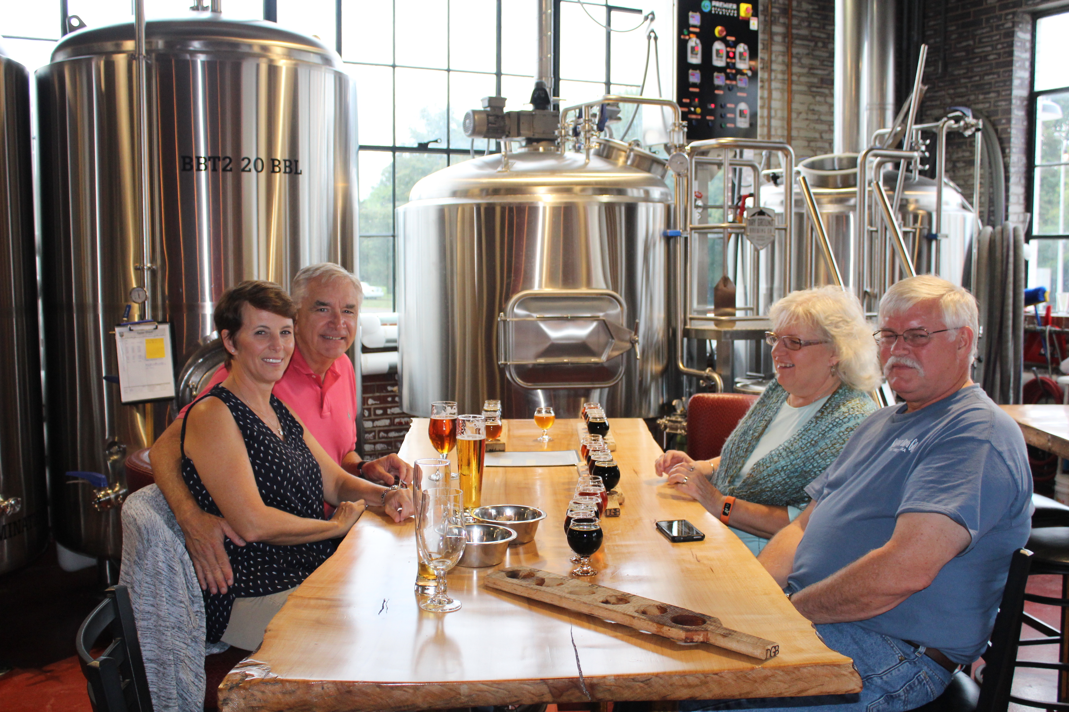
    Welcome aboard to Greg & Doreen, thanks for taking the time to follow the adventures of Still Waters II. It was also a blast cruising down the Mississippi River to Green Turtle Bay with you.  Have a great winter in Marathon, Florida!

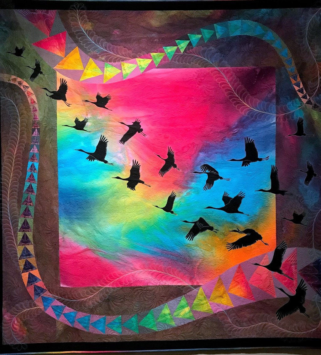
    The Birds, was one of the more colorful quilts in the National Quilt Museum.  If you look closely, each triangle has a bird sewn into the shape.

    20 Birds (2)

    Summary of week:

    Kentucky Lake

    The theme for this week has been falling temperatures.  The cool weather has chased the crew south.  For example, on Friday, St Louis had 3 inches of snow, the earliest snow accumulation on record.  The crew woke to frost on the ground in Clifton that morning with overnight lows in the 20’s.

    St Louis on November 9th, photo courtesy of Mike Fuller

    snow in St Louis

    The crew left Paducah on Monday with Gammel Dansk and cruised the flooded Ohio River to the Cumberland River.  They navigated the Barkley Lock and ended the day in the dark at Green Turtle Bay (1).

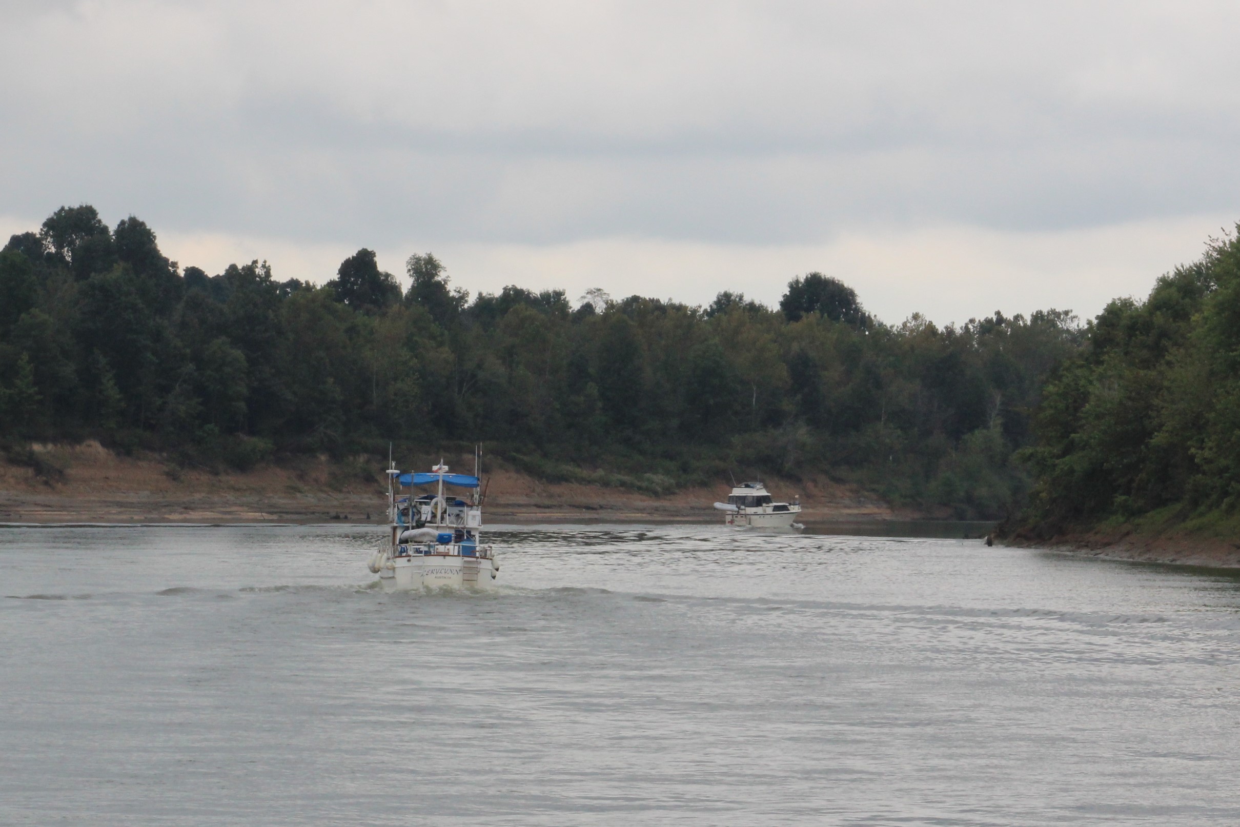
    The crew then buddy boated with two Nordic Tugs, the green hulled Gammel Dansk and the red hulled Chip Ahoy.  The three boat flotilla made four additional stops during the week to travel the length of Kentucky Lake, mostly in cold rainy conditions.

    2.  Paris Island State Park on Wednesday

    3.  Pebble Isle Marina on Thursday

    4.  Clifton Marina on Friday

    5.  Pickwick State Park on Saturday

    4 Gammel Dansk and Chip Ahoy

    Click here to read the day-to-day travel log. This includes weather report, sea conditions, captain’s log, a summary of the day’s experience, and a few pics of the route.
    The voyage of discovery did answer the following questions this week:

    At the Box Office

    This week’s video shows Still Waters II cruise along the Cumberland River as she makes way to the Barkley Lock. At the lock she joins a large tow in the lock for an interesting ride in the lock.  Enjoy!

    Barkley Lock from Still Waters II on Vimeo.

    To see past videos, click on the link to the Still Waters II Vimeo site.  The library contains videos of Still Waters II cruising America’s Great Loop.

    Sunday, November 4th

    The crew decided to go visit the National Quilt Museum today.  At first glance you might think this would be a total waste of time.  And if you have that thought, you would not be alone.  The skipper and Admiral both pondered the decision long and hard.  Matter of fact, in 2016, they skipped the Museum all together; however, they kept hearing good things about the Museum so they decided to take a look for themselves.  They were not disappointed.

    For starters, it is hard to call the material hanging on the walls quilts.  The people behind the quilt making have taken the art to a whole new level.  In fact the quilts look more like art than quilts.  The museum has a permanent collection of 601 quilts with only about 60 on display at any given time.  They rotate the quilts every 2-3 months.  Then there are two traveling exhibits on display also.

    The Lemur’s Tale

    The quilter took two years to complete this quilt.  The quilter commented, “To me this quilt represents not only the endangered species of this beautiful planet, but also how we all endanger our relationships with each other, this earth, and our creator.  Beauty results when we work through life’s challenges and don’t give up on it.”

    17

    The Wrath of Poseidon

    The quilter visited several body-building sites to get the physique just right.  The chest is from a wrestler, the legs are Michelangelo’s, and the flap at the end of the banner is sewn down – no peeking.

    12.1

    Spring of Desire

    This was inspired from the wedding tissue of the quilter’s great-great-grandmother.  She was married on April 16, 1829.

    15

    The Hobbit

    Can you find all the items in the quilt below?

    16.1

    16

    One of the travelling displays was a collection of quilts made from patterns that were printed in the Kansas City Star newspaper from 1928-1961.  One of these quilts had multiple squares with each square made by a different woman.  Each woman signed her particular square.  And look what the skipper found, a Margaret Fuller participated in the project.

    19

    Monday, November 5th

    After sitting for a few days on the dock, it was time to leave the safe confines of Paducah and strike out for Green Turtle Bay on Lake Barkley.  To get there, the crew would need to continue up the Ohio River for another 12 miles, then take the Cumberland River for 30 miles to the Barkley Lock.

    The mystery of the day would be how the lockage would go at the Barkley Lock.  A good experience and the crew would dock in daylight hours. A poor experience and they would be docking in the dark.  Unfortunately, the Kentucky Lock is currently closed, so all commercial tow traffic was also taking the Cumberland River route.  This would shrink the odds of a good lock experience.

    Once they got off the dock and headed up stream , it was obvious that the river was running harder due to the flooding.  They had the throttles set the same as when they arrived a few days ago, but now were only making 4.5 mph for a loss of 0.5 mph from Friday.

    The skipper began to wonder how the Ohio River flood of 2018 compared to other historical floods.  The Ohio River crested Sunday in Cincinnati at 60.53 feet.  However, this high level does not even make the top ten worst floods for the Ohio River.  The worst ever flooding you ask?  1937 with a crest in Cincinnati at 80 feet.

    The Admiral found a historical marker in Paducah that discussed the Ohio River flood of 1884. Turns out the 1884 flood was the second worst Ohio River flood with a crest of 71.1 feet in Cincinnati.  But more interesting than that was that Clara Barton, founder of the American Red Cross, led a flood recovery effort in 1884 from Pittsburgh to Cairo.  She was in Paducah on March 13, 1884 as part of the relief effort which turned out to be the first flood relief effort of the young  Red Cross.

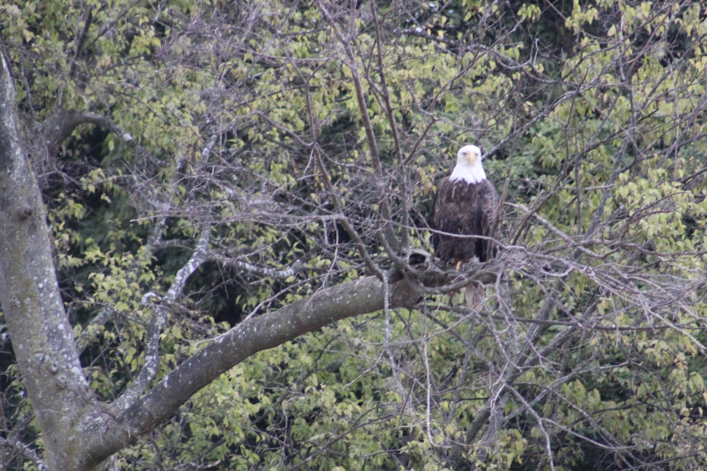
    The crew arrived on the Cumberland River at 0930 and headed for the Barkley Lock, 30 miles up stream.  Along the way they were met with  picturesque Cumberland color and numerous Bald Eagles resting in trees.

    8.1

    8 Cumberland Color

    8.2

    10.2

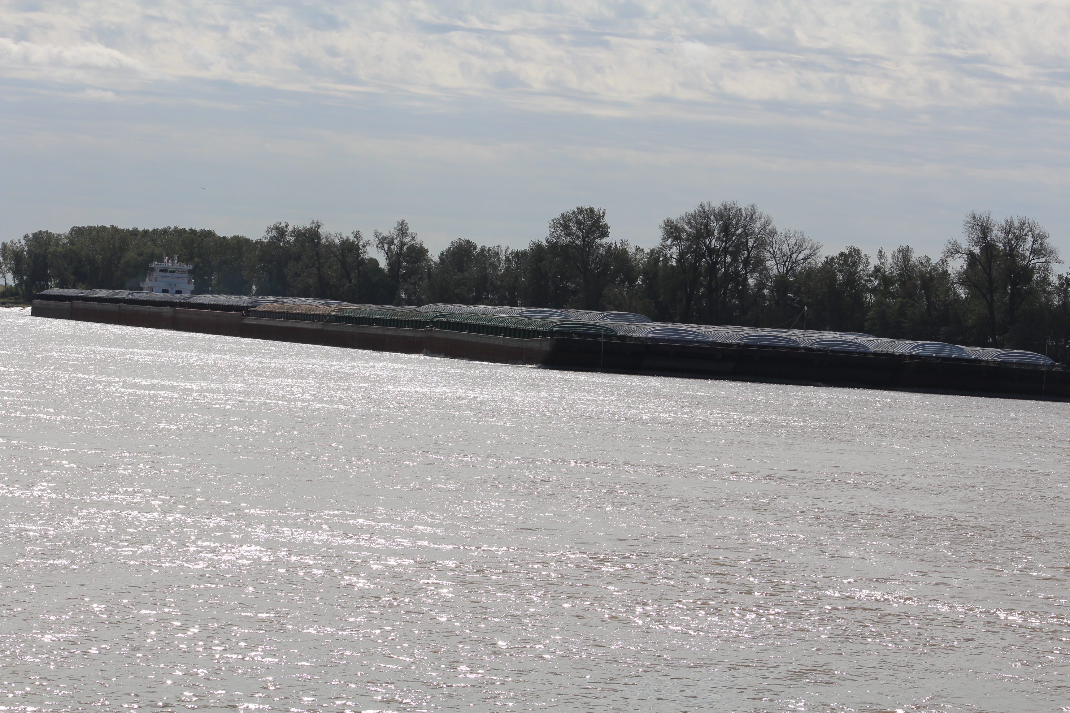
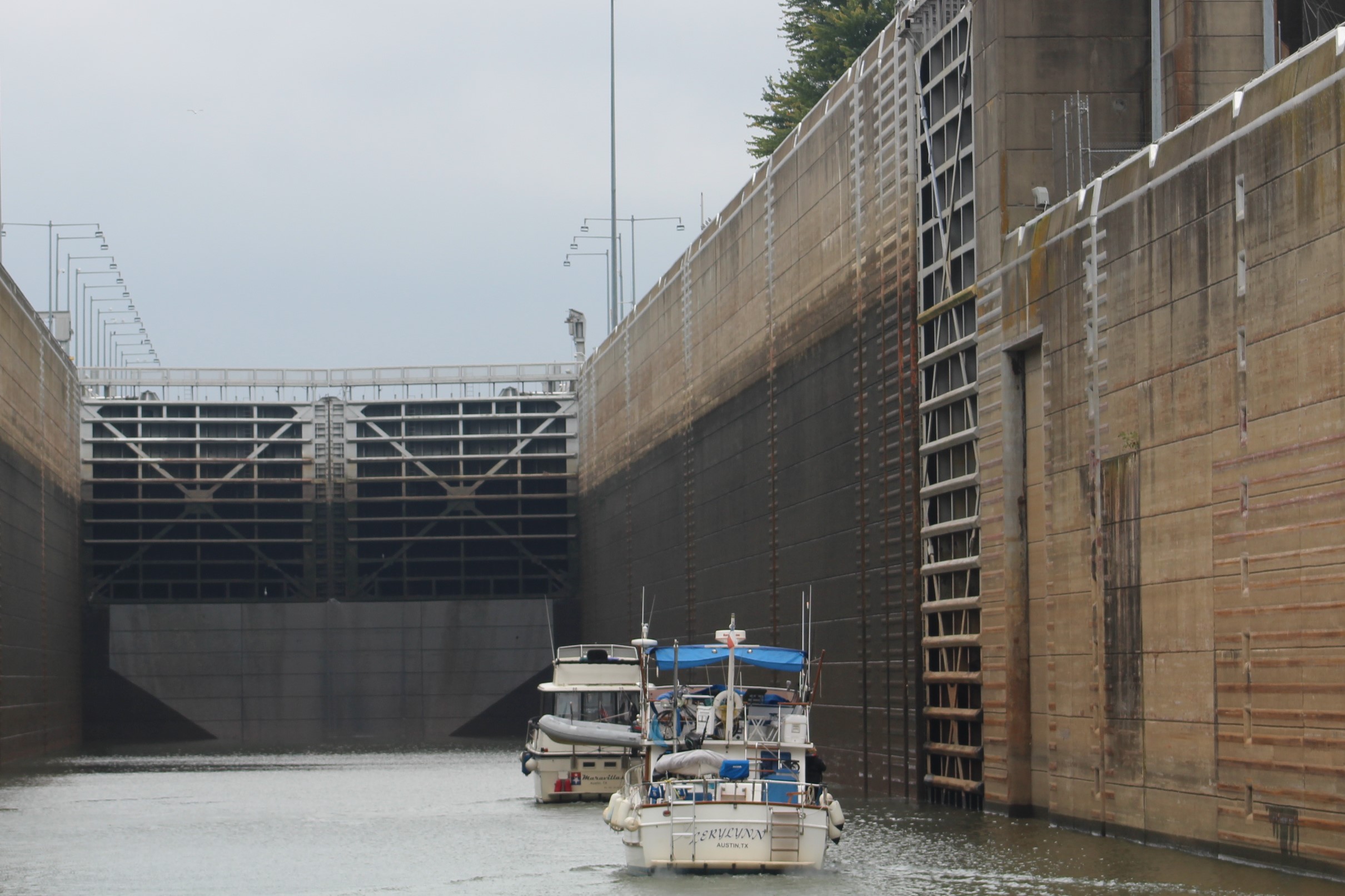
    As the crew approached within three miles of the Barkley Lock, they met a down bound tow pushing several barges.  This was not a good sign.  Twenty-five minutes later, when the crew arrived at the Barkley Lock they were told to move over to the port side of the river and monitor channel 12.  The lock master said he would get them thru as quick as he could.  An hour and a half later (1637), a tow entered the lock and the lock master directed the pleasure craft to enter the lock behind the tow.

    This will be a new experience for the crew.  They have never locked thru with a fully loaded tow before.

    11 Barlkley Lock

    11.1

    The gates behind Still Waters II closed at 1641 and it was a quick ten minute ride up in the lock.  The front gates began to swing open at 1651.  The skipper looked at the weather site and noticed that sunset was at 1652.  With 30 minutes of dusk before the darkness set in, it did not look good for docking with some light.

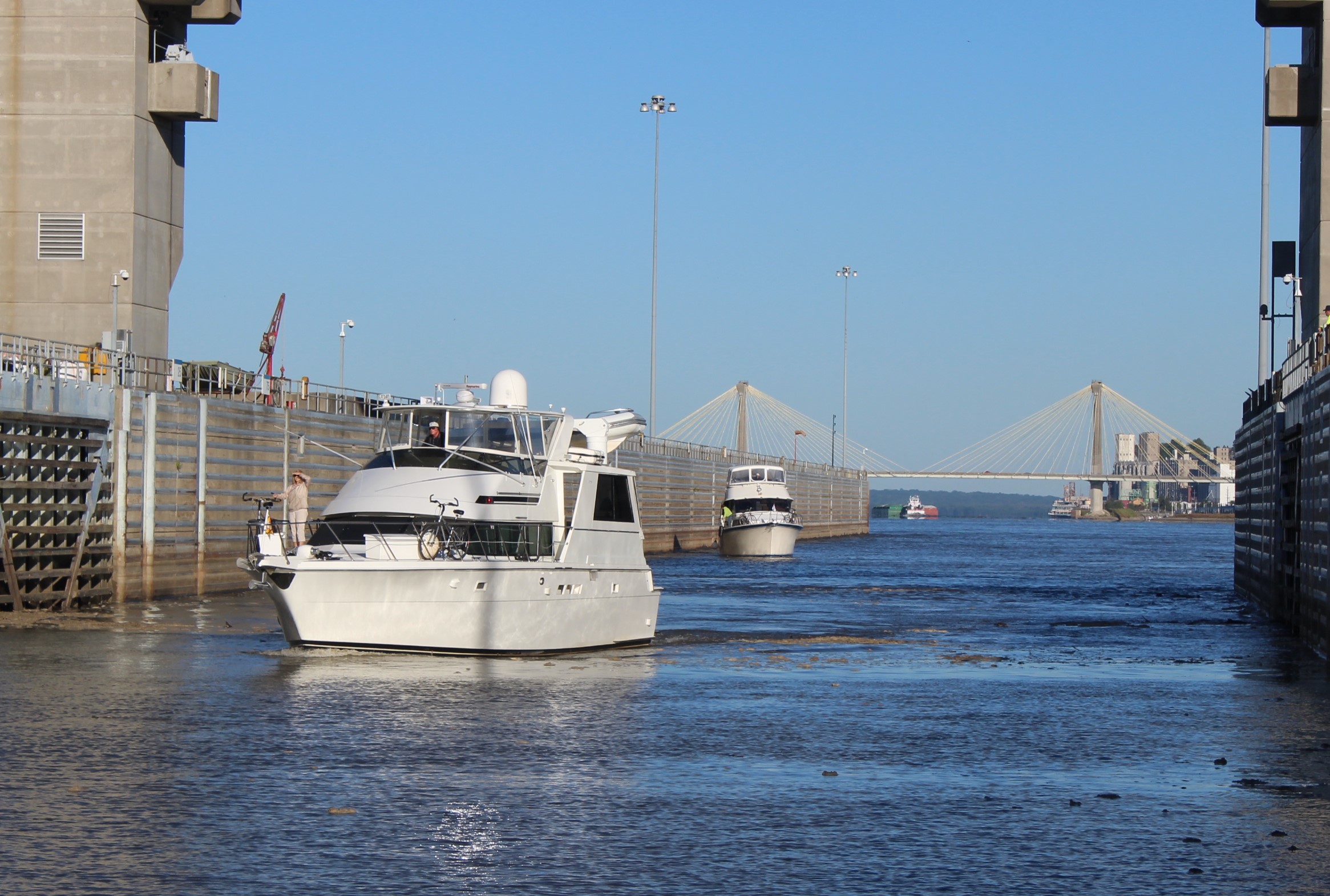
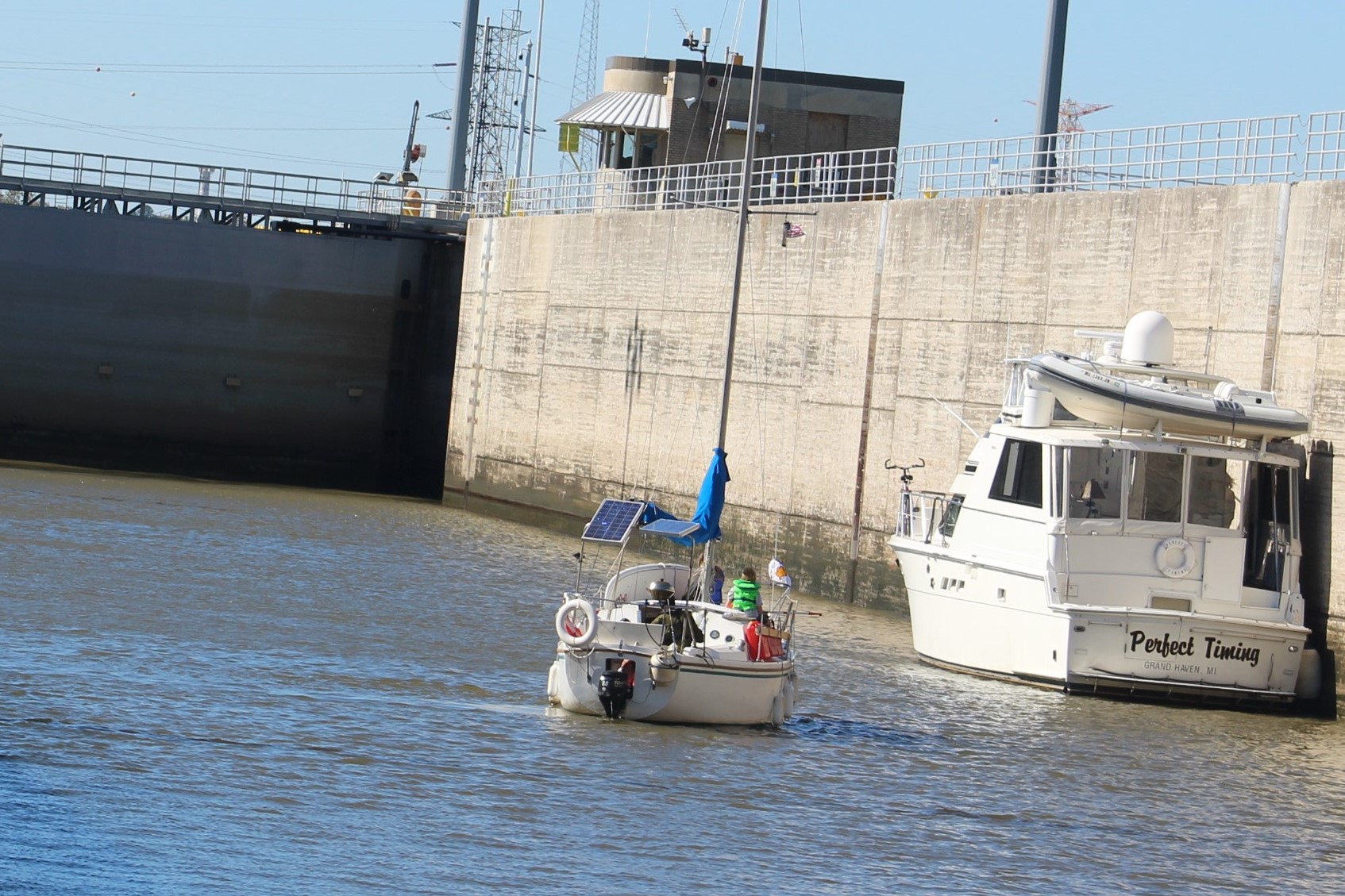
    Gammel Dansk floating up in Barkley Lock

    11.2

    Still Waters II in Barkley Lock

    11.7

    It took the big tow 10 minutes before she cleared the gate so the crew shoved of the lock wall and headed the last mile to the Green Turtle Bay Resort with Gammel Dansk following closely behind.

    11.3

    By the time they overtook the tow and arrived at the channel entrance to the marina, it was pitch black.  The entrance is a narrow tricky channel that requires an exact line to take from the main channel to the marina channel.  Then almost a 90 degree turn, and then thread a needle between a gap of land to enter the marina basin.

    18 GTB (2)

    Once in the basin, the crew had to snake around a few docks and past the fuel dock to land in their designated slip.  Did I mention it was pitch dark, and raining.  It was a harrowing 45 minutes before both Gammel Dansk and Still Waters II were docked.  Capt’n Dan of course took all this docking in the dark in stride and it did not seem to phase him one bit.  In fact, he told the skipper, “Welcome to my world.”

    In that 45 minutes, Still Waters II got out of the channel twice and found three feet of water, sounding the water level low alarm.  Then the skipper ran over something that rocked the boat pretty good as they tried to thread that needle between the gap in the land.  After thinking about it for a day or two, the skipper thinks he may have run up on the buoy marking the  channel entrance.  Luckily there appears to be no boat damage at this time.

    After getting thru the gap, the skipper positioned himself in the middle of the gap so that Gammel Dansk could aim at the boat and pass thru the gap with no issues.  Once both boats were in the marina basin they found the fuel dock and then eventually found their respective slips.

    Blurred Lines were waiting for them on the dock and helped get them both safely docked.  Then Blurred Lines invited both crews over for hot soup and cherry pies.  Thanks for making a crazy day end on a positive note.  Doreen and Greg are todays Great Loop heroes.

    I did over hear the Admiral tell the skipper she never wants to do that again.

    Tuesday, November 6th

    After that day yesterday, it was time to take a day to relax, catch up on a few boat projects, and get the laundry caught up.  Unfortunately for the Admiral, she had to use the marina laundry services.  The washing machine on board has died and is no longer serviceable.  The skipper has found a washing machine in Mobile that is small enough to fit thru the salon doors (23 inches) but large enough to be useful.  The skipper is really looking forward to that little project in a few weeks.

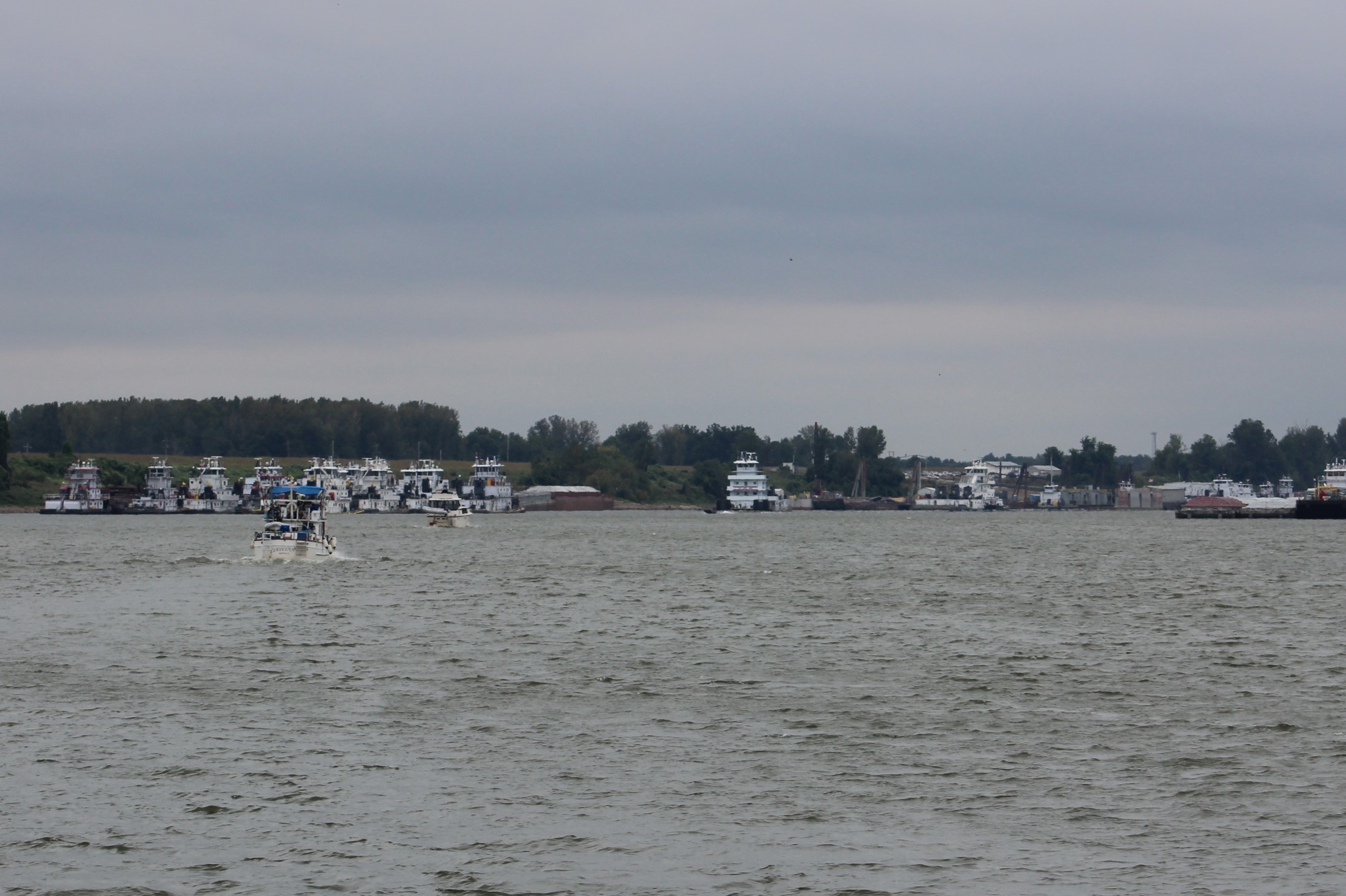
    Speaking of projects though, there are several Looper boats here at Green Turtle Bay getting some serious work done.  One boater is having to replace his engine because it can no longer build compression.

    Another boater has been here for a month replacing an engine due to catastrophic failure.  The first new engine was installed last week, but when tested it turned the wrong direction for a port main engine.  They started removing the new engine this week so he will likely be here another month.

    Then there is Bill, on a tug like Gammel Dansk who experienced transmission troubles.  His new transmission came from Turkey and finally got installed over the weekend.  He has been here for 56 days.

    Lastly, a boat left today that had engine problems that took 55 days to repair.

    After hearing all the war stories about blown engines, transmissions, and other repairs, the skipper is counting his lucky stars that he only has to swap out a washing machine.

    Wednesday, November 7th

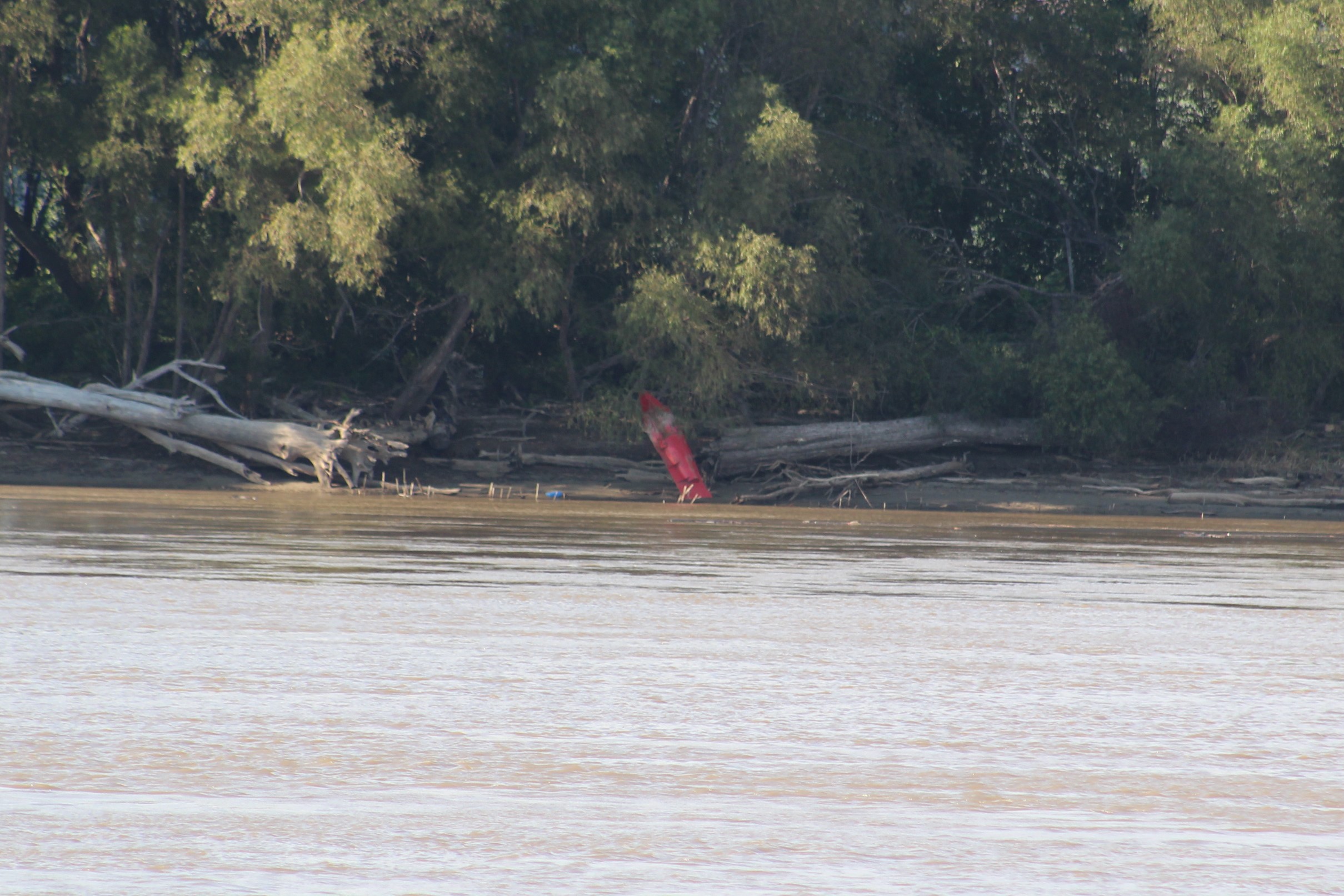
    The crew took time to eat breakfast at the café before setting out down Kentucky Lake.  When they left the marina he confirmed his hunch about running over a buoy, only it was a No Wake buoy rather than a channel marker.  That was good because those No Wake buoys are made of plastic rather than metal.  Hmmm, looks like the buoy is on its side rather than standing up.  I wonder what caused that?

    No Wake buoy that the skipper probably hit coming in Friday night in the dark

    1 Leaving GTB_LI

    While leaving the marina, a second Nordic Tug, Chip Ahoy, decided to join the crew for the run down to Paris Landing State Park.  Capt’n Dan made a comment that the two tugs needed to make sure they were on the proper side of the channel while they traveled so nobody miss took them for navigation aids since their boats are red and green.  Funny Dan.

    The Tennessee River continued to dazzle with a full display of fall colors.

    3 Tennessee Shore

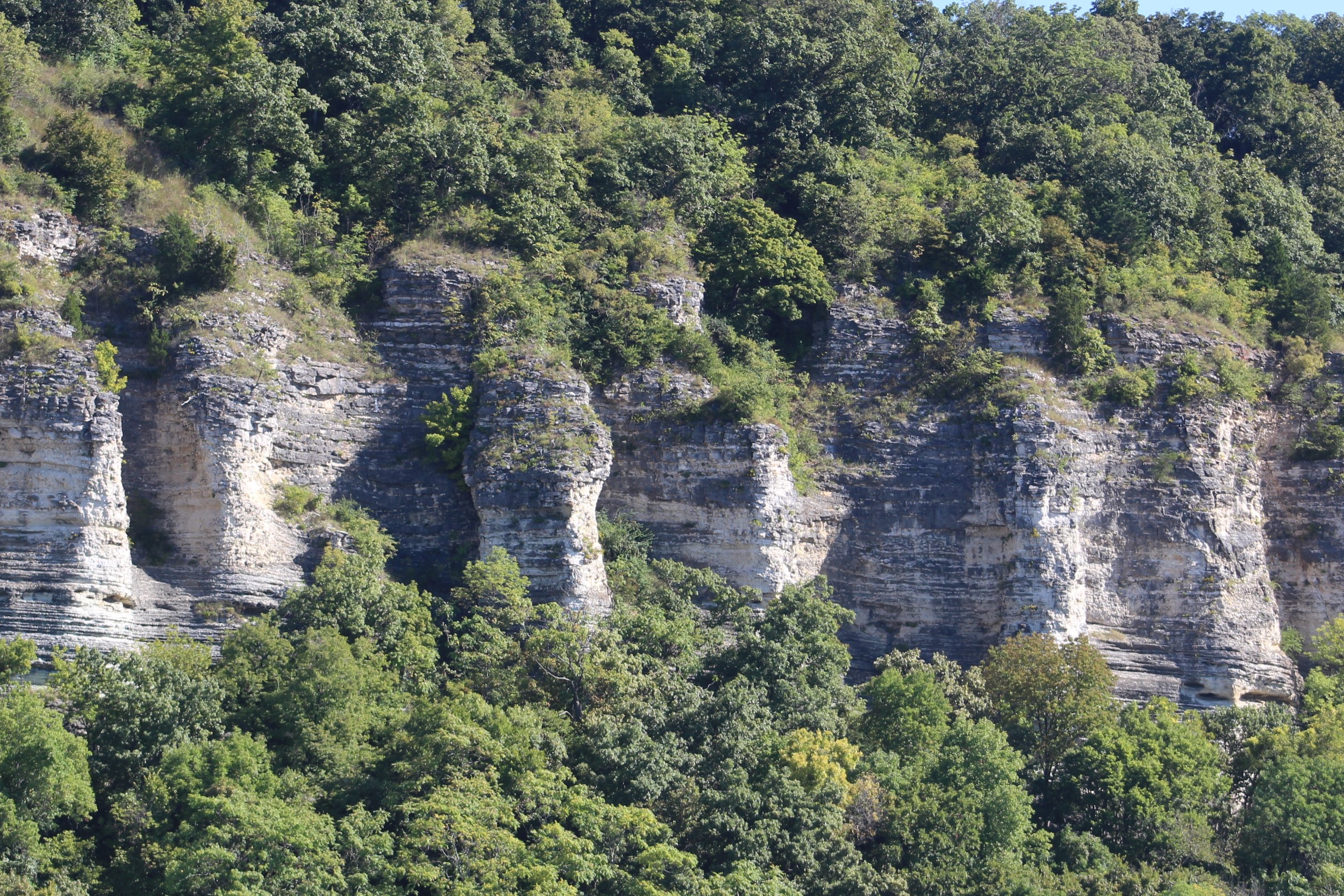
    The crew especially likes when a rock bluff is covered in color.

    3.2

    It was a fairly straight forward run down to the State Park.  Once docked, the crew took a stroll to see what they could discover in the park.  They headed towards the entrance to see if there was some sort of visitor center.  The crew discovered some cages, and upon further investigation found several  owls perched on limbs.

    Oscar was found on the ground as a baby and has been raised by humans his whole life.  

    6

    These Barred Owls were each missing an eye so would not survive in the wild.

    8

    Thursday, November 8th

    The crew left with an escort of two Nordic Tugs again.  There are not many marinas along this route so the crew will take what the river has to offer, and today the offer was a short run to Pebble Isle Marina near Paris, Tennessee.

    Just outside of town is a 70 foot replica of the Eiffel Tower.  
    21 Paris Eifel Tower

    Another discovery about Paris has to do with the skipper’s county of birth, Tarrant County.

    22 Edward_H._TarrantThe county was named after Edward H. Tarrant who fought in the War of 1812, was a member of the Militia’s of Kentucky, Tennessee, and Texas at various times.  He also gained fame as an Indian fighter in Texas.  In fact he led a battle in Arlington, Texas just a few miles from the skipper’s childhood home.  The battle has been commemorated with a Texas Historical Marker #5654:


    ‘Archeological excavations along the course of this Trinity River tributary have unearthed evidence of several prehistoric villages. Artifacts from the area date back almost 9,000 years and represent a culture of food-gatherers and hunters. In the 1830s the Creek served as a sanctuary for several Indian tribes who made frequent raids on frontier settlements. The conflict grew worse in 1841 when major attacks were reported in Fannin and Red River Counties. Brigadier General Edward H. Tarrant (1796-1858) of the Republic of Texas Militia led a company of volunteers in a punitive expedition against Indian villages in this area. On May 24, 1841, following brief skirmishes at several encampments, two scouting patrols were attacked near the mouth of the Creek and retreated to the main camp. Reportedly twelve Indians and one soldier, Captain John B. Denton, were killed. As result of the Battle of Village Creek, many tribes began moving west. Others were later removed under terms of the 1843 Treaty signed at Bird’s Fort (10 mi. NE) which opened the area to colonization. Much of the battle site is now located beneath the waters of Lake Arlington.’

    Like many before him, Tarrant was not born in Texas, but he got there just as soon as he could.  But before Texas, he lived in Paris, Tennessee.  Just one last odd observation and connection with this story, the skipper’s Dad was born on May 24th.

    Friday, November 9th

    It was early to rise and time to shove off the dock at first light.  The crew has a long day ahead to make the next marina which is 62 miles up stream.  The crew is marina hopping because the nighttime temperatures are too cold for overnight on the anchor.

    And yes, you read that correctly, up stream.   The Tennessee River forms on the east side of Knoxville and flows southwest into Alabama, where it then turns and heads northwest and becomes the largest tributary for the Ohio River.  The section that the crew is currently cruising is the section that runs northwest.  So even though the crew is mostly travelling south, they are travelling up bound on the Tennessee River.

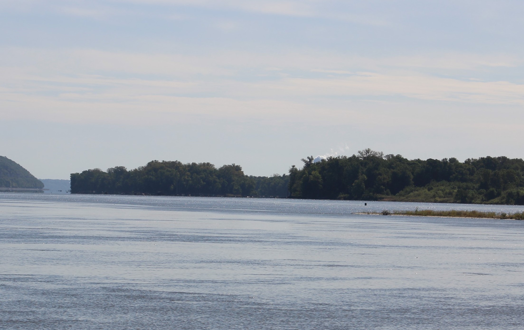
    The cruise today was sprinkled with rain for the first several hours.  Then it was sprinkled with some interesting rock formations, Bald Eagle sightings, and homes.

    The Rocks

    18.1

    18.3

    Bald Eagles

    15 Bald Eagle

    15.2

    Homes

    17 Lighthouse

    20 Home

    The crew stopped for the night at Clifton Marina.  While there, the skipper observed Tori work with Capt’n Dan and continues to be impressed by the dog.  Once landed, Tori led Dan ashore so she could relieve herself.  Upon their return, she took the same path back to Gammel Dansk, though alternate paths were available.  Later in the evening, the two crews shared a burger dinner in the café, and once again, Tori took Dan the same route and in the back door of the café.  When dinner was over, Dan headed for the front door.  Tori was having none of that and stood her ground.  When Dan reached the end of the leash he felt the tension.  Dan gave Tori a command but she ignored the command and responded by giving the taught leash a couple of tugs signaling Dan, “we are not going that way.”  Dan then headed back over towards Tori and she led them out the back door they had entered by and returned to the boat.  Makes the skipper wonder who really is on the leash, the dog or Dan?

    Saturday, November 10th

    The crew had one more long run to make today so it was up and out at first light again.  The first step on the dock for the skipper was a bit slick as he discovered a frost build up due to the overnight low temperatures.

    Prepping to leave at 0600

    23 Early Start from Cliifton

    The two Nordic Tugs would be challenged today to motor against the head current.  When the boats got back in the main channel it was obvious that the river was running harder than yesterday, speed over ground was down to 5.5 mph.  As the day progressed the speed just continued to drop while maintaining the same throttle speed.  As they approached the lock and dam at Pickwick the current really accelerated which caused the boats to move at a snails pace.  At one point the skipper commented that he could walk faster than they were moving over the water, to wit:

    1. Mile 203, speed 4.5 mph
    2. Mile 204, speed 3.3 mph
    3. Mile 205, speed 2.7 mph
    4. Mile 206, speed 2.3 mph………. arrive at Lock at mile 206.5

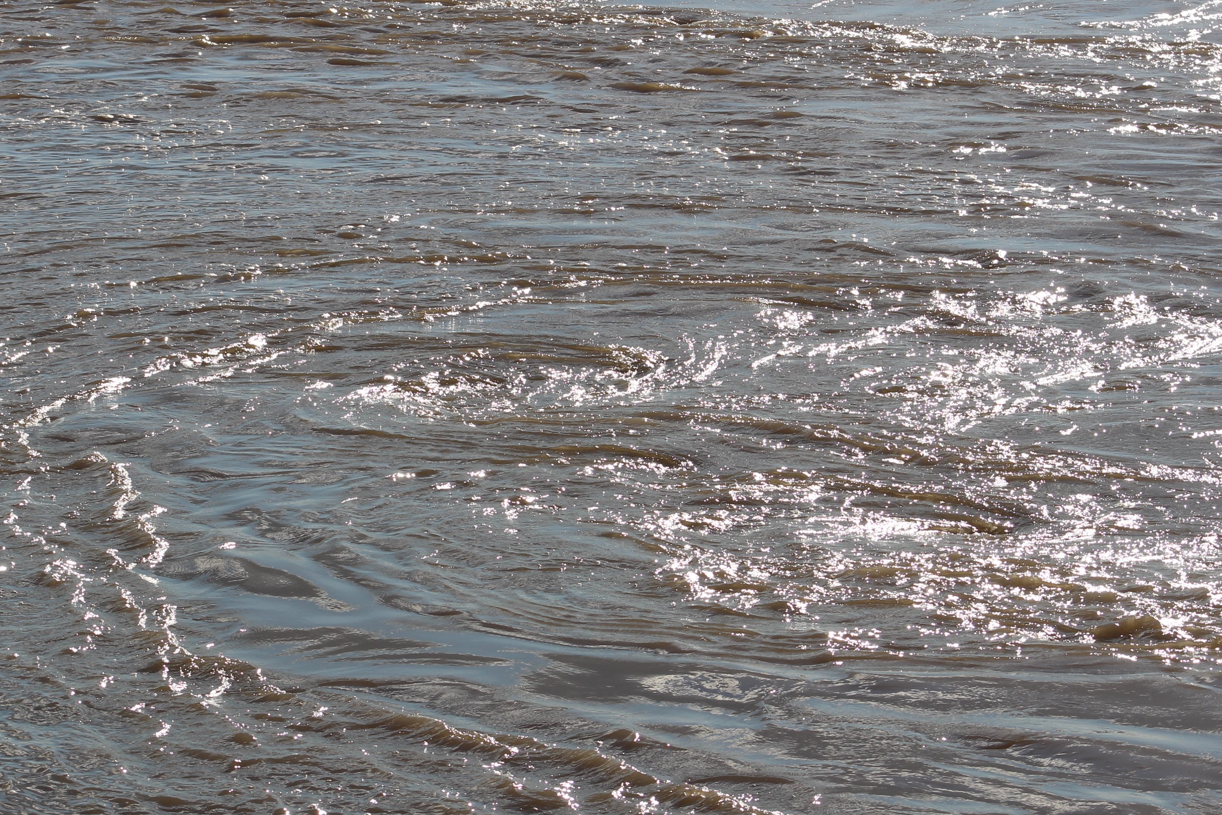
    The water being released at the Pickwick Dam, 91,000 standard cubic feet per second (scfs) 

    33 Pickwick Dam

    The skipper later learned that the water level behind the dam had continued to rise all day Friday while releasing water at 71,000 scfs, hence the increased flow rate that they saw on Saturday.  The skipper checked the lake level on Sunday and it continues to rise, so they have again raised the release rate to 94,000 scfs.  With all the rain, the lake authority has there hands full trying to reach the winter pool levels.

    Eventually, all three boats made it inside the lock where they got floated up on a bollard 43 feet.  When they came out of the lock it was too late to make Aqua Yacht Harbor in daylight, so they pulled into the Pickwick Landing State Park and called it a day.

    However, along the route today the crew did pass some interesting rock formations and historic sights.

    Swallow Bluff

    24 Swallow Bluff.JPG

    Chalk Bluff, that clay must be the inspiration for the orange color for the Tennessee Volunteers

    27 Chalk Bluff

    House above the Chalk Bluff

    27.2

    At mile 189, the crew passed by a home built in 1830, Cherry Mansion.  The home was originally built and presented as a wedding present to Sarah and her husband, W.H. Cherry.  The home was also General Grant’s Headquarters on April 6, 1862 when the southern forces attacked the union forces 10 mile upstream to begin the bloody battle of Shiloh.  It was estimated that 23,000 men lost their lives in the two day battle.

    Cherry Mansion

    30.2


    The Shiloh National Military Park runs along the banks of the Tennessee River for a little over a mile where some of the most deadly fighting took place on April 6 and 7, 1862.  The union forces fell back during the first day’s fighting to the area known as Pittsburgh Landing.  The confederates took a break from the fighting overnight which allowed the union troops to re-enforce their troops and launch a counter attack the next morning.  By the end of the second day of fighting both sides were exhausted.  The confederate troops retreated during the second night and the union troops choose not to pursue them, thus ending the battle.

    Pittsburgh Landing

    31 Pittsburgh Landing

    Boat Name of the Week

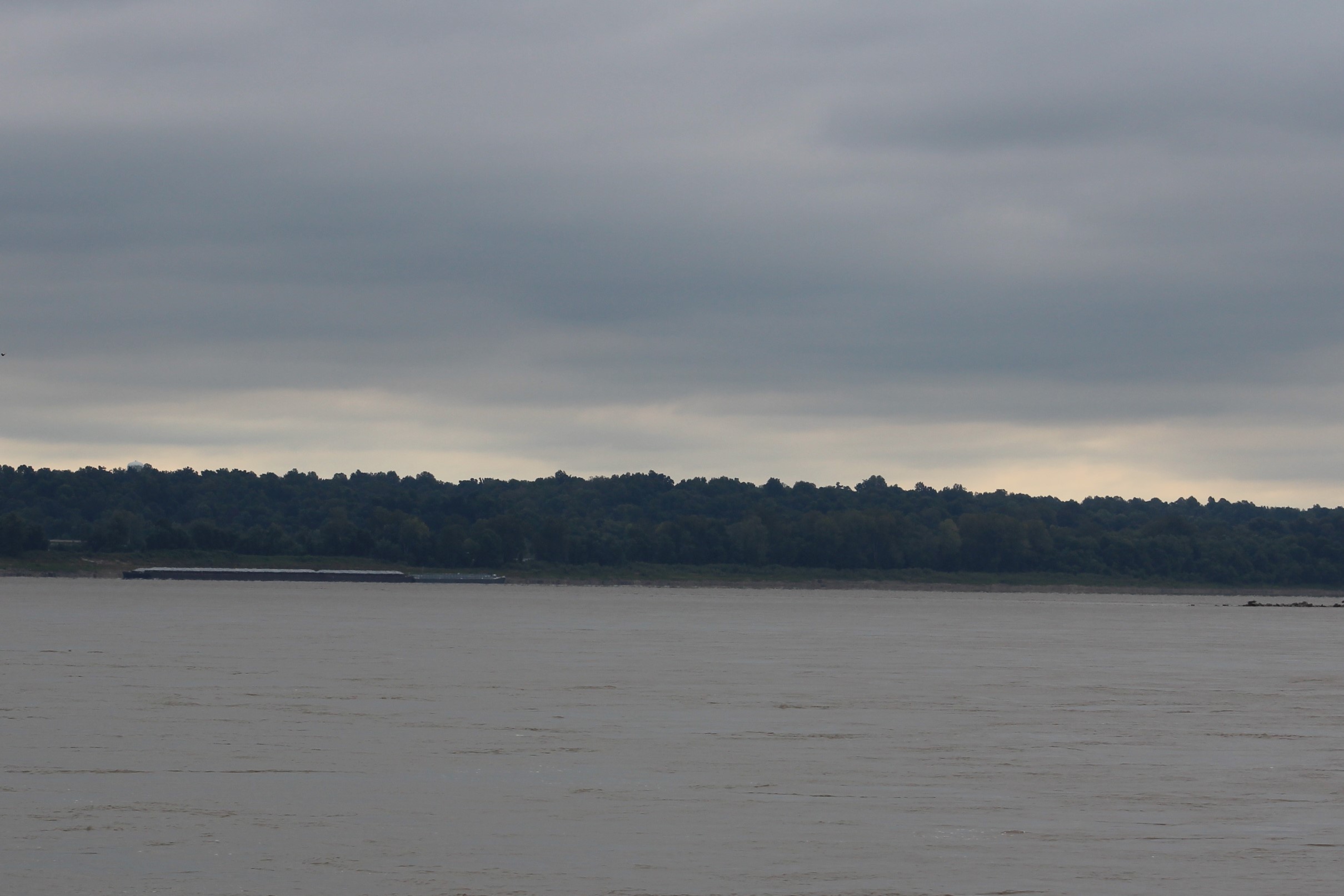
    Pat’s Summer Cottage is way too far north in cold weather to be a summer cottage.  These are Looper’s on their way to warmer weather in Florida.

    28 Pat's Summer Cottage

    Next Week –

    The crew will spend a few days at Aqua Yacht Harbor completing a few boat projects while they wait for some very cold weather to pass.  Cruising in 20 degree weather is not much fun so they will wait till Wednesday to set out down the Tenn-Tom Waterway.

    They will then travel three days down to Columbus where they hope to share turkey with the locals at the Columbus Marina.

    Loop On – Where the road ends, the water begins. The water goes on forever, and the adventure never ends.

    Eric the Red

  • T for Tennessee

    Hello virtual crew members and fellow adventures.  This week’s post is a tad late because the crew has been without any internet signal since the weekend.  These backwoods Tennessee folks apparently have no need for the internet.  For some reason though the skipper keeps saying, “Speed up, I think I hear banjo music.”

    La Salle here catching you up to date on the latest travels of Still Waters II. Click on this link to see the day- to-day travel log.

    The week saw our crew return to Green Turtle Bay on the Cumberland River.  Then set out up the Tennessee River.  They have only made it to mile 96 near New Johnsonville, Tennessee.

    IMG_0014.JPG
    Near New Johnsonville on Tennessee River


    A little about the Tennessee River since the crew will be on this river for several weeks:

    The river is the 7th largest in the US.

    The river is the largest tributary of the Ohio River.

    The river begins east of Knoxville, flows southwest and then turns north to flow into the Ohio River at Paducah, Kentucky.

    Water from east of the Smoky Mountains actually flows westward through the mountains to the Tennessee River rather than flowing east to the Atlantic Ocean.

    Then the river flows almost 200 miles north to the Ohio River rather than flowing westward straight over to the Mississippi River which is actually much closer.

    The area was first visited by the Spanish explorer Desoto in 1540.

    Me and my French brothers claimed this area for France when we claimed all the lands drained by the Mississippi River.  We finally sold all this land to you Americans to help fund our Napoleonic wars.

     Monday, October, 10, 2016

    The crew shoved off this morning to complete the two day journey back to Green Turtle Bay.  Since we have shared the history of this section of river already, I have decided to show the river and let the beauty speak for itself.


    80-mile-95
    Cumberland River ~ mile 95
    83-mil3-90
    Cumberland River ~mile 85
    98-mile-80
    Cumberland River ~ mile 75
    109-mile-75
    Cumberland River ~ mile 75
    110-mile-73-dry-creek-anchorage
    Dry Creek Cove ~ mile 70 Anchorage
    111-sunset-at-dry-creek
    Sunset across Cumberland River at Dry Creek Cove


    One observation of the day though was that the skipper noticed an unusual number of Grey Herons along the shore.  He decided he would count the number of Herons spotted for the next twenty five miles before the crew anchored.  He spotted 80 of the birds in those twenty five miles.


    Tuesday, October 11, 2016

    The crew weighed anchor and made their way back to Green Turtle Bay.  There were not as many Looper boats in the marina as when the crew left last week.  Most of the Loopers are trying to get south for the fall rendezvous event at Joe Wheeler State Park, which starts next week.

    Our crew is lagging behind to allow this surge of boaters to get to the state park so there will not be crowds at anchorages and marinas.  The crew is skipping the rendezvous because they only need to get from Joe Wheeler to Fort Myers to cross their wake and complete this journey.  The crew thinks they can figure out how to get to Fort Myers from here.

    112-mile-70
    Cumberland River ~ mile 70


    115-mile-65
    Cumberland River ~ mile 65, snags in the shallow water


    116- mile 60.JPG
    Cumberland River ~ mile 60, making the Devil’s Elbow turn


    117-mile-55
    Cumberland River / Barkley Lake ~ mile 55


    118-mile-50
    Barkley Lake ~ mile 50


    119-mile-45
    Barkley Lake ~ mile 45, notice the Pen in the background


    121- mile 35.JPG
    Barkley Lake ~ mile 35, marina just ahead


    Thursday, October 13, 2016

    The crew has buddied up with LyreLynn once again.  The two crews had breakfast and then set out for a short cruise to Duncan Bay on Kentucky Lake.  As the skipper exited the marina, a large barge was going by so the crew waited for the tow to pass.  Unfortunately, the tow was also headed into Kentucky Lake.  The crew followed the tow through the canal.  I think this could be the longest two miles ever travelled, 32 minutes.


    IMG_0002.JPG
    Barkley Canal


    After the crew entered Kentucky Lake, they headed south, up bound on the Tennessee River.  Along the right descending bank, there are five large bays off of the lake.  The crew anchored in the third one, Duncan Bay.

    IMG_0006.JPG
    Anchored in Duncan Bay on Kentucky Lake


    Friday, October 14, 2016

    The plan was to weigh anchor at 0800 and head out on a 64 mile cruise.  However, the starboard engine decided it would play hard to start.  After trying to start the engine, troubleshooting and finding nothing wrong, and failing to start again: the skipper decided to weigh anchor and proceed on the port engine only.

    IMG_0008.JPG
    Rock formations along Kentucky Lake


    After the anchor was secure and the crew was idling back to the main channel, the skipper reached over and turned the key on and pressed the start button for grins.  To his surprise the starboard engine immediately cranked and started.  Interesting, interesting indeed.

    IMG_0009.JPG
    Big rock on Kentucky Lake


    With both engines running the crew made their way up the Tennessee River to the Pebble Isla Marina.

    IMG_0019.JPG


    The other issue today would be the rainy weather.  It looked as though the storms might pass and the crew would be spared cruising in the rain.  However, as the crew continued south they eventually caught the storm.  The rain was more of a drizzle and only functioned to make it hard to see.  On a brighter note, as the crew was approaching the marina the drizzle stopped and the crew was able to dock without getting wet.

    IMG_0011.JPG
    The skipper has spent many a day vacationing in the rain


    A few interesting highlights on the way south:

    –          The crew entered Tennessee at about mile 62.6

    –          There was an old building left abandoned in the river at mile 78.  The building was flooded when the Kentucky Dam was built.  Authorities tried to remove the building but it was so well built that efforts to destroy it failed.  The final solution was to leave it standing.

    IMG_0012.JPG
    Abandoned Building in Lake


    –          The crew passed Pilot Knob just before entering the marina.  Early steamboat captains used the knob as a handy landmark while piloting the river.  However, the knob also oversaw the only battle in history where a Cavalry defeated a Navy.  Yes, you read that right, a Cavalry defeated a Navy.  The crew will go visit the State Park and museum tomorrow to get the details.  This should be a good story.

    IMG_0016.JPG
    Pilot Knob


    Saturday, October 15, 2016

    The skipper likes to say that the victors in battle get to write the history.  Seems that is what has happened when it comes to Sherman’s famous march across Georgia.  Turns out there was a reason he decided to have his army live off the land as they headed to Atlanta, and then on to the Atlantic Ocean.  His supply lines and supplies were destroyed on November 4, 1864 in Johnsonville, Tenn.

    The Union army had created a large depot in Johnsonville where supplies were shipped down the Ohio, Cumberland, Mississippi and Tennessee Rivers.  Then the Union army had built a rail system connected with the existing rails that supplied Nashville.

    A Confederate Plan was put into motion to destroy the Depot in Johnsonville.  Confederate General, Nathan Bedford Forrest started the action to destroy the supply lines on October 24, 1864.  He initially attacked the Union forces further north on the Tennessee River and then disappeared.  The Union forces thought that they had defeated General Forrest and went back to business as usual.

    Actually, the General was busy placing heavy artillery within 50 yards of Johnsonville.  A young officer working for the General noticed that the Union cannons placed above Johnsonville were located such that they would be unable to lower the cannon fire to the low bluffs along the opposite side of the river.  He also noticed that the iron clad ships were too low in the water to return fire to the bluffs.  After strategically setting 10 cannons along the bluffs, the General opened fire at 1300 on November 4th.

    IMG_0018.JPG

    By nightfall, 33 Union ships had been sunk, two trains destroyed, Sherman’s supplies worth 6 million dollars were burned to the ground, and 150 Union troops were captured.  Sherman had no choice but to live off the land because all his supplies were literally up in smoke.

    Sherman was quoted as saying, “That devil Forrest must be hunted down, even if it costs 10,000 men and bankrupts the Federal Treasury.”

    Another fun fact about Forrest, he mustered into the army as a private and ended the war as a Lieutenant General.  The only person ever to pull off such a rise in American military history.

    Next Week – The crew will continue their journey up the Tennessee River with a goal to reach Chattanooga by the weekend.


    Loop On – The water goes on forever and the adventure never ends.

    La Salle

    IMG_0017.JPG
    Lynn painted this portrait of Still Waters II while anchored in Duncan Bay


    Thanks Lynn!!!!!

  • Nashville Nights

    Hello virtual crew members and fellow adventures.

    La Salle here catching you up to date on the latest travels of Still Waters II. Click on this link to see the day- to-day travel log.

    I would also like to welcome the crew of Moon Shadow aboard as fellow adventurers and voyagers.  They are cruising the loop in a 1997 Mainship Trawler.  Welcome aboard and hope to meet you on the water!

    The week was spent making the 160 mile run up the Cumberland River to Nashville, Tennessee.  Then beginning the return trip to Green Turtle Bay by stopping in Clarksville.

    The Cumberland River may not be one of America’s, biggest rivers, but it certainly has had a big impact on the nation’s history.

    img_0008
    Shore line of the Cumberland River


    The navigable waters start at the Ohio River and run for 381 miles to the small town of Celina, TN.  The river actually carries on for another 350 miles past Celina.

    The Cumberland River first served as a passage way through the Appalachian Mountains and then as a stream of commerce.  In the years before the Civil War, there were 340 steamships that carried cargo and passengers up and down the river.

    After the war, 26 steamboats continued to run cargo and people on the river.  In 1887 a plan was developed to reduce the hazards on the river because of a few dangerous places that caused both loss of life and loss of ships.  Eventually 15 locks and dams were built to calm the river.  As modern ships replaced the steamships requiring both more depth and width in the locks, the old locks were replaced with four new locks and dams.  Two above and two below Nashville.

    Today, the river still is an industrial artery for the nation’s commerce, but it also provides hydro-electric power, flood control, and recreation for people such as our crew.

    Tuesday, October, 4, 2016

    The crew left Green Turtle Bay and headed out into Lake Barkley.  The crew will actually follow the old river channel in the lake up to mile 148 where they will encounter the next dam and lock.  Though the lake is 2 miles wide at this point, most of the water is extremely shallow out of the river channel.  The fall draw down of the lake water level has also begun.  The water looks to be about 3 feet below normal summer pool level.

    img_0001
    The Castle on the Cumberland

    The first major landmark along the river was the Kentucky State Penitentiary.  The main building was completed back in 1888.  Kentucky imported 30 Italian stonemasons to work on the building.  The building has the nickname of “The Castle on the Cumberland.”  So, if you would like to live in a castle, come to Kentucky and commit a major crime.  I am sure they would be glad to house you in their only maximum security prison.  But buyer beware, this place also holds the record for the most legal executions in one day, set back on Friday, July 13th, 1928, when seven men met sparky, the electric chair.


    img_0011
    White Pelicans enjoying a sand bar


    Finally, at about mile 70, the lake changed to look more like a river.  The area is referred to as the “Thousand Islands” due to all the sandbars that stick up out of the water.  Then just a mere four miles further, the crew entered Tennessee.

    img_0013
    The Volunteer State


    When the crew came around a bend in the river at mile 86, they noticed a battery of cannons pointed at them.  This was Fort Donelson, the site of the first major victory for the North in the Civil War, and the beginning of the end for the South.  The battle took place on February 14, 1862 and eventually resulted in the surrender of 13,000 Confederate Troops.

    img_0021

    The surrender took place on February 26, 1862 in the Dover Hotel. General Grant accepted the unconditional surrender of Confederate General Simon B. Buckner.  Interesting enough, this was the one and only unconditional surrender by a large army during the war.

    The crew soon passed  Dover on the river and then continued up-river to anchor for the night behind Dover Island.

    img_0023
    Dover Island Anchorage


    Wednesday, October, 5, 2016

    img_0024
    These guys passed the crew on Tuesday.  The crew found them working on Wednesday morning replacing navigational aids


    After weighing anchor in the morning, the crew cruised a more scenic peaceful river until a few large stacks dominated the horizon.  The 1,000 foot stacks belong to the TVA Cumberland steam plant.  When the construction crews were excavating the foundation of the plant they found evidence from a meteorite.  Scientist believe that a 20 mile wide meteor struck the earth in the vicinity.

    img_0025

    After passing through the town of Clarksville, the crew arrived at the Cheatam Lock and Dam.  After clearing the Lock, the river passed through a waterfowl refuge.  The crew saw many birds in this area.

    IMG_0029.JPG
    Entering Cheatam Lock for a 26 foot lift


    As the sun began to drop in the late afternoon the crew pulled up a mile into the Harpeth River to drop the anchor for the night.

    img_0033
    Tonight’s water view in the Harpeth River


    Thursday, October 6, 2016

    img_0034
    Travelling the Cumberland River in the fog


    The crew wanted to get an early start so that they would arrive around noon in Nashville.  But as boating is teaching the crew, their plans do not always take shape.  With the warm water and cool fall night, there was a heavy fog in the morning.  The crew waited until they had about a mile visibility before heading out of the Harpeth River and into the Cumberland River.  The idea of rounding a bend and finding a down bound tow did not seem worth the effort to travel in the fog.

    img_0036
    Better view without the fog


    Along the river from here to Nashville there were many freight terminals working with such materials as grain, gravel, cement, petroleum, coal, and scrap metal.

    img_0039
    Look closely.  That is a Bobcat attached to the bucket.  They put the Bobcat down in the barge to get every last little bit of material.  The crew passed by as they were pulling the Bobcat out of the barge.


    At mile 182 on the river the crew passed under the Andrew B. Gibson bridge for Tenn I55.  The parkway encircles Nashville at a radius of about 5 miles from downtown.  However, by boat it is another 10 miles to the downtown docks due to the winding and twisting of the Cumberland River.

    img_0041
    5 by land – 10 by river


    The first white men to come to this area were my fellow French Fur Traders, but James Robertson and John Donelson are the folks credited for starting the town of Nashville.  James Robertson led a group of men, boys, and livestock overland to the banks of the Cumberland from the Carolinas.  The men arrived on Christmas 1779 and began to build shelters.  John Donelson, who arrived in the spring of 1780, took the wives and children of the men on 30 boats on a 1,000 mile journey up the Tennessee River, Ohio River, and then the Cumberland River to the site on the west bank where the men had started to build a fort.

    img_0054
    Founding Father Statue


    The little fort was renamed Nashville in 1784.  In 1843, the state capital was moved from Knoxville to Nashville.  During the Civil War, Nashville’s strategic location on the river and railroad links to towns further south, made it a natural target for the North.  After Fort Donelson fell protecting the river route to town, Nashville fell to the North and remained occupied for the three remaining years of the war.

    img_0043
    The view from Still Waters II on the east shore


    After the war years, Nashville prospered.  By the 1920’s the town was linked to country music and by the 1950’s every major record label had offices in the city.  America’s longest running radio show, WSM’s Grand Ole Opry, started in one of these studios in 1925.  Moved to the Ryman Auditorium in 1941, and has been in its new home near the Opry Land Hotel since 1974.

    img_3165
    Larry Gatlin at the Ryman Auditorium


    img_3161

    Night Life in Nashville


    Friday, October 7, 2016

    This was a shore excursion day for the crew.  The skipper loves him some hamburgers, and there is a Five Guys Burger and Fries only 1.8 miles from the boat.  The Admiral and skipper set out on foot to enjoy a burger for lunch.  It had been back in June since they had a Five Guys Burger, and well, that is just too loooooong.

    After satisfying their burger craze, they headed over to Vanderbilt University to explore the campus.  The 330 acre campus is actually a national arboretum and features over 300 different species of trees and shrubs.

    img_0046
    The stone column is all that remains from the original main entrance to campus


    The crew then headed back towards the downtown area.  When they arrived at the visitor center, they ran into a policeman who came up and introduced himself. The officer asked where the crew was from and welcomed them to his fine city.  During the conversation, the skipper asked the officer where the best ice cream in town could be found.  Without hesitation, the officer said Mike’s and gave directions.

    The Admiral and skipper found Mike’, and both had the banana pudding ice cream.  It was delicious.

    img_0045
    Budding Artist at the Art Museum


    img_0044
    Cornerstone laid in 1830


    The crew wandered around town a little longer and then headed back to the boat to sit on the dock and listen to the country music flow across the river.

    img_0053
    The Admiral found this guy and wandered over for a closer look.  Wish the skipper would have caught her shock when the snowman moved


    Saturday, October 8, 2016

    The crew shoved off from the dock and headed back down river with the current with the goal of making Clarksville.  Though they made the marina before dark, it was with only about 30 minutes left of light for the day.

    img_0058
    The skipper spotted this flag on an up bound tow


    img_0059
    The tug’s home port is Houston, TX


    When the crew arrived at the Cheatam Lock and Dam, there was an up bound tow in the lock.  The tow was pushing a 3 x 5 set of barges.  The lock was not long enough to get all the barges through with one lift so the tow had to untie the barges and put them through in two chunks.  After the first set of barges were through the lock, they were made fast on the wall.

    img_0057
    The crew prefers to meet this size tug


    The tug then went down and retrieved the remaining barges and locked up.  Then the tug crew had to tie and make fast before the tow could clear the lock.

    Our crew arrived when the first set of barges were locked up and the tug was headed back down.  The crew dropped the anchor and waited two hours before the evolution was complete and the tow passed the crew.  After the tow passed, the lock master gave our crew the green light to enter the lock and make the 26 foot drop back down to the Barkley Lake level.

    img_0060
    Interesting engineering solution to a boat launch problem


    With 25 miles to travel to the marina it was a good thing the current was providing a nice push down river.  The crew arrived at 1800 with an 1820 sunset.

    Next Week – The crew will continue their return to Green Turtle Bay on the Cumberland.  They then plan to cross over into Kentucky Lake and continue the loop south on the Tennessee River.

    Loop On – The water goes on forever and the adventure never ends.

    La Salle

    In the 60’s, Six Flags Over Texas opened with the famed LaSalle River Adventure.  The skipper was a young boy when this park opened and his family visited every season.  I can recall watching the young skipper dive for the bottom of the boat every time we approached the cannon fire of the Spanish Fort.

    I was a bit surprised when Eric told me that our skipper was going to even try to cruise down the Mississippi River.  I took this assignment just to see if his fears of cannon fire had subsided.  I did get a good chuckle when the crew rounded that bend on the Cumberland and the skipper was facing the cannons.  I sure wish one of them would have fired.  You would find me still laughing at the skipper.

    Since we did make it safely down the Mississippi, I thought I would share the virtual ride back in the day.  Click on the link to take the river boat ride.  The cannon fire starts about three minutes into the video.  Enjoy.


  • Divine Appointment

    Hello virtual crew members and fellow adventures!

    La Salle here catching you up to date on the latest travels of Still Waters II. Click on this link to see the day – to – day travel log.

    The week was spent making the 300 mile run down the upper Mighty Muddy Mississippi River, from Alton, Illinois to Cairo.  From here the crew travelled up the Ohio River to the Cumberland River and eventually landed at Green Turtle Bay Marina in Grand Rivers, Kentucky.

    gtb

    Monday, September, 26, 2016

    The crew was informed at docktails on Saturday night that both Hoppies Marine Services and Green Turtle Bay Marina transient docks were full of Looper boats and that a 48 hour advanced reservation was required to get dock space.

    The skipper called Hoppies and sure enough the 300 foot of available dock space was full for Monday night.  The skipper made reservations for Tuesday.  To shorten the run on Tuesday, the crew decided to move 15 miles down river to Alton.

    img_0001
    Convergence of Illinois and Mississippi River’s.  Pic taken from the Illinois River.  The upper  Mississippi River is on the other side of the sliver of land to the right of pic.

    This is mile 0 on the Illinois River and mile 218 on the upper Mississippi River.  The boat got an extra 1 knot push after entering these waters.

    img_0004
    Cliffs on the left descending bank (LDB)

    Almost immediately after entering the upper Mississippi River these limestone cliffs appeared.  During the Marquette-Joliet Expedition in 1673, to determine if the Mississippi River actually made it to the Gulf of Mexico, the native Indians warned the explorers that there were dragons that guarded the path south.  When the expedition saw these cliffs, they also saw a dragon painted onto the cliff walls.  Marquette actually made a sketch of the dragon in his journal and wrote:

    “While Skirting some rocks, which by Their height and length inspired awe, We saw upon one of them two painted monsters which at first made Us afraid, and upon Which the boldest savages dare not Long rest their eyes. They are as large As a calf; they have Horns on their heads Like those of a deer, a horrible look, red eyes, a beard Like a tiger’s, a face somewhat like a man’s, a body Covered with scales, and so Long A tail that it winds all around the Body, passing above the head and going back between the legs, ending in a Fish’s tail. Green, red, and black are the three Colors composing the Picture. We have learned that the great-great-great-great-great-great grandfather of Miss Jessica Beetner smote this monster. Moreover, these 2 monsters are so well painted that we cannot believe that any savage is their author; for good painters in France would find it difficult to reach that place Conveniently to paint them. Here is approximately The shape of these monsters, As we have faithfully Copied It.”

    piasa-bird-alton-il
    Reproduction now on the cliff wall


    But with the rain of time the dragon has washed away.  However, the cliffs remain standing guard over the river.

    img_0007
    Statue in Portage des Sioux on right descending bank (RDB)

    In 1951 the town of Portage des Sioux was threatened for the very first time in its history with flooding.  Father Edward B. Schlattmann called upon his parish to start praying for protection from the flooding.  While other river communities indeed were swept up under the flood, the town of Portage remained mostly high and dry.  In gratitude, the parish erected this statue overlooking the river.  The 25 foot statue stands on a 20 foot pedestal.

    img_0009
    First tow encountered on the upper Mississippi River

    As the crew continued down bound they encountered this large tow moving up bound.  The tow has three barges across and is 5 barges long (3×5) for a total of 15 barges.  The skipper hailed the tow to determine which side to pass down.  The tow captain said on the ‘One” so the skipper steered to starboard and passed the tow port – to – port.


    img_0010
    The Clark Bridge between Illinois and Missouri

    After passing the tow the crew could see the Clark Bridge 5 miles down river.  The Alton marina is just on the other side of this bridge at mile 203.

    img_0011
    The red line running across the tank below the flag marks the high point of flooding in 1993

    After docking, the crew walked around Alton to see what the town was all about.  What they learned was that flooding is a major problem and threat here.  There have been three major floods, 1844, 1973, and 1993.  The 1993 was the worst with the flood waters 23 feet above the flood level of the river.

    Tuesday, September 27, 2016

    The crew got off to a good start today by making the Mel Price Lock with a minimal wait.  Once the crew secured the boat to the bollard the lock master informed the crew that they would wait for two other boats who were just passing under the bridge two miles upstream.

    img_0012
    Lock companions at the Mel Price Lock

    Just a few miles down stream the crew encountered the Missouri River pouring into the Mississippi River.

    img_0014
    Looking back up the Missouri River


    The Lewis and Clark Expedition, also known as the Corps of Discovery Expedition, started up this spot in May 1804 to explore the Missouri River all the way to its head waters and then onto the Pacific Ocean.  Many know the story of the expedition, but have you ever wondered what happened to them after the expedition was over?

    Clark went on to become the first governor of the newly created Missouri Territory in 1813, and held the position until the time that Missouri became a state in 1821.  He also held the position of Superintendent of Indian Affairs for the west.  He died in September 1838.

    However, his story is not near as interesting as the mystery of Lewis.  Following the expedition, Lewis fell into depression that then led him to heavy drinking.  In the midst of his depression, he was on his way to Washington to collect some debts the government still owed him from the expedition.  On the Natchez Trail, he stopped at Grinder’s Stand, about 70 miles from Nashville.  He was found the next day, October 11, 1809,  with two pistol shots, one to the chest and one to the head.  His money and horses were missing.  The officials ruled suicide brought on by depression.  Others believe it was murder so the government would not have to pay the legitimate travel expenses that Lewis was trying to collect.  So, did someone get away with murder?

    The next thing encountered by our crew was this large sign telling them to go to the left down the canal rather than the right down the rapids caused by the ‘Chain of Rocks.’

    img_0017
    To the right is un-navigable rapids


    img_0016
    Looking down the canal

    When the crew arrived at the end of the canal at Lock 27, they found a large tow in the lock and four boats waiting to lock through.

    img_0018
    Tow in Lock 27

    After the tow exited the Lock, six pleasure craft entered the lock to get dropped down 12 feet. The lock master allowed the Living Life sailboat to just float in the lock while all others tied off.

    img_0020
    Floating in Lock 27

    Five miles downstream the crew drifted by the Gateway Arch in St. Louis.

    IMG_0022.JPG

    The river traffic along the St. Louis banks was busy with barges and tows all around.  In fact, it was nearly 8 miles of barges on both banks before the crew finally broke free of the view and saw the trees again.

    IMG_0026.JPG
    Barges just anchored in the river

    But before the crew left the city of St. Louis, they did see some interesting yard art along the houses overlooking the river.


    img_0025
    Bottoms up

    The crew continued down river dodging water hazards.  With the river running at a couple of knots, these water hazards can do some serious damage to the boat.  Luckily for the crew, there are less hazards this week than last.


    IMG_0028.JPG
    Old tree = Water Hazard

    The crew arrived at Hoppies Marine Services in good time due to the current.  After docking the crew walked around town and had lunch at The Blue Owl.  The town was a pleasant surprise but the Blue Owl was a great surprise.  Excellent food at reasonable prices.  Fern, the owner of Hoppies, had recommended their apple pie.

    IMG_0032.JPG

    The apple pie is named Levee High Apple Pie.  The name comes from the famous 1993 flood.  The town would have been under water except the temporary sandbag levee held and protected the town.

    img_0033
    White sandbags and dirt can be seen at the end of the bridge on either side of the road leading into town

    The Blue Owl commemorated the near miss with the Levee High Apple Pie. Here is one slice of pie.

    img_0031

    The crew needed to get back to the dock so they could attend the briefing that Fern does for the boaters.  She discusses the down stream hazards, anchorages, and safety precautions to be used for the next 200 miles.

    img_0029
    Fern holding court and a cigarette

    Yes, that green hose is the fuel line for the diesel.  Court is held on the fuel dock.  And yes there are signs posted that say No Smoking.

    img_0030
    No Smoking sign – dead ahead

    The briefing was excellent and the information was priceless.  The crew is ready to anchor out the next three nights as they make their way to the next marina at Green Turtle Bay on Barkley Lake.

    Wednesday, September 28, 2016

    The crew shoved off the dock a little after daybreak this morning because they plan to have a long cruise today, 110 miles on the Mississippi River.  There are no locks in this section of river so running with the current the crew should make these miles easily.

    img_0034
    On the dock at Hoppies

    The scenery did not change much all day.  The Missouri side of the river continued to have high limestone bluffs standing guard over the river.  While the Illinois side was mostly flat tree lined shore.

    The big news today was the big tows that were passed.  One tow was six barges wide and seven barges deep, a new record for our crew.  The tow was pushing up river and the prop wash from behind the boat was huge.  Water was churning up over five feet from behind the tug.  This caused five foot waves which then bounced off Kthe shore and back into the river.  Then the waves collided with each other out in the middle and caused confused seas.  It took almost four miles before the waves calmed down and the river returned to normal flow.

    IMG_0037.JPG
    6×7 tow


    Another new hazard was introduced today also.  There are underwater dikes and /or wing dams that have been built along the shore of the river.  These funnel the water from the shore out into the center of the channel to prevent shore erosion.  At some locations where the bend in the river is narrow, these dikes cause small to large whirlpools.  Some underpowered boats like a sailboat can get caught in the swirling water and not have enough force to get out.

    IMG_0044.JPG
    Small whirlpool


    Still Waters II has enough horsepower not to get caught, but the swirling action of the water can spin the boat around if you are not careful.  The crew had to pass two of the more dangerous whirlpool areas on the run today.  It was very impressive to see the water funnel clouds spinning around in the water as the crew passed safely by.

    Then the last surprise is the number of navigational aids that are missing or are off station.  Fern warned of this yesterday in her briefing.  The skipper estimates that at least 25 % of the aids are missing.  To counter this, the crew is piloting the boat down the sailing line drawn on the electronic chart plotter.

    img_0043
    Red Marker on the shore


    But interesting enough, the crew did pass a cache of new navigational aides stacked over on the left descending bank today.  Maybe the Corps of Engineers is staging for a work party to put some of the markers back in place.

    img_0042
    Need to get these on station


    The crew made the 110 miles down river in 9 hours and anchored in the Little River Diversion channel off the main River about 1700.  They found Maravillas  and LeryLynn also anchored in the area.

    Thursday, September 29, 2016

    The crew got another early start and left the anchorage at day break with Maravillas and LeryLynn to make a three boat flotilla for this next section of river.  This next section is famous for long delays at two separate locks.

    The flotilla made good time making the Cairo Point Junction 50 miles down river by 1045.  Cairo is mile 0 of the upper Mississippi, mile 953 of the lower Mississippi, and mile 981 of the Ohio River.

    img_0047
    Cairo Point, Looking down the lower Mississippi River


    img_0051
    Cairo Point, Looking up the Ohio River


    The run on the Ohio River slowed the flotilla as the boats were going against the current.  It took a little over two hours to make the 17 miles to the Olmstead Lock.  This lock is under construction and is scheduled for operation in 2020.  For now, boats are escorted thru the lock chamber that is completed.  Because of the escort, it not uncommon for boats to wait several hours to get thru the lock.

    img_0056
    Tow headed into Olmstead Lock


    Our flotilla arrived just as a tow was beginning to make the passage thru the lock.  The lock master told the flotilla to fall in behind the tow and go thru the lock.  The flotilla took less than an hour to clear the lock.

    From here it was another 23 miles to the infamous Lock 52.  This Lock is old and in need of retirement.  The Olmstead Lock is being built to replace Lock 52.  The flotilla arrived at Lock 52 to find five pleasure craft anchored and waiting to go thru the lock.  There were 11 tows below the lock and 14 tows above the lock waiting their turn to pass thru the lock.  It takes a tow about an hour to enter, lock, and exit the area to allow the next tow into the lock.

    When the flotilla arrived at 1700, there was a down bound tow in the lock.  The lock master radioed the pleasure craft and informed the boaters that he was going to allow them passage thru the lock when the tow exited.

    img_0063
    Floating in Lock 52


    img_0065
    Exiting Lock 52


    After exiting the Lock, the flotilla had eight miles to go to the nearest spot to anchor.  The crew arrived in the dark and got the anchor down to complete a very successful 97 mile day with few delays.

    Friday, September 30, 2016

    With only 44 miles needed to go and one lock to Green Turtle Bay Marina, the flotilla decided to weigh anchor at 0800.  After an hour and half of cruising on the Ohio River, the flotilla entered the Cumberland River.

    img_0072
    On the Cumberland River

    The Bald Eagles were plentiful during the day.  The crew saw 14 eagles, many were soaring along the shoreline looking for breakfast.


    img_0069

    The flotilla arrived at the Barkley Lock about 1330.  As they approached the lock the lock master was lowering the water level in the lock and opening the gates to allow the boats to enter.

    img_0075
    Entering the Barkley Lock


    After the 57 feet rise in the lock, the flotilla entered Barkley Lake and headed to the Green Turtle Bay Marina.

    The last challenge would be finding dockage.  Because the run south went so much better than anticipated, the boats arrived a day ahead of their reservations.  The marina told the boats to come to the fuel dock and they would find a place to put the boats.

    Still Waters II was docked at the end of pier 5.  After a short shower, a rainbow appeared in the sky just above the boat.  A gentle reminder of God’s promise of protection while on this adventure of a lifetime.

    fullsizerender-1

    Saturday, October 1, 2016

    The morning started out as a day of recuperation for the crew as they rested after a few long days cruising the inland rivers.

    However, Al and Ruth Darelius keep their boat in Green Turtle Bay and also just happen to be spending a long weekend on their boat this wekend.

    They called our crew and invited them out to see and experience some of the local sites.  The crew happily accepted the invitation and set out on a fun afternoon of exploration.

    The first stop was the Kentucky Lake Lock and Dam.  After spending a few minutes marveling at the size of the dam and contemplating the flood waters that the dam protects from, the couples headed to Paducah, Kentucky.

    Paducah is located at the junction of the Ohio and Tennessee Rivers, near where the crew anchored out on Thursday night.  The town was actually laid out by none other than William Clark in 1827.

    As with most of the towns along these rivers, flooding is a constant danger.  The worst flooding in Paducah occurred back in 1937.  The Ohio River rose 10.8 feet above flood level, which is 50 feet above normal pool level.  The earth levees did not prevent the town from flooding  so the town spent three weeks under water waiting for the water to recede back into its banks.

    The Corps of Engineers has since built a flood wall to protect the town.  The flood wall has been painted with murals to highlight the history of the town.  A few samples of the murals:

    After admiring the murals the group took a trip over to the Ice Cream Factory to sample the local cream.  The skipper tried the peanut butter ice cream.  It was amazingly good.  It had a texture and taste of creamy peanut butter fudge.

    The Admiral tried the banana, Ruth tried the pumpkin, and Al sampled the coffee ice cream.  All reported that their ice cream flavor was good so it was time to cleanse the palette with a little homegrown Kentucky Moonshine.

    img_0090
    Still at The Moonshine Company Museum


    The best moonshine in these parts can be found at The Moonshine Company.  Cousin Billy, the master distiller, has ben perfecting his craft for 54 years.  He actually started running moonshine when he was 12.  He learned the craft from Uncle Mosey who supported the family through the Great Depression and prohibition by running moonshine.  It is even said that the gangster Al Capone sold Uncle Mosey’s moonshine back in the day.

    img_0087
    – family owned and run –


    The group sampled some 80, 90, and 102 proof moonshine and then tried some flavored mixed spirits.  All seemed to agree that the Sweet Apple Pie was the best.  The skipper bought a bottle of Lewis & Clark Ardent Spirits (the 102 proof stuff) and a bottle of Apple Pie Moonshine Mixer.

    The next stop was at the Dry Ground Brewing Company.

    The Brewery gets its name from the 1937 flood.  The town Coca-Cola bottling plant was submerged during the flood.  A Mr. Carson used an empty syrup keg to float out the second floor window of the bottling plant to reach a rescue boat.  Mr. Carson was heard saying, “If I ever reach DRY GROUND, it is there that I will build my new bottling plant.”

    Mr. Carson did open a new bottling plant back in 1939 on that DRY GROUND.  Now the DRY GROUND Brewing Company proudly occupies the building.

    Even though loopers all basically travel the same 6,000 miles around the great loop, each boater has a completely different and unique experience.  The uniqueness truly makes this an adventure of a lifetime.  The people who were about to unexpectedly cross the crews path will forever make the trip to Paducah forever memorable.

    Upon entry into the Brewery, Al directed the crew to take a seat at the bar.  As he was talking with the bar tender a man came up to Al and said hi. The man works in Atlanta and recognized Al from his time working in Atlanta.  Turns out he just happened to be visiting family in Paducah.  He just happened to be in the Brewery with his wife when our crew arrived.  It just so happened that the skipper was on a three week work trip with this same man back in 2012.  What are the chances that these three would all end up at the same place, at the same time, in Paducah, Kentucky?

    img_0092
    Debbie & Russ on the left – Ruth & AL on the right

    The three couples sat down and chatted for a while.  Debbie and Russ have been contemplating buying a boat and doing some cruising of their own.  It was great fun for the Admiral and skipper to share their stories and encourage the new potential boat buyers.  Debbie and Russ swung by the marina on Sunday morning to tour Still Waters II as they were headed out of town to Nashville.  This gave them a chance to look around and start their ‘must have’ list for a boat.

    After this little party broke up it was time to go find some food.  The Admiral had been wanting a good rib eye and the skipper had a hankering for a chicken fried steak.  Turns out there was a Texas Roadhouse nearby that could fulfill both cravings.

    After supper, it was time to head back to the marina, but Al had one more surprise.  Metropolis was nearby and since we were this close, we just HAD to go see Superman.  And yes, in downtown Demopolis, there is a huge statue honoring the home town boy who has turned into America’s Hero fighting for “Truth, Justice, and the American way.”

    img_0094

    It was a great day of shore excursions in and around Paducah, Kentucky.  Thanks to Al & Ruth for their hospitality.  And what a bonus to unexpectedly run into Debbie & Russ.

    Next Week – The crew plans a side trip on the Cumberland River to Nashville, Tennessee and return to Green Turtle Bay.

    Loop on – The water goes on forever and the adventure never ends.

    La Salle