Tag: Erie Canal

  • Who Do I Pay?

    Who Do I Pay?

    Hello virtual crew members and fellow adventurers!

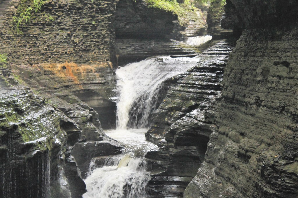
    One of the many waterfalls at Watkins Glen State Park

    51.8b

    Summary of week:

    Spencerport

    The crew moved around most everyday during the last week, though many of the moves were short distances:

    1. Sunday afternoon, the crew moved down to Sampson State Park on the east shore of Seneca Lake
    2. Monday, the crew made it down to the south end of Seneca Lake, where they visited the Watkins Glen State Park on Tuesday
    3. They returned to Seneca Falls on Wednesday, after a stop at Belhurst Castle for lunch on the western shore
    4. Newark was the stop on Thursday
    5. Followed by Fairport on Friday
    6. And they ended the week in Spencerport on Saturday

    Click here to read the day-to-day travel log. This includes weather report, sea conditions, captain’s log, a summary of the day’s experience, and a few pics of the route.

    The voyage of discovery did answer the following questions this week:

    1. When and where was the first road race in the United States following World War II?
    2. Who built the walkways and archways at the Watkins Glen State Park?
    3. Who designed Belhurst Castle?

    At the Box Office

    This week’s video shows Still Waters II as she works her way up the 19 Watkins Glen waterfalls.   Enjoy!

    To see past videos, click on the link to the Still Waters II Vimeo site.  The library contains videos of Still Waters II cruising America’s Great Loop.

    Sunday, July 15th

    The crew decided to put a few miles on the water after Church.  They headed towards Sampson State Park about a third of the way down Seneca Lake.  After they got docked another transient boat showed up and provided the evenings entertainment.  The couple on the boat were easily in their late 80’s.

    A few wood carvings along the Cayuga-Seneca Canal

    38

    40

    While trying to dock the boat, the man was pulling into the slip, stern first.  He could not turn around to see, so his wife was standing at the back of the boat providing the following information:

    Wife, “You are about to hit a post, YOU ARE ABOUT TO HIT A POST.  YOU HIT THE POST!!!”

    Husband, “Did I hit something?”  As he pulled forward.

    The skipper got off Still Waters II to see if he could lend a hand.  As the man started backing up again, he headed straight for the post, again.  The skipper was able to shove the 25 foot boat away from the post to prevent another collision.  The skipper then grabbed the handrail of the boat and help guide the boat back.  The skipper was looking for a line to tie the boat up with when he noticed they had no lines or fenders ready to deploy.  The skipper just held the boat for about ten minutes while the couple got some lines to tie down the boat.

    The view looking south down Seneca Lake

    42 Seneca Lake looking south

    Once the boat was all secure, the skipper noticed that the hailing port was Marathon, Florida, down in the Keys.  That got the skipper’s attention so he asked if they had brought the boat up from Florida.  The man responded’ “Sure did!  Put her on a trailer and drove her up here at 70 miles per hour.”

    The man grew up in Nova Scotia during the depression.  He said that he moved to the states when their potatoe crop came in but they were unable to get them to market.  Because of the Depression, there was no infrastructure to move the potatoes to the starving people in the cities.  He mentioned that his father moved the potatoes into the barn and they just walked away.  He said that was why they called it the Depression, because it was depressing.

    There are several more stories to tell that would make you laugh, but I will stop here.  The skipper and Admiral are just impressed that the couple are still going strong, good for them.

    Sunset from Sampson State Park, looking west across the lake

    43.2

    Monday, July 16th

    The crew set off this morning for the southern reach of Seneca Lake, and the village of Watkins Glen.  The dock master had asked that they arrive before noon so he could meet them and not be late to his doctors appointment.  The crew obliged and arrived about 1120.

    Bloomer Creek Vineyard on the east shore of Seneca Lake

    45 Bloomer Creek Vineyard- East Shore

    After getting secured in the marina, the crew walked around the Village.

    47.1

    One of the first things they noticed were the motor speedway plaques in the sidewalk.  The town has a Drivers Walk of Fame that was started back in 1993 to honor drivers who have competed at Watkins Glen.

    49.2

    Racing seems to be a big thing in town.  In fact, racing has been a big deal in town for a long time.  The first post-WWII road race in the United States took place here on October 2, 1948.  The 6.6 mile circuit ran through the existing roads in town with spectators watching from the sidewalks.  At the town Visitor Center, you can pick up a road map of the original course and drive the original circuit for yourself.

    Start Finish Line of the Watkins Glen road race

    49 Race Way

    A few murals in town about racing

    48 Race Mural

    48.1

    Another big attraction in town is the Watkins Glen State Park.  The park contains the Gorge Trail that runs along Glen Creek for 1.5 miles and 19 waterfalls.  The crew walked to the park entrance and looked around the Visitor Center and Gift Shop.  They plan to do the Gorge Trail in the morning when it will be cooler and less crowded.

    The crew found this Bear eating ice cream so they went inside to give it a try.

    50 Bear

    Tuesday, July 17th

    Well, it poured for most of the night, so the waterfalls should be running well today as the crew hikes the Gorge Trail.  This weeks video highlights the waterfalls, so here are just a few pics to encourage viewing of the video.

    51.3b

    51.6a

    51.8c

    The walkways, steps, trail, and archways in the above pics were all originally built by the Civilian Conservation Corps (CCC), which was a public work relief program for unemployed , unmarried men during the depression.  Like the falls, they have stood the test of time.

    There was a heavy rainfall back in 1935 that caused some serious flooding of the Gorge.   The water level rose nearly 80 feet through the canyon.  The locals claim that the water rose within five feet of the arched bridge in the below pic.

    51.3a

    After returning to the main entrance, the Admiral went in the Gift Shop to look around.  The skipper found a place in the shade to relax.  While waiting on the Admiral, he witnessed a real live ‘Who’s On First” episode.  But this time the confusion centered around the word ‘Park.’

    To set the stage for this conversation, one must understand that there is an $8 parking lot fee to park your car in the State Park parking lot.  Entrance to the State Park and hiking the 1.5 mile Gorge Trail is free.

    So, while the skipper was waiting on the Admiral, a man walked up to a volunteer and asked; ‘Where do I pay to get in the Park. The volunteer answered, “It is free to get in the Park.”  The man said, “No, I paid $8 to get in the Park yesterday at the other entrance.”

    The volunteer countered, “No you paid the attendant $8 to Park, but there is no entrance fee for the Park.  The Park is free.”

    Man, “No I paid $8 to get in the Park, where do I pay to get in the Park here?”

    Volunteer, “The Park is free.  But here, there is no attendant at the parking lot, so you put your money in that machine right over there (pointing at machine), you will get a Parking sticker, and you put it on the dash of your car.  Then you walk up there (pointing at the walkway up to the Gorge Trail) and go take the hike,….. it    is    free.”

    Man, “No I paid $8 to get in the Park yesterday.  Where do I pay today?”

    Believe it or not, this circular conversation went on for nearly 15 minutes.  Finally, the skipper could not take it any longer and asked the volunteer if he might assist him in providing the man an answer to his questions.  The exasperated volunteer said sure.

    The skipper looked at the man and said, “For the rest of this conversation, you are not allowed to use the word ‘Park’.  As this volunteer has been trying to explain to you, yesterday when you entered the area, you came to an attendant guarding the lot where people leave their cars.  You payed the lot attendant $8 to get a pass to leave your car in the lot.  You placed the $8 pass you bought on the dash of your car.  After you got out of your car, you walked around and did not pay anybody to see the sights, because it was free to look around. Today, you need to go to that machine over there and pay $8 to buy another pass to leave your car in the lot.  Then you can walk around here all day long and not pay anybody because walking the Gorge Trail is free.”

    About the time the skipper finished, a lady walked up and said, “Honey, I found a place to park the car for free, and I learned that the Park is free also.  Isn’t this place great!”  She grabbed his arm as she was walking by and headed up towards the waterfalls.

    I am not sure if the man ever got it, but the volunteer did thank the skipper for the intervention.

    After returning to the boat, the crew learned that there would be a free concert in the Park about three blocks away from the marina, starting at 1900.  The crew grabbed some chairs and enjoyed the music.  The band played a wide range of music: Texas Swing, Charlie Daniels, Merle Haggard, Beatles, Eagles, and some lesser knowns.

    Concert in the Park

    51.16 (2)


    Wednesday, July 18th

    When the crew first visited the Watkins Glen Visitor Center, they were told that the area is known for four things:

    1. Seneca Lake
    2. Original Road Racing Trail
    3. Waterfall Trail
    4. Wineries/wine trail

    The crew had experienced three out of four, so the skipper thought he would look for a winery that had a boat dock large enough for them to land and explore the winery.  After using Google Maps to search the lake shore line, he noticed that the only opportunity might be the Belhurst Castle.  The website for the winery did not mention the boat dock, but the skipper found a phone number and called.  The person on the other end of the phone did not know the depth of the water at the dock, so she put the skipper on ‘ignore’ to see if she could find the answer about the depth of water at the dock.  When she returned, she still did not have an answer to the depth question, but she did say people land on the dock all the time.

    Overhead view of Belhurst Castle grounds and the boat dock

    IMG_0671 (2)

    With that scant bit of info, the crew decided to give it a try, so they shoved off from Watkins Glen and headed towards Geneva to visit Belhurst Castle.  While the skipper was researching the Castle, he learned that the architect was Albert Fuller (1854-1934).  Turns out Albert designed many of the landmark buildings in Albany.  The castle is built in the ‘Richardsonian Romanesque’ style from the 11th century.

    52 Belhurst Castle

    Another interesting story the skipper unearthed was about a man named Henry Hall.  Henry arrived in the area in the 1830’s in a cloud of mystery.  He bought the property that Belhurst sits on today, but put the property in a Deed of Trust to an Isabella Robinson.

    He built a home on the property that the locals nicknamed Hermitage.  As you might gather, Henry was a bit of a recluse.  Upon his death the truth finally came out. Henry was actually William Henry Bucke.  In the early 1830’s, William was the treasurer for a London Opera House.  He emptied the coffers of the theater and started a new life in America.  Isabella was an Opera singer, who could have guessed?

    But back to our crew.  They arrived at the boat dock and made an approach to check the depth.  Of course the charts did not show the depth at the dock.  When they got within 10 yards of the dock the depth alarm went off (3 feet under props).  The water was clear and you could see the bottom.  It looked like mud, so the skipper inched the boat forward so the Admiral could get a line around a post.  (Depth now showing only 1 foot below the prop.)  The skipper made a high risk decision to go ahead and swing the stern of the boat around and land on the dock.  The depth hung in at 1 foot below the props as they landed safely.  They did kick up a large bit of mud in the water though.

    Still Waters II at Belhurst Castle dock

    52.2

    The crew headed up to Belhurst Castle to enjoy lunch and some wine tasting.

    Modern day addition to the Castle

    52.3

    After lunch, the crew made way back to Seneca Falls for the night.  While on the wall, the crew was surprised by a knock on the boat.  Mike and Jen arrived and the four spent the evening swapping stories.  Mike and Jen will cross their wake when they return to Milwaukee, after departing in the fall of 2016.

    Thursday, July 19th

    This was not a very long route day, but turned into a long day due to passing through eight locks.  They had an unusual long wait (40 minutes) at the Cayuga-Seneca Lock 1 due to the Canal workers moving a couple of barges.

    The train of equipment leaving C-S Lock 1

    53.1

    After passing through C-S Lock 1 the crew quickly arrived at the Canal Junction with the Erie Canal.  The crew turned to port and headed towards Buffalo.

    Canal Junction, back on the western Erie Canal, mile 201

    54 Canal Junction

    The locks are no longer the challenge on the western Erie Canal.  The new challenge is ensuring that the boat can safely pass under the multiple low bridges.  Todays stretch consisted of five bridges that were 16 feet or less.

    Approaching a high 17 foot bridge

    63 Low Bridge

    But today was only practice for tomorrow.  The crew will pass under the lowest bridge on the Erie Canal sometime tomorrow.  Hope they make it, because if not, they will be turning around and doing the Great U-Turn rather than the Great Loop.

    After seven hours of cruising, the crew pulled onto the wall at Newark.  The area is known for its many murals painted on bridges and buildings.

    Newark mural on bridge as you approach town

    65 Mural in Newark

    Friday, July 20th

    Today would be another day of five low bridges under 16 feet.  The skipper kept thinking of the old adage, $1K for every knot of speed to repair the boat if you hit something.  The last thing the skipper wants to do is tear the canvas enclosure off the flybridge on one of these low bridges.

    They practiced using the air draft tool several times as they approached the low bridges.  The Admiral would take the PVC pipe to the bow pulpit, and the skipper would slow to a crawl.  They would then pass under the bridge.  The 10 foot PVC pipe is 5 feet 8 inches above the water when sitting on the bow pulpit.  This gives a total height then of 15 feet 8 inches at the top of the PVC pole.  If the pole makes it under without hitting anything, then the boat will pass safely under the bridge.  The boat clearance is 15 feet with the radar dome taken down and sitting behind the skipper in the helm.

    On station at the bow pulpit as they approach a 16 foot bridge

    78 Air Draft

    The slow approach

    78.2

    And the moment of truth, they can make it under this one

    78.3

    Not sure what the skipper was worried about, he had at least 3 inches of clearance to the tip of the pole on that one above.  As with many things on the Loop, the lowest bridge turned out to be a non event.  The two railroad bridges before the ‘lowest bridge’ were actually lower than the ‘lowest bridge’.  The lowest bridge is advertised to be 15.6 feet at normal pool level.  The skipper asked the lock operator what the pool level was when they entered the pool with the lowest bridge.  The lock master said it was a half inch high.  So that should not make much difference for getting under the bridge.

    They finally arrived at the ‘lowest bridge’.  There was a home and dock just past the lowest bridge on the starboard side.  A lady was sitting on the dock watching as the crew approached and passed under the bridge.  After the crew slid under the bridge, she clapped and said, “Great Job.”  It would probably be fun to sit and chat with that women.  I bet she can tell a story or two about boats hitting that bridge.

    About 8 inches to the bridge from top of GPS, Clearance at the ‘lowest bridge’.  What was the skipper worried about again?

    78.4

    After they had that non-event behind them, they pulled into Fairport.  Most of the dock space was taken so the skipper was thinking about going on past the bridge to see if there was room west of the Lift Bridge.  The Bridge Operator radioed the skipper and told him he could stay down at the end of the wall in the reserved space because there would be no tows in town tonight.  The skipper said thanks and backed the boat down to the reserved spot.

    Fairport Main Street Lift Bridge

    81 Fairport Main St Lift Bridge

    The crew landed on the wall, but soon discovered that there was no power at this location.   The temperature was 90 and air conditioning sure would be nice if they could get some power.  The skipper walked the docks east of the lift bridge, but there was no spot with power there either.  While returning to the boat, he saw a dock master.  The skipper asked if they could tighten up three boats to make room for Still Waters II on the wall.  The dock master agreed and pulled the three boats closer together.  The hole on the wall was just big enough to land Still Waters II.  The dock master said he would hold the spot, but the skipper needed to hurry because possession is 9 tenths the law on the wall.

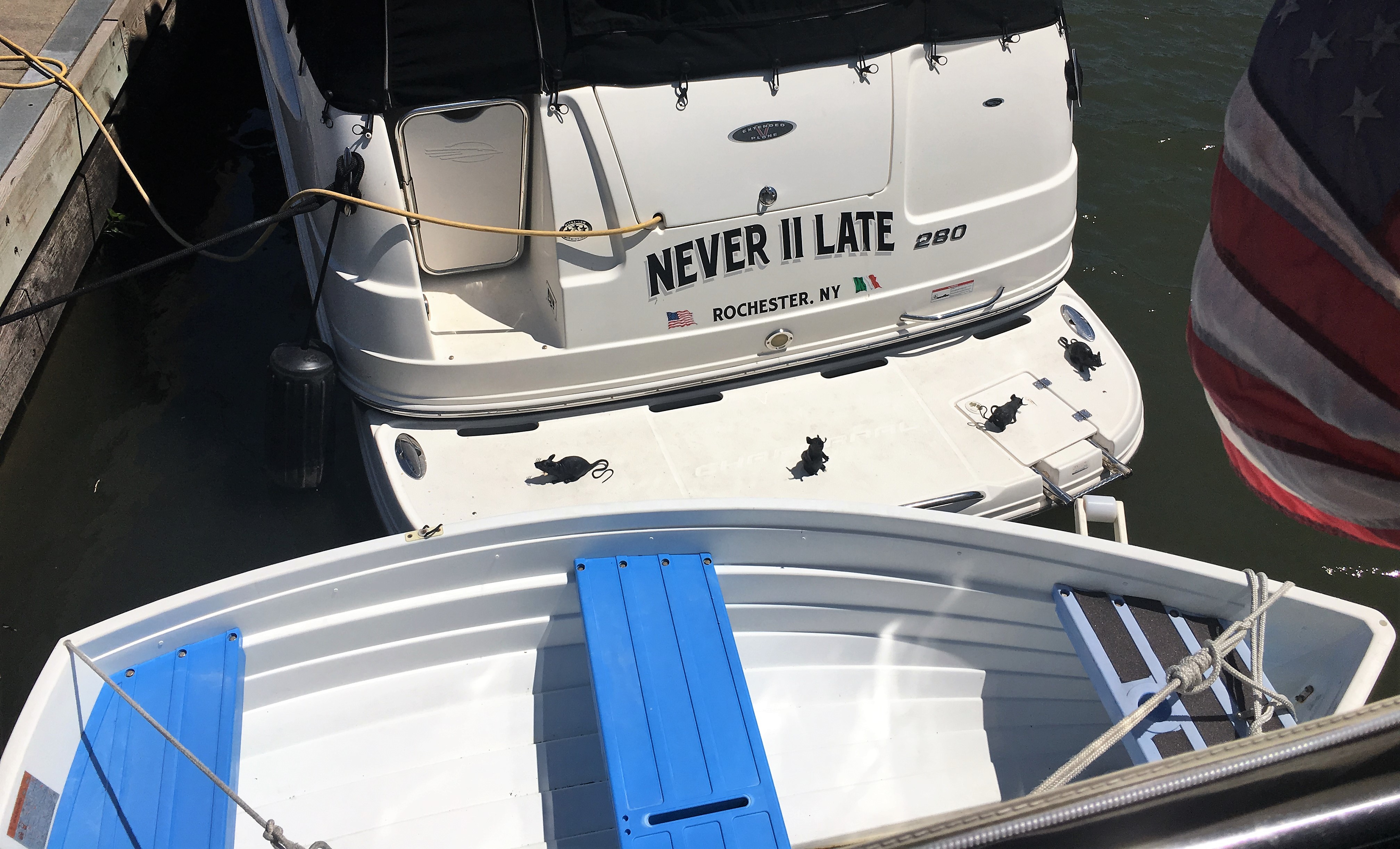
    The skipper fired up the engines and the crew moved the boat to the open spot.  It would be a tight fit, but the skipper managed to shoehorn the boat in the hole. The Admiral said her heart was pounding but looked up and saw that the skipper was as cool as a cucumber.  However, it was a tight squeeze.  Even the rats on the boat behind them were nervous and about to abandon ship.

    The stern gap

    80.4

    The bow gap

    80.5

    Saturday, July 21st

    Today the crew had two locks to rise up 50 feet and 5 more of those pesky 16 foot bridges.  The crew had no problems with those obstacles and enjoyed the cruise today.

    Much of the canal today had the Canal Bike Trail running along side where the old mule tow path used to be.  In fact, there were many places along the canal today that you could see the tow path on both sides of the canal.

    The flat area is the old tow path

    83 Tow Path along canal

    The mules had to pull the barges 362 miles from Buffalo to Albany back in the original canal days.  That would be a long hard walk.

    Mule in Village of Fairport

    80.2 Sal the mule

    While passing south of Rochester, there were many interesting arched briges across the canal.

    86.1

    Then the crew passed through a four mile area named the ‘Rock Cut.’  During the expansion of the canal in 1918, the canal was moved south of Rochester.  To accomplish this task, the builders had to cut through the solid rock in the area.  Hard to imagine cutting though this area with out the modern day earth moving equipment.

    The Rock Cut

    88 Rock Cut

    88.1

    The crew finally stopped in a village named Spencerport.  They will stay here through the weekend and head further west on Monday.

    The Admiral liked the flowers in the yard today

    90.1

    Next Week –

    The crew will move the 68 miles to Tonawanda over three days next week and complete the western Erie Canal.  They will stay a week there and visit the surrounding area, including Niagara Falls.  The grandkids and kids are also expected to arrive late next week, so it should be a fun week ahead.

    Loop On – Where the road ends, the water begins. The water goes on forever, and the adventure never ends.

    Eric the Red

  • It’s Not All Fun and Games

    It’s Not All Fun and Games

    Hello virtual crew members and fellow adventurers!

    So what do you do with spare pump casings and impellers you ask?  Well the Gould Pump Company of Seneca Falls sponsored this sculpture on the Ludovico Sculpture Trail.

    24.9

    Summary of Week:

    Seneca Falls

    The crew travelled four days last week making the following stops along the way:

    1 – Monday, they stayed on the Lock E20 wall near Marcy, NY

    2- Tuesday, they travelled to Winter Harbor Marina in Brewerton to get some work done on the boat

    3- Thursday, they officially entered the western Erie Canal and stopped at Baldwinsville for the night

    4- They then started a side trip to the Finger Lakes Region and stopped at Seneca Falls on Friday

    Click here to read the day-to-day travel log. This includes weather report, sea conditions, captain’s log, a summary of the day’s experience, and a few pics of the route.

    The voyage of discovery did answer the following questions this week:

    1. What is the highest point above sea level of the Erie Canal?
    2. When was the last time the Lock E23 power plant was used?
    3. When and where was the first Women’s Rights Convention held in the US?
    4. How did the Haudnosaunee Nation influence the Convention?
    5. What is the ‘bridge scene’ in A Wonderful Life based on?

    At the Box Office

    No new video this week, the skipper has been busy with other boat projects.

    To see past videos, click on the link to the Still Waters II Vimeo site.  The library contains videos of Still Waters II cruising America’s Great Loop.

    Monday, July 9th

    The Admiral was off to the Post Office to mail the youngest granddaughter her birthday gift. While she was off on her errand, the skipper pulled down to pump out the holding tanks.

    The forward holding tank vacuum pump has developed a leak and human waste has dripped into the forward bilge. After pumping the forward tank out, the skipper ran the hose through a window, through the salon, and down into the bilge and got that stuff out of the boat. (Probably a good thing the Admiral was not present to witness this activity.) He will have to repair or replace the pump upon arrival in Brewerton. Now there is a task to look forward to.

    When the crew shoved off the wall, there was another boat approaching.  The skipper allowed the other boat to pass and then fell in behind them and followed them to Lock E19.  When they arrived at the lock, they learned that Island Time had just entered the lock, so the crew would lock thru with two other boats this morning.

    Arrival at Lock 19, port gate was broken, lift up 21 feet

    46 Lock E19

    After exiting the lock, the trio of boats were off towards Lock E20, ten miles away.

    47

    The crew decided to pull off the canal at Utica for lunch.   The dock side restaurant was closed so the crew hiked about a mile into town and found a Denny’s open  After lunch they had one more lock to negotiate and then they stopped for the afternoon.

    Lock E20, letting out water, lift up 16 feet

    49.1

    After exiting Lock E20, the boat has climbed to 420 feet above sea level from New York Harbor. This is the high point on the Erie Canal.

    The crew stopped in front of Governor Roosevelt for the evening.

    50 Gov Roosevelt

    The skipper got the bikes off the boat and the crew rode the Canal Trail for a little exercise.  The Canal Trail could be an adventure in itself.  The Trail consists of just over 220 miles of paths along the canal.

    Tuesday, July 10th

    Today the crew had two locks to negotiate and then needed to get across the open waters of Lake Oneida before the afternoon winds picked up.  The morning was calm though and made for glass like conditions on the canal.

    Mirror reflection of bridge over canal

    52

    Arrival at Lock E21, step down 25 feet

    53 Lock 21

    There was a little excitement upon leaving Lock E21 though. The port main engine decided she would not start. The skipper had to leave the lock on the starboard engine which made getting off the lock wall a bit difficult.

    A virtual crew member, Scott, asked last week, how do you normally get off the lock wall?.  The short answer is that we shove off the wall to get some space (about 1-2 feet) then use the engines to move further off the wall and get underway.

    However, with only the starboard engine running, and the boat up against the lock wall on the port side, the skipper delicately bumped the starboard engine a few times to get some forward momentum while steering to starboard.  Once some water started to flow by the rudder, he was able to steer the boat to the center of the lock.

    After they exited the lock, the skipper went down in the engine room and checked the cables to the starter on the port engine. He managed to get about a half a flat turn on one nut. When he got back up in the helm, the port engine started right up.

    Passed this little canal work boat on the way to Lock E22.  Do you see the guy riding the tow?  If that tow line breaks, he is in the ‘line of fire.’

    54

    Safely in Lock E22

    55 Lock 22

    There were no issues exiting the second lock. The crew made way to Sylvian Beach and then into Lake Oneida. The lake runs east to west for about 20 miles and is not all that wide. The crossing of the Lake went well. The Lake was fairly calm except for the occasional boat wake, but the waves did build to one foot as the wind started to blow from the west. The crew exited the lake and entered Oneida River before conditions got to bumpy. They then docked at Winter Harbor Marina with about eight other Looper boats.

    Hopefully the marina has the breaker the boat needs to replace the failed Main Line 2 Breaker.

    Wednesday, July 11th

    Today the skipper had several projects to complete around the boat as well as have the marina replace the Main Line 2 Breaker.  The electrician found that the breaker had a loose connection that had arced and sparked.  The arc caused some of the breaker’s molded case to break off and also burnt some surrounding wires that will be replaced.

    The bad breaker and wire

    IMG_0001

    The skipper finally managed to get the radar dome down so that the air draft of the boat is now 15 feet. This will allow the crew to slide under a 15.5 foot bridge on the western Erie Canal. He also built a measuring device to put out on the bow to verify they can clear the bridge. We shall see how it works in a week or so.

    The skipper also replaced that forward head vacuum pump. Let’s just say that was the nastiest job completed on the boat to date. Where is Mike Rowe when you need him?

    With the projects around the boat complete, the crew took a courtesy car to town and bought a few provisions for the next leg of the journey, The Cayuga-Seneca Canal.

    Thursday, July 12th

    After topping off the fuel tanks, the crew initially headed towards Syracuse where they had planned to visit the Erie Canal Museum.  After a few miles they arrived at Lock E23. The lock master made them wait for a second boat because the first lock on the Oswego Canal had a problem with the 7 foot lift bridge. They are having to manually open the bridge.  The crew mentioned that they were not going to Oswego, but they got to wait for the second boat anyway. While waiting the crew did learn some interesting things about Lock E23.

    Lock E23, step down 7 feet

    1 Lock E23
    This lock is the busiest lock in the entire system because of its proximity to the eastern Erie, western Erie, and Oswego Canal Junction. The lock master said he locks about 100 boats on a Saturday. On July 4th, he said he locked 132 boats.

    Power House for Lock E23

    1.1 Power Plant

    Another interesting feature of this lock is that its original power house is still onsite and available.  The generator is maintained and ready to supply power if required as a back-up. However, the lock master said they had not fired up the power plant since the Northeast Blackout of 2003.  There were four boats trapped in the lock when the power went out in 2003, so they started the power plant up to operate the lock equipment and let the boaters out of the lock.

    Looking out of Lock E23

    1.2 View Looking down

    The crew soon arrived at the Canal Junction and officially entered the Western Erie Canal.

    Canal Junction

    2 Canal Junction

    They were not on the western Erie Canal long though, the skipper diverted toward Syracuse across Lake Onondaga. However, when they arrived at the entrance canal to Syracuse a RR Bridge, which shows to be 17 feet on the charts, turned out to be less than 15 feet. The crew could not get under the bridge so they headed back to the Erie Canal and decided to stop at Lock E24.

    Nope, not getting under that bridge

    4.3

    While making way to Lock E24, the crew saw several swans.  Including one cygnet, or baby swan.

    4.2

    5

    Upon arrival at Lock E24, the Admiral spotted a Cake and Ice Cream store.  They agreed that they would make that the first stop while exploring the town of Baldwinsville.  A little historical tidbit, Lock E24 was the first lock completed during the modern Barge Canal era of the Erie Canal.  The lock opened May 9, 1910, almost eight years ahead of the canal completion.

    Lock E24, Lift 11 feet

    6 Lock E24

    After clearing the lock, the crew found a spot along the upper lock wall to moor for the night.  The skipper did find the ice cream store.  He bought a big kahuna, two peanut butter cookies sandwiching vanilla ice cream.

    6.2

    Friday, July 13th

    With the crew unable to make Syracuse, and the unscheduled stop at Lock E24 in Baldwinsville, the skipper had to recalculate the next few days moves.  He has decided to head to Seneca Falls for the weekend.  The crew headed down the western Erie Canal to the Canal Junction with the Cayuga-Seneca Canal at mile 201.

    A few sights on the western Erie Canal

    10

    11

    One surprise caught the crew a bit off guard.  However, it did give the crew a chance to use their new air draft tool for getting under low bridges.  The skipper was approaching a 17 foot bridge, which should have been no problem.  However, he noticed a bunch of cables dangling below the bridge.  As they approached closer, he could tell there were people on a platform working under the bridge.

    12 Men at Work

    The skipper slowed to a near stop, had the Admiral go raise the air draft tool, and then proceeded slowly towards the bridge.  Turned out the crew still had a foot of clearance to the dangling cables below the bridge.  The skipper did notice that the work platform the guys were working on was really an extension ladder.

    12.1 A few more miles down the canal, the crew crossed the remains of the Montezuma Aqueduct.  The Aqueduct was built back in the 1862 expansion when the canal designers were having issues with the canal crossing the Seneca River.  The solution was to build this 900 foot long Aqueduct over the Seneca River.

    Aqueduct remains

    17 Aquaduct

    Just a few more miles and the crew reached the Canal Junction with the Cayuga-Seneca Canal.  The crew headed south (left) to start their side trip into the Finger Lakes Region of New York.

    Canal Junction

    18 C_S Canal Junction

    18.2

    The crew traveled along the Montezuma Wildlife Refuge where they saw many birds and a deer along the bank.

    Osprey Nest

    20 Osprey

    Bald Eagle in flight

    16 Bald Eagle

    The crew then arrived at Lock CS1 which raised the boat 7 feet to be the same level as Lake Cayuga.  The crew made a right turn upon exiting the lock and headed towards Seneca Falls where they would encounter Locks CS2 and 3.

    Lock CS1, lift 7 feet

    21 Lock CS 1

    Locks CS2 and 3, combined lift of 49 feet

    22 Lock CS 2

    23 Lock CS 3

    The first sight of Seneca Falls is this Episcopal Church along the Canal front.

    29.1

    After making the bend, the crew saw the village walls and found a spot to moor for the weekend.  The skipper noticed a Sculpture Garden Trail Head that was near the boat, so the crew headed down the one mile trail to see the sights.

    24 Ludovico SculptureTrail

    24.3

    24.6

    24.7

    Saturday, July 14th

    Seneca Falls turned out to be an interesting stop.  The village has a rich history.  There number one claim to fame is the location of the first Women’s Rights Convention at the Wesleyan Chapel on July 19-20 1848.

    Wesleyan Chapel

    33 NP of Women's Movement

    It was here that the Declaration of Sentiments was signed and eventually led to the 19th Amendment to the US Constitution in 1920.  The Women’s Rights National Historic Park tells the story of how women fought for equality and the right to vote.

    33.2

    Of the 300 folks in attendance at the Women’s Rights Convention, only 100 signed the Declaration of Sentiments.

    32 Seneca Falls Visitor Center

    The town also houses the National Women’s Hall of Fame, which showcases great American Women.  Of the women inducted there, the skipper has to admit that he did not know many of them by name.  He did recognize Susan B. Anthony, Lucile Ball, Clara Barton, Amelia Earhart, and Betty Ford, to name just a few.

    He did discover a Margret Fuller in the Hall of Fame.  She lived 1810 – 1850.  From 1839 to 1844 she held a series of ‘Conversations’ for women of Boston, encouraging women to think and talk together about ideas.  These dialogues led Fuller to write her most important work, Women in the Nineteenth Century (1845), considered a classic work of American feminist thought that had a profound influence on the Seneca Falls Women’s Rights gathering in 1848. (From the National Women’s Hall of Fame)

    Future home of the National Women’s Hall of Fame (under remodel)

    26.1

    One of the interesting back stories that the National Park told was of the Haudenosaunee (ho-dee-noe-sho-nee) or Iroquois.  The six nations make up the oldest living participatory democracy on earth.  Their government of unity and equality go back over 800 years.  The chiefs of the Haudenosaunee were invited to speak at the Continental Congress on June 11, 1776.  Many of their ideas of unity and equality made it into our Declaration of Independence.

    33.5

    There was still a presence of these tribes in central New York in the mid 1800’s.  These Native Americans had an impact on the women of Central New York.  The women began to take notice how the native women already had the rights that were denied by the laws of the United States.  For example, the native women had a Council who actually picked the Chief for the six nation Confederacy.  Then the six nations individually voted (both men and women) on the choice.  The nominee had to carry all six nations to become the Chief of the Confederacy.  If the nominee did not carry all six nations, then the Women’s Council would select a second candidate.

    The Quaker and Methodist women of Central New York took notice of the rights of the Native Women and used their observations to form the backbone of the Declaration of Sentiments that was edited and approved at the 1848 Convention in Seneca Falls.

    The Iroquois Women would tell the women fighting for equal rights, We

    • Own the Land, the Lodge, the Children
    • Ours is the right to adoption, life or death;
    • Ours is the right to raise up and depose chiefs;
    • Ours is the right to representations in all councils;
    • Ours is the right to make and abrogate treaties;
    • Ours is the supervision over domestic and foreign policies;
    • Ours is the trusteeship of tribal property;
    • Our lives are valued again as high as man’s.

    These ideals drove the American Women forward towards the right to vote and buy property.

    Statue capturing the meeting of Susan B Anthony and Elizabeth Cady Stanton

    34 Susan B Anthony meets Eizabeth Stanton

    On another note, It’s A Wonderful Life Museum is also in Seneca Falls.  The locals believe that Seneca Falls was the inspiration for Frank Capra’s script.  He is known to have visited the area while working on the screenplay.

    30 It's A Wonderful Life Museum

    Some similarities between Seneca Falls and Bedford Falls of the movie:

    • Both are located in western New York
    • The film makes reference to surrounding areas such as Buffalo, Rochester, and Elmira
    • Originally, Harry Bailey attended Cornell University, in nearby Ithaca
    • The steel bridge in the movie is very similar to the bridge over the canal, down to the detail of the color of the paint
    • The movie has a scene where Harry is contemplating suicide and performs a rescue.  In real life, a lady jumped from the bridge and was rescued; however, the rescuer died.

    35 Bridge (2)

    All in all, Seneca Falls was an interesting stop.

    Boat name of the week

    8

    Next Week –

    The crew will head into Seneca Lake and then move over to explore Cayuga Lake.

    Loop On – Where the road ends, the water begins. The water goes on forever, and the adventure never ends.

    Eric the Red

  • Happy 242 America

    Happy 242 America

    Hello virtual crew members and fellow adventurers!

    Ski show in Scotia started with the Star Spangled Banner

    25.2

    Summary of week:

    Ilion

    The crew put in four travel days during the week, setting up a pattern of one travel day followed by one day to explore the area:

    1- Started the week out at the Waterford Visitor Center at the beginning of the Erie Canal

    2- Travelled to Scotia on Tuesday and celebrated the 4th with the locals

    3- Made way to Canajoharie on Thursday

    4- Ended the week on Saturday by stopping in Ilion for the weekend

    Click here to read the day-to-day travel log. This includes weather report, sea conditions, captain’s log, a summary of the day’s experience, and a few pics of the route.

    The voyage of discovery did answer the following questions this week:

    1. Where is the shortest canal system with the largest lift in the world?
    2. What is Cohoes Falls?
    3. Where are 5 barges, made of concrete during WWI?
    4. What is a ‘Boiling Pot’
    5. When and Where did Remington start his ‘Arms’ Factory

    At the Box Office

    This week we have two videos to share.  The first features Sea Horse as she navigates Erie Canal Lock E2.

    The second feature shows Still Waters II on the dock with other Looper boats.  Then she watches as they leave the dock and pass through Lock E2. She enjoys a ski show off her bow in Scotia, and explores Canajoharie Creek.  Enjoy!

    To see past videos, click on the link to the Still Waters II Vimeo site.  The library contains videos of Still Waters II cruising America’s Great Loop.

    Sunday, July 1st

    The crew broke with tradition and decided to travel a short distance on Sunday, and take a rest day on Monday. The main thing which drove this decision was the heat wave that has descended on upstate New York. The temperatures and heat index will be more comfortable on Sunday, than on Monday, to be out on the boat motoring around and locking..

    First site of Albany from the water.

    41 Albany

    The crew traveled only a short 26 miles to arrive at the Waterford Welcome Center before noon. The 50 amp power locations were already taken along the dock. But the skipper noticed that the first power pedestal at the end of the dock had an available 50 amp plug with his name on it. He swung the boat around and backed up to the end of the dock and tied up along the concrete wall. The crew managed to deploy the power cable over to the dock and secured 50 amp power which means they can run both air conditioners as the temperature rises to 100 degrees.

    5 Waterford

    The Federal Lock just before Waterford

    43 Federal Lock
    Upon arrival at The Welcome Center, the skipper noticed they had a Farmers Market that was in full swing.  However, he quickly learned the Market would close at 1300. After the boat was secured the Admiral was off in search of fresh farm raised tomatoes. She procured some tomatoes and some strawberries for the crew. The skipper, well he purchased some maple syrup coated pecans.

    There are five Looper boats at the Welcome Center. Three of which are from Texas. The crew hopes to meet them all before they launch the Erie Canal Cruise on Tuesday.

    Monday, July 2nd

    The crew plans to travel from Waterford to Buffalo – on the New York Canal System, a distance of 352 miles. However, there are 524 navigable miles of waterways in the System. The canals that make up this System are the Erie, Cayuga-Seneca, Oswego, and Champlain.

    1 Canal System

    The crew has navigated the eastern Erie, Oswego, and Champlain Canals. This year they will run the eastern Erie again, then the Cayuga-Seneca, and then complete the western Erie. When they arrive in Buffalo, they will have completed all 524 miles of the system.

    The present day Erie Canal has three distinct periods. The original canal was begun in 1817, and opened for commercial navigation in 1825. You may recall that last year when the crew cruised the Champlain Canal, the system was celebrating their 200th birthday, and the state of New York gifted the recreational boaters with free access to the canals.

    Original Erie Canal with mules pulling the barges

    2 Mule train

    The second period began in 1862 and is referred to as the Enlarged Erie Canal. By 1918, the mules and tows were no longer needed, and were replaced with motorized vessels which required deeper wider canals.  The modern canal abandoned many of the old canal routes and locks, and used existing rivers.

    3 Abandoned Canal

    And guess what, the system is celebrating the 100th Birthday of the modern canal system during 2018. And yes, once again the state of New York has gifted free access to recreational boaters for the 2018 season.  FOG!

    The Erie Canal by the numbers:

    • 524 navigable miles of waterway
    • 34 National Historic Landmarks
    • 24 New York State Parks
    • 11 State Wildlife Management Areas
    • 9 New York State Historic Sites
    • 4 National Park units
    • 4 National Natural Landmarks
    • 2 National Wildlife Refuges
    • 2 New York State Bike Routes
    • 1 National Forest
    • 1 National Scenic Trail

    So much to see and do,………. so little time.

    Tuesday, July 3rd

    Ever heard of Cohoes Falls? Probably not. However, believe it or not, it is actually larger than its big sister at the other end of the Erie Canal, American Falls at Niagara Falls.

    Cohoes Falls at full flow

    4.3

    Cohoe Falls in late Spring

    4 Cohoes Falls

    Comparing Cohoes Falls to Niagara Falls:

    Width
    Cohoes – 1,000 feet
    Niagra – 830 feet at American Falls
    Height
    Cohoes – 75-90 feet
    Niagra – 70-110 feet
    Water Flow
    Cohoes – 0 – 90,000 cubic feet per second
    Niagra – 5,000 – 21,000 cubic feet per second
    Tourism
    Cohoes – no tourist industry
    Niagra – tops 28 million tourist per year

    The Cohoes Falls were a major obstacle for the planners of the Erie Canal back in 1817 when work began. The original 1825 Canal went through the town of Cohoes. Back in 1862, when the Enlarged Canal was developed, the canal continued to run through Cohoes.

    In 1918, during the Modern Barge Canal Era of today, the canal was moved to bypass Cohoes and run through Waterford. However, there was still vibrant industry due to the mills in the area of Cohoes. During the Great Depression, the mills closed down and the city leaders were desperate for cash. They leased/sold the water rights to power companies and the Canal System.

    Cohoe Falls in summer

    4.1 Cohoes Falss

    Consequently, the falls run strong following the fall rains, but dry up by late spring/early summer due to water diverted to the power companies and to the Canal Locks. Leading to the no tourist industry for the town today.

    Speaking of today, the crew starts their official passage through the Erie Canal when they enter Erie Canal Lock E2 at Waterford.  Lock E2 is the first lock of the Waterford Flight of Five, Locks E2-E6. These locks make it possible to bypass the Cohoes Falls, and complete the largest lift in the shortest distance of any canal system in the world.  The five locks will lift Still Waters II 169 feet in just a little more than a half mile of distance. This will surely be a workout for the crew.

    A fleet of six Looper boats all decided to leave together and travel as a group today. They got off the dock around 0700 and headed for Lock E2.  Our Crew stayed back to do one of the skippers favorite tasks, pump out the holding tanks. After the dirty, nasty task was complete, the crew shoved off the dock and headed to Lock E2 to start the Erie Canal Adventure.

    Looper Fleet entering Lock E2 at Waterford to begin the Flight of Five, up 34 feet

    10.1

    After they exited the Lock, the Lockmaster informed the crew that the Lock E3 operator was pulling double duty today and was operating lock E3 and E5. The Lockmaster told the skipper to pull up to Lock E3 and tie along the wall, it might be a while.  He was right, an hour and half later, the skipper got a radio call from the Lock E3 operator saying he would be opening the gates in about 15 minutes.

    While the crew waited to enter Lock E3, Almost There showed up and joined the wait party.  Our crew managed to tie along the wall under a bridge so they were in the shade while they waited.

    12.2 Almost There
    The crew got the green light to enter Lock E3 at 1030. By 1145, they had completed Locks E3-6. They had completed the 169 foot rise around Cohoes Falls, but now it was time to find some electricity.

    Lock E3, Waterford, up 35 feet

    12.1

    Lock E4, Waterford, up 35 feet

    13 Lock E4

    Lock E5, Waterford, up 33 feet

    14 Lock E5

    Lock E6, Waterford, up 33 feet

    15 Lock E6

    From there, it was about ten miles to Lock E7, so the Admiral got lunch together for the crew. When they arrived at Lock E7, they were informed that they would have to wait for some eastbound boat traffic to lock down before they could enter the lock. When the gates opened, there was a sailboat under tow by BoatUS. It was a narrow squeeze to get three boats abreast as they passed Still Waters II. When they passed the crew got the green light to enter the lock.

    Almost There entering Lock E7, Vischer Ferry, up 27 feet

    22.1

    The dam at Lock E7

    21 Dam Lock E7

    After exiting Lock E7, it was 8 more miles to the town of Scotia where the crew tied up for the night at the municipal dock.  Upon arrival though, they learned that a ski team puts on a show every Tuesday Night, about a hundred yards north of the dock.

    25 Ski Team Show

    At 1900, the crew wandered down and joined the crowd that had gathered to watch the ski show.

    25.1

    This was the 50th anniversary of the ski team, so they were doing a montage from past competitions and shows.  They had skiers from all generations of the ski team performing, also. A few pics from the show:25.4 25.10

    25.20

    The Bare footer

    25.13

    25.14

    25.15

    25.16

    25.17

    The Grand Finale, 4 tier pyramid

    25.28

    Wednesday, July 4th

    The crew decided to spend a second day in Scotia.  They did not do much, but they did enjoy grilling burgers and dogs at the Freedom Park next to the docks.  Unfortunately, the second line of power went out on the boat in the late afternoon.  The skipper has exhausted his troubleshooting and will have to find a marine electrician to fix the problem.  It looks as though the Line 2 Main Breaker may of failed. The main consequence though, loss of air conditioning during the New York heat wave.

    Off to go see the local fire works demonstration.  The casino is footing the bill, so the crew hopes it is a good show.

    Thursday, July 5th

    The crew set a goal to make Canajoharie by the end of the day.  In 2016, when the crew wished to stop here the docks were full and people were rafted two abreast.  The crew skipped this stop and went two locks further west.

    To arrive at Canajoharie, the crew would have to pass through six locks.  These would be smaller locks, so much easier than Tuesday.  Also, the heat index is near one hundred again today, so it will be necessary to stay hydrated while locking through.

    With calm conditions predicted all day, the Admiral decided she would practice her boat handling skills by motoring off the lock walls once the lock operator opened the gates.  She did an excellent job.

    The winds were non existent when the crew shoved off the dock.  The water was like a mirror. 

    26 Mohawk River Like Glass

    Lock E8, Scotia, up 14 feet

    27.1

    The crew entered lock E8 with a boat named Patricia Ann.  After the gate closed, the lock operator started to raise the water level in the lock, but then stopped.  The skipper noticed the lock was draining, and then the gates swung back open to allow a third vessel in the lock.

    Today’s lock buddies

    29 Today's Lock partners

    Lock E9, Rotterdam, up 15 feet

    28 Lock E9

    Lock 9 has an interesting piece of history.  While the skipper approached the Lock, he noticed that the charts plotted a total of 5 sunken vessels, above and below the lock, just to the side of the channel.  The vessels are concrete barges that were built in WWI.  Following the war, the state of New York gained control of the barges and used them as approach walls for the lock.

    And why would the US government build barges and ships out of concrete you ask?  During the war, metals such as steel were at a premium, so they used reinforced concrete rather than steel to build the barges and some ships.  Twelve concrete ships were commissioned during WWI. The government did the same thing during WWII, and commissioned 24 concrete ships.

    Lock E10, Cranesville, up 15 feet

    30 Lock E10

    Lock E11, Amsterdam, up 12 feet

    32 Lock E11

    The Admiral managing the bow line in lock 11

    32.1 (2)

    Lock E12, Tribes Hill, up 11 feet

    33 Lock E12

    While in Lock 12, the skipper struck up a conversation with the Captain of the Patricia Ann.  They are from Alaska, and will also be doing the western Erie Canal.  The crew will probably be seeing more of the Patricia Ann in the days ahead.

    The Patricia Ann

    33.1 Patricia Ann

    Lock E13, Randall, up 8 feet, last lock of the day

    34 Lock E13

    After exiting Lock E13, it was seven miles to the Riverfront Park in Canajoharie.  On the way, the crew passed an empty building.  Back in the early 1900’s, there was not local power available to operate the locks, so the Canal Authority built local power plants to power the locks.  They contained two 50 KW turbines.

    31 power Plant

    Upon arrival, there was no dock space with electric power.  However, there was space on the terminal wall where the crew tied up.  With no power, there will be no air conditioning which will make for a long hot afternoon.  And probably a long hot night.  Makes you wonder how people survived the summers down south before the invention of air conditioning.

    Friday, July 6th

    The heat wave finally broke.  It is only supposed to get in the mid 70’s today with a low in the 50’s tonight.

    With the temperatures moderated, the skipper decided to set out and explore the name sake of Canajoharie.  The name is Mohawk for ‘Boiling Pots.’  The Canajoharie Creek bed is lined with soft shale rock.  As the water cascades down the river bottom it has eroded the shale rock into round holes, called ‘boiling pots.’

    The creek bottom looked very much like walking the dinosaur tracks in the Paluxy River back in Glen Rose, Texas.

    Canajoharie Creek

    36.2 Canajoharie Creek

    A small boiling pot, only 1 foot in diameter

    DCIM100GOPROGOPR0836.JPG

    Larger Boiling Pot, 10 feet in diameter, maybe 5 foot deep

    DCIM100GOPROGOPR0837.JPG

    On the way back to the boat the skipper passed two interesting things.  One was a reference to the hot temperatures over the last few days.  The other was a traffic light that is placed directly in the middle of the intersection.

    Church Warning 

    DCIM100GOPROGOPR0838.JPG

    Traffic Light in the middle of the road

    38 traffic Light

    The skipper decided to do some more troubleshooting on the Main Line 2 bus and breaker.  After taking multiple voltage readings, it looks like the Main Line 2 Breaker has failed.  The skipper cycled the breaker open and shut several times, but still no power getting to the individual component breakers.

    Saturday, July 7th

    Headed out today towards Ilion Village Marina, just past Lock E18.  The crew would get stepped up 196 feet through five Locks, including the largest step on the Erie Canal.  They would also end the day with a great discovery.

    Lock E14, Canajoharie, up 8 feet

    39 Lock E14

    Lock E15, Fort Plain, up 8 feet, most western Lock that is directly on the Mohawk River

    40 Lock E15

    Lock E16, St Johnsville, up 20 feet

    41.3

    The Mohawk River turns to the right just before the Lock.  During construction of the modern Erie Canal, the designers dug a 3.6 mile ditch along side the old Erie Canal and the Mohawk River.  Lock E16 is the entry into this man-made canal that was dug in 1907.

    The view of the man-made canal

    42

    Lock E17, Little Falls, up 40 feet, being drained so the crew can enter

    44.1

    Lock E17 was a design challenge for the engineers back in the early 1900’s.  The lock was built into solid rock and needed a unique solution to fill the chamber.  Part of the design was building a pond that would be used to fill the lock.

    Also, this lock is the largest lift on the Erie Canal.  Part of the design was a guillotine lift gate that the boater goes under.  There are only two such locks in North America  The other one is located on the Ottawa River in Canada.

    The guillotine gate being lifted

    44.2

    Sea Horse in Lock E17

    44.5 Sea Horse

    The solid rock that was cut for the Lock

    44.7

    Lock E18, out in the countryside west of Little Falls, up 20 feet

    45.2

    On the way up in the Lock, the skipper noticed a large ship on the other side of the east gate waiting to get in the Lock.  The low profile allows the ship to get under the low bridges on the Erie Canal.

    45.3

    While exiting the lock, the Admiral asked the folks where they were headed on their cruise?  They answered New York City.  Well, they have about 240 miles to go.  The skipper looked back and noticed that the design of the ship allows a snug fit in the lock.

    45.5

    After Lock E18, the crew motored just a few more miles and pulled into the Ilion Village Marina.  You probably would never guess that Ilion is pronounced “E-lee-on” rather than “I-Lion,” but it is.  The skipper is having a hard time remembering how to say the name of this place.  I have head him refer to it as the town that starts with an “I”, and then the other person says the town name for him.  A great coping strategy.

    In a more positive note though, after arriving at the marina, the skipper plugged into the 50 amp service.  When he went in the boat, he cycled the Main Line 2 breaker numerous times, and cha-ching, the air conditioners came back on.  FOG!  A great way to finish the week.

    Historical Note – Ilion is the home of Eliphalet Remington, who created his first gun and started the Remington Arms Company back in 1816.  The factory and museum hire 1,300 folks in town making it the village’s largest employer.

    Boat name of the week

    Gettin’ Looped

    gett'n looped

    Next Week –

    The crew expects to complete the Eastern Erie Canal early next week.  They will then take a side trip on the Cayuga-Seneca Canal into the ‘Finger Lakes.’  They hope to be in Ithaca, at the southern tip of Cayuga Lake by the end of the week.

    Loop On – Where the road ends, the water begins. The water goes on forever, and the adventure never ends.

    Eric the Red

  • All’s Well that Ends Well

    Hello virtual crew members and fellow adventurers!

    While waiting for the wind to lay down and get less than 15 mph, the skipper decided it was time to replace the batteries on Still Waters II.  The house battery bank had a few bad cells and the batteries were not holding a charge at all.  After pulling the batteries from the engine compartment the skipper checked the date on the existing batteries.  They were vintage 2002 batteries.  Yes, new batteries certainly were needed.

    IMG_0381
    On the wall at Oswego waiting to cross Lake Ontario

    After a two day maintenance and upkeep period the crew was ready to shove off and tackle the obstacles of completing the Erie canal, completing the Oswego Canal, crossing Lake Ontario, cruising the 1000 Islands, and then head down bound on the St Lawrence River.


    Day 8 Erie and Oswego Canal

    IMG_0341
    Lock E23


    The crew only had a mile to travel to the last lock on the eastern Erie Canal.  Lock E23 dropped our crew 7’ along with a sailboat.  After exiting the lock, Still Waters II passed the sailboat and headed to the three rivers junction.  At this junction, the boater can turn left and continue on the western Erie Canal or turn right and head up the Oswego River to Lake Ontario.

    IMG_0345
    Right turn to Oswego


    Our crew has decided to make the right turn and head north to Lake Ontario.  The main reason is that there are some 15.5 foot bridges on the western Erie that Still Waters II cannot sail under.

    Construction on the Oswego Canal started in 1826 and the canal was open for traffic in 1828.  In 1917, the old canal was abandoned and the canal moved into the Oswego River since most ships were now self-propelled.  This marked the end of an era for the mule drawn canal boats.

    The cruise down the river required negotiating 6 locks that dropped the crew 114 feet.  The crew tried a new strategy for fender placement around the boat today.  The big change was hanging a fender horizontal along the rub rail at amidships.  The new strategy worked to perfection and the crew had no issues while locking today.


    IMG_0361
    View on Oswego Canal


    The crew stopped along the Lock wall north of Lock 7 and just south of Lock 8.  If the weather is good in the morning the plan will be to go through lock 8 and then head out into Lake Ontario.  About halfway across the lake, the crew will turn to starboard and work their way through the thousand islands and eventually dock in Clayton, NY.

    An interesting sailboat with a rich history was at the Lock O7 Wall, the ‘When and If.’  The boat was built for General Patton and was named When and If based on the following famous line:

    “When the war is over, and If I live through it, Bea and I are going to sail her around the world.”

    – General George S. Patton


    Click on WHEN and IF to go to a link to learn more about the vessel and its current mission to fulfil the dream of the General since the original goal died with him in 1945.

    The skipper dreams of circumnavigating the globe someday.  The Great Loop is training for the crew and for the Admiral to get used to cruising without land in site.  As she grows her sea legs, the skipper gets to cruise around while the Admiral can see land most of the time.

    Crossing Lake Ontario

    With a good weather window and low wind, the crossing of Lake Ontario was a non-event.  Four boats entered Lock O8 at 0800.  After the drop of 10 feet, the gate opened and the four boats headed to the break waters for the Lake. Mascot is the trawler on the left and that is a mast-less 26 foot McGregor sailboat doing the loop on the right below.

    Around 1130, and near the Gallo Islands, the skipper noticed that part of the chart was whited out and showed no data.  After about 15 minutes of trying to figure out what the heck was happening, the skipper finally realized that the white out was Canadian waters.  The computer chip in the chart plotter was a US only chip.

    IMG_0398
    One of the times land is a distant memory


    The Admiral took over the helm and the skipper went down below to go and get the Canadian chip.  To the skippers’ surprise, there was no Canadian chip.  However, he does have two Bahama chips, one of which should have been a Canadian chip.  Oh well, the skipper has a couple of days to develop a solution to the problem since the crew will not officially enter Canadian waters till then.

    Lake Ontario was beautiful.  The water and surrounding area was absolutely gorgeous.


    IMG_0403
    Fuller Bay


    One area that caught the skipper’s eye was Fuller Bay.  There was a white lighthouse overlooking the bay.

    At about 1330, the crew exited the Lake and entered the head waters of the St Lawrence River.  While running this river mostly in an easterly direction, Canada was on the north side of the boat and the US was on the south side of the river.  The crew only went about 15 miles on the St Lawrence River before pulling into the transient docks at Clayton, NY.

    After docking, the skipper tried to find a Canada chip in town, but the effort was not rewarded with the desired outcome of a new chip.  Once he exhausted all avenues, the crew decided to walk the waterfront.

    St Lawrence River, mile 15 to 63

    IMG_0425
    Home in Clayton, NY


    The crew timed their departure from the dock so that they would arrive at Boldt Castle around noon.  When the crew arrived, there were several small boats tied along the dock.  The skipper only saw one spot that Still Waters II might fit.  The spot was between a bass boat and a pontoon boat.  He pulled up between the two boats and determined he had at least five feet of clearance.  The folks in the bass boat had just arrived and were getting out of their boat.  They stuck around to help the crew dock and make sure their little bass boat survived.

    The Admiral threw a bow line over to the bass boat.  They cleated the line just behind their boat.  The skipper then put the port engine in reverse and slid Still Waters II up against the dock.  The bow pulpit was overhanging the bass boat, and the swim platform on the stern was about five feet from the pontoon boat.  A perfect fit.

    The crew spent about three hours on their shore excursion in and around the grounds at Boldt Castle.  The short story is that the wife died in January 1904.  The scheduled completion and grand opening was scheduled for February 14.  With the death of his wife, George Boldt suspended all work on the Castle.  He never stepped foot back on the Island and allowed the Castle to fall into disrepair.  The Castle has been undergoing restoration since about 1978, and they have almost completed the task.

    In case you were wondering who and the heck is George Boldt?  Well, he was the man behind the Waldorf-Astoria Hotel.  His hotel chef invented  Thousand Island Salad Dressing.  He introduced room service to the hotel industry and he coined the phrase: “the customer is always right.”

    IMG_0477
    Singer Castle


    After departing the Castle, the crew travelled further east through the ‘thousand Islands’ and passed another famous Castle – the Singer Castle.  The Singer Castle only does tours on the weekends this time of year so the crew passed by and did not stop.


    IMG_0486
    If this house could talk


    After four additional hours of cruising, the crew finally stopped at 1945 at a little town called Ogdensburg.  It is actually the oldest incorporated town in New York.  It also happens to be the home of the Remington Art Museum.  The crew will visit the museum in the morning and then set sail up the St Lawrence River.

    St Lawrence River, mile 63 to 100

    IMG_0487The crew enjoyed the shore excursion to the Remington Art Museum.  The museum is located in an old house that Mrs. Remington lived in after the death of Frederic Remington.  The widow left all their belongings to the city of Ogdensburg.

    IMG_0492

    The museum has the world’s largest collection of Remington artwork.  The museum was good but the house was better.  The home has had its share of interesting owners.  Along with showcasing Remington’s work, the museum tells the story of his life.  In one upstairs room, the story of the house is told, and an interesting story indeed.  The home was originally built by a man who migrated from Europe.  He spent his life fortune (28 million dollars) trying to make a go of it in upstate New York.  He purchased 200,000 acres of property and built the home that now houses the Remington museum.  He eventually returned to his homeland, tried and failed at other businesses, and eventually committed suicide by jumping off of a bridge.

    IMG_0491
    The Lady

    A nephew took ownership of the property and home.  The nephew did well in the states and at his death the property was sold at auction to the third owner.  However, the nephew caused a huge stir in the tiny community when he won a ‘Lady Friend’ in a gambling game.  The new owners moved in and raised their family here, eventually selling the property to George Hall.  George was friends with the Remington’s, and allowed the widow Remington to live in the home until her death.


    After the museum, the crew went and had lunch at a local diner that was highly recommended by some local boaters.  The food was good and the price was better.  But it was now time to shove off and head down river.

    The skipper was met with a surprise when he looked down in the engine room to perform pre-engine checks.  Seems he left the oil fill cap off of the starboard engine after adding oil yesterday.  Oil splatter was everywhere.  After an hour delay cleaning up his mess, the skipper went to start the engines and the starboard engine did not even make a sound.

    The skipper went back down in the engine room to look around.  Since the engine made no noise what so ever, the skipper reasoned that the problem had to be electrical.  Right above the oil fill are a bunch of wire terminations.  While cleaning these wires, the skipper must have loosened one of the connections because he found one loose termination.  He tightened the one wire and the engine started right up and ran well all day.

    IMG_0499
    Prescott – Ogdensburg International Bridge over the St Lawrence River


    Once on the water the crew had to figure out how to lock through the Iroqoiuis Lock.  They initially tied up on the port side commercial wall while they looked for the pleasure boat dock.  About the time they saw the proper dock, a Canadian came up and pointed out the dock also.

    IMG_0501
    Large heavy laden vessels leave large wakes


    The crew moved the boat over to the starboard pleasure craft dock and the skipper went up to a little cage area.  He purchased the lock permit and talked on the phone with the lock master.  The lock master gave them a green light and they passed through the lock.  This was very anticlimactic because they were only lowered about 4 inches.  The lock master did give the crew a booklet that explains the next six locks.

    IMG_0503
    Deer at the anchor spot


    After passing out of the lock, the crew set sail for the Croil Islands to find an anchorage near Talcotts Point.


    St Lawrence River, mile 100 to 152

    Saturday, June 18, 2016, was the one year anniversary of our crew moving aboard Still Waters II.  What a year it has been.  I would like to thank everyone who has also come aboard as a virtual crew member to share in this epic adventure.  Count Dracula has been keeping up with the numbers and is glad to report the following stats:

    • 707 hours of cruising
    • 4,936 miles cruised
    • Passed under and/or through 357 bridges
    • Cleared 37 Locks

    Through it all, the crew has actually developed some good seamanship skills.  It is pretty awesome to see how far they have come onboard Still Waters II.  Who would of thunk it.

    On today’s journey, the crew experienced some more Boat FOG (favor of God).  After pulling anchor the crew headed to the Eisenhower Lock.  The locks on the St Lawrence Seaway are used mainly for commercial traffic.  They reluctantly allow pleasure craft to also use the locks.  However, the vessel must be at least 20 feet in length.

    IMG_0507
    Ship leaving the Eisenhower Lock


    The skipper had called ahead and found that up bound commercial traffic would also arrive at the lock at 0920 and 1020.  The goal was to try and make the lock so that the crew could enter between the two commercial vessels headed toward Lake Ontario.

    When Still Waters II arrived at the lock, the first vessel was preparing to leave the lock.  The lock master told our crew to head over to an area south of the channel and wait till after the 1020 vessel left the lock and he would then allow the crew to lock through.  The crew did as directed.  While heading to the holding area south of the channel, the lock master radioed back and gave directions to enter the lock after the 0920 vessel was clear of the lock.

    IMG_0509
    Still Waters II entering lock


    He had changed his mind and would allow Still Waters II to lock down on the turnaround as the lock master prepared the lock for the arriving 1020 vessel.

    Inside the lock, the crew found a new experience.  This lock has floating bollards recessed into the lock wall.


    IMG_0514
    Exiting lock with 1020 ship arriving


    The technique used to lock down is to cleat a line on the bow, pass the line around the bollard, and then make the line fast to the original cleat.  Then do the same thing with a stern line.

    Once the boat was attached to the bollard the lock master started to drain the chamber.  It was a ten minute ride down 42 feet in the lock.  The lock master opened the gate and Still Waters II exited and passed the arriving 1020 vessel.


    IMG_0529
    Holding Still Waters II off the Snell Lock wall


    Three miles down river, the crew passed through the Snell Lock and was lowered an additional 42 feet.  Many people had warned the crew that delays can take up to four hours just to get in the locks.  Our crew managed to clear both locks in less than an hour.  Now that is Boat FOG.

    Another interesting milestone was when the crew crossed the 45 degree parallel.  At this point, the crew is half way between the north pole and the equator.


    IMG_0549
    Officially in Canada at Green 1

    And finally, the crew passed out of American waters and into Canadian waters at navigational aide, green 1.  There are some old customs about entering countries via the water.  The vessel displays a yellow flag on the bow of the vessel until the ship clears customs.  The yellow flag is called a quarantine flag.  The name and color go back to the days of immigration and the yellow fever scares.  The yellow flag was a declaration that no crew or passengers were sick.


    IMG_0544

    Still Waters II was fitted with a yellow flag as she entered Canadian waters.  When she and the crew clear customs, the yellow flag will be replaced with a small Canadian Curtesy flag.  They have moved the AGLCA Burgee to the port antenna while in Canadian waters.

    When the crew arrived at Valleyfield to take a marina and to clear customs, the crew was a bit surprised to find that the 400 slip marina was completely full.  This is hard to believe because the crew could see empty slips, but those boats could be out on the water and expected to return later.  This is a very busy pleasure boating center.

    IMG_0552
    Busy busy busy


    There is a steady stream of pleasure boats leaving and arriving.  The skipper thinks maybe that some of the problem on getting a slip is the language barrier between these French speaking Canadians and his Texas dialog.

    So with no slip available, the crew motored over to an area north of town and dropped anchor for the night.

    Or so they thought.

    The skipper was tired when they first dropped anchor so he laid down and took a short nap.  When he woke up he began searching for the phone number to call Canadian Customs and to phone in the crew’s arrival since they could not check-in at the marina.  He called the phone number at 1930 and started a strange chain of events.

    As expected, the customs agent asked for boat documentation information, passenger information, and passport information.  This was consistent with the others who had phoned in upon arrival in Canada.  The other thing that is usual is for the customs agent to thank you and tell you to have a nice trip while in Canada.  This would not be so for our crew.

    Somewhere during the questioning, the customs agent inquired about the skipper’s middle name by calling him David Charles Fuller.  The skipper denied that Charles was his middle name and stated that his middle name was Wayne.  After this exchange, the customs agent asked a few more questions and put the skipper on ignore.  After about 5 more minutes the customs agent returned and informed the skipper that he needed to report to Creg Quay Marina for an 2030 appointment with Border Control.  The skipper mentioned that it was getting late and would be dark soon.  The customs agent said the crew could pull anchor and return to American waters (3-4 hours away) or report to Creg Quay Marina, the choice was his.  The skipper said he would report to the marina.

    After hanging up the phone, the skipper grabbed the charts to figure out where the marina was located.  Yikes! The marina is 14 miles back west.  The skipper does not know much but he does know that he cannot make the 14 miles by 2030.  He called the customs agent back and informed the agent of the time problem.  The customs agent was kind enough to move the appointment all the way to 2100.  The skipper mentioned that he probably could not make that either but would call back with an estimated time of arrival once they got out in the channel.  The customs agent agreed and requested a call back once they determined their arrival time.

    After scurrying around and making sure the boat was ready to go the Admiral manned the helm while the skipper hauled the anchor.  Of course the area where the boat was anchored was saturated with weed growth, so it took longer than normal to get the anchor up without 2 bales of weeds.

    With the anchor finally up it was to miles to the main channel at a slow speed due to all the other boaters returning to the marina at the end of the day.  In some places, the channel was only wide enough for one boat at a time.  Once they reached the main channel the skipper increased speed to 10 knots and determined that they should arrive about 2200.  The skipper then called the customs agent back and he graciously changed the appointment to 2200.  He also commented that the Boarder Control Agents would meet the crew at the dock.

    With a little more Boat FOG, the crew enjoyed a beautiful sunset and a nearly full moon that helped them see in the dark as they made way to Creg Quay.  After traveling 10 miles in the main channel, the skipper turned towards the marina for the final 2 miles of the journey.

    Unfortunately, these markers were not lit and impossible to see.  The Admiral was providing the Look Out while the skipper basically steered by watching the chart plotter.  He also kept looking up to try and see the markers that led to the marina.  The crew batted 100% and did not see a single one of the 7 pair of markers on the way into the marina. The skipper later learned from a local that the markers are not actually in the water, just show on the electronic and paper charts.  The US is also testing the idea of virtual navigational aides.  After navigating in the dark, the skipper has decided he does not like virtual buoys.

    IMG_0556
    Looking out at marina entrance


    Once they arrived at the Marina entrance they discovered that it was a bit narrow and shallow.  The Skipper made 4 attempts to enter the marina but was met with 4 foot 1 inch water each time.  With a 3 foot 9 in drat this is not the margin of safety that the skipper likes.  The skipper finally backed the boat into some 10 foot water and called the customs agent to report the dilemma.  The customs agent put the skipper on ignore once again, and returned with more instructions after about 5 minutes.

    The customs agent said the Canadian Border Patrol could see the crew was having trouble getting into the marina and requested to talk to the crew directly.  With an exchange of phone numbers, the crew made contact with the Canadian Border Patrol at 2215.  The Border Patrol informed the skipper that they had gotten a retired police officer to come out on a jet ski to lead the skipper into the marina.  Sure enough in a few minutes a little jet ski with a big white light appeared.

    Captain Jet Ski told the skipper that the channel was wide enough for the boat to get through.  The Admiral informed Captain Jet Ski that they knew it was wide enough, the problem was that it was not deep enough.  He assured the crew that it was actually deep enough and to just follow the white light.

    With great reservation the skipper started to follow Captain Jet Ski into the marina at a snails pace.  When the chart plotter got to 4 feet 1 inch again the sphincter muscle tightened and a few prayers were lifted up.  The skipper continued to just bump the engines forward a little at a time.  After moving forward about 20 yards the depth finally started to get better until the boat was floating in 6 foot of water.  Captain Jet Ski then pointed them to a dock and instructed the crew to tie up.

    It is never good to draw a crowd when docking, but by now a small crowd had formed to see what all the commotion was about.  The boat directly behind where they wanted the skipper to dock turned his stern lights on while the boat owner in front came out with a flashlight and was shining the light on his bow.

    The skipper managed to get close enough to the dock that the Admiral tossed a line over.  A gentleman grabbed the line and helped pull the boat over.  He continually kept saying, “Go slow, take your time, you can do this.” After getting tied up to the dock, the skipper learned that the gentleman was the owner of the boat behind Still Waters II with the whole 3 foot of clearance between the two boats.

    After docking, two Border Patrol Agents then stepped forward and boarded the boat.  They informed the crew that normal procedure was to have the crew leave the boat while they searched it, but they were making an exception and allowing us to stay aboard.  One agent went below decks to search the vessel while the other agent stood between the crew and the exit on the sun deck.  Hmmm.

    The agent on the sun deck then opened a brief case, removed a file, then removed a sheet of paper from the file.  He then pulled out his flashlight so he could read the paper, and then asked the skipper the following question, “What is your national number?”

    The skipper replied, “do you mean my Social Security Number?”  Of all the questions this guy could ask that question was totally unexpected.

    Border Agent, “yes.”  The skipper rattled off the social security number and was starting to think thoughts of what the heck is going on here.

    The Border Agent then reopened the brief case and carefully filed the sheet of paper back in the rightful file.  He closed the brief case and then asked to see the passports.  The crew handed over both passports.  The first one he opened was Claudia’s.  He closed it and set it aside.  Then he opened David’s and gave it a good look over.  Looking up and comparing the picture to the person standing in front of him.  After a long pregnant pause he finally asked if the skipper had ever been in Canada before.  You could start to feel the tension leave the boat as a normal conversation started to unfold.

    IMG_0559

    After completely searching the boat, the agents stamped the crew’s passports and wished them a great journey and good time while in Canada. But, before the agents got off the boat the skipper had a few questions for them.  He mentioned that most boaters reported that they just had to phone in to clear customs and he asked if the crew had done something inappropriate.


    The Agent responded that nothing was wrong, that down around Kingston (where most boaters report in at) that they do not have enough agents to check the vessels so they do the phone only method most of the time.  However, up here they have more agents and can take the time to visually search.  (That did not pass the common sense test.  Why not redeploy agents where they are needed.   hmmm)

    The skipper then pried a little more and found that the reason they wanted the boat to come to Creg Quay was because they did not have any jurisdiction up where the boat was in Valleyfield. (interesting word – jurisdiction).  And with that, the Border Agents left.  The skipper checked the time and it was now 2330.  What a strange 4 hours since placing a phone call to Canadian Customs.

    The crew talked amongst themselves and have concluded that they must have been looking for a David Charles Fuller.  Our skipper will just add this to the ever growing list of humorous stories about mistaken Dave Fuller’s.  Such as the bank lost paycheck, the $6,000 relocation check when he had not moved, the American Express business travel card fiasco (every time a certain Dave Fuller used his travel card for business, our skipper’s travel card got charged.), and the miss understanding of identity between the skipper and a verbose poster to the AGLCA forum who is named Dave Fuller and lives in Marietta, Georgia.

    And what used to be his favorite, the wedding dress story.  Yes, a wedding dress showed up from UPS in a box at work.  UPS delivered the box to the company mail room.  The mail room called and informed the skipper that he had a package for pickup.  Since he was not expecting anything, this got the best of his curiosity so he walked over to the mailroom and received his package.  He returned to his office to open the package.  To his chagrin, he opened the package with an audience.  When he pulled out the wedding dress in front of the crowd of ex-sailors (oh, did I mention he was single at the time) the ribbing began.

    There was actually a receipt in the box from a cleaner’s in Granbury, TX about 7 miles north of the power plant.  The skipper called the cleaners.  They were happy to hear from him.  Seems the dress had been missing for 6 weeks and the wedding was scheduled for the weekend.  The bride was informed and drove out to pick up her dress.  Turns out the groom’s name was – Dave Fuller.  The mystery of how the dress left the cleaners, got in a box mailed to a nuclear power plant, and eventually landing on Dave Fuller’s desk remains a mystery.

    IMG_0558
    Still Waters II displaying Canadian Courtesy Flag


    But as with the Customs story, all is well that ends well.

    Story Update – when the skipper went to pay the marina for the nights dockage the clerk was intrigued by the story.  Seems the crew is the talk of the marina this fine Sunday morning.  She informed the skipper that there is an active smuggling ring that the authorities are trying to catch.  Both sides of the border are working to catch those involved.  She explained that is why there are more agents up here rather than closer to the border.  Interesting, interesting indeed.  However, she did give the crew free dockage for Saturday night (more Boat FOG) and only charged for the Sunday night stay.

    In the coming week the crew will make way to Montreal.  Come back next week to catch up on the unfolding adventure aboard Still Waters II.

    The water goes on forever and the adventure never ends……….

    Eric the Red

  • Just Add Water

    Hello virtual crew members and fellow adventurers!

    Welcome aboard to Sharon P. as our newest virtual crew member!  Too bad those Michigan Wolverines did not live up to their billing.  But like the skipper, I am a Big 12 fan so I was glad to see the Sooners win the Softball Championship.

    Henry Hudson here with a few parting words as I and the crew have parted ways.  The skipper took time on Monday to re-measure the air clearance of Still Waters II.  He was hoping that he could take down the track-vision satellite and anchor light to get enough clearance to pass under a few 15 foot bridges on the Champlain Route.  When these measurements and tactics came up empty, he finally decided that they would scrap the Champlain Route and take the Erie Canal. 

    Since I have never seen the head waters of the Hudson, or travelled to Lake Champlain, I have decided to go north while the crew turned West.  Eric has returned to continue the adventure.  It was fun cruising my namesake river with you.  Be safe on the canal.

    Henry Hudson

    IMG_0199

    The crew spent most of Monday working around the boat and studying up on the Erie Canal.  Back in the day, many stated that the canal was an impossible engineering feat and a colossal waste of money.  The canal finally opened in 1825 as the largest public works project ever undertaken by a state.  The canal opened the great lakes and mid-America to the consumers of the east coast. 

    But everything has a season, and so it was with the canal.  With the advent of trains to carry cargo, the canal fell out of favor.  However, the canal re-invented itself as a passageway for recreational boaters such as you and I. 

    Waterford

    IMG_0194


    The Waterford Town dock was the first stop along the Erie Canal.  There is a mule statue along the waterfront paying homage to the past.  When the canal first opened, mules would pull the ships loaded with cargo along the canal.

    The skipper went up to Lock 2 and purchased a 10 day permit to transient the Erie Canal and Oswego Canal. 

    IMG_0209IMG_0211


    IMG_0210


    Day 1 Erie Canal: Lock Training

    IMG_0214

    The next morning, Tuesday, 4 boats agreed to leave about 0900 and transient the locks together.  The first lock was a first rate goat rope.  One boat got pushed off the starboard wall and their crew lost control of the ropes.  Their boat began to drift towards Still Waters II on the port wall.  The Lock Master noticed and changed the water flow.  This resulted in the boat getting pushed back against the wall but caused Still Waters II to then drift off the wall.  The crew was able to pull Still Waters II back against the wall but not before much grinding and gnashing of teeth.

    IMG_0215
    Floating at the top of Lock 2

    After the Lock was full of water and had lifted the boats 34 feet, the Lock Master kept the gates shut and went around the different boats and gave them all some on-the -job training.  He had some good pointers to help everyone develop better skills locking through the system.


    There would be plenty of practice because in this first 1.5 miles there are 5 locks which lifted the boats 34 feet per lock.  These 5 locks are referred to as ‘The Flight of Five.’   By the end of the day the crew completed a total of 7 locks for a total lift of 211 feet. 

    IMG_0222
    Entering Lock 3

    IMG_0228

    Leaving Lock 4 enter Lock 5


    IMG_0252
    Waiting for Lock 7 to open

    IMG_0267

    Waiting for Lock 8 to open


    Day 2 Erie Canal: Gaining Proficiency

    IMG_0278The crew shoved off the Lock 8 wall at 0915 and fell in behind another boat to Lock E9.  The temperature was a cool 52 degrees, and with the 12 mph winds it felt much worse.  In the first Lock, the boat the crew was traveling with lost hold of the ropes and had to restart their engines as the water was filling the lock chamber.  Because of the swirling current as the lock fills, the boat drifted across and hit the lock wall on the opposite side as they started.  The captain regained control and got back over on the starboard wall.  But then they lost their hold on the ropes a second time.  The wind was really causing them problems.  Reminded the crew how the first lock yesterday started. 

    The skipper could tell the Admiral was struggling to keep control of the bow lines she was holding.  He cleated his line and went to take the bow line from her.  She then moved aft and took the stern line.  They managed to clear the lock with no issues.

    IMG_0281

    On the second lock, the wind had gained strength so the crew decided to follow the same game plan of the skipper taking the bow line.  As the skipper maneuvered the boat into the lock, The Admiral secured a bow line.  The skipper then went and secured a stern line.  He went back to the helm, secured the engines, and then took the bow line.  The Admiral handled the stern line and all went well. 

    The crew needed to get their holding tanks pumped out so they made a stop in Amsterdam, at the River Link Park.  The wind just kept building so they decided to call it a day and wait till the morning to push further west.

    IMG_0288


    After the two locks the crew had only risen 30 feet.  Avocet cruised by after our crew stopped for the day.


    Day 3 Erie Canal: Going Solo

    Today found Still Waters II going through 5 locks by themselves.  This was certainly much easier and stress free.  The total lift for the day was up 47 feet.  Traffic on the Canal is picking up and causing some places to be full.  With that said the crew did find a good spot to stop because others had cancelled due to the high winds.  The winds started at 12 mph and built to 20 mph.  This caused most people to sit tight.  However, our crew pushed westward because the locks were not going to be that difficult.


    Crew did see one bald eagle while cruising today.  He flew in and landed on the North shore just upstream of the boat.

    The crew stopped in St Johnsville marina and met another looper boat from Canada, ‘On Business.’  The crew met Andy and Twylla McKendry and enjoyed speaking to them about the Canadian waters that lay ahead. 

    Day 4 Erie Canal: High Point

    The weather is once again dictating the moves of Still Waters II.  Forecasts show 20 plus mph winds for Sunday and Monday that would make crossing Lake Oneida foolish.  Rather than wait for good weather next week, the crew has decided to put in a couple of longer than planned for days to get across on Saturday, while the wind is relatively calm.  Calm being a relative term because the wind is blowing 12-15 mph.


    The crew put in 38 miles with 5 locks.  One lock was 16 feet, three locks were 21 feet, and one lock was 40 feet.  Wrestling the lines in the locks makes for a tired crew.  After clearing Lock 20, the crew was at the highest point on the Erie Canal.  The Locks tomorrow will start dropping the crew back towards sea level.


     Day 5 Erie Canal: Dreary Erie

    With the weather about to turn even worse, the crew got an early start with a goal to get across Lake Oneida by mid-afternoon.  They left in the rain as the skipper monitored the weather radar.  He was adjusting speed as they travelled west and managed to arrive while the rain began to slacken. 

    IMG_0333.JPGWith about a 20 minute rain delay the crew entered and negotiated their first down lock on the Erie Canal.  The lock lowered the boat 25 feet.  The crew commented that these down locks are much easier than the up locks.  Another mile and the crew went down another 25 feet in Lock 22.  The crew then headed out across Lake Oneida. 


    IMG_0339.JPG
    Sailboat on Lake Oneida

    With the wind out of the Southwest the swells were on the boats starboard quarter and made for an uneventful crossing.  The crew then pulled into Winter Harbor Marina to wait out the high winds that are predicted for the next couple of days before heading North to Oswego.


    The skipper noticed that the crew of ‘Tasteful Traveler’ was in a nearby marina.  He checked their blog and found that they were on a sabbatical back home in Minneapolis.  Our crew will leave Brewerton before the ‘Tasteful Travel’ crew returns next week so we will give them a shout out and say “hope to see you on the water soon.”

    The plan next week is to exit the Erie Canal and take the Oswego Canal to Lake Ontario.  Cross Lake Ontario and head up the St Lawrence River to Montreal.

    Come back next week and see how the crew has progressed.  The skipper likes the Highwaymen and so I am altering a line from their signature song as my closing from now on.

    The water goes on forever and the adventure never ends.

    Eric the Red