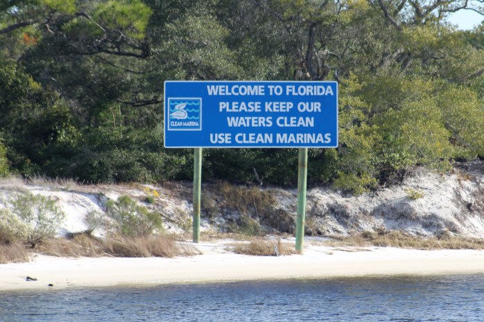
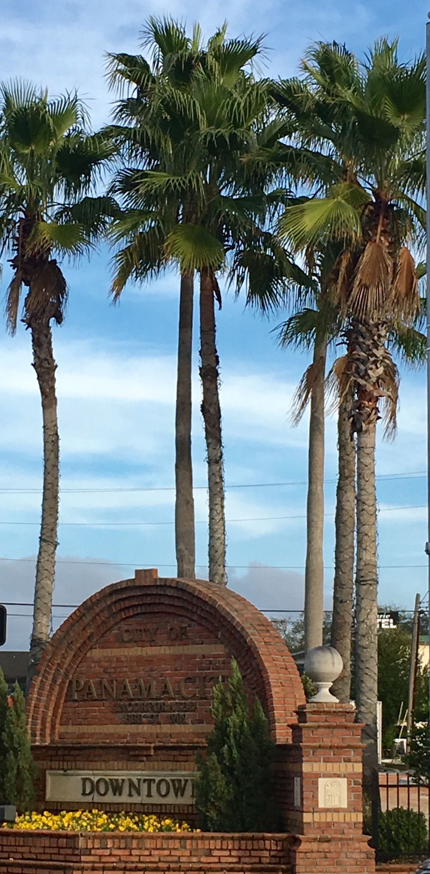
Hello virtual crew members and fellow adventurers!
John and Lou Ann J. have come aboard as our latest virtual crew members. They are family of Dan and Mary of the Gammel Dansk. Also, indianeskitchin has come aboard. Welcome Aboard!
Summary of week:
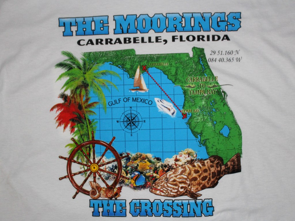
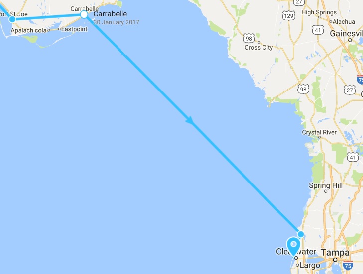
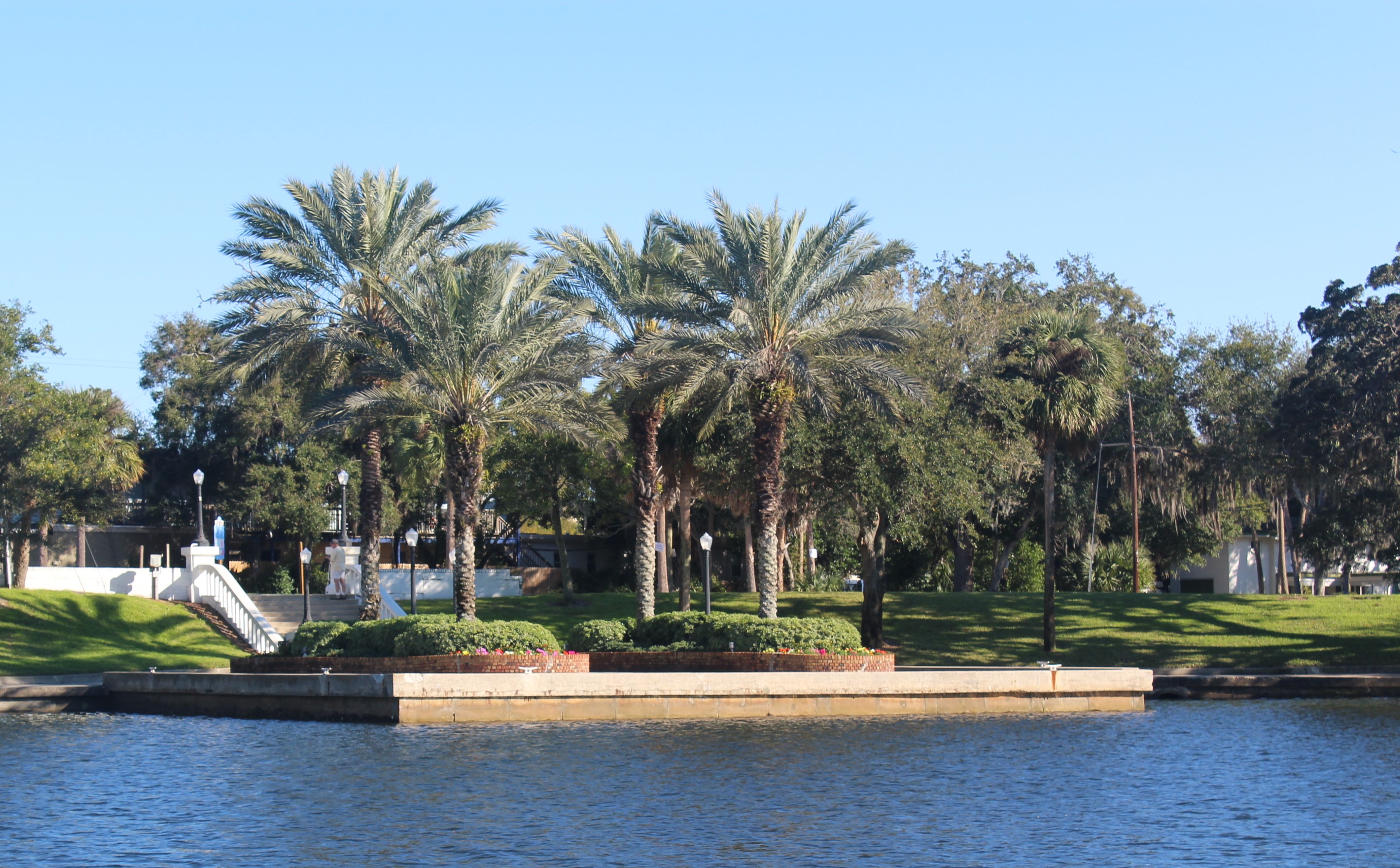
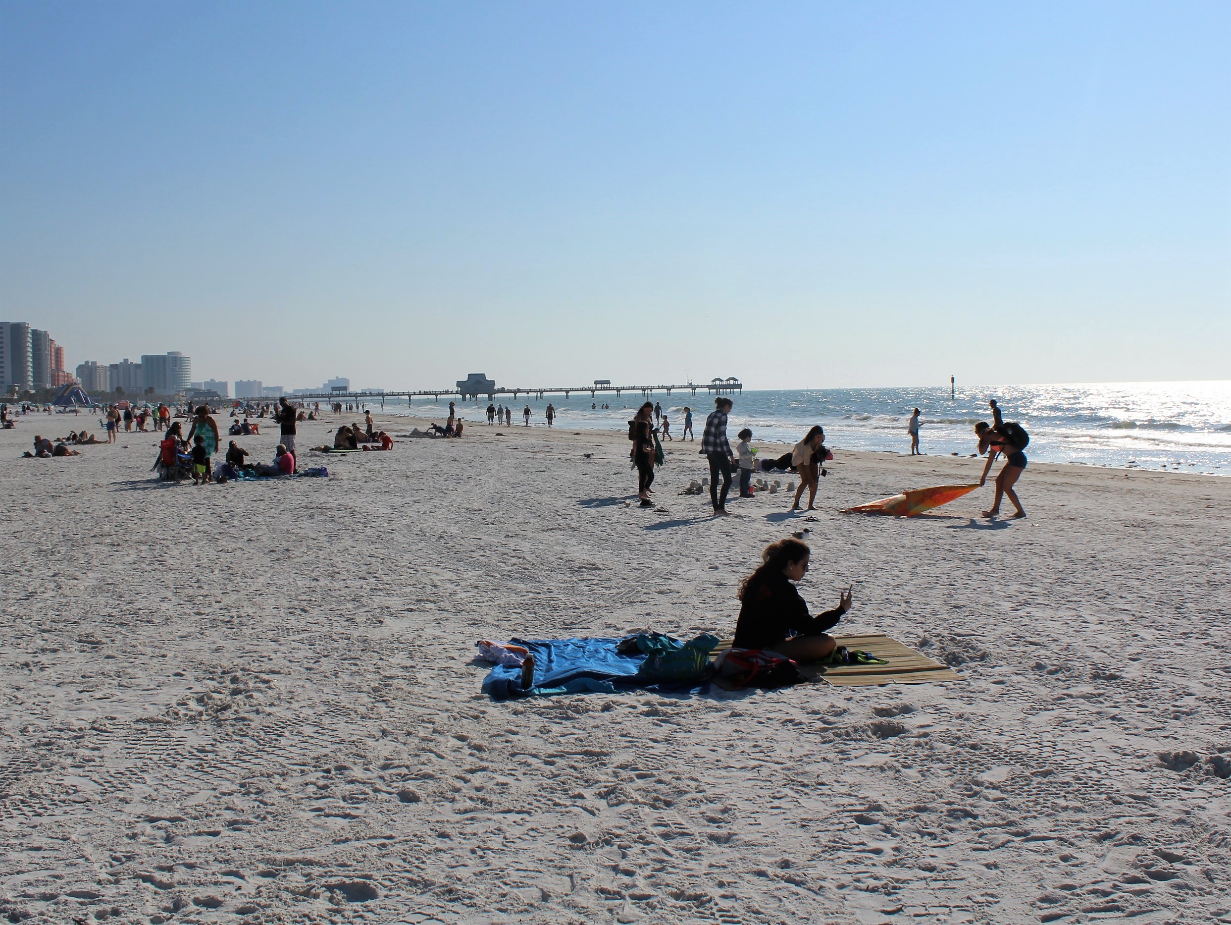
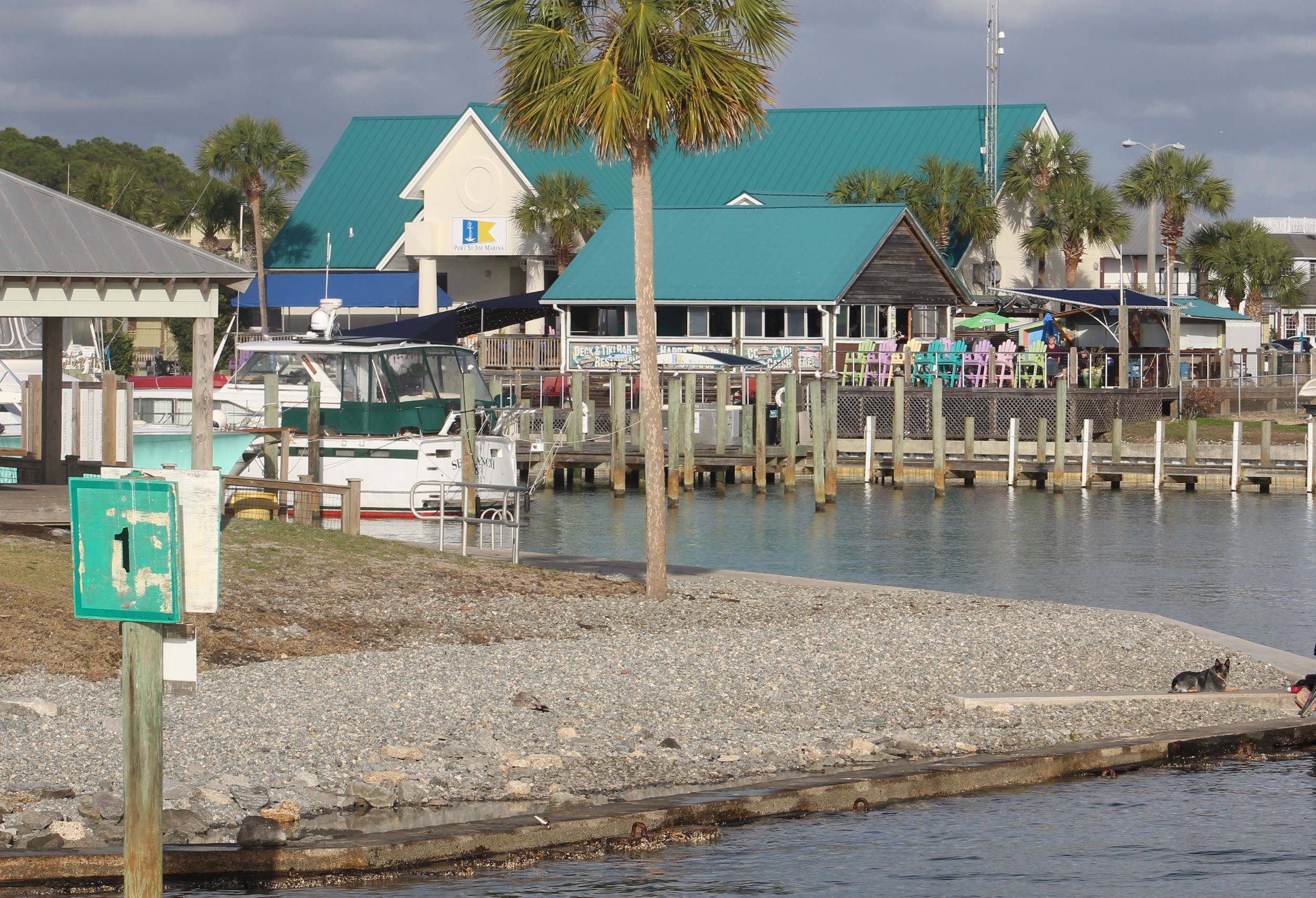
The weather window for a Tuesday/Wednesday Gulf crossing held. The crew left Carrabelle at noon on Tuesday and managed to make it across the Gulf. They docked at Marker 1 Marina in Dunedin at 1515 on Thursday.
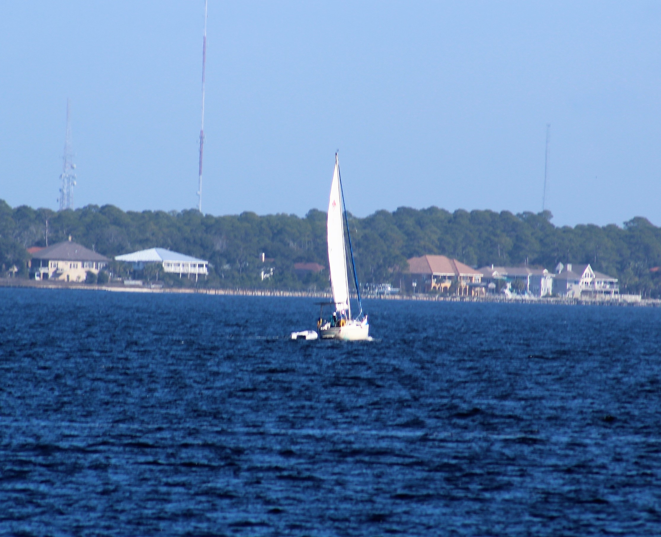
This week’s video shows Still Waters II as she makes way across the Gulf of Mexico to the western shore of Florida. Enjoy!
Gulf Crossing from Still Waters II on Vimeo.
To see past videos, click on the link to the Still Waters II Vimeo site. The library contains videos of Still Waters II cruising America’s Great Loop.
Tuesday, December 18th
The skipper checked his weather apps as soon as he woke up to determine if today would be the day to cross the Gulf. The weather apps were in agreement and looked favorable for a good crossing. The skipper was looking for winds under 10 mph and waves less than 2 feet. Tuesday looked really good with winds light (under 5 mph) most of the day. The wind was predicted to pick up after midnight, but with the direction out of the east, the waves should not build too quickly and the fetch would shorten the closer the crew came to shore.
The skipper then checked Eddy’s Weather Wag to see what he had to say about a Tuesday/Wednesday crossing:
It’s a great day for Go-Fast Loopers to burn some serious fossil fuel. Sea conditions should stay very favorable for your entire journey.
Those who are doing the overnight crossing will have very favorable sea conditions throughout most of the night. As winds pick up slightly in the pre-dawn hours, the seas may become a bit “confused”, but it shouldn’t make your ride uncomfortable.
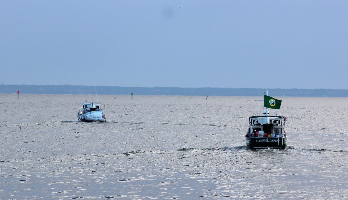
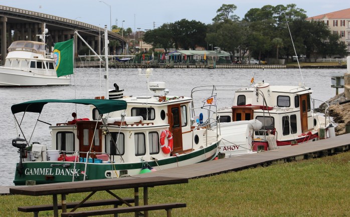
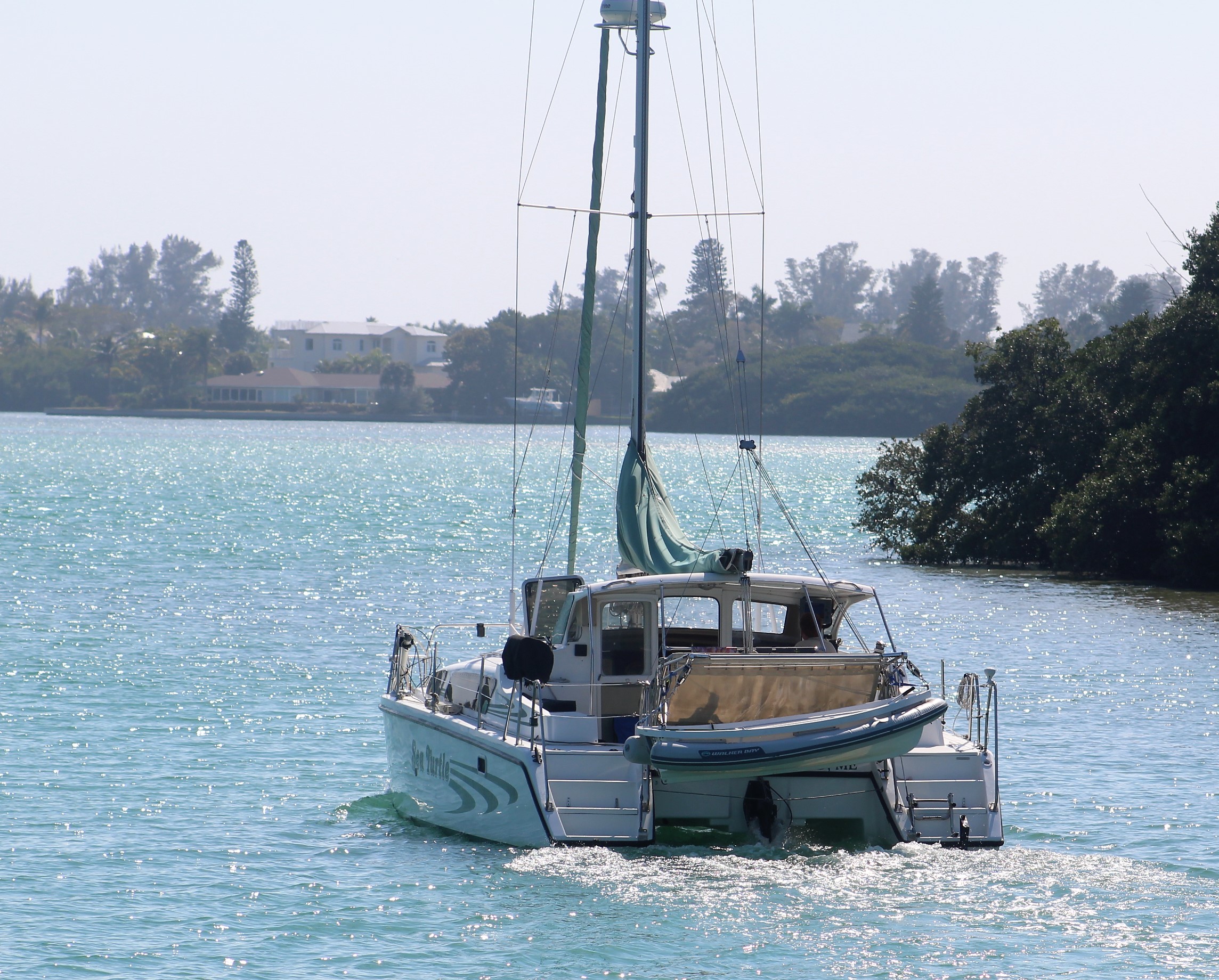
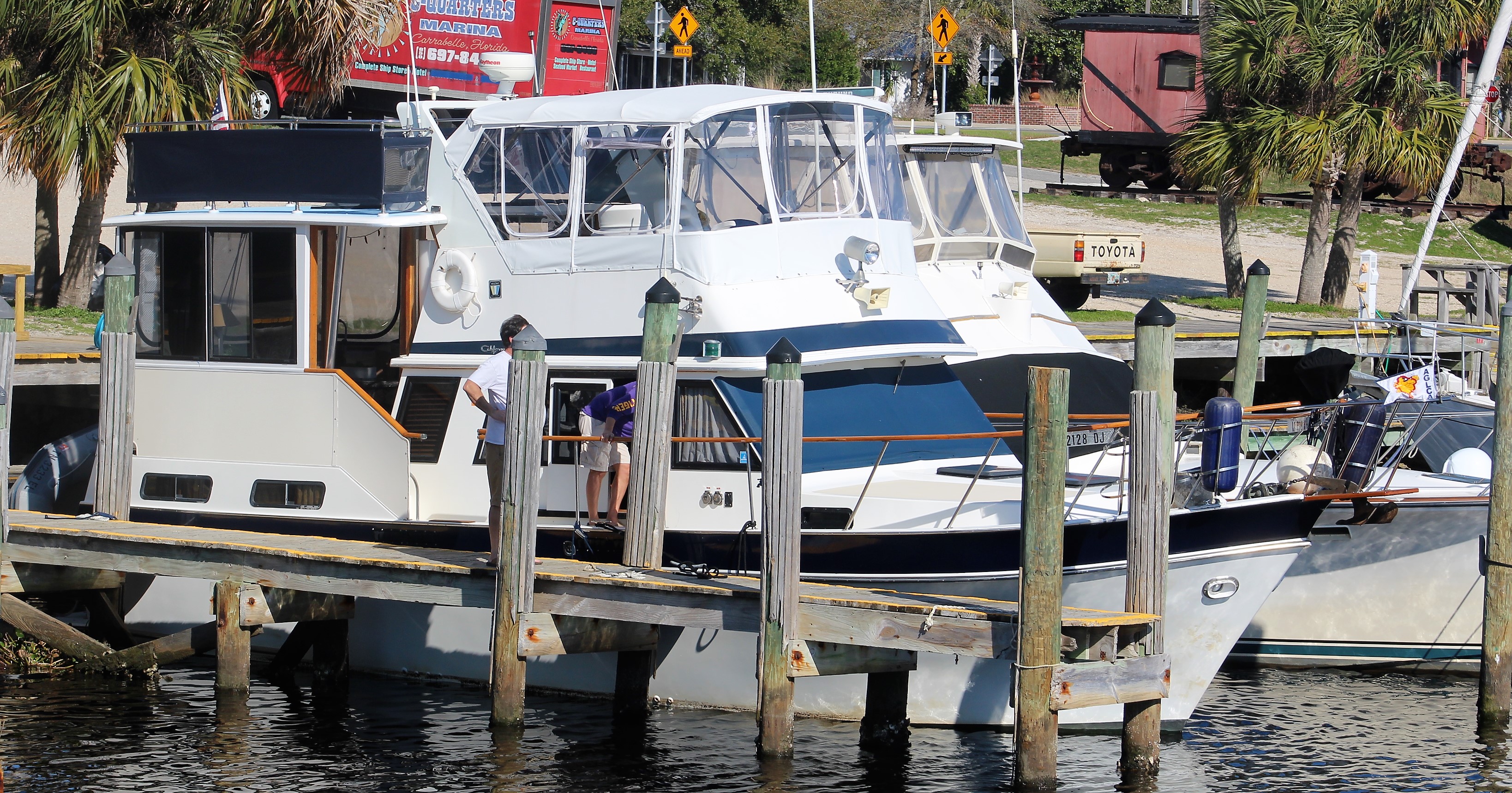
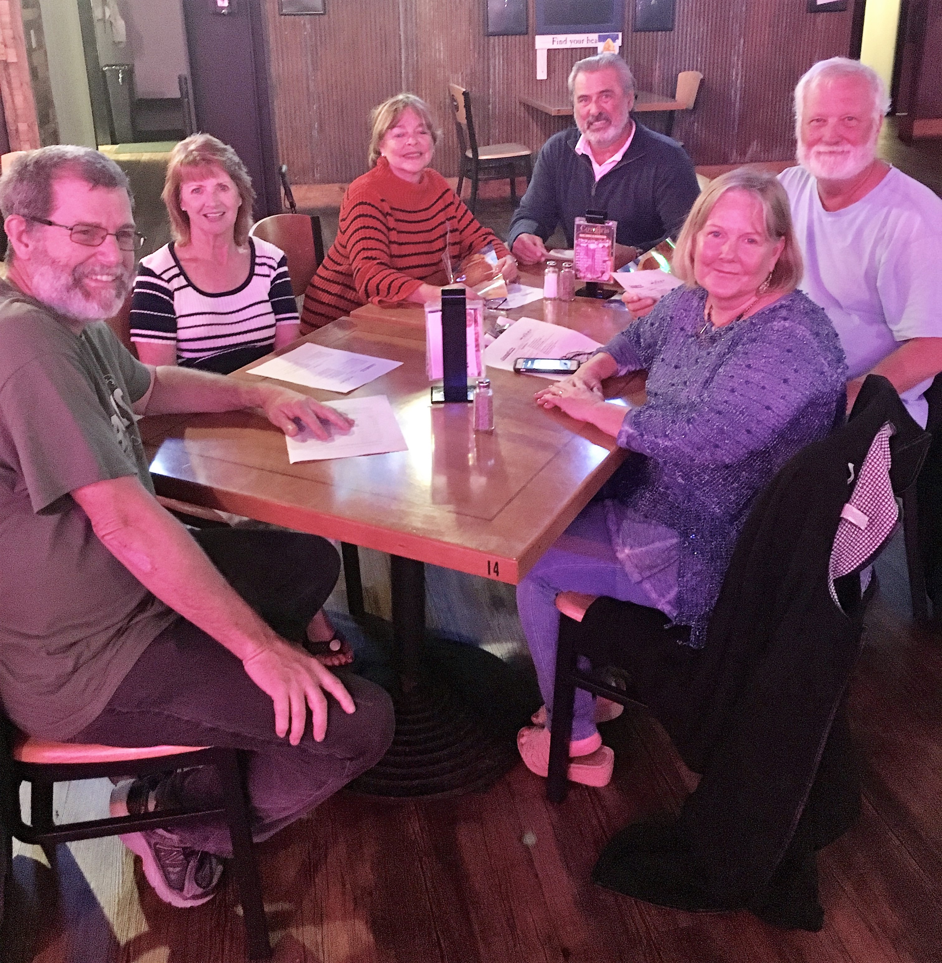
With this info in his hip pocket, the skipper headed to breakfast to discuss the crossing with the other captains who would also be crossing today. It was determined that Still Waters II would cross with three other boats, Gammel Dansk, Chip Ahoy, and Aurora. It was agreed that the flotilla would slip off their lines and leave the marina at noon.
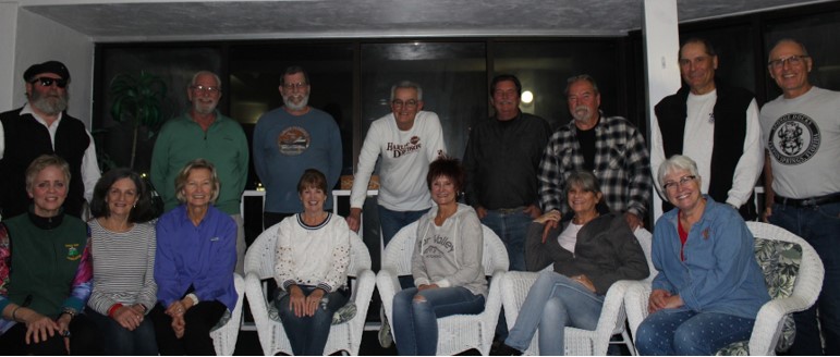
Just before shoving off, Mary managed to get a group shot of three of the four crews.
A fifth boat would leave with the four boat flotilla, but was headed to Clearwater so would be on a different heading once the boats entered the Gulf. Compass Rose did manage to get this shot as the flotilla approached East Pass.
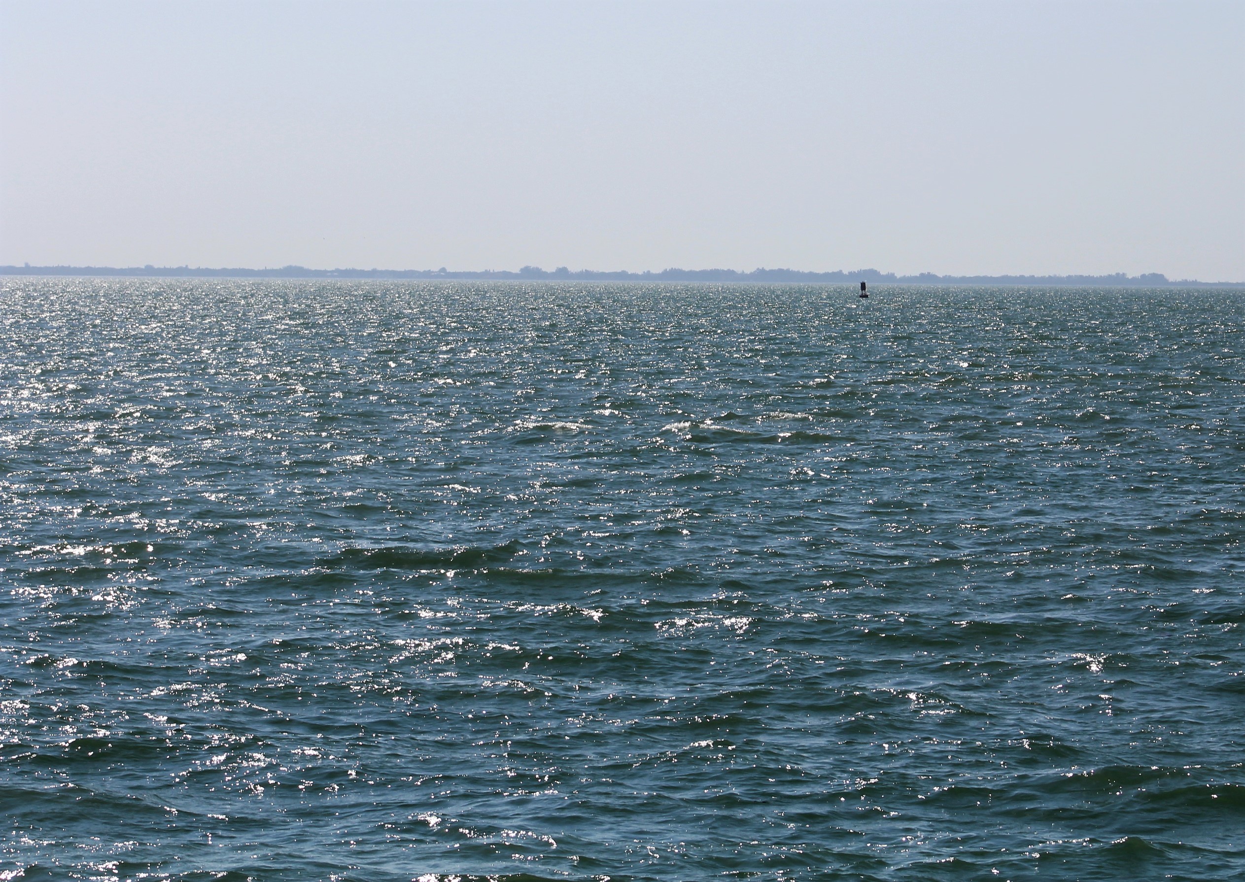
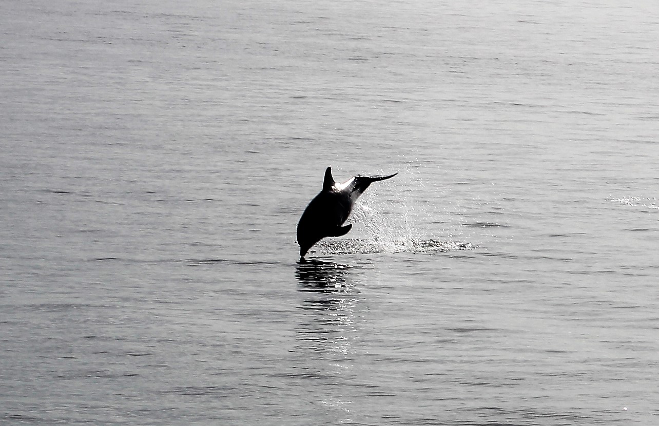
Once the group entered the Gulf, they found the conditions very favorable. The winds were light as predicted which made for flat calm sea conditions. The calm conditions existed all the way to sunset.
As the sun began to set, the flotilla closed ranks and got closer together to ensure they would be able to see each other in the dark.
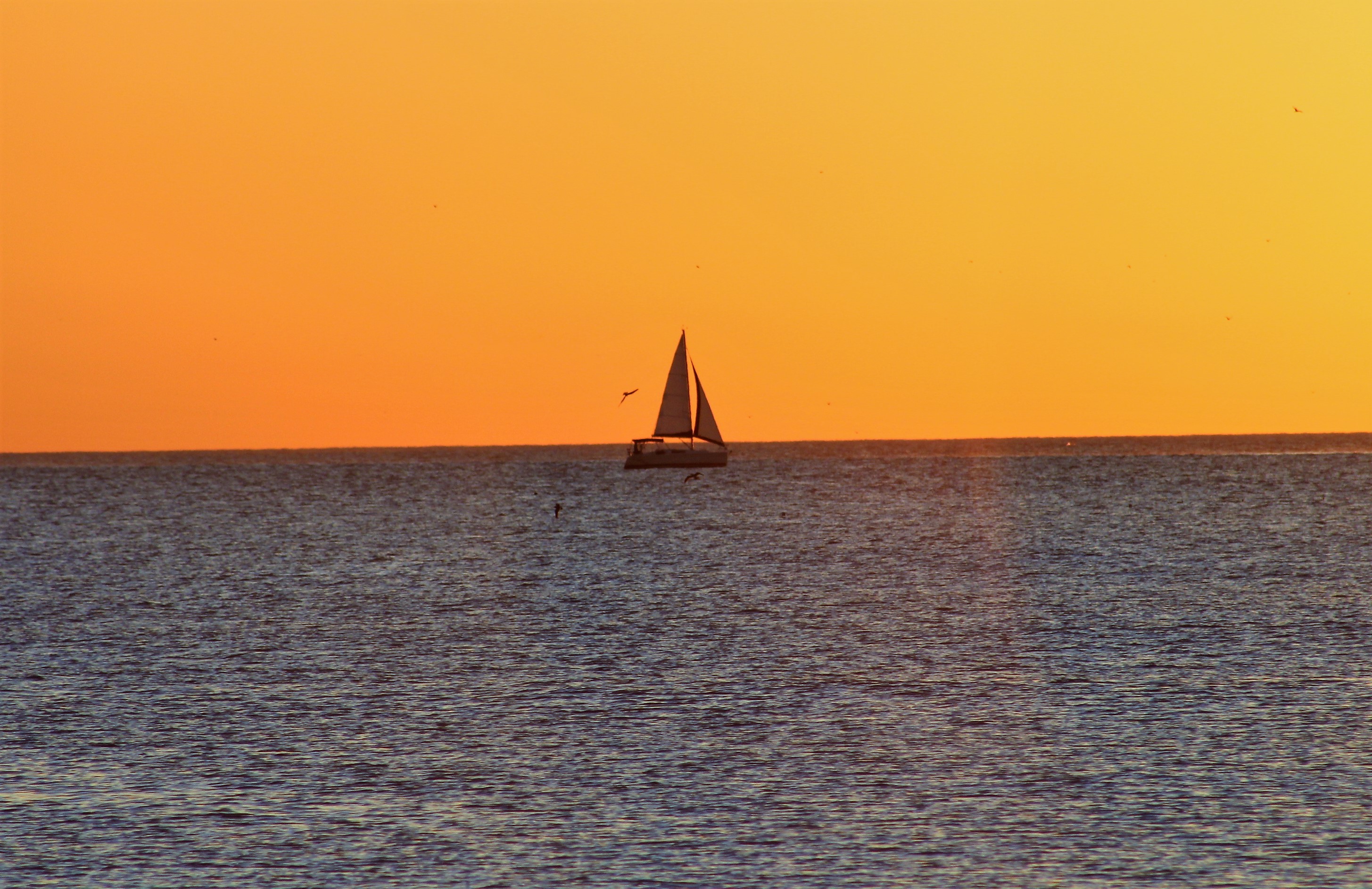
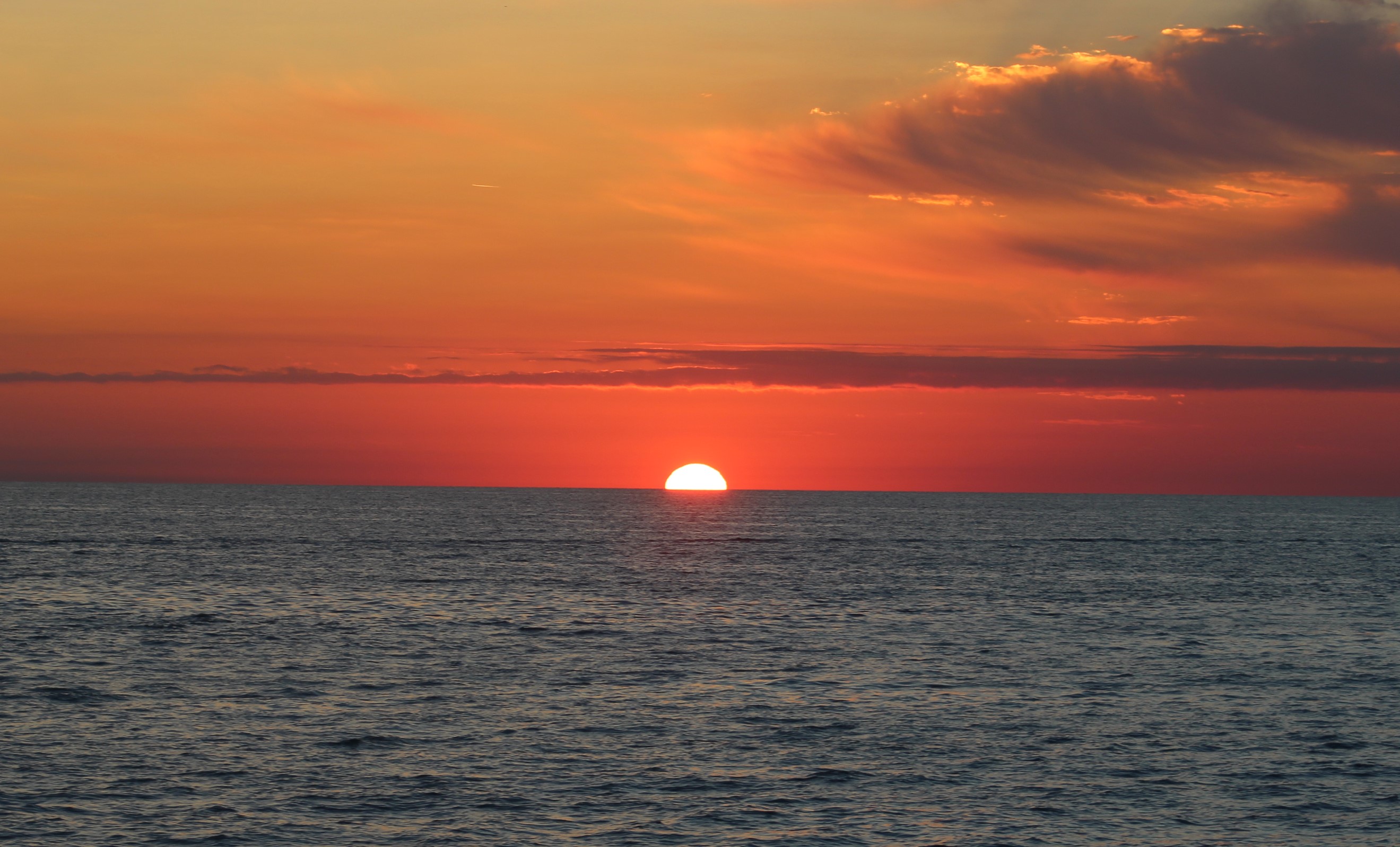
As the sun continued to set, a vibrant red orange sky greeted the flotilla. Chip Ahoy came over the radio and reminded everyone that: “red sky at night, sailors delight.”
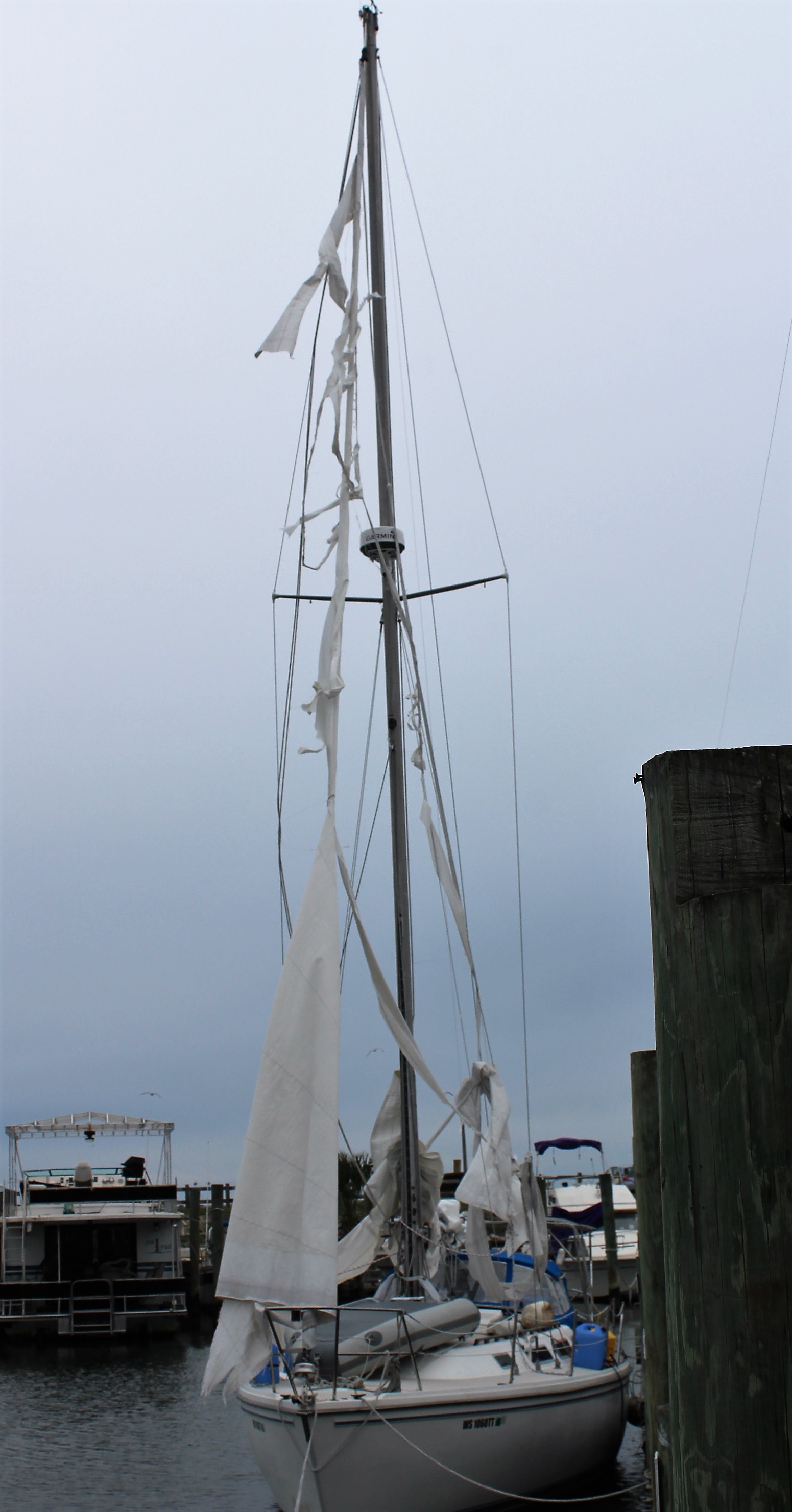
As predicted, the winds started to pick up out of the east following mid night. The longer the wind blew the larger the waves began to form. Most of the waves were 1-footers initially, but by 0300-0400, the waves were building to two feet. The main problem was not the height though, but the direction. The waves were striking on the side of the boat causing a very rolly motion.
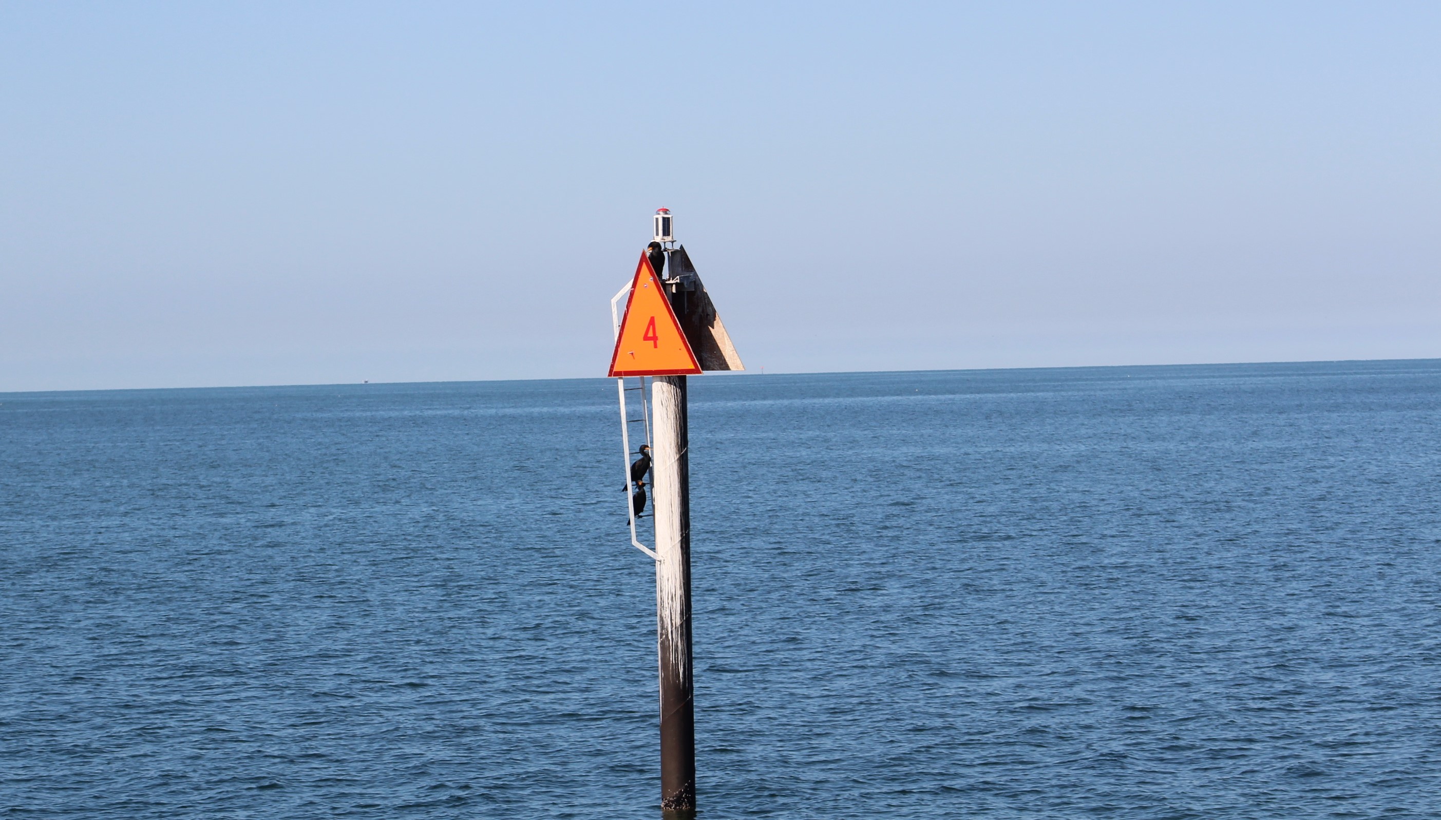
The boats had started on a heading of 138 degrees magnetic to reach the Red 4 entrance buoy at Tarpon Springs that was initially 150 miles from the East Pass back near Carrabelle. It was decided to alter course to see if that would help smooth out the ride. The course change was initially successful. However, just about sunrise the seas became very confused and seemed to be coming from every direction. This lasted for about 2 hours before things started to settle down.
As the boats continued to the Red 4 marker the seas fell back to consistent 1 footers and the last 30 miles to the Red 4 were much more manageable/
Aurora in the morning
But the 26 foot tugs were still having a tuff go of it in the wind and waves.
Within about ten miles of the Red 4 marker conditions had settled enough that the Admiral and skipper decided to try and pass some coffee over to Chip Ahoy. Bill was making the trip solo and could not leave the helm to brew any coffee. The Admiral went down and brewed some coffee and put the brew in a thermos. She also put a piece of cake in a sealed container. Then placed both items in a bag with straps that could be placed on the boat hook and handed over to Bill.
While Bill was trying to get up to Still Waters II, the skipper managed to drop the bag in the Big Pond and almost lost the bag with the Java Juice. He finally snagged the straps on the third try just before the bag was out of reach. With the bag back on the boat hook, Bill pulled along side Still Waters II and the skipper was able to get the goods to Bill. He removed the bag from the boat hook and moved away from Still Waters II.
The view from Gammel Dansk during the coffee transfer.
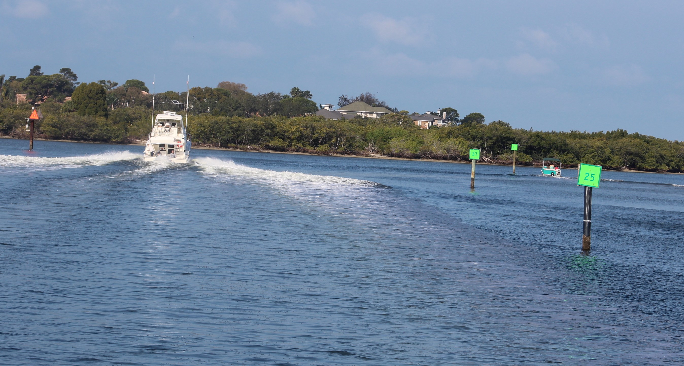
The coffee and cake seemed to rejuvenate Bill and help him make the last few miles to the red 4 marker. The skipper used two 20 oz bottles of Mountain Dew to help him thru the night. At 1304, the flotilla finally arrived at the Red 4 marker officially ending the Gulf crossing. The boats still had about two hours of cruising left before they were safely secured in a marina, but the worst was behind them now.
When they did finally arrive in the marina, the skipper calculated that they had travelled 175 miles at 6.5 mph which led to a long 27 hour crossing.
Next Week –
With the Gulf crossing behind them, the crew rented a car and headed to Texas to visit family for the holidays. They will return to the boat sometime after Christmas and resume the quest for the Platinum Flag in the new year. It appears that they could easily make Ft Myers in 5 travel days from Dunedin, so they should complete their second Loop before the end of January.
Loop On – Where the road ends, the water begins. The water goes on forever, and the adventure never ends.
Hello virtual crew members and fellow adventurers!
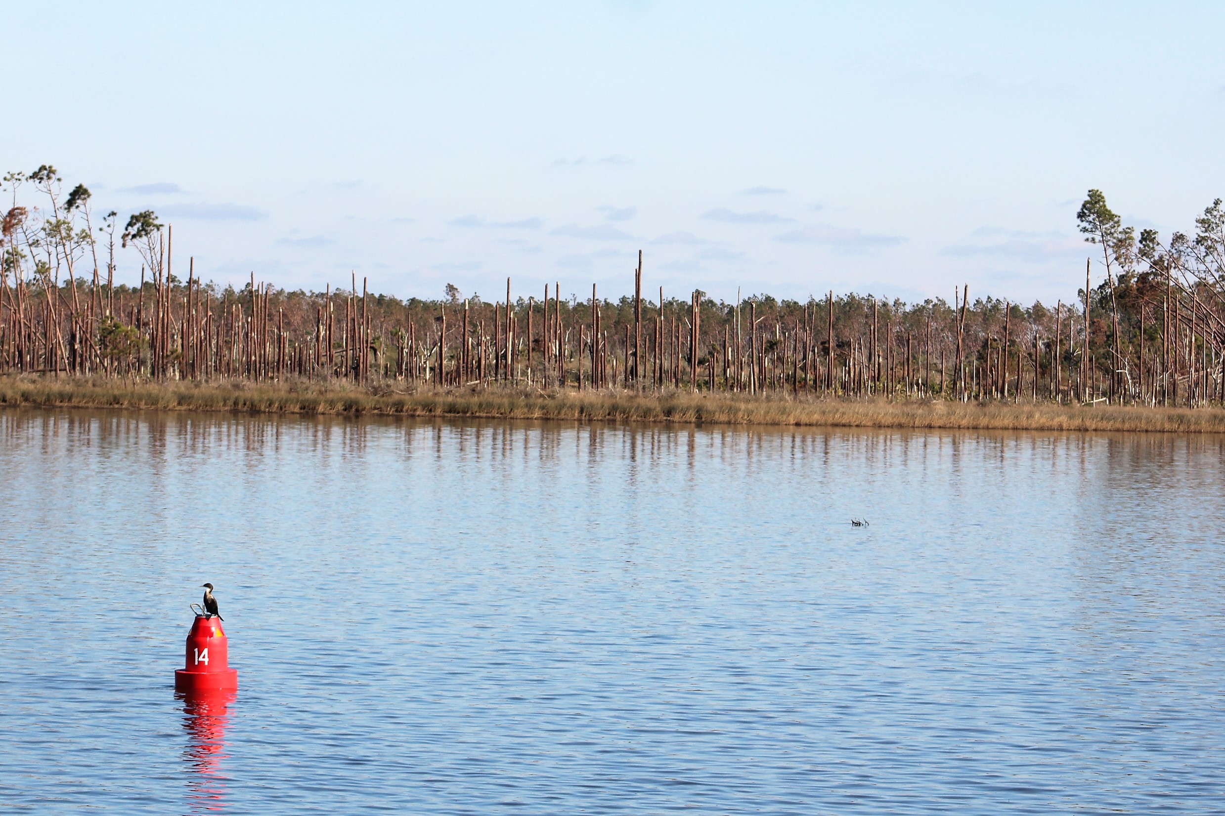
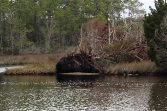
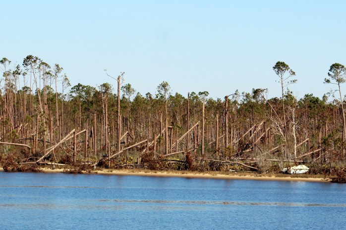
The crew spent the week cruising thru the damage done by Hurricane Michael. Notice that the tree tops have all disappeared.
On the brighter side, we get to welcome some new virtual crew members aboard this week. You are just in time to cross the Gulf of Mexico with the crew. Welcome aboard chmyers2000 and Greg P. Hope you enjoy the adventure!
Summary of week:
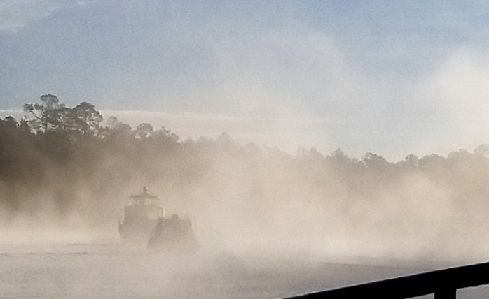
It should be obvious by the map above that the crew did not make last Wednesday’s Gulf crossing. That was unfortunate because the weather was perfect for a glass smooth sail across the Gulf. However, because of high winds over the weekend the crew was unable to leave Ft Walton Beach and get staged for the crossing.
Waiting out the wind in Ft Walton Beach (notice that green flag on the green tug)
Instead, the crew hunkered down and let the high winds blow by. On Monday, it was finally safe enough to continue eastward so the crew made three moves to stage for the next weather window to allow safe passage across the Gulf.
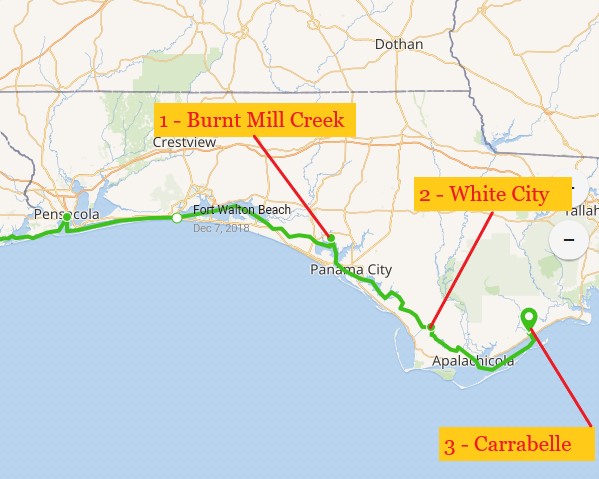
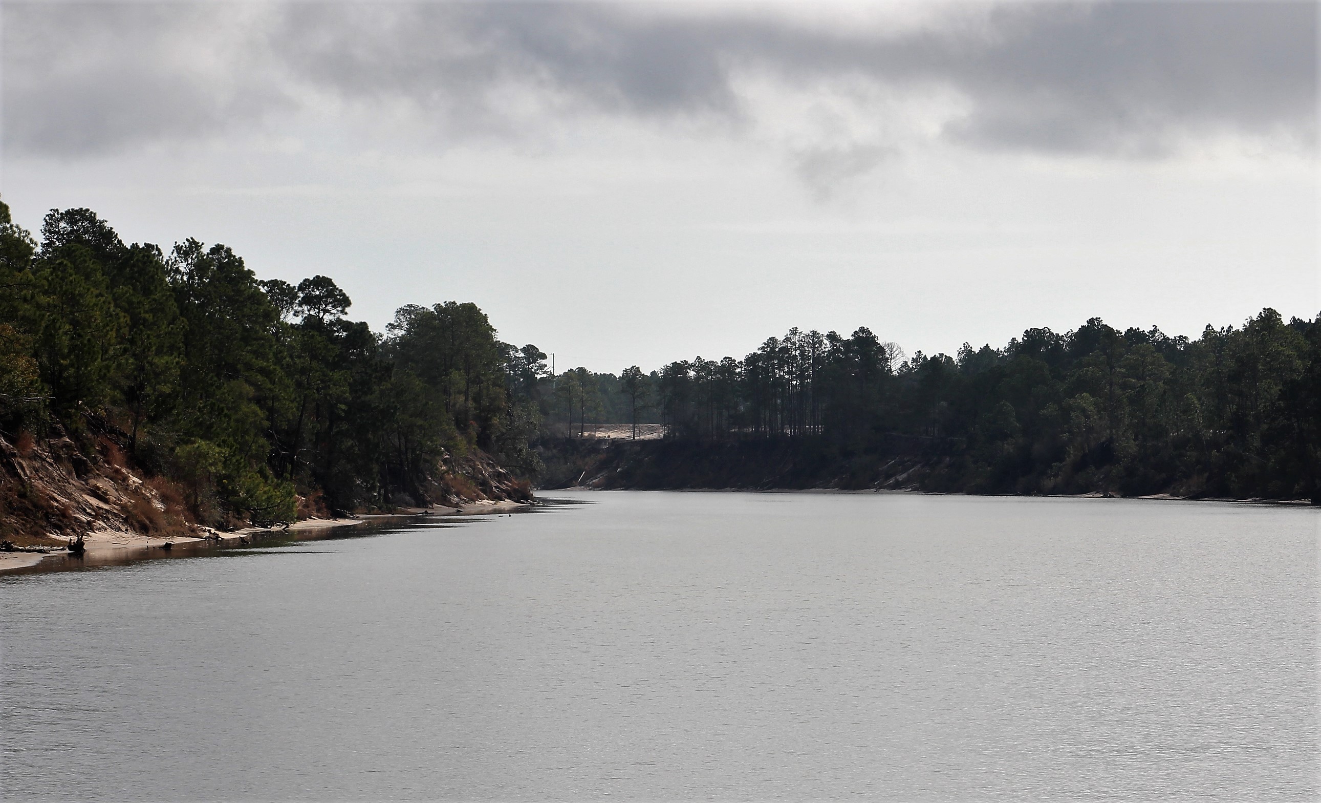
They anchored out north of Panama City on Monday in Burnt Mill Creek (1). Then stayed at a free dock in White City (2) on Tuesday. They then made way to Carrabelle (3) where they will sit and wait for a weather window to open.
This week’s video is an intro to the Great Loop from America’s Great Loop Cruising Association. Enjoy!
To see past videos, click on the link to the Still Waters II Vimeo site. The library contains videos of Still Waters II cruising America’s Great Loop.
Monday, December 10th
Ft Walton Beach to Carrabelle was a 150 mile journey through the devastation of Hurricane Michael. Because of the damage, the marinas along this route are still closed which necessitated finding docks or anchorages to stop along the way.
First signs of Hurricane Michael devastation
The first night, the crew planned to stop at a restaurant that has a dock but is closed on Mondays. However, upon arrival, the skipper could not find enough water under the keel to safely dock without going aground. When he finally abandoned the dock strategy it was time to head to Plan B, an anchorage about an hour away.
This was interesting to see, three trees blown over in one root ball
When the crew arrived at the anchorage they dropped the anchor but it did not set. On the second try, the anchor failed to set again. But this time when they brought the anchor up they noticed it had some grass hanging from the points. The skipper moved to some deeper water to get out of the grass and the anchor set on the third try.
The skipper then launched the dinghy to take Tori ashore. Under the category of ‘No job is as easy as it looks,’ the skipper could not get close to shore because of the shallow water. He finally gave up on finding a path to shore in the boat, got out of the dinghy, then waded and pulled the dinghy to shore.
After Tori did her business and loaded back in the dinghy, the skipper waded back out to deeper water and floated away. Luckily, Chip Ahoy was there to assist and get the dinghy, dog, and skipper back to their respective boats. This was especially good because it was getting dark and dark fast.
The temperature was also dropping fast so the skipper was glad to get back on board to fire up the generator to warm the boat and dry off.
Tuesday, December 11th
The crew woke with temperatures in the 30’s, so the skipper fired up the generator again to warm the boat before the Admiral crawled out of bed for her first cup of coffee. Mary also called and said it was too cold to be wading in the water to take Tori ashore. Tori would either hold it all day or use the green carpet. Obviously, Tori does not like artificial grass because she choose to hold it all day.
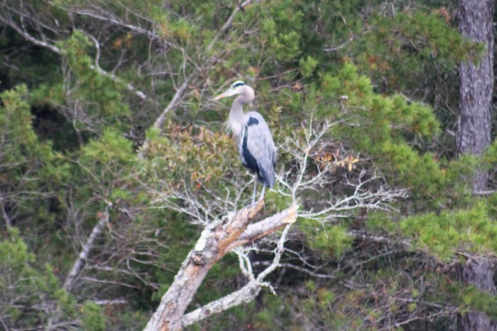
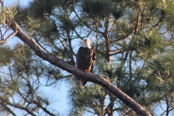
On the way to Panama City the crew saw a grand assortment of birds.
HeronRed Shouldered Hawk Bald Eagle
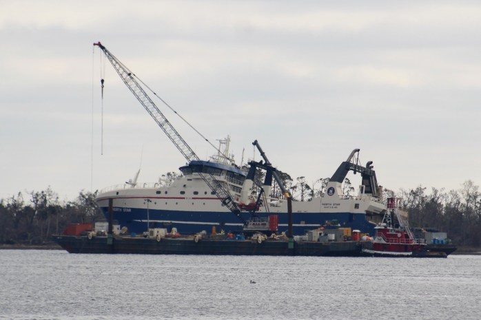
The Admiral came up with an idea to try and get Tori off the boat and on to shore at the Panama City Marina along the sea wall. However, when Gammel Dansk was approaching the wall to tie up, a police officer showed up and told them the area was off limits and they could not land.
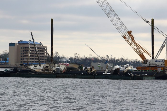
Looking around at all the damage it was obvious why the area was off limits. It looked like a virtual war zone and liability nightmare.
Cleaning out the marina
Tori would have to wait until the flotilla landed in White City. The town free docks are normally closed to over night stays. But because the marina at Port St Joes was destroyed, White City has allowed transient boaters to stop for the night while passing through the area.
Big yacht aground
While making way to White City, the crew saw this large yacht aground. They later learned that the yacht is on order for someone in California. Supposedly it is a 100 Million dollar boat. The builders decided to move the boat to a mooring ball rather than take the chances in a marina during the hurricane. The winds broke the boat free of the mooring and the storm surge floated the boat away. After the waters receded, she was left aground. They are slowly trying to move her to deeper water and float her off.
Looks like a tornado may have ripped thru this narrow section of damage Docked in White City
Wednesday, December 12th
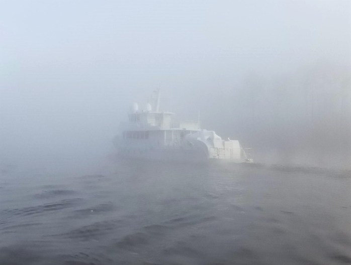
The skipper woke to literally freezing temperatures. The handrails and deck were covered in a thin layer of ice. A new experience on the Great Loop. Oh, did I forget to mention the fog that enveloped the boat also.
With the fog starting to break up a little bit, the flotilla set off. It would not take long though to experience a scary moment on the water in the fog. The skipper had the radar on to help detect approaching targets. He noticed an object come out from beyond a bend in the river. He sounded the horn to alert the boat to his presence. About the same time as the horn sounded he made visual contact with the fast approaching boat. Luckily the boats were not on the same line and the boat quickly passed to the starboard of Still Waters II. While all that was happening, he was trying to warn the two tugs behind him of the fast approaching boat over the radio.
Somehow, Mary managed to get a photo of the boat in the fog as it passed them.
The fog cleared not too very long after this near miss, so the skipper took the time to go below and change his underwear.
Gammel Dansk following Chip Ahoy and Still Waters IIFog Free in Saul CreekAnybody hear banjo music?
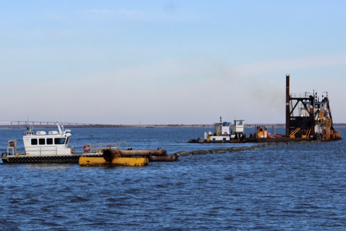
With the fog gone, the skipper thought it would be smooth sailing for the rest of the day. But that was not meant to be. As they came out into the Apalachicola Bay, they encountered a dredge dead center in the channel. The dredge told the skipper to pass on the 1, so the skipper moved to starboard to go around the dredge. He looked at the chart and noticed that there would be only 5 feet of water. Not good when your boat draft is nearly 4. The skipper slowed and eased his way around the dredge until he could get back into the marked channel.
Dredge blocking channel
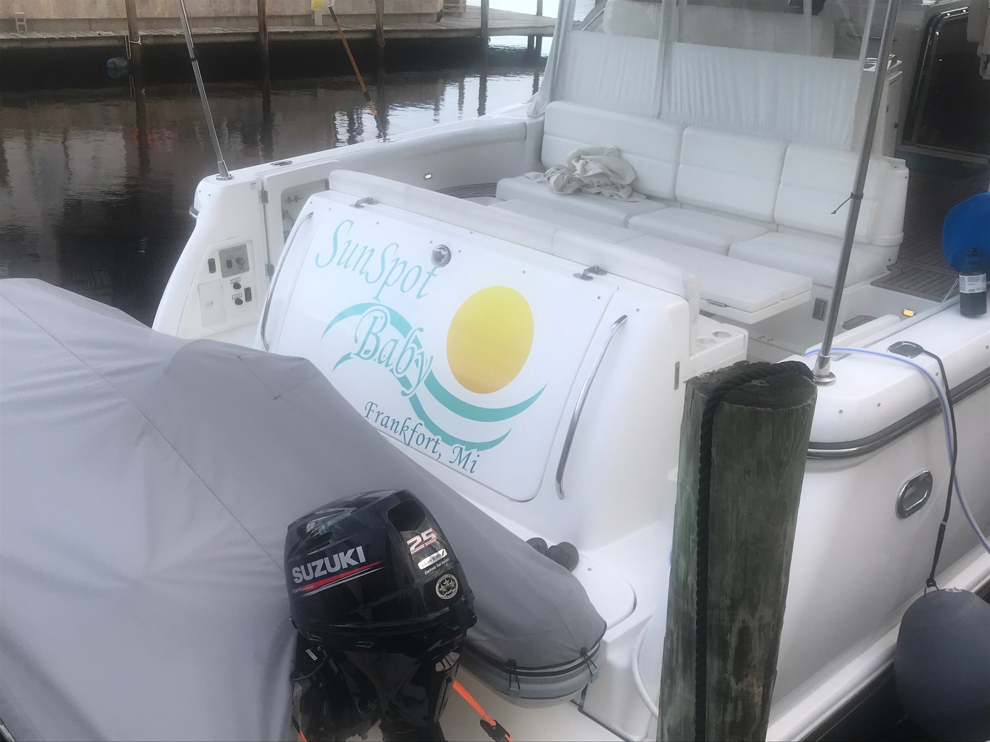
Not long after this, the crew was overtaken by a boat named SunSpot Baby. She is crewed by Dave and Nancy from up north on Lake Michigan. They had planned to cross the Gulf today in that great weather window but had some issues getting out into the Gulf. They are now headed to Carrabelle to wait for the next window to cross.
SunSpot Baby
Thursday, December 13th
SunSpot Baby hosted dock tales on their boat. The Admiral got the Grand Tour. The skipper learned that the boat is named for a Bob Seger tune by the same name.
She packed up her bags and she took off down the road
Left me here stranded with the bills she owed
She gave me a false address
Took off with my American Express
Sunspot Baby
She sure had me way outguessed
Thanks for a great evening aboard SunSpot Baby.
Friday, December 14th
There have been several groups of boaters who have ventured out into the Gulf over the last few weeks in marginal and deteriorating weather conditions. Then when things did not work out well for them they blamed the forecast for their bad decision. This fits perfectly with the skipper’s quote of the day, “To err is human, to blame the other guy is more human.”
For example, back on December 6th, a group of 13 captain’s got together to discuss their Gulf crossing plan. Two of these captain’s decided the weather window was not good for them and choose not to go. The other 11 left and encountered 3 foot seas at East Pass, just after entering the Gulf. Two more decided that this was not their cup of tea and returned to Carrabelle.
The other 9 continued on for twenty more hours getting kicked around by the seas. Rather than own their decision to cross based on what they saw with their own two eyes, they blamed the forecast for their choice.
One of the survivors had this to say after making it across the Gulf:
In my humble opinion, and recent personal experience, this crossing IS a big deal. We have no auto pilot and no stabilizer. We traveled in a very stable albeit small boat and it was the most frightening 22 hours of fighting the elements in total blackness I have encountered in 25+ years of boating. Despite all monitored apps, NOAA, consensus at the captains meeting (involving 13 other boats) the projected weather was not as expected. I am not ashamed to say I was very frightened.
It was obvious to the skipper that some people do not understand the basics of wave height, so he shared this little simple thought experiment with the AGLCA membership in hopes that others will not follow out into the Gulf in three foot waves, especially in a small boat.
As we now sit in Carrabelle waiting our turn to cross the Gulf, my thoughts have begun to ponder why many before me use the thumb rule of:
– Less than 10 mph winds
– Less than 2-foot waves
as their go-no-go decision tool.
I have also begun to ponder if I would go if the waves were just three foot just past Dog Island after entering the Gulf at East Pass.
To answer these and other questions, I ran this thought experiment and determined not only no, but heck no, I’m not going in three-foot seas. Read the thought experiment and you can make your own decision if you would go or not.
Thought experiment:
If the average wave height was predicted to be three foot, what could I actually expect to see while crossing the Gulf at 8 mph?
First, I found the following definition for wave height on the NOAA, National Weather Service page.
Significant Wave Height – is an average measurement of the largest 33% of waves.
IMHO- that is not very useful on the surface
Second, I also found this info following the above definition:
Significant wave height measured by a wave buoy corresponds well to visual estimates of wave height. Most human observers tend to over estimate the real height of waves.
As the significant wave height is an average of the largest waves over a recording period it should be noted that some waves might be much LARGER than the average.
Third, that begged the question, ‘How many are some?’
Answer – on average, about 15% of waves will equal or exceed the significant wave height. The highest 10% of waves could be 25-30% higher than the significant wave height.
And on occasion (about one per hour) one can expect to see a wave nearly twice the significant wave height.
So, in layman terms what does that mean to me as I spend 21 hours to cross 170 miles at 8 mph across the Gulf?
Assuming 3-foot waves in the Gulf with a 6 second period the entire route across.
And ignoring the fact that the boat is actually moving across the Gulf.
I could expect to see at least 7,560 waves (6 sec period, so 6 waves per minute, so 360 waves per hour)
The highest 10% of waves could be 25-30% higher. So, 30% of 3-foot wave would be 1 more foot or a bunch of 4-foot waves. How many is a bunch? 10% of 7,560 = 756 four-foot waves
And on occasion (about one per hour) one can expect to see a wave nearly twice the significant wave height. Therefore, we should expect to see some waves twice as high as the three footers which means we get to surf some 6-foot waves 21 times as we go across the Gulf.
Summary:
# of waves – 7,650 (which most look like three footers to the untrained eye)
# of 4-foot waves – 756
# of 6-foot waves – 21
As a reminder this was assuming the boat is not moving which we know it is. So, in reality you will see even more waves than this simple thought process.
However, for me and my wife, these numbers are proof enough that we do not want to go out in 3-foot seas, meet a bunch of 4 footers, and get kissed hourly by a 6-footer.
So, when I stick my nose out in the Gulf and see 3-foot seas, we are making a game-day-decision to return to Carrabelle, and wait for the next window. Four to six-foot waves take the pleasure out of pleasure boating for us.
But every body is different. On our boat we have two people on board and two types of peanut butter (creamy and crunchy). Different is neither right or wrong. It is just different.
So maybe you would go, if you do, I hope you make it safely. I am sure you will. It might not be pleasurable but it would probably be safe.
One clever response to the skipper’s post was as follows:
A wave is wave of course, of course
But the height of the wave is of course, a force?
The simple truth is, how much force do you want?
No force, little force or the boat doing stunts.
For me it is simple, while riding the seas
I only want a MINIMAL BREEZE!
If you want to brag that you survived the worst
Get out there and do it! You may be the first!
Saturday, December 15th
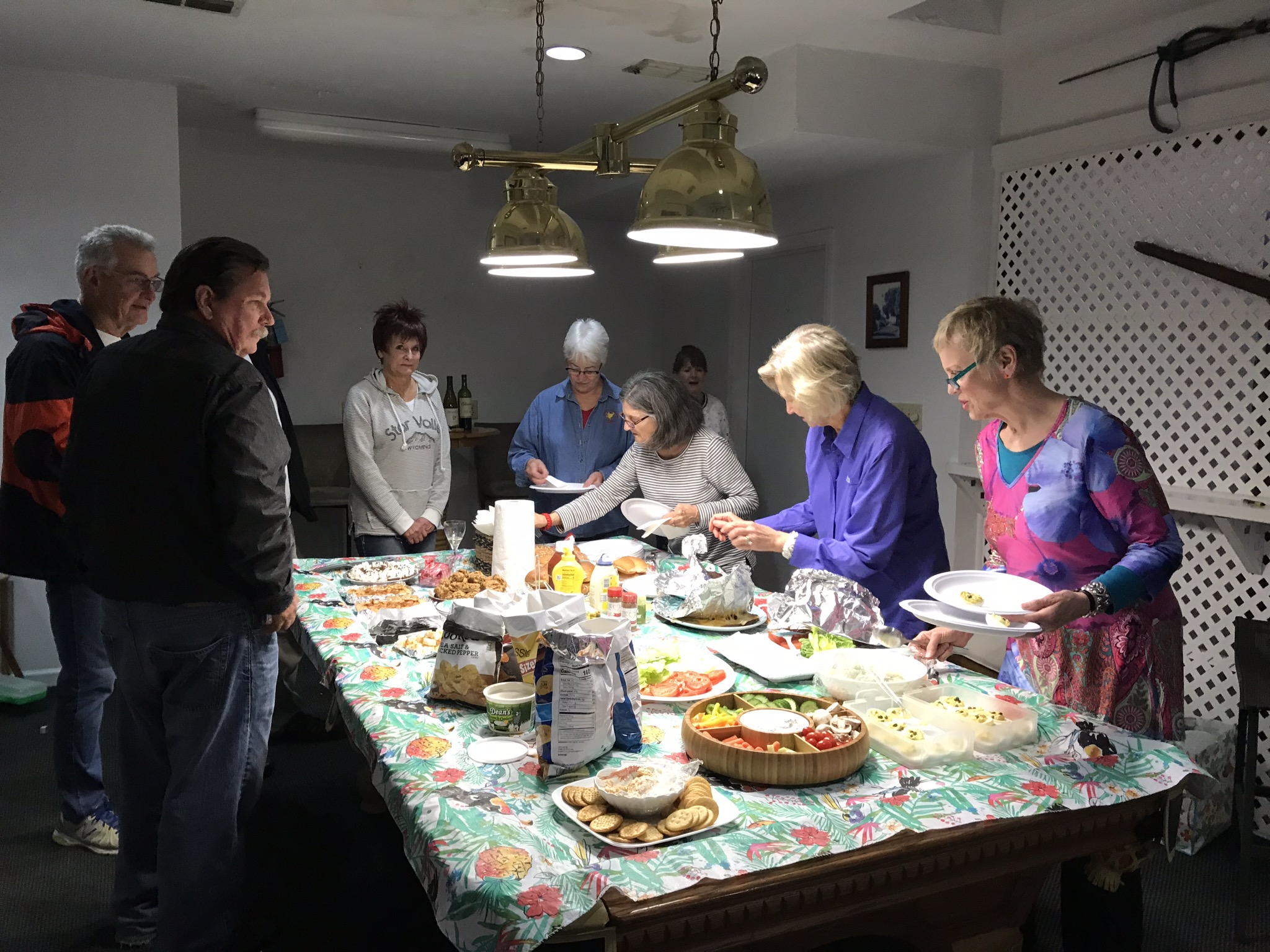
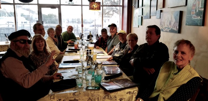
There are now 8 boats at the Moorings in Carrabelle waiting for the next weather window to cross the Gulf. To pass the time the group of 8 decided to have a potluck dinner that actually turned into hamburgers and hotdogs.
The ladies transformed the Boaters Lounge into a nice place for dinner, converting the pool table into a serving table with all the food.
It appeared that all had a good time, but before breaking up for Looper Midnight I managed to get this group shot. Notice I even got the skipper in the pic.
Gammel Dansk, SunSpot Baby, Still Waters II, Michigan Girl, Chip Ahoy, Aurora, Last Call, Compass Rose
Also, a shout out and big THANK YOU to the management of the Moorings of Carrabelle for the two bottles of complimentary wine. It was a nice surprise and much appreciated!
Boat Name of the Week
SunSpot Baby
Next Week –
The next weather window to cross the Gulf seems to be opening up on Monday. Because the winds have blown hard for the last several days, it will take a while for the waves to calm down. Based on the current forecast, a Tuesday night Wednesday crossing looks the best. If the forecast holds the crew should make the jump across the Gulf and be safely docked in Dunedin by Wednesday afternoon
Loop On – Where the road ends, the water begins. The water goes on forever, and the adventure never ends.
Hello virtual crew members and fellow adventurers!
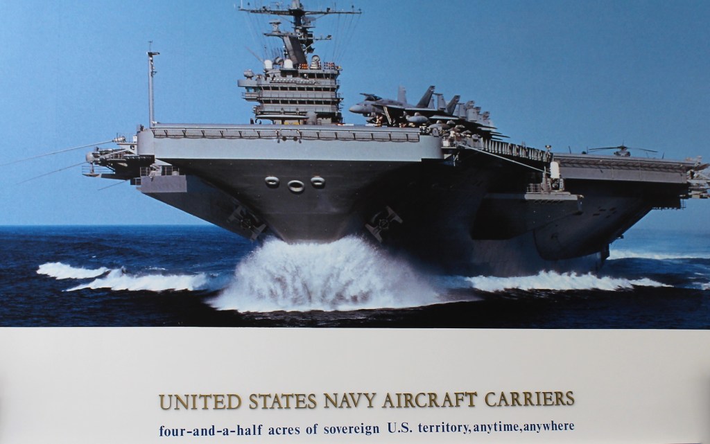
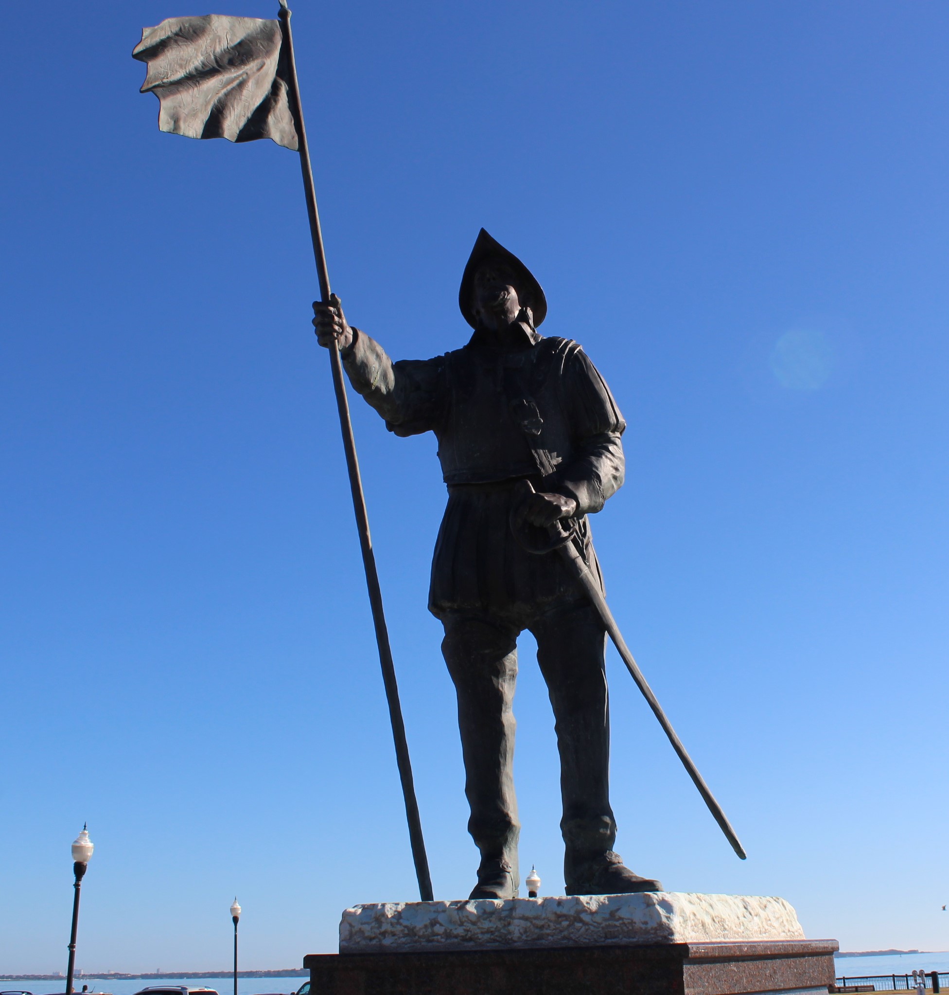
The skipper saw the picture of this big target when he first entered the Navy Aviation Museum. For those who know that the skipper served aboard a submarine, he would remind you that the Navy only has two kinds of ships, targets and submarines. That is one big target.
Summary of the Week:
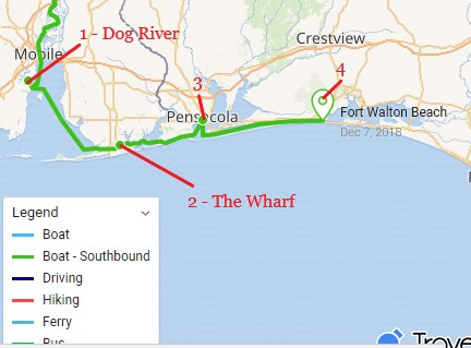
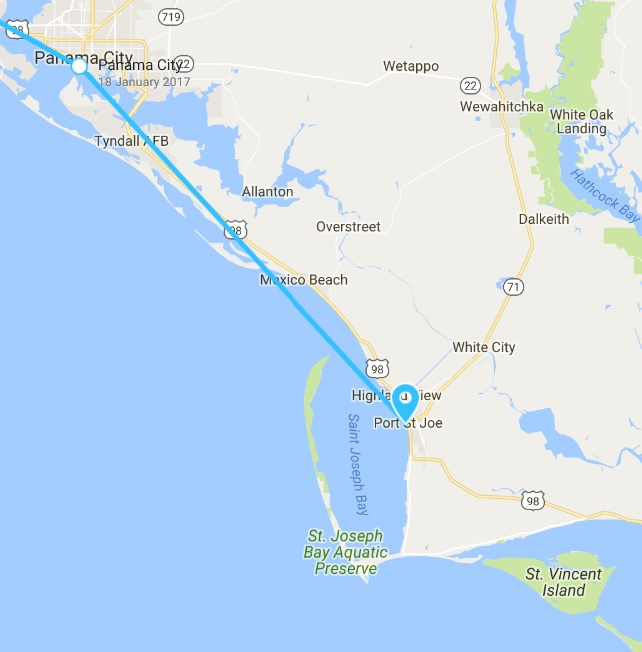
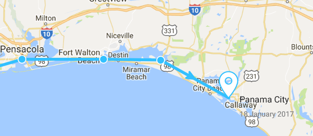
This past week the crew started their eastward journey along the Gulf Coast. As often happens on The Loop, they were thwarted by the weather. They did manage three travel days and a 0.3 mile jump to find safe haven from the storm scheduled to arrive Saturday afternoon. The Crew Left Dog River (1) and arrived on the Gulf Coast to dock at The Wharf (2) Monday. Stopped at Pensacola (3) to visit the Navy Aviation Museum on Thursday. Ended up at Ft Walton Beach (4) on Friday.
The voyage of discovery did answer the following questions this week:
Who was the Navy’s first Ace?
What war did he achieve Ace status?
Who commissioned the Blue Angels?
At the Box Office
This week’s video shows Still Waters II as she visits the Navy Aviation Museum. Enjoy!
To see past videos, click on the link to the Still Waters II Vimeo site. The library contains videos of Still Waters II cruising America’s Great Loop.
Monday, December 3rd
The crew left with their flotila of Nordic Tugs and headed out into Mobile Bay. With the wind out of the north, it would be a rolly ride with beam seas as the crew traveled east on the Dog River Channel.
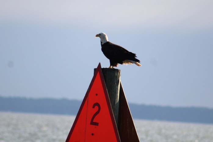
On the Dog River Channel headed to Mobile BayBald Eagle marking the entrance to Mobile Bay
After getting back to the Big Ship Channel, the crew made a left and headed toward the Gulf Coast Intracoastal Waterway (GC ICW) with following seas. A much more comfortable ride with those waves on the stern.
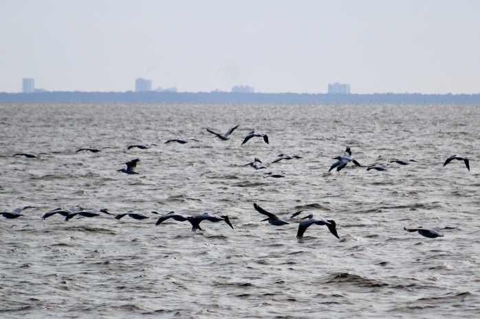
Pelicans in flight above Mobile Bay
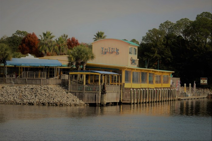
When the crew left the Bay, they set their sites on LuLu’s Restaurant where they planned to Dock & Dine. However, upon arrival the skipper noticed that there were no lights on. The Admiral noticed a guy on the fuel dock so she yelled across the water to inquire if LuLu’s was open. He responded, “No they are closed on Monday’s.” Now that was disappointing.
Not eating here this year
With that sad news, it was a short two miles down the ICW to The Wharf Marina where the crew would spend the next few days.
Tuesday and Wednesday
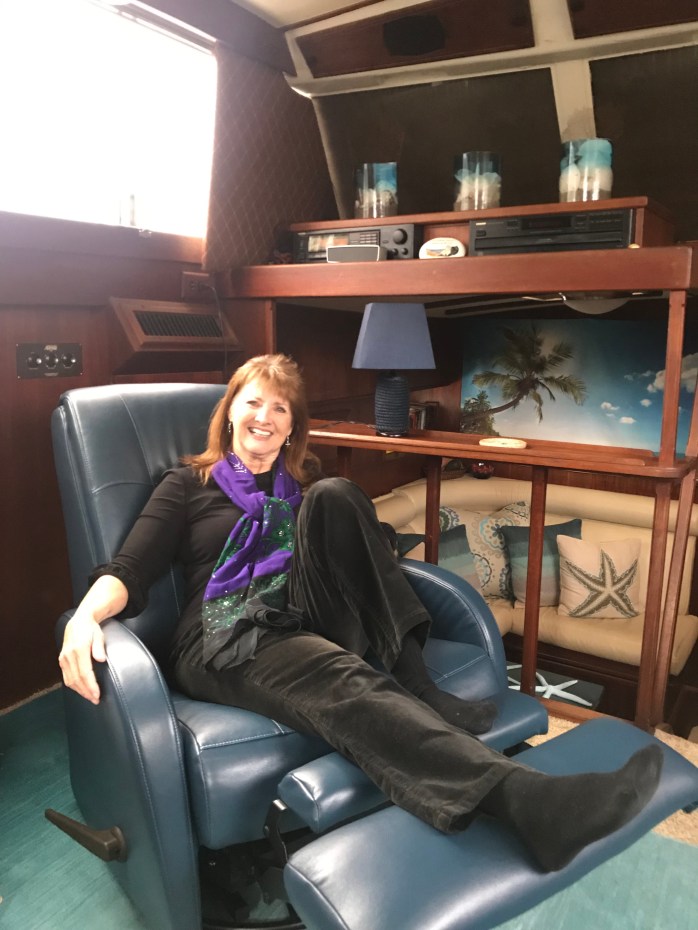
The Wharf is a shoppers haven. With so many stores to shop the Admiral had her work cut out. She rose to the challenge and shopped till she dropped. Unfortunately, she dropped a few George Washington’s along the way. After three years of searching, she finally found her perfect recliner that can fit thru the 23 inch door and is the right color.
After an exhausting day of shopping it was nice that KC and Scott set up a dinner for the Loopers at the Wharf.
The Wharf decorated for Christmas:
Thursday, December 6th
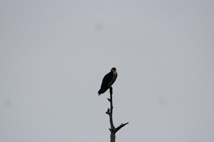
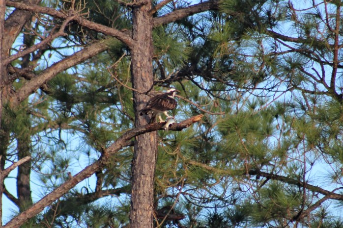
The crew made an early departure so that they could arrive in time at Pensacola to go visit the Navy Aviation Museum. The first interesting development in the morning though was watching an Osprey swoop down and catch a fish for morning breakfast just off the bow of the boat.
Fish Breakfast
The crew then entered Florida waters, so they know the quest for the Platinmum Flag is drawing near. A quick rough calc and it appears the crew has around 450 miles to go to complete their second Loop.
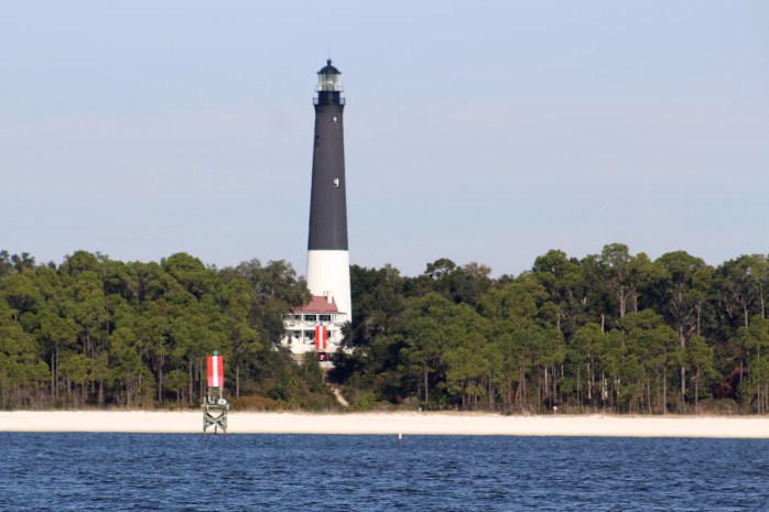
When the crew spotted the Pensacola Lighthouse they knew the day’s run was about over. They got docked, and then Bill arranged for an Uber ride to the Museum. Strangely enough, taxi’s are allowed on the Naval Base but Uber and Lyft are not. The Uber driver performed a bit of slight of hand and managed to deliver the group to the front door of the museum. The skipper does not think the driver fooled the gate guard at all, but what the heck, mission accomplished.
Pensacola Lighthouse
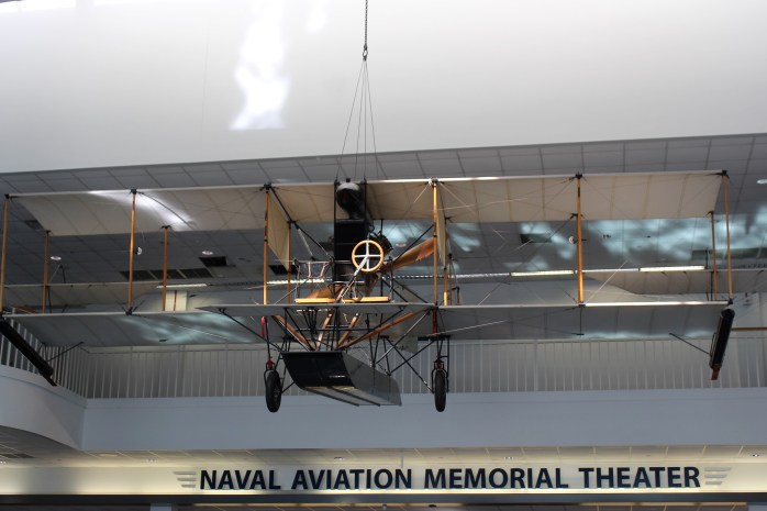
The museum was extremely interesting. The group arrived just in time to catch the 45 minute, 1300 tour. At 1530, the tour guide wrapped up his presentation. The tour guide did an excellent job of show and tell, and explaining the evolution of Naval Aircraft from the Navy’s first plane to the planes of WWII.
The Navy’s first ever airplane
The group only spent the afternoon at the museum, and the skipper could easily have spent two days taking in all the exhibits. He diffentily has this place on his ‘return and visit some more’ list.
With a 2.5 hour tour, the skipper has many interesting stories to share but will only share a few here.
For starters, the skipper is always looking for connections to home and family when he visits museums. He found both at the Aviation Museum.
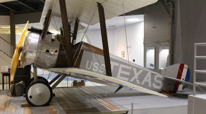
The Texas connection
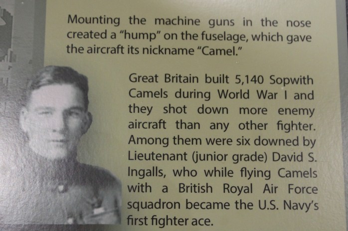
The tour took them to an interesting little plane named USS Texas. The plane was a Sopwith Camel and was used in WWI. In fact, a Lieutenant (junior grade) flew one of these planes to become the Navy’s first ever Ace. You may recognize that this is also the plane that Snoopy flies in the Peanuts cartoons.
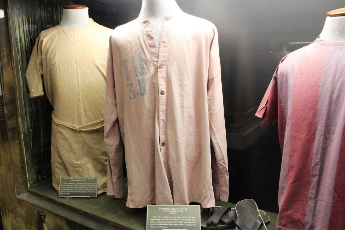
The family connection was discovered by Mary. It was tucked a way in a corner of the museum where the curator had built a Hinoi Hilton display comemorating all the naval pilots shot down in Vietnam. One of these pilots was Captain Robert B. Fuller who was shot down July 14, 1967.
Clothing of the Hanoi Hilton
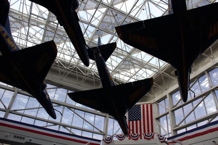
The last story to share was about a display of the Blue Angels flying in formation. The guide told a story about when the display was first finished, the curator brought in some past Blue Angel pilots to get their feedback. When they unveiled the display, it was obvious by the looks on the pilot’s faces that something was wrong. When questioned, the pilots asked why the planes were so far apart. They commented that while flying in formation the planes are never more than 18 inches apart.
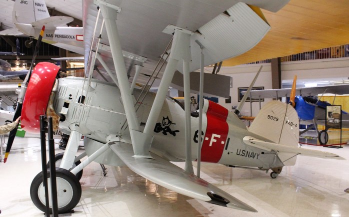
The guide also pointed out another interesting little plane that was used by the Navy between the World Wars. This plane was used to do flight demonstrations while tied together with two other planes. After WWII, Admiral Nimitz commissioned the now famous Blue Angels to carry on the mission and keep the general public interested in Naval Aviation. The Blue Angels formed in 1946 and are the secondest oldest aviation aerobatic team.
Predecessor of the Blue Angels
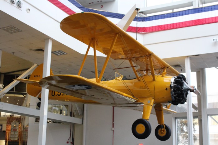
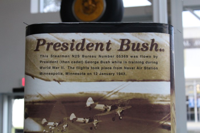
Ok, you probably guessed there would be one more last story. In honor of Presiden Bush who passed away this past week, here is a picture of the plane he used to log 30 flight training hours in before earning his wings.
The group returned to the marina just in time to witness the sunset.
Friday, December 7th
The run to Ft Walton Beach was anti-climatic for the crew. However, they did begin to see the first signs of Hurricane Michael which tore thru the area earlier in the year. The first signs of damage were the number of new docks that had already been rebuilt along the waterway. The second sign was an abandoned sailboat still lying on the shore waiting for disposal.
The worst of the damage is still east of the crew. As they pass by Destin, reports are pretty bleak. The two marinas in Panama City have still not re-opened. The marina at Port St Joe was completly destroyed.
But those are challenges to deal with next week. Today, the Admiral spotted a Whataburger that was only a mile from the Ft Walton Beach free dock and she mentioned she wanted to partake of a Whataburger for the evening meal. After all the boats were safely docked, several of the group headed to the local supermarket on foot to reprovision.
View from the Ft Walton Beach free dock
Later, after returning to the boat and stowing the groceries, the group set off for the Whataburger. While crossing the streets with Dan and Tori, the skipper learned the finer points of those bumpy mats found at the end of a sidewalk near the road.
When Tori approaches a corner, she pulls Dan over to those bumps and positions Dan on the mat. He can feel the bumps thru his shoes and knows he is ready to cross when the traffic stops. But if a sighted person is standing on the bumpy mat, the seeing eye dog and blind person, who the bumpy mat was designed for, cannot get properly positioned to cross the road.
If you are like the skipper, yes you have stood on the bumpy mat waiting to cross the road. The skipper prides himself on trying to learn something new every day. Today he learned to stay off the bumpy mat. Maybe you learned something new today also.
And yes the Whataburger was most excellent!
Saturday, December 8th
The weather dictated that the flotilla stay put today. The winds were already blowing about about 10 miles per hour at 0700, and are predicted to climb to 20 by late afternoon. The gusts are forecast for the 30’s. With no good options for a marina in the next 150 miles due to the hurricane damage, the flotilla moved across the waterway to get in a small cove that is better protected from the wind and wave action to ride out the blow.
Moved along red line to protected coveIn a protective coveRiding out the blow
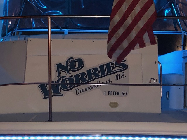
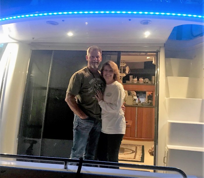
Boat Name of the Week
Notice the back of their boat has the following scripture reference: I Peter 5:7 (ESV)
……casting all your anxieties on him, because he cares for you.
The crew of No Worries. Had a wonderful evening with ya’ll.
Next Week
The crew will continue their east bound journey along the Gulf Coast and stage in Carrabelle for the Gulf Crossing to Tarpon Springs. At this point, the forecast shows a poential crossing for Wednesday/Thursday night. If that window does not materialize, the next opportunity to get across the Gulf and to the west coast of Florida may not appear until December 18th. The crew will watch and wait to see what happens.
Loop On – Where the road ends, the water begins. The water goes on forever, and the adventure never ends.
Eric here catching you up to date on the latest travels of Still Waters II. Click on this link to see the day- to-day travel log.
I would also like to welcome new virtual crew members Port Canaveral Transportation. I am not sure where we will put the limo yet, but I am sure we will figure something out.
Welcome aboard!
Lastly, I will be dedicating this post to a good friend of the skipper, Bill Nix. The skipper and Bill met back in 1987 and became good friends and fishing buddies. Bill was also a huge fan of Salvador Dali’s work. He also has an uncanny resemblemce to Crabby Bill.
Bill Nix, friend extraordinaire
Crabby Bill ‘s is a favorite restaurant of the crew
Summary of week:
The crew left Clearwater and cruised to Gulfport to visit the Salvador Dali Museum. After a surreal experience in Gulfport they made their way to Venice.
Monday February 6, 2017
With only a short run of 25 miles to Gulfport, the crew got a late start. What a difference a few days makes. With everybody back at work there were very few boaters on the water today. A much more comfortable and enjoyable time today on the water.
Condos lining the GICW
Much of the run was through condo lined beaches and shores. When there was not a condo there would be private residences. This meant that the NO WAKE signs were posted along most of the run today which slowed progress down.
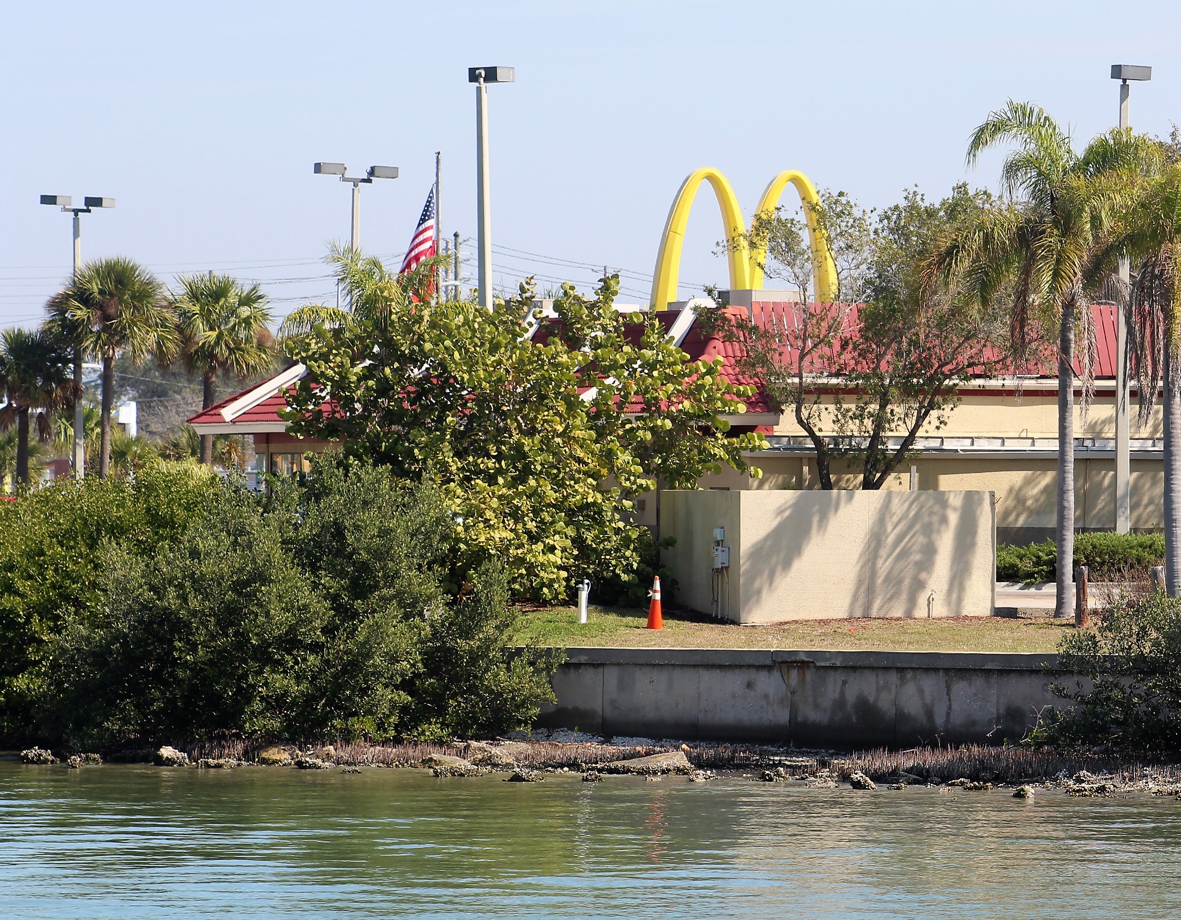
McDonald’s on the water = milkshakes and hot apple pies for crew members
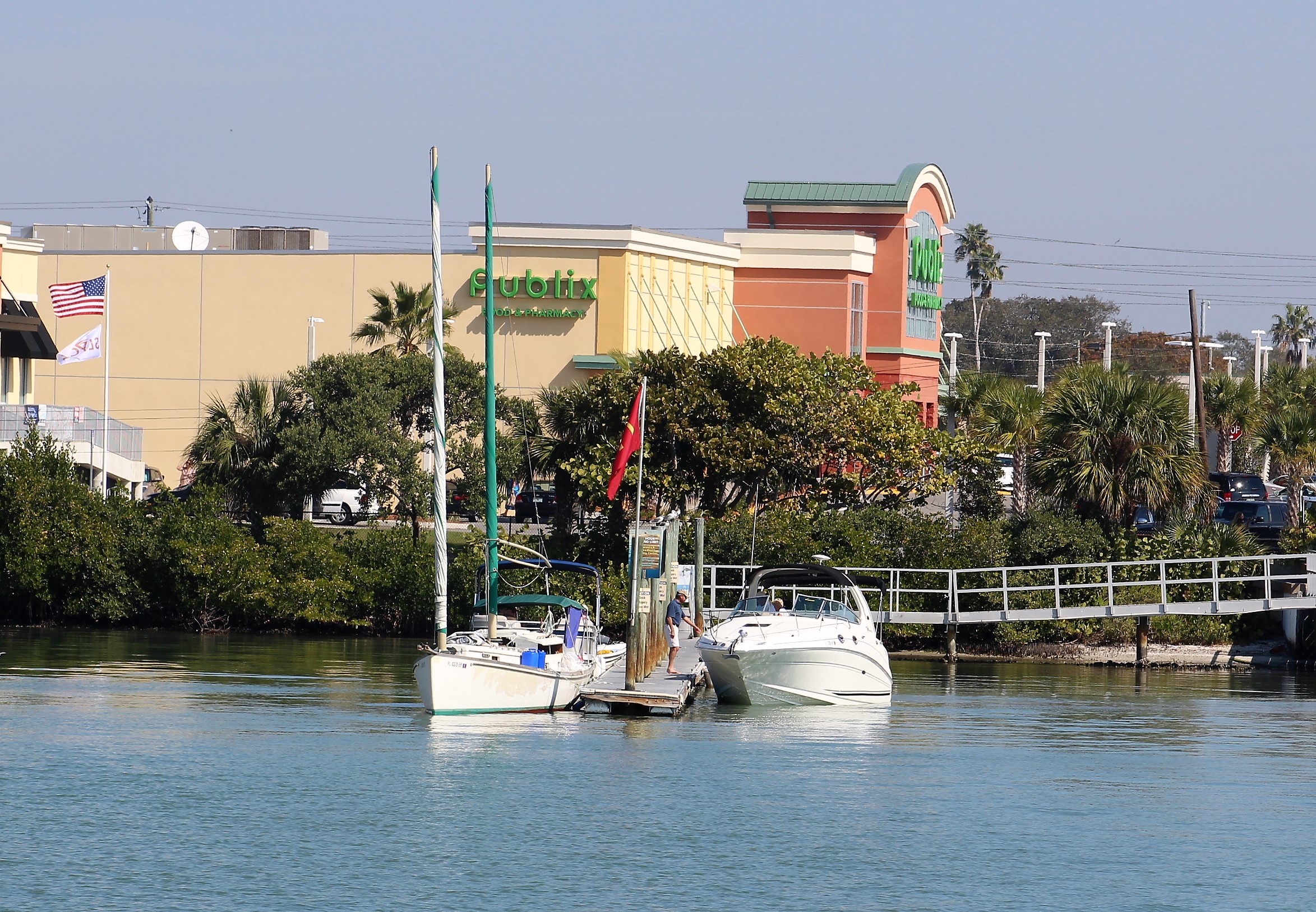
The skipper noticed that a McDonalds was positioned along the water with a private dock. The crew decided to dock and go buy milkshakes for an afternoon snack. An added bonus was a Publix grocery store next door, so the Admiral also made a small provisioning run for a few items that the crew needed.
Arriving at the McDonald dock
After arriving in Gulfport, the crew took a short walk to check out the waterfront part of town.
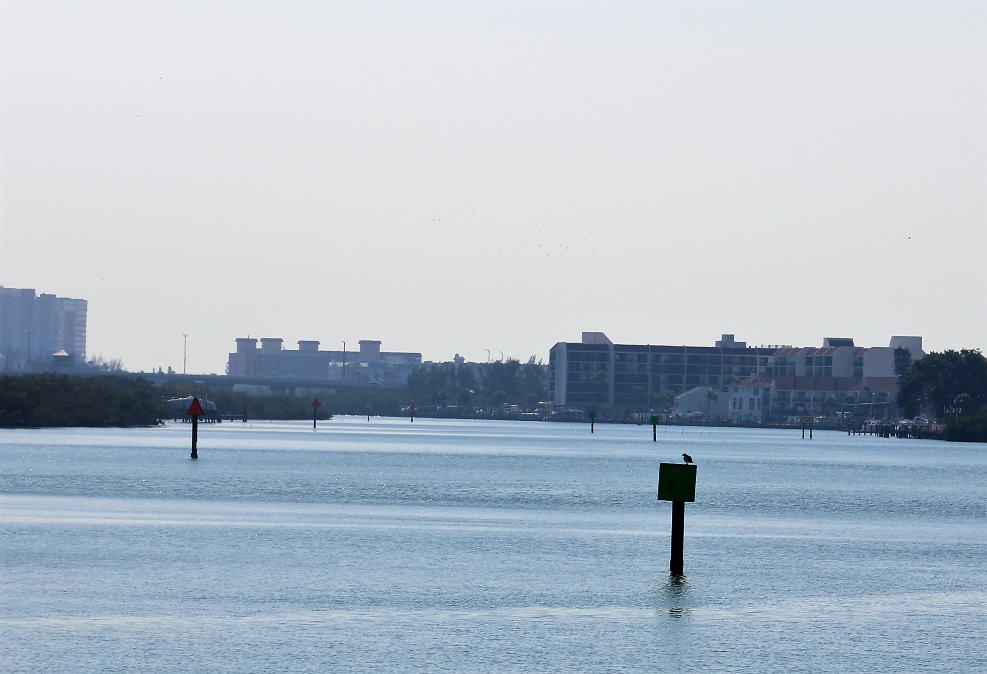
Overhead view of Gulfport Municipal Marina
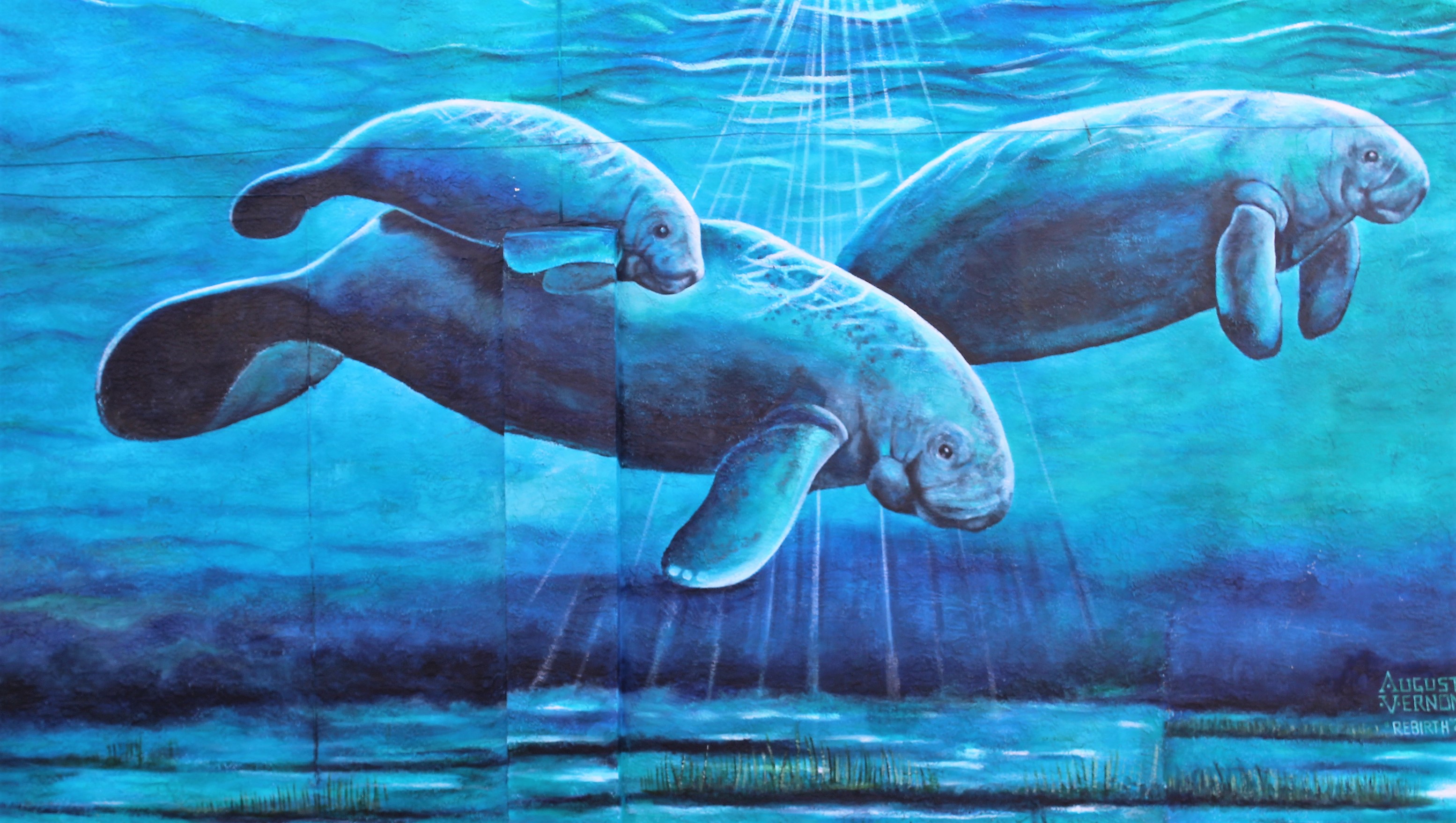
Manatee mural on side of business
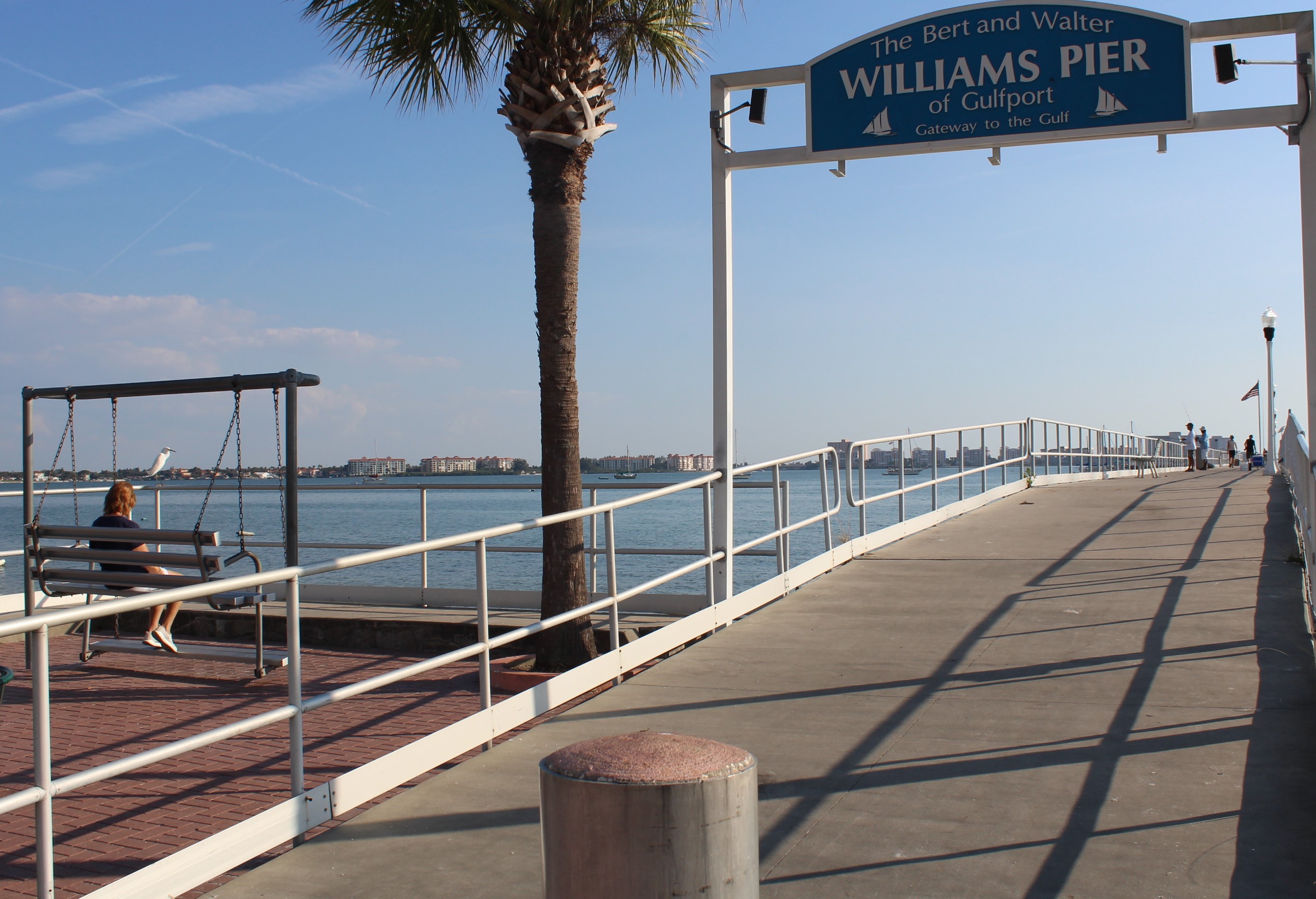
Of course, the Admiral found the swing overlooking the Bay.
Tuesday, February 7, 2017
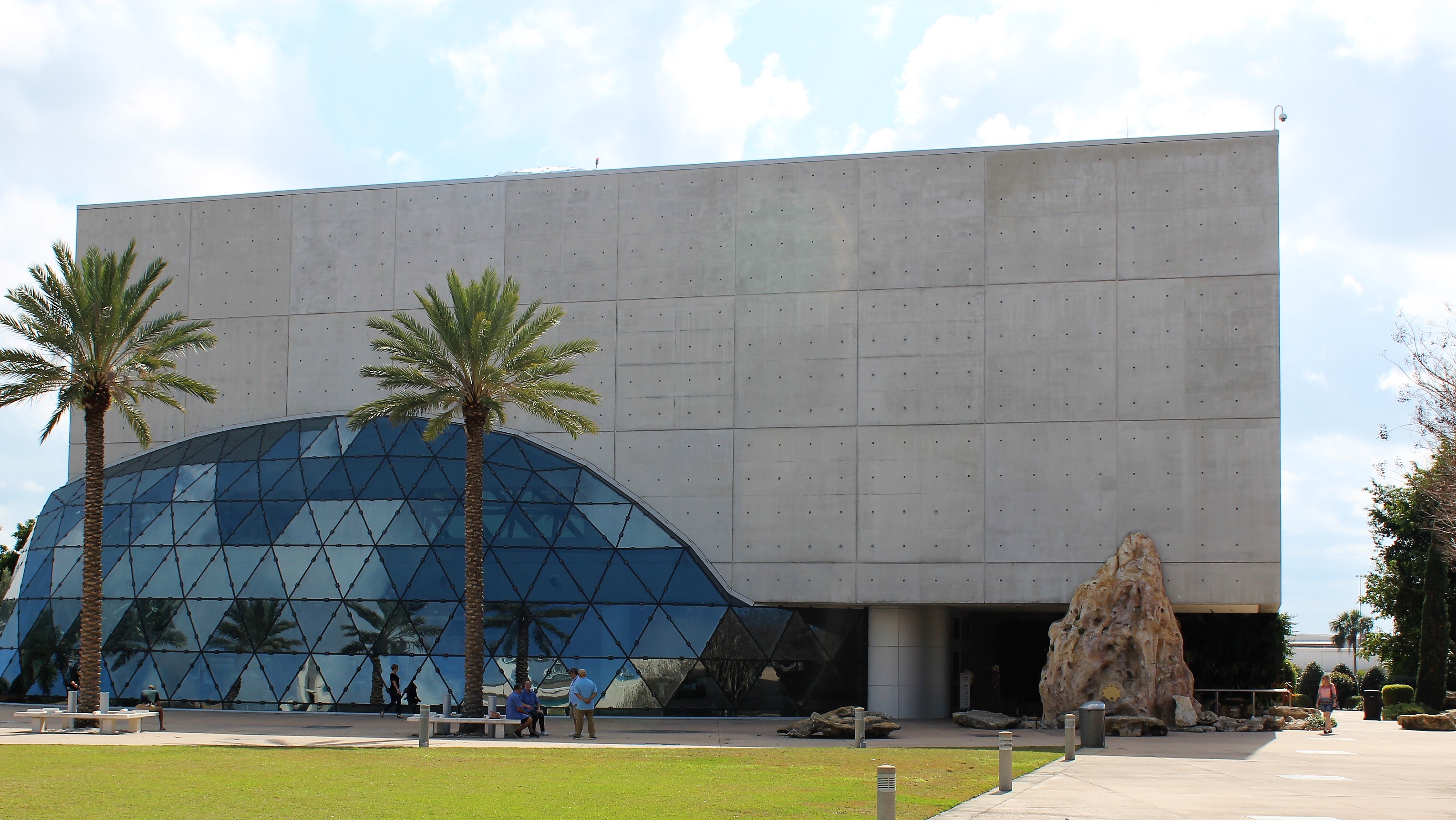
Today’s destination was the Dali Museum which houses the largest collection of Salvador Dali’s work outside of Europe.
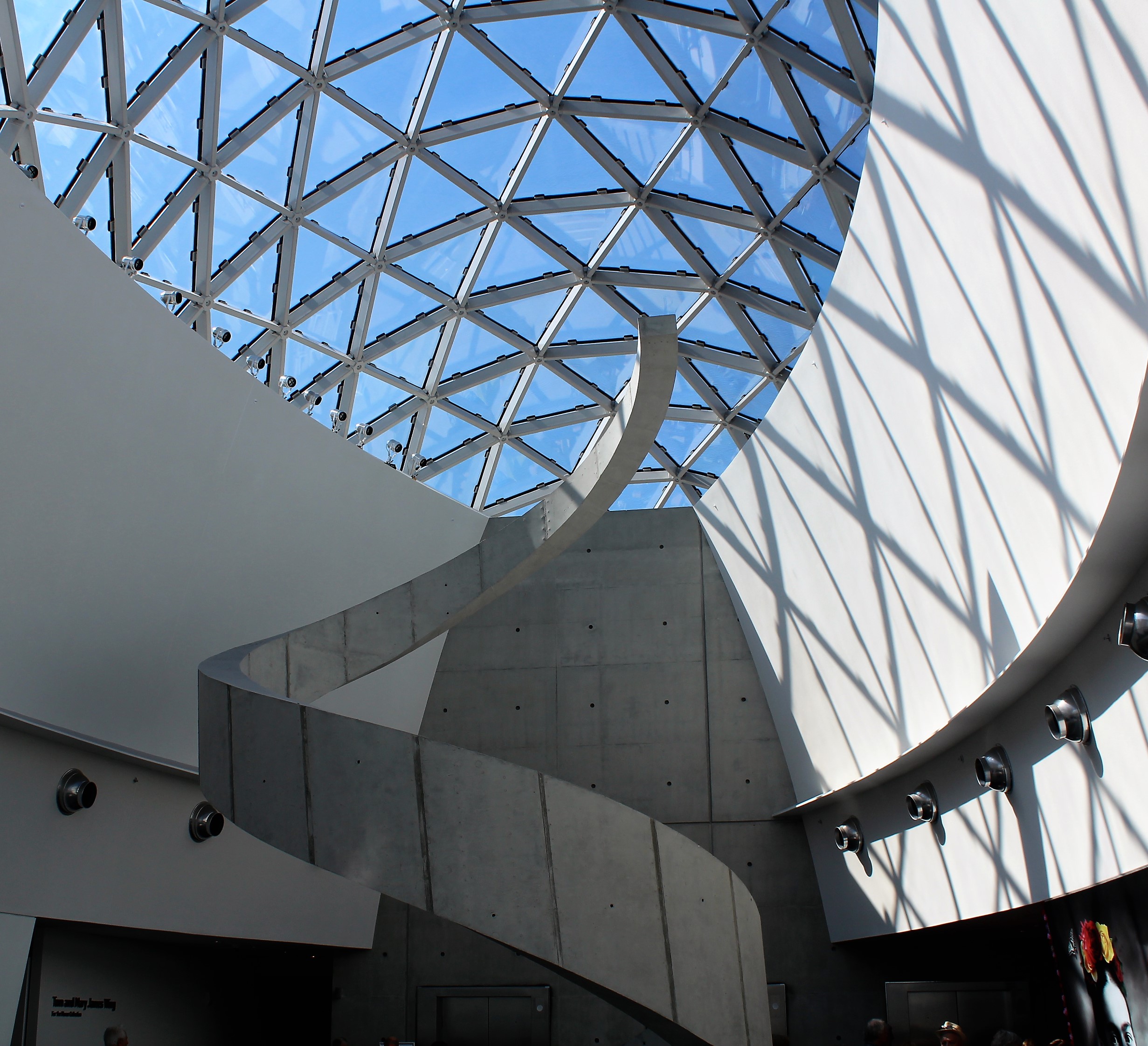
Dali Museum
The crew wanted to stay at the St. Petersburg Marina which is next door to the museum, but the transient docks are under repair and their was no slip available. Thus, they went to Gulfport which is about eight miles from the museum.
Spiral staircase inside the museum
The skipper found a bus route that was near by (1 mile walk to pick up bus) and that would drop the crew off within a quarter mile of the museum. The bus ride took them through some of the finest neighborhoods in St Petersburg, NOT!
After arriving at the museum, they purchased tickets and took the audio tour of the museum and exhibits. The audio tour was excellent. If you would like to participate in the audio tour, go to the app store and download the free Dali Museum Virtual Tour app. The app will show the works on exhibit and give a brief explanation on the piece. The app is the same tour we had at the museum.
17 year old Dali self portrait
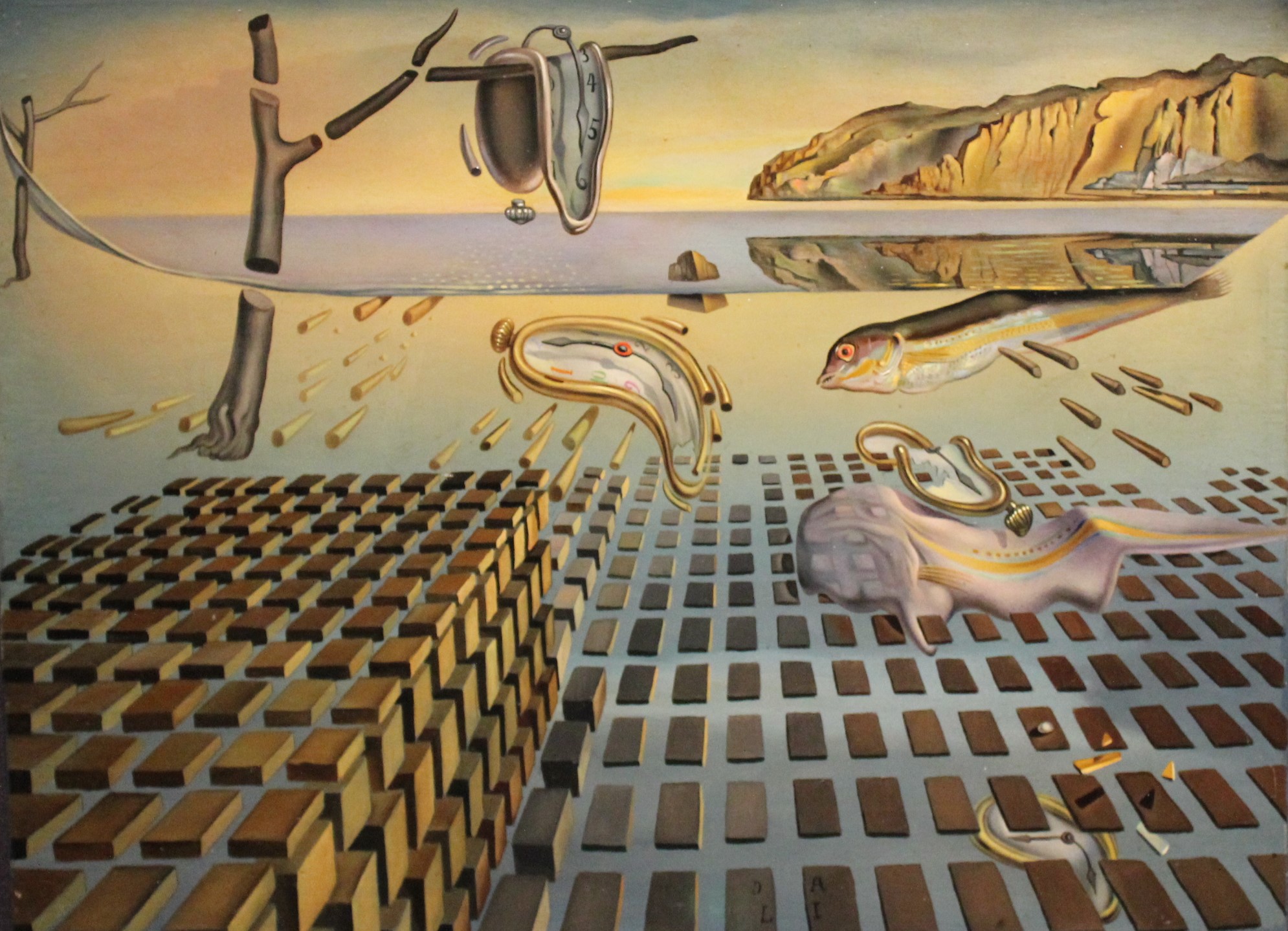
The Disintegration of the Persistence of Memory
The above painting was a redo of his Persistence of Memory painting that he completed in 1932. The above project was completed in the 1950’s after atomic energy was discovered and shows time melting away while the other parts are breaking down into their subatomic pieces.
Gala Contemplating the Mediterranean
The above painting is a double image. At the museum, if you stand 20 meters from the painting you can see a portrait of Abe Lincoln. If you squint your eyes while looking at the pic you can see Lincoln. Also, if you hold a mirror up to the painting or pic and look at the reflection you can see Lincoln.
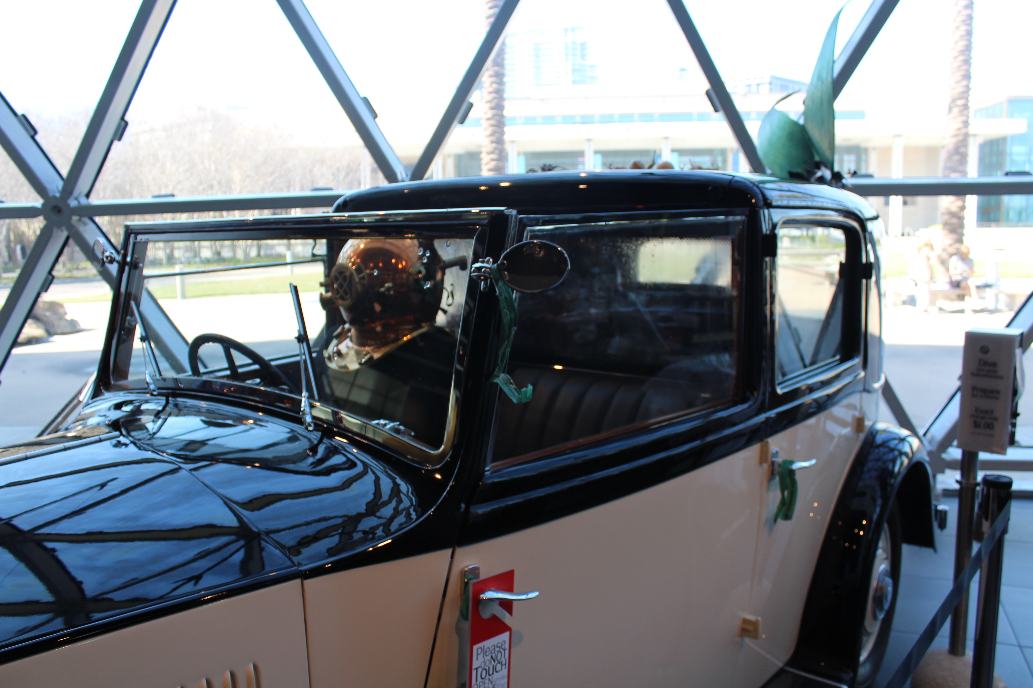
The Rolls Royce was an interesting piece. Usually you get in a car to get out of the rain. If you look at the driver, you will notice he has on a deep dive suit and helmet. The backseat has been enclosed and water is falling along the windows. The passenger is a mermaid.
Famous Dali moustache in the gardens.
Another neat exhibit was a virtual reality tour of the painting Archeological Reminiscence of Millet’s “Angelus”.
The virtual reality tour put you in the painting and you could walk around inside the painting to explore it closer.
Overall, this was an exceptional day for the crew at the Dali Museum.
Now all they have to do is figure out how to get back to the boat using their all day bus tickets. There is always adventure around every corner. They got on a route 23 bus that should have taken them within about half a mile of the marina.
But somewhere on the route the bus driver stopped and got off the bus. A few minutes later he got back on the bus and took off again. The skipper noticed that they were now on route 14 verse 23. The skipper pulled up the route maps and laid 14 and 23 out together. He found a spot where 14 and 23 intersected.
At the intersection, the crew got off the 14 bus and had to wait 20 minutes for a 23 bus. Once on the 23 bus they were once again headed in the right direction. The 7 mile distance back to the marina took almost two hours to execute. hmmm
Wednesday, February 8, 2017
As the crew traveled further south on the west coast of Florida, the competition for marina slips has begun to increase. The crew had planned to stay in Sarasota for a few days, but the marina slips were not available because a Yacht Club had arrived and taken most of the spots through the weekend. There was one mooring ball available, but the wind is supposed to kick up to 20 mph on Thursday and the crew did not want to be out in the middle of the water bouncing around in the wind and waves tethered to a mooring ball. The crew opted to move further south to Venice.
Crossing Tampa Bay
The 52-mile run was made even longer because the course went through some narrow channels that were marked for slow speed due to Manatee Zones.
Following a sailboat in a manatee zone
When the crew was not in a manatee zone they were in areas with houses and canals which were posted No Wake.
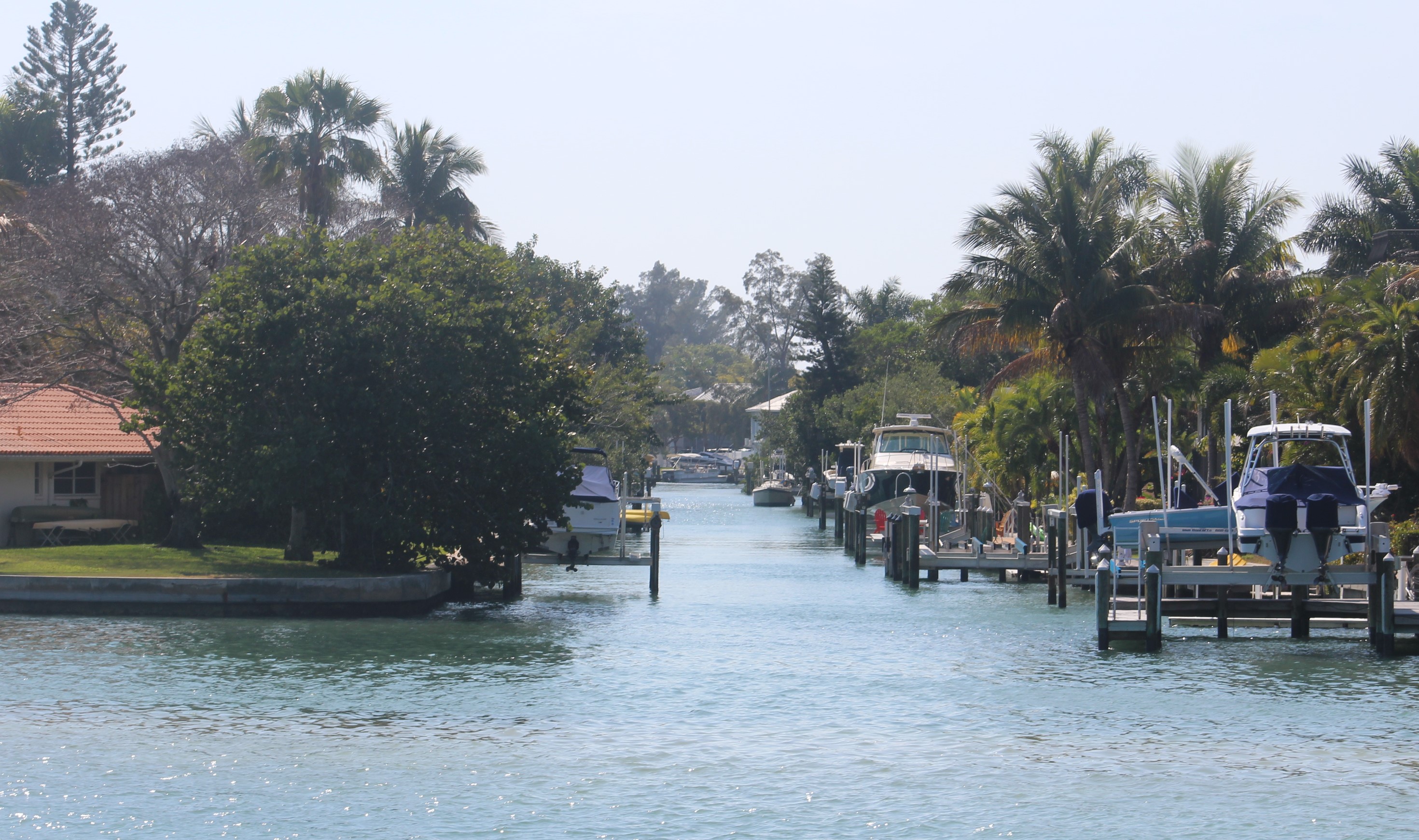
One of hundreds of canals lined with boats in this area
Overhead view of a few canals.
Then there were the million dollar homes that lined the shore also.
This home has water on three sides
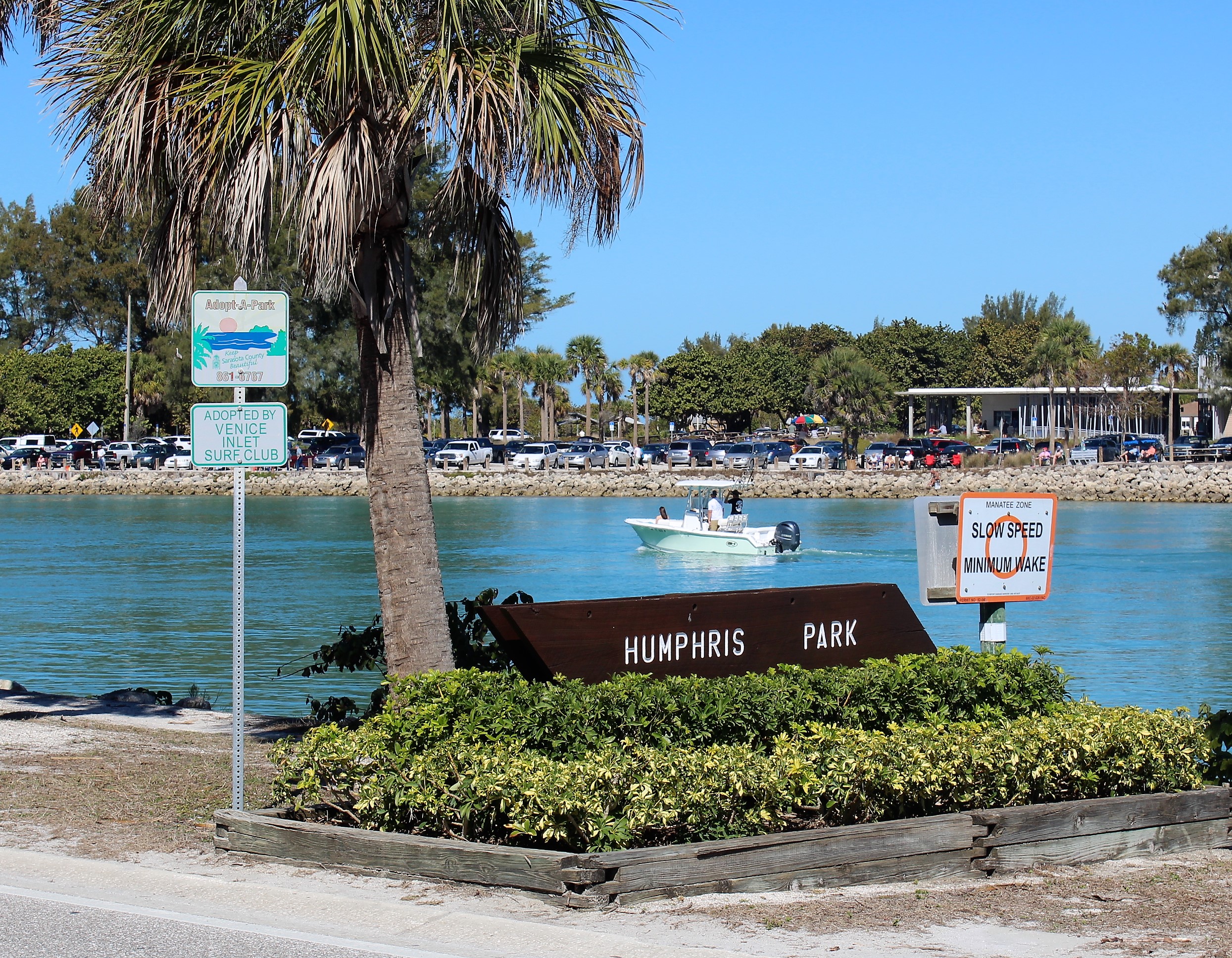
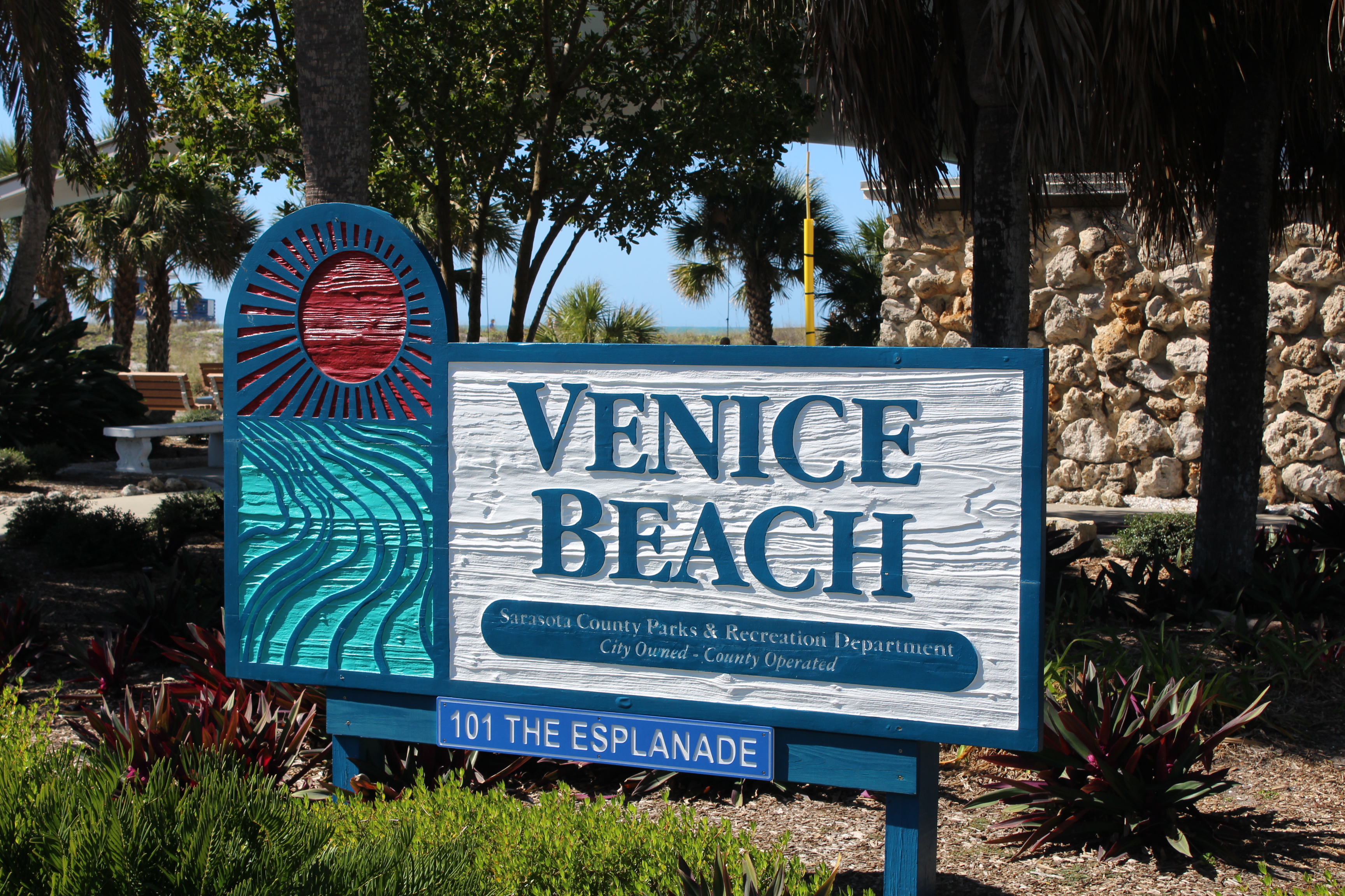
The crew eventually arrived in Venice where they will hang out for a week because the marina provides a pay for 5 nights, get 2 nights free. The skipper has trouble passing up free.
Docked at Crow’s Nest Marina
Saturday, February 11, 2017
The crew spent an uneventful day cleaning and working on the boat yesterday, so today they decided to walk around historic Venice and check the place out.
One of the places the locals and snowbirds come to watch the sunsets.
The first observation is that this is definitely a place that the retired crowd has taken over. There are not many folks under 50 even visible. The beach is full of older folks but no youngsters. It is a very quiet and peaceful town. There also is a very large snowbird population here based on the license plates driving around town.
Sailing at sunset
The crew finally discovered an historical marker that explained the retirement vibe going on in town. The town was actually designed and built to be a retirement community for railroad employees. The ‘city plan’ was completed in 1926 by John Nolen. George A Fuller was selected as the contractor to build the town according to the plan. The first road was completed in 1926.
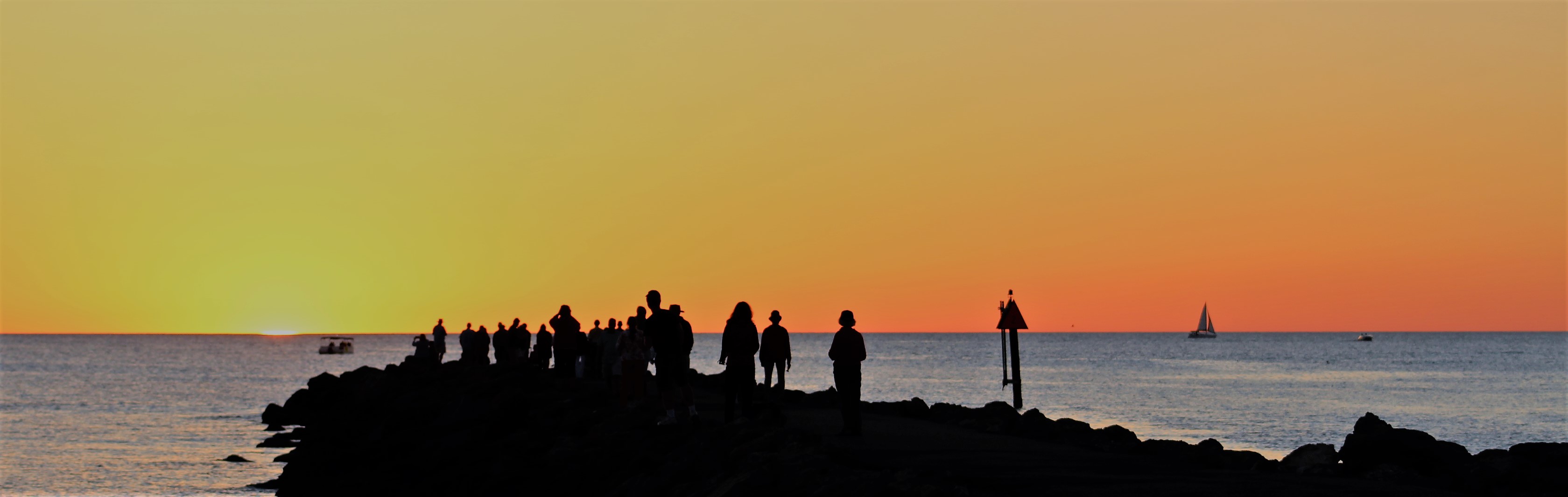
Folks watching the sunset from the jetty
The Great Depression put a major hit on the development of the area and much of the plan was put on hold. The town got a kick start when an Army Air Base was established here in 1942.
A sad claim to fame is that three of the 9/11 hijackers completed their flight training at Huffman Aviation which is located at the Venice Municipal Airport.
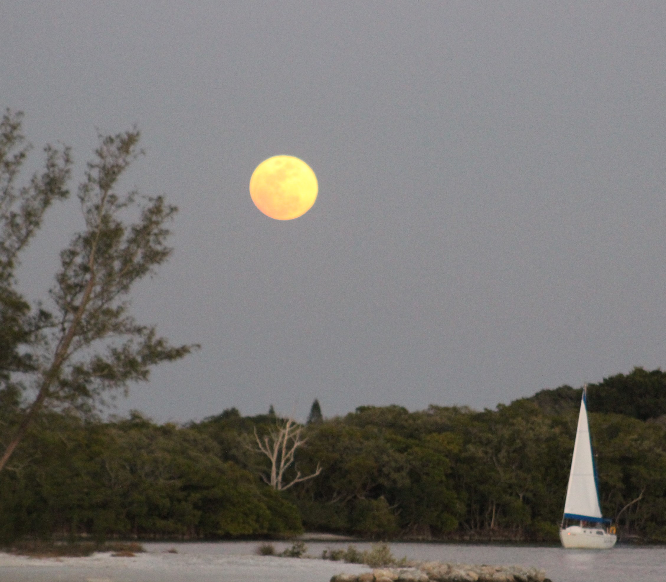
February Snow Moon from Marina
Next Week – The goal is to actually make it back to Sweet Water Landing Marina by the end of next week. You might recall that this is the marina where this adventure started back on June 28, 2015.
The skipper is watching the weather and wind to determine the actual path and travel days to make these last 58 miles before crossing their wake and hoisting the gold flag.
Loop On – The water goes on forever and the adventure never ends.
Eric here catching you up to date on the latest travels of Still Waters II. Click on this link to see the day- to-day travel log.
I would also like to welcome Scott M. aboard as our newest virtual crew member. Scott plans to start the loop in May 2017. Welcome aboard Scott.
Summary of week:
The crew moved to Carrabelle on Monday and launched their Gulf crossing to Tarpon Springs on Wednesday. They then moved to Clearwater on Saturday.
Sunday, January 29, 2017
The wind was forecasted to lay down Saturday about 1600. Well that did not happen. In fact, the winds continued to blow all day Sunday, so the crew cancelled their anticipated run to Apalachicola. The skipper was busy recalculating the next route based on the latest weather information.
Monday, January 30, 2017
The wind finally laid down about 0200 in the early morning. The crew decided to skip Apalachicola and make the 62-mile run all the way to Carrabelle because there looked to be a good weather window to cross the Gulf on Tuesday night / Wednesday.
Shrimp Boats near Port St Joe
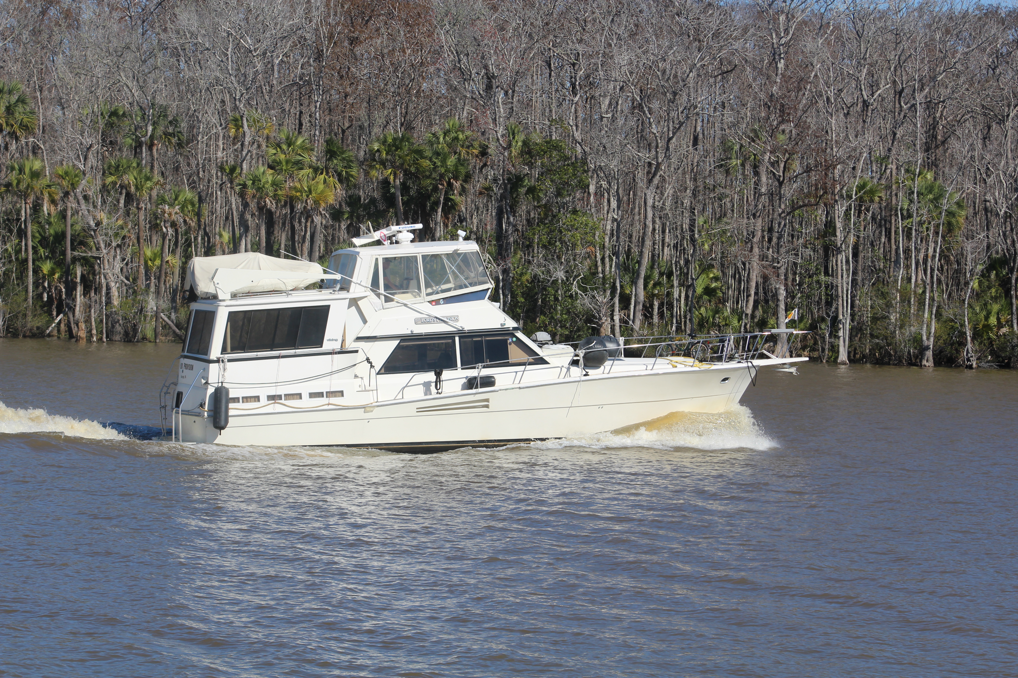
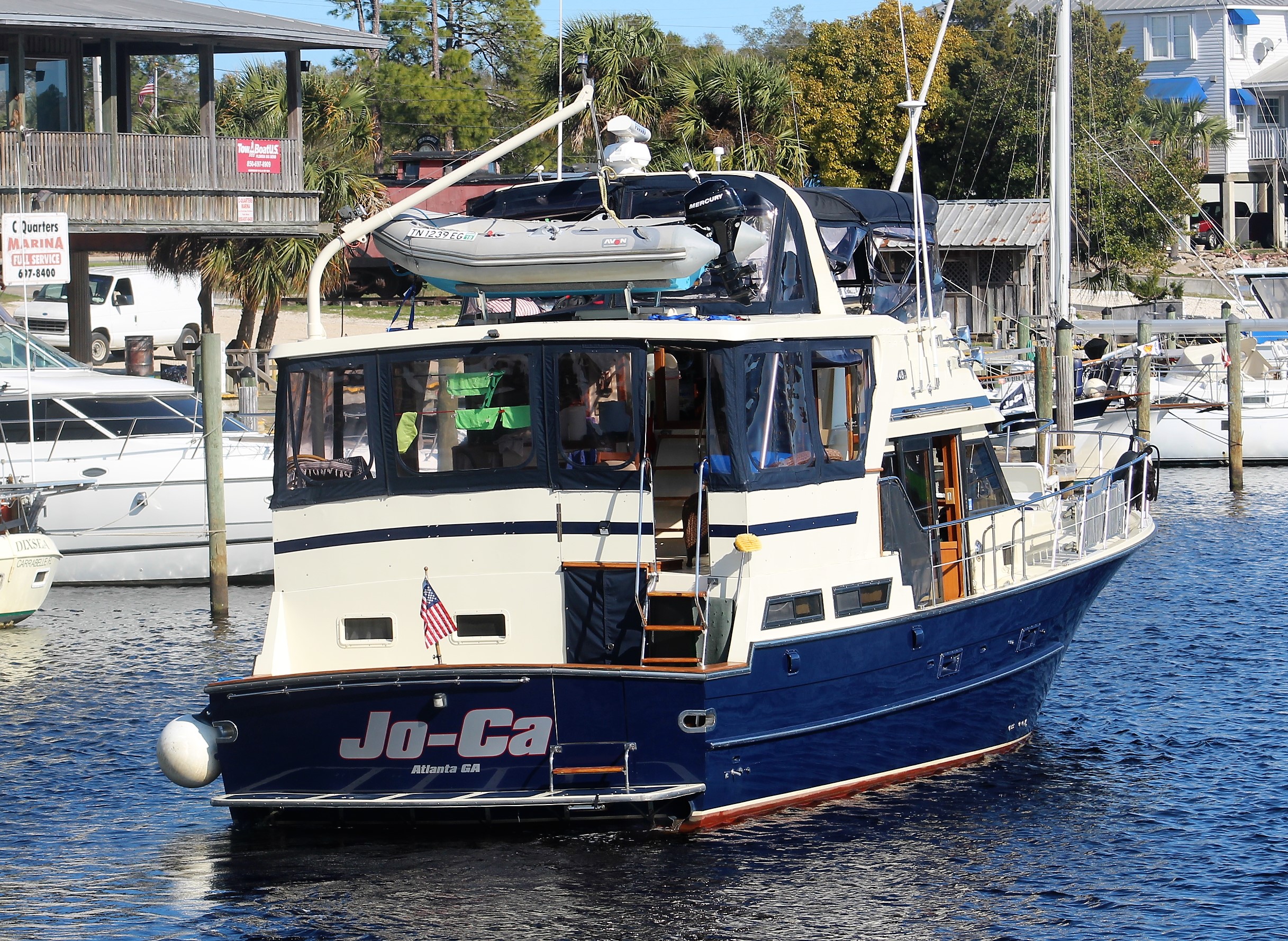
The crew buddy boated with The Lord’s Provision. The two crews left just before 0900 and made good time over to The Moorings at Carrabelle. The crew met up with Abaco Lady, Journey and Jo-Ca, also staged at The Moorings Marina to cross the Gulf on Tuesday.
The Lord’s Provision, a 48′ Viking
Based on the ever-changing weather conditions, all the crews agreed that a Wednesday / Thursday crossing looked better than launching out on Tuesday.
Tuesday, January 31, 2017
Tuesday became a day of relaxation and planning as all the crews were gearing up for the Gulf crossing.
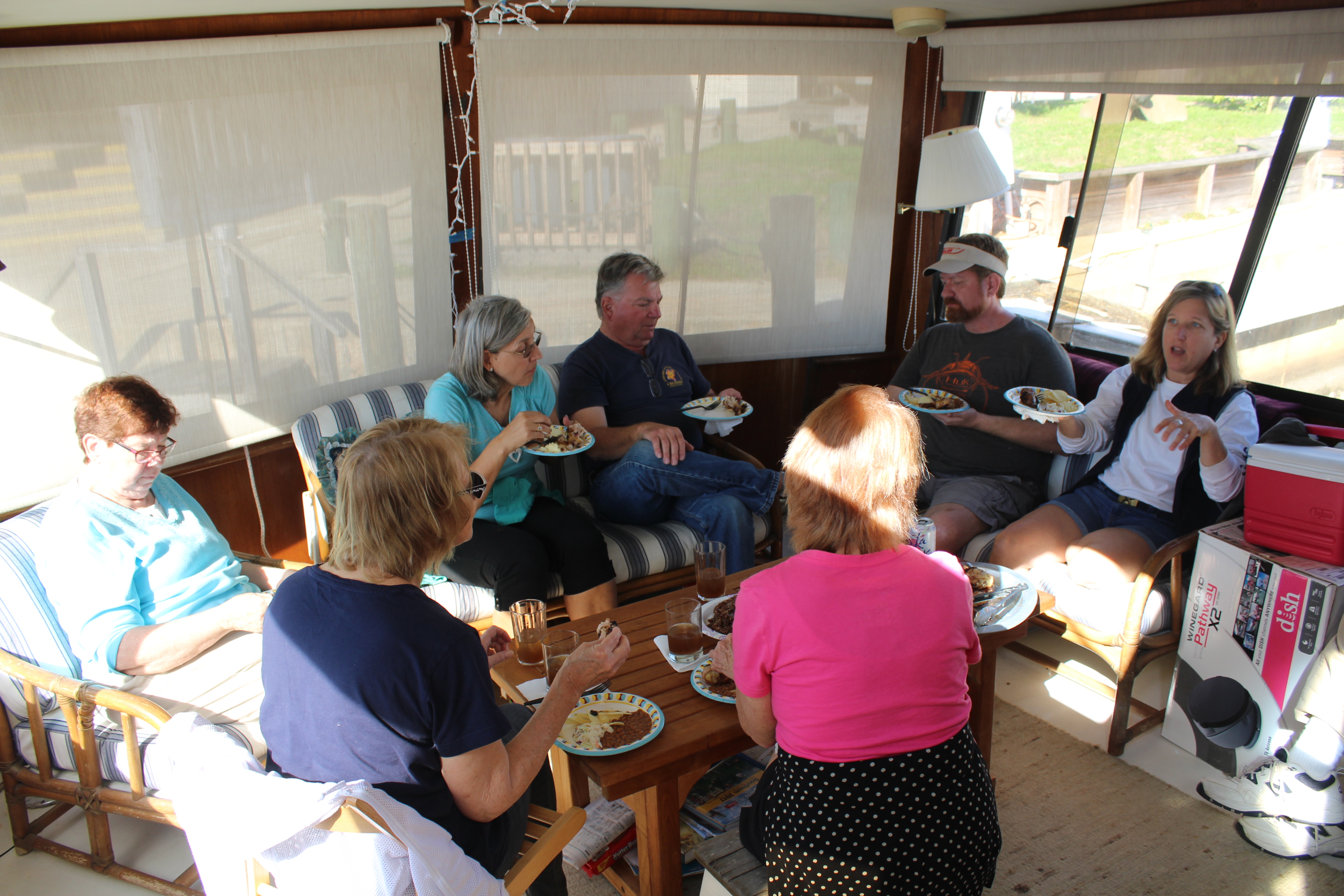
Roger, the skipper of The Lord’s Provision, decided to grill chicken for everybody, so we met on board his boat for lunch and the skipper dubbed it ‘The Last Supper.’
Lunch on The Lord’s Provision
After lunch, the crews had a final preparation meeting to finalize plans to cross the Gulf. The Lord’s Provision, Abaco Lady, and Journey were going to go fast (18 mph) and complete the crossing in 10 hours. While Jo-Ca and Still Waters II planned to go slow (9 mph) and complete the crossing in 20 hours.
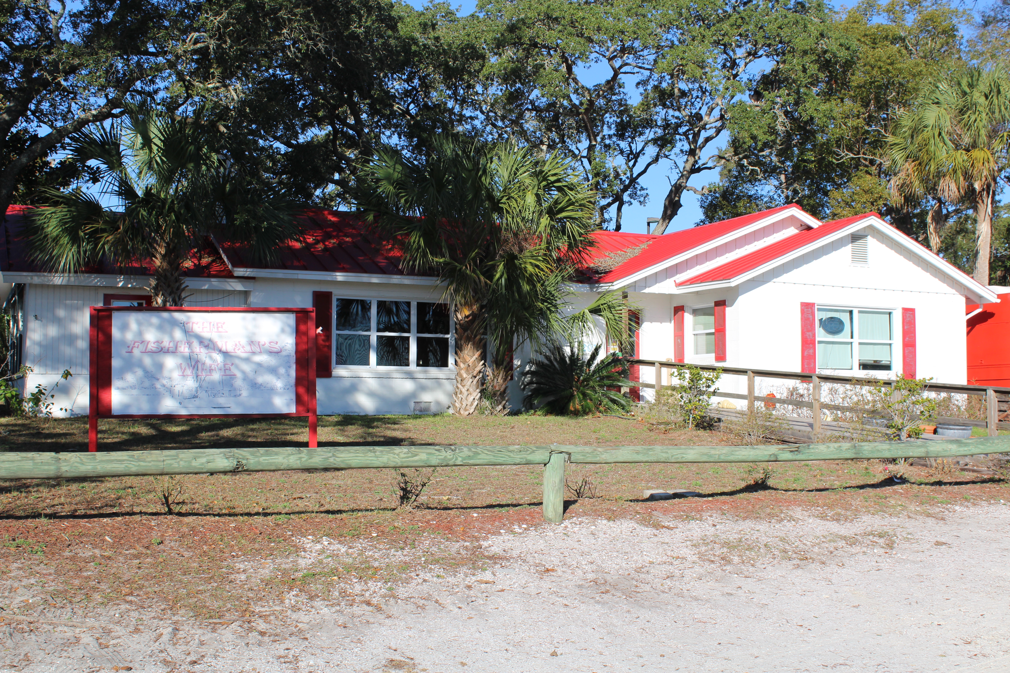
The Fisherman’s Wife – Some of the best fresh seafood on the loop
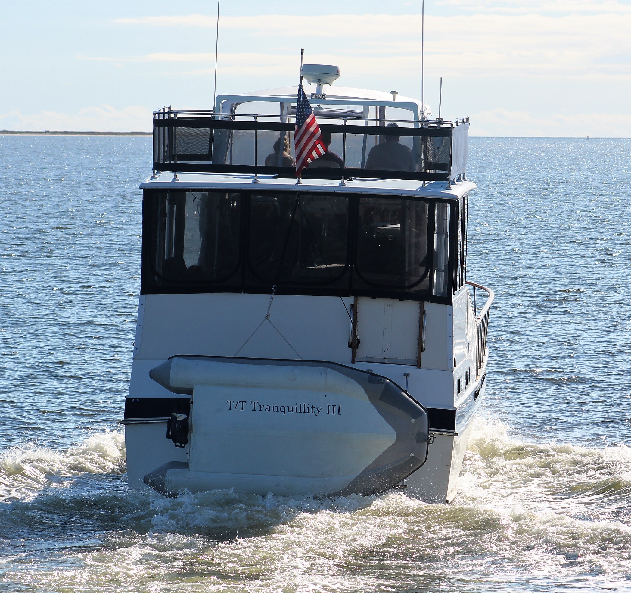
After the crew meeting, most folks went to The Fisherman’s Wife for supper. While at supper, the crew ran into the crew of Tranquility III. The crew of Tranquility III was interested in joining the slow boats for the crossing. The final preps were made, and the slow boats decided to leave together at 1500 on Wednesday.
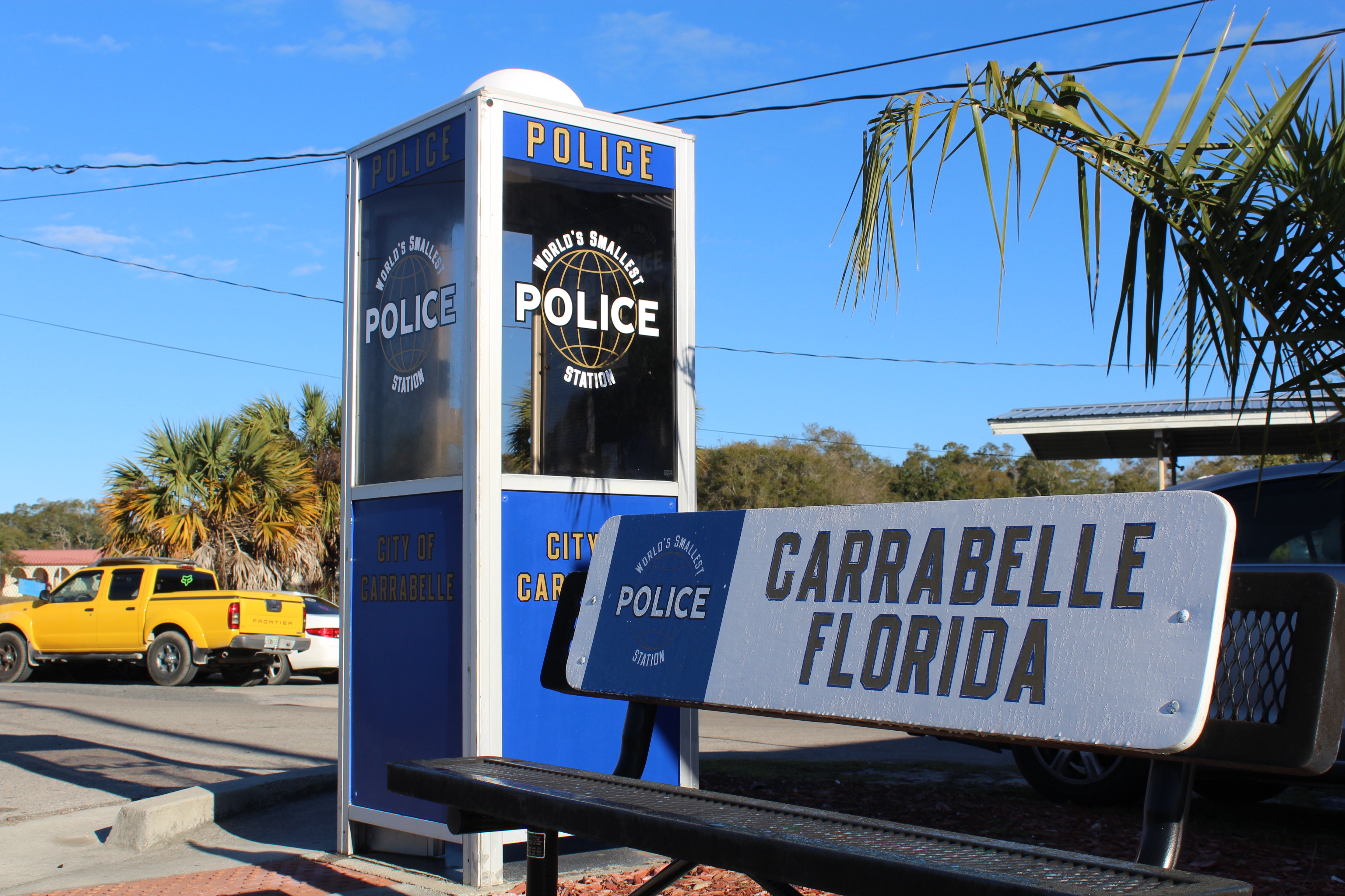
World’s Smallest Police Station
After spending a few days in Carrabelle the crew learned a few things worthy to share. For starters, the town was incorporated in May of 1893. The area had many natural resources of virgin forest and a deep water harbor. The railroad also came to town to help the area prosper.
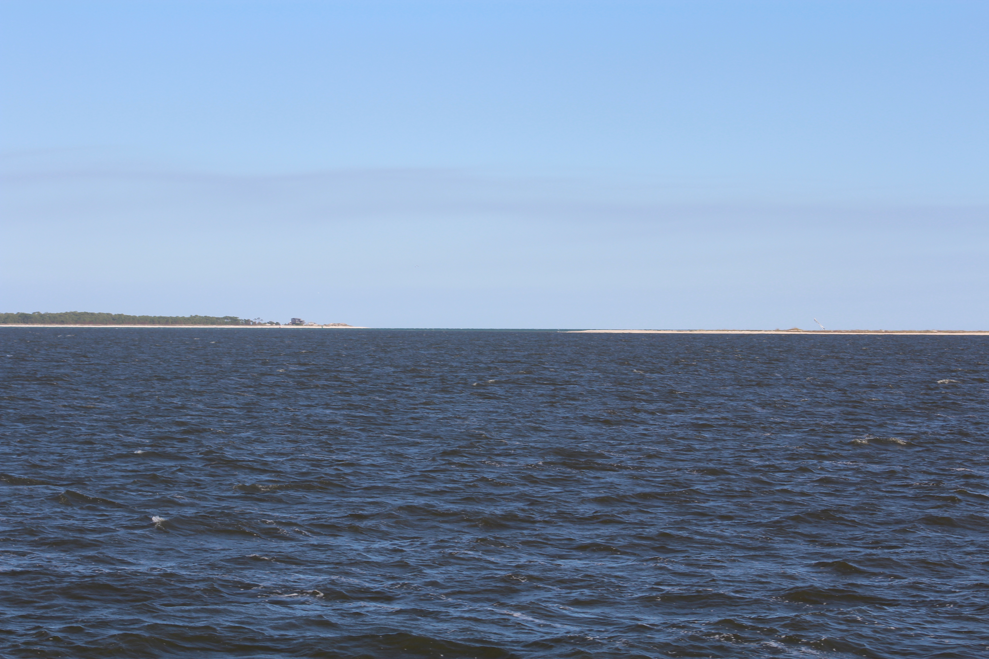
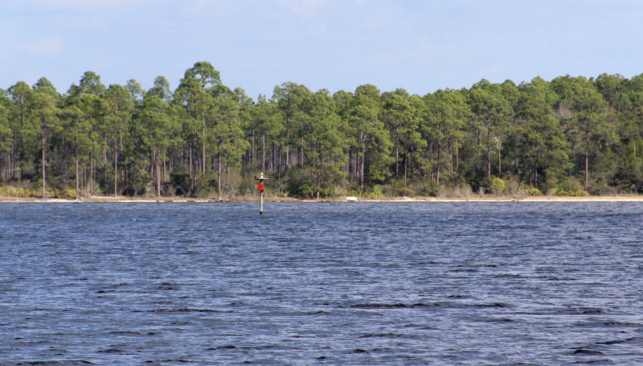
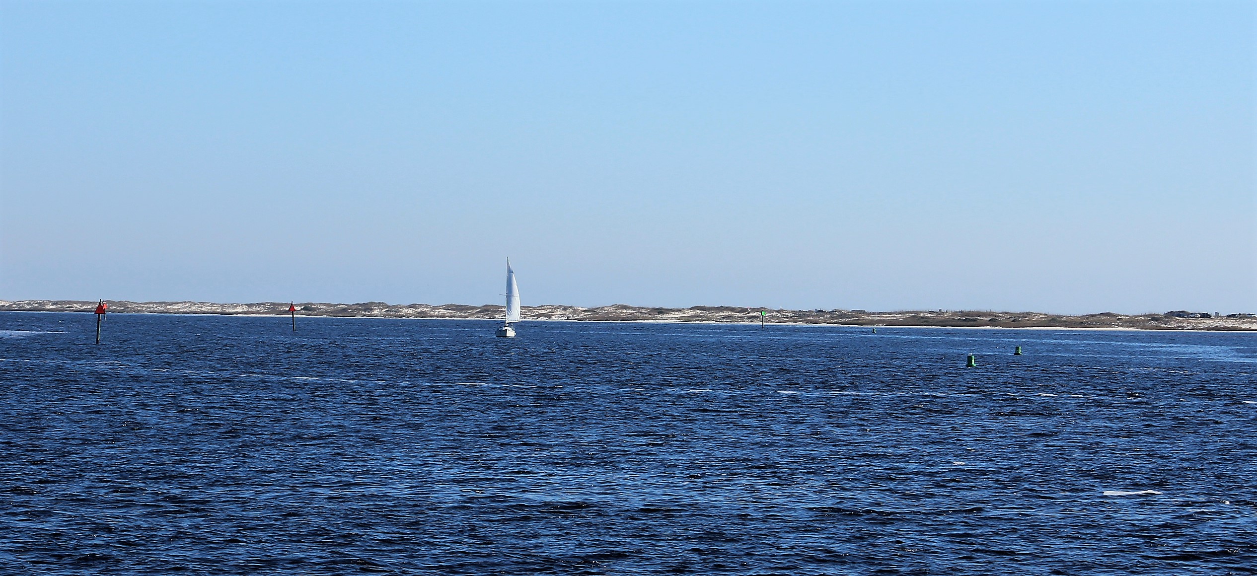
During WWII Camp Gordon Johnston trained 250,000 men in the art of amphibian warfare. The area was selected for this specific task due to the barrier islands, Dog Island and St George Island. The army practiced their beach landings on these two islands that the crew will pass between on their way into the Gulf of Mexico.
East Pass to the Gulf. St George Island on the right and Dog Island to the left
Wednesday night / Thursday, February 1-2, 2017
The fast boats got up before the crack of dawn and were off the dock by 0530.
One of the three slow boats crossing with Still Waters II
The slow boats continued their final preps and were off the dock by 1500. One minor issue though was an unexpected wind that blew in about 1400. Before leaving the dock, the skipper reviewed his favorite weather sites and learned that this new wind was predicted to lay down at dark (1830).
Tranquility III preparing to leave the dock for the Gulf crossing
Unfortunately, when the crew got out of East Pass and entered the Gulf of Mexico, the crew found the winds about 12 mph and the waves 2-3 feet. The three boats decided to continue to cross the Gulf based on the wind forecast. Again, the forecast was wrong. The wind did not lay down until about 2300 and the waves did not calm down until midnight. This made for a very lumpy, rolly, rocky, ride for the first nine hours of the run.
Tranquility III took the lead across the Gulf. They have auto pilot and set a waypoint on the Red 4 Marker on the other side of the Gulf. Still Waters II fell in behind Tranquility III and followed her across the Gulf.
Headed to East Pass and the Gulf of Mexico
The swells were hitting the boat on the starboard beam while the windblown waves were hitting the bow of the boat. With the average waves at 2-3 feet, there were many waves in the 4-5-foot range. The period between waves was less than 4 seconds.
Just a few examples of just how bad it was for the first nine hours:
Tranquility III had three people onboard. Their plan was to have two people at the helm at all times, and one person below sleeping. Within the first hour of entering the Gulf, one crew member got seasick. Then, within the next hour, a second crew member got seasick. Now they had one member at the helm and two members below trying to recover from the Gulf Flu.
Onboard the Jo-Ca, the constant beating of the waves on the bow caused a port hole to blow out. Now every time a wave hit the boat they were taking on water. Eventually this caused a high bilge alarm to warn the crew of a problem. The forward stateroom was soaked due to the incoming water. It took about an hour, but eventually the crew was able to affect a temporary MacGyver repair that lasted the duration of the run.
Onboard Still Waters II, a large wave hit the boat that caused the cookie cache to go flying across the helm resulting in the loss of over half the cookies. Anybody who knows the skipper knows that this is a real big deal.
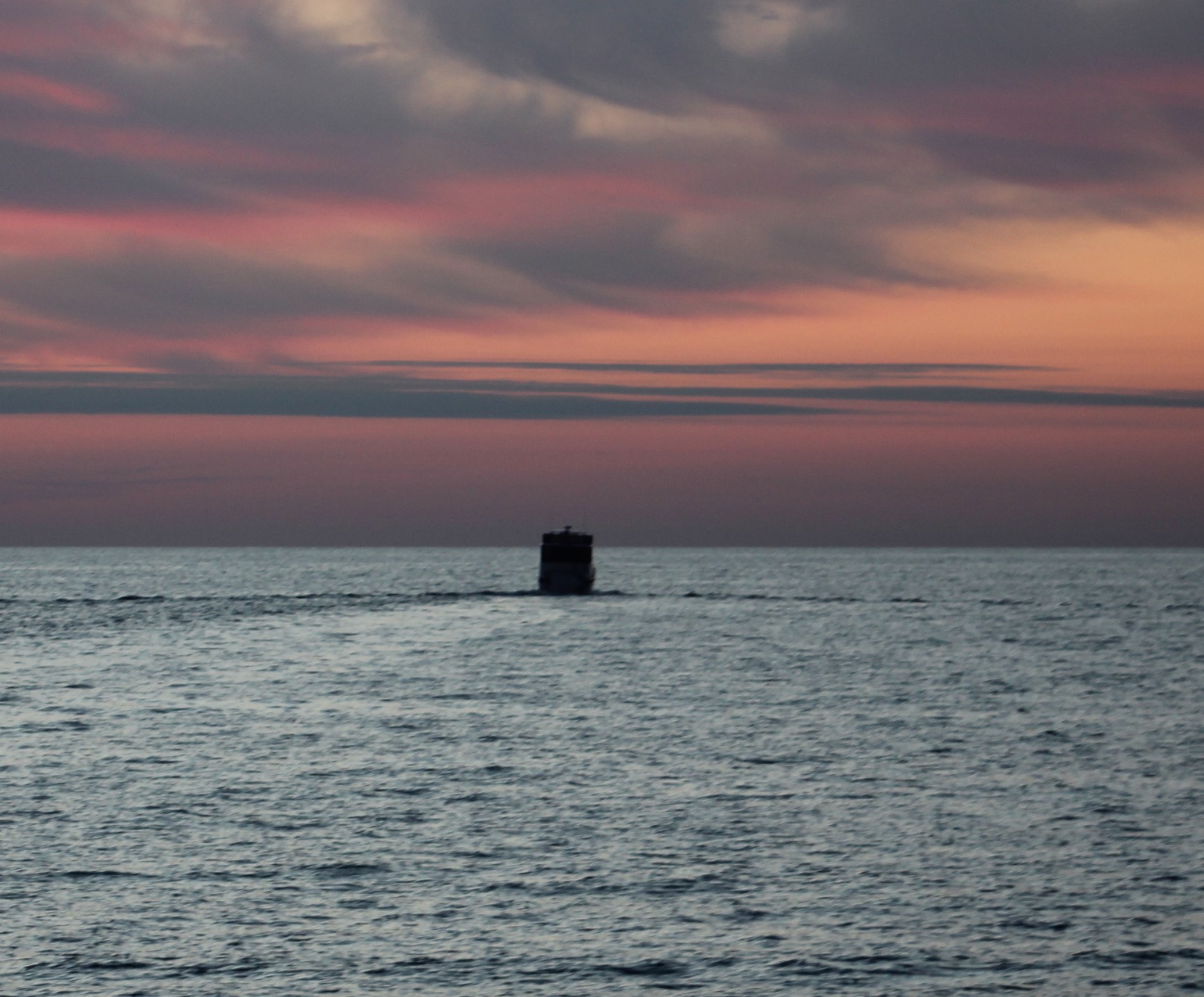
Sunset on the Gulf following Tranquility III
Just a little bit after dark, the crew saw a red flare shoot up. The flare was judged to be a long distance away due to the height of the flare. The crew tried hailing any distressed vessels in the area, but there was no response.
Then about 45 minutes later a second and third flare was seen. These two flares were just off the starboard side and were very high. Again, when the crew tried to hail any distressed boat, there was no response. While the skipper was trying to hail the boat shooting the flares, the Captain of Jo-Ca hailed the Coast Guard to report the flares and our GPS position.
The Coast Guard reported that they were performing flare training in the area and NOT to launch a search for the boat. Interesting enough, there were no more flares after the call to the Coast Guard. I guess training was complete. Hmmmm, interesting indeed. The Admiral was just relieved that they did not have to go searching for any boater in the dark and bad waves.
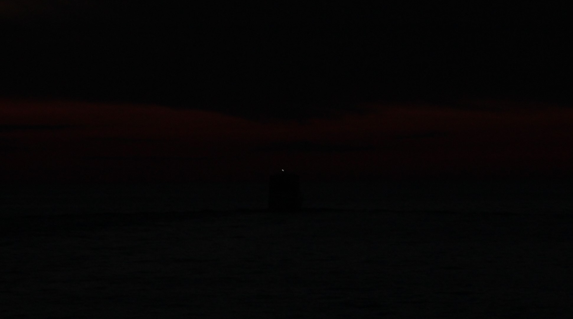
This was the crews view for the 12 hours across the Gulf in the dark. Following the little white light on Tranquility III. The light is dead center of pic.
A little around 2100, a large light was seen on the horizon. As the three-boat flotilla got closer, the crew could tell that it was a sport fisher boat with a tuna tower. The skipper checked the charts and determined that the nearest land was 61 miles away. The crew began to wonder why on earth would someone be out here fishing in these nasty conditions.
A few minutes later the Captain of the sport fisher boat hailed the flotilla. The Captain could not identify what kind of vessel the three boats were. At the time, the three boats were running with only a quarter mile distance between boats to maintain visual contact during then night crossing. The Captain thought we were a large tow and was beginning to worry that we were getting way to close for his comfort level.
The Captain of Tranquility III, Mike, let the sport fisher know that we were actually three separate boats crossing the Gulf. Mike also inquired of the sport fisher, “What are you doing out here in this weather?” The sport fisher responded in a southern drawl, “Oh, we’re just out here catch’n a few red snappers.”
After six hours of misery bouncing around in the waves, the crew found humor in the response.
Finally though, the wind did lay down and the waves settled down also. There was only a light breeze and the waves were less than 1 foot. So much for the saying that nothing good happens after midnight.
With the calmer seas, the crew of Tranquility III began to recover enough to come over the radio and sing “The Wreck of the Edmund Fitzgerald.”
Sunrise on the Gulf
At 0630, the dawn of a new day was beginning. At 0720, that big ball of hydrogen fusion peeked over the horizon to give the crew a beautiful sunrise.
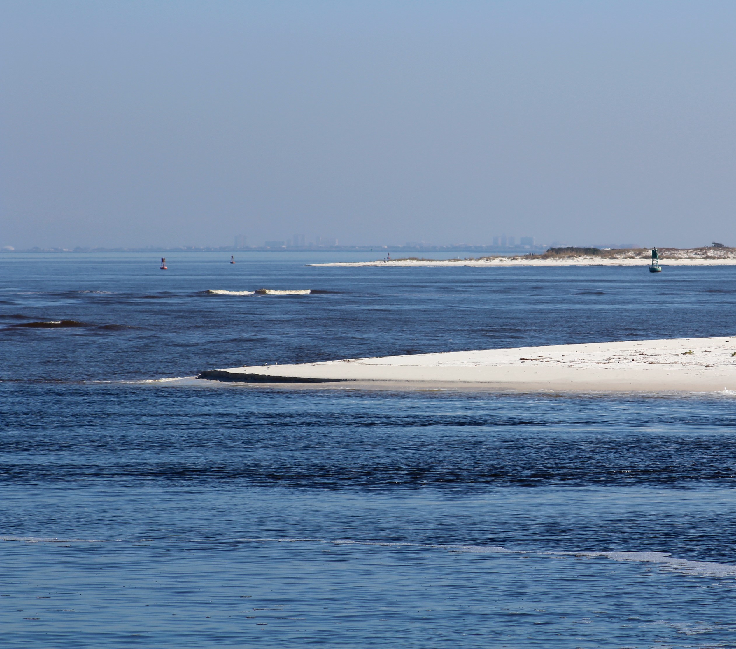
At 0850, the crew spotted land and the skipper yelled, ‘Land Ho!”
At 0945, the crew passed back within 3 miles of shore.
At 1010, the crew passed a red day marker R4 that officially ended the Gulf crossing as the crew entered back into the GICW.
Been targeting this marker since 1600 yesterday
At 1051, the crew entered the Anclote River at low tide.
Entering the Anclote River
The skipper called the marina and the staff warned the skipper that the low tide had caused water levels to be about 4 feet deep on the approach to the dock. The staff suggested that the skipper anchor and wait for the tide to rise before entering. Since the skipper was tired from a long night with little to no sleep, he and the Admiral decided to risk the low water level and try to make the dock. With a draft of 3 feet 9 inches and the fact that the bottom would be soft and sandy if they went aground, the crew headed for the marina.
At 1145, the crew was safely secured at the dock. On the last mile of approach to the dock, the water level showed to be 4 feet 3 inches.
The crew took a well-deserved nap, then headed to Rusty Bellies to celebrate the successful Gulf crossing with the crews of Abaco Lady and Journey.
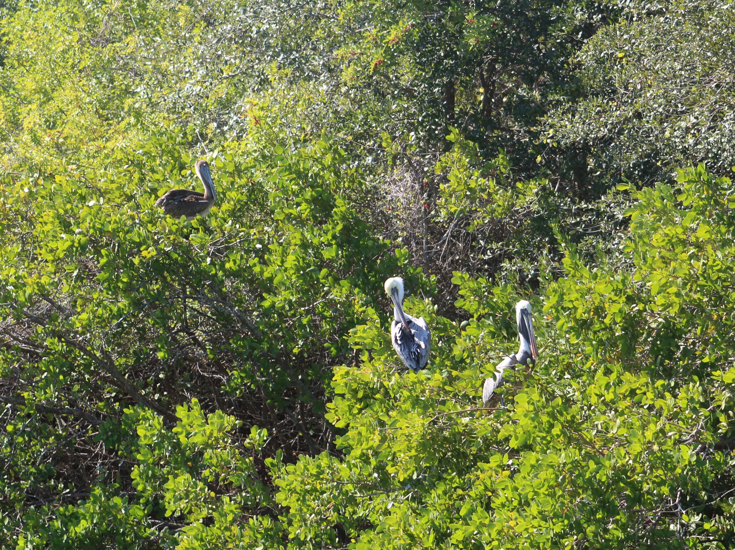
Pelicans also napping in the trees
Friday, February 3, 2017
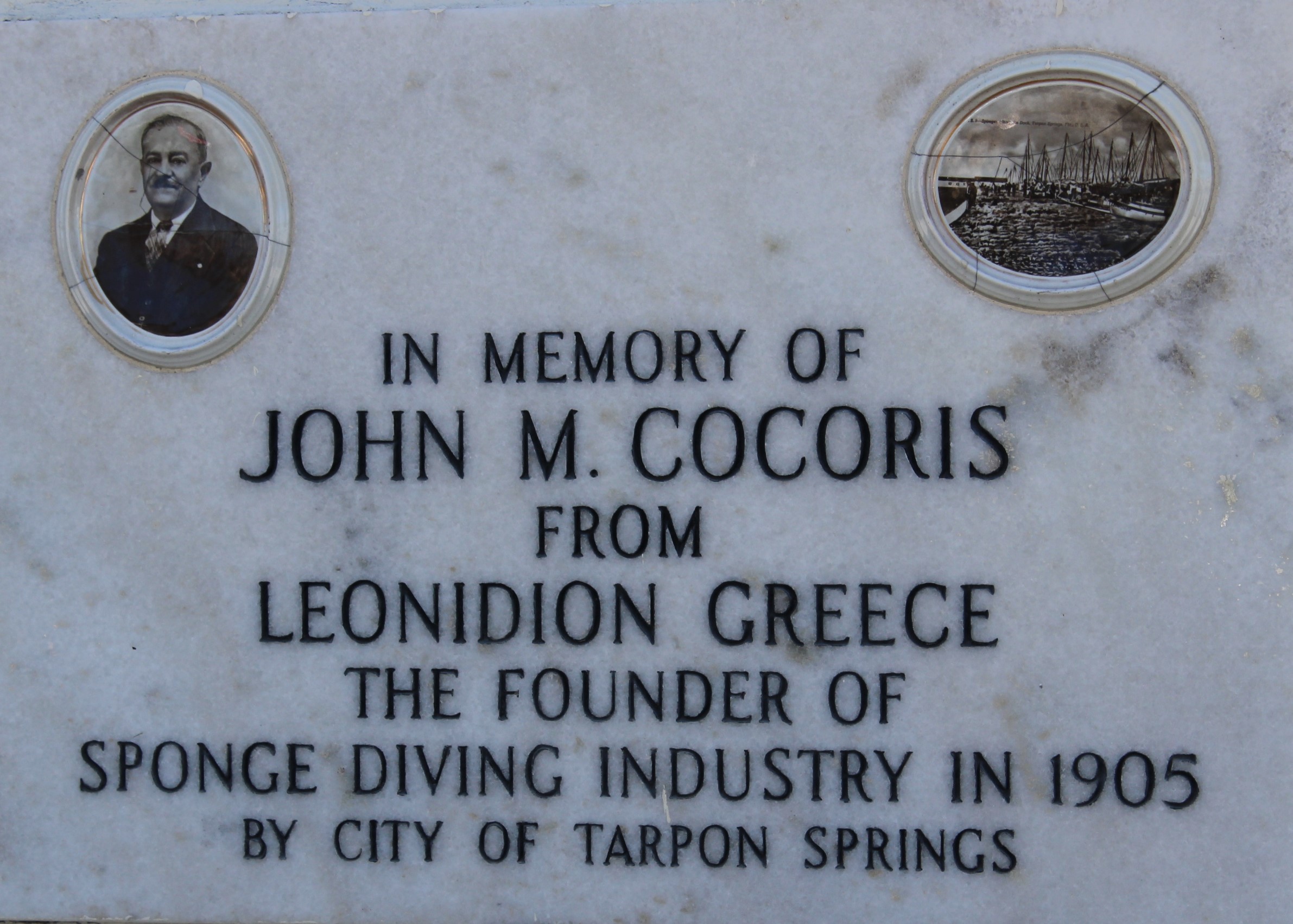
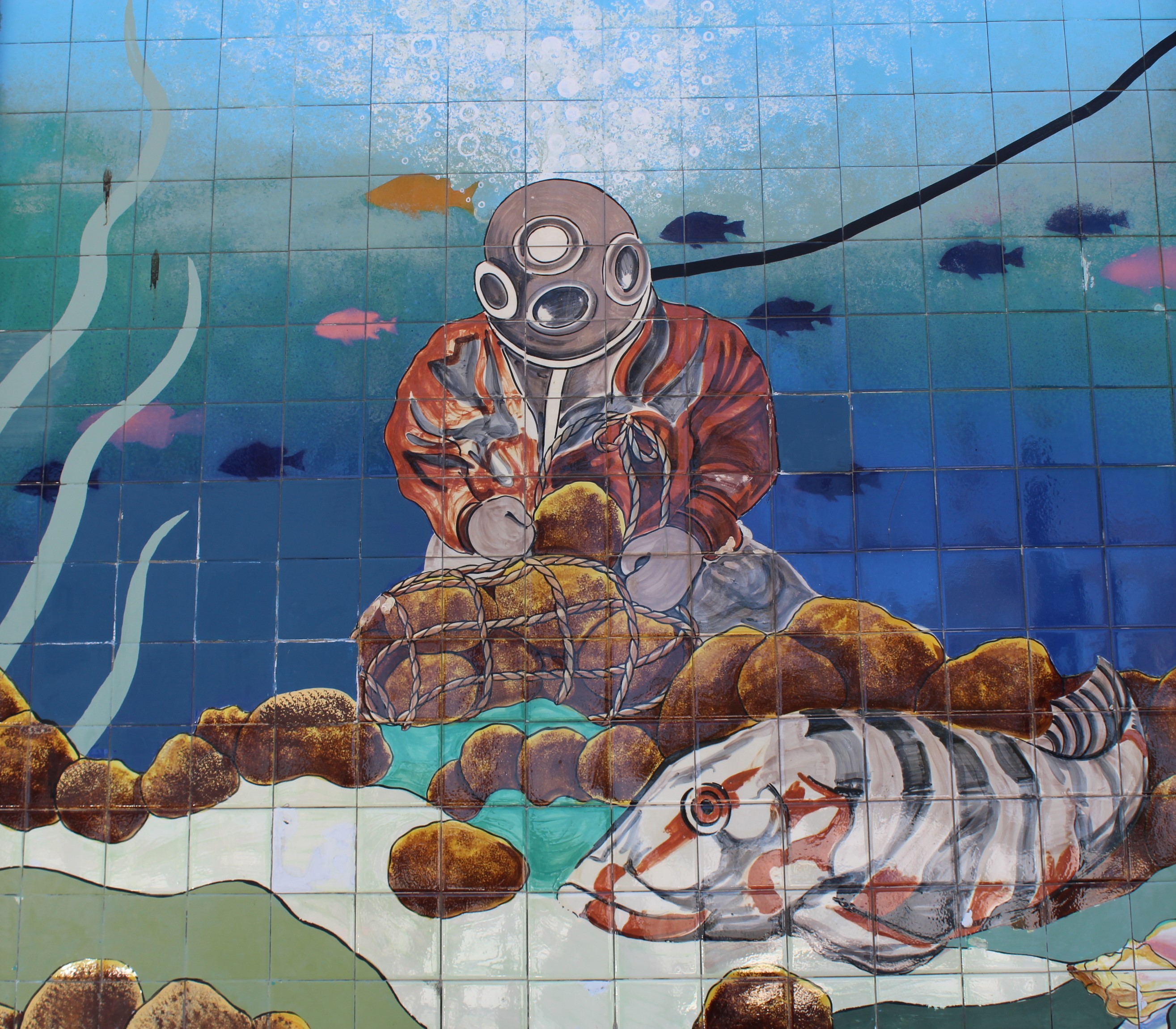
The crew explored the sponge docks in the afternoon and tried to learn a little about the Greek culture that spawned Tarpon Springs.
In the 1880’s, John Cheyney started the first sponge business in the area. Greek’s began to migrate to the area to work in the sponge industry. In 1905, John Cocoris began using divers to harvest the sponges. The heyday of the sponge industry peaked in the 1930’s with about 200 boats in the sponge industry. In 1947, a red tide algae bloom killed off most of the sponges and the sponge industry. Only about a dozen sponge boats still work the Gulf fields.
Tile Dive Mural on the Sponge Docks
The town now has the largest percentage of Greek’s than any other community in the United States.
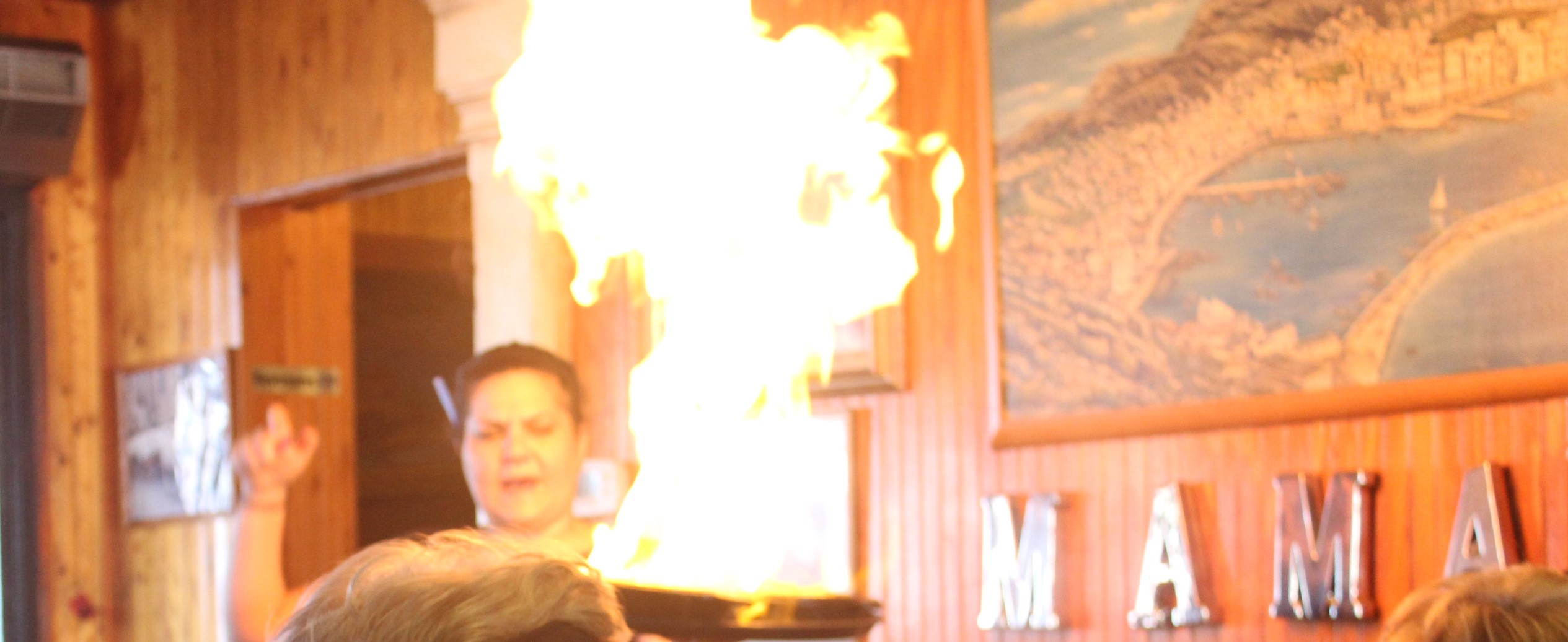
The crew tried a Greek restaurant for a late lunch and then tried some Greek pastries for a late-night snack. While eating lunch, one of the hot menu items was Flaming Goat Cheese. The waitress would pour some liquor over the cheese and then light the concoction on fire which would toast the cheese.
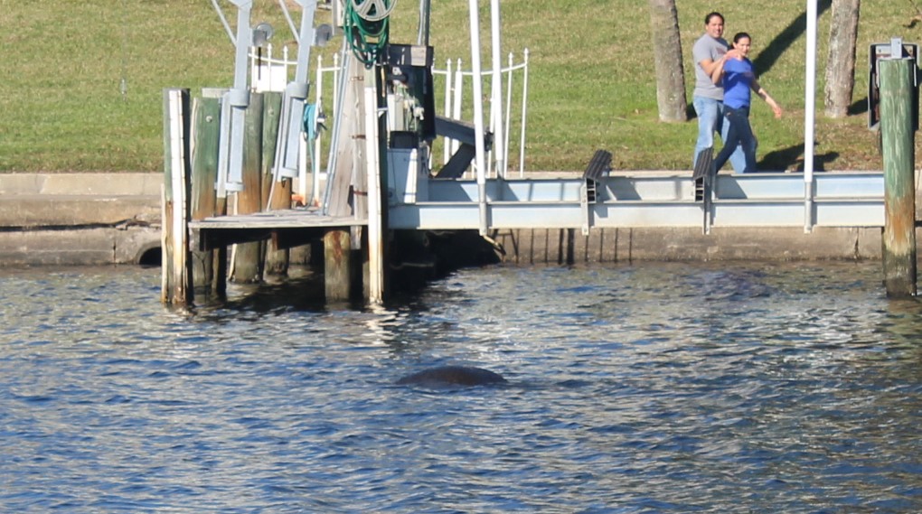
The crew also walked down to Craig’s Park to discover if any manatees might be swimming around in the bayou. The crew watched four manatees for a couple of hours while they also took in the warm Florida sunshine.
Can you see the manatee?
Craig Park
Saturday, February 4, 2017
The initial Float Plan today was to travel to Caladesi Island State Park. The water level approach is shallow so the skipper waited for a rising tide before heading out. Unfortunately, within 100 yards of turning off the main channel to the State Park, the boat nudged the soft sand bottom. There was already one boat solidly aground here and the skipper did not want to become number 2.
Leaving Tarpon Springs – 1st of many boat wakes today
He called the State Park Marina and learned that the first come first serve slips were already taken so it was time for the skipper to recalculate the next move. The skipper then called the Marker 1 Marina in Dunedin only to learn that they were also full.
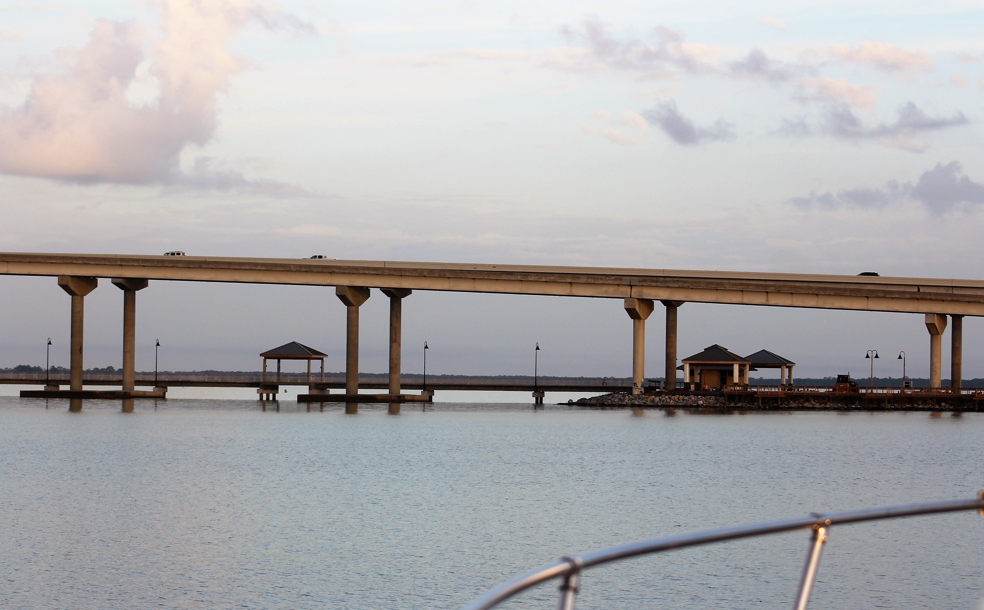
Anclote River Lighthouse
This was a beautiful Saturday which caused more than the normal number of boaters to be on the water. The crew just wanted off of the water because all the boaters were running fast and throwing huge wakes. Not much boating courtesy being shown on this run.
When the skipper called the Clearwater Municipal Marina he learned that they had one slip available. He booked the slip and headed to the marina. Luckily, they were only 6 miles from the Marina.
Still Waters II in Clearwater Beach Marina
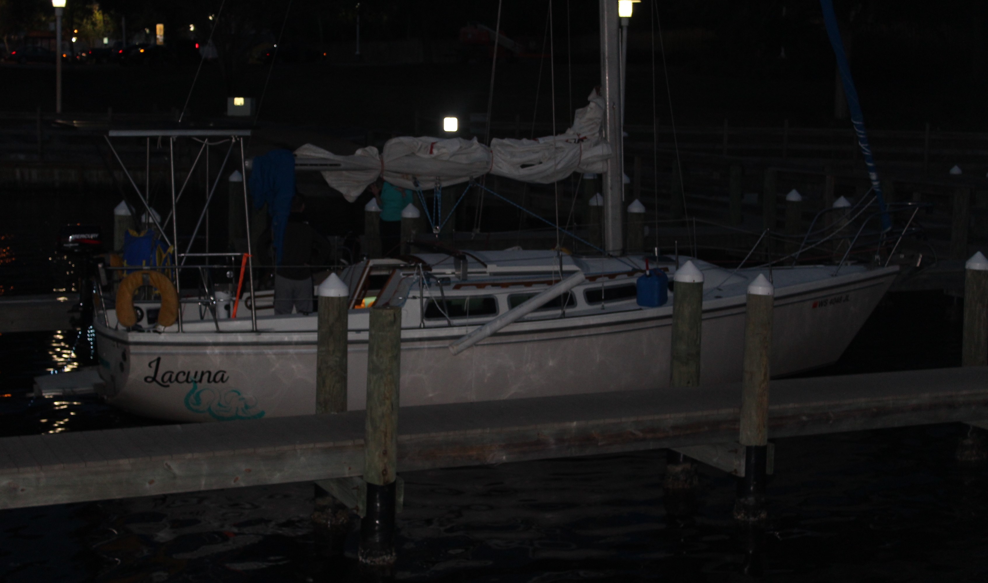
After securing the boat, the crew discovered that they were docked just in front of their new friends aboard Lacuna. You might recall they first met back at Ft Walton Beach. Turns out that it was Jen’s birthday and her parents and brother had come down to visit. Happy Birthday Jen from the crew of Still Waters II!!!!.
The crew debarked the boat and took a two-hour stroll along Clearwater Beach.
Another public art display. 120 of these dolphins are scattered around Clearwater
Next Week – Keep heading south along the west coast of Florida with potential shore excursions in St. Petersburg, Tampa, and Sarasota.
Loop On – The water goes on forever and the adventure never ends.
Eric here catching you up to date on the latest travels of Still Waters II. Click on this link to see the day- to-day travel log.
Summary of week:
After a week stay in Panama City to allow the weather to literally blow through, the crew finally made passage to Port St. Joe. The crew continues to lay and wait here for a weather window to open so they can safely cross the Gulf.
Sunday, January 22, 2017
As reported in last week’s blog entry, the winds have really decided to kick it up a notch. Today the Coast Guard was putting out Gale Force Wind Warnings (winds > 40 mph). The wind did not disappoint.
By 1000 the winds were blowing 15-20 mph. Unfortunately, the wind direction was out of the east-southeast. This caused three foot waves to form and come directly into the marina and against the beam of Still Waters II.
The skipper spent the next four hours adding and adjusting lines and fenders to protect the boat from the dock. It got so bad that the skipper could not stay on the boat because she was bobbing up and down so bad. He took a seat on the dock in between adjusting lines and fenders.
Finally, about 1400 the wind shifted direction from the west-northwest which caused the waves to shift also, so now the waves were hitting the break water wall. This resulted in the waters in the marina to calm down and become almost smooth. With the wind shift, the winds also picked up intensity. The wind speed quickly rose to the low 30’s with gusts over 40.
The winds stayed strong through the rest of the day and began to die off during the night into the low 20’s. On Monday, the winds continued to drop in intensity until they finally got back down to normal, less than 10 mph about dark.
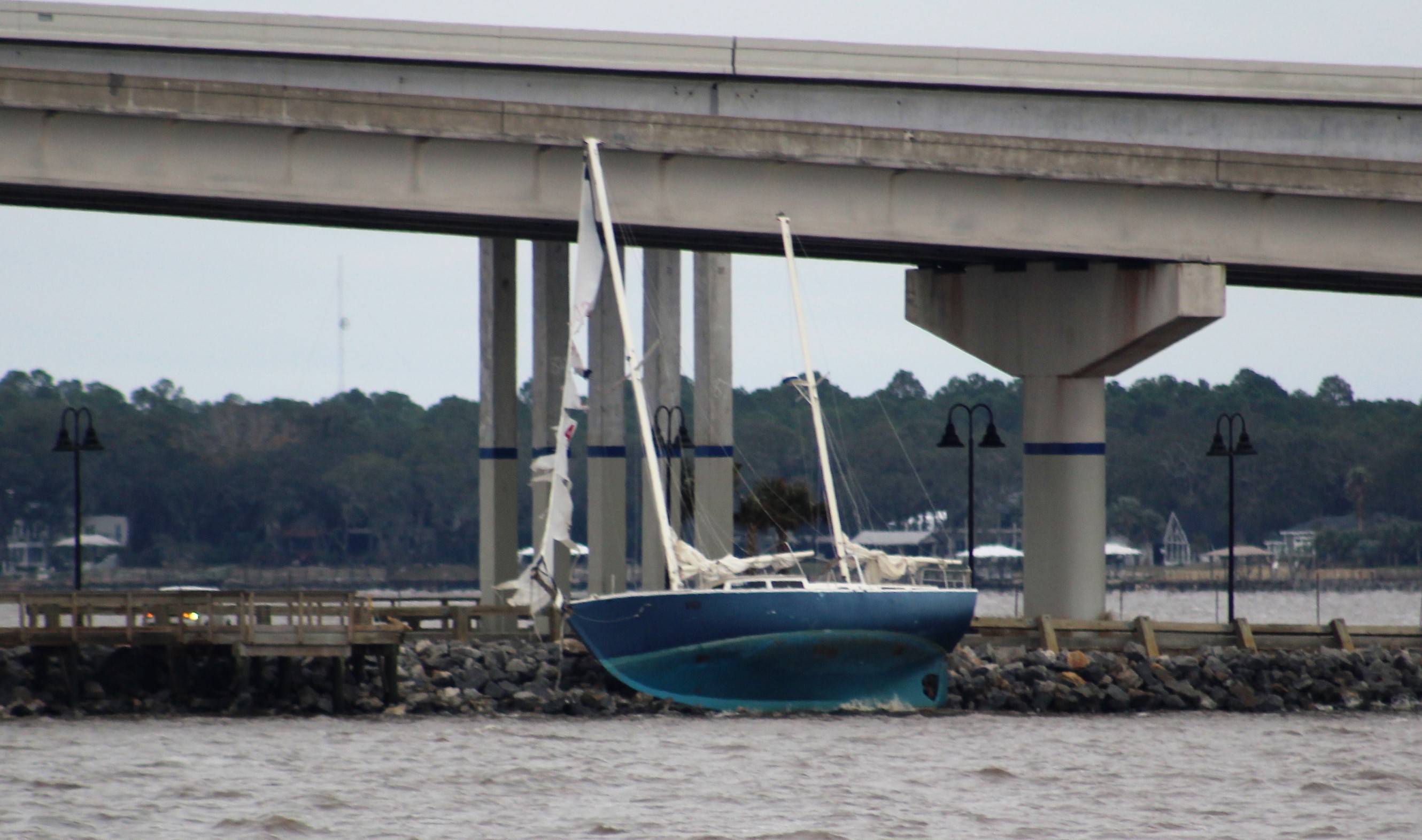
This sailboat did not survive the wind
The good news is that Still Waters II suffered no damage. Many of the other boats were not as fortunate. When the winds were out of the east on Sunday, the boats were swinging up and down as much as 3-5 feet. This caused damage to several boats as they crashed into the wood docks. In addition, the high winds ripped the canvas and bimini tops off several boats.
And you are probably asking yourself, “Where was the Admiral during the Sunday afternoon fun?” She had gone to Church. When she left Church she got a severe weather alert with a tornado warning. She did the smart thing and went shopping at Home Depot to wait out the warning.
By the time she got to the boat, the wind had shifted direction and the marina water had calmed down. The skipper told her he was glad she missed the fun.
Tuesday, January 23, 2017
While in Panama City, the crew bought a new dinghy. This was a safety purchase as they prepare to cross the Gulf. Better to be prepared for the unexpected in case something happens to the mother ship.
For example, a local boater shared a story with the skipper where a series of unfortunate and seemingly unrelated events resulted in an explosion onboard his boat. The boat burned to the water line before the fire department could arrive and extinguish the fire.
The skipper spent most of the day adjusting the davit system to hold the dinghy on the swim platform. Hopefully with these adjustments the crew will not lose a third dinghy.
Walker Bay dinghy mounted on davits
Wednesday, January 25, 2017
With the weather cooperating today, the crew headed east to Port St. Joe with no issues.
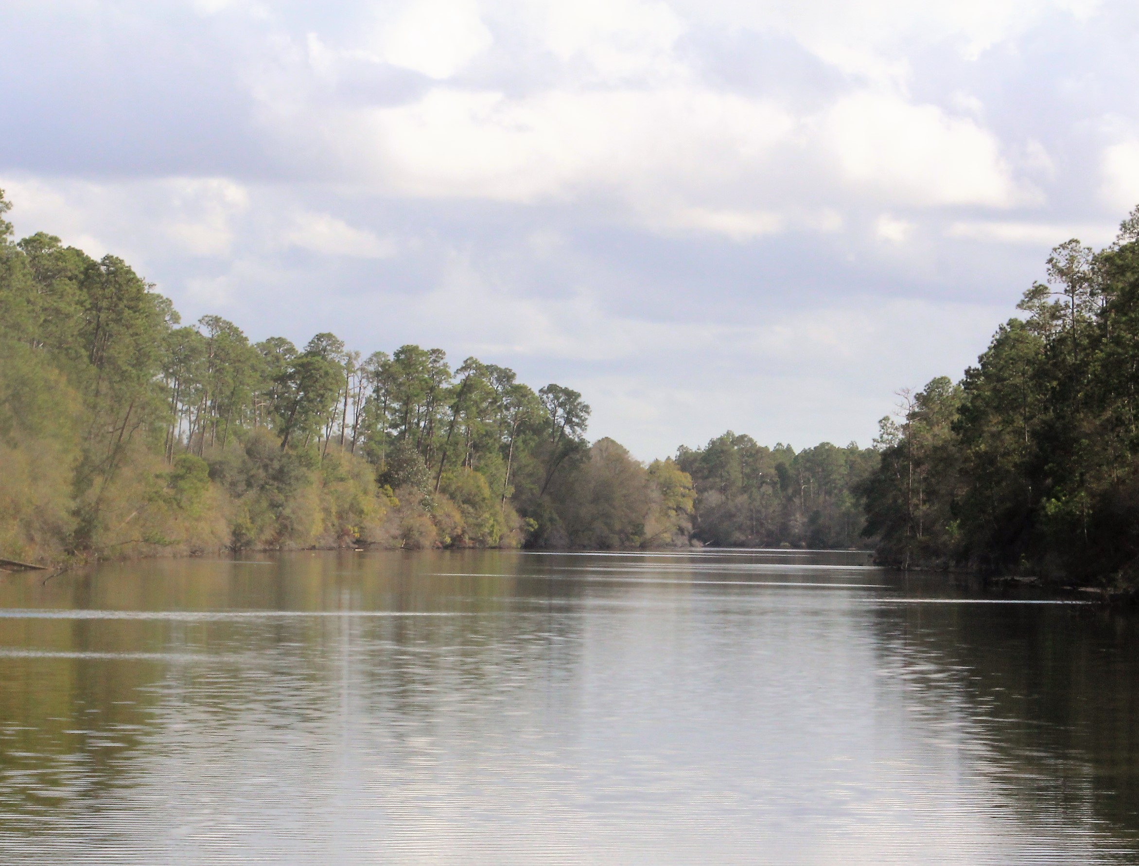
Leaving the East Bay
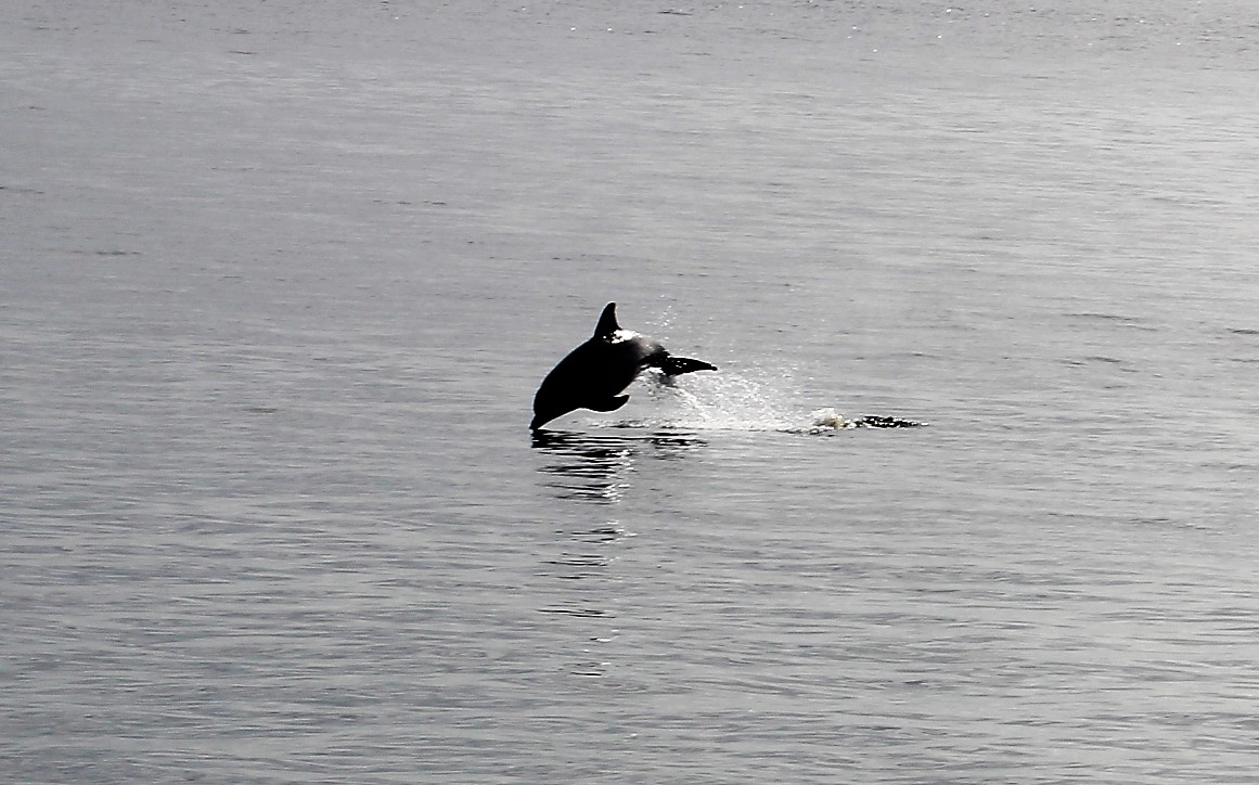
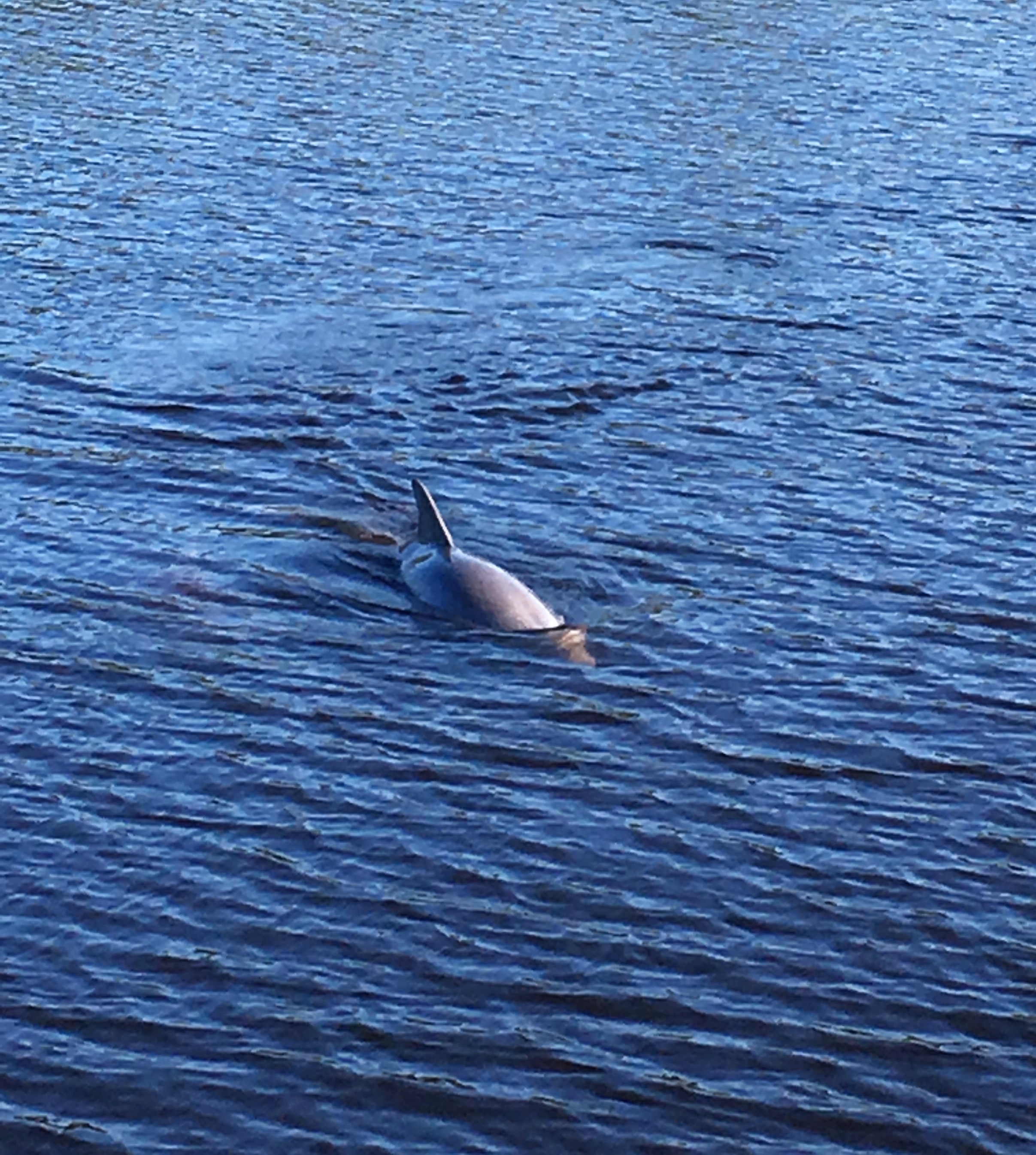
While passing through the East Bay a dolphin decided to play in the wake of the boat. At one point, the dolphin jumped completely out of the water as high as the helm on the boat. Interesting looking eye-to-eye with a dolphin when you are 10 feet above the water line.
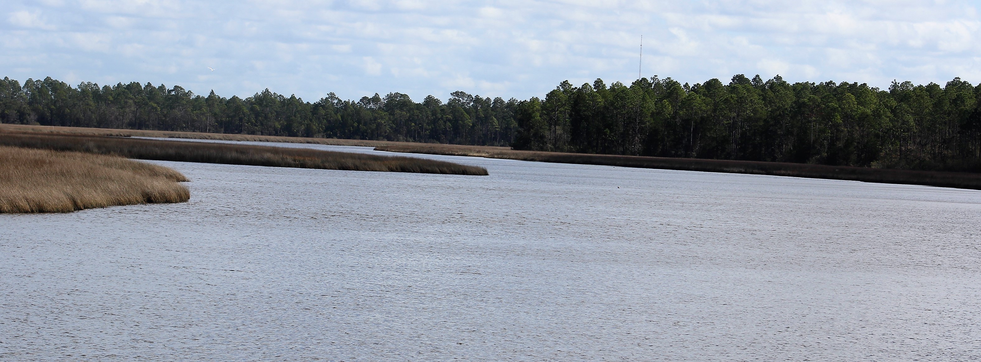
Salt Marsh in Wetappo Creek
The crew made it far enough east to enter the Eastern Time Zone. The loss of an hour caused the crew to arrive at Port St. Joe Marina just 30 minutes before closing.
The crew is not sure how long they will stay here, so the Marina Staff took a credit card and put it on hold much like a reservation at a hotel.
The crew saw more derelict boats on this run than anywhere on the loop
Continuation in Wetappo Creek
Entering the Port St. Joe Marina basin
Shore Excursions at Port St. Joe
The crew wandered around the small downtown area on Thursday afternoon. They found this interesting store display of a guy having a bad day.
They then walked over to the area Welcome Center and enjoyed the view of the bay.
On Friday, AbacoLady and the Journey pulled into the marina. There are now seven loopers at Port St. Joe. People are moving east to take advantage of the weather window to cross the Gulf Tuesday and Wednesday.
Saturday, we walked over to the SanDollar with Journey and AbacoLady to enjoy a good breakfast. Conversation was exciting as stories were swapped about the Loop and the fun that has been had.
Latter in the day, TheLord’sProvision arrived and joined the party at Port St. Joe. The crew of Still Waters II will probably buddy boat across the Gulf together.
Next Week – As mentioned several times, the next big challenge in front of the crew is to cross the Gulf over to the West Coast of Florida.
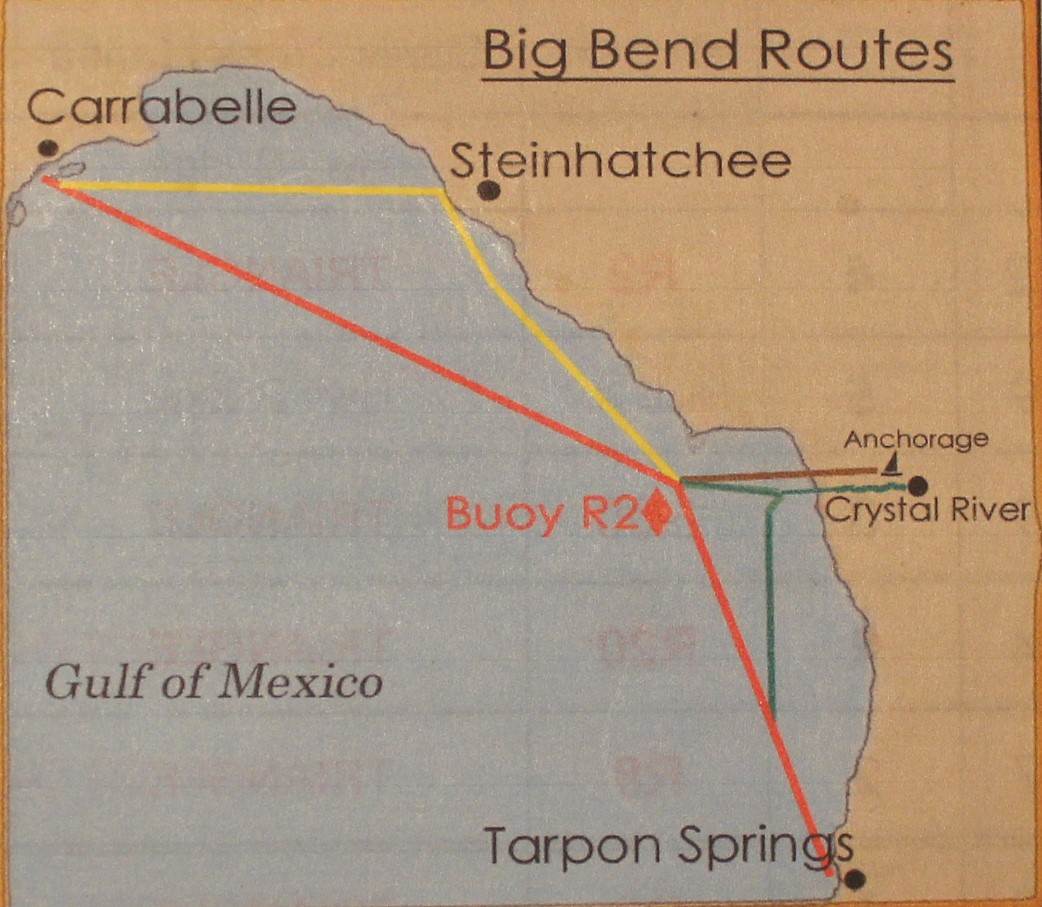
The following pic and information is from Alan Lloyd’s Navigation Notes.
Tarpon Springs Route – 175 miles
Carrabelle to Buoy 2 – 112 miles
Buoy 2 to Tarpon Springs – 63 miles
Steinhatchee Route (yellow/red) -206 miles
Carrabelle to Steinhatchee – 85 miles
Steinhatchee to Buoy 2 – 58 miles
Buoy 2 to Tarpon Springs – 63 miles
The brown and green routes have a controlling depth of only 4.5 feet. With the draft of the boat at 3’ 9 inches, the margin of only 9 inches to going aground is not worth the risk. These routes are off the table for the crew.
The crew plans to travel at 9 mph, so it will take about 20 hours to cross over to Tarpon Springs on the red route. This can be done in one long cruise starting about 2100 and arriving in Tarpon Springs about 1700 the next day, an hour before sunset. The pro of this route is that you only need one weather window to cross. The con is that you cruise 9 hours in the dark and will not get much sleep, if any in those 20 hours.
The pro of the Steinhatchee route is that you have more daylight time and less night time travel. However, the con is that you need two days of good weather to cross. This time of year, getting two days back to back is rare. The weather windows seem to be about a week apart, so after arriving in Steinhatchee, the crew might be stuck for a week waiting for the next good day.
And what may a good day look like, says you?
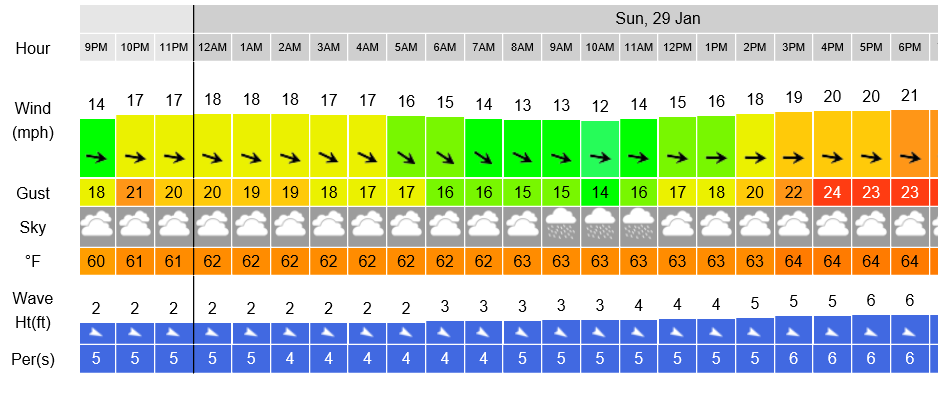
The crew is using the following criteria:
Winds less than 10 mph
Wave height less than 2 feet
The skipper is using Eddy’s Weather Wag to help gage the criteria, as well as consulting three independent marine weather sites to pick the window. But as you know, predicting the weather no easy task.
For example, on Monday, January 23rd, Eddy was predicting a Saturday/Sunday weather window.
Ahoy Fellow Loopers!
Told you it would get worse! Latest check of sea conditions at Buoy 42036 show 15 footers rolling across that part of the Gulf.
It will take a while for things to settle down out there. The predicted Saturday-night / Sunday weather-window (28th-29th) will likely be the next crossing opportunity.
By Wednesday, January 25th, Eddy had this to say:
Ahoy Fellow Loopers!
It looks like a conspiracy! Mother Nature and King Neptune are not only dismantling this weekend’s projected weather-window, but they’re also taking away Florida’s warm, balmy temperatures!
Is there no end to this merciless mistreatment? How long can we endure 50 degree temperatures at night? How can you be expected to keep a tan when daytime highs are only in the 60s? And that’s just here in south Florida! Our fellow Loopers who are trapped along the northwest Gulf coast are suffering even worse.
I’m hopeful that the arrival of a new month will change all this. If we collectively concentrate on sending out positive vibes, perhaps we could effect that change by the last day of this month. That would show Mother and King where the real power lies! To paraphrase: “Let our people go” (across the Gulf)!
Then on Thursday, January 26th, Eddy had these encouraging words:
Ahoy Fellow Loopers!
This morning, four out of four on-line weather sites that I reviewed predict that a weather window will be available for a Tuesday-night / Wednesday crossing. That would be January 31st and February 1st. Just like most people, sometimes these sites get it right and sometimes they don’t.
However, only one of those four sites is still predicting that a Saturday-night / Sunday crossing opportunity. That would be January 28th & 29th. This particular site has been very reliable in the past for getting it right.
So (to paraphrase Dirty Harry) the question you have to ask yourself is, “Am I feeling lucky”?
Our crew is not feeling lucky. The sites the skipper uses to watch the weather do not meet the crew’s criteria for safe travel. For example, this is the Sail Flow page wind and wave height prediction for Saturday/Sunday. Wind is never below 10 mph and the waves build to 6 feet. No thank you.
However, the Tuesday night/ Wednesday crossing is looking promising. Winds less than 10 mph (even the gusts are under 10) and waves only 1 foot for the whole run. Now that is what I’m talking about!
IF, and that is a big IF, the weather predictions hold, THEN this is the anticipated Float Plan for the crew next week:
Monday – travel to Carrabelle and stay at the Moorings Marina.
Tuesday –
1- Move the boat after lunch and anchor at Shipping Cove by Dog Island (this will shave an hour off the night time travel)
2- Weigh anchor about 2100 and enter the gulf via East Pass
3- Target Buoy R2 (N28-56.5 W83-11.0) west of Crystal River
Wednesday –
1- Arrive near Buoy R2 about 0900
2- Arrive near Buoy R4 (N28-14.8 W82-49.9) about 1500
3- Arrive at Turtle Cove Marina, Tarpon Springs about 1700
After crossing the Gulf the crew will get some well deserved sleep and figure out what their next move will be.
Loop On – The water goes on forever and the adventure never ends.
Eric here catching you up to date on the latest travels of Still Waters II. Click on this link to see the day- to-day travel log.
Summary of week:
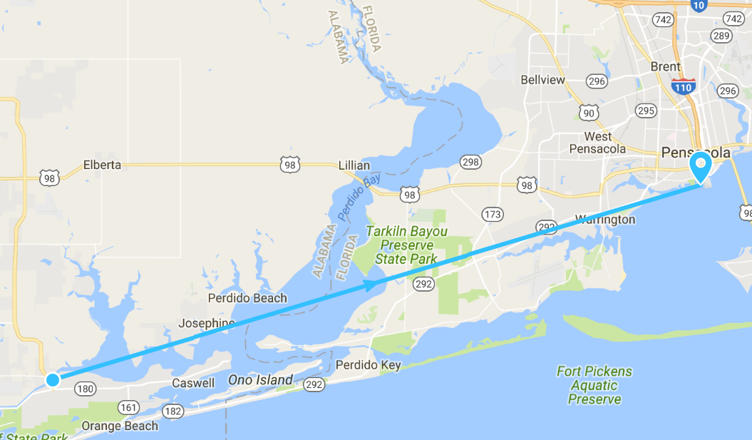
The crew departed Pensacola and cruised three days last week as they headed east along the Emerald Coast. The first stop was in Fort Walton Beach. The crew continued east and stopped in Destin to dock and dine for lunch at Dewey Destin’s Seafood Restaurant. Then they made their way across Choctaw Hatchee Bay and dropped anchor near the HWY 331 bridge. Next stop was Panama City where the crew held up to allow some nasty weather packing high winds and rain to pass.
Monday, January 16, 2017
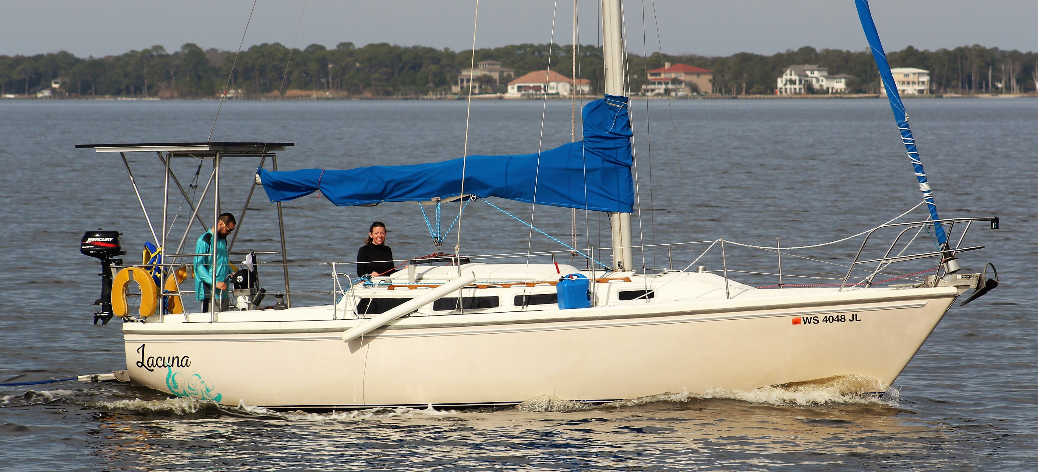
The cruise to Fort Walton Beach was uneventful. Along the run though the crew passed a sailboat, Lacuna, while running in the Santa Rosa Sound.
Lacuna in Santa Rosa Sound
About two hours after our crew landed at the Ft Walton Beach City Marina, the sailboat pulled in also. A good example of the adage in boating, “everyone ends up at the same place, the only difference is how much did you spend on fuel to get there.”
Still Waters II in Fort Walton Beach City Marina
Turns out the crew of the Lacuna, Mike and Jen, left from Wisconsin back in October to start the loop but are not members of America’s Great Loop Cruising Association. They are a young couple who are working onboard via the internet as they do the loop. The definition of Lacuna is gap or hiatus. They explained that they are taking a lacuna from their dirt dwelling life to cruise the loop. Very inspirational.
Dock neighbors for the night
Tuesday, January 17, 2017
Before the crew got started this morning they welcomed some folks from Kentucky onboard. They were doing a photo shoot at the City Park and Marina.
The young man is on Instagram at braden_shannon for any of the single virtual crew members who might be interested.
Braden, the model
The crew also spent some time with Mike and Jen, the crew of the Lacuna, comparing notes and stories. Seems the two crews are on about the same schedule to move east along the pan handle of Florida and stage for the Gulf crossing.
Mike and Jen in Choctaw Hatchee Bay
Dewey Destin’s Seafood
The crew shoved off a bit after 1000 a.m. and made the hour run over to Destin to stop and enjoy a Dock and Dine at Dewey Destin’s Seafood.
They landed at the end of the T-dock. The restaurant does not look like much but the food was very good and the portions for lunch were unexpectedly huge. The crew took a to go box and have enough food left for another meal.
As the crew was walking back down the dock to leave, a couple stopped the crew and asked if they were doing the loop. The crew answered yes, and had an interesting conversation with the couple. Turns out the couple are neighbors with Ron and Eva Stob, the originators of the Great Loop Cruising Association. Small, small world.
After the conversation, the crew shoved off from the dock and headed back to the Bay. The dolphins were ready to play today and this one was very acrobatic as he jumped out of the water several times.
The crew ran another 20 miles, and dropped anchor for the night near the Choctaw Hatchee Bridge. (HWY 331)
Anchored a quarter mile from bridge
Wednesday, January 18, 2017
The crew woke up to heavy fog this morning. The crew could hear vehicle traffic on the bridge but could no see the bridge. The skipper was getting impatient with the fog, so at 1000 he called the Panama City Marina and learned that the fog had cleared over there. The crew discussed their options and decided to go ahead and leave at 1100 even if the fog was still present.
Looking at the bridge at 1100
At 1100, the fog was still socked in so the crew raised the anchor and headed east four miles with the hope that when they entered a narrow 16-mile channel that less water would mean less fog.
As they approached the canal opening the crew could not find the green day marker that was supposed to mark the entrance of the channel. They could not see the day marker on the radar either. Finally they saw a small object on radar that turned out to be a small Coast Guard boat in the position of the missing green day mark. Looked like the Coast Guard was deploying a floating green can. After passing the Coast Guard boat, the skipper noticed the green day mark washed up on shore.
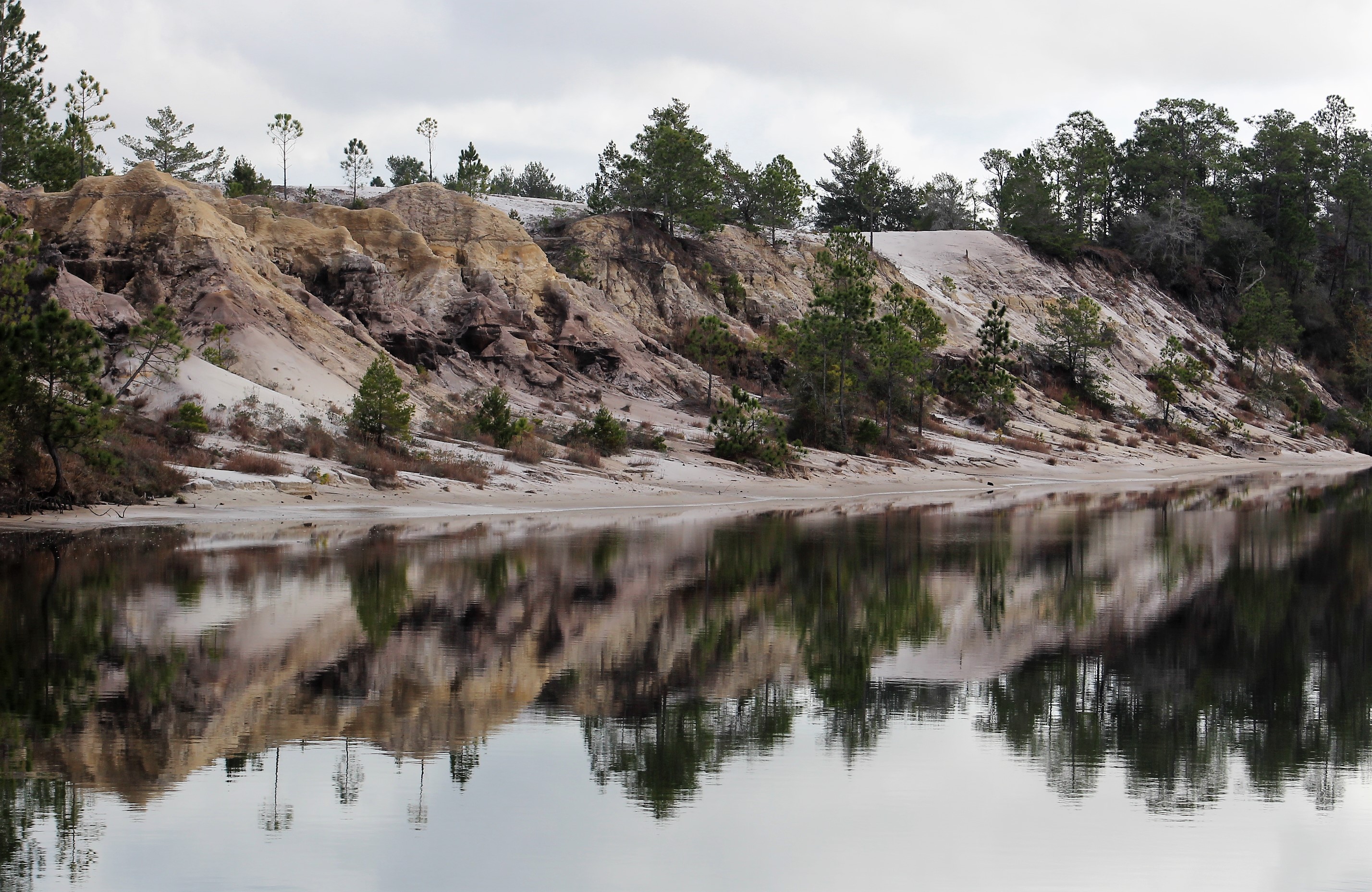
Within a half mile of entering the narrow channel, the fog was completely gone and the crew cruised in partly cloudy skies the rest of the day. The channel turned out to be a big surprise with good scenery.
Finally no fog
Some pretty shoreline and reflection
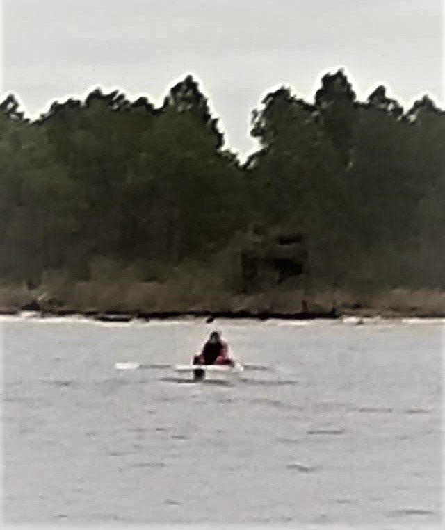
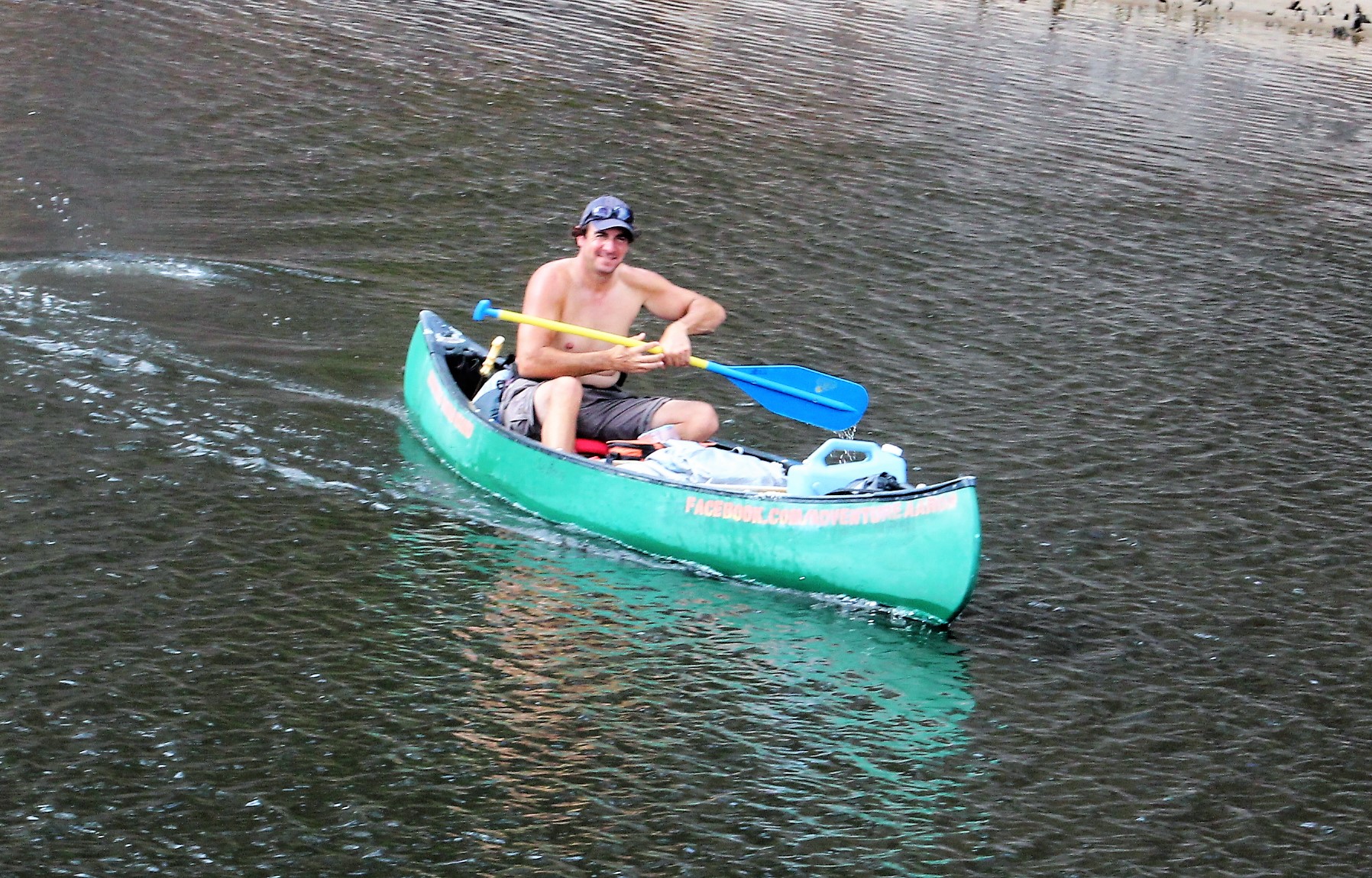
While running through the narrow channel, also referred to as the ‘Grand Canyon,’ the crew passed a man paddling a canoe. Not all that unusual, except this canoe had Guinness World Record painted along the side of the canoe.
Adventure Aaron
The crew stopped in the channel and the man paddled over to Still Waters II. His name is Aaron. He started his current adventure on the Missouri River in Montana. He is paddling to raise awareness about adoption. His goal was to paddle the Missouri River to the Mississippi River, and then the Mississippi River down to the Gulf.
He said once he arrived at the Gulf he still had gas in the tank so he turned east and started paddling the Gulf Intercostal Water Way. His new goal is to paddle to the Atlantic Ocean. He has a website if you would like to learn more about Aaron and/or his cause. http://adventureaaron.com
The crew found this interesting since their own daughter and son-in-law just started their own adventure by adopting a sibling group of four in 2016.
After talking with Aaron the crew pressed on to Panama City Marina.
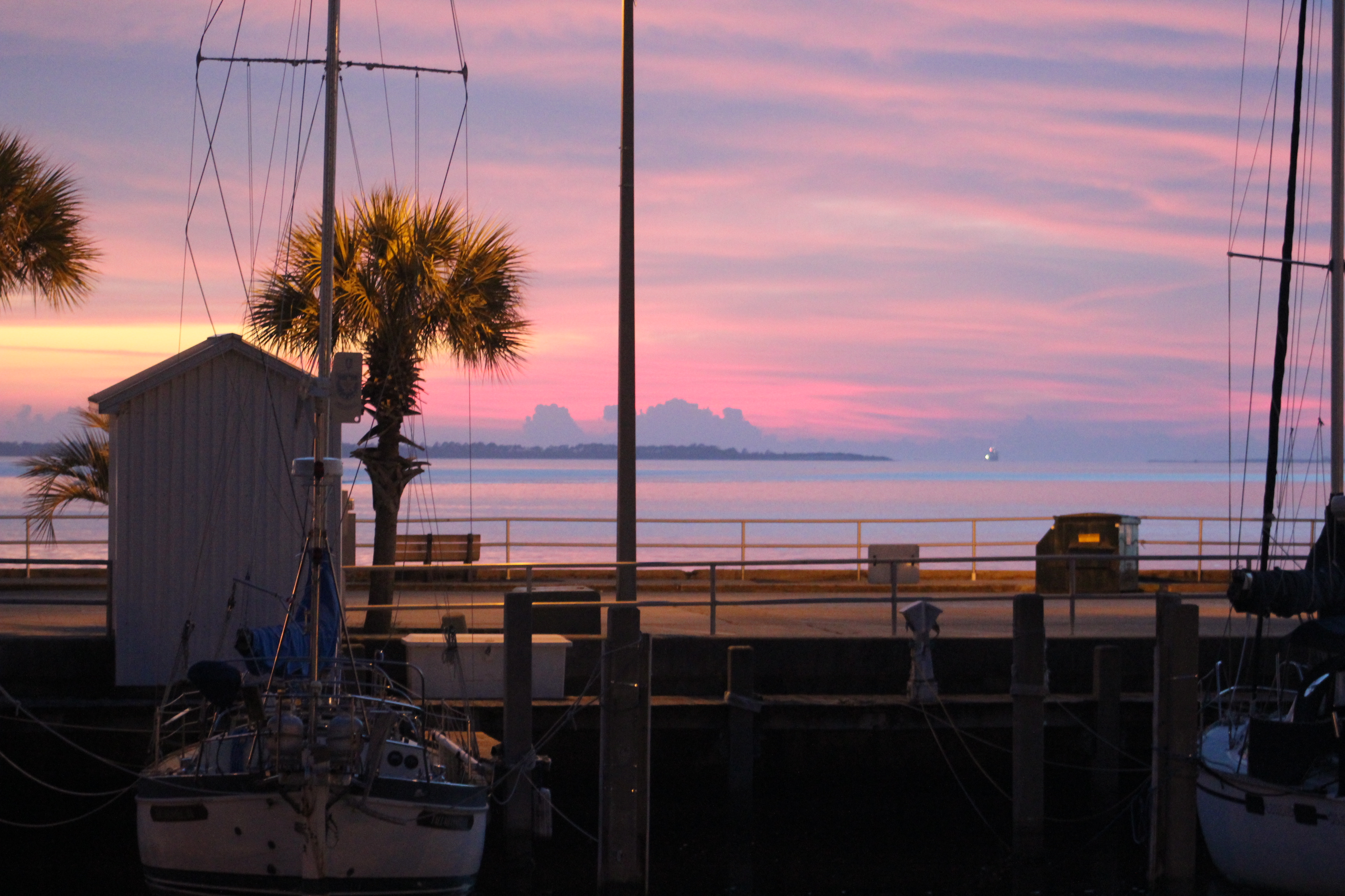
Sunset from sundeck of Still Waters II at Panama City Marina
Shore Excursion – Panama City
The crew decided to rent a car for the weekend and explore the area.
This next photo is of a four headed palm tree. Thought to be the only one in the world. It is located in a city park in St Andrews.
St Andrews Park
The next two pics show why this area is called the Emerald Coast.
Beach at St Andrews State Park
While shelling along the shoreline, the crew found this rare shell back turtle coming ashore. Turtles should not arrive until March so this must be a scout.
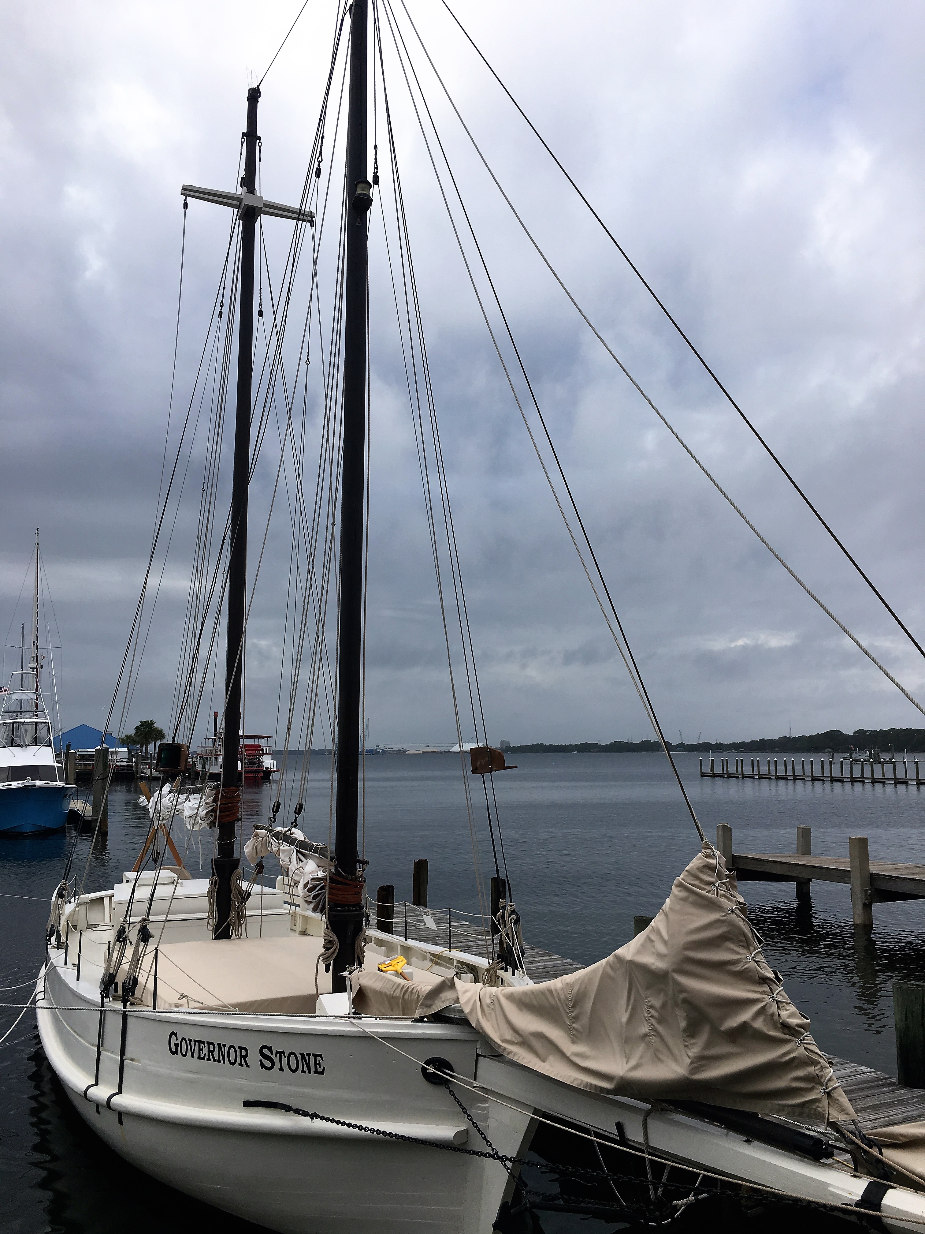
The Governor Stone is the last known working Gulf Coast schooner. She served during WWII, and has worked as an oyster buy boat, a rum runner during prohibition, a resort day sailor, a private yacht, and a sponge boat. She is now a floating sailing museum.
She was built in Pascagoula, Mississippi in 1877, and has actually been sunk three times.
Next Week – The weather and wind is predicted to be bad through Monday, winds at 24 mph and gusts over 30. The crew will stay put till mid week and then make their way over to Port St. Joe. They will stay at Port St Joe until a weather window opens to cross the Gulf. When a weather window opens they will move further east to Carrabelle, Florida where they will launch their Gulf crossing to Tarpon Springs.
Loop On – The water goes on forever and the adventure never ends.
Welcome back onboard as we begin to cruise in 2017
Eric here catching you up to date on the latest travels of Still Waters II. Click on this link to see the day- to-day travel log.
Summary of week:
After spending a month at The Wharf in Orange Beach, Alabama the crew finally cruised a whole day last week. They left The Wharf on Friday the 13th and made their way to Palafox Pier in Pensacola, Florida.
But before we get started cruising, the crew would like to give a shout out and congratulations to LeryLynn for crossing their wake as they made the run to The Wharf.
Wayne and Lynn with their Gold Burgee
Celebrating new Gold Loopers Lynn and Wayne. Brenda and Scott also at the party.
Friday, January 13, 2017
The crew had planned to cruise along the panhandle of Florida with The Lord’s Provision. However, Roger came over in the morning and informed our crew that Grace was ill and was headed to the hospital. The skipper helped Roger move The Lord’s Provision over for a pump out and get resettled in her slip before setting out for Pensacola.
Still Waters II at rest at The Wharf
Leaving The Wharf
The cruise was exceptional for dolphin watching. The crew counted about 35 dolphins swimming and playing in the water today.
Just before noon, the crew re-entered Florida waters after leaving them in April 2016. Little-by-little, the crew is sneaking up on their goal of crossing their wake in Ft Myers. Today was a major milestone in this quest.
Cruising along the Gulf Islands National Seashore.
Entering Pensacola Bay.
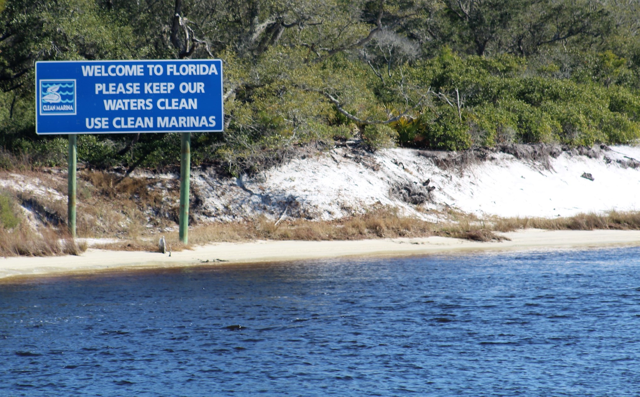
After crossing Pensacola Bay, the crew landed at Palafox Pier. After securing the boat, the crew headed out to learn about the history of Pensacola.
Luna who landed in Pensacola in 1559
The Pensacola colony got off to a rocky start. In September 1559, they were wiped out by a hurricane. The survivors continued to try to make a go of it for two more years but finally abandoned the colony in 1561 and returned to Veracruz.
The Spanish settled the area again in 1698 to guard Florida from the French who were expanding eastward from New Orleans. This Spanish period lasted till 1719.
The French then controlled the area 1719-1722. As with the first colony, a hurricane destroyed Pensacola and the French burned what survived. The French then moved back west to New Orleans.
The Second Spanish period was 1722-1763. The Spanish reclaimed the area and moved Pensacola from the barrier islands to its present location.
The Treaty of Paris-1763, transferred Florida to the British following the French and Indian War because the Spanish had sided with France.
The Third Spanish period was 1781-1819. Following the Revolutionary War the British gave the land along the coast all the way to the Mississippi River back to the Spanish.
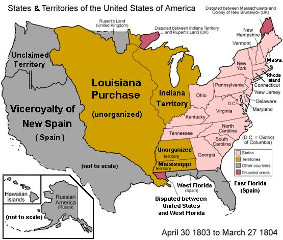
Spain sold the Louisiana territory to France. The French then sold the land to the United States in 1803. This basically surrounded the Spanish area known as East and West Florida by the growing United States.
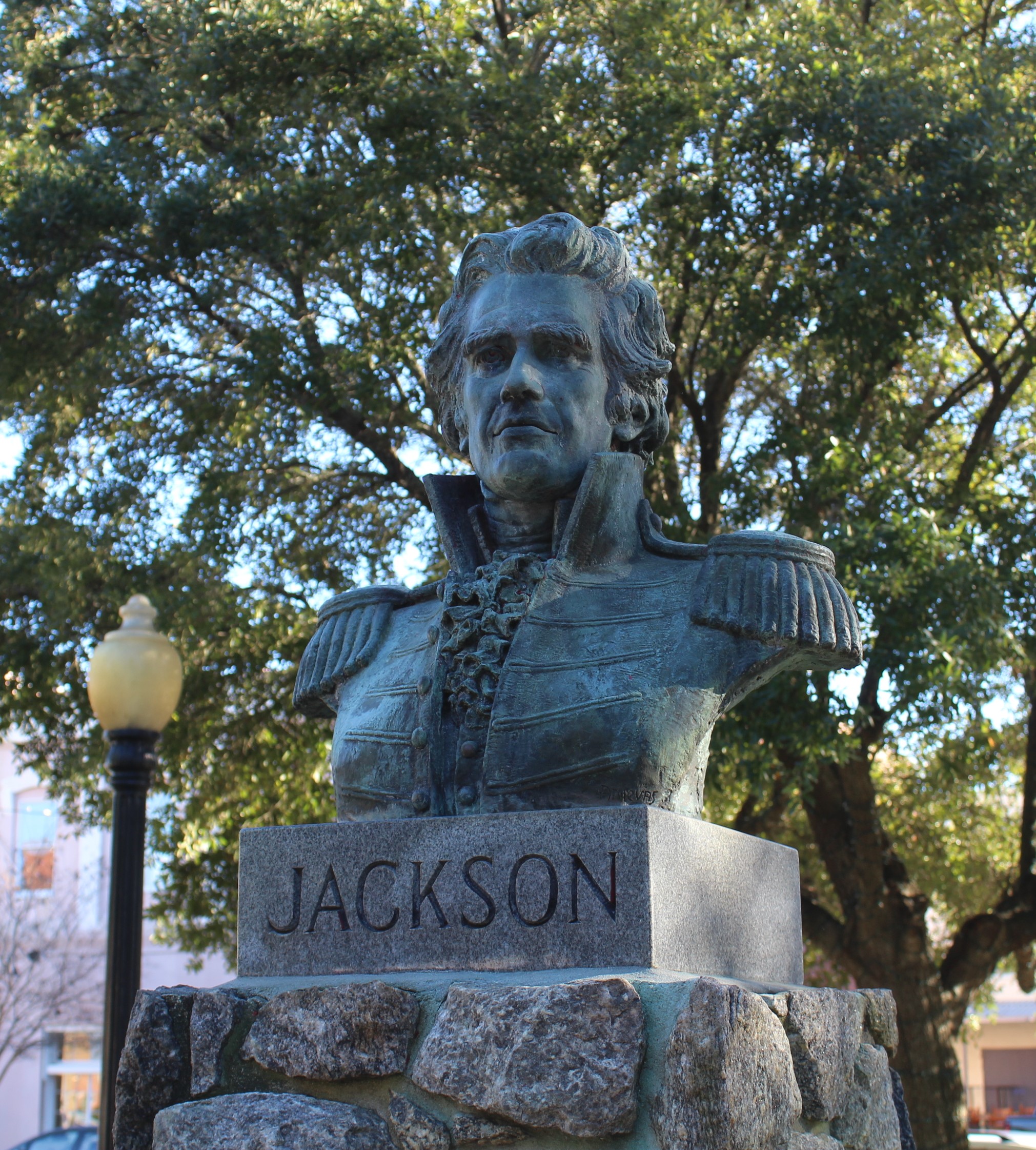
Andrew Jackson led the US invasion to Spanish West Florida
In 1819 the United States invaded Pensacola and took control of the area. In 1821, Spain sold Florida to the United States.
On January 10, 1861, Florida became the third state to leave the United States and join the Confederate States of America.
Following the Civil War, Florida was readmitted to the Union on June 25, 1868.
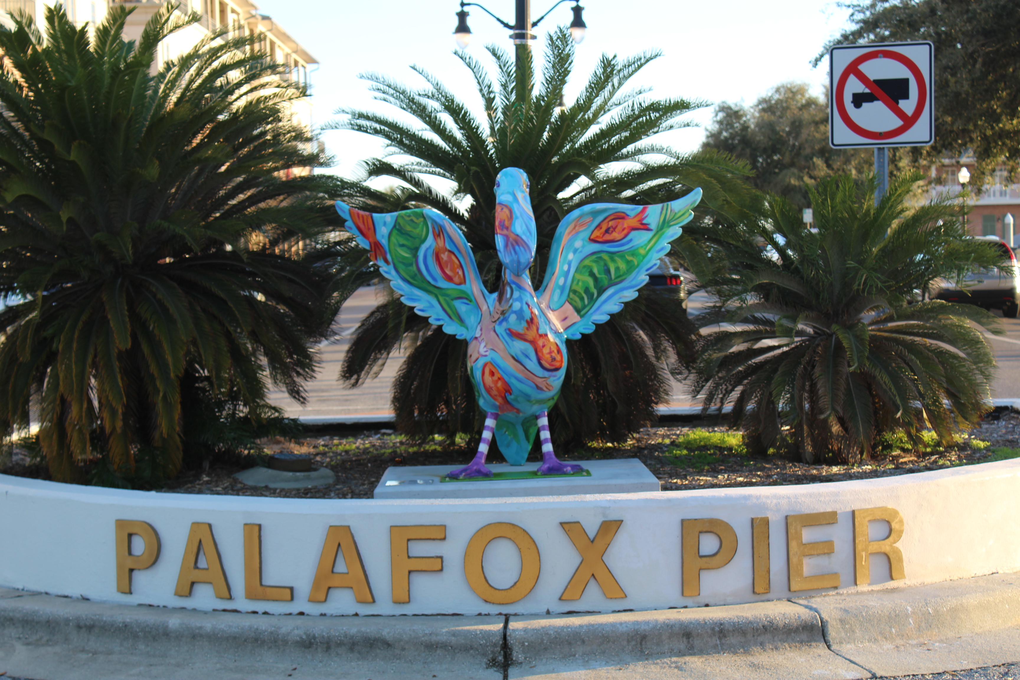
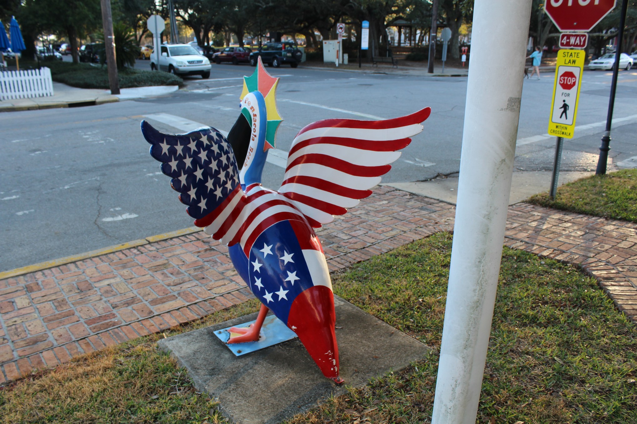
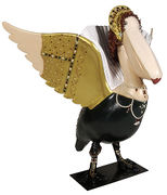
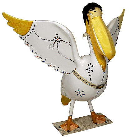
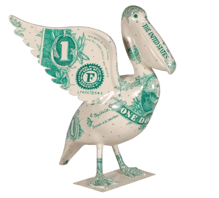
While walking around historic Pensacola the crew began sighting Pelicans in Paradise, a public art display scattered around Pensacola. The crew found 14 of the Pelicans that were within walking distance of the marina.
Some of the crew’s favorite pelicans:
A few feathered friends that were too far away to go find on foot.
Pelvis
Buck
Peg Leg Pete
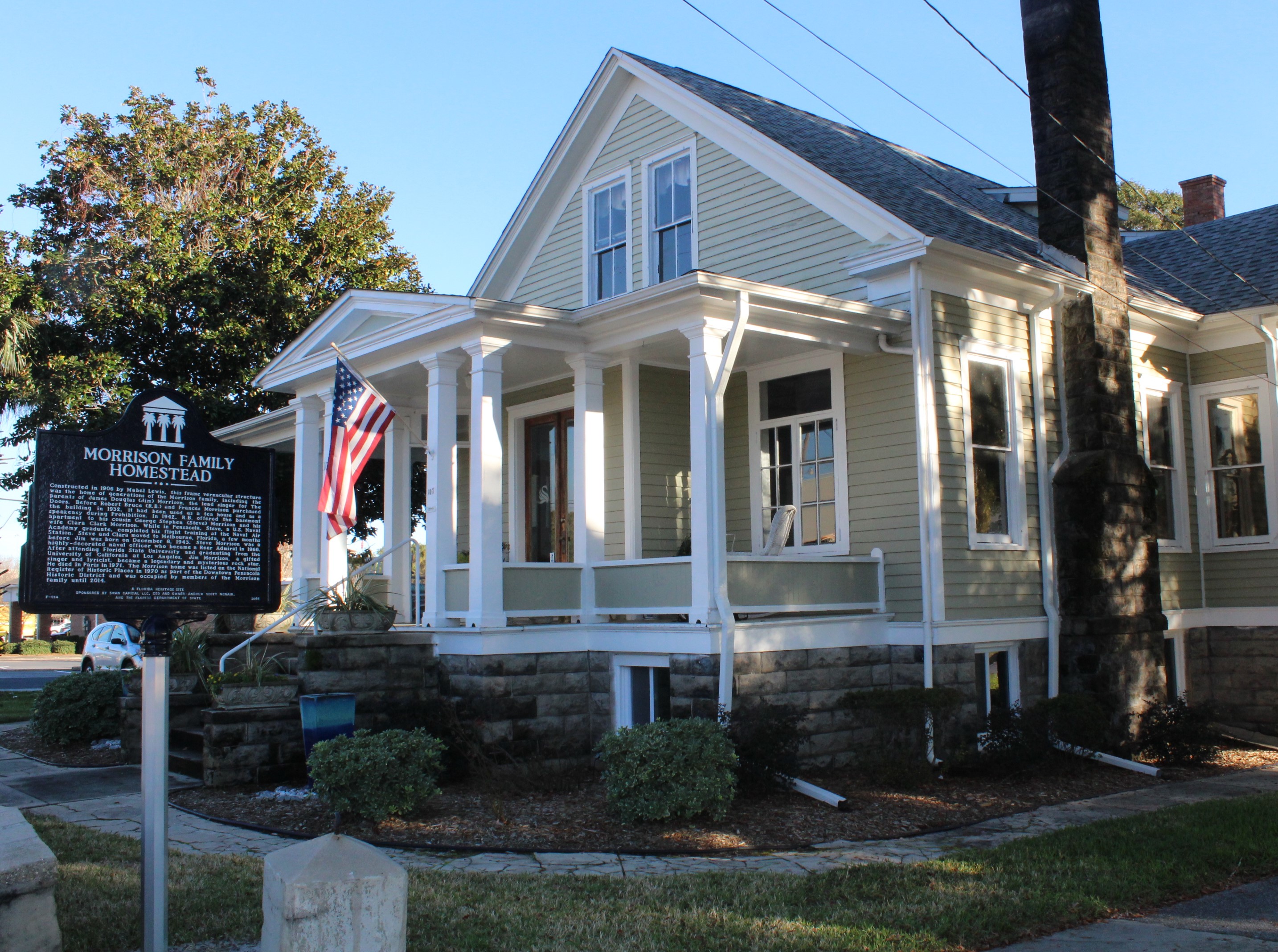
While walking around historic Pensacola looking for Pelicans, the crew stumbled upon this modern piece of history, The Morrison Family Homestead. The home was built in 1906. The Morrison family bought the home in 1932. The lead singer of the Doors, Jim Morrison, was born and raised in this home. Who would of known?
Next Week – The crew plans to continue along the panhandle of Florida and visit Fort Walton Beach, Panama City, and Port St. Joe. The crew will stage in Port St. Joe and wait for a weather window which will allow them to cross the Gulf over to the west coast of Florida.
Loop On – The water goes on forever and the adventure never ends.