Tag: Side Trip

  • Fall Foliage Spectacular

    Hello virtual crew members and fellow adventures.

    La Salle here catching you up to date on the latest travels of Still Waters II. Click on this link to see the day- to-day travel log.

    But first we have had a bunch of folks meet the crew on the pier and come aboard as virtual crew members.  So we need to pause and welcome aboard:

    • Shoaib R.
    • Matnobles
    • Ginasjoys
    • Russ B.

    So a hearty Welcome Aboard!!!!  Glad you joined the adventure.

    oct-21
    Sunday anchored near Clifton, Monday anchored near Savanah, Tuesday & Wednesday at Aqua Yacht Marina for repairs, Thursday anchored, Friday free dock in Decatur, and Saturday free dock in Guntersville

    The crew did not make their goal of Chattanooga this week.  Still Waters II decided she wanted some rest and relaxation at the Aqua Yacht Marina.  The crew limped into the marina on one engine on Tuesday.  After getting repairs complete the crew commenced the side trip up the Tennessee River towards Chattanooga.

    Sunday, October, 16, 2016

    The crew left out of Pebble Isle Marina after stopping at the fuel dock and taking on 216 gallons of fuel.  The marina gives a 10 cent per gallon discount for both a AGLCA and Boat US memberships, for a total of 20 cents off each gallon.  That was just too good of a deal to pass up without topping off the tanks.  Then there was an added surprise at the fuel dock.  The guy helping fuel the boat brought out three large hot cinnamon rolls from the restaurant and gave them to the Admiral.  Now this is a good way to start the day and week.

    img_0020
    Shoreline along Tennessee River


    Unfortunately, the good start to the day and week would not last long, but such is the life of a live aboard cruiser.  The skipper noticed that the port engine temperature was acting erratic during the cruise, a harbinger of things to come.

    img_0022
    Cypress Trees in the River – well sorta


    After cruising about 20 miles the crew passed under the Interstate 40 bridge between Nashville and Memphis.  The skipper can remember crossing over this bridge at least a dozen times over the years, but this is the first time either crew member has passed under the bridge in a boat.

    img_0024
    I-40 between Memphis and Nashville


    Another 20 miles up-river, the crew passed Lady Finger Bluff.  The Bluff was so named after a woman jumped to her death from the bluff rather than be captured by Indians.

    img_0030
    Lady Finger Bluff


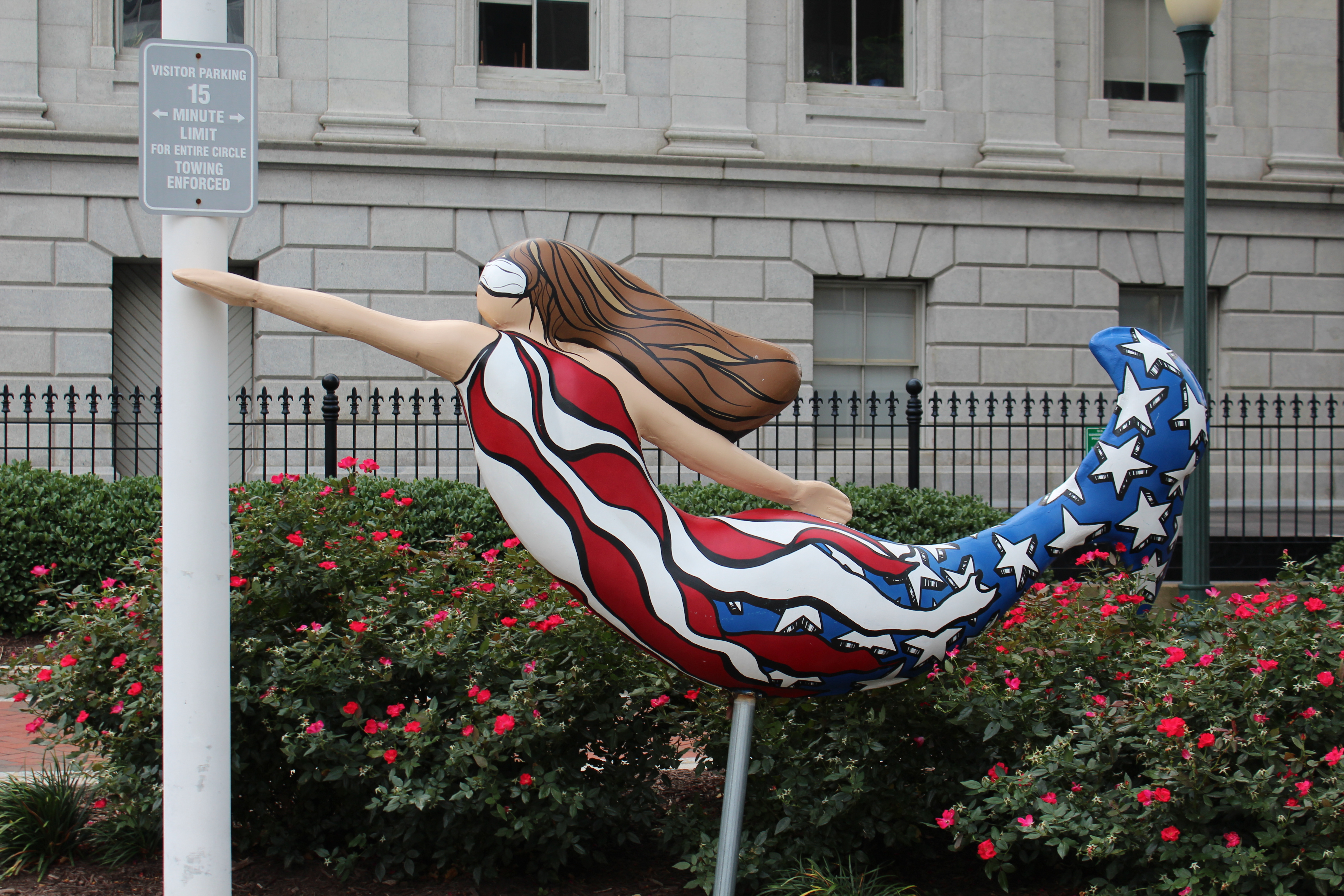
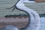
    Then 10 more miles found this little lady advertising for the Mermaid Marina.  The crew resisted the advertisement and went on up river to Double Island to anchor for the night.

    img_0033

    Monday, October 17, 2016

    This morning when the skipper started the engines to allow them to warm up, the port engine temperature again became erratic.  The temperature climbed up to about 200 degrees and then dropped down to 175 where the engine normally runs.  Then the temperature started to climb again.  This time the temperature kept going past 200.  When the temperature reached 210 and climbing the skipper turned the engine off.  The initial troubleshooting could not find anything wrong so the skipper decided to go on one engine for the day and look more in depth at the end of the day.

    img_0020
    Shoreline Shot


    Cruising on one engine developed a few new skills for the skipper.  The boat handles much differently and it took a while to get used to the new dynamics.  For example, trying to turn around on one engine is much more difficult.  And while at idle speed, steering with the wheel is tough because there is not much water passing by the rudder.  The skipper learned to increase the throttle a little to help steer while going slow.

    img_0040
    More Shoreline


    The crew passed by a small town on the river after they got going, Clifton, Tenn.  The town was almost the state capitol of Tennessee back in 1843.  The town lost by one vote to the eventual winner, Nashville.

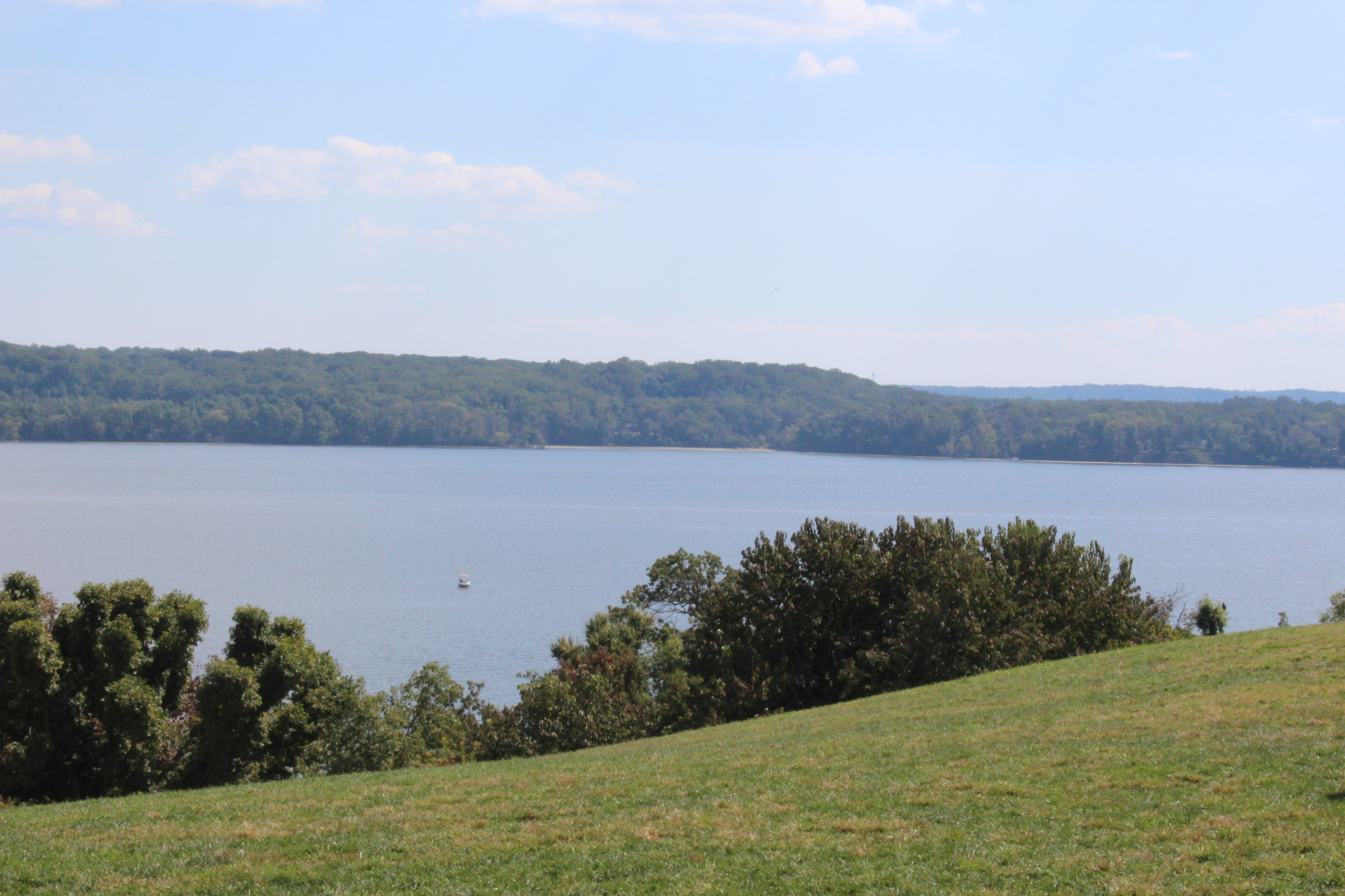
    Coming around a bend in the river the crew saw what the chart had plotted as Chalk Bluff, very scenic area.  As the crew approached the bluff, you can see that the bluff is actually clay and sand, no chalk.

    img_0041
    Chalk Bluffs


    Then just a little further up river, about five miles they came to Cherry Mansion.  The house was built in 1830 by David Robinson.  He gave the home to his daughter, Sarah, and her new husband, W.H. Cherry.

    img_0047
    Cherry Mansion – Built in 1830


    But the home was used by General Grant in April 1862.  Grant was actually eating breakfast in the home on Saturday morning, April 6, 1864 when the confederates attacked his soldiers about 8 miles up-river at Pittsburgh Landing.  The first day the Union forces took heavy losses and it looked to be a Confederate win in the making.  However, late in the day the confederates let up and stopped their attack.  This allowed the Union forces to bring in re-enforcements overnight and launch a counter attack on Sunday morning.

    img_0048
    Pittsburgh Landing where Union troops re-enforced from the river


    The confederates withdrew from the battlefield late Sunday and the Union troops did not pursue the Confederates.  When the fighting ended on Sunday, the Battle of Shiloh was the bloodiest battle to date with nearly 25,000 dead and wounded.  General Albert Sidney Johnston was one of the many casualties.  He is the highest ranking American ever killed in combat.

    After skirting around the sacred battle ground, the crew  made another 5 miles and dropped anchor at Wolf Island for the day.

    img_0055
    Water view from sundeck at Wolf Island


    Tuesday, October 18, 2016

    The crew weighed anchor and set out for the Aqua Yacht Marina to get the port engine repaired.

    To get to the marina though they would first have to make it through the Pickwick Lock, which was about two hours away.  The crew called the lock and learned that there was one tow about two miles in front of them.  The lockmaster agreed to lock the pleasure craft through the lock if they arrived more than 30 minutes ahead of the tow.  The skipper did some ciphering and figured they could catch the tow by mile 200.  Then due to the bends in the river and the slow speed that the tow would have to go to maneuver around the curves, that they could make the lock (mile 206.5) 30 minutes ahead of the tow.

    img_0050
    Looking out the Pickwick Lock


    When the crew was about two miles from the lock, the skipper called the lockmaster again. The lockmaster agreed to let Still Waters II and LeryLynn through the lock and he had the gate open when they arrived.  With only one engine, getting into the lock and safely secured was a bit of a challenge but the crew worked together and made it happen.

    After clearing the lock, it was only another hour to the marina.  The little bit of Pickwick Lake that the crew saw was beautiful.  But the crew had to turn off the Lake and head into the Tenn-Tom Waterway to get to the marina.  The crew passed one point where Tennessee, Alabama, and Mississippi merge in the waterway.

    img_0057
    In the water before the point, Tennessee, Alabama, and Mississippi borders meet


    The crew then made their way over to the transient dock at the marina and managed to safely land the boat.  No small accomplishment with the high winds blowing the boat off of the dock and maneuvering with only one engine.

    The maintenance team came down and decided that the water pump needed to be replaced.  They will order the part and the part should arrive sometime Wednesday.


    Thursday, October 20, 2016

    The new water pump arrived as expected on Wednesday and the mechanic changed the pump out.  Post maintenance checks were sat so the crew shoved off from the dock to test the port main engine repairs under actual running conditions.  Glad to report that the engine ran well all day.  The folks at Aqua Yacht Harbor did a fine job.

    img_0061
    Some Fall Foliage Color


    With the engine running well, the crew set out to return to the Tennessee River and start their side trip to Chattanooga.  The first half of the trip was wonderful, but about 1300 a thunderstorm caught the crew.  They were in a heavy down pour for about 45 minutes and even had one lightning strike less than a quarter mile from the boat. After the storm passed the sun tried to break through but just couldn’t make it.

    img_0063
    Been a while since the crew got drenched


    The crew timed another lock well and got a lift of 93 feet at the Wilson Lock.  The lock is named for Woodrow Wilson, our 28th president.  After clearing the lock, the crew entered Wilson Lake and headed another six miles upriver to six-mile creek to anchor.

    IMG_0066.JPG
    Waiting for the Wilson Lock gates to open


    Friday, October 21, 2016

    The crew weighed anchor and set out to the Joe Wheeler Lock.  This lock is named for Joseph Wheeler.  He was one of many West Point graduates that fought for the Confederate Army.  During his military career, he rose to the rank of General, fought in 127 battles, and had 16 horses shot out from underneath him.  After his military career, he served in Congress.  Upon his death, he was laid to rest in Arlington National Cemetery.

    The crew saw a small armada of 12 looper boats headed down bound leaving the fall looper rendezvous.  Because of the distance between the boats, the crew did not recognize any of the boats.

    img_0074
    Part of the armada leaving Joe Wheeler


    Upon arrival at the lock, there was a tow entering the lock.  The lockmaster said it would be two and a half hours before the crew could enter the lock.  The lockmaster did give the crew permission to tie up along the wall of the auxiliary lock to wait.  The LeryLynn arrived about an hour later, so they rafted off of Still Waters II and the two crews chatted while waiting on the lock.

    img_0077
    Had to wait for this big guy to clear the lock


    Finally, a little after noon the tow completed locking up and the crew was prepped to go in the lock.  When the lockmaster lowered the water level in the lock, the water came boiling up near the crew.

    img_0079
    For a little perspective, the wall is about 5 foot tall


    Three looper boats locked down and the crew saw Abaco Lady for the first time since Norfolk, Virginia, way back in May.  The two crews waved at each other as they passed by.

    img_0080
    Abaco Lady and Crew


    After clearing the lock, the crew made their way to the town of Decatur where there is a free dock to tie up on for the night.  There was a looper boat, Irish Lady Too already on the dock so the crew came over to catch our crew’s lines and help them dock.   Kurt and Susan crew Irish Lady Too.  They set out on the loop in May of 2015 from Baltimore, Maryland.

    img_0084
    Sunset in Decatur


    Saturday, October 22, 2016

    After shoving off from the dock the crew dodged a near catastrophe.  Just another reminder that the crew has to be constantly diligent of their surroundings.  After getting past the break water wall for the dock the skipper ran the boat up on an underwater sand/mud bar.

    img_0088

    The depth changed from 9-10 feet to less than 4 feet almost instantly.  The good news was that the skipper was only running at idle speed waiting for the engines to fully warm up.  The starboard engine shut off and the skipper turned off the port.  The Admiral ran below and checked all the bilges and made sure there was no water coming in the boat.  After a positive report from the Admiral, the skipper started the port engine and tried reverse.  The boat budged a little bit.  The skipper tried reverse again and the boat rocked back a little more.  The skipper then started the starboard engine and put both engines in reverse.  The boat slid backwards and off the sandbar.  Not a good way to start the morning.

    img_0097

    After allowing the engines to warm up the skipper put the engines in forward and speed up.  The engines ran fine all day and all seems to be ok.

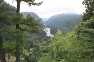
    The run along the river was breath taking today.  The fall foliage continues to change more colorful by the day.  The cool weather, in the 40’s at night might be the reason for the color change.  The run after the Guntersville Lock and Dam was spectacular.  The cliffs surrounding the lake were just gorgeous.

    img_0093

    The crew did pass one interesting area full of space history, Huntsville, Alabama.  This is the area where the US entered the space race thanks to the German engineering of Dr. Wernher von Braun.  Von Braun is credited for developing Germany’s V-2 rocket that was used to bomb the day lights out of the British.  With the war winding down and not wanting to be captured by the Russians, von Braun and his team headed towards American forces and surrendered to the Americans.  Following the war, von Braun and 100 members of his team agreed to come to the United States.

    img_0104
    Cruising with LeryLynn


    They initially were sent to Ft. Bliss, Texas.  In 1950, the von Braun rocket team was moved to Huntsville, Alabama.  On January 31, 1958 the US launched a Jupiter-C Rocket from Huntsville carrying Explorer 1, which became our first earth orbiting satellite.  Huntsville is the home of the Space & Rocket Center, the world’s largest space museum.  The crew plans to visit the museum on the return trip down the Tennessee River.

    img_0111
    LeryLynn


    About two hours after cruising by Huntsville, the crew approached the Guntersville Lock.  The Lockmaster had the gate open for the crew and they cruised into the lock for the 40 foot lift up to Guntersville Lake.

    img_0095


    After clearing the lock the crew headed for the town of Guntersville and found another free dock at a municipal park.  The crew tied up and grilled steaks on the dock with the crew of LeryLynn.

    Next Week – The crew is still two days away from Chattanooga.  The plan is to arrive on Monday and spend three nights in town.  They will leave Chattanooga on Friday morning and start the four-day journey to Knoxville, Tennessee.


    Loop On – The water goes on forever and the adventure never ends.

    La Salle

  • Famous Last Words

    Hello virtual crew members and fellow adventurers!

    Eric here catching you up to date on the latest travels of Still Waters II.

    Click on the Travel Map above or this link to see the day-by-day travel log.

    The crew started through the waters of the North Channel late last week.  This leg of the journey is 138 miles long.  The small craft route takes the cruiser through some very remote areas.  For example, in the village of Killarney, the first road was finally built in 1962.  The shore is not lined with summer cottages, just some of the oldest rocks known to exist on earth. The crew completed the North Channel and decided to stick their nose into Lake Superior to visit the Shipwreck Museum at Whitefish Point.

    Monday, August 22, 2016

    The wind howled all day yesterday and continued through the night.  As morning dawned, the wind was finally subsiding to a mild 11 mph.  Since the skipper figured the swells would still be out in the big part of the bay, he decided that the crew would take the more scenic long way through the islands.  This provided some break from the wind and waves and gave the crew something to look at instead of just wide open water.

    IMG_0003
    Benjamin’s in the background, the orange colored rocks are the sow and piglets

    They motored past Islands named the Benjamin’s, with rock formations named the sow and piglets.  Many a Captain have stubbed their pinky’s on these rocks.


    IMG_0010
    Turtle Rock

    After passing through a narrow channel named Little Detroit, the crew passed a rock formation known as Turtle Rock.


    After coming around the last island of the day, the crew had about an hour of 3-5 foot seas to contend with.  The good news was that these waves were coming directly out of the west and Still Waters II was cutting through them with ease.  However, as I have witnessed in the past, the boat can take much rougher seas than the crew.  They were glad to finally arrive near the marina where they could get behind the breakwater and out of the waves.

    WIN_20160827_18_28_37_Pro
    Geocaching Pin for FTF

    After arriving at the marina, the skipper checked his Geocaching app and noticed that someone had hidden a new cache in the marina on Saturday, and no one had found the cache yet.  With the cache only 385 feet from the boat and a chance for a First-to-Find (FTF) the skipper and Admiral were off the boat in a flash and in full search mode.  After a short walk and a quick find, the Tex Snoop Dogs found their 277 cache.  Best of all they were the FTF the cache.


    Tuesday, August 23, 2016

    IMG_0013
    Glad to be in safe harbor after rough day on the water

    Well as soon as the crew left the protected waters of the marina they realized that this would be another rough day on the water.  The wind had been predicted to be from the north-east which should have provided protection as the crew cruised just south of the mainland.  Unfortunately for the crew the wind was just about due west.  To make matters worse, there were swells of 3-5 feet that were coming directly against the beam.  This always makes for a rough ride as the boat rocks between the swells.


    After about an hour and a half, the swells began to dissipate and the crew only had to be concerned about the windblown waves dead ahead.  As the day wore on the crew began to see St Joseph Island in the distance.  As the crew began to close in on the island, the waves began to get smaller and smaller.

    IMG_0012
    Even the birds needed a rest after that wind

    The last hour of the cruise was actually nice as the skipper could enjoy the pretty water and surroundings rather than just stay focused on the wheel and trying to stay on course.


    Wednesday, August 24, 2016

    The crew left about 0900 and headed north to their last stop in Canada, Sault Ste. Marie.  This little community has an interesting history.  There is actually two Sault Ste. Marie’s, one in Ontario and one in Michigan.  Prior to the war of 1812 there was only one town.  As part of the Treaty to end the war, the St Mary’s River was used as the boundary between the US and Canada, which essentially split the town.

    IMG_0124
    The Soo Rapids

    The name is also a little odd.  Sault is French for rapids or falls.  The Sault is pronounced ‘su’.


    The name was based on the rapids that fall 20 feet from Lake Superior to the head waters of the St Mary’s River.  In the old days, merchandise would be shipped from Lake Superior to Sault Ste. Marie.  Then the goods would be portaged around the rapids and reloaded in a ship below.

    IMG_0023
    On the St Mary’s River

    The US side of Sault Ste. Marie had the lock, so the US controlled the shipping.  In 1870, the US refused to allow a Canadian steamer, Chicora, carrying Colonel Garnet Wolseley to pass through the lock.  The Colonel was on a mission to stop a rebellion of the western providences and prevent US expansion into Canadian territory.


    The Colonel portaged his goods on the Canadian side of the river and continued his successful campaign. However, the Canadians decided it was time they built a lock.  The lock was completed and opened in 1895.

    IMG_0030
    On the way to Sault St.  Marie


    Today, all commercial traffic goes through the US lock and all the recreational traffic goes through the Canadian Lock.

    IMG_0127
    The American Locks


    Thursday, August 25, 2016

    The crew took a shore excursion day and rode a train 114 miles into the Ontario back country.  The train was a rolling museum as the history of the area was broadcast on TV sets about every 20 minutes.  The train rolled past the shores of Lake Superior and many other smaller lakes and streams.  The train had a dining car where breakfast and lunch was served.  After a four hour ride through some gorgeous back country, the train arrived at the Agawa Canyon Park.  The train conductor provided an hour and a half site seeing break for the train riders.


    Our crew set out for the three waterfalls in the park.

    IMG_0085

    After the falls the crew headed back up the canyon to the Lookout station which was 300 feet up the canyon.  The lookout provided a great view up and down the canyon.  The crew arrived back at the train with 10 minutes to spare before the engineer headed back to the train station in Sault Ste Marie.


    IMG_0034.JPG
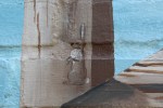
After arriving back at the boat the crew went to a nearby Walmart to stock up on a few items.  On the way to the store the crew stopped at a statue honoring the first Canadian female astronaut.  The marina and surrounding park are named for her.


    Upon return to the boat they noticed that a boat had arrived with a hailing port of Dallas, Texas.  The crew spoke with the owners of the boat and learned that they had just bought the boat and this was their very first day of ownership.  The skipper quizzed the new owners about the old owner and learned that the owner was none other than Marty Turco, an ex-goalie for the Dallas Stars.

    IMG_0123Turns out Marty Turco was born in Sault Ste Marie, Ontario and still maintains a home here.  He also has a home in Highland Park, Texas.  He spends his summers here in Ontario.  The best line of the conversation was when the new owner mentioned that they had gotten Marty Turco’s autograph, most expensive autograph ever.


    Friday, August 26, 2016

    After spending nearly 10 weeks in Canada, today was the day that the crew would return to the states.  The skipper called border patrol and was told that he needed to check-in before heading into Lake Superior.  The skipper cruised across the river to Sault Ste Marie, Mi. and called border patrol.  While waiting for the agent to arrive, the skipper took on fuel.

    The customs agent arrived, asked his many questions, reviewed passports, gave the crew a thumbs up, and welcomed them home.  This border crossing was much easier than the last.

    IMG_0128
    Viewing area for people to watch boats lock through

    With the check-in complete the crew headed for the lock to cross into Lake Superior.  Not many loopers take the time to head this direction, but the crew has heard many good things about the Ship Wreck Museum at Whitefish Point and believe the side trip will be worth the effort.

    IMG_0137
    Whitefish Point Light

    The ride across the bay started out relatively calm but as the crew continued northwest across the Bay, the waves continued to build.  The waves were mostly 3 footers with an occasional 5 footer to keep the skipper on his toes.  After an hour of hammering through the waves, the point began to come into view.  As the crew continued to approach the point the waves became less of a problem as the land began to block the wind.


    IMG_0129As they arrived in the marina, the skipper noticed that their friends onboard Avocet were docked here.  The crew of Avocet came out and caught the crew’s lines and helped them get the boat secured.  The Admiral and skipper spent some time talking with Dick and Phyllis before heading down the road to the Lighthouse Museum.


    Fun Fact: This will mark the furthest north that the crew will venture in 2016.

    GPS Location:

    N   46* 45’.652

    W  84* 57’.819

    Time to start heading south.

    Saturday, August 26, 2016

    IMG_0132
    Rudder from lost ship

    The crew made the run to Whitefish Point so they could visit the Great Lakes Shipwreck Museum.  The museum complex was well worth the effort.  The complex included the Whitefish Point Lighthouse and Keepers Quarters, USCG Lifeboat Station, Shipwreck Museum, Video Theater, and several scenic overlooks.


    IMG_0174
    9 years to build Lego replica

    The crew went to the Theater first to watch the film about the sinking of the Edmund Fitzgerald.  The Big Fitz sank just 17 miles from Whitefish Point.  The winds had gotten up to 75 mph with gusts to 100.  The wind had churned up 30 foot waves that were actually coming over the deck of the vessel.  At one point the ship suffered a crack that began allowing water into the ship.  The bilge pumps were turned on and the pumps were keeping up with the flooding so that water level was not rising in the ship.


    IMG_0168A second ship was following the Edmund Fitzgerald and was staying in radio contact.  A series of large waves in excess of 35 feet crashed over the top of the second vessel.  The second vessel radioed forward to warn the Big Fitz about the series of large waves.  The Captain of the Big Fitz last words over the radio were “We are holding our own.”  Sometime after this transmission, on the night of November 10, 1975 the ship and her crew were lost in 530 feet of water along the Shipwreck Coast of Lake Superior.

    IMG_0134

    The crew’s tribute to the Edmund Fitzgerald:


    In 1994 the ship was found and in 1995 the ship’s bell was raised.  The original bell was replaced with a new bell.  The new bell was engraved with the names of the crew.  A memorial with the original bell was held to commemorate the lives of the lost crew.  The bell was rung 29 times as the name of each crew member was announced.  Then the bell was rung one last time for all the other mariners who have lost their lives while on the Great Lakes.

    One story told in the film was about two brothers who had lost their father when the older brother was 13.  The older brother went to work to support his other four siblings and mother.  When the younger brother got drafted to go to Vietnam, the older brother told the younger not to worry, if anything goes wrong, I will go over there and bring you home.  The younger brother was telling the story while they raised the bell from the ship.  You could see the anguish in the younger brother’s eyes and the tears down his face when he was apologizing to his older brother for never bringing him home.  The younger said that the raising of the bell would be as close as he would ever come to bringing his older brother home.

    IMG_0144
    The ship’s bell


    IMG_0148

    IMG_0155

    IMG_0169

    IMG_0170
    The Griffin


    IMG_0179
    Looking out over the graveyard


    Tune in next week to see the progress of the crew as they return from Lake Superior and continue thru Lake Michigan on their way to Chicago.

    The water goes on forever and the adventure never ends.

    Eric the Red


  • North bound on St Johns River

    Hello mates and fellow adventurers!  We have several new virtual crew members who have joined us by following the blog.  Welcome aboard:

    Denise and Fred Baldwin.  The crew met them on the pier at Ortega Landing Marina aboard their boat Wandering Star.

    The skipper’s Aunt Karen.  Life is always good when Aunt Karen is in the mix.

    And someone with e-mail address as aojckj@…. has come aboard.  Not sure who you are but glad to have you cruise with us.

    The crew set off from Hontoon Island and continued south to Sanford, mile zero on the navigable waters on the St Johns River.  After having lunch in Sanford, the crew turned around and started back to Jacksonville, anchoring out two nights before returning to Ortega Landing Marina.

    When the crew cast off on Tuesday, the port engine was running poorly.  The rpm’s were about 250 less than normal when at idle.  After leaving the dock and increasing the throttle, the port engine died.  Not a good way to start the day.  The skipper restarted the engine but it coughed a few times and then died again.  The Admiral took over the helm while the skipper went below to check out the engine room.


    IMG_0003, Holy Bluff Houseboat.JPG
    One of many Holy Bluff House Boat rentals on St Johns River


    The initial check did not find anything abnormal.  Since the engine sounded like it was starved for fuel, the skipper decided to change the fuel pre-filter.  After changing the fuel filter, the skipper primed the fuel system and tried to start the engine.  No luck.  The skipper went back below and worked on priming the fuel system some more.  The engine finally started and began to purr like normal. By the time the skipper cleaned up his mess and got back to the helm the crew had already cruised about 8 miles.

    With the engines running well the crew set sites on Sanford which is located at the south west side of Lake Monroe.  The marina allowed the crew to come in the west basin and tie up for a few hours while they got lunch.  The crew ate at Sanford Steak and Sea Food along the edge of Lake Monroe.  The fish-n-chips were good and made a great dock and dine.

    IMG_0006, Sandford Steak and Sea Food
    Sanford Steak and Sea Food along shore of Lake Monroe

    With lunch complete it was time to head back north.  The plan was to go back past Hontoon Island and anchor in Alexander Spring Creek just south of Lake Dexter.  At the north end of Lake Monroe, the crew had to wait for two trains to pass before the bridge operator would open the railroad bridge.

    IMG_0008, RR Bridge Lake Monroe
    Waiting on train to pass for the bridge to open


    After that small delay the crew continued north and eventually pulled into Alexander Spring Creek.  Unfortunately, there was a fishing boat where the crew needed to anchor.  The crew tried to go further up the creek but there was no spot to anchor.  The skipper decided to keep going north to find another spot.  However, the crew was running out of daylight and needed to find a place within the hour.

    As the crew got North of Lake Dexter they noticed another boat anchored on the east side of Lungren Island.  The skipper checked the chart and decided that there was enough depth and room to anchor just north of the other boat.  The crew dropped the anchor at 1930 as the sun was setting over the river.

    IMG_0020, SUnset at Lungren Island.JPG
    Sunset at Lungren Island


    On Wednesday, the crew pulled anchor and headed for Lake George.  The Lake is about 10 miles long.  When the crew got about a third of the way across the lake, they turned left at red marker 10 and made a heading of 270 degrees towards Silver Glen Springs.  Upon arriving at the entrance of the springs, the crew dropped anchor in 5 foot of water.  They launched the dinghy and headed up the creek towards the spring.  This spring bubbles up 65 million gallons of crystal clear water a day.  The closer the crew got to the spring the bluer the water turned.  After spending two hours exploring the springs it was time to head back to the boat.

    artmax_698
    Silver Glen Springs


    By the time the crew got back to the boat the wind had picked up and the waves were 2-3 feet.  Loading the dinghy was a bit tricky bouncing around in the waves but the crew finally were successful and headed north back to Murphy Creek for the night.  The crew dropped anchor about 1730 and grilled hot dogs on the sundeck.


    IMG_0045.JPG
    Old Palatka Ferry in Murphy Creek: 2 school buses, 1 air stream, 1 crane, and 1 catamaran all on deck.  Sailboat and motor boat in the water.

    On Thursday, the crew got an early start by pulling anchor at 0700 for the run back to Ortega Landing.  After passing north of Palatka, the river widens up and become very wide.  The skipper decided to run a test to see how the dinghy would ride at different speeds.  The wind was blowing about 15 mph and causing 2 foot waves.  The skipper began raising the rpms on the engines and watching how the dinghy was riding on the swim platform.  After reaching 15 knots, the boat was gliding over the water smoothly and there were no issues with the dinghy.

    The crew returned to the marina about 1500 and docked back on the B Dock in slip 66.  With the wind out of the west the boat was being blown from the dock.  A guy down the dock came down and helped secure the boat to the dock.  Good thing because the crew was having troubles maneuvering the boat close enough to the pier to allow the Admiral to jump off and tie up the boat.

    While completing this 290 mile round trip river cruise the crew saw many birds along the way.  Bald Eagles, Osprey, Sand Hill Cranes, Ibis, Egrets, Herons, Belted Kingfisher, Anhinga, and Cormorants.

    These last two birds are often confused with each other.

    The Anhinga has no oil glands so his feathers are not waterproof.  He becomes heavy when wet which enables him to dive and chase fish underwater.  Sometimes when he swims his head sticks out of the water and he looks like a snake.  After a swim you will see the Anhinga with his wings spread to dry in the sun.  His beak is pointed for spearing fish.

    The Cormorant also dives underwater to feed on fish.  While swimming on the surface, the Cormorant’s body stays above the water.  The beak of the Cormorant is hooked for grasping its prey.

    The crew will lay over at the marina for a week and then head for Norfolk via the AICW on Thursday.

  • St Johns River Cruise

    Hello mates and fellow adventurers!

    Eric here reporting on the travels of Still Waters II and crew on their south bound journey up the St Johns River.  Yes, you read that right, up river.  The St Johns River is a rare north flowing river.  The river starts in central Florida near Vero Beach and runs north 310 miles to the Atlantic Ocean.  It is a slow moving river because there is only a 30 foot elevation drop over the 310 mile journey to the Atlantic.

    The river was first named by the Spanish in the early 1500’s as Rio de Corrientes, River of Current.  Seems to be a silly name since it is a ‘lazy’ river with little current.

    In 1562, the French established the first outpost on the river at Fort Caroline.  The French named the river La Riviere du Mai, because they arrived there on May 1.  The Spanish were non to happy about the French fort, so the Spanish marched north from St Augustine and captured the fort.

    The Spanish renamed the river San Mateo to honor a saint whose feast followed the day of the capture.  The Spanish renamed the river once again to Rio de San Juan after a mission near the river’s mouth.  After the English took control of Florida in 1763, they anglicized the name to the St Johns River.

    The history of the river has a strange connection to our skipper.  Seems a Mrs. W.F. Fuller who lived along the river in the 1880’s, travelled to New Orleans in 1884.  She attended the World’s Industrial and Cotton Centennial Exposition and obtained a South American plant, hyacinth, as a gift from the Japanese.  When she returned home she planted the hyacinth along the shore of her river home.  Within 10 years the plant covered an estimated 50 million acres of the river.  Oooopppps.

    IMG_0062
    A little fish for supper


    In 1998, President Clinton designated the river an American Heritage River.

    The navigable part of the river is made up of three distinct areas: Lower – Atlantic to Jacksonville, Middle –  Jacksonville to Palatka, and Upper – Palatka to Sanford.

    The crew left Ortega Landing Marina after partaking of a fine breakfast at the Metro Diner.  The crew shoved off about 1015 and cruised 65 miles on Tuesday, March 29.    After passing under the Palatka Bridge it was visibly obvious that the river had changed.  The river narrowed from 1 – 2 miles wide to only hundreds of yards wide.  The crew found a spot in Murphy Creek to drop anchor for the evening.

    IMG_0055
    Claudia out taking pictures of gators


    On Wednesday, March 30 the crew put in another 60 mile day and made it all the way to Hontoon Island State Park.  The river continued to narrow the further south the crew travelled.  The crew also crossed Lake George which is Florida’s second largest lake.  The crew spotted four gators along the shore before arriving at the park.  The park has two piers with about 20 slips available for boaters.  However, it is first come, first serve.  Still Waters II needed to be out on the T-dock and the crew was hopeful that nobody else was already tied up in the spot. The skipper was caught a bit off guard when he approached a bend in the river and realized that the State Park was just around the bend.  The skipper had to tell the Admiral to hang up the phone and prepare for docking because the Admiral was engaged in a lengthy conversation catching up on grandkid stories from the Easter weekend.  Luckily, as they rounded the bend, the crew could see that the T-dock was available so they made way for the spot and got tied up at 1730.  Nothing like last minute preps to get ready to dock.


    Still Waters II at T-Dock
    Still Waters II at T-Dock


    Shore Excursions Hontoon Island State Park – The park is an island with no vehicle access.  The park service runs a small 6 passenger ferry boat named ‘Island Bridge’ from the main park entrance to a parking lot across the river.  Folks come park their car and then take the 150 yard ferry crossing to the park.  The last ferry runs at 1830, so after that the crew pretty much had the island all to themselves.

    IMG_0098
    Kingfisher


    This changed on Friday however.  There were a steady stream of campers coming to the island for the weekend. The campers load their stuff in park provided wheel barrows.  Then load up on the ferry.  Once on the island they push the wheel barrows to one of three vans.  They get one trip to the camp ground using the van.  The campgrounds are about a mile from the ferry landing.  On Sunday, this ritual reversed as people were moving their gear back to the parking lot.  At one point Sunday afternoon, a long line of campers and their gear were patiently waiting on the ferry.  It was about 1930 before the park service got everyone back off the island.

    IMG_0103, Island Bridge
    Island Bridge Ferry

    Thursday, March 31, the crew launched the dinghy and took a two hour ride on the back side of the island.  The crew saw lots of birds and turtles but no gators.  That evening though the gators came out to play around the boat and were putting on a good show as they were feeding on fish in the river.

    IMG_1280 (2)
    Greg and Leslie at Hontoon State Park


    IMG_0059

    Friday, April 1, the skipper got up early and kayaked around for about two hours.  The skipper saw three more gators in the water.  After returning to the boat, the crew borrowed a motorized dinghy to make the 10 mile loop around the island and visit Blue Springs State Park.  The loop took them down Hontoon Dead River to Snake Creek.  Snake Creek wound around and eventually came out on the St Johns River.

    Heading north the crew went to Blue Springs State Park and enjoyed a swim in the 72 degree spring waters.  The springs are the winter habitat for about 200 manatees, but they were already gone so the crew did not see any manatees.  After floating down the springs and cooling off, the crew made their way back to Hontoon Island to complete the loop.  After returning the dinghy, the crew went to dinner with Greg and Leslie.  The couple took them to a local restaurant, Shady Oaks, where the skipper finally saw a manatee swim by.

    Saturday, April 2, the crew took a two hour hike around the island and visited an ancient Indian mound.  On the way to the mound, the crew took some time to find seven geocaches.  One cache was a little more exciting than it should have been.  A snake was guarding the path to the cache.  With a little persistence the crew finally made the “find” and escaped unharmed from the snake.

    IMG_100, Dave Geocaching
    A little Geo-Caching

    Sunday, April 3, Greg and Leslie invited the crew to the Deland Art Festival.  The crew spent Sunday afternoon walking around the Deland Park admiring the art work and listening to good music.  One musician was named Jack.  He was strumming his guitar and singing old country tunes.  When his set was up he sang “Hit the Road Jack” as his last song and then exited the stage.  How appropriate.

    IMG_0051
    Sand Hill Crane with baby chick


    On Monday the crew will prepare for the next leg of the journey and prep the boat for cruising.  The crew will leave Tuesday and head south to Sanford.  Plan to eat lunch, then head back north and anchor out.  Wednesday they hope to visit Silver Springs and then anchor out in Murphy Creek.  Thursday they should arrive back at Ortega Landing to re-provision.  They plan to leave on Monday, and start their journey up the AICW to Norfolk.

  • Palm Sunday Blessing

    Ahoy Mates!

    Eric here providing an update on the crew of Still Waters II.

    Every Thursday, the crew gets a Cruiser’s Weekly Update from WaterWay Guide.  The Update provides new navigational alerts, cruising news, and Marina & Harbor Events.  The skipper noticed that the Captains Club  and the Jacksonville Sail and Power Squadron were hosting the annual Blessing of the Fleet on Palm Sunday.


    Lone Sailor Statue
    Lone Sailor Statue

    Blessing of the Fleet is a tradition that was started many centuries ago in Mediterranean fishing communities.  The vessel, captains, and crews were blessed to ensure a safe and prosperous season. The tradition is now held in coastal fishing communities throughout much of the world, including in a number of coastal cities in the United States.

    Line of Boats
    Line of Boats

    The crew decided to throw off the dock lines and make the hour cruise to downtown Jacksonville.  The crew arrived at the staging area east of the statue at 1330 and joined about 50 other boats.  The Master of Ceremonies came on Channel 72 at 1345 to give instructions and inform the boaters that they would start as soon as the Padre arrived.  Seems he was running late, something about his service running long due to Palm Sunday.

    Spectators by the Statue
    Spectators by the Statue

    Amazing enough, the Padre arrived a few minutes later and the procession of boats made way to the Lone Sailor Statue for their individual blessing.

    The Blessing
    The Blessing

    After all the boats passed the Padre, the official boats formed a wheel in the middle of the river and performed a wreath laying ceremony.


    561544173_260x146

    Click the Padre pic to watch a 40 sec video of Still Waters II Blessing.


    STILL WATERS II

    PRAYER


    Keep our engines

    cruising around

    Keep our boat

    from running aground


    Keep our lives

    in YOUR care

    Keep us safe

    everywhere


    Bless our guest

    Who come aboard

    May they leave

    Refreshed and restored!

    Author.

    Skipper Dave


  • All We Lack is Finishing Up

    Ahoy Mates!

    Eric back,  with a little update on the crew of Still Waters II.

    IMG_0123
    Foggy morning at the marina

    Our crew has been working diligently on getting the boat ready for the 2016 cruising season.  New furniture, new rugs, refurbished cabinet, updated stairs, and many other smaller items on the Admiral’s To Do List.  Yes, the skipper has been busy this winter!

    The skipper also added a 2015 map that links to the stops along the journey last year.  You can find the link near the top right corner labeled mysteriously as “2015 Map.”  The good news is that the Admiral has just about completed her over haul of the interior decorating and the summer cruising season is just around the corner.

    IMG_0147.JPG
    Walking around the local neighborhood


    Current thinking is that the crew will leave Jacksonville March 29 and head south down the St Johns River for a few days.  After exploring the River, the crew will head north back to Norfolk for the spring rendezvous  of the America’s Great Loop Cruising Association (AGLCA).

    IMG_0145.JPG
    One of many local little parks


    The crew will then make way for Cape May, New Jersey where they stopped their forward progress in October 2015 due to cool weather.  From Cape May, the crew will head to NYC, up the Hudson River, and then cross Lake Ontario into Canada.  Eventually making it to Chicago about Labor Day Weekend.

    IMG_0025
    Shake a leg and let’s get going. Boat from Christmas parade.

    Hope to see you back aboard as a virtual crew member!

    Enjoy the ride, maintain course and speed.

    IMG_0141
    The skippers favorite local historical marker


  • Shore Excursion in Washington DC

    Hello fellow adventurers and virtual crew members!

    Captain John Smith here reporting on the shore excursions in Washington D.C. and Mount Vernon.  The problem with visiting D.C. for only a few days is trying to decide on what to visit and what to skip.  Sooooo many choices.

    Capital Hill
    Capital Hill

    The crew decided to visit the zoo on Sunday, the Mall on Monday, a few museums on Tuesday, and finally Arlington Cemetery on Wednesday.  On Thursday the crew motored south and anchored across from Mount Vernon.  On Friday, they weighed anchor and tied up on the Mount Vernon wharf.

    White House
    White House

    Panda Mania at the Zoo

    IMG_0092

    The first challenge of the day was getting to the zoo on the Metro (DC subway).  After getting help from an attendant, the crew received a free pass on the metro from the guy.  They started on the green line and had to make one exchange to the red line.  After several stop and goes, making sure they were in the right place, and headed in the right direction, the crew finally arrived at the zoo.  First order of business was to check out the giant pandas.

    IMG_0099

    Giant Panda Mei Xiang gave birth back in August and the zoo was all a buzz about the new arrival.  The new unnamed male cub will not be put on display until sometime in November.  However, there is a panda cam link that you can catch a view of the new cub before the formal coming out party.

    Mom and baby on Panda Cam
    Mom and baby on Panda Cam

    The zoo did have the baby panda’s dad on display and the crew got to watch him for about a half hour entertain the crowd.

    The trip to the zoo was only surpassed by a visit from Al Darelius.  Al is the guy who introduced the crew to the idea of the Great Loop. Al was on his way to the Surry Nuclear Power Plant and took a large detour to come visit.  The skipper and Al swapped stories until it was late.  Al still needed to get to his hotel on the west side of Richmond, so the visit was cut short so Al could go do his J O B.  The skipper failed to get Al’s picture, so if you would Al, send a picture of you and your boat in response to this post.

    Walking the National Mall

    The skipper likes to refer to Trip Advisor to review the top ten things to do in the areas they visit.  One clown gave the mall a poor rating because the reviewer could not seem to find the shopping center.  The reviewer even went as far as suggesting they rename the area to prevent further confusion.

    IMG_0029

    As far as our crew was concerned, they used the National Park Service National Mall app and did the One-Day Tour.  The tour takes you to 19 monuments and/or memorials.  The app also provides much additional information on each of the stops.

    IMG_0033

    The crew was really impressed with the “new” WWII memorial.  While visiting the memorial, a bus tour of WWII veterans from Colorado and Oklahoma arrived.  It was obvious they were moved by the memorial as they drifted to the theater of war that they were personally involved with.

    IMG_0035
    Wall of stars for the fallen soldiers

    One memorial that was a surprise to the crew was the George Mason Memorial.  Thomas Jefferson called him the wisest man of their generation.  Mason left the Constitutional Convention in 1787, refusing to sign the document because they did not prohibit the continued importation of slaves or guarantee individual liberties dearly won during the Revolutionary War.

    George Mason Memorial
    George Mason Memorial

    Museums

    The crew opted for the Botanical Gardens, the Castle, and the Holocaust Museum for this trip.

    IMG_0075

    The jewel here was the Castle.  This is actually the Information Center for the Smithsonian Museum complex, but has a small exhibit for the founder of the museum.  A fascinating story unfolds in the Castle as they explain how the Smithsonian came to be.

    IMG_0101

    The short story follows here:

    James Smithson was born, raised, and lived in Europe, and never visited the United States.  James inherited his wealth from his mother’s estate.  James never married or had children.  His will left his estate to a nephew when James died in 1829.  The nephew died in 1835 with no heirs.

    James Smithson's crypt in the Castle
    James Smithson’s crypt in the Castle

    There was a codicil in the will that stipulated that if the nephew died without children, then the property would be donated to the United States, “to found in Washington D.C., under the name of the Smithsonian Institution, an establishment for the increase and diffusion of knowledge among men.”

    Richard Rush was sent to Europe to claim the estate on behalf of the Nation.  It took about two years to settle the estate.  Richard Rush then liquidated the assets of the estate, converted the cash into gold bars.  The gold bars filled 11 cases.  Then Rush shipped the bars back to the US with a hope and prayer that the ship would not sink with the $508,318.46 of gold bars.

    Gardens at the Castle
    Gardens at the Castle

    As usual, it took congress a year to figure out what to do with the money and honor the will.  But finally in 1847 they authorized building the Castle as the beginning of what we now know as the Smithsonian Institution.

    Arlington Cemetery

    The crew took the metro to Arlington Cemetery in the afternoon and opted for the bus tour of the grounds.  I suspect the bus tour idea was the skipper’s since he decided to ride his bike from the marina to Mount Vernon in the morning, about a 23 mile trip – one way.

    After arriving at Mount Vernon, he took a short rest and then rode the Mount Vernon Trail back to the marina.  He made some comment that riding a mountain bike 45 miles on 3 inch tires is much harder than riding his road bike where only 1/8 inch of rubber meets the road.

    Entrance to Arlington
    Entrance to Arlington

    The bus tour made seven tour stops, but the most fascinating was the Arlington House from which the place gets its name.  George Washington Park Custis (grandson of Martha Washington) acquired the land in 1802 and began construction of the Arlington House.

    Arlington House - on high ground overlooking DC
    Arlington House – on high ground overlooking DC

    The estate passed to his daughter, Mary Anna who eventually married Robert E Lee.  The Lee’s evacuated the estate at the beginning of the Civil War, and the union troops occupied the high ground overlooking DC on May 24, 1861.

    By 1863, the federal cemeteries were almost full so congress passed a bill to purchase more land for burial of the war dead.  The federal government began burying the war dead at Arlington House in part to prevent the Lee’s from ever regaining their property following the war.

    Good fellow Texan
    Good fellow Texan

    The government refused to accept the tax payments of $92.07 because they were not paid in person and seized the property.  Following the war, the Custis estate began the legal process of reclaiming their land.  In 1882, the Supreme Court ruled that Arlington had been confiscated without due process and returned the property to the family.

    Stumbled across this marker while looking for something else
    Stumbled across this marker while looking for something else

    In March 1883, Custis Lee sold the property back to the US for $150,000 with a signing party with Secretary of War Robert Todd Lincoln.

    Guarding the unknowns
    Guarding the unknowns

    Another interesting story line is the Unknown Soldier of the Vietnam War.  It took until 1984 to find an unknown to represent the Vietnam era.  However, in 1998 the remains were disinterred and identified as Air Force 1st Lt Michael J. Blassie.  The crypt remains empty of a Vietnam soldier.  With modern technology, I wonder if there will ever be another unknown from any conflict.

    Fun Fact: The soldier guarding the unknowns takes 21 steps and pauses 21 seconds while marching back and forth.  This tradition was established because a 21 gun salute is the highest military honor.

    Mount Vernon

    The wharf at Mount Vernon is first come first serve, so the skipper decided to leave DC and motor down closer to ensure a spot at the dock.  The crew anchored out across the river from Mount Vernon.  On Friday morning they pulled anchor and idled over to the Mount Vernon wharf.

    Still Waters II at the Mount Vernon Warf
    Still Waters II at the Mount Vernon Warf

    The crew spent the majority of the day touring the grounds.  The education center had a wonderful exhibit on the life of George Washington.  The center started with his early life and chronicled his life story as a surveyor, war years fighting for the British in the French and Indian War, life on the farm at Mount Vernon, call to duty as leader of the Continental Army, call to be President, and return to Mount Vernon.

    Young George the Surveyor
    Young George the Surveyor

    After the exhibit, the crew ran into Mrs. Washington and sat spell bound as she answered questions and told stories of her and the General’s life.  The skipper got to ask how George became owner of Mount Vernon.  Short story is that he acquired it from a nephew after his half-brother died.

    IMG_0162

    The mate got to ask Martha how she met George.  This questioned brought a big smile on her face as she launched into the long story.  But basically she first met George while she was married to her first husband.  Six years later, following the death of her husband and two of her children, they were re-introduced by a mutual friend and neighbor.  She said that what she most admired about George back then was how kind he was to her two living children.

    George and Martha laid to rest
    George and Martha laid to rest

    The crew could have stayed all day and listened to stories, but it was time to find the boat and head back down river.

    The view from front porch
    The view from front porch

    The crew stopped at Gilligan’s again and stayed at the dock for the night.  The next morning it was time to make way for Chesapeake Bay and bring this side trip to its end.

  • Shore Excursions – Norfolk

    Hello fellow adventurers and virtual crew members!

    Captain John Smith
    Captain John Smith

    Captain John Smith here providing Eric a much deserved sabbatical after chronicling the travels of Still Waters II up the Atlantic ICW.  He also ran into his son Leifr Eiriksson at the Newport News Mariner’s Museum and has decided to hang with him for a while.  Since I have explored most of the area the crew is headed, I agreed to take over the reporting on the adventures of the crew.

    Leifr Eiriksson
    Leifr Eiriksson

    In fact, there is now a Captain John Smith Chesapeake National Historic Trail that recreates the adventures of 1607 – 1609 as I mapped 3,000 miles of the Bay and rivers.  Visit smithtrail.net to explore more of the trail on your own.

    Captain John Smith Chesapeake National Historic Trail

    The Chesapeake Bay Interpretive Buoy System was launched back in 2007.  The buoys are placed along the water trail that we will be following.  The first buoy placed was the Jamestown marker to commemorate the 400th anniversary of my initial explorations of the Chesapeake Bay.  There are a total of ten markers now that make up the Captain John Smith Chesapeake National Historic Trail.  The crew is planning on cruising all ten locations.

    You can access the information from the buoys anytime by dialing a buoy (877-Buoy Bay) and follow the prompts or log on to the website (buoybay.noaa.gov) to learn more about the areas that we will be cruising together.  If using the website, then select a buoy, and then select the “information” to read or listen to the info.

    Norfolk Buoy
    Norfolk Buoy

    The first buoy we encountered was at Norfolk.  The Norfolk buoy gives some history of my explorations of the Elizabeth River back in September 1608.  There is also a piece on the war of 1812, Geography info, and some seasonal information.

    The second buoy we encountered was at First Landing.  I first stopped here back on April 26, 1607.  We tried to establish Fort Henry here but were unsuccessful.  We decided to move further upstream and finally settled at Jamestown on May 14, 1607.

    The third buoy we encountered gives the history of our struggles to make a go of it at Jamestowne.  The crew visited historic Jamestowne and got to walk the same ground as I.  Initially 104 colonists started the settlement.  The walls of our fort made a triangle with two walls 100 yards long, and the third wall 140 yards long around the river front.

    Pocahontas
    Pocahontas

    An additional 600 colonists migrated to the fort by the end of 1609.  In 1610 an additional set of colonists arrived to find only 60 survivors.  The visitor center hints that the area was in an eight year drought.  Living on the island with little to no fresh water took its toll.  Interesting to note that until 1610 all colonists were men.  The 1610 colonists included 90 unmarried women.  Seems things started to go better after 1610, go figure.

    Monument at Jamestown
    Monument at Jamestown

    Jamestown may have been the birthplace of America, but Yorktown was where she won her independence.

    The Visitor Center gave a superb overview of the build-up and eventual siege that took place at Yorktown.  After viewing the displays and films at the Visitor Center, the crew took the driving tour of the actual battlegrounds.  Many of the trenches and battle areas are still preserved.

    IMG_0127

    The wheels finally came off in 1781 for the British when they concluded that they would lose the northern colonies but would make a run at saving the southern colonies for the crown.  The British believed that if they built a port on the lower Chesapeake and controlled Virginia that the remaining southern colonies would stay with British rule.  Cornwallis decided on Yorktown for the port, and began to fortify the area.

    Escape route over the York River
    Escape route over the York River

    Unfortunately for the British, the French had joined with the Americans.  The French Navy defeated the British Navy at the mouth of the Chesapeake and prevented additional supplies for Cornwallis.  With this victory, the Americans began a troop build-up with the aid of France.  Cornwallis was basically surrounded with only an escape route over the York River.  Standing on the shore of Yorktown, it is about two miles across the river to the north shore.

    A few of the many siege cannons
    A few of the many siege cannons

    After two days of heavy cannon pounding, the British tried to escape over the York River.  They lost most of the boats and the men in them on the first crossing.  The weather and wind were not in the favor of the British.  With no escape route, Lord Cornwallis finally surrendered.

    Location where French buried their dead
    Location where French buried their dead

    A couple of interesting things about the surrender that the skipper had forgotten from days gone by:

    1. Cornwallis negotiated the terms of the surrender for him and his men.  However, on the formal day of surrender, he claimed he was sick and stayed in his tent.  He sent one of his Junior Officers to represent him and surrender his sword.
    2. The troops were made to march about two miles outside of town and surrender their weapons by laying them down in a field.  Each man was allowed to carry one round of ammo.
    3. As part of the surrender agreement, the British had to pay the Americans room and board for all the new prisoners of war that had just surrendered.  Since the formal Peace Treaty was still about two years away, that was a pretty smart move on George Washington’s part.
    Atop the victory memorial
    Atop the victory memorial

    On Sunday, September 6th, the crew set out on a mermaid hunt.  The city of Norfolk has made the mermaid their official mascot.  Originally about 130 mermaids were created and auctioned off by the city.  Now 25 of these mermaids are within walking distance of the waterfront.

    Blind Justice at the courthouse
    Blind Justice at the courthouse

    The crew was successful in locating 22 of 25 mermaids.

    Go Diva in the mall
    Go Diva in the mall

    On Monday, September 7th, the crew went to visit the Newport News Mariner’s Museum.  To do this collection justice, it is probably a two day visit.  The crew only had one day so they skipped a couple of 3D movies and exhibits.

    The museum did reinforce a belief of the skipper though….”the victors get to write the history books.”  In this case the north gets to tell the story of the Navy battle between the Monitor and Merrimack.  The Virginians running the museum are quick to point out that the battle was between the Monitor and the CSS Virginia.

    IMG_0213

    The union troops sank the Merrimack as they were leaving Norfolk at the beginning of the war.  The south raised her and re-fitted her as an iron clad.  Also gave her a new name, the CSS Virginia.

    The museum does a superb job of telling the story of the battle that changed navy vessels and navy warfare.  The two day battle shaped navy vessels (no more wooden ships) and navy tactics that are still used today.

    Does anyone notice a family resemblance?
    Does anyone notice a family resemblance?

    With the Labor Day weekend winding down, the crew returned to their ship and began making plans for the next leg of their journey.  Weather permitting, they plan to cruise the Chesapeake Bay up to the northern reaches.  They will start with a side trip to Washington D.C. up the Potomac River.

    The skipper got all excited when he saw the inside of a submarine
    The skipper got all excited when he saw the inside of a submarine

    Chesapeake Bay Fun Facts:

    1. The name Chesapeake originates from the Algonquin Indian phrase “K’che-se-piak” meaning “land along the big river.”
    2. The Chesapeake Bay is about 200 miles long
      1. Narrowest width – 2.8 miles
      2. Widest point – 30 miles
    3. The bay and tributaries stretch out to 11,684 miles of shoreline
      1. 7,213 in Virginia
      2. 4,471 in Maryland
  • The Beginning or the End

    Hello fellow adventurers and virtual crew members!

    Eric here reporting on the run to Elizabeth City, North Carolina and Norfolk, Virginia.

    The crew left Hertford, North Carolina on September 1st and made their way to Elizabeth City.  The next morning the crew entered the Dismal Swamp and spent the night at the Visitor Center dock.  On Thursday, the crew finished off the Dismal Swamp, made their way to Norfolk, circled the navigational aid Red Buoy #36, and then docked at the Waterside Marina in Norfolk.

    Back on the ICW
    Back on the ICW,  What is that strange building in the background?

    The crew decided to have an extended stay in Norfolk over the holiday weekend and let the crazy people enjoy the water while the crew stayed safely tied to the dock.

    Run to Elizabeth City

    After leaving the dock at Hertford at 0900, the crew spent 3.5 hours dodging those nasty crab pots in the river and sound.  By 1220 the crew had made it out of the Albemarle Sound and into the Pasquotank River.  Then 20 minutes later they rejoined the ICW at mile 65 officially ending the side trip around the Albemarle Sound.

    IMG_0009

    There were some interesting sites to behold on the way to Elizabeth City.  Most interesting was the Blimp Air Field.  The crew spotted a strange building on the horizon which eventually showed itself to be a blimp hanger.

    Small Blimp and hanger
    Small Blimp and hanger

    Upon arrival in Elizabeth City, the crew strolled around the waterfront.  At 1800 they were entertained by a local band for two hours, as the town came out to enjoy a concert in the park.

    Summer Concert in the Park
    Summer Concert in the Park

    The town lived up to their nickname, “Harbor of Hospitality.”

    IMG_0032

    Though the mate was hoping for 5 boats to be in town so she could get a rose, Still Waters II was only one of two boats docked, so no rose this trip.

    IMG_0018

    Run to Dismal Swamp Visitor Center

    On Wednesday September 2, the crew went to the local Mariner Museum and then headed out to the Dismal Swamp.  The only thing more dismal than the swamp was the Texas Longhorn’s showing against the Fighting Irish on Saturday.  Looks to be another loooooooooooong season for the burnt orange fans such as the skipper.

    Dismal Swamp
    Dismal Swamp

    The trip up the swamp took a little planning to time scheduled bridge and lock openings.  The crew left about 1220 and needed to be at the South Mills Lock before 1530 to make the last opening of the day.  The skipper knew the time and distance and used that info to calculate the speed needed to make the opening.

    Swamp Reflections
    Swamp Reflections

    The skipper padded the calculation a little and the crew arrived 30 minutes before the lock opening.  Plenty of time to set the fenders and ropes to pass through the lock.  The trip through the lock raised Still Waters II about 12 feet.

    South Mill Lock
    South Mill Lock

    The same person operates both the lock and the South Mills Bridge.  So after opening the lock gates the bridge tender jumped in his truck and raced down to the bridge to open it so as not to cause any delays on the water.  As usual though, plenty of delays for car traffic as they wait for the bridge to close so they can get on down the road.

    IMG_0058

    Just 5 more miles of swamp and the crew arrived at the Visitor Center.  There were already 2 boats tied to the dock, but there was plenty of room to dock on the north end past a 26 foot sailboat.  The sailboat captain jumped up and helped the mate secure Still Waters II to the dock.

    At Visitor Center Dock
    At Visitor Center Dock

    Run to Norfolk

    The crew spent the morning exploring the Dismal Swamp Park and Visitor Center.  However, they needed to get back on the water so they could make the bridge and lock openings again.  They shoved off about noon, and thirty minutes later they passed into Virginia.

    IMG_0078

    The crew arrived at the Deep Creek Bridge about 40 minutes ahead of schedule.  Just south of the bridge on the east bank was a large concrete structure with cleats attached.  So what do you do when you need to wait 40 minutes for the bridge to open?

    Deep Creek Bridge
    Deep Creek Bridge

    Duh, you tie up to the structure, run across the street to Hardees, and order vanilla shakes for the crew.  Then buy a watermelon from the guy sitting on the corner in his pick-up truck.  Yes, that is exactly what you do!!!

    First Mate enjoying vanilla shake
    First Mate enjoying vanilla shake

    After making it passed the bridge and through the lock, it was another two hours to Norfolk.  There was very little traffic on the Elizabeth River on the run up to Norfolk, but there was plenty of activity along the water front.

    Deep Creek Lock
    Deep Creek Lock

    Before entering the Waterside Side Marina in Norfolk, the crew went a little further up river and rounded Red Buoy #36.

    The end at marker 36, or is it the beginning?
    The end at marker 36, or is it the beginning?

    This buoy is mile marker “0” for the beginning of the  Atlantic ICW.  The crew was pretty excited that they had actually made it all the way from Fort Myers, Florida.

    USS Wisconsin in Norfolk
    USS Wisconsin in Norfolk

    The crew would like to thank the virtual crew members who have completed this leg of the journey from the safety of their electronic devices.  Your words of encouragement keep the crew going strong.

    The crew will take shore excursions to visit Jamestown, Yorktown, and the National Mariner’s Museum over the Labor Day weekend, then start the next leg of the journey on the famed Chesapeake Bay next week.

    Wildlife sequence – Osprey catching fish

  • Albemarle Sould Side Trip part 2

    Hello fellow adventurers and virtual crew members!

    Eric here reporting on the completion of the Albemarle Sound Loop side trip.  The hospitality of the marinas and town folks has been overwhelming.

    Plymouth, Columbia, and Hertford.
    Plymouth, Columbia, and Hertford.

    The original float plan has been altered, and the new course after leaving Plymouth is to cruise to Columbia and then on to Hertford.  After Hertford, the crew will go back to the ICW and head to Norfolk (mile 0) via the Dismal Swamp Route.

    Columbia

    The run over to Columbia was very rough on Thursday, August 27th.  The wind was out of the east and blowing directly down the sound. Unfortunately for the crew, east was the direction they needed to head after leaving the Roanoke River.

    The only good news is that the rough ride was short because the run only took 4 hours.

    No big celebrations while we were here on the anniversary of hurricane
    No big celebrations while we were here on the anniversary of hurricane

    Upon arriving in Columbia, the crew walked around town. On the side of one of the buildings is a painting.  Not so unusual.  However, within the painting are 10 hidden animals that can be seen around the area.  The crew spent about an hour looking the picture over and found 8 of 10 of the animals.

    Wall Painting
    Wall Painting

    On Friday morning the crew walked over to the Pocosin Lakes National Wildlife Refuge and wandered around the boardwalk.

    If you are like the skipper, you may be wondering, ‘what in the world is a Pocosin?”  The crew learned that a Pocosin is a swamp on a hill.  The term hill is used loosely here, can be just a few feet rise from the coastal waters.

    The refuge was very peaceful.  One section of the mile long boardwalk was closed and the entrance was guarded by a large spider.  There were many large spiders along the walk.  There must be lots of bugs in the swamp to grow such spiders.

    Spider Guard
    Spider Guard

    Completing the boardwalk, the crew saw many large spiders, turtles, and a rare woodpecker. The skipper heard the woodpecker, but it took almost ten minutes to locate the little bird.  He was darting in and out of a hole in a tree.  Great way to spend the morning.

    The crew then wandered back over to the painting and found the last two hidden animals.  After lunch, it was time to shop the town down and provision for the next week of the journey.

    Hertford

    On Saturday, August 29th, the crew motored over to Hertford, North Carolina.  The Sound was up to its usual tricks.  The wind was out of the east again but the waves were confused and seemed to be coming from every direction.  It took a couple of hours to cross but luckily once in the river the waves calmed down.  Then it was back to dodging crab traps.

    Crossing the Albemarle Sound
    Crossing the Albemarle Sound

    The skipper says he would not want to be a crab in these waters because with so many crap pots it would be impossible to move around without getting caught.  Lucky for the crabbers, one female has about 2 million little crabs per brood.

    The marina docks in Hertford are brand new and have not been used much by larger vessels.  This was apparent as the crew came into the harbor at the end of the river.

    Hertford Dock
    Hertford Dock

    The last S swing bridge in the country guards the entry.  The bridge tender stopped the traffic and swung the bridge open.  The drivers of the stopped cars were getting out of their cars and taking pictures as the boat passed through the bridge. Even the bridge tender was taking pictures. Once docked, a man showed up from the newspaper and interviewed the crew for the local paper.  The paper only comes out weekly on Wednesday, and looks like the crew will be the news of the town.

    Last S Swing Gate Bridge in USA......on schedule to be replaced by 2020
    Last S Swing Gate Bridge in USA……on schedule to be replaced by 2020

    The REAL big deal in Hertford is Jim ‘Catfish’ Hunter.  For those not in the know, he was born, raised, and died here in Hertford.  The skipper is a big baseball fan, and was a big fan of ‘Catfish” Hunter.  The Chamber of Commerce houses the museum dedicated to their favorite son.

    IMG_0047

    Tribute to Jim ‘Catfish’ Hunter

    Born April 8, 1946, James Augustus Hunter learned to play baseball on his family farm.  He claimed that his three older brothers taught him the game.  He developed his awesome control by practicing throwing rocks and potatoes through a hole in the family barn.  The hole was made by the brothers.  They painted an X on the barn, then cut a hole at the center of the X.

    He was only 17 and still in high school when he signed his first contract with the flamboyant owner of the Kansas City A’s.  His parents had to co-sign the contract.  First contract was for $75,000.

    Catfish

    His career almost never got started because one of his brothers accidently shot him in the foot with a shotgun.  This caused the lose of his big toe, and a delay in his major league start.  Charles O Finley, owner of the A’s, sent him to a clinic and covered his medical and rehab cost.

    In 1971, he got his first of five consecutive 20 game winning seasons.  In 72, he helped win the first of three straight World Series with the A’s. Then in 74 he won the Cy Young Award with 25 wins and an 2.49 ERA.

    catfish-hunter

    Following the 74 season, he discovered a clause in his contract that was not honored.  Specifically, Charlie O was trying to defer 50% of Hunter’s salary to the next year for tax purposes rather than pay at the end of the season ($50,000).  Hunter took the case to arbitration and became the first free agent of the era.  A bidding war ensued for his talent (23 of 24 teams made offers), and he eventually decided to sign with the New York Yankees.  This contract was the first million dollar contract in sports.  He got a 1 million signing bonus and a 3.5 million dollar contract.

    catfish-hunter-y

    In 75, Hunter led the American League with 23 wins and taught the Yankees how to win again.

    In 76, Hunter became only the fourth pitcher to win 200 games in the modern era before his 31st birthday.  It was also in this time that he was diagnosed with Diabetes and his numbers began to fall off.

    From 76-78, he helped lead the Yankees to three straight American League pennants and two World Series championships.

    He honored his five year contract with the Yankees and retired back home to Hertford after the 79 season to return to farm life.  The locals talk of him sitting in the corner pharmacy signing baseballs for fans with one caveat, they were not to sell the ball for more than $3 because he wanted everyone to have an autographed ball.

    Autograph corner for Hunter
    Autograph corner for Hunter

    In 1987 he was inducted into the Baseball Hall of Fame.

    Notice his hat does not have team insignia. He did not want to short either the A's or Yankees, so he choose none.
    Notice his hat does not have team insignia. He did not want to short either the A’s or Yankees, so he choose none.

    In September 1998 he was diagnosed with Amyotrophic Lateral Sclerosis (ALS) and a year later he died of complications from ALS on September 9, 1999 at the young age of 53.

    IMG_0051

    IMG_0052

    Former teammate with the A’s and Yankees, Reggie Jackson described Hunter as a fabulous human being.  He was a man of honor.  He was a man of loyalty.

    George Steinbrenner, owner of the Yankees who signed Hunter for 3.5 Million, said “We were not winning before Catfish arrived…… He exemplified class and dignity and he taught us how to win.”

    Former teammate Lou Piniella said, “Catfish was a very unique guy.  If you didn’t know he was making that kind of money, you’d never guess it because he was humble, very reserved about being a star type player. But he told great stories.  He had a heck of a sense of humor.  When you play with guys like that, you feel blessed.

    Best testimony of all is the town folk who speak highly of him and his family.  Just another farmer here in town that just happened to play a little ball in between hunting seasons and harvest.