Tag: Virginia

  • Fabulous Fisherman Finale

    Fabulous Fisherman Finale

    Hello virtual crew members and fellow adventurers!

    Norfolk is that-a-way

    3 Mermaid near Norfolk

    Summary of week:

    The crew had six good travel days this past week: 1 – travelled to Belhaven and took a slip at River Forrest, 2- Anchored just north of the Alligator River Bridge to stage for an early morning crossing of the Albemarle Sound, 3- Stayed at the Dismal Swamp Visitor Center Free Dock, 4- took a marina slip at Top Rack, 5- anchored off the shore of Hampton, 6- took a slip on the eastern shore of Chesapeake Bay at Onancock Wharf.
    Onancock
    Click on the link to read the day-to-day travel log. This includes weather report, sea conditions, captain’s log, and a summary of the day’s experience.

    The voyage of discovery did answer the following questions this week:

    1. Who won the Big Rock Blue Marlin Fishing Tournament?
    2. How much was the purse for the first place finish?
    3. Why did the third place finisher win the Fabulous Fisherman contest?

    At the Box Office

    This week’s video shows Still Waters II meet a shrimp boat in Adams Creek, cross the calm Albemarle Sound, transit the Dismal Swamp, and get a few lessons on how to blow a conch shell. Enjoy!


    To see past videos, click on the link to the Still Waters II Vimeo site. The library contains videos of Still Waters II cruising America’s Great Loop.

    Sunday, June 10th

    A follow up to the ‘Big Rock” Fishing Tournament:  Interesting enough, the fisherman take a break on Sunday and do not wet a hook.  The crews were all onboard their respective boats prepping for the big week ahead.

    24.11 Ready for tomorrow

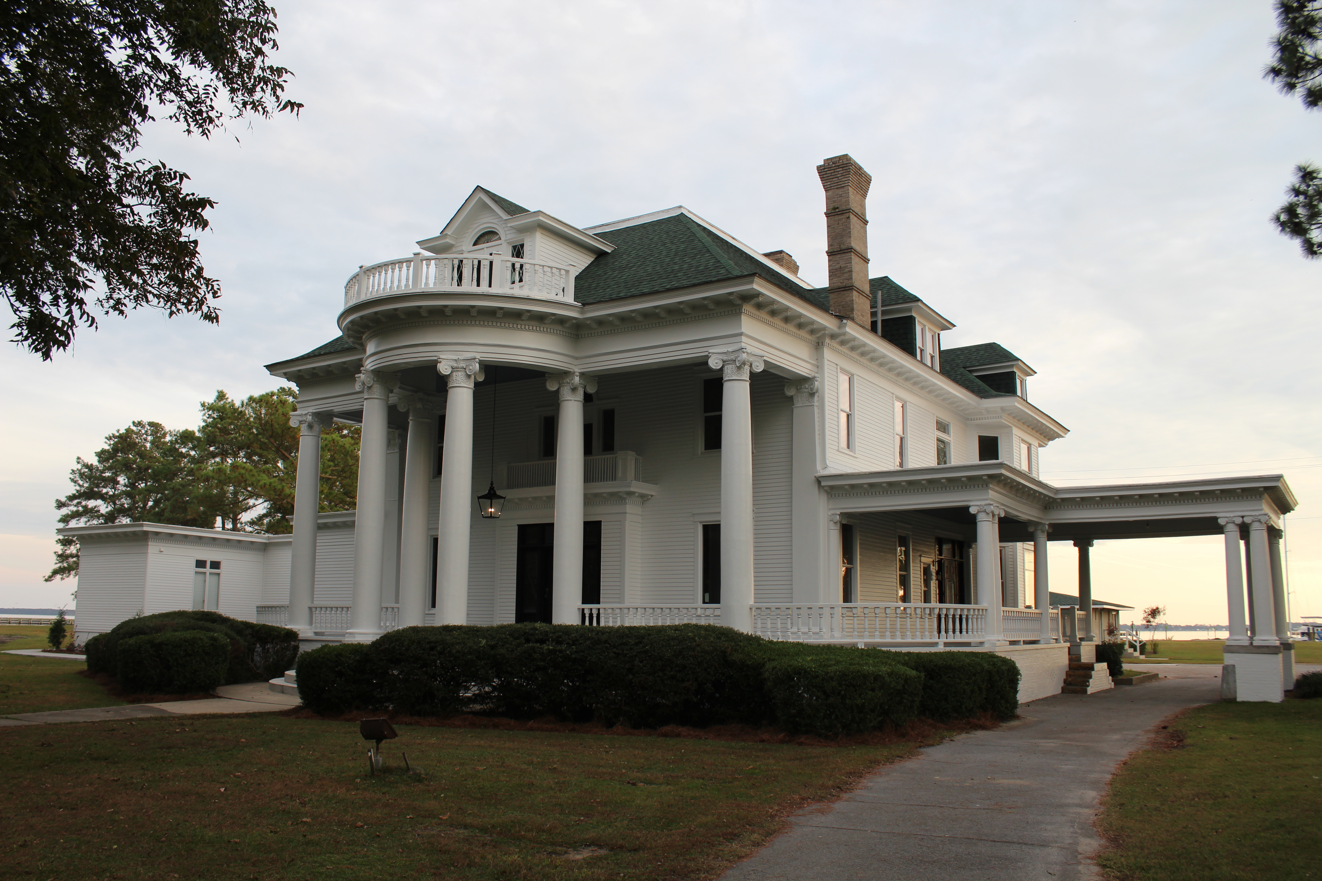
    While the fisherman were busy rigging lines, the crew had Sunday Brunch with Satisfied Frog at The Spouter Inn.  The food was exceptionally good.

    The restaurant from the water.

    24.12

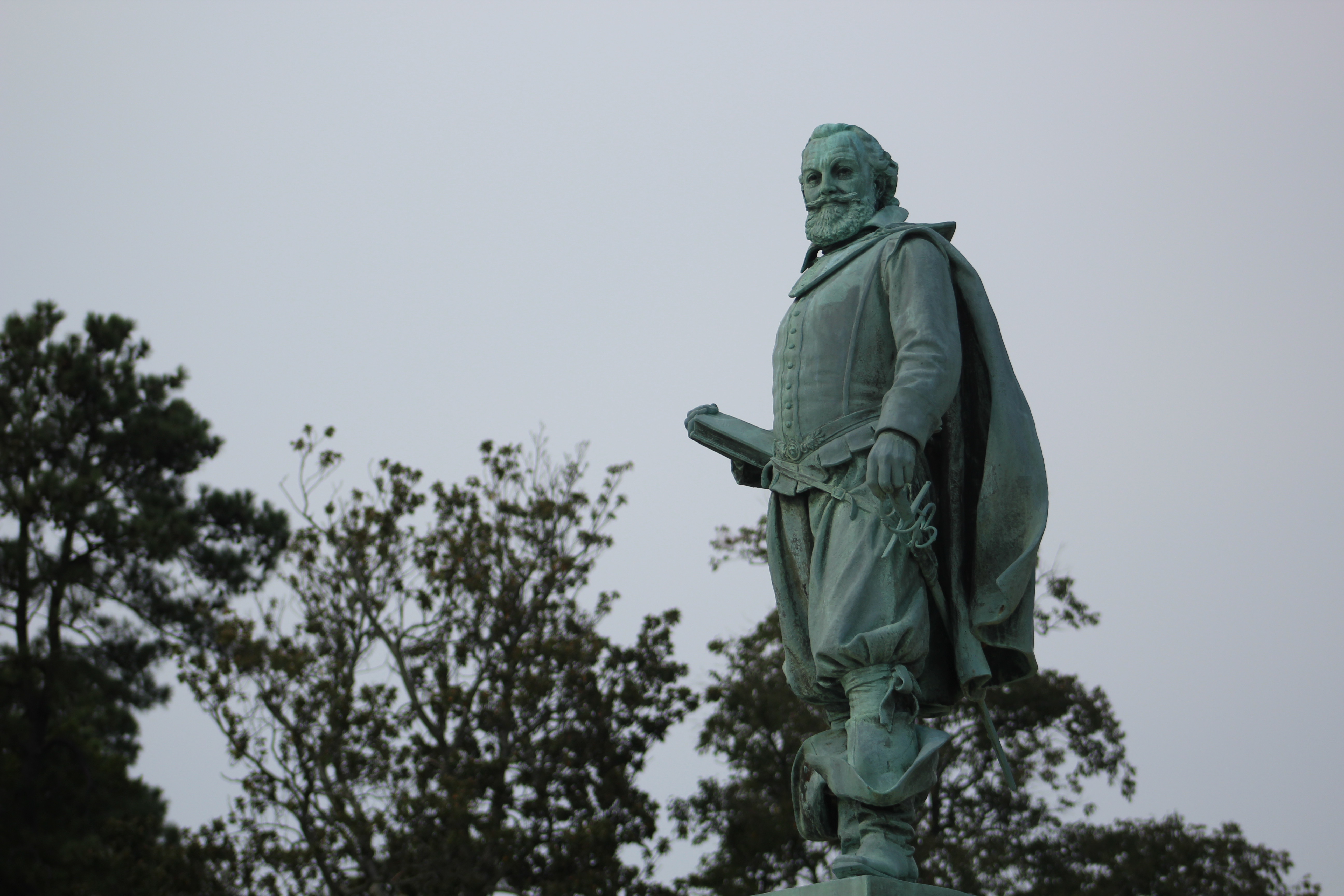
    Following Brunch, the crew took a tour boat to learn about some of the local history of Beaufort, North Carolina.

    24 Beaufort Whale Tour

    Much of the colorful history started with Blackbeard the Pirate.  He had a home in Beaufort overlooking the inlet into town.  His home also just happened to be next door to the county tax collector, interesting arrangement.

    The Pirates Revenge tour boat

    24.6 Pirates Revenge

    The governor of North Carolina once pardoned Blackbeard, but he did not stop his pirate ways.  He just shifted his tactics to attack ships headed to Virginia rather than North Carolina.  The Virginia government eventually killed Blackbeard after they petitioned the North Carolina governor for help with Blackbeard, and got no help at all.

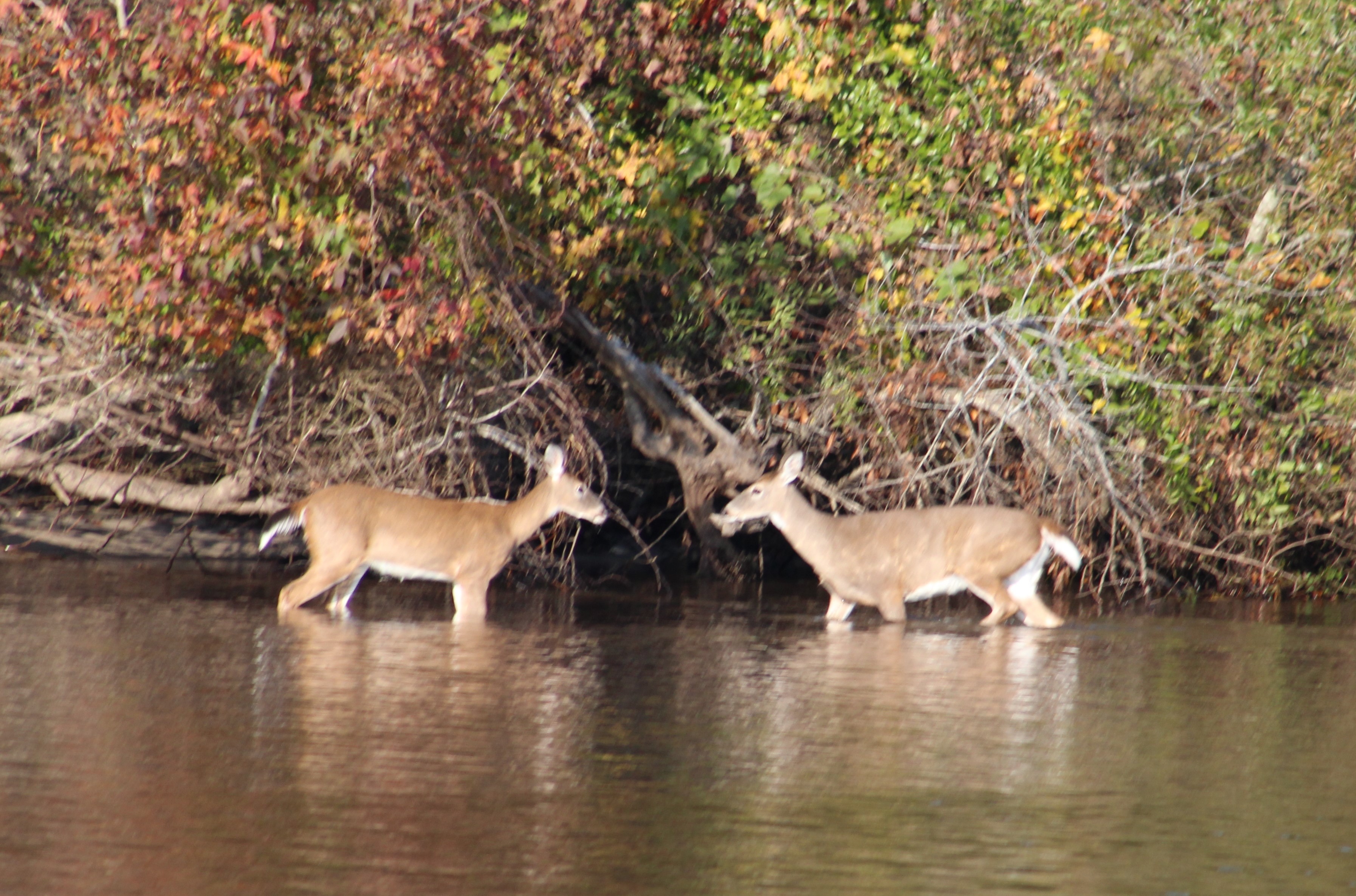
    New born colt spotted from tour boat

    24.9

    Monday, June 11th

    The day got off to a good start as the crew made good time thru Adams Creek.  While transiting the Creek, the crew met a shrimp boat who had their nets down.  There must have been several hundred gulls following the shrimp boat looking for an easy meal.

    27 Shrimp Boat and Birds

    After exiting Adams Creek, the crew ran north along the Neuse River and eventually came to Gale Creek.  At the right angle, looking at the shore in the distance along the Neuse River, the trees and shore seem to form the looks of an alligator.

    The tree alligator

    28 Tree Alligator

    After the Neuse River, the crew entered Gale Creek.  The name of this creek would soon become an omen.  The skies began to darken as storm clouds began to form.  The temperature dropped about ten degrees in front of the pending storm.

    The calm before the storm on Gale Creek.

    30 Gale Creek

    Just after passing under the bridge in the above pic, the rain started with just a sprinkle.  Within just a few minutes, the rain was falling so hard that visibility was down to less than a quarter of a mile.  Then the winds hit.  The skipper put the boat in neutral to allow the winds to push the boat backwards into both deeper and wider water.  Once the boat was in a wider part of the channel, the skipper turned the boat to face the wind.  Visibility had dropped to about 50 yards, and it was difficult to see the shore and Satisfied Frog.  The skipper had turned the radar on when he noticed the heavy rain headed their way.  The radar helped the skipper keep the boat in safe water.

    The skipper also checked the weather radar and watched a red cell pass directly over them.  The weather radar showed 40 plus mph winds (gale force winds)  After about 5-10 minutes of these high winds and heavy down pour, the winds died back off and the rain slacked back to a sprinkle.  The skipper looked over at the Admiral and said, “Well, that was exciting!”

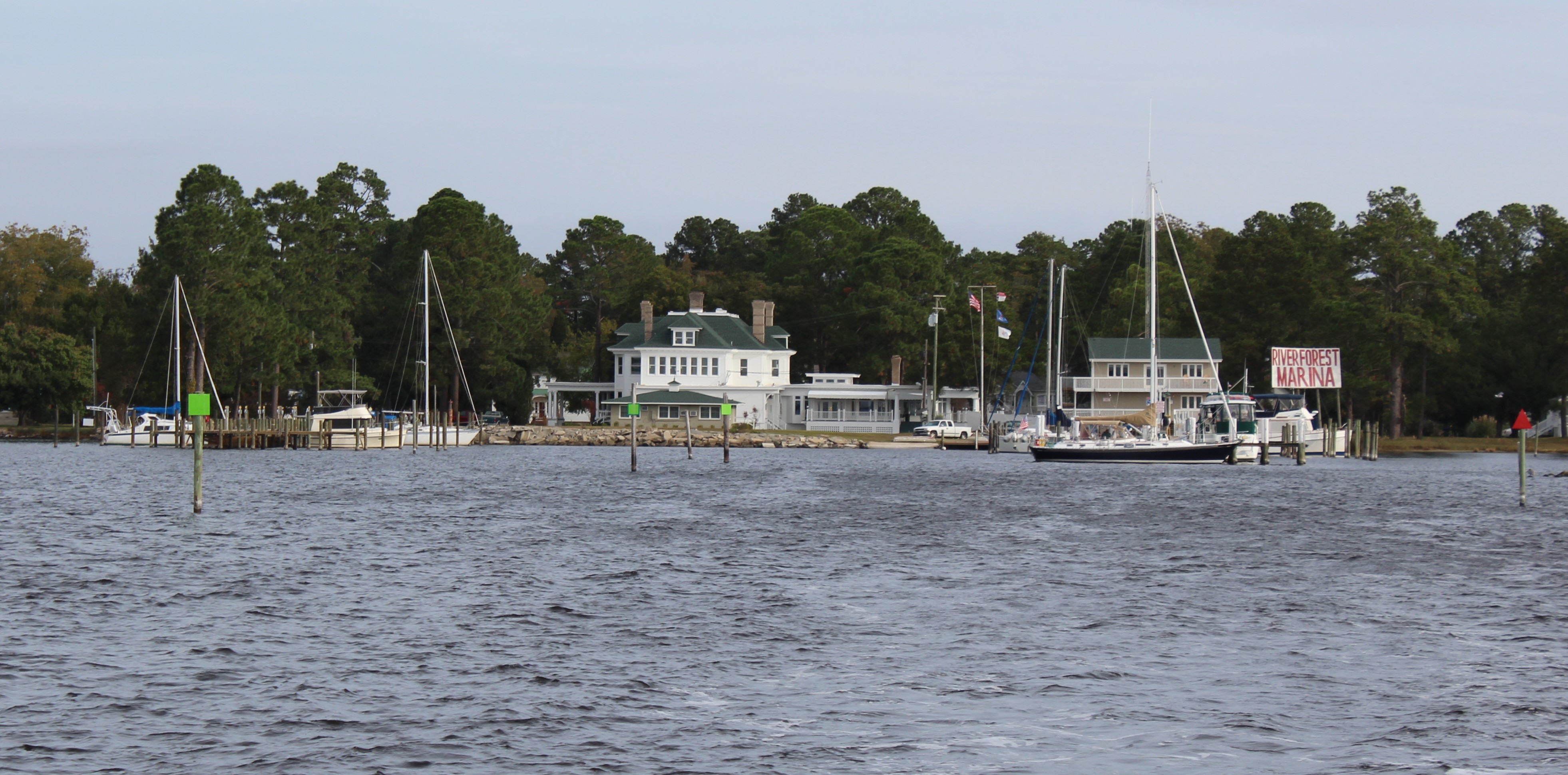
    The weather predicted more storms for the rest of the afternoon and thru the night.  Rather than anchor, the crew decided to call it a day and pulled into the River Forrest Marina in Belhaven.

    Tuesday, June 12th

    The original cruising plan was to make Elizabeth City on Tuesday and the Dismal Swamp Visitor Center on Wednesday.  But due to the high winds (20 mph/ plus or minus 5) coming from the east, the skipper did not believe crossing the Albemarle Sound on Tuesday was a good idea. Instead, they choose to anchor just north of the Alligator River Bridge along the eastern shore to get protection from the east winds.

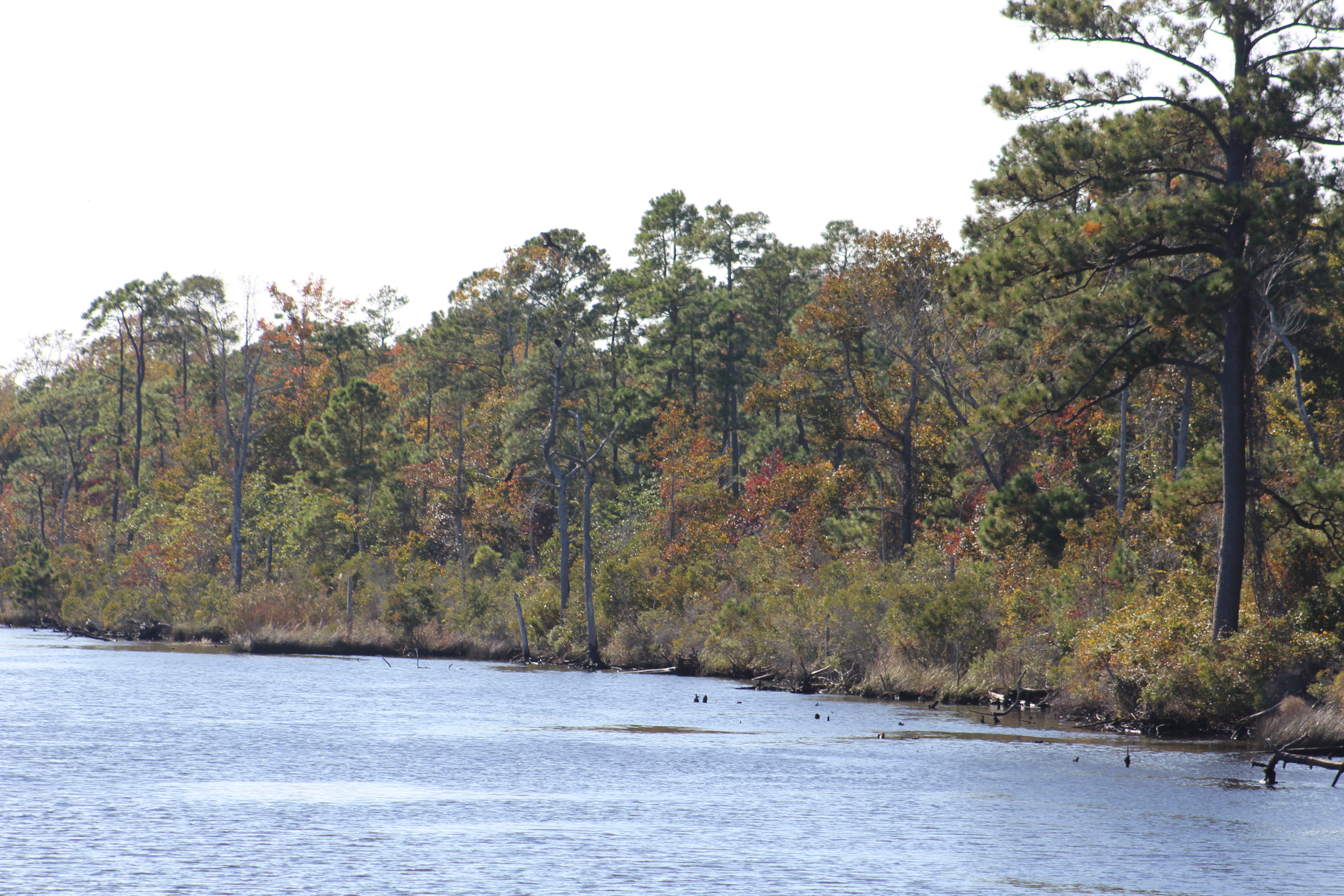
    The first half of the voyage was relatively calm as the crew passed thru the Alligator River-Pungo River canal.  After coming out of the canal, the crew entered the Alligator River and ran north along the eastern shore.

    Canal conditions were flat

    31.1

    Conditions in Alligator River were about one foot waves

    32 Alligator River

    As the crew navigated towards the bridge, they met a sailboat headed south.  The skipper picked up the radio and hailed the sailboat.  After a short conversation, the skipper’s decision to NOT cross the Albemarle Sound was confirmed.  The sailboat captain reported that the waves were 3-5 foot and because of the wind direction, the waves were hitting the beam of the boat.  He reported that the waves broke over the bow of his sailboat several times as he crossed.  The skipper reminded the Admiral that this is supposed to be ‘recreational boating’, and fun.  Three to five foot waves are not fun.

    After passing thru the Alligator River Bridge, the crew followed a couple of other boats over to the eastern shore and dropped the anchor, along with Satisfied Frog.  Another indication that this was not the day to cross came when the Coast Guard announced that a 16 foot sailboat had capsized in the Albemarle Sound and asked boaters to keep a look out for the boat.

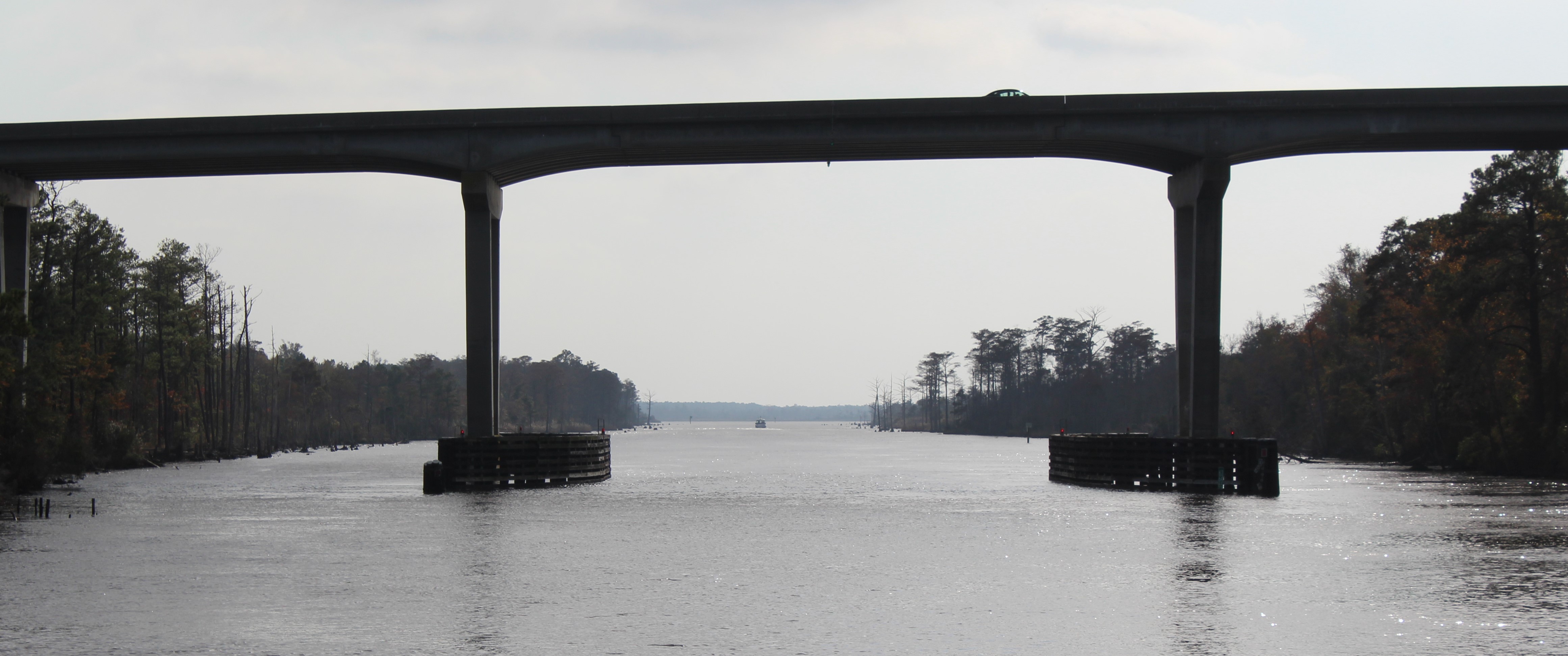
    Passing thru the Alligator River Bridge

    33.1

    Wednesday, June 13th

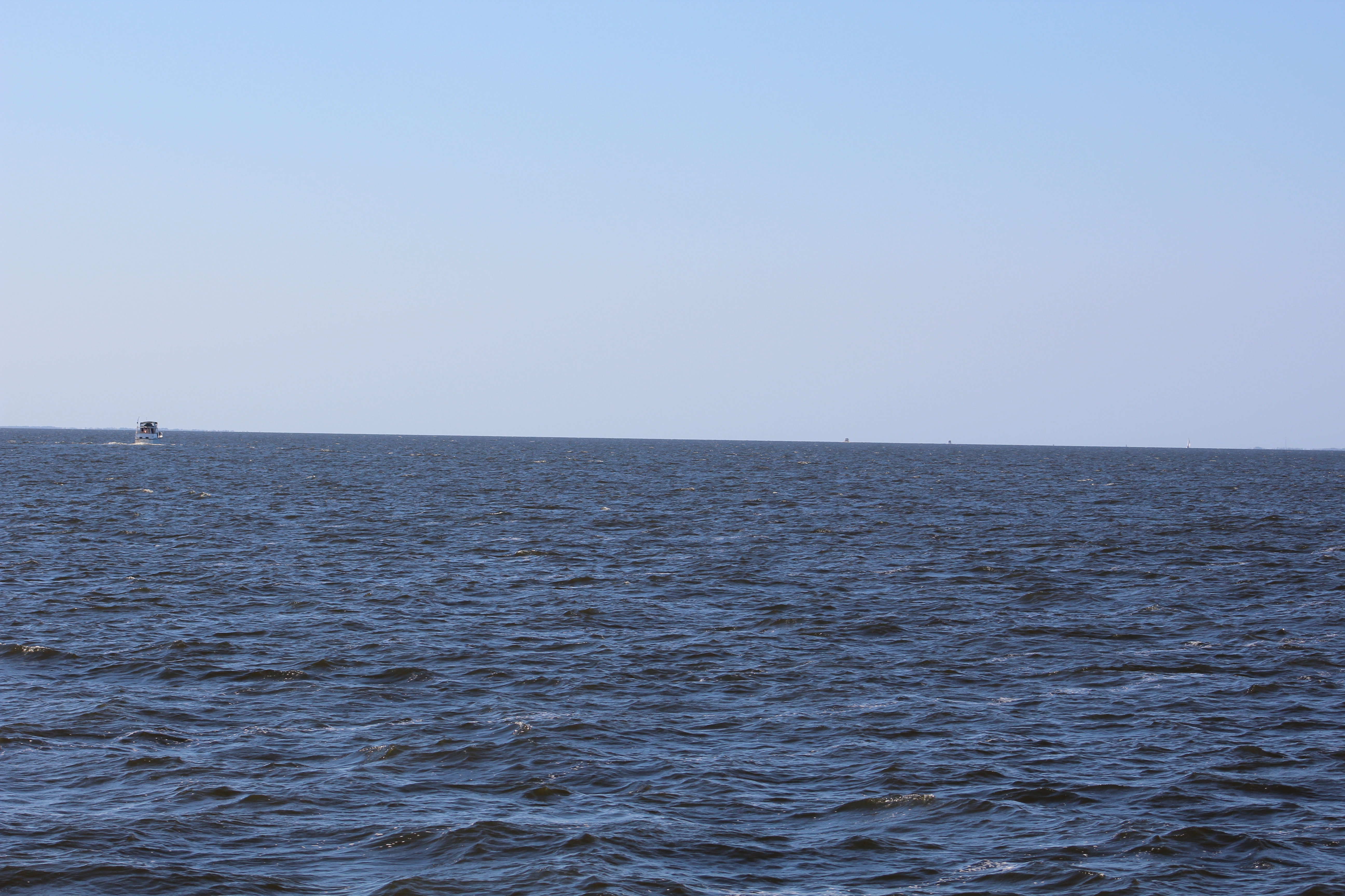
    What a difference 12 hours made.  The winds died off over night as predicted, and the Albemarle Sound calmed down also.  In fact, this was the 6th time our crew has crossed the Sound, and this was the smoothest crossing to date.  The light wind had shifted out of the south and caused less than one foot following seas across the Sound.

    The crew made good time to Elizabeth City, but decided not to stop for lunch because it had started to rain.  However, after passing thru the Elizabeth City Bridge, the weather abruptly changed again.  The grey dreary clouds gave way to a beautiful sunshine afternoon.

    Elizabeth City Bridge, dreary conditions

    34 Elizabeth City Bridge

    Entering the Dismal Swamp

    37

    An interesting tree ornament 30 feet above the water

    41

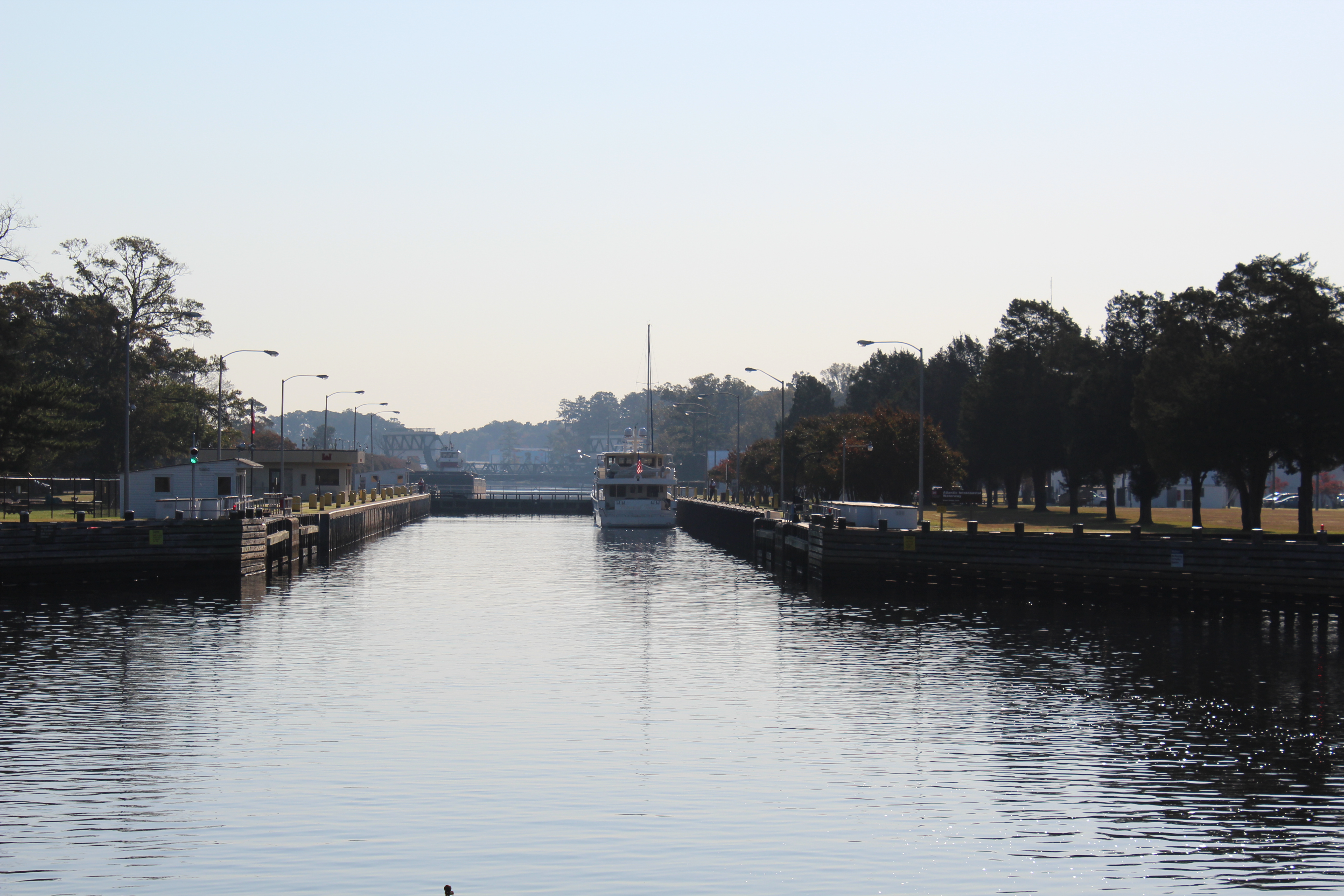
    After 18 miles at idle speed (6 mph) the crew arrived at the South Mills Lock.  The lock raised the boat about 8 feet.  After the lock is a bridge that must be opened, and then only a couple of miles to the Visitor Center.

    48 South Mills Lock

    The Dismal Swamp Canal is not very wide so when you have a situation with boats meeting, it gets a little tight.

    Meeting a boat in the swamp

    51.2

    When Satisfied Frog arrived at the Visitor Center Dock there was only room for one more boat.  Once Satisfied Frog was safely landed, the skipper pulled up and rafted off Satisfied Frog.  Then another boat arrived, a 32 foot PDQ catamaran.  The skipper got two other boats to adjust their position on the dock which opened a 36 foot spot on the dock.  The  PDQ managed to slip in the tight spot.  Eventually, a 32 foot Nordic Tug also showed up.  The tug rafted off the PDQ motor cat, so there were 6 boats along the dock for the night.

    Boats docked at Visitor Center

    52 Dismal Swamp Free Dock.JPG

    Thursday,  June 14th

    Today would be another short day to cruise.  It was about eighteen miles to the Deep Creek Lock and then just a few more miles to the Top Rack Marina where the crew would stay the night.

    The Corps of Engineers reopened the Dismal Swamp in the fall of 2017 after dredging the canal.  The controlling depth is now around 6 feet.  With the draft of Still Waters II at 4 feet and only 2 feet of water below the keel, the skipper was a bit nervous.  The depth alarm was sounding almost continuously, so the skipper finally just turned it off.  Luckily the crew made it thru without hitting bottom or a deadhead log.

    The water was glassy smooth on the way to the lock.  The reflections on the water looked like a mirror.

    5 Reflection in Dismal Swamp.JPG

    The Deep Creek Lock experience turned out to be the best lock experience ever.  Robert, the Lockmaster, gave a demo on how to play music on a conch shell, as well as gave a brief history of the Dismal Swamp.  Watch the video to see Robert do his thing.

    The Admiral was so impressed, she left one of her prized Bahama conch shells on the lock wall to add to Robert’s conch garden collection.

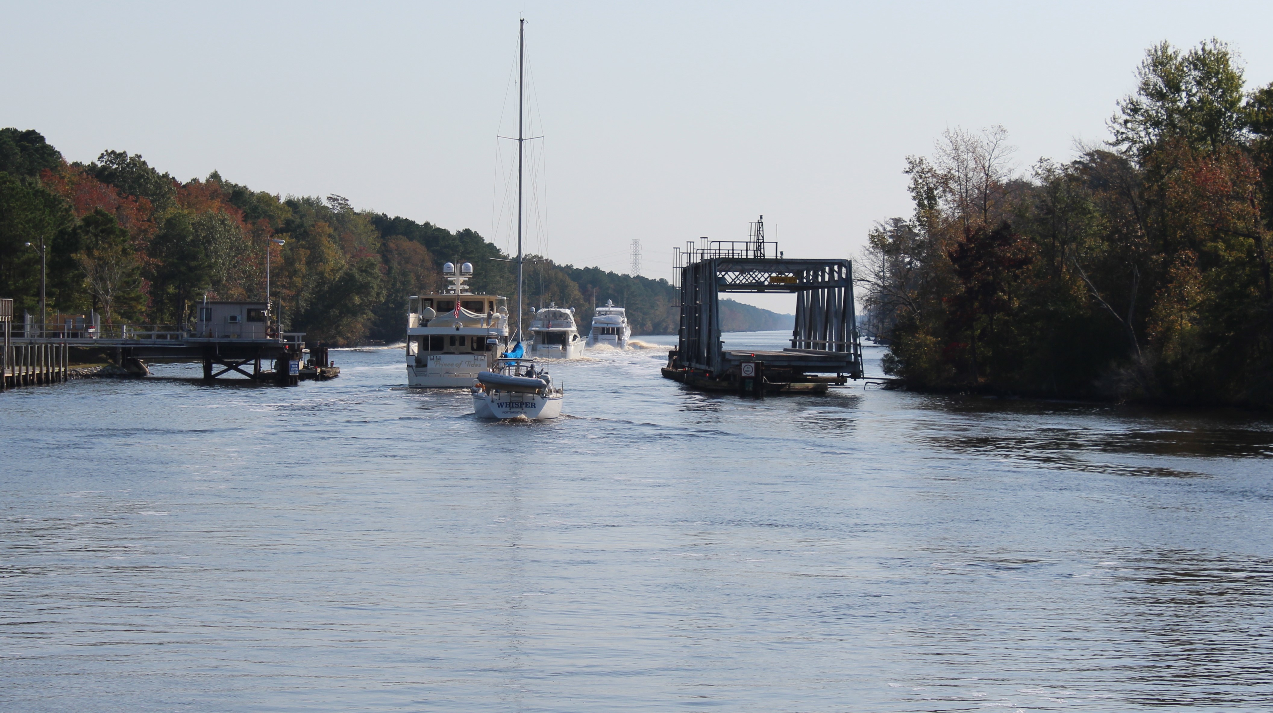
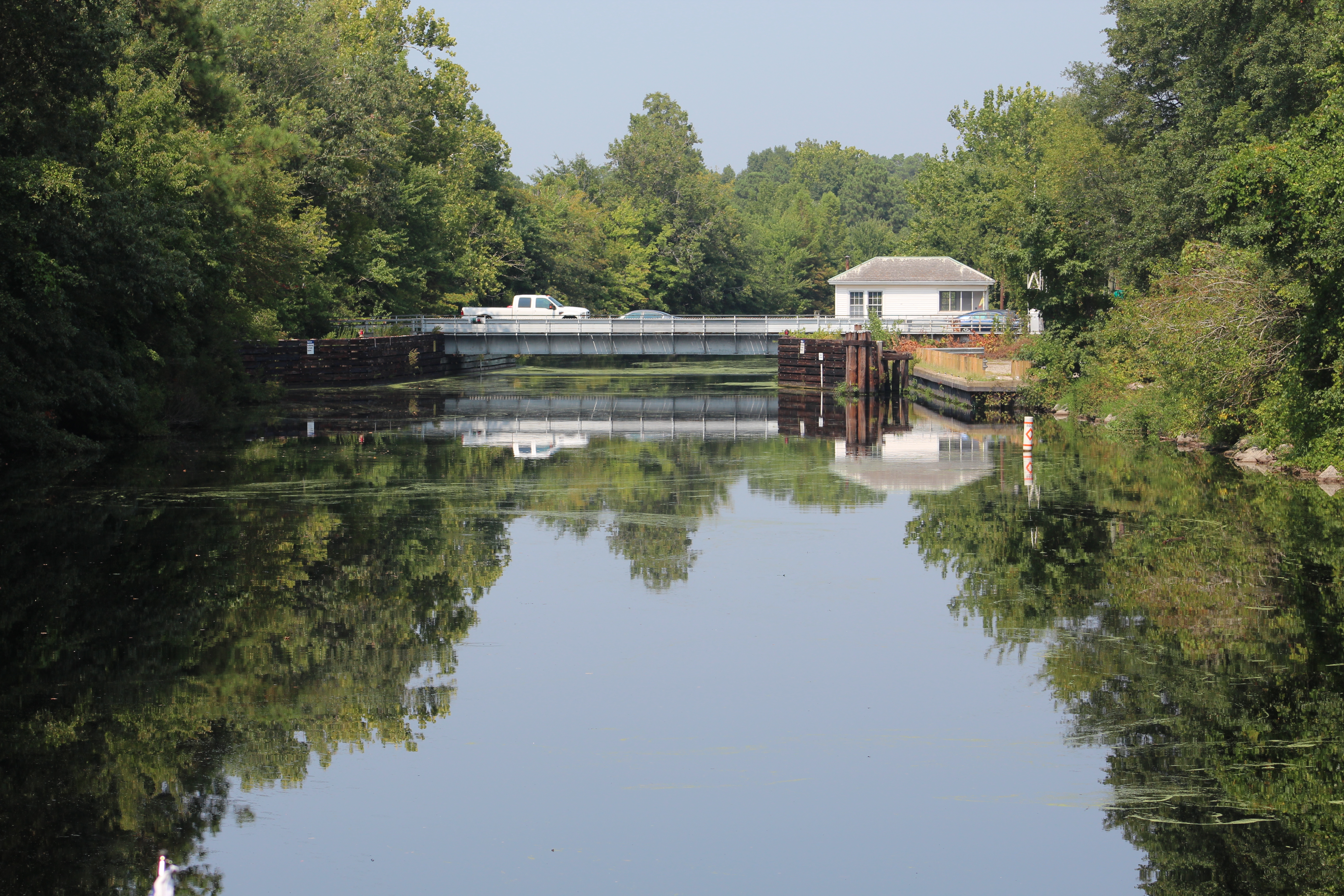
    1100 o’clock opening of the Deep Creek Bridge

    10 Deep Creek Bridge

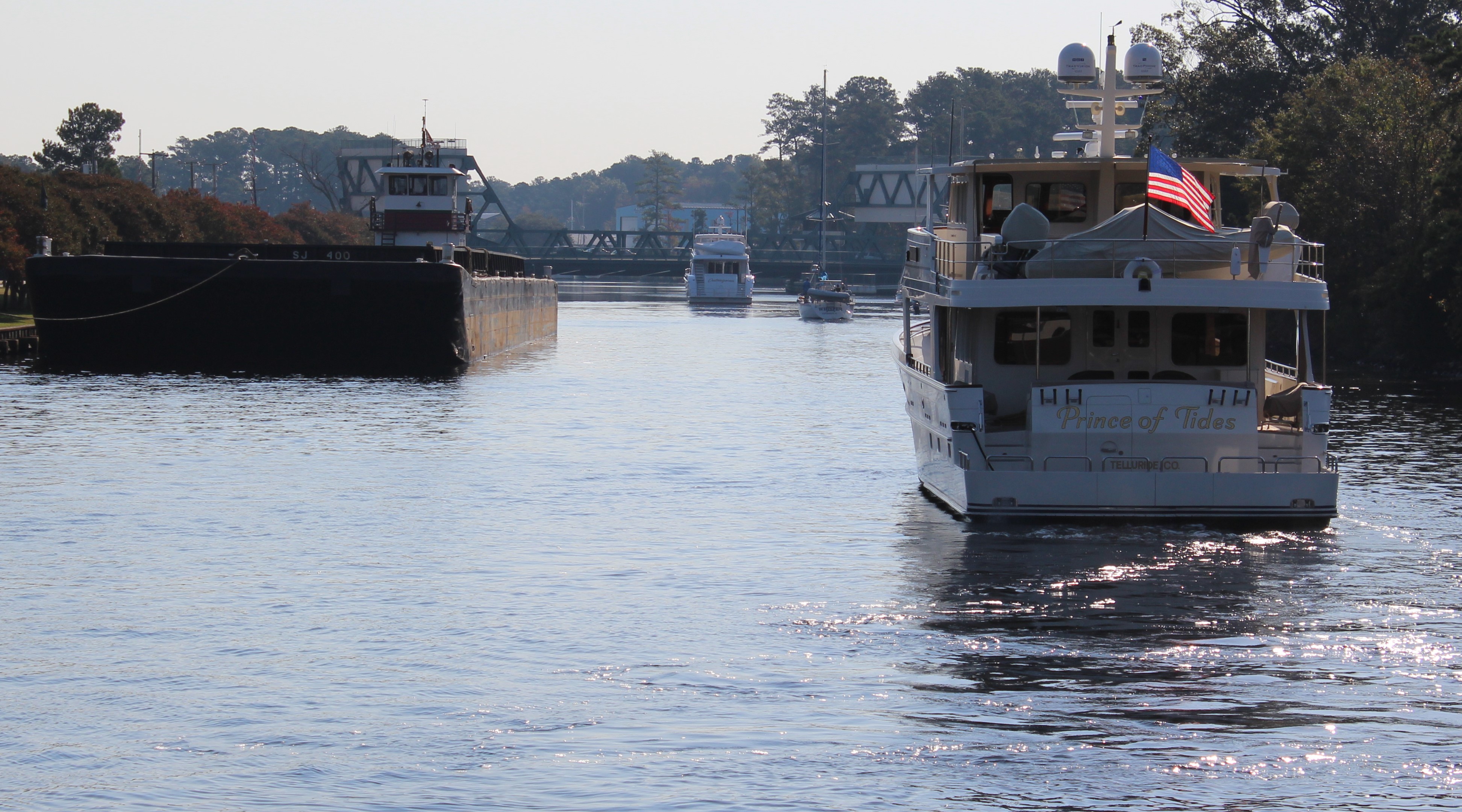
    After the Deep Creek Lock, it was time to head towards the Top Rack Marina.  Our crew will stay the night.  However, the crew of Satisfied Frog is off to Hampton where they have work scheduled on the boat to start on Friday.  It has been a blast cruising up the ICW with Berrlin and Debra.

    9 Debra and Berlin

    Friday, June 15th

    The skipper struck up a conversation with a couple that are on a sailboat.  The skipper has passed this sailboat almost daily for the last week.  The sailboat is crewed by Howard and Sue from England.  In fact, they sailed the boat across the Atlantic Ocean.  Their story was a bit surreal.

    After leaving England and heading for the British Virgin Islands, they ran into a large storm that raged for a few days.  Howard commented that the waves were in excess of 15 feet.  After the storm passed, their engine failed, day 4 of their crossing.  They raised the sails and soldiered on.  Then they found the doldrums.  For ten days they basically drifted in the Atlantic Ocean because they had no wind.  The winds did eventually return and they completed their crossing in a total of 22 days.

    Howard and Sue aboard Sundowner

    12.1 Crossed Atlantic in the boat

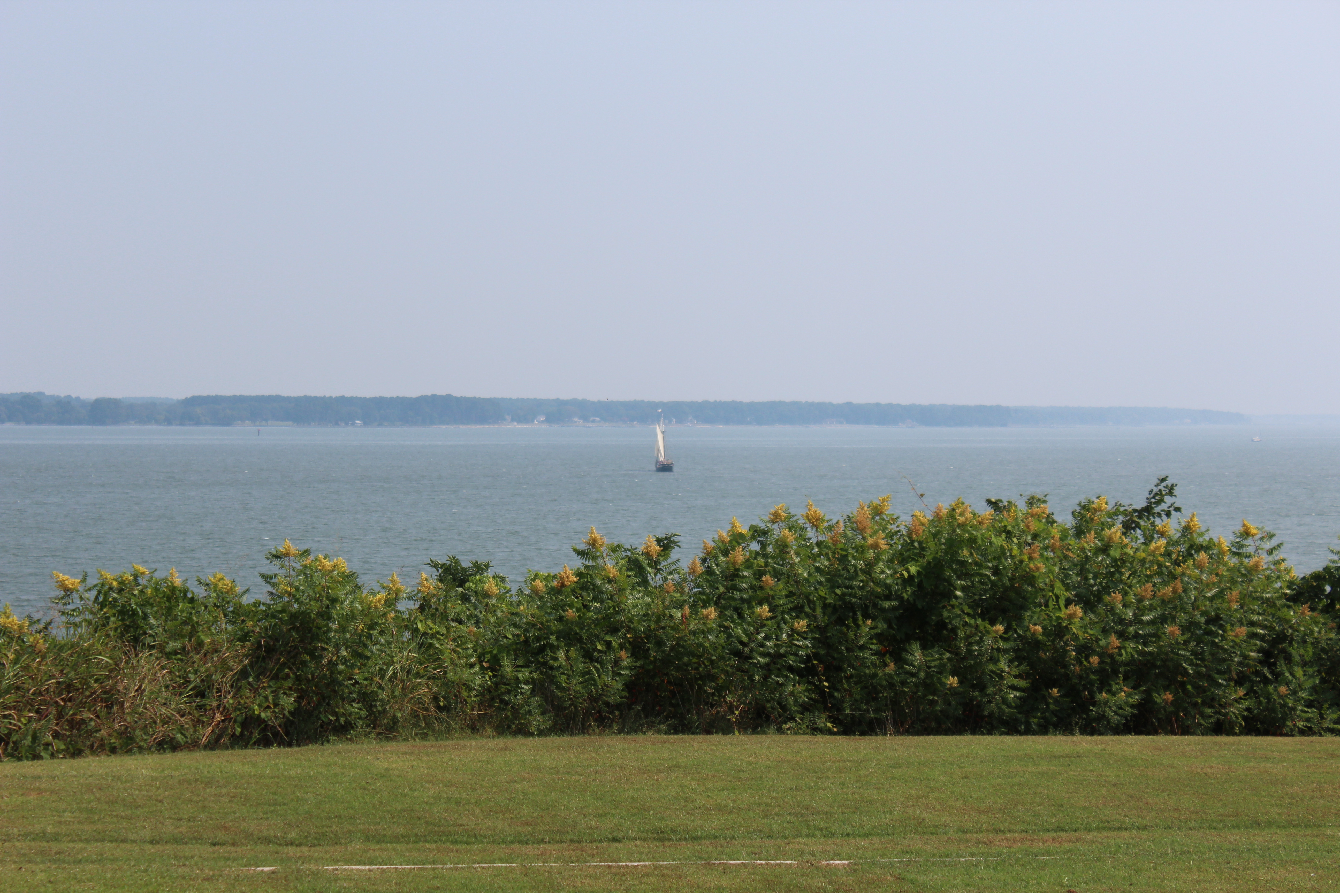
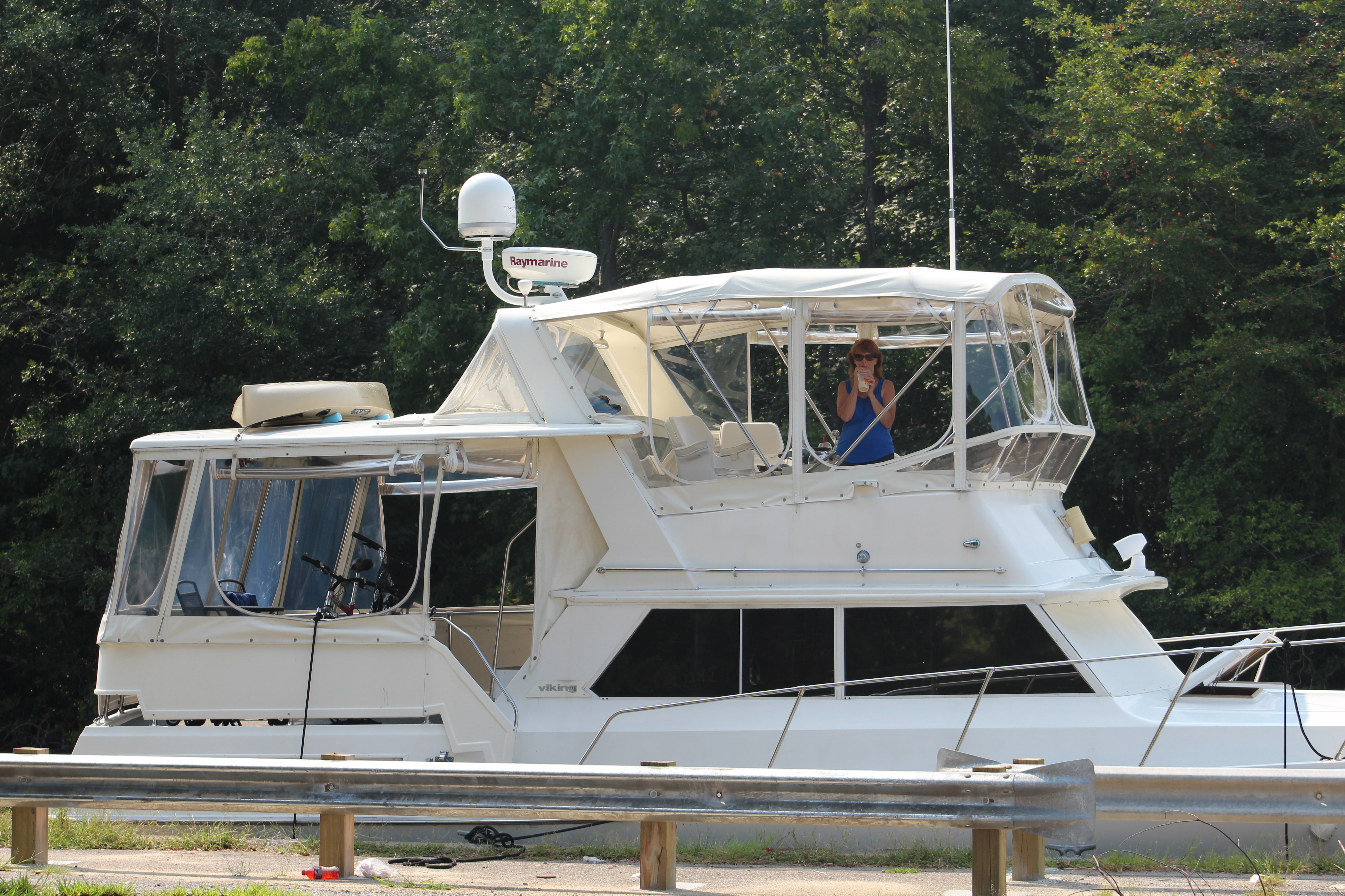
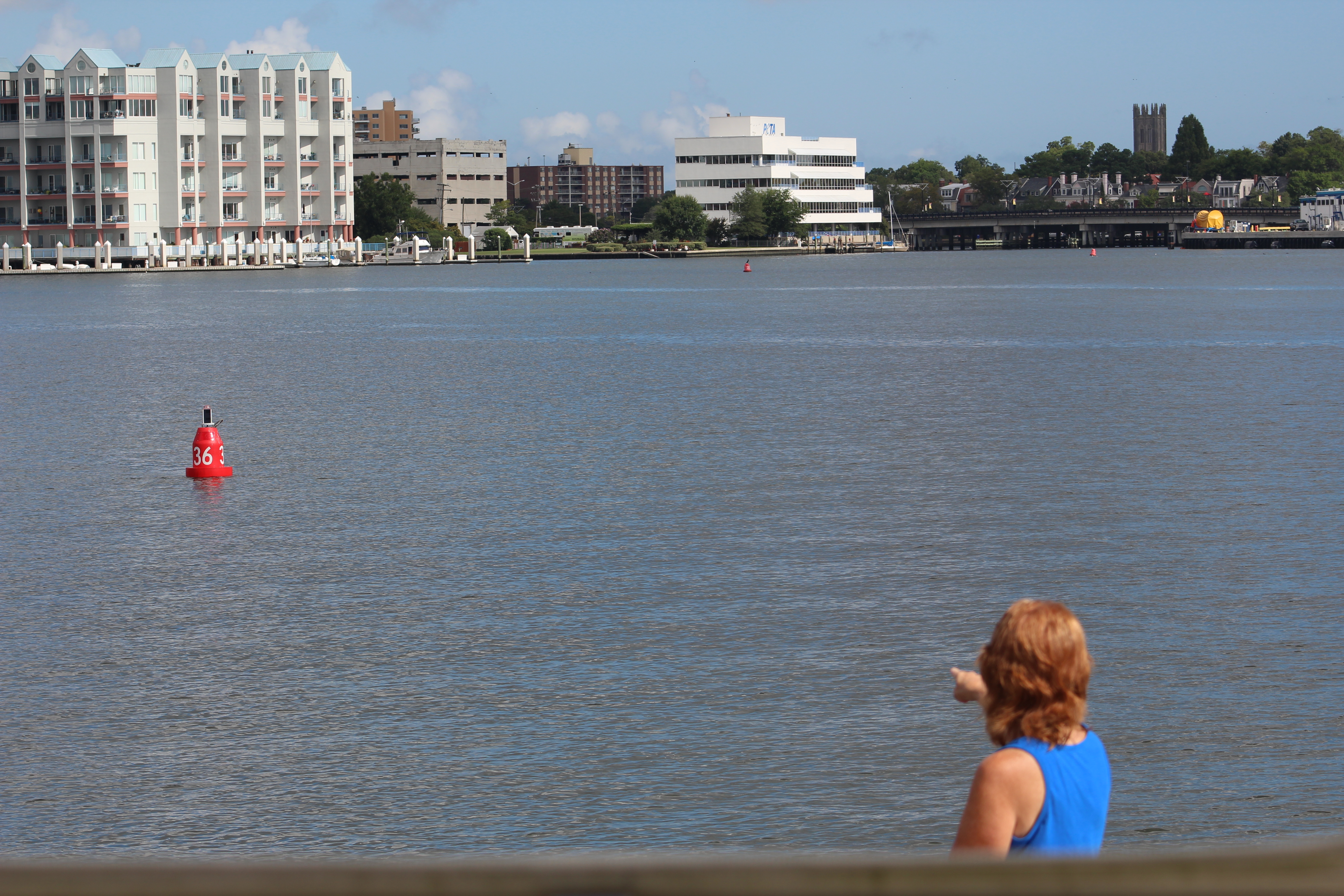
    Today the crew only traveled to the north side of Norfolk so they could stage to cross the Chesapeake Bay on Saturday.  The weather, wind, and waves are much more favorable on Saturday to make way across the Bay to the Eastern Shore.

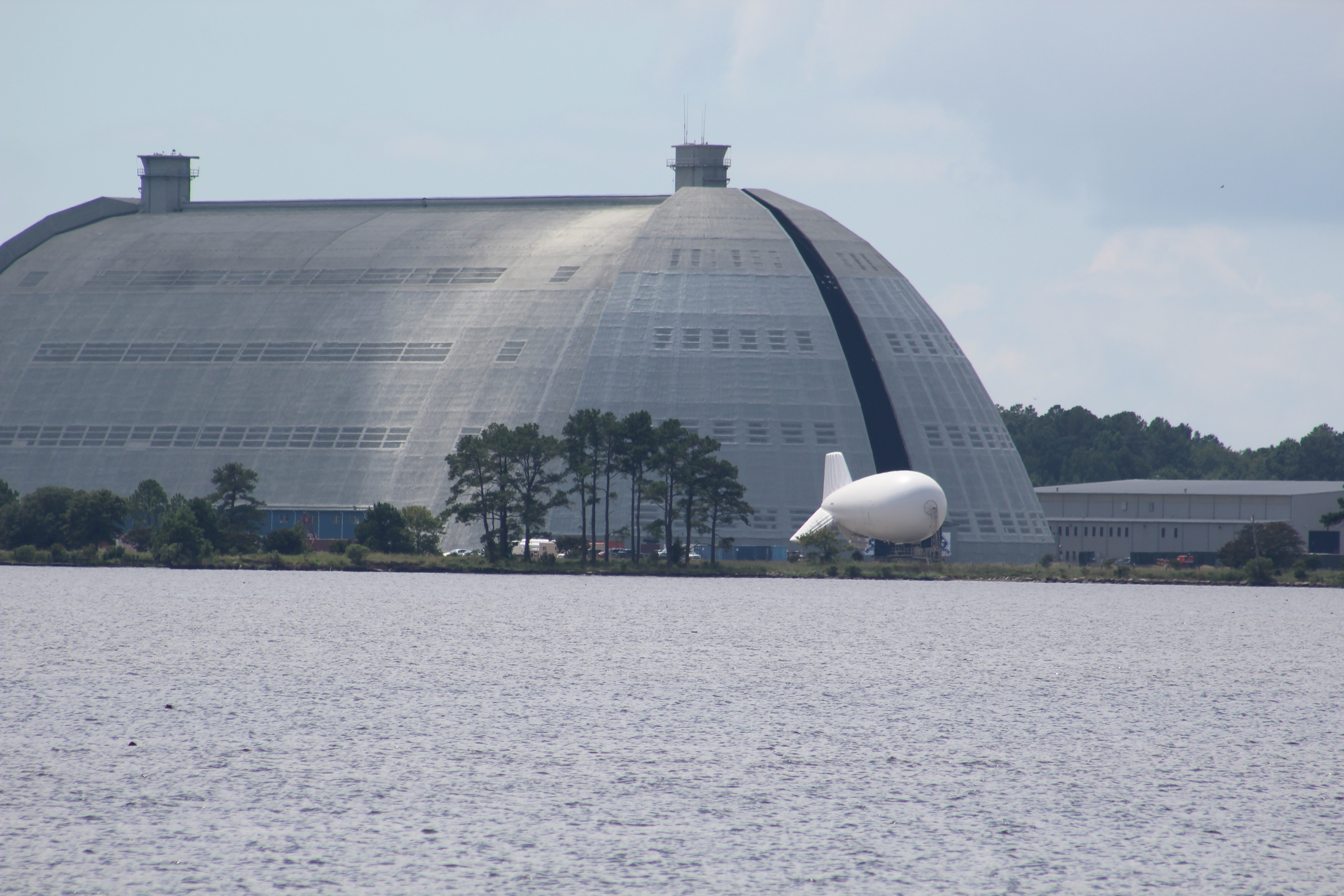
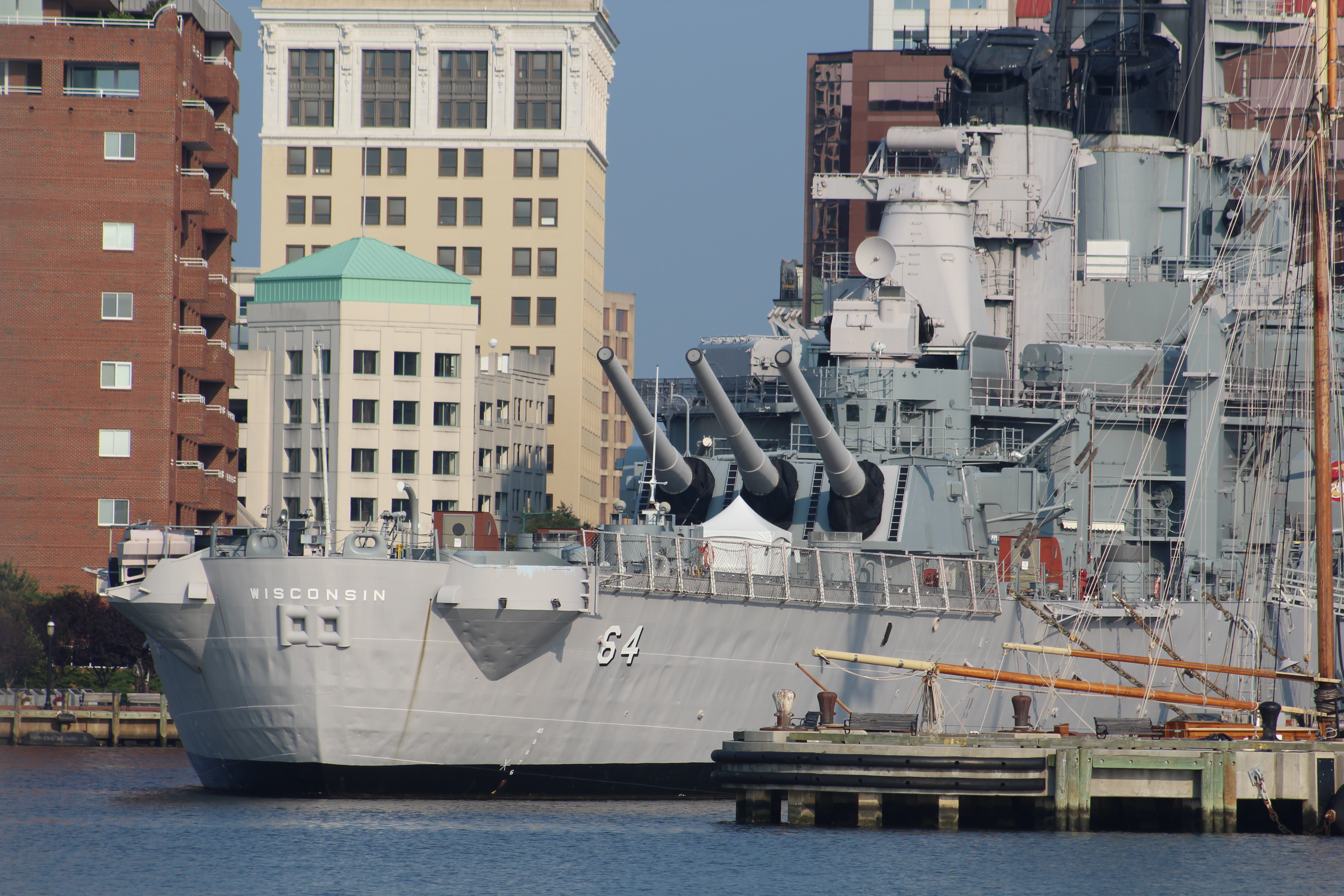
    There were many more US Navy ships at the Naval Shipyard than in years past.  Looks like the Navy is putting those new tax dollars to work.

    A sub in for overhaul

    14 Navy Shipyard

    Even saw the Ike in for maintenance

    14.1

    OK, only one more ship, but how about that dry dock

    14.2

    The Waterside Marina also had a new addition.  They have added a Ferris Wheel to the waterfront.

    15 Entertainment District

    After passing thru Norfolk, the crew completed the Atlantic ICW leg of the Loop.  The crew anchored in Hampton Flats for the night, prepared to weigh anchor and cross the Bay early in the morning.

    Mile Zero of the A-ICW

    16 Mile Zero AICW

    Saturday, June 16th

    The crew woke to very calm conditions so they attempted to bring the anchor up and set out for Onancock.  However, the anchor brought up some garbage off the sea floor that the skipper had to untangle before they could get started.  It was only a short delay, and the crew still managed to get underway by 0630.

    Never a dull moment

    IMG_0015

    It was about 70 uneventful miles across the Bay.  About the only excitement occurred when the crew passed thru the large ship anchorage near Cape Charles.

    IMG_0016

    A helicopter came and landed on one of the ships to drop off a navigation pilot.  Then a boat pulled alongside another large ship and the navigation pilot had to climb some stairs to get onboard.

    Helicopter

    IMG_0017

    The run up Onancock Creek was pretty with many nice homes which line the River.

    IMG_0025

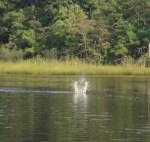
    Fabulous Fisherman Final update, from the Big Rock

    In the Big Rock Fishing Tournament, the boats can enter as many as 9 different contests.  Total cost to enter all 9 events was $23,000 this year.  One of the events is called the Fabulous Fisherman.  The cost to enter the event is $5,000, but the payout was $500,000 to the first boat to land a 500 pound fish.  Well, sorta.

    The first 500 pound fish was a blue marlin weighing in at 518.5 pounds caught by Honey Hush on Tuesday.  Unfortunately for them, they did NOT enter the Fabulous Fisherman event so could not claim the prize.

    bigrock500_1528833939855.jpg_45257709_ver1.0_640_360[1]

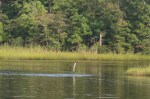
    In fact, the prize remained unclaimed until the last day of the contest when Carterican landed a 500.9 pounder and claimed the cash.  The fish put them in second place for the overall contest, for the moment.

    IMG_4407[1]

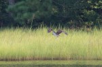
    However, the final results would not be known until the last weigh-in of the day.  Fender Bender landed a  large fish and eventually won second place with a 514.3 pound Blue Marlin.

    p1529207671[1]

    With only three 500 pound fish caught all week, and two of those on the last day, you might understand why Honey Hush did not enter the Fabulous Fisherman contest.  However, since they ended up winning the overall tournament and the $753,875 purse, I think they are just fine with the outcome.

    Next Week –

    The skipper has looked at the weather forecast for next week, and the Bay looks to be calm all week with winds under 10 mph.  If these conditions hold, the crew will attempt to cruise 8 hours each day.  With fair winds, they hope to make Cape May next weekend.

    Loop On – Where the road ends, the water begins. The water goes on forever, and the adventure never ends.

    Eric the Red

  • Waiting and Wind

    Hello virtual crew members and fellow adventurers!

    Eric here with the latest travels of Still Waters II.

    Antebellum home in Belhaven, dressed up for 4th of July and posting now for Veterans Day.Belhaven


    Summary of week:

    This would turn out to be one of the strangest weeks on the water yet.

    1. The crew left Norfolk on Monday and made a measly 12 miles to the Great Bridge Bridge.
    2. On Tuesday, they crossed the dreaded Albemarle Sound and pulled into the Alligator River Marina to wait out the weather.
    3. On Thursday, the wind dropped into the high teens, so the crew decided to make a go of it and made way to Belhaven.  Once again, they had to wait out the weather before getting underway for points further south.
    4. Saturday, the winds had dropped into the high teens again with forecast that the wind speed would continue to fall.  The crew made it to Beaufort, N.C. but had to dock in a 20 mph cross wind.

    Beaufort, NC

    Click on the link to read the day-to-day travel log.  This includes weather report, sea conditions, captain’s log, and a summary of the day’s experience.

    At the Box Office

    This week’s video shows Still Waters II headed down the Alligator River with some Gulls feeding in the boat wake.  Enjoy!

    To see past videos, click on the link to the Still Waters II Vimeo site.

    Monday, November 6, 2017

    The day started with the Admiral piloting the boat out of the Waterside Marina and back onto the AICW.  The skipper then took over the helm and guided Still Waters II through the many Norfolk boat yards and container ship transfer points at idle speed.

    When they finally arrived at the Gilmerton Bridge, they noticed three other boats hovering in the area.  As the skipper moved forward, he noticed the normally open #7 RR Bridge was closed.  Turned out the RR Bridge had closed to allow a train to pass over, but was now stuck in the down position and halting all boat traffic.

    1 RR Bridge Stuck Shut

    The crew arrived at 1055 to begin the wait for the RR Bridge to open.  At 1128, it appeared that a maintenance crew arrived to start work on the RR Bridge.  By this time, there were now nine boats hovering around in the channel.

    At 1210, the maintenance workers left and hopes were high that the RR Bridge would open.  The skipper called the RR Bridge Tender and learned that the crew observed had only come to pick up some equipment.  The folks that were dispatched to fix the RR Bridge had yet to arrive.  There were now 15 boats hovering in the channel, so the skipper decided to move out of the way and drop the anchor and wait.

    Just after the crew set the anchor at 1214, the RR Bridge Tender came over the radio at 1216 and said the Bridge was fixed and would be opening momentarily.  At 1217, the RR Bridge was open.  The crew weighed anchor at 1221, but had to wait for the other boats in the pack to pass by before they could join the parade and go through the RR Bridge.  They passed through the RR Bridge at 1229.

    The plan was to go a few miles further down river and pull into the Top Rack Marina to take on fuel and eat lunch.  When the crew arrived at the Fuel Island there was no room to dock.  Looks like our crew was not the only ones wishing to take advantage of the low fuel prices at Top Rack.

    The crew arrived at 1255, had to hover out in the channel for about 30 minutes while others fueled.  After Leap of Faith left the Fuel Dock the skipper backed in and fueled up.  When they finished lunch, they noticed some boaters that they had met on the inland rivers last fall.  After talking with the crew of Let It Ride, our crew finally got back underway at 1425.

    At 1450, they arrived at the Great Bridge Lock for the scheduled 1500 opening.

    2 Great Bridge Lock

    However, the Lock master did not open the gates until 1520, so once again the crew hovered in the channel.  Once the gates did open, then they had to wait for another boat to arrive.  They finally cleared the lock at 1548, almost an hour after arrival.

    2.1

    Since it was getting dark here at 1700, the crew was glad to see space along the Great Bridge Bridge wall that they could tie up to and bring this day to a close.

    While docking, they did notice the sailboat in front of them had a hailing port of Kamah, Texas.  The crew is Wayne and Linda C.  They have been full time cruisers since 2004.

    The skipper also noticed another Texas favorite nearby, a Dairy Queen was less than a half mile down the road.  There were Blizzards in the crews future.

    Tuesday, November 7, 2017

    The winds were predicted to be less than 10 mph all day, but were forecasted to build over 20 mph overnight.  Armed with that information, the crew decided to make a long day of it and try to make the Alligator River Marina on the south side of the Albemarle Sound.

    This is Isla sliding under a 65 foot bridge with a 64 foot mast.

    3 65 ft HWY Bridge

    The crew made the 0900 hourly opening of the Great Bridge Bridge, then negotiated two more bridge openings.  They managed to clear all three bridges by 1030, but had only travelled 8 miles.  With 64 miles to the Marina, it became apparent that the crew would probably be docking in the dark.

    The crew of ISLA, Wayne and Linda.

    3.1

    Sure enough the sun set at 1702, the crew arrived at the Marina at 1730 just as dark was setting in for the evening.  The  crew did find Let it Ride and Dragonfly on the docks.  The three crews had an enjoyable dinner aboard Let It Ride.

    Thursday, November 9, 2017

    As predicted the winds picked up and howled Tuesday night, all day Wednesday, and are still going strong Thursday morning.  By 0900, the winds had dropped to 15 mph out of the south, so the crew decided to make a run for it to Belhaven.  The hardest part of the day would be getting off the dock.

    Still Waters II was facing east, with the wind directly out of the north.  The wind had her pinned to the dock fairly securely.  With the aid of two folks on the dock, the skipper’s first two attempts to free her were unsuccessful.  On the third attempt, he finally got the bow pointed out and gunned the engines to get away from the pier.  Unfortunately,  the last two inches of rub rail kissed a pilling.  The smack caused about a foot of the rubber rub rail to break.  The good news was that the rub rail did its job and protected the boat from any fiberglass damage.

    After the excitement of shoving off the dock, the next mile and a half was the roughest part of the day.  The Marina is on the north side of a highway.  The crew had to travel with three foot beam seas out to the bridge to go under the highway.  Once the boat turned south the crew had a more enjoyable ride.

    Sailboat enjoying the ‘freshened’ winds

    5 Alligastor River

    With the wind on the stern and following seas, the crew made good time down the Alligator River.  After cruising through the Alligator River-Pungo River Canal for 20 miles, they arrived at the Pungo River in the rain.

    Birds feeding in the wake.

    6 Gulls

    Luckily, by the time the crew arrived at the River Forest Marina the rain had stopped.  Leap of Faith, Let It Ride, and Dragonfly also arrived later in the day.  A mini Looper Rendezvous on the docks as the crews all swapped their latest sea stories.

    Dock hands waiting for the next arrival at River Forest Marina.

    IMG_0018

    Saturday, November 11, 2017

    The theme of the week, waiting and wind, would continue.  The winds were in the mid 20’s with gusts to the mid 30’s much of Thursday night through Saturday morning.  The winds dropped down into the mid-teens on Saturday morning with forecast to continue to drop during the day.

    This next section of water has some wide open and exposed areas so before leaving the dock, the skipper found three bailout locations along the route just in case things did not go as planned.

    The crew shoved off the dock in 17 mph winds.  This time the wind blew them away from the dock and it was much easier to get underway.  Amazingly, the waves were only 1-2 footers and following which made for an easy ride on the Pungo River.

    Seas as the crew crossed the Pamlico River.

    IMG_0024

    When they arrived to cross the Pamlico River, the wind had picked up to 19 mph and whipped up the waves to 3-5 feet.  The angle of the waves were off the back starboard quarter which caused the boat to fishtail back and forth.  The crew got across this nastiness in 30 minutes and entered a narrow canal where things were much nicer.

    Another sailboat enjoying the wind.

    IMG_0025

    The crew of Leap of Faith were about an hour ahead of our crew and were texting back sea conditions in the Bay River and Neuse River.  Lets just say the weather forecasters were wrong again.  The winds continued to stay strong all day.  The crew passed their first bailout point and decided to press on to see for themselves the waves in the Bay River.

    The waves in the Bay River turned out to be about 3 footers.  But with the direction of travel the ride was comfortable.  The skipper took an angle out of the channel over marked deep water that also helped to make for a calm ride.  They passed their second bailout location and continued south on the Neuse River

    When they passed Oriental, the third bailout location, all seemed to be going smoothly.  With all the big water behind them, it would now only be another 15 miles in narrow creeks out of the wind.  Well of course, except for docking.

    A small reprieve from the wind.

    IMG_0027

    When they came out of the narrow creeks, they discovered that the winds had picked up again.  The wind was now blowing in the low 20’s.  To make matters worse, the wind would be blowing directly across the boat while trying to dock.  It took three tries before the skipper was finally able to get the right strategy to back the boat in the slip.  He started backing the boat towards the slip, two boat slips north of his designated slip.  The wind blew him south and as he arrived in front of his slip he was able to get between the dock and the boat just south of him.  Good thing that big 60 foot boat was blocking the wind after he got in the slip.

    After getting all secure, the skipper went up to the office to check in.  To his surprise, the dock master gave him a large bag of fresh shrimp.  This has been a strange week, but at least it will end on a good note with a shrimp boil tonight.

    IMG_0028

     IMG_0030


    Boat Name of the Week

    Waiting at the North Landing River Bridge

    4

    Next Week –

    The forecast continues to show wind to be a challenge to safe navigation.  So depending on how the weather actually plays out will certainly have an impact on how far south the crew makes it this next week.  They hope to get somewhere between North Myrtle Beach and Charleston.

    Loop On – The water goes on forever and the adventure never ends.

    Eric the Red

  • Hole Foods and Inconvenient Truths

    Hello virtual crew members and fellow adventurers!

    Eric here with the latest travels of Still Waters II.

    IMG_0045
    Moonrise over Norfolk waterfront

    Summary of week:

    Chesapeake


    The crew left the safe haven of the Georgetown Yacht Basin and headed south down the Eastern Shore of the Chesapeake Bay.


    The first stop was at Kent Narrows on Tuesday.


    The cruise south was long on Wednesday as the crew skipped their first anchor choice and continued down Bay due to calm seas.


    On Thursday the crew made way to Onancock for some good hole foods.


    Friday, the crew decided to make 80 miles to Norfolk while the Bay was still calm.

    Click on the link to read the day-to-day travel log.  This includes weather report, sea conditions, captain’s log, and a summary of the day’s experience.


    At the Box Office

    This week’s video shows Still Waters II cruising down the Eastern Shore of the Chesapeake Bay.  The clip starts with some smooth sailing in calm waters.  The clip then transitions to some choppy water, and ends when a cargo ship and car carrier converge near the south end of the Bay.  Enjoy!

    To see past videos, click on the link to the Still Waters II Vimeo site.  The library now contains 43 videos of Still Waters II cruising America’s Great Loop

    Tuesday, October 31, 2017

    The crew took advantage of the calm conditions to make it south to the Kent Narrows.  They arrived about 1600.  They were the only boat at the marina.  After they landed, they went to the Jetty Restaurant to enjoy another dock and dine experience.  While dining, the Admiral asked if they could stay on the dock for the night.  The Manager agreed to allow them to remain on the dock for the night.

    the jetty
    From The Jetty website.  Still Waters II was docked where the big boat is at, top left.

    Wednesday, November 1, 201

    The run today started out well.  In fact, about noon, things were going so good the crew decided to skip the anchor spot in the Choptank River and continue south to the Honga River where they had planned to anchor tomorrow.  The winds were out of the east at about 8 mph which resulted in fairly flat seas.  This looked to be a good decision until 1330.  Then suddenly, as is prone to happen on the Bay, the wind changed direction out of the south and the winds picked up to 12 mph.  This made the last three hours rocky as the crew cruised in 2-3 foot waves with occasional 4-5 footers.  A little boat spray from the pounding waves:

    12.1

    After the crew dropped anchor in the Honga River, the winds died down and the crew had a calm night on the hook.  Watching the sun set while at anchor.

    13 Sunset Honga River

    Thursday, November 2, 2017

    The crew awoke to very calm conditions this morning.  The winds were light and stayed less than 5 mph out of the south all day.  with these flat calm sea conditions, the crew once again decided to skip a scheduled stop and push further south.  There are strong winds predicted for the weekend and the crew has set a goal to get off the Bay while it is still calm.

    At some point on the way south, they counted 17 fishing boats working the same general area.  They watched intently as every once in a while a boat would pull up a basket and dump the contents.  However, they were not ever close enough to tell what the fisherman were keeping.

    14 Fisging Boats

    The skipper guessed that they must have been working an oyster bed.  The next day, the skipper’s guess was confirmed when an oysterman came to the dock with his ‘catch.’

    IMG_0034

    As the crew passed Tangier Island, the skipper decided to run a controlled experiment on the claims that the water level of the Bay is rising significantly.  You may recall that Al Gore often makes this claim as he peddles his brand of global warming.  His claim is that warming is causing the water level to rise and will eventually overtake the Island.


    15 Tangier Island
    Tangier Island


    So the skipper decided to apply the scientific method to Al Gore’s claim:

    Step 1: Ask a question. – Can we measure a difference in water level of the Bay to prove Al Gore right?

    Step 2: State a hypothesis. – If water level is rising,  then we should be able to measure higher water levels from past Bay water level measurements.

    Step 3: Test hypothesis. – Water levels were measured (sounded) back in the 1800’s.  Todays charts are based off of these 1800 measurements.  The charts used for the measurements were the NOAA charts, latest survey data updated in 1987.  These charts show Mean Low Water Level.  While passing by Tangier Island, the skipper will take three soundings of specific areas where he has agreement in the charts as to past water levels.  The soundings will need to be compensated for the tidal change at the time of the soundings.

    Step 4: Analyze Data. –

    Time 1850’s Chart Depth 1987 Chart Depth Tide Change Expected Value

    1987 data + tide change =

    Measured Value

    Oct 26, 2017

    Result
    1230 59 58.7 + 1.6 60.3 59.9 Lower
    1247 58 57.7 + 1.51 59.21 57.8 Lower
    1300 43 43 + 1.43 44.43 43.9 Lower

    First observation is that the water level was either the same or lower from the 1850’s charts to the more accurate measuring systems of 1987.

    By adding the expected tide change to the 1987 chart data we arrived at an expected depth value.  Since the chart depths are ‘Mean’ water levels, we would expect some small variations in actual measurements.

    The water was calm, as can be seen in the above photo,  so waves did not effect the measurements.

    Second observation is that all three measured values were lower than expected value.  These differences were less than six inches and can be accounted for by the ‘Mean’ explained above.

    Step 5: Draw Conclusion. – The water level as measured is basically unchanged.  Because the water level is unchanged our hypothesis that water level is rising is wrong.  Therefore, Al Gore is wrong.  Go figure!

    Step 6: Communicate Results. – See above.

    The skipper loves science!

    OK, back to cruising ……….The main reason for pulling into Onancock was to try the healthy hole foods (donuts) and sticky buns from the Corner Bakery.  Some friends have told the crew that the sticky buns are the best in the world.

    18.1

    The donuts were very good, but they were sold out of sticky buns by the time the crew arrived.  In fact, the Admiral says the donuts might be the best donuts ever.  This was probably a good sign.   Another good sign was when they found this guy working the counter.  How can you go wrong when this guy is your counter help?

    18.2

    The skipper will get up and go get some sticky buns in the morning before they shove off the dock.

    Sunset at Onancock Wharf:

    IMG_0032

    Friday, November 3, 2017

    The Corner Bakery opened at 0730 and the skipper arrived about 0800.  He got a dozen donuts, but would have to wait until 0900 to get the coveted sticky buns.  While he was waiting, the Bakery began to fill with 5-6 older men sitting around a table drinking coffee.  When the first guy entered the Bakery, the man gave the skipper a strange look.  When a second guy entered and gave the skipper ‘the eye’, he finally figured out he must be sitting at the local ole guy fettle fart club table.

    The guys were entertaining to listen to.  One of them was a 91 year old WWII Navy Veteran.  Once the group learned that the skipper was also a Navy Veteran, they forgave him for sitting at their table.

    The WWII Veteran told an interesting story about how his ship was sunk by a couple of Kamikaze pilots near the end of the war as the Navy was closing in on Japan.  The survivors of the sunk ship were all given 30 days ‘Survivor Leave’ and sent back to the States.  He was actually still home on Leave when Japan surrendered.  The Navy processed him out of the service while he was on Leave, and he never had to go back.

    After the sticky buns were procured, the skipper said good by to the locals and commented that he would be back in the spring.  The Romeo’s (retired old men eating out) said they would be there waiting to talk again upon his return.

    I bet they are there everyday, so yes, they will be there in the spring  also.

    The skipper delivered the goods to the boat and the crew shoved off for Norfolk. And yes, the sticky buns were as good as advertised.

    The crew did not see any other cruisers until they got close to Norfolk.  As they left the Chesapeake Bay and entered the Elizabeth River, they had several boats following them.

    IMG_0038

    When they neared the Waterside Marina, they passed by mile zero of the Atlantic Intercostal Waterway (AICW) marked by this red buoy.

    IMG_0042

    The crew then passed by this building welcoming them back to Norfolk.

    IMG_0043

    The marina and waterfront have been under renovation since the crew last stopped here.  The new marina look.

    IMG_0044


    Boat Name of the Week

    Norfolk

    Next Week –   

    The crew will continue south on Monday and hope to make Beaufort, North Carolina by next weekend.  They do have two large bodies of water to cross and will wait for the proper weather conditions before putting in those areas.  So we will have to wait and see how far they actually go.

    Loop On – The water goes on forever and the adventure never ends.

    Eric the Red

  • It Is A Small World

    Hello virtual crew members and fellow adventurers!

    Eric here reporting on our crew’s attendance at the AGLCA Spring Rendezvous in Norfolk, Va.  In 2015, you might recall, the crew only met one couple from Texas, and the couple had lived in Arlington, Texas.

    This year, there were six couples from Texas, and 25% of them had lived in Arlington, Texas.  In case you did not know, our skipper was born and raised in Arlington.  Rafe  lived in Arlington as a child and moved from Little Road to Boyd, Texas before Junior High.  He also graduated from High School in 1978, same as our skipper.

    IMG_0011
    Rafe’s  Cat


    Lynn attended The University of Texas at Arlington earning her degree and eventually taking a job in Austin, Texas.  Speaking of Austin, two of the boats hailed from Austin, Texas.

    IMG_0010
    Lynn is what is known as a reluctant spouse for this journey, hence the name of the boat, Lerry Lynn.  However, she now loves being on board for three years and counting.


    The two other Texas boaters hailed from Blanco, TX and Porter, TX.  Can you spot the Star Trek fan?

    The crew spent most of their time sitting in presentations and learning more about navigating the Great Loop.  I will not bore you with the details of the seminar, but our crew definitely learned more about the adventure that lies ahead and is itching to get to New York City and beyond.

    IMG_0009

    The crew also finally got to meet Joe and Pam of Tasteful Traveler.  Still Waters II spent most of 2015 following in the wake of Tasteful Traveler, but the two crews never crossed paths and actually met.

    The Looper Crawl was a huge success for the Admiral.  The crew showed Still Waters II during all three Looper Crawls.  The Admiral got many compliments from the folks who came aboard.  Several people came back each day to look at her again and take away some of the Admiral’s decorating ideas.  One lady even commented that the Admiral should start a Boat Decorating Business and help others finish out the interior spaces of their boats.

    Still Waters II turned out to be a popular spot for people to just hang out.  On Monday, the Looper Crawl officially closed at 1730, but she had people onboard all the way to 1900.  On Tuesday, a crowd gathered and finally dispersed about 2000 because they all decided to finally go find something to eat.  On Wednesday, another crowd gathered and broke up at 1900 so they could attend the seminar dinner.

    IMG_1654
    Skipper, Christy, Doyle, Rafe, and Patsy


    On Wednesday night, the crew went down to Abaco Lady and joined Doyle and Christy who hosted a sing-a-long aboard their boat.  The skipper was encouraged by the gathering to join in and sing.  He informed them that he was tone deaf and a prison singer – you know – always behind a few bars and never has the right key.  The crowd allowed him to just stay and watch.

    IMG_1659

    On Thursday afternoon the crew said good bye to another couple, Thad and Cindy, aboard Glorious Dei.  I suspect there will be many more meetings between these two in the days and months ahead because the Admirals have really hit it off.  In fact they have made some kind of pact together.  We will have to wait and see what comes of that.

    Our crew left Friday morning in the rain after some of the other boats cleared out of the marina.  First destination was  Yorktown to attend the Blues, Brew, and BBQ festival.  The rain followed the crew most of the day but cleared long enough to get docked.  However, they were surprised to find the Hokule’a  at the Riverdale Landing in Yorktown.

    IMG_0030

    Hokule’a left Hawaii in 2013 to circumnavigate the globe.  The crew got to board and tour the vessel.  The skipper asked what the worst seas that they had encountered.  A crew member reported a stretch in the Indian Ocean where they had 20 foot swells.  The skipper thinks he will skip any passage on the Hokule’a.

    IMG_0037.JPG
    Still Waters II in the background of Hokule’a


  • Parade of Boats

    Hello fellow adventurers and virtual crew members!

    Eric here reporting on the southbound voyage of Still Waters II.  Before leaving Top Rack Marina on Friday morning, the crew topped off the fuel tanks.  After taking on fuel the crew headed south on the Virginia Cut route.  The crew anchored out Friday and Saturday nights, then pulled into the River Forest Manor and Marina in Belhaven, North Carolina early on Sunday.

    Friday October 23, 2015

    There are two routes south from Norfolk to cross the Albemarle Sound.  The Dismal Swamp and the Virginia Cut.  Since the crew took the Dismal Swamp route on the way north, they decided to try the Virginia Cut on the way south.  The Virginia Cut has one lock to navigate and several bridges that are on set opening schedules.  So the way takes some patience and coordinating.

    Entering the Great Bridge Lock
    Entering the Great Bridge Lock

    The Great Bridge Lock was the first obstacle to time.  The lock operates on the hour and the crew arrived at 0953.  A tug had just passed through so the lock gates were open and Still Waters II motored into the lock and took her place along the south wall.  She was the fourth boat in the lock and one additional boat pulled in behind her.  The gates were closed and the lock master raised the water level about a foot and opened the south bound gates.  All five boats exited the lock with no issues and were headed to the Great Bridge for the 1000 opening.

    Parade of boats at the Great Bridge
    Parade of boats at the Great Bridge

    Next was the Centerville Turnpike Swing Bridge three miles south which opens on the hour and half hour.  The five boats stayed in order and all made the 1030 opening.

    Parade of Boats thru the swing bridge
    Parade of Boats thru the swing bridge

    Next up was the North Landing Swing Bridge 5 miles south.  There was a sailboat that was second in line of the parade of boats and was not making much speed.  There was not enough room for the three boats behind to pass so they arrived at the swing bridge at 1110 and had to wait 20 minutes for the 1130 opening.  While waiting at the bridge the sailboat moved over and let the three motor boats pass.

    Mile 10 - Southern Branch of Elizabeth River
    Mile 10 – Southern Branch of Elizabeth River

    After negotiating all the obstacles and clock, the crew dropped anchor in the North River after cruising an additional five hours.

    Mile 50 - Coinjock Bridge over North Carolina Cut
    Mile 50 – Coinjock Bridge over North Carolina Cut

    With the parade of boats headed south, all of which are making different speed, and some in a hurry while others are not, the patience of some captains has begun to wear thin.  Common boating curtesy is to hail the boat in front of you and request to pass.  Once permission is granted the lead boat slows and the passing boat slows to minimize the wake while overtaking the lead boat.  The radio was alive with chatter of boats requesting to pass.  However, there are some folks in a hurry that just plow by other boaters and give off huge 3-5 foot wakes, some even larger.  One of these guys got reported to the Coast Guard by several other boaters.  When he passed within 15 feet of Still Waters II he threw a 7 foot wake and really rolled her.  There is a special place in Sheol for people like that.

    Mile 57 - Sunset at anchor in Broad Creek
    Mile 57 – Sunset at anchor in Broad Creek

    On the lighter side, there are some very creative people who come up with interesting boat names so we will begin to feature the boat name of the day as the crew journeys south.

    Boat Name of the Day – 44 foot powered catamaran – “Stray Cat”

    Saturday October 24, 2015

    The crew logged a 70 mile voyage and crossed the Albemarle Sound.  The plan was to get across the Sound in the morning before the winds got up and caused the big waves that the Albemarle is famous for.  The Sound is also known for ‘confused seas’ which means waves from all directions.  The Sound did not disappoint.  The wind was out of the north/northeast at 15 mph with gusts to 20.  This made for 3-5 foot waves coming from all quarters and a bit of a rough ride across.  However, the skipper is getting better at finding the right speed to cruise the rougher water to make for a smoother ride.  He has been getting more practice than he wished for, but hey, practice makes perfect.

    Mile 70 - in Abemarle Sound
    Mile 70 – in Abemarle Sound

    After crossing the Sound the crew entered the Alligator River with plans to stop at the Alligator River Marina for lunch and one of Wanda’s excellent hamburgers.  Unfortunately, when the skipper called Wanda to ensure that they could dock, she informed the crew that the low tide was very low and they would not be able to get into the marina.  Since there would be no stopping the crew passed the marina and headed for the Alligator River-Pungo River Canal.  The canal was a 25 mile long welcome escape from the wind and waves.  After exiting the canal, the crew dropped anchor in a crowd of about a dozen other boats in the Pungo River.

    Mile 110 - Alligator River-Pungo River Canaal
    Mile 110 – Alligator River-Pungo River Canaal

    One interesting side note was a sailboat that also wanted to enter the Alligator Marina.  The sailboat turned off the ICW and entered the channel markers leading to the Marina entrance.  Wanda saw them coming so she tried hailing them on the radio.  However, there was no response from the sailboat.  When the sailboat entered the breakwater, Wanda came back on the radio and told them to stop, but the sailboat kept going.  The next radio transmission was Wanda on Channel 16 in a very smug voice for all to hear, “Sailboat stuck, sailboat stuck, Alligator Marina back to monitoring Channel 16.”

    Mile 125 - Alligator River- Pungo River Canal
    Mile 125 – Alligator River- Pungo River Canal

    Lesson Learned – One should carry a radio onboard and monitor Channel 16 while underway.  You just never know what you might need to know.

    Boat Name of the Day – on a 70 foot motor yacht – ‘Castle Finn’

    Sunday October 25, 2015

    The crew weighed anchor and made 15 miles to the River Forest Manor and Marina in Belhaven, North Carolina, AKA “Beautiful Harbor.”  The crew needed to provision and there was a grocery store about 1.5 miles from the marina.  The marina offers courtesy golf carts and the crew used them to make the provisioning run to the store.  New experience cruising through town on a golf cart.

    River Forest Manor and Marina
    River Forest Manor and Marina

    The marina is under new ownership and the owners have spent the last year performing upgrades to the marina.  The owners and dock hands were very friendly and provided excellent service.  The marina owners are now in the process of restoring the River Forest Manor that was built in 1899.

    River Forest Manor
    River Forest Manor

    Boat name of the Day – 44 foot catamaran – Gypsea Cat

    The next big challenge is to cross back through the edge of the Pamlico Sound.  The weather report is for 15 mph winds on Monday, but the winds are going to grow to 20 mph on Tuesday.  The talk of the dock was about who was going and who was staying.  For those staying, the talk was for how long to stay before a good weather window.

    Our crew has decided to venture out and cross with the 15 mph winds.  The winds should be north/ northeast and only cause a problem for about an hour.

    Keep a look out for the next log entry as I describe the wisdom or folly of the decision.

    Till then may the wind be in your back and you find still waters.

  • Shore Excursions – Norfolk

    Hello fellow adventurers and virtual crew members!

    Captain John Smith
    Captain John Smith

    Captain John Smith here providing Eric a much deserved sabbatical after chronicling the travels of Still Waters II up the Atlantic ICW.  He also ran into his son Leifr Eiriksson at the Newport News Mariner’s Museum and has decided to hang with him for a while.  Since I have explored most of the area the crew is headed, I agreed to take over the reporting on the adventures of the crew.

    Leifr Eiriksson
    Leifr Eiriksson

    In fact, there is now a Captain John Smith Chesapeake National Historic Trail that recreates the adventures of 1607 – 1609 as I mapped 3,000 miles of the Bay and rivers.  Visit smithtrail.net to explore more of the trail on your own.

    Captain John Smith Chesapeake National Historic Trail

    The Chesapeake Bay Interpretive Buoy System was launched back in 2007.  The buoys are placed along the water trail that we will be following.  The first buoy placed was the Jamestown marker to commemorate the 400th anniversary of my initial explorations of the Chesapeake Bay.  There are a total of ten markers now that make up the Captain John Smith Chesapeake National Historic Trail.  The crew is planning on cruising all ten locations.

    You can access the information from the buoys anytime by dialing a buoy (877-Buoy Bay) and follow the prompts or log on to the website (buoybay.noaa.gov) to learn more about the areas that we will be cruising together.  If using the website, then select a buoy, and then select the “information” to read or listen to the info.

    Norfolk Buoy
    Norfolk Buoy

    The first buoy we encountered was at Norfolk.  The Norfolk buoy gives some history of my explorations of the Elizabeth River back in September 1608.  There is also a piece on the war of 1812, Geography info, and some seasonal information.

    The second buoy we encountered was at First Landing.  I first stopped here back on April 26, 1607.  We tried to establish Fort Henry here but were unsuccessful.  We decided to move further upstream and finally settled at Jamestown on May 14, 1607.

    The third buoy we encountered gives the history of our struggles to make a go of it at Jamestowne.  The crew visited historic Jamestowne and got to walk the same ground as I.  Initially 104 colonists started the settlement.  The walls of our fort made a triangle with two walls 100 yards long, and the third wall 140 yards long around the river front.

    Pocahontas
    Pocahontas

    An additional 600 colonists migrated to the fort by the end of 1609.  In 1610 an additional set of colonists arrived to find only 60 survivors.  The visitor center hints that the area was in an eight year drought.  Living on the island with little to no fresh water took its toll.  Interesting to note that until 1610 all colonists were men.  The 1610 colonists included 90 unmarried women.  Seems things started to go better after 1610, go figure.

    Monument at Jamestown
    Monument at Jamestown

    Jamestown may have been the birthplace of America, but Yorktown was where she won her independence.

    The Visitor Center gave a superb overview of the build-up and eventual siege that took place at Yorktown.  After viewing the displays and films at the Visitor Center, the crew took the driving tour of the actual battlegrounds.  Many of the trenches and battle areas are still preserved.

    IMG_0127

    The wheels finally came off in 1781 for the British when they concluded that they would lose the northern colonies but would make a run at saving the southern colonies for the crown.  The British believed that if they built a port on the lower Chesapeake and controlled Virginia that the remaining southern colonies would stay with British rule.  Cornwallis decided on Yorktown for the port, and began to fortify the area.

    Escape route over the York River
    Escape route over the York River

    Unfortunately for the British, the French had joined with the Americans.  The French Navy defeated the British Navy at the mouth of the Chesapeake and prevented additional supplies for Cornwallis.  With this victory, the Americans began a troop build-up with the aid of France.  Cornwallis was basically surrounded with only an escape route over the York River.  Standing on the shore of Yorktown, it is about two miles across the river to the north shore.

    A few of the many siege cannons
    A few of the many siege cannons

    After two days of heavy cannon pounding, the British tried to escape over the York River.  They lost most of the boats and the men in them on the first crossing.  The weather and wind were not in the favor of the British.  With no escape route, Lord Cornwallis finally surrendered.

    Location where French buried their dead
    Location where French buried their dead

    A couple of interesting things about the surrender that the skipper had forgotten from days gone by:

    1. Cornwallis negotiated the terms of the surrender for him and his men.  However, on the formal day of surrender, he claimed he was sick and stayed in his tent.  He sent one of his Junior Officers to represent him and surrender his sword.
    2. The troops were made to march about two miles outside of town and surrender their weapons by laying them down in a field.  Each man was allowed to carry one round of ammo.
    3. As part of the surrender agreement, the British had to pay the Americans room and board for all the new prisoners of war that had just surrendered.  Since the formal Peace Treaty was still about two years away, that was a pretty smart move on George Washington’s part.
    Atop the victory memorial
    Atop the victory memorial

    On Sunday, September 6th, the crew set out on a mermaid hunt.  The city of Norfolk has made the mermaid their official mascot.  Originally about 130 mermaids were created and auctioned off by the city.  Now 25 of these mermaids are within walking distance of the waterfront.

    Blind Justice at the courthouse
    Blind Justice at the courthouse

    The crew was successful in locating 22 of 25 mermaids.

    Go Diva in the mall
    Go Diva in the mall

    On Monday, September 7th, the crew went to visit the Newport News Mariner’s Museum.  To do this collection justice, it is probably a two day visit.  The crew only had one day so they skipped a couple of 3D movies and exhibits.

    The museum did reinforce a belief of the skipper though….”the victors get to write the history books.”  In this case the north gets to tell the story of the Navy battle between the Monitor and Merrimack.  The Virginians running the museum are quick to point out that the battle was between the Monitor and the CSS Virginia.

    IMG_0213

    The union troops sank the Merrimack as they were leaving Norfolk at the beginning of the war.  The south raised her and re-fitted her as an iron clad.  Also gave her a new name, the CSS Virginia.

    The museum does a superb job of telling the story of the battle that changed navy vessels and navy warfare.  The two day battle shaped navy vessels (no more wooden ships) and navy tactics that are still used today.

    Does anyone notice a family resemblance?
    Does anyone notice a family resemblance?

    With the Labor Day weekend winding down, the crew returned to their ship and began making plans for the next leg of their journey.  Weather permitting, they plan to cruise the Chesapeake Bay up to the northern reaches.  They will start with a side trip to Washington D.C. up the Potomac River.

    The skipper got all excited when he saw the inside of a submarine
    The skipper got all excited when he saw the inside of a submarine

    Chesapeake Bay Fun Facts:

    1. The name Chesapeake originates from the Algonquin Indian phrase “K’che-se-piak” meaning “land along the big river.”
    2. The Chesapeake Bay is about 200 miles long
      1. Narrowest width – 2.8 miles
      2. Widest point – 30 miles
    3. The bay and tributaries stretch out to 11,684 miles of shoreline
      1. 7,213 in Virginia
      2. 4,471 in Maryland
  • The Beginning or the End

    Hello fellow adventurers and virtual crew members!

    Eric here reporting on the run to Elizabeth City, North Carolina and Norfolk, Virginia.

    The crew left Hertford, North Carolina on September 1st and made their way to Elizabeth City.  The next morning the crew entered the Dismal Swamp and spent the night at the Visitor Center dock.  On Thursday, the crew finished off the Dismal Swamp, made their way to Norfolk, circled the navigational aid Red Buoy #36, and then docked at the Waterside Marina in Norfolk.

    Back on the ICW
    Back on the ICW,  What is that strange building in the background?

    The crew decided to have an extended stay in Norfolk over the holiday weekend and let the crazy people enjoy the water while the crew stayed safely tied to the dock.

    Run to Elizabeth City

    After leaving the dock at Hertford at 0900, the crew spent 3.5 hours dodging those nasty crab pots in the river and sound.  By 1220 the crew had made it out of the Albemarle Sound and into the Pasquotank River.  Then 20 minutes later they rejoined the ICW at mile 65 officially ending the side trip around the Albemarle Sound.

    IMG_0009

    There were some interesting sites to behold on the way to Elizabeth City.  Most interesting was the Blimp Air Field.  The crew spotted a strange building on the horizon which eventually showed itself to be a blimp hanger.

    Small Blimp and hanger
    Small Blimp and hanger

    Upon arrival in Elizabeth City, the crew strolled around the waterfront.  At 1800 they were entertained by a local band for two hours, as the town came out to enjoy a concert in the park.

    Summer Concert in the Park
    Summer Concert in the Park

    The town lived up to their nickname, “Harbor of Hospitality.”

    IMG_0032

    Though the mate was hoping for 5 boats to be in town so she could get a rose, Still Waters II was only one of two boats docked, so no rose this trip.

    IMG_0018

    Run to Dismal Swamp Visitor Center

    On Wednesday September 2, the crew went to the local Mariner Museum and then headed out to the Dismal Swamp.  The only thing more dismal than the swamp was the Texas Longhorn’s showing against the Fighting Irish on Saturday.  Looks to be another loooooooooooong season for the burnt orange fans such as the skipper.

    Dismal Swamp
    Dismal Swamp

    The trip up the swamp took a little planning to time scheduled bridge and lock openings.  The crew left about 1220 and needed to be at the South Mills Lock before 1530 to make the last opening of the day.  The skipper knew the time and distance and used that info to calculate the speed needed to make the opening.

    Swamp Reflections
    Swamp Reflections

    The skipper padded the calculation a little and the crew arrived 30 minutes before the lock opening.  Plenty of time to set the fenders and ropes to pass through the lock.  The trip through the lock raised Still Waters II about 12 feet.

    South Mill Lock
    South Mill Lock

    The same person operates both the lock and the South Mills Bridge.  So after opening the lock gates the bridge tender jumped in his truck and raced down to the bridge to open it so as not to cause any delays on the water.  As usual though, plenty of delays for car traffic as they wait for the bridge to close so they can get on down the road.

    IMG_0058

    Just 5 more miles of swamp and the crew arrived at the Visitor Center.  There were already 2 boats tied to the dock, but there was plenty of room to dock on the north end past a 26 foot sailboat.  The sailboat captain jumped up and helped the mate secure Still Waters II to the dock.

    At Visitor Center Dock
    At Visitor Center Dock

    Run to Norfolk

    The crew spent the morning exploring the Dismal Swamp Park and Visitor Center.  However, they needed to get back on the water so they could make the bridge and lock openings again.  They shoved off about noon, and thirty minutes later they passed into Virginia.

    IMG_0078

    The crew arrived at the Deep Creek Bridge about 40 minutes ahead of schedule.  Just south of the bridge on the east bank was a large concrete structure with cleats attached.  So what do you do when you need to wait 40 minutes for the bridge to open?

    Deep Creek Bridge
    Deep Creek Bridge

    Duh, you tie up to the structure, run across the street to Hardees, and order vanilla shakes for the crew.  Then buy a watermelon from the guy sitting on the corner in his pick-up truck.  Yes, that is exactly what you do!!!

    First Mate enjoying vanilla shake
    First Mate enjoying vanilla shake

    After making it passed the bridge and through the lock, it was another two hours to Norfolk.  There was very little traffic on the Elizabeth River on the run up to Norfolk, but there was plenty of activity along the water front.

    Deep Creek Lock
    Deep Creek Lock

    Before entering the Waterside Side Marina in Norfolk, the crew went a little further up river and rounded Red Buoy #36.

    The end at marker 36, or is it the beginning?
    The end at marker 36, or is it the beginning?

    This buoy is mile marker “0” for the beginning of the  Atlantic ICW.  The crew was pretty excited that they had actually made it all the way from Fort Myers, Florida.

    USS Wisconsin in Norfolk
    USS Wisconsin in Norfolk

    The crew would like to thank the virtual crew members who have completed this leg of the journey from the safety of their electronic devices.  Your words of encouragement keep the crew going strong.

    The crew will take shore excursions to visit Jamestown, Yorktown, and the National Mariner’s Museum over the Labor Day weekend, then start the next leg of the journey on the famed Chesapeake Bay next week.

    Wildlife sequence – Osprey catching fish